REPORT
On the first ascent to the summit of Khaokan North (4848 m)
via the eastern ridge, category 1B
1. ASCENT DETAILS
-
Ascent area: Tian Shan, southern part of the Fergana Ridge
-
Summit name: Khaokan North (4848 m, N 40°32.864′, E 74°37.445′ (WGS 84))
-
Route name: via the eastern ridge
-
Category of difficulty: proposed 1B–2A
-
Route type: snow-ice
-
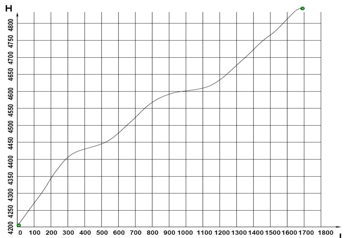
Elevation gain: 640 m (according to GPS). Route length: 1700 m. Average slope: 21°.
-
Equipment used on the route: Pitons used on the route: rock – 0, ice – 0, incl. ITO – 0. No drill-in or removable bolts were used.
-
Departure for the route: at 8:45 on July 17, 2007.
Summit reached: at 11:45 on July 17, 2007.
Return to camp: at 13:15 on July 17, 2007.
-
Team's total climbing hours: 4.5 hours.
-
Leader: Dmitry Martynenko, 2nd category (alpinism)
-
Members: Dmitry Shapovalov, 1st category (sports tourism), Ekaterina Ananyeva, 2nd category (sports tourism)
-
Coach: Nikolai Goryunov (Kiev), Master of Sports (alpinism).
The ascent was carried out without prior route preparation.
2. AREA DESCRIPTION
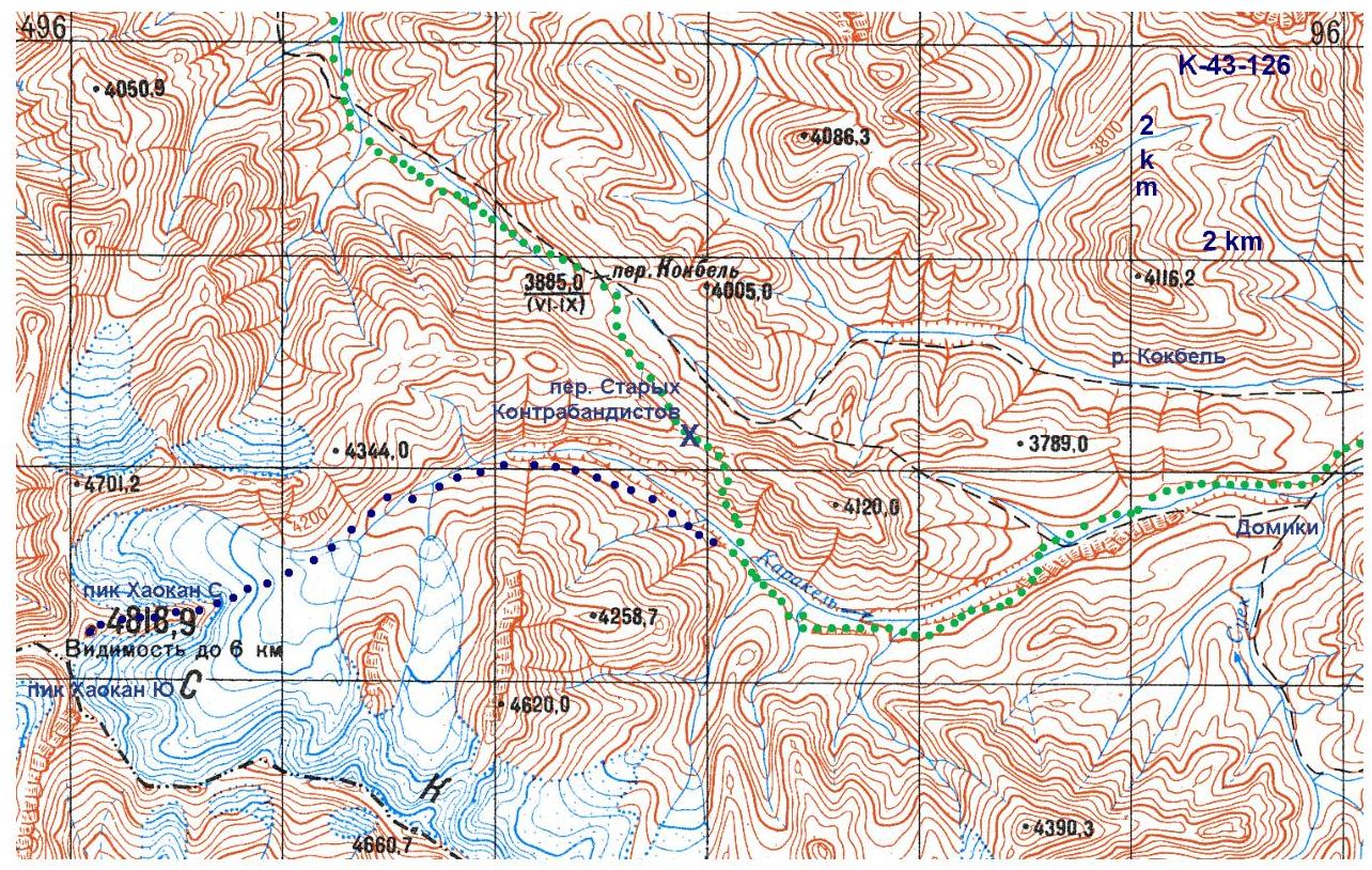
The Khaokan summit (marked as "4818" on maps) is located in the southern part of the Fergana Ridge (Tian Shan) in the upper reaches of the Karakel River. The Fergana Ridge is over 200 km long and oriented from NW to SE. Its southern part is bounded to the west by low mountains east of the Fergana Valley, to the north by the Chitty Pass, to the east by the Arpa Basin, and to the south by the eastern end of the Alai Ridge (Chinese border). The average height of the peaks is 4600–4700 m. Routes to the summits in the main ridge typically start above 3500 m, while the valley floors surrounding the ridge are about 2900 m high. The main ridge is primarily composed of heavily weathered rock, unsuitable for rock climbing (metamorphic schist). However, the glaciation creates opportunities for short but technical ice and snow routes to the summits (estimated up to category 4) and passes (estimated up to category 3A). Glaciers prevail on the NE slopes, and technical passes are found not only in the main ridge but also in its spurs.
The climate of the area is determined by the ridge's orientation and the prevailing direction of air masses. Moist air from the Fergana Valley moves from west to east, is blocked by the Fergana Ridge, and falls as heavy precipitation on its western slopes. Additionally, the main ridge acts as a barrier to cold air masses in winter. This contributes to lush vegetation. The color of the mountains west of the main ridge is green: a sitting person is almost invisible in the grass, and even the most trodden paths become overgrown in just a few years. The eastern slopes receive no less precipitation, but their color is white due to extensive glaciation, despite the Fergana Mountains being relatively low. In the summer season, approximately 50% of days (if not more) have precipitation, and 30% of days have prolonged precipitation. In the summer, rain can fall even at 4300 m, although snow occasionally falls as low as 3000 m. Possible summer temperatures range from −5 °C to +25 °C. The Arpa Basin receives little precipitation, and its climate is dry and sharply continental. It is a typical high-altitude desert. Winter temperatures can reach −50 °C.
The easiest access to the main ridge is through the Arpa Basin, turning off the Naryn – Torugart Pass (Chinese border) highway onto one of the many dirt roads crossing the basin. These roads require 4WD vehicles. The long drive leads to short approaches – from the valley, one can reach any summit in the main ridge in just a day. Additionally, the main ridge can be accessed from the western side: from the Uzgen – Karakuldja – Alayku highway (4WD required). This road follows the Tar and Oital River valleys. In this case, short drives (from 4 hours from Osh) lead to multi-day approaches. One or several passes through the branching western spurs of the Fergana Ridge must be crossed. Moreover, river crossings are necessary, some of which, like the Karakuldja, require suspended crossings for most of the summer season.
The climbing history of the southern part of the Fergana Ridge is very scarce, if it exists at all. The area has been visited repeatedly only by water tourists for rafting on the Oy-Tal, Karakuldja, and Arpa rivers. The lack of climbing activity in Soviet times can be attributed to the proximity of the Chinese border, the rainy climate, and the typical abundance of climbing objects near major cities and roads in Kyrgyzstan.
3. AREA MAP
4. TECHNICAL AND TACTICAL ACTIONS OF THE TEAM
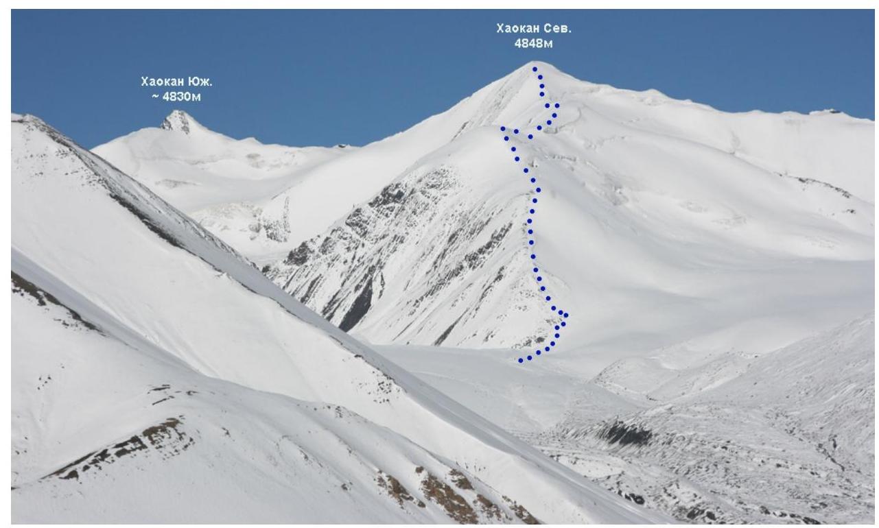
On July 15, we set up camp (N 40°33.078′, E 74°38.600′) under the summit marked on the map as 4818. The weather that day was good but cloudy. At night, it started snowing and continued for most of July 16. We waited all day for the weather to improve. By evening, the weather had cleared, but it snowed again at night. A total of about 40 cm of fresh snow fell on July 16–17. The weather normalized by 7:00 on July 17. We decided to start the ascent via the eastern ridge, as it was the safest route considering the avalanche situation. We departed at 8:45 and reached the summit in 3 hours. The GPS showed a height of 4848 m at the summit. We trudged through shallow snow (knee-deep). An ice axe and crampons were necessary. The descent to camp via the ascent route took 1.5 hours.
5. PHOTO PANORAMA OF THE AREA
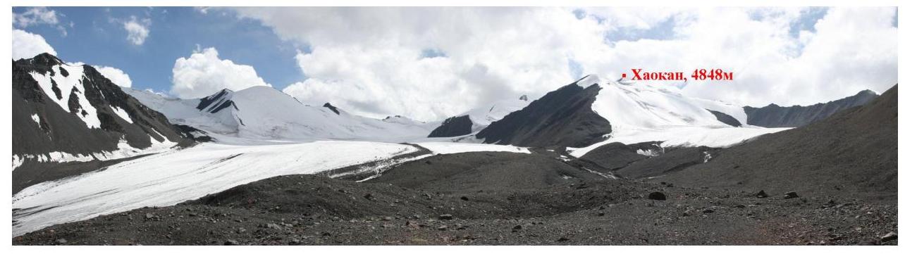
- View from the east. Taken on July 15, 2007 (before snowfall)
- View from the Old Smugglers' Pass. Taken on July 18, 2007 (after snowfall)
6. PHOTOGRAPH OF THE ROUTE AND SUMMIT
- View from the east. Taken on July 15, 2007 (before snowfall)
7. DRAWN PROFILE OF THE ROUTE (FROM CAMP)
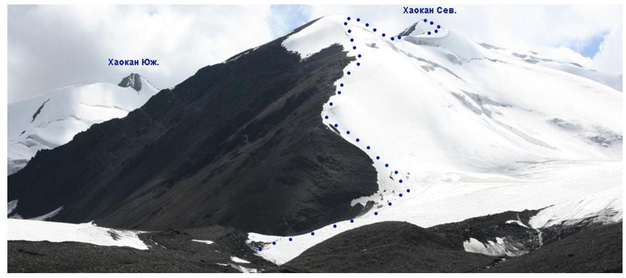
8. PHOTO ILLUSTRATIONS
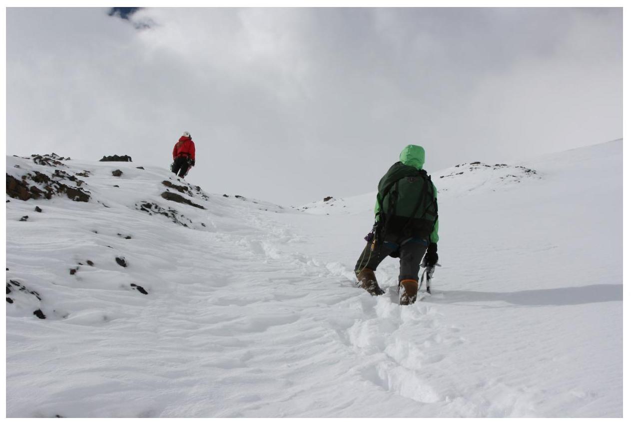
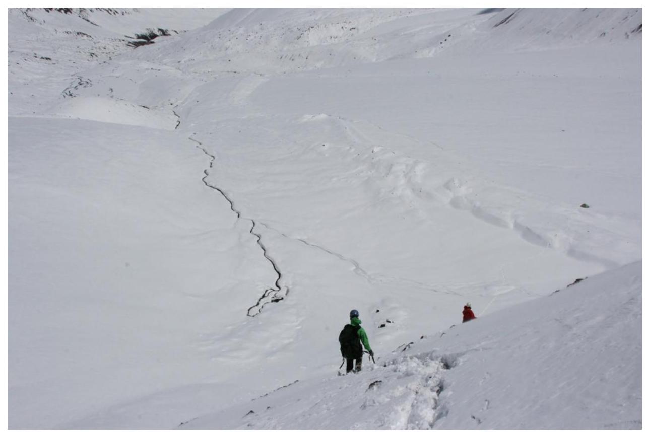
- Lower part of the route. Taken on July 17, 2007
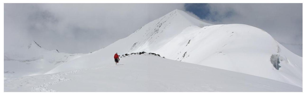
- Middle part. The route follows the ridge. Taken on July 17, 2007
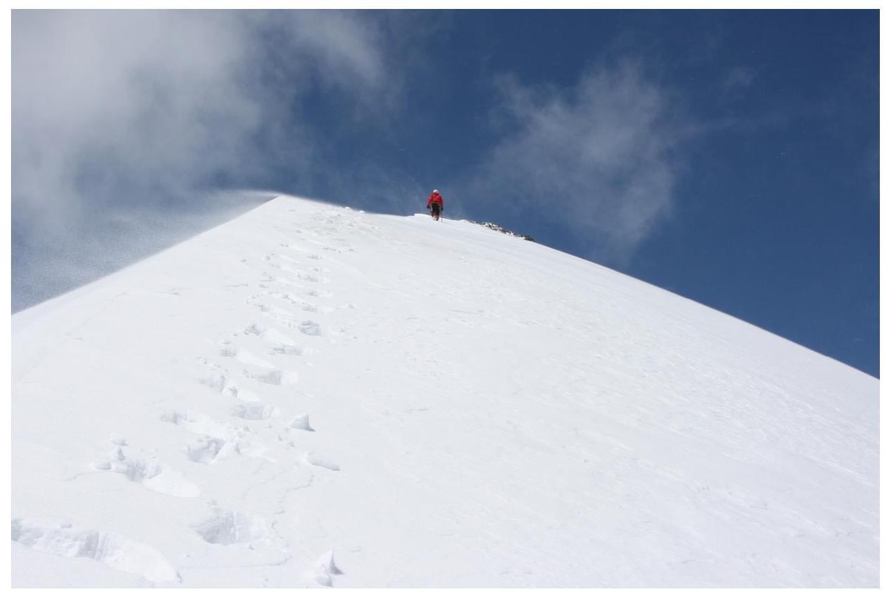
- Pre-summit ascent. Taken on July 17, 2007
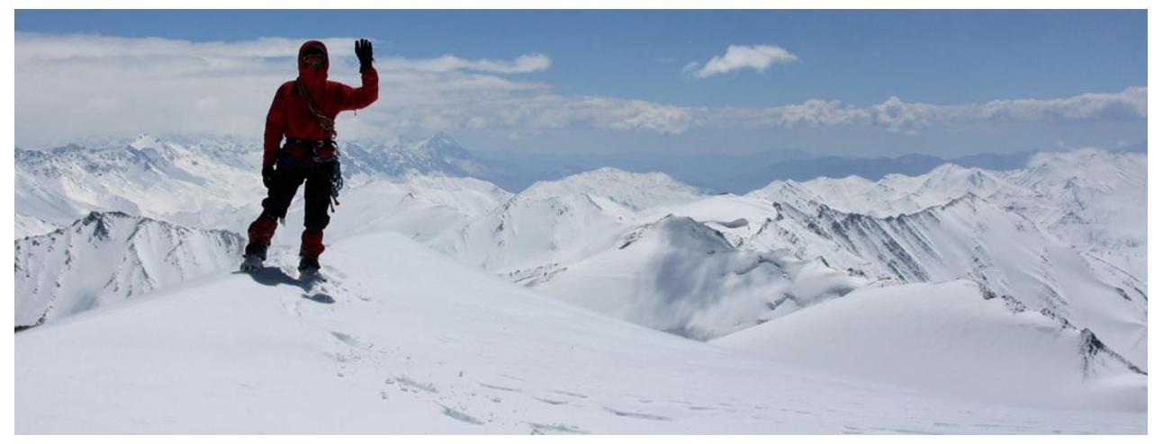
- Summit, view to the southeast. Taken on July 17, 2007
- Descent from the summit. In the lower part of the ridge. Taken on July 17, 2007
9. LINKS
Report on this trip, passports of the passes and summits traversed: www.tkg.org.ua/node/8888
Ascents in the neighboring Torugart-Too and At-Bashi ridges: www.alpinist.com/doc/web07f/newswire-kyrghyzstan-exploration-jamantay
Risk Onsite, No. 32. Article by Dmitry Shapovalov.
The report was compiled by D. Martynenko, and the photographs were taken by D. Shapovalov.