Report
On the First Ascent to the Summit of Uch-Zeit (4905 m)
via the North-Eastern Wall, Category 4A
1. Climbing Passport
- Climbing Area: Tian Shan, southern part of the Fergana Ridge
- Name of the Peak: Uch-Zeit (4905 m, N 40°42.434′, E 74°21.235′ (WGS 84))
- Route Name: via the North-Eastern Wall
- Complexity Category: proposed 4A
- Route Type: ice
- Route Elevation Gain: 550 m (according to GPS readings). Route Length: 960 m. Average Steepness: 35°. 7 ice pitches up to 65°, Al2.
- Equipment Used on the Route: pitons used on the route: rock – 0, ice – 8, including ITO – 0. Bolt hangers (stationary, removable) were not used. Ice tools: Petzl Arztarex, Cassin Mirage.
- Approach to the Route: at 05:45 on July 22, 2007. Summit Ascent: at 12:00 on July 22, 2007. Return to Camp: at 15:15 on July 22, 2007.
- Team Climbing Hours: 9.5 hours.
- Team Leader: Dmitry Martynenko, 2nd sports category (mountaineering)
- Participants: Dmitry Shapovalov, 1st sports category (sport tourism), Ekaterina Ananyeva, 2nd sports category (sport tourism)
- Coach: Nikolai Goryunov (Kiev), Master of Sports (mountaineering).
- Route Features: closed crevasses on the ridge section before the summit
The ascent was carried out without prior route preparation
2. Area Description
Uch-Zeit Peak, 4905 m, is the highest point of the Fergana Ridge (Tian Shan) and is located in its southern part. The peak is situated in the western part of the Ochi-Koman glacier. The Ochi-Koman river, a tributary of the Arpa, originates from this glacier. The Fergana Ridge is over 200 km long, oriented from NW to SE. Its southern part is bounded by:
- to the west — by low mountains to the east of the Fergana Valley;
- to the north — by the Chitty Pass;
- to the east — by the Arpa Basin;
- to the south — by the eastern end of the Alai Ridge (Chinese border).
The average height of the peaks is 4600–4700 m. Routes to the peaks in the main ridge usually start above 3500 m, while the bottom of the surrounding valleys is around 2900 m. The main ridge is primarily composed of highly fragmented rock, unsuitable for rock climbing (metamorphic schists). At the same time, glaciation creates ample opportunities for short but technical ice and snow routes to the peaks (up to category 4B inclusive, estimated) and passes (up to category 3A inclusive, estimated). Glaciers prevail on the NE slopes of the ridge, and technical passes are found not only in the main ridge but also in its spurs.
The climate of the area is determined by the ridge's orientation and the prevailing direction of air masses. Moist air from the Fergana Valley moves from west to east, is blocked by the Fergana Ridge, and precipitates heavily on its western slopes. Additionally, the main ridge acts as a barrier to cold air masses in winter. All this contributes to lush vegetation growth to the west of the main ridge: a person sitting is almost invisible in the grass, and the most trodden paths are completely overgrown in just a few years.
The eastern slopes also receive a significant amount of precipitation, but their color is white due to extensive glaciation. In the summer season:
- approximately 50% of days (if not more) — with precipitation;
- 30% of days — with prolonged precipitation.
During the summer season, rain can fall even at 4300 m, although snow occasionally falls at 3000 m. Possible summer temperatures range from –5°C to +25°C.
The Arpa Basin receives less precipitation, and its climate is dry and sharply continental. It is a typical high-altitude desert. Winter temperatures can drop to –50°C.
Access to the southern part of the main Fergana Ridge is easiest through the Arpa Basin, turning off the Naryn — Torugart Pass (Chinese border) highway onto one of the many dirt roads crossing the basin. These roads require 4WD vehicles. The long drive leads to short approaches — from the valley, one can approach any peak in the main ridge in just a day.
Additionally, the main ridge can be accessed from the western side: from the Uzgen — Karakuldzha — Alayku road (4WD required). This road follows the valleys of the Tar and Oital rivers. In this case, short drives (from 4 hours from Osh) lead to multi-day approaches. It is necessary to cross one or several passes through the branched western spurs of the Fergana Ridge. Moreover, one has to ford numerous rivers, some of which, like the Karakuldzha, require suspension crossings for most of the summer season.
The climbing history of the southern part of the Fergana Ridge is very scarce, if it exists at all. The area has been visited repeatedly only by water tourists for rafting on the rivers:
- Oy-Tal;
- Karakuldzha;
- Arpa.
The lack of mountaineering activity in Soviet times can be explained by the proximity of the Chinese border, the rainy climate, and the typical abundance of climbing objects near major cities and roads in Kyrgyzstan.
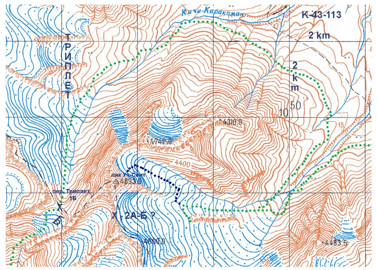
3. Area Map
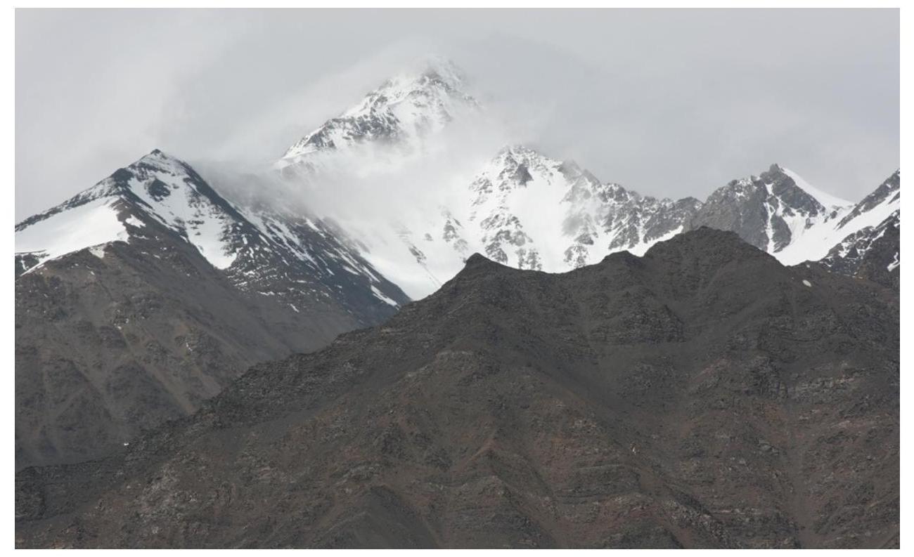
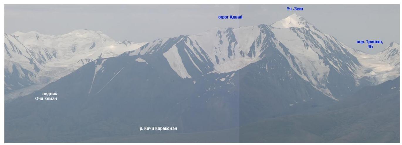
4. Area Photopanorama
- Uch-Zeit from the south, view from the slopes of the western spur of the Fergana Ridge. Taken on July 24, 2007.
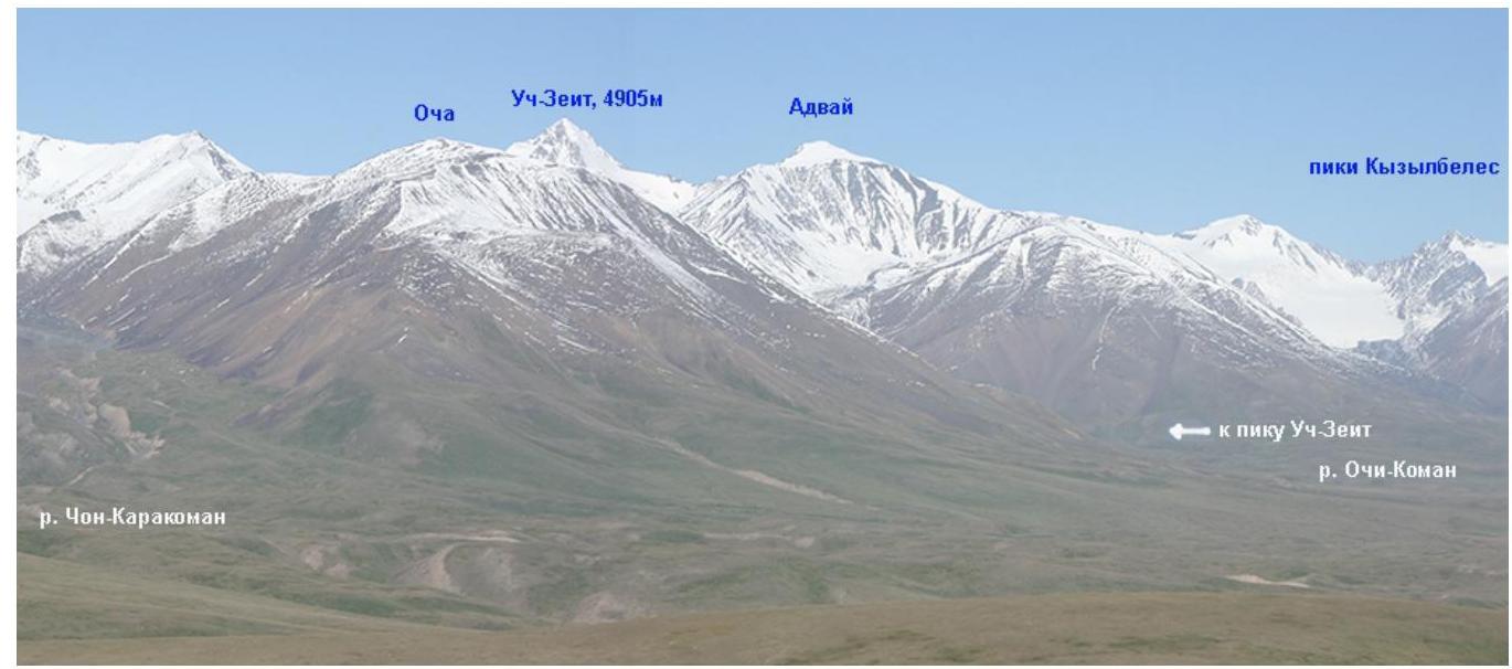
- View from the east, from the Arpa River valley. Taken on July 19, 2007.
- View from the north, from the Jamantay Ridge. Taken on July 5, 2007.
5. Team's Technical and Tactical Actions
On the evening of July 20, we reached the base of the northern wall of Uch-Zeit. We set up camp directly under the wall at an altitude of 4350 m (camp coordinates: N 40°42.683′, E 74°21.677′ (WGS 84)). On July 21, the weather was unstable. Intermittent rain/snow/fog. Early bedtime, with the plan to start the route early the next day. On July 22, the weather was also unstable: fog, snow, but sometimes the sun was visible, and there was no wind. We began the ascent. Half an hour of approaching the bergschrund. Then, we climbed 7 ice pitches with a change of lead. We moved straight up, parallel to the debris ridge protruding from the slope, to the right of it. The technical part of the route ended on the pre-summit ridge (4775 m, coordinates of the ridge exit point: N 40°42.442′, E 74°21.443′ (WGS 84)). We traversed the ridge in teams, in harness. The summit was a large snow cornice. We built a cairn on the rocks adjacent to the summit and left a note. During the descent, it rained, and the snow that had fallen earlier kept sliding down the slope.
6. Summit Photographs

- View from the east, from the Ochi-Koman glacier. The approach to the route is via the glacier on the right side of the photo. Taken on July 20, 2007.
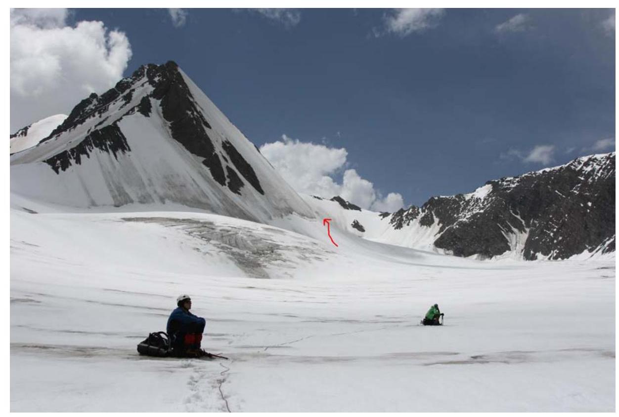
- View from the northeast, approach to the start of the route via the 3rd branch of the Ochi-Koman glacier. Taken on July 20, 2007.
7. Complexity Table for Individual Ropes
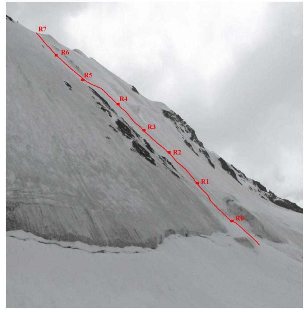
| Section # | Length (m)/Steepness |
|---|---|
| R7–R6 | 60 m / 55° |
| R6–R5 | 60 m / 60° |
| R5–R4 | 60 m / 65° |
| R4–R3 | 60 m / 65° |
| R3–R2 | 60 m / 65° |
| R2–R1 | 60 m / 60° |
| R1–R0 | 60 m / 60° |
8. Drawn Route Profile (from the Camp)

9. Photo Illustrations
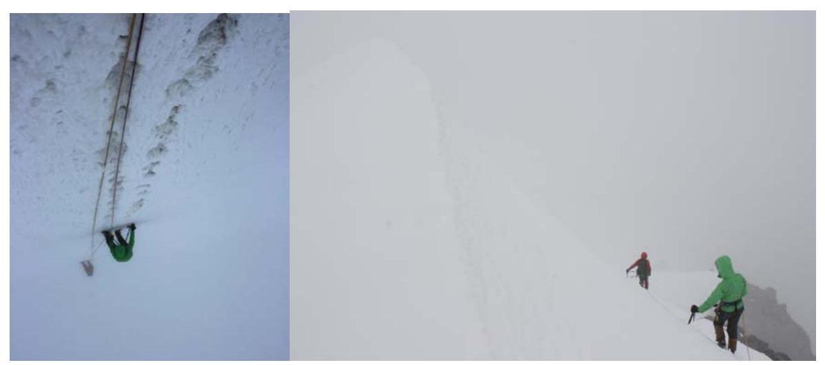 7. Snow and ice section on the wall.
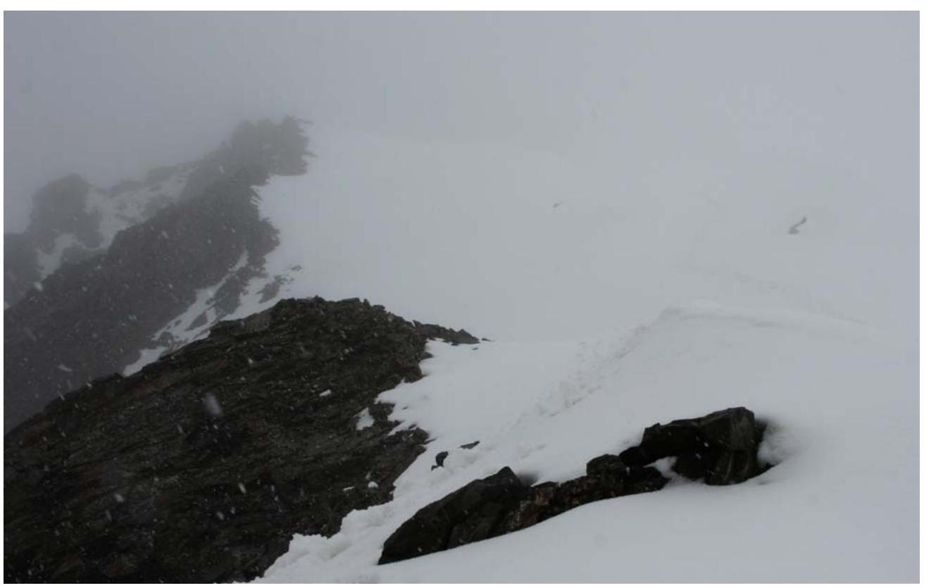
8. Ridge section, descent from the summit.
Taken on July 22, 2007.
7. Snow and ice section on the wall.
8. Ridge section, descent from the summit.
Taken on July 22, 2007.
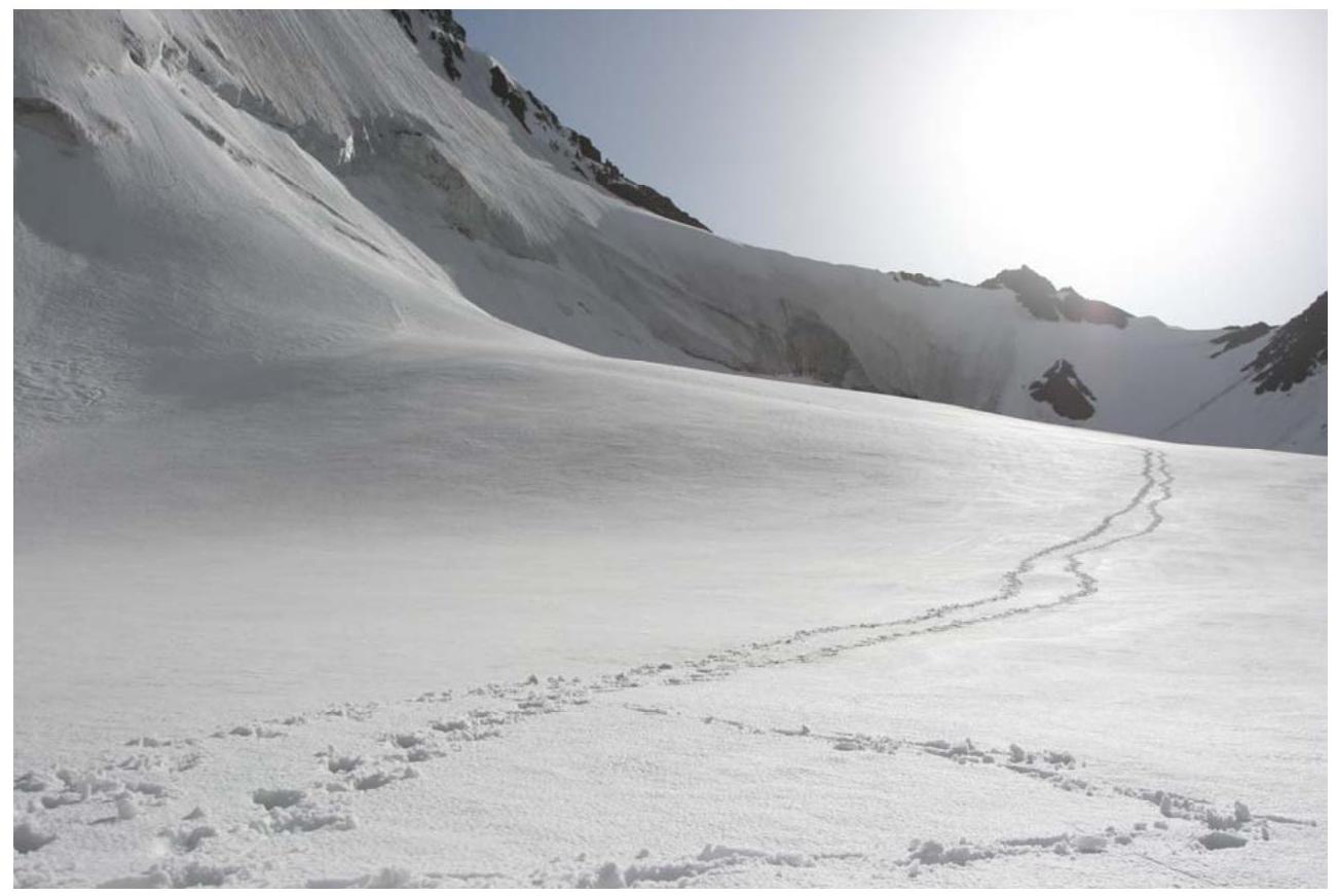 9. Approach to the bergschrund: exit to the edge and then up it to the bridge in the upper left corner of the photo. Taken on July 22, 2007.
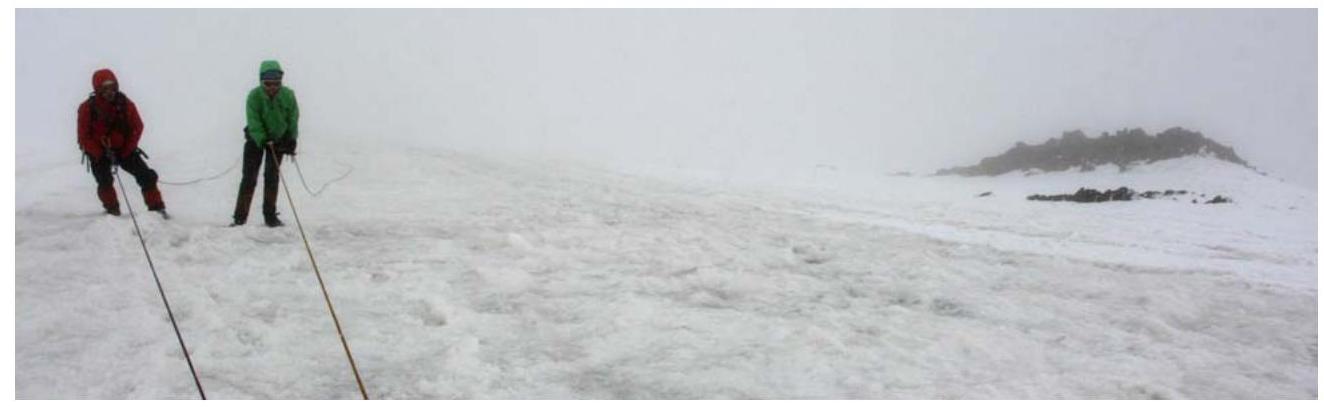
 10. Pre-summit ridge, the summit is not yet visible. Taken on July 22, 2007.
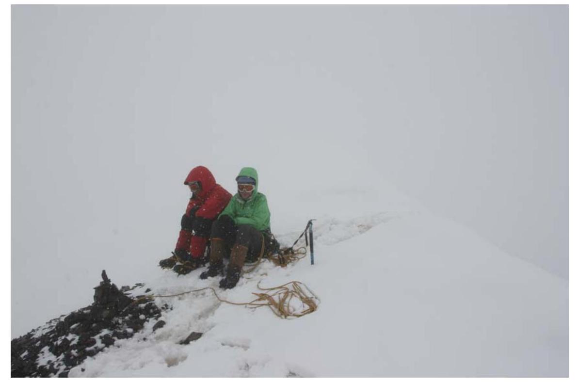 11. The summit. Taken on July 22, 2007.
 12. One of the first rappels. The descent goes parallel to the debris ridge on the right. Taken on July 22, 2007.
10. Links
Report on this trip, passports of the passes and peaks traversed:
Climbs in the neighboring Torugart-Too and At-Bashi ridges
Risk Onsite, issue 32. Article by Dmitry Shapovalov.
The report was compiled by D. Martynenko, photographs were taken by D. Shapovalov.