Ascent Passport
- Ascent class — technical.
- Ascent area — Western Tian-Shan, Pskem Ridge.
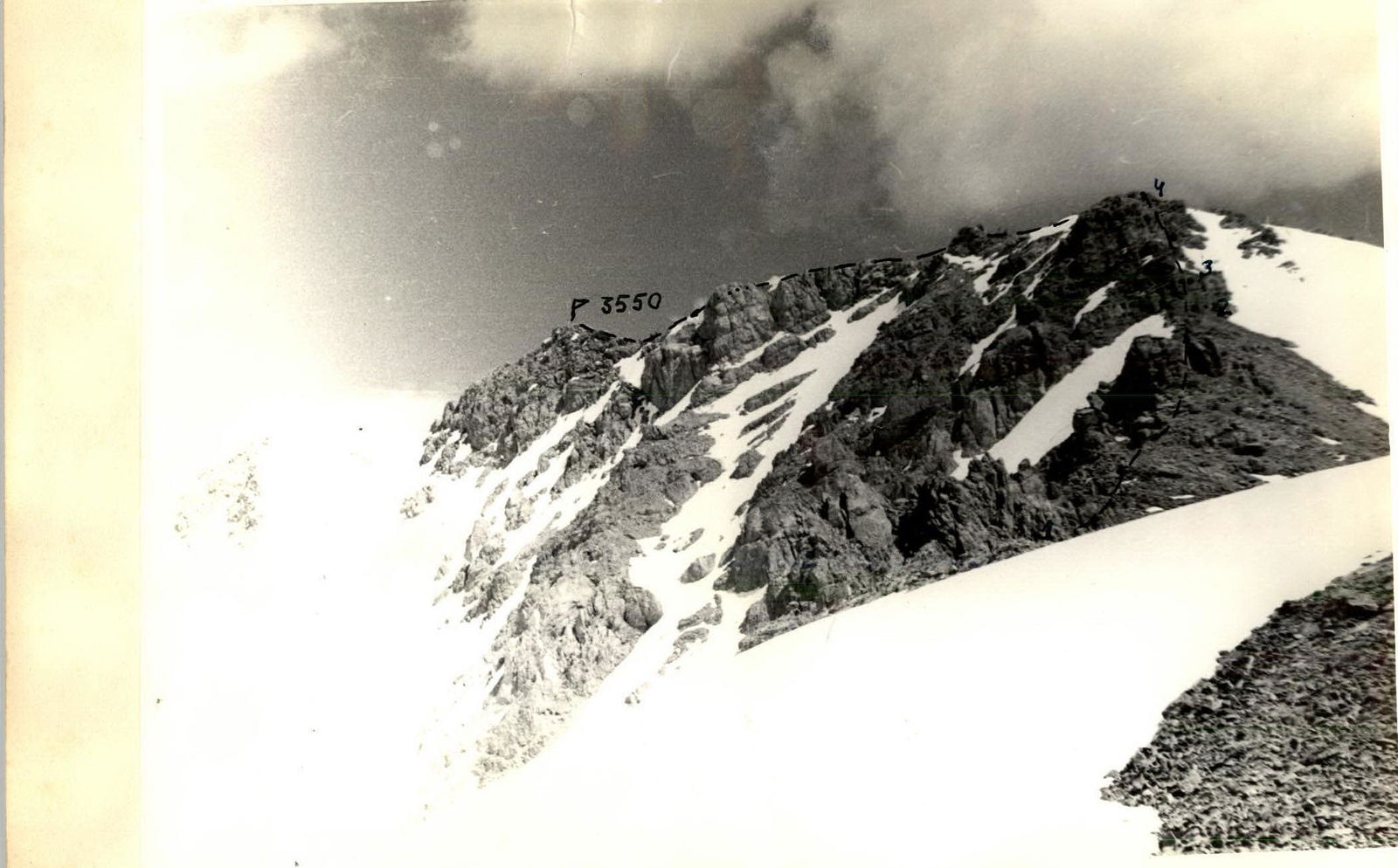
- Ascent route — peak 3550 via the northern ridge.
- Expected difficulty category — 2B
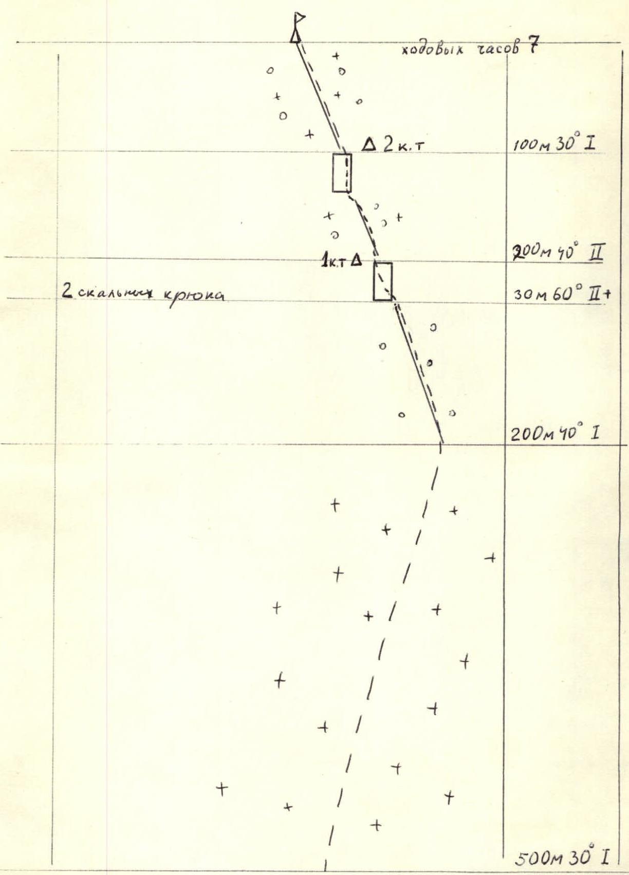
- Route characteristics — height difference — 1200 m, average slope — 35°.
- Pitons hammered in: rock — 2 ice — bolt —
- Number of travel hours — 7 hours.
- Number of overnight stays —
- Surname, initials of the leader, participants and their qualification: Khazhiniazyov K.S. — 2nd sports category Milyaeva K.A. — 3rd sports category Bondareva E.A. — 3rd sports category Fursov V.D. — 3rd sports category Kutlimuratov A.S. — 3rd sports category Egorov D.M. — 3rd sports category
- Team coach — Kuznetsova N.P.
- Date of departure on the route and return — May 2, 1931.

Route Description
The route starts from the Abas-Say circus from the base camp in the Akbulak-Say valley. A trail from the village of Ispay leads to the b/c parking lot via a dirt road. Travel time from the Pskem River (Ispay village) to the Akbulak-Say parking lot is 3 hours.
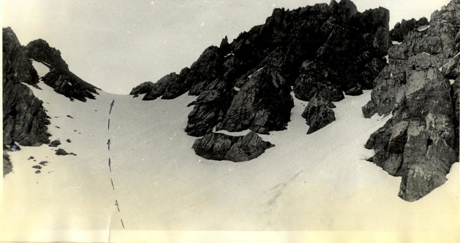
Section R0–R1. Snow-firn slopes with a slope of 25–30° lead to the first saddle I at a height of approximately 3000 m. Ascent time is 2 hours 00 minutes. Then the ascent continues to the second saddle on the northern ridge of peak 3550. Movement is simultaneous.
Section R1–R2. 300 m long rubble ridge with rock outcrops. Passed simultaneously. Time — 30 minutes.
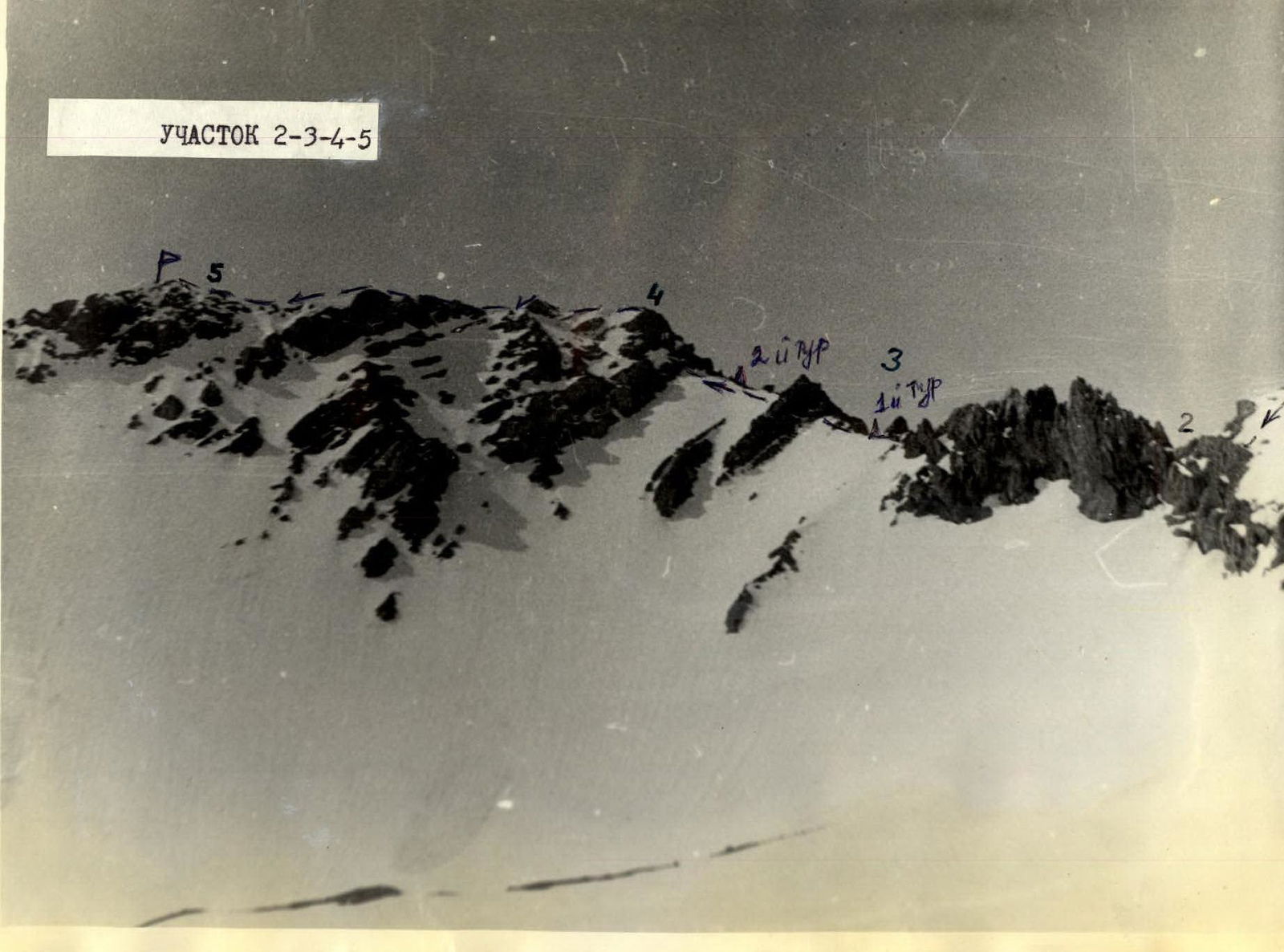
Section R2–R3. The first big gendarme (key section):
- Passage from right to left along 20–30 m wide shelves.
- Insurance through ledges along the crevice, 1–2 pitons.
- Alternating movement.
- First control point on the left side of the gendarme.
Section R3–R4. Rocky ridge. Second big gendarme. Easy rocks on short sections of medium difficulty are passed:
- head-on
- to the right along shelves
Alternating movement. Second control point.
Section R4–R5. Exit to the pre-summit ridge. Simultaneous movement. Exit to the summit.
Descent follows the ascent path.
Table of main characteristics of the ascent route to peak 3550 via the northern ridge, category 2A (approximately)

Description of the route to peak 3550 via the northern ridge, category 2A in UIAA symbols

Section R0–R1
Section R2–R3–R4–R5