August 15.
Route Description
3718 m.
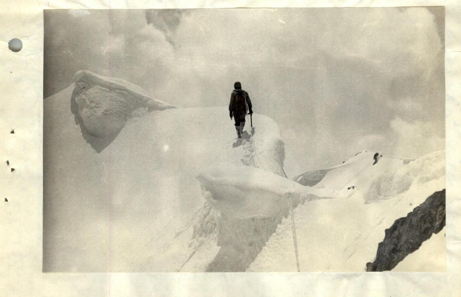
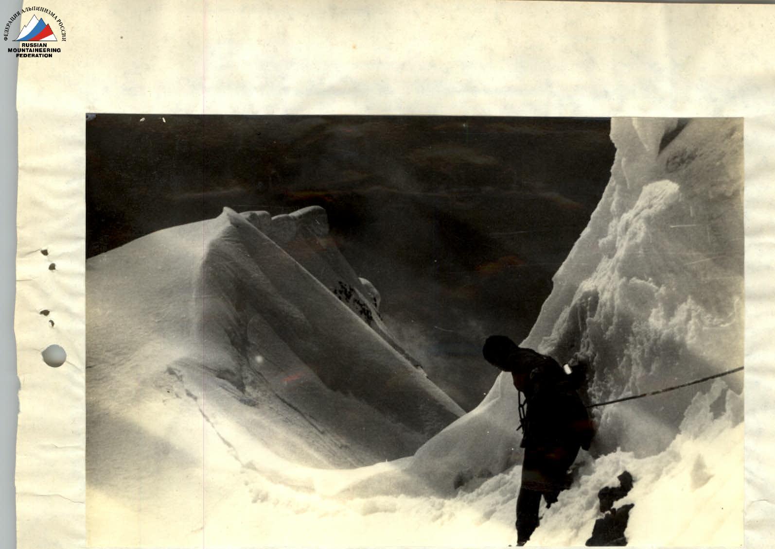
From the base camp located on the moraine under the northern walls of Mt. Piazak, the approach to the saddle of the North Ridge is via a snowy couloir (scree in summer) along the rocky outcrops on the left (1 hour). From the saddle: — right along the ridge (60 m, 45°, snow) under a rocky outcrop; — then along the couloir (40 m, 50°, snow, местами натёчный лёд) towards the rocky wall in the ridge (piton belay).
The wall is traversed on the left and via broken rocks — exit to a steep snowy section of the ridge. Moving on the right side of the ridge, exit onto broken rocks. Along the snowy ridge 250 m to the summit (snow cornices on both sides, movement in rope teams). The summit is broken rocks.
In fact, the summit of Piazak is double-headed. The Eastern and Western summits are at least 500 m apart and are of equal height. The ridge between them is snowy and presents no technical difficulty. The control cairn is set on the Eastern summit. The descent from the summit to the base camp took 2 hours via the ascent route. A easier descent is possible via the Western summit along its Western slope into another cirque, but in this case, having lost altitude, one will have to climb back to the base camp, bypassing Piazak from the West.
Recommendations
In winter, the narrow gorges used for the approach are avalanche-prone; in summer, they lack water, so it's necessary to stock up on drinking water.
Borisov E.I. Lukin A.A. Nits 10.3 Luneva R.A. Baimolin G.A. April 30, 1982 700 m, 45°, 4 hours, 3 hours 30 minutes.
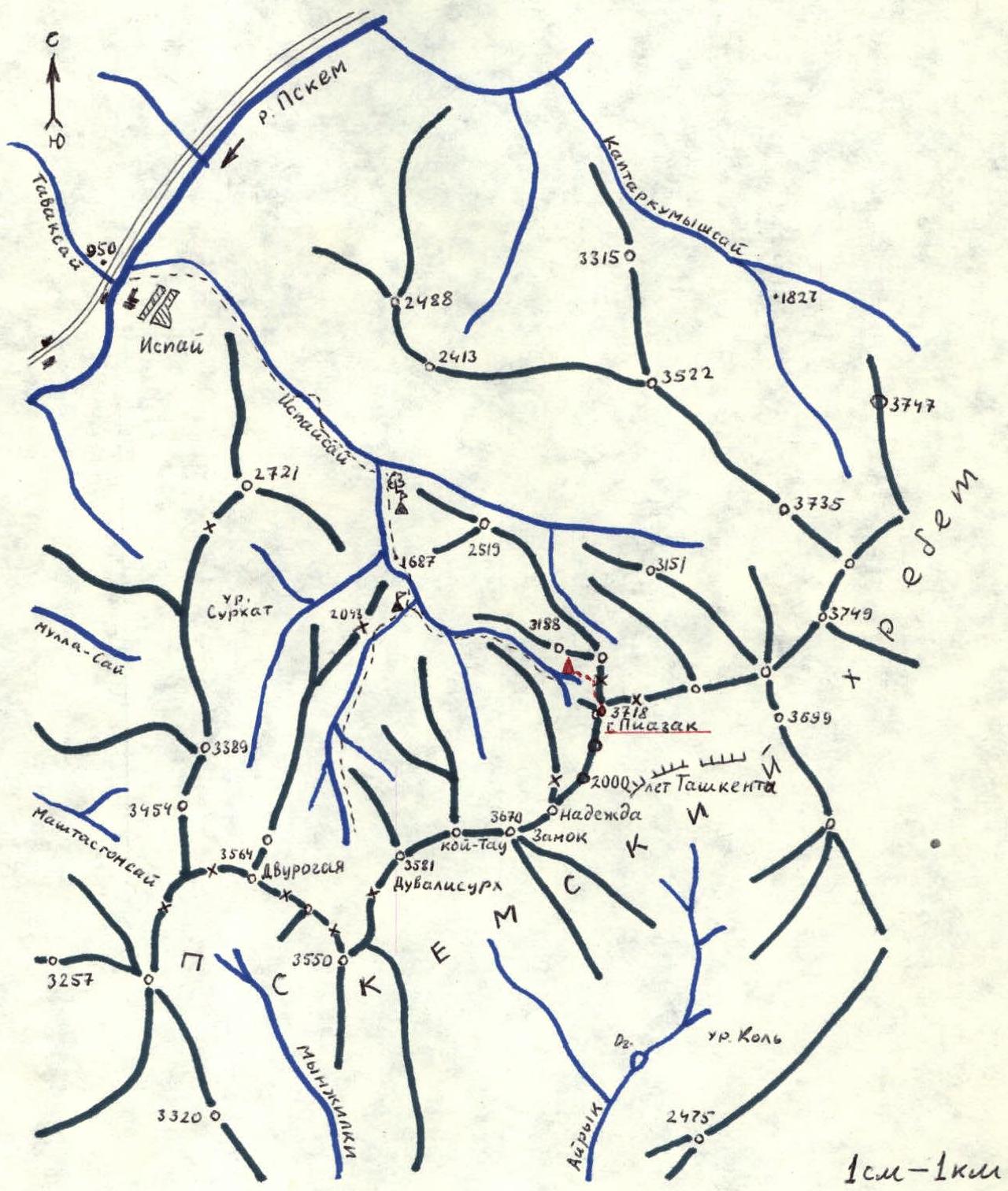
▲ — base camp — — ascent route – — possible base camp locations
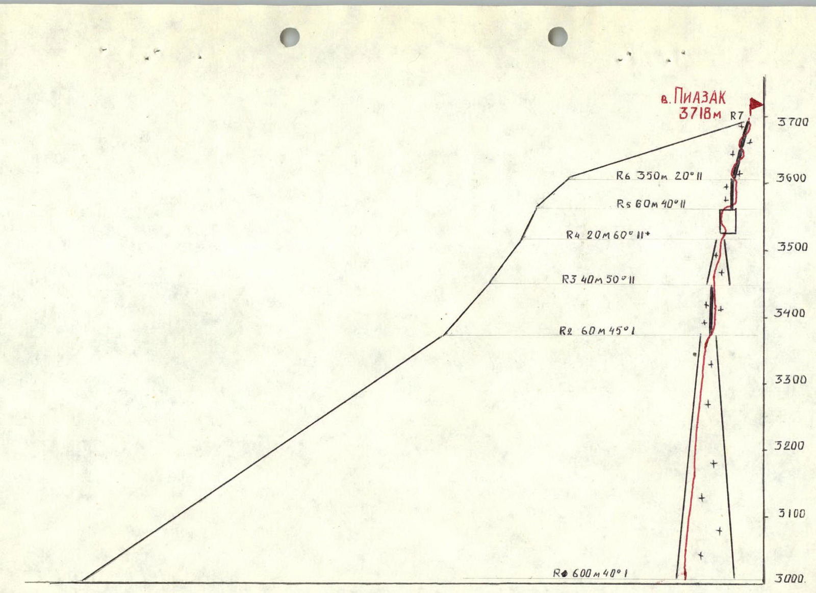
Profile and route diagram for Mt. Piazak, 3718 m, from the saddle of the North Ridge, category 2A.

Table of Main Ascent Characteristics
| Section | Avg. slope, ° | Length, m | Terrain type | Difficulty | Condition | Belay type | Pitons | Weather |
|---|---|---|---|---|---|---|---|---|
| R0–R1 | 20 | 1000 | Snow fields | I | Deep snow | --- | --- | Clear |
| R1–R2 | 40 | 600 | Couloir | I | Deep snow | Self-belay | --- | —"– |
| R2–R3 | 45 | 60 | Ridge | I | Deep snow | Simultaneous movement in rope teams | --- | —"– |
| R3–R4 | 45 | 40 | Couloir | II | Snow with ice patches | Piton belay, alternating | 2 | —"– |
| R4–R5 | 60 | 20 | Wall | II | Broken rocks | Piton belay, alternating | 2 | —"– |
| R5–R6 | 40 | 60 | Snowy ridge | II | Deep snow | Alternating movement | --- | Cloudy |
| R6–R7 | 20 | 350 | Snowy ridge | II | Cornices | Alternating movement in rope teams | --- | Cloudy |
The total time taken to cover all sections (R0–R7) was 3 hours 30 minutes. The descent from the summit via the ascent route took 2 hours.
Section R2
Section R6