Sary-Aigyr (S—M.) 7.11 2A cat. diff. FA Elena Kerher elenakercher@mail.ru Shymkent, RK
Ascent Passport
7.11 Western Tian-Shan, Sayram-Su gorge (base camp 1760)
Sary-Aigyr (S—M.) FIRST ASCENT
Route FA: from east to southern ridge traverse
Proposed: 2A cat. diff. rock
Total altitude difference according to altimeter: 900 m
Oriented length: 1600 m
Steepness: up to 50°
"Hooks" — not used
Approach from Base Camp 1760 via Smorodino gorge to the start of the route: from 6:00 to 8:30 on July 15, 2013
Start of the route: at 8:30
Reached Sary-Aigyr South summit: at 12:30
Reached Sary-Aigyr Main summit: at 14:30
Descent from the summit from 14:50 to 18:30 via northern ridge 1B cat. diff.
Return to Base Camp 1760 at 18:30
Total hours: 12 h 30 min (1 day July 15, 2013), including without approaches, without rest, and without descent: 5 h 10 min.
Leader: Kerher Elena Gustavovna (III cat. № 062) Participants: 2. Arbachauskas Vitas (–) 3. Zinovieva Evgenia (–) 4. Mustafa Olzhas (–) 5. Pazylbekov Kairat (AK) 6. Sydykov Meirzhan (–) 7. Obert Viktor (–)
Senior coach AM: MS USSR Levin M.S. (I cat. № 036)
Coach, responsible for Report: Kerher E.G. (Elena Kerher elenakercher@mail.ru)
Organizers AM: — Tourist station of Shymkent, RK — Chelyabinsk climbers' club
Note. It is proposed to make a change in KTHM 7.11: — Was: 53, 54. Sary-Aigyr 3350 m — Should be: 53, 54. Sary-Aigyr (M.) 3350 m
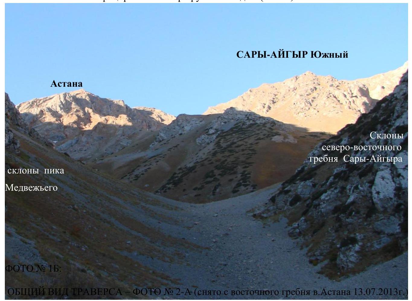
Sheet 1–2, PHOTO № 1A: taken on the approach via Smorodino gorge on July 13, 2013 No classified routes are visible (there are none).
SARY-AIGYR Main 3350 m
 GENERAL VIEW OF THE TRAVERSE — PHOTO № 2-A (taken from the eastern ridge of Astana peak on July 13, 2013)
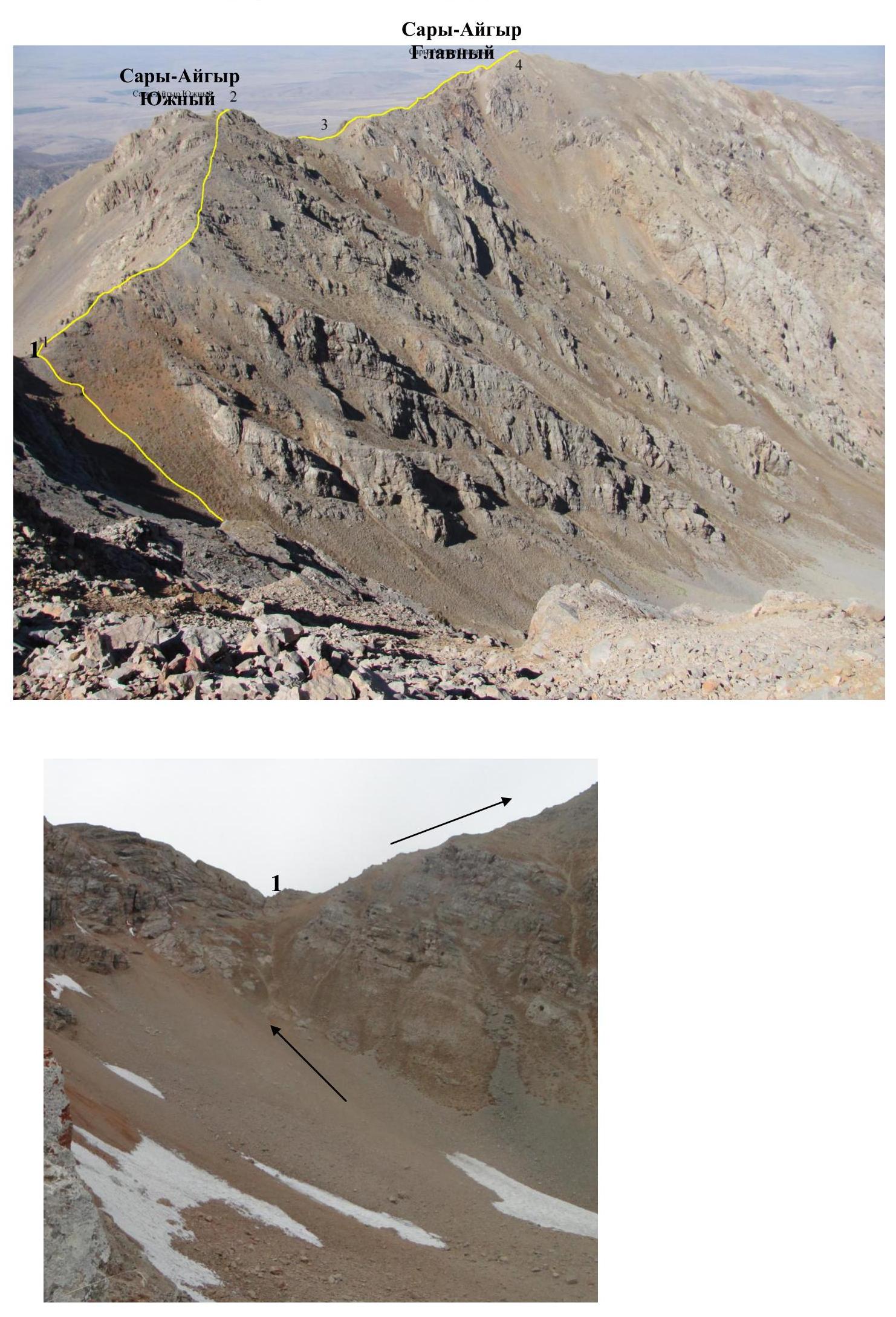 Sheet 2–3, PHOTO № 3: profile of the described route (taken from the eastern ridge of Astana peak on July 13, 2013)
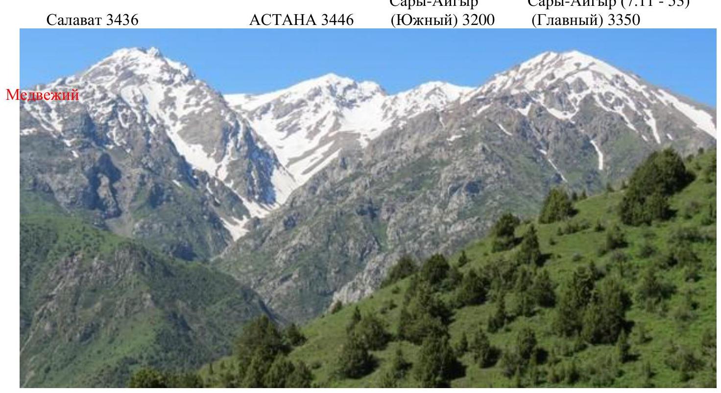 Sheet 2–4, PHOTO № 4: Panorama (I. Istomina, May 4, 2013 from the slope of the watershed ridge between Sayram-Su gorge and Sazanat gorge)
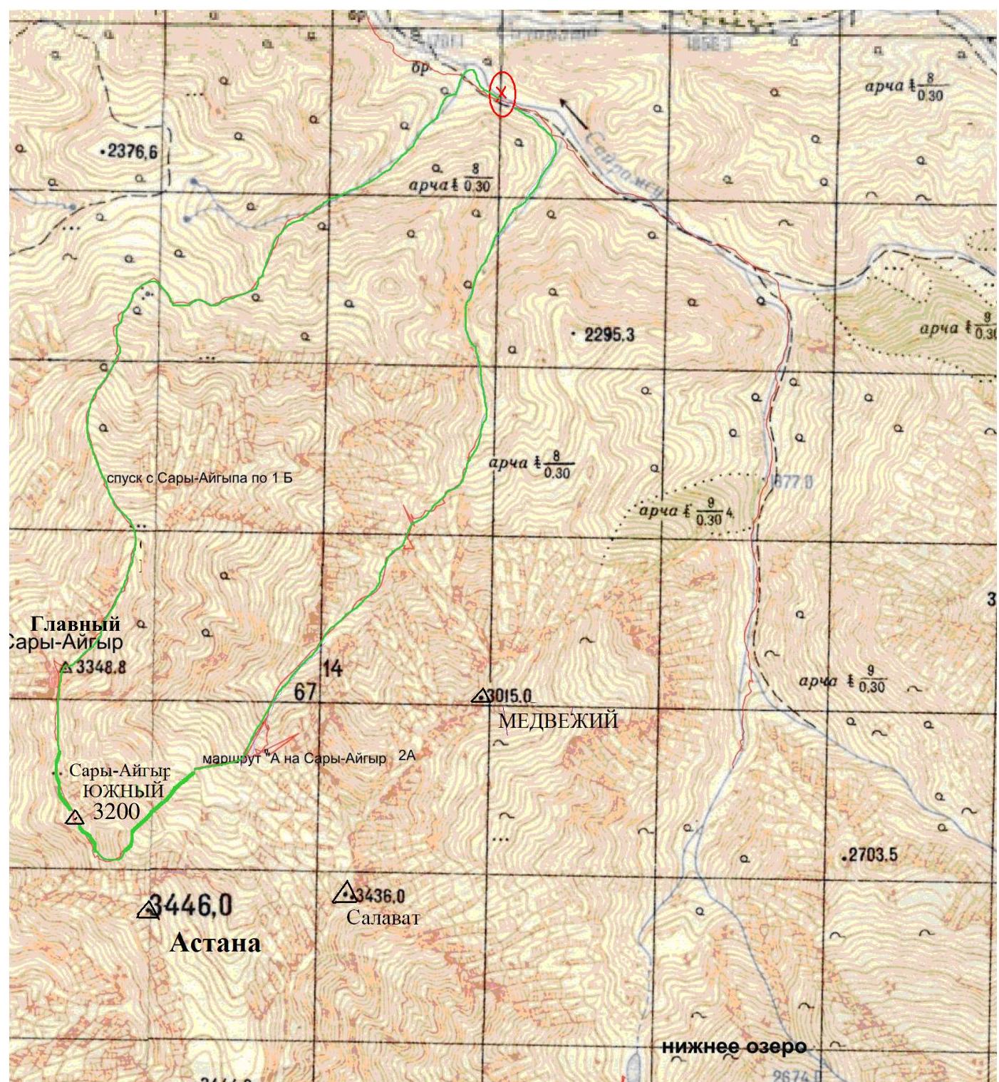
Sheet 3–5a, Map of the first ascent area (K. Pazylbekov, July 15, 2013)
Grid 500 m × 500 m
Exploration of the most interesting peaks of the Ugam ridge began in the 60s of the XX century, precisely from the Sayram-Su gorge. Now it is possible to drive by car to an altitude of 2000 m in 2 hours (80 km from Shymkent, including 76 km on asphalt); communication between the base camp and Russia via local SIM cards Aktiv and Kcell is stable.
Approach from Base Camp 1760 to the entrance to Smorodino gorge — 10 minutes uphill along the road, then to the right along the trail, heavily overgrown in summer (in May — a lot of snow), to the fork.
From the right branch, the described route to Sary-Aigyr South and further traverse begins, as well as an unpassed route to the so-called p. Tolebi along the northern ridge with further traverse to p. Astana.
The 2A cat. diff. route along the NE ridge of Sary-Aigyr should be started from the north, not from the right southern branch.
From the left branch, you can ascend to p. Medvezhy and p. Salavat along their northeastern counterforts.
Sheet 3–6 Table of main characteristics Traverse of peaks: Sary-Aigyr (S.) — Sary-Aigyr (M.)
| № sect. | Oriented length | Steepness | Character of relief and advancement | Cat. diff. | Number of "hooks" | Time | Heights by GPS |
|---|---|---|---|---|---|---|---|
| 4 | 520 m | up to 50° | Destroyed rocks of the southern ridge of Sary-Aigyr (M.) — in ropes | P | through ledges | 14:30 13:15 | 3350 m 3150 m |
| 3 | Descent to the saddle of the southern ridge of Sary-Aigyr (M.) — in ropes | 1 | through ledges | 13:15 13:00 | 3150 m 3200 m | ||
| 2 | 120 m | 30° | |||||
| 2 | 230 m | up to 50° | Destroyed rocks of the southern ridge of Sary-Aigyr (S.) — in ropes | P | through ledges | 12:30 11:00 | 3200 m 2900 m |
| 1 | |||||||
| 1 | 750 m | up to 35° | Grassy-scree slope of the southern ridge of Sary-Aigyr (S.) — simultaneously | 1 | none | 10:40 8:30 | 2900 m 2500 m |
| 0 |
Sheet 4–8: Brief description of the traverse route "Sary-Aigyr (S) — Sary-Aigyr (M)"
In Smorodino gorge, closer to base camp 1760 m (traditional for May alpinadas), it is necessary to have routes of 1B and 2A cat. diff.
The described route is safe in summer, in spring the southern ridges of both peaks quickly clear of snow.
Gaining height along Smorodino gorge, we turn into the right branch (on the way) and move along it to the beginning of the slope, leading to the only depression in the ridge connecting the Astana massif (left) and the southern ridge of Sary-Aigyr South.
In ropes: — bypass the first gendarme of the southern ridge; — further all the time along the rocky ridge; — to the summit of Sary-Aigyr South; — behind it, having descended a little, — to the summit of Sary-Aigyr Main.
Descent into Sayram-Su gorge along the northern ridge of Sary-Aigyr Main (route 1B cat. diff.)
The route is more complicated than 1B Kergely and 1B on Sary-Aigyr. There are few traverses in the area, but you can compare the described ridge with the northeastern ridge of Sary-Aigyr Main, along which a 2A cat. diff. route is laid.
Sheets 5–10: Photo illustrations of technically complex sections
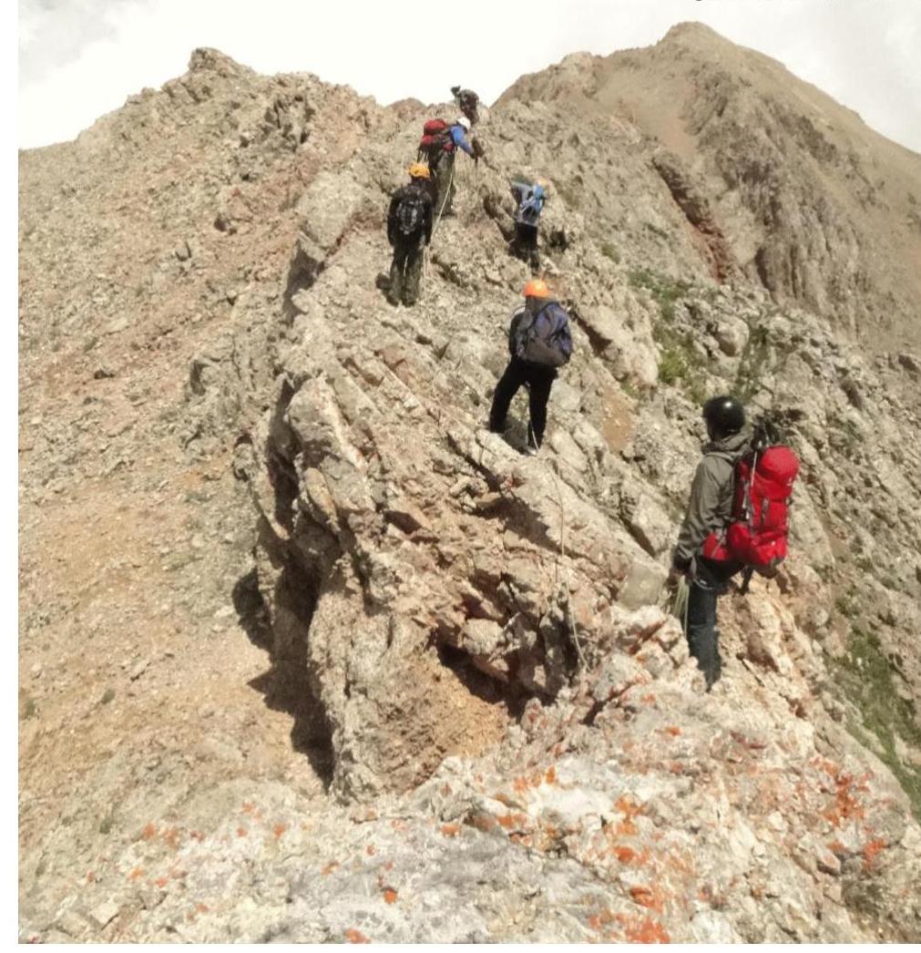
PHOTO № 5 and 6: On the southern ridge (R1–R2) of Sary-Aigyr South.

SARY-AIGYR Main
 Mandatory PHOTO: built a cairn on the summit of Sary-Aigyr South. In the background — Sary-Aigyr Main.
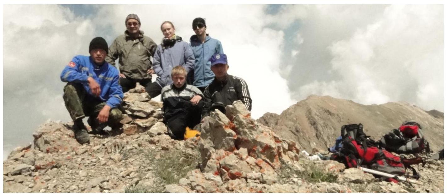 PHOTO № 7: Descent to the saddle between the peaks (R2–R3).
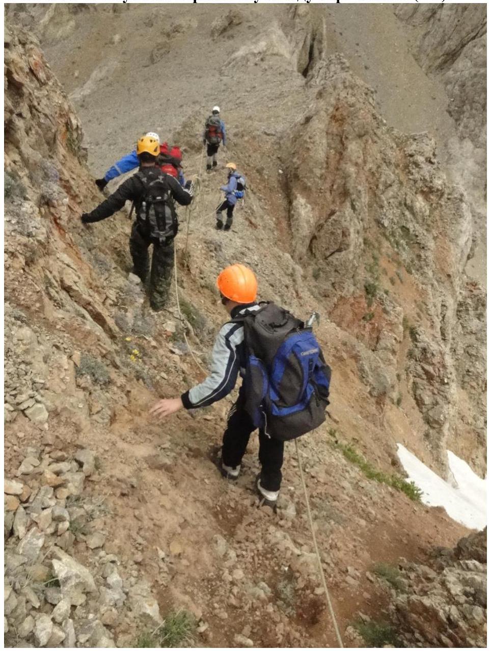 PHOTO № 8: In the background — the saddle between the peaks.
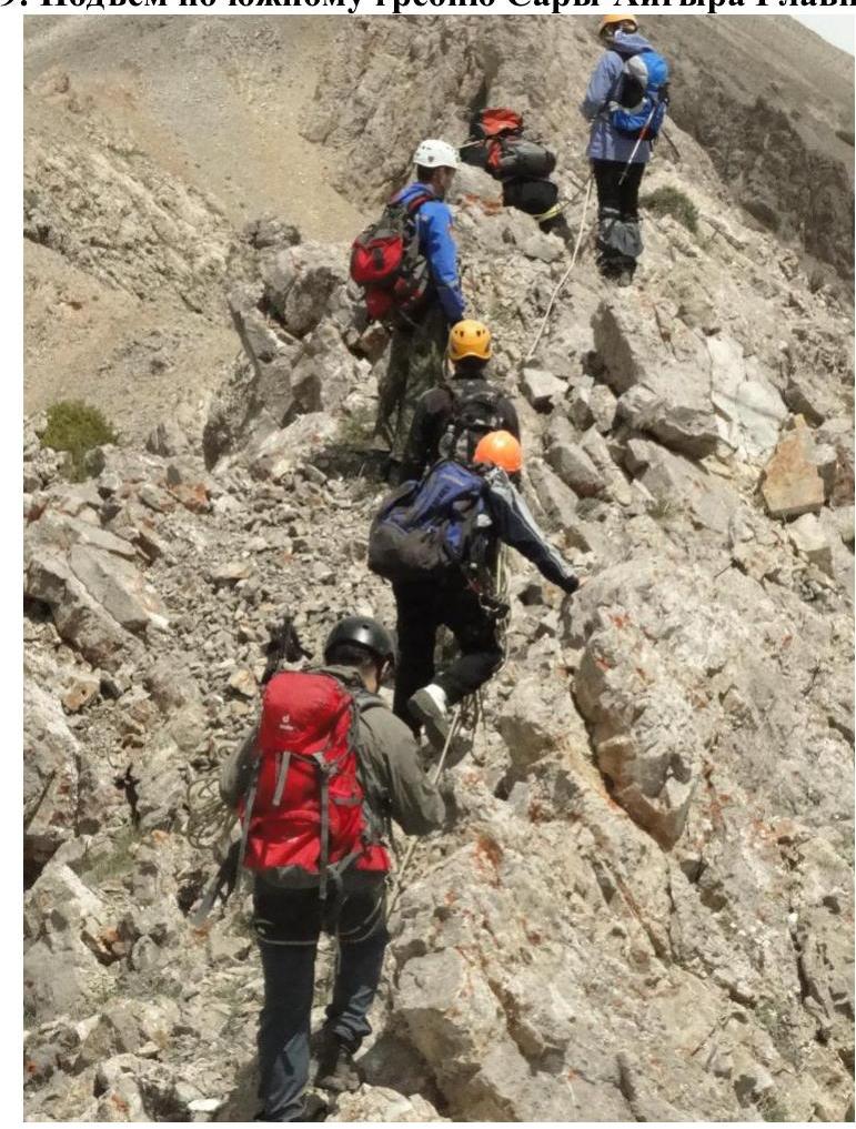
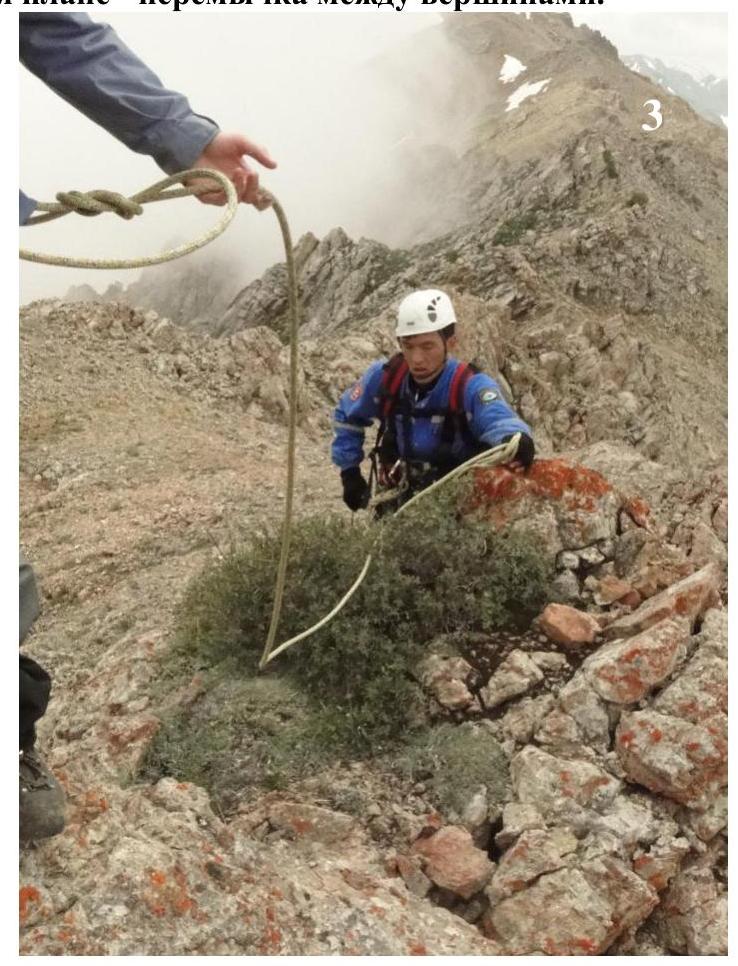 PHOTO № 9: Ascent along the southern ridge of Sary-Aigyr Main (R3–R4).
 Mandatory PHOTO: at the cairn on the summit of Sary-Aigyr Main.
