Ascent Passport
- Ascent class: rock climbing
- Ascent area: Western Tien Shan, Ugam Ridge
- Peak, its height, and ascent route: "Sary-Aygyr", 3350 m, NE ridge
- Estimated difficulty category: 2A
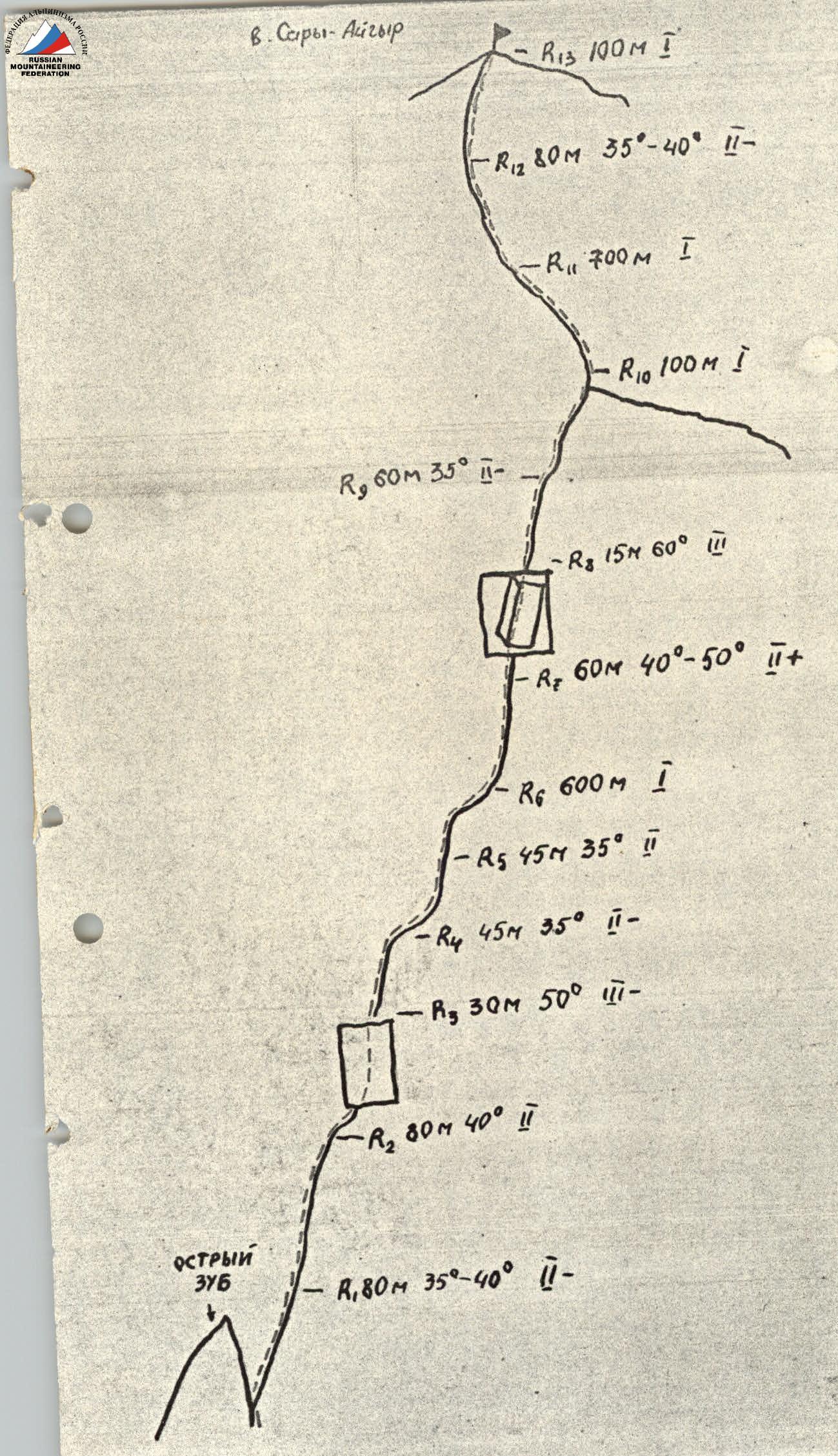
- Route characteristics:
- height difference: 700 m
- average steepness: 43°
- length of sections: I–500 m, II–450 m, III–45 m
- Pitons hammered:
- rock pitons: 3 pcs.
- protection gear: 4 pcs.
- bolt pitons: –
- Total climbing time: 7 hours
- Number of nights stayed and their characteristics: none
- Participants' full names and their sports qualification:
- Melnikov V.G. — 1st sports category
- Rezaev I.V. — 1st sports category
- Tungushbekov B. — 1st sports category
- Rafikov Sh.R.
- Coach:
- Date of ascent and return: August 22, 1990
- Organization: SKF "Altex"
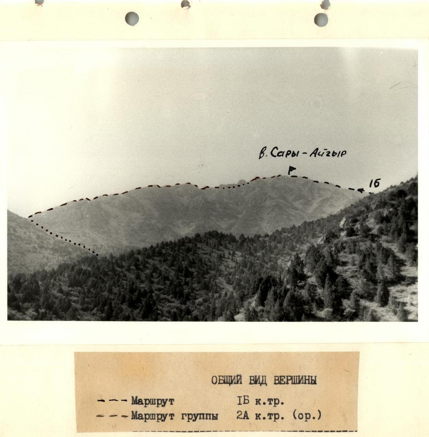
General view of the summit
--- Route: 1B category of difficulty
-
-
- Group's route: 2A category of difficulty (original)
-
Brief description of the route
The "Sary-Aygyr" peak is located in the Ugam Ridge (Western Tien Shan), southwest of the "Sayram" peak — the highest point in the area.
From Chimkent city, take the asphalt road to the Kask-Su settlement and then continue on the dirt road along the Sayram-Su river to the base camp (see the area map).
From the base camp, follow a good trail into the first right gorge, on its left side, to the beginning of the route. The start of the route is to the right of a sharp tooth.
Descent via 1B category of difficulty.