Rafikov I.Sh. (team leader), Vchinnikov S.I., Li N.B., Mendorf V.R. Route: Sairam – Ayutor, NE ridge, to the right. Length 45 km. Height 4724.6 m, 20 hours. 24-25.09.1984.


Ascent to Sairam Peak
- Group's route
- Sedelnikov's route, 5B cat. diff.
Crux of the route
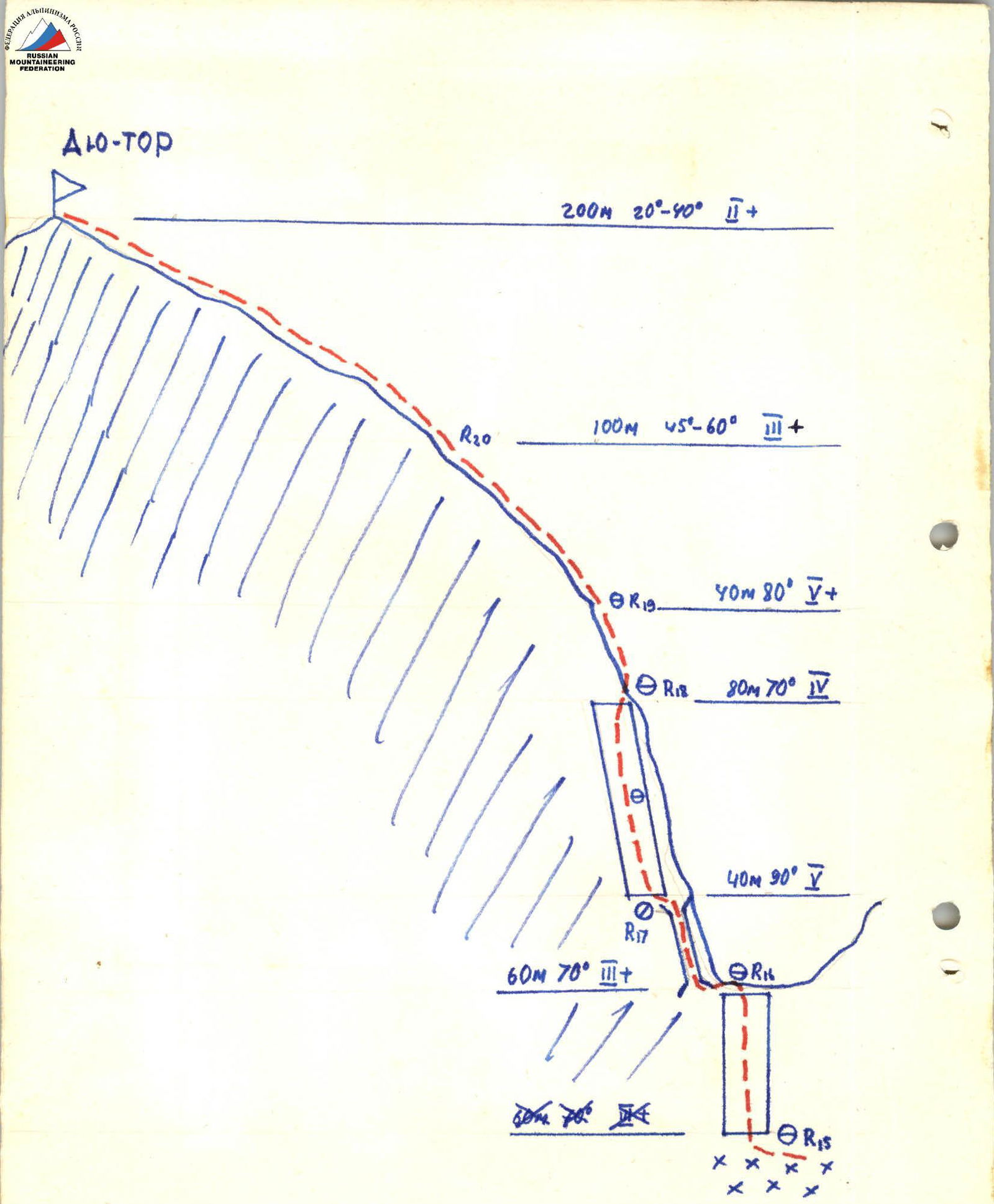
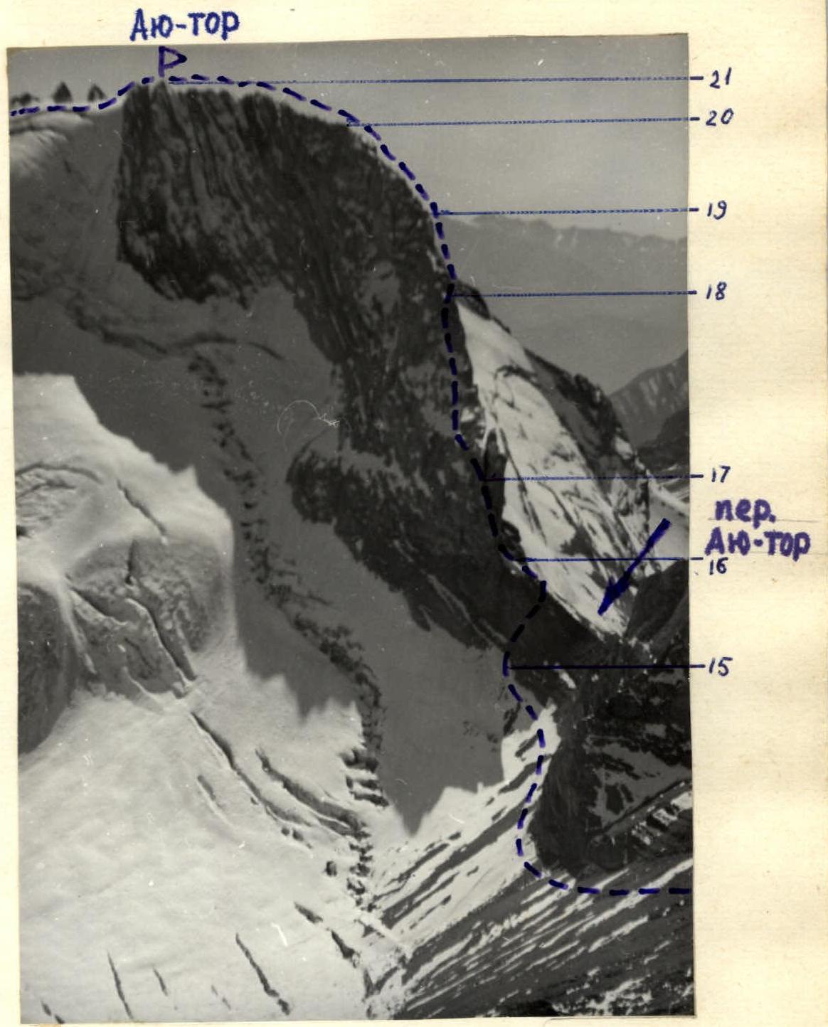
North edge of Ayu-Tor peak (left profile) TABLE of main characteristics of the Sairam – Ayutor traverse route
Descent to the south along the ridge into the Chimbulak river valley
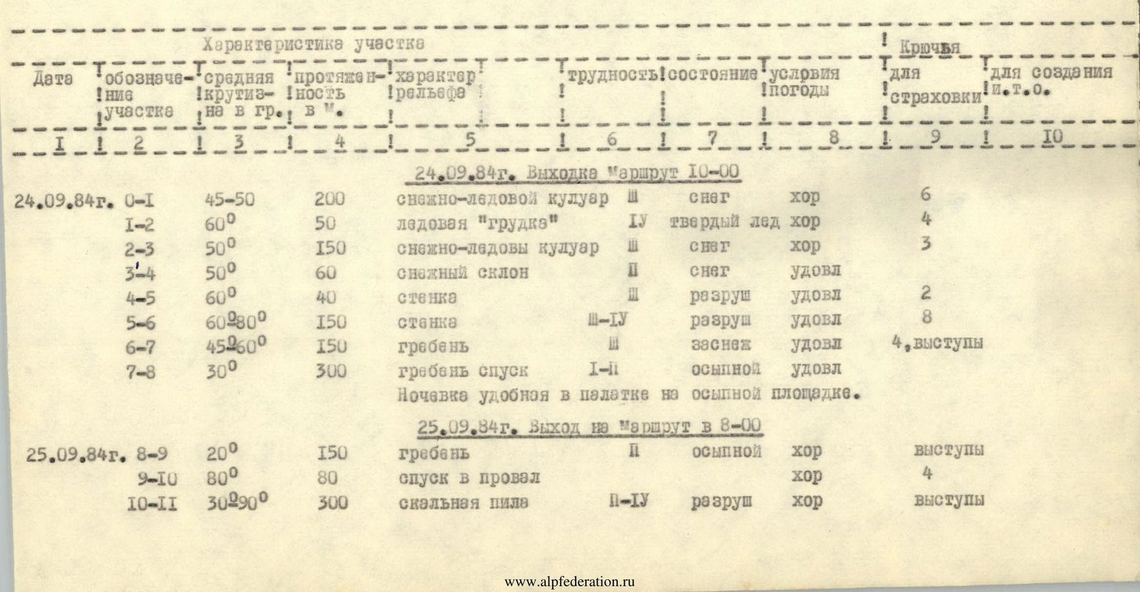
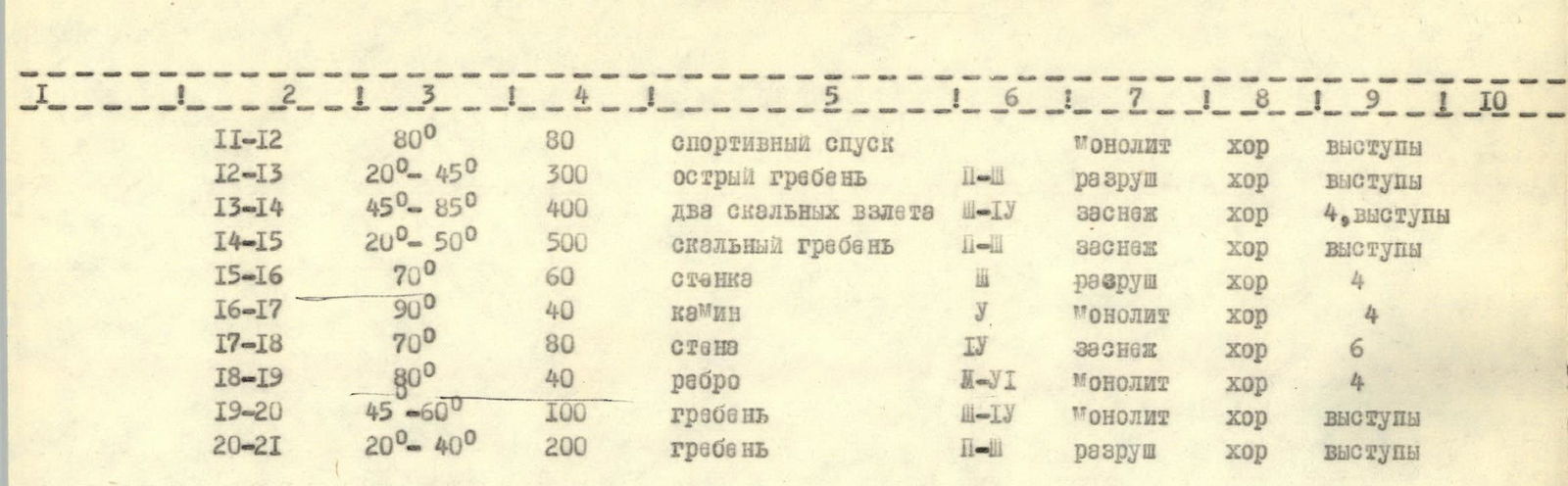
Brief description of the route
The traverse of Sairam – Ayutor peaks passes through the most elevated part of the Ugam range. The entire route lies at an altitude of 4000 m.
From a large clearing (base camp location) via Solnechny pass under the northern wall of Sairam peak.
The entire journey takes 4 hours. Up a snowy-icy couloir, to the left of the hanging glacier, ascent to the plateau. From the plateau (attention — crevices) up a snowy-icy slope and then up a rocky wall to the saddle of the north-eastern ridge of Sairam peak. Along the left edge of the ridge – exit to the pre-summit ridge and then to the summit of Sairam peak. From the base of the couloir, the entire route takes 8-10 hours.
Descent from Sairam peak to the south (500 m). Overnight stay on a rocky platform. From the overnight stay – a significant ascent to the southern shoulder of Sairam peak, and from it two 40-meter rappels into the ridge gap. From the gap, up a "rock saw" consisting of a series of "gendarmerie" peaks, ascent to the rocky tower of Chiment peak. Then two 40-meter sport descents and along a sharp rocky ridge to the saddle between Chiment and Arsen peaks. Ascent to Arsen peak via a 300-meter rocky ridge consisting of two large steps.
From Arsen peak, a rocky bastion branches off to the left, descent under Ayutor pass. Up a 50-meter wall to the pass – to the crux of the route: the northern edge of Ayutor peak.
Ascent to Ayutor peak begins up a 40-meter vertical chimney. Then along the left edge of the edge 80 m up to a small ledge. Difficult climbing, rocks are snow-covered. Up a vertical ascent of the edge (small sections overhang) 40 m up to a platform and along a gradually flattening ridge – ascent to Ayutor peak.
From Ayutor peak, descent to the south along the ridge, and then down scree into the Chimbulak river valley.
The route is logical and is one of the most beautiful in the area.
The ascent corresponds to 4B cat. diff.