Ascent Passport
- Ascent class — rock
- Ascent area — Western Tian-Shan, Ugam ridge
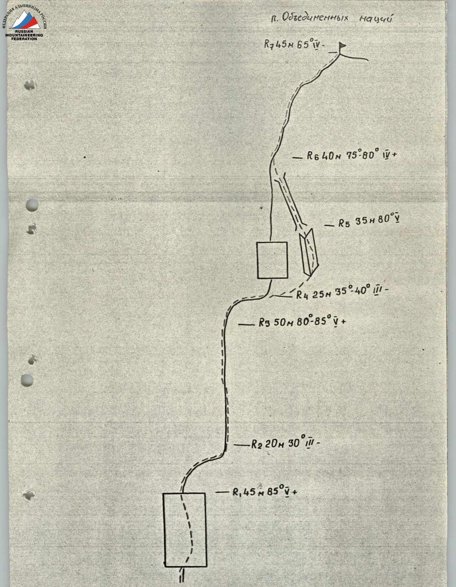
- Peak, its height, and ascent route — "Ob'edinennykh natsiy", 3900 m, NW ridge
- Estimated difficulty category — 3B
- Route characteristics: height difference — 200 m average steepness — 65° length of sections: 3 – 45 m, 4 – 85 m, 5 – 130 m
- Pitons driven: rock — 7 chocks — 15 bolted — none
- Travel time — 8 hours
- Number of overnight stays and their characteristics — none
- Participants' names and sports qualification: Rezaev I. V. — 1st sports category Melnikov V. G. — 1st sports category Rafikov Sh. R.
- Coach —
- Date of ascent and return — August 29, 1990
- Organization — SKF "Altex"
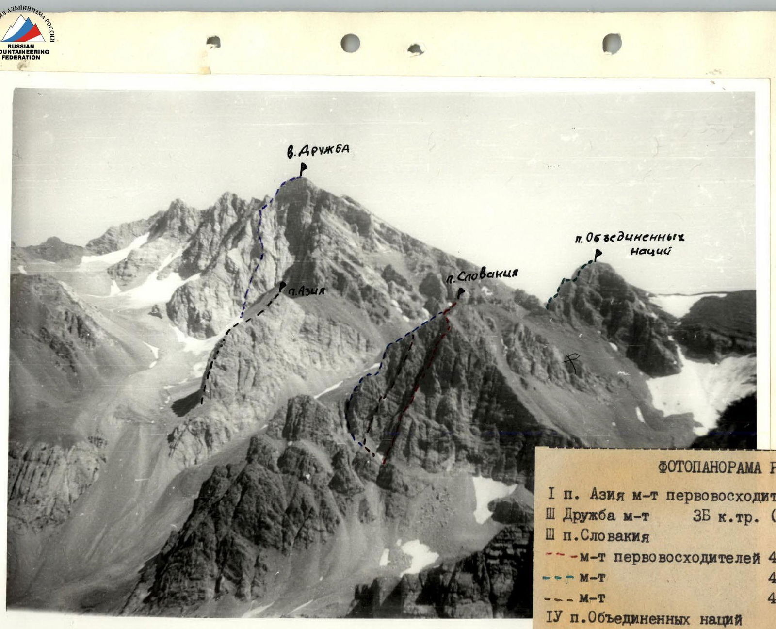
PHOTO PANORAMA OF THE AREA
- p. Aziya — route of first ascenders 4A cat. diff. (orig.), 3rd group
- p. Druzhba — route 3B cat. diff. (orig.) center coff. Ber.
- p. Slovakiya: – route of first ascenders 4B cat. diff. (orig.), 3rd group – route 4A cat. diff. (orig.), 23rd group – route 4B cat. diff. (orig.), central ridge
- p. Ob'edinennykh natsiy — route of first ascenders 4A cat. diff. (orig.), NW ridge
Brief description of the route
The peak "Ob'edinennykh natsiy" is located in the Ugam ridge (Western Tian-Shan), southwest of the peak "Sayram" — the highest point in the area.
From the city of Chimkent, take the asphalt road to the settlement of Kaska-Su and then continue on the dirt road along the Sayram-Su river to the base camp (see the map of the area).
From the base camp, follow a good trail along the Kergely river for 3 hours and 30 minutes to reach the overnight stay location near the upper lakes.
The approach to the start of the route takes 3 hours, walking along a wide moraine leading to the "Ob'edinennykh natsiy" pass. Then, head right to the saddle between the peak "Slovakia" and the peak "Ob'edinennykh natsiy" to the start of the route.
The descent from the summit is to the left, along the ledges, through the "Ob'edinennykh natsiy" pass, down to the upper lakes.