Ascent Passport
7.11 Western Tien Shan, Sayram-Su gorge (base camp 1760)
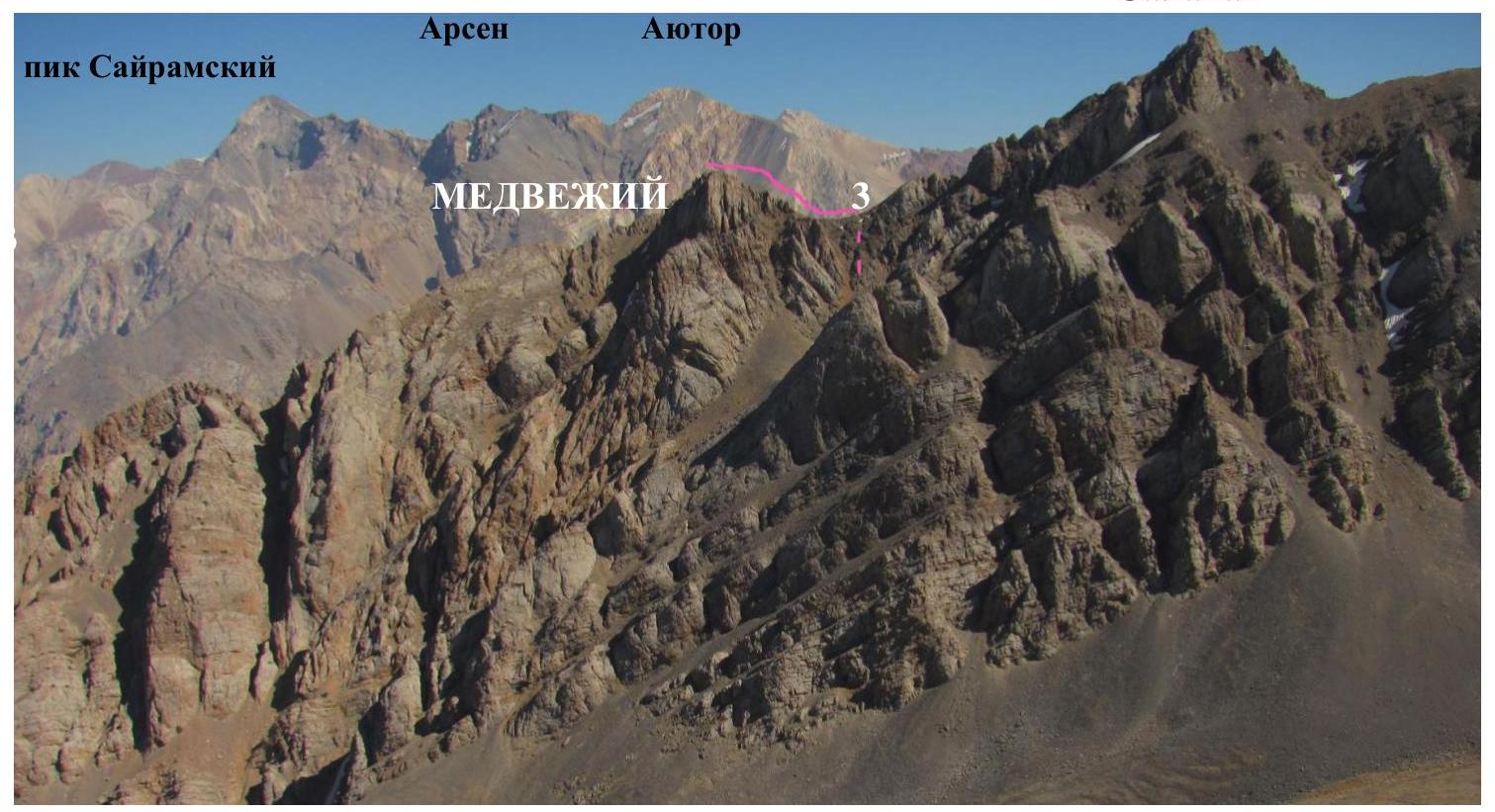
Medvezhiy 3015 m
First Ascent X)
Route of first ascent: from the east to the south ridge Proposed: 1B cat. difficulty, rock Altitude difference according to altimeter: 725 m Estimated length: 1500 m Steepness: up to 40° on difficult sections "No hooks left" Approach from Base Camp 1760 via Kirgiyly gorge: from 17:00 to 19:15 on July 11, 2013 Departure from bivouac 2100 in Kirgiyly gorge: at 5:30 on July 12, 2013 Start of ascent: at 6:00 Reaching the summit: at 12:00 Descent from the summit: from 13:00 to 15:30 via the ascent route to bivouac 2100 Return to Base Camp 1760 at 17:50 Time taken to reach the summit (excluding approaches and rests): 5 hours 30 minutes (one day, July 12, 2013)
Leader: Kerher Elena Gustavovna (III cat. No. 062) Participants: 2. Arbačiauskas Vitas (–) 3. Bochkareva Viktoriya (Shs/r.) 4. Zinovyeva Yevgeniya 5. Lainopulo Stanislav (Shs/r.) 6. Mustafa Olzhas 7. Slavin Denis (Sh+s/r.) 8. Obert Viktor (–) 9. Tanyaev Viktor (Shs/r.)
Senior coach AM: Master of Sports of the USSR Levin M.S. (1st cat. No. 036) AM organized by the Climbers' Club of Chelyabinsk. Responsible for the Report: Kerher E.G. (Elena Kercher elenakercher@mail.ru)
X) Starting to explore the Smorodino gorge, Vadim Melnikov laid out a route in 1990 along the north-eastern counterfort of peak 3015 and named it "Medvezhiy peak", but this 3A cat. difficulty route, repeatedly repeated, did not make it into the KTHM. There is no description - on the rock, they painted 3A and an arrow, and that's where it starts.
Sheet 1-2, PHOTO No. 1: View from the slopes of peak Kh.A.Yasavi (3500) on September 24, 2012 Shown:
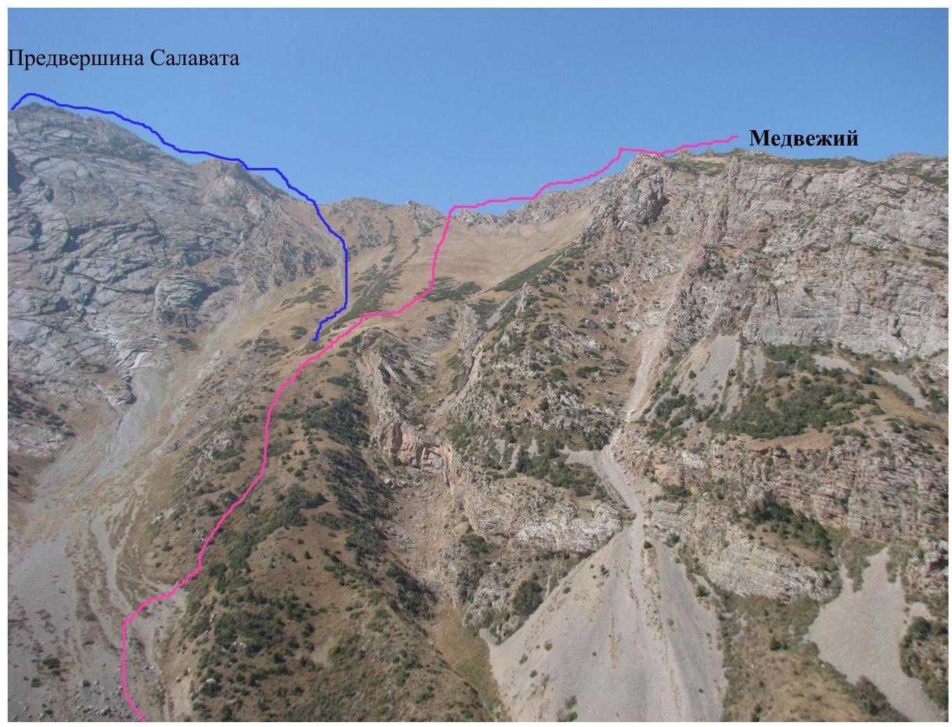
- (red line) the described route from the east to the south ridge of Medvezhiy
- (blue line) the route 1B cat. difficulty from the east to the north ridge of Salavat (the summit is not visible).
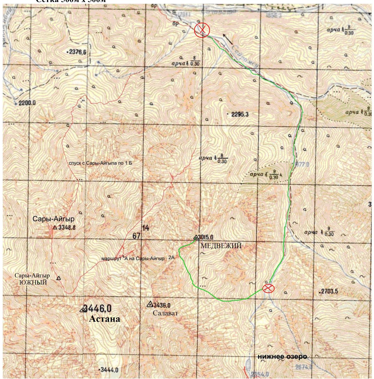
We ask that this photo be counted as a profile on the right (2-3). Sheet 3-5a Map of the area of the first ascent (K. Pazylbekov, July 15, 2013) Grid 500 m × 500 m
The exploration of the most interesting peaks of the Ugam ridge began in the 60s of the XX century, precisely from the Sayram-su river gorge. Now, by car, you can reach an altitude of 2000 m in 2 hours (80 km from Shymkent, including 76 km on asphalt), and there is stable communication between the base camp and Russia using local SIM cards Aktiv and Kcell.
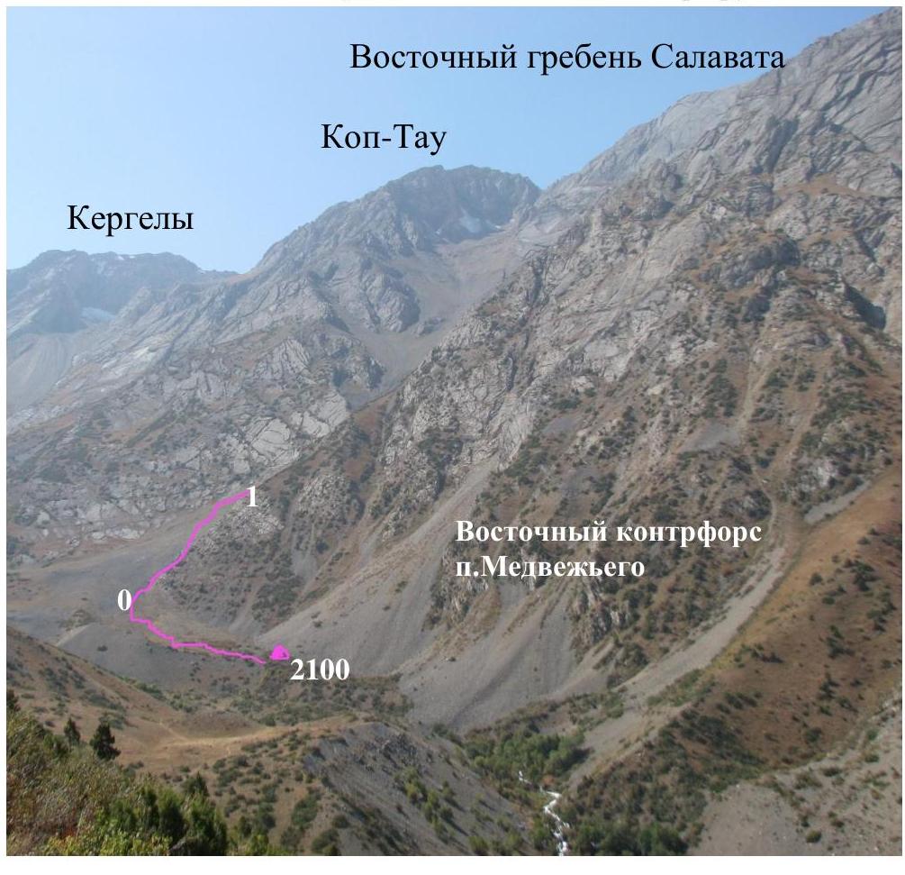
Approach from Base Camp 1760 along a good trail along the Sayram-su river, then across a sturdy bridge to a small bridge beyond the confluence with the Kirgiyly river, then to a bad bridge across the Chimbulak river and across an old bridge to the left (orographic) bank of Kirgiyly. Here is a bivouac on a clearing at 2100, near the beginning of the slope of a large couloir - the ascent route between the slope of Salavat and the eastern counterfort of Medvezhiy (the ascent could be done without organizing a "hop", but in July, on the eastern slope, it's very hot during the day!).
The base camp 1760 and the assault bivouac 2100 to the SSE of Medvezhiy 3015 are indicated.
Sheet 3-6, TABLE OF MAIN CHARACTERISTICS. Summit: MEDVEZHIY 3015 m
| Section No. | Estimated length | Steepness | Nature of relief and method of advancement | Cat. difficulty | Number of "hooks" | Time | Heights according to GPS |
|---|---|---|---|---|---|---|---|
| 4 | 150 | up to 40 | Pre-summit rocky ridge - in rope teams | 1 | via ledges | 12:00-11:20 | 3015-2800 |
| 3 | 500 | 20 | Crossing the couloir to the saddle of the south ridge - simultaneously | 1 | none | 10:50-9:00 | 3000-2800 |
| 2 | 700 | 30 | Transition to the slope of the eastern counterfort - simultaneously | 1 | none | 9:00-6:40 | 2800-2405 |
| 1 | 150 | up to 35 | Grassy-scree slope bypassing the eastern counterfort - simultaneously | 1 | none | 6:40-6:00 | 2405-2290 |
Sheet 4-7, TECHNICAL PHOTO (No. 5, 6) Pre-summit of Salavat
Notes on PHOTO No. 6:
- the bivouac site at 2100 is shown conditionally.
- the summit of Medvezhiy peak is not visible.
- the blue line shows the route 1B cat. difficulty to Salavat peak
Sheet 4-8: Brief description of the route along the north-eastern ridge of peak MEDVEZHIY
Along a good trail along the Kirgiyly river to a very wide eastern couloir, leading to the saddle of the ridge between the pre-summit of Salavat (left) and the summit of Medvezhiy (not visible from below).
Choosing a path through the couloir does not present technical difficulties, and there is no risk of rockfall. In May, the snow on the eastern slope melts early, leaving patches.
Important features of the route:
- Move along the south ridge of Medvezhiy in rope teams
- Cornices are possible in May
The tour is quite high and clearly visible.
The route is educational, allowing work on:
- scree,
- grassy slopes,
- with a rope on a safe rocky ridge.
Descent is via the ascent route.
The considerable length and varied relief make it possible to compare the described route with other 1B category difficulty routes, such as those to Bashkortostan and Enbek: here, after traversing a long slope, the group ends up on a rocky ridge with sections of 1 cat. difficulty.
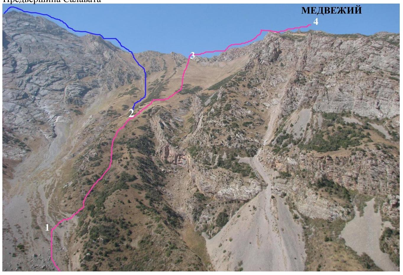
Sheet 5-10: Photo illustrations of technically complex sections (showing the line of movement) PHOTO No. 5: start of the route.
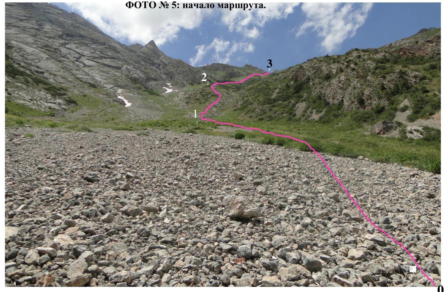
PHOTO No. 6: bypassing the counterfort on the left (1-2).
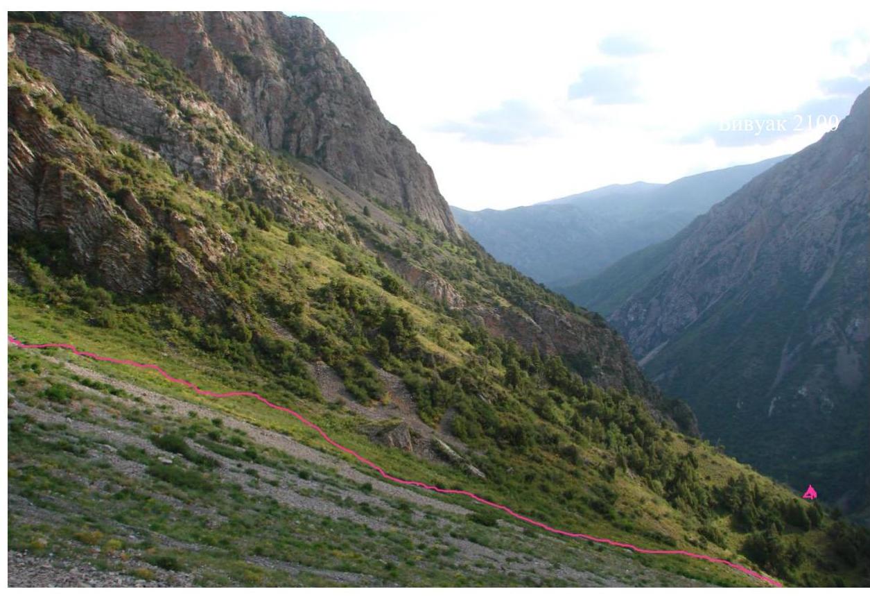
PHOTO No. 7: Upper part of the route.

PHOTO No. 8: On the ridge (3-4)
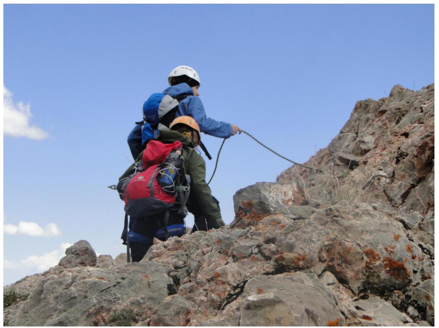
PHOTO No. 9: Reaching the summit!
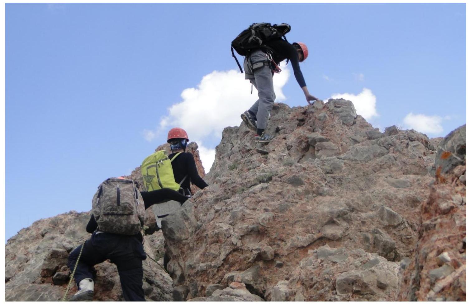
PHOTO No. 10: View from the summit of peak ASTANA to the north-east. Salavat
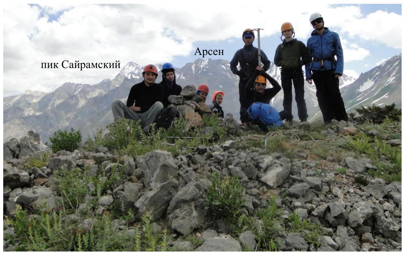
Mandatory PHOTO: On the summit of peak MEDVEZHIY.