ASCENT DOCUMENT
- Ascent class — rock climbing
- Ascent area — Western Tian Shan, Ugam ridge
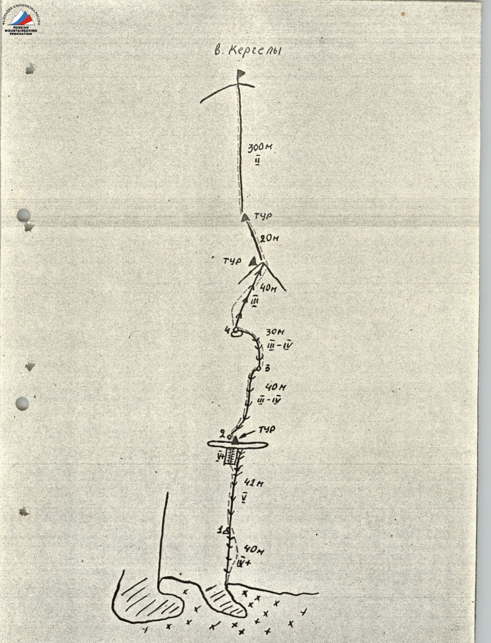
- Peak, its height, and ascent route: "Kergely" — 3887 m, via NW side
- Estimated difficulty category: 3B
- Route characteristics:
- Height difference: 390 m
- Average steepness: 65°
- Section lengths: 2–300 m, 3–75 m, 4–75 m, 5–42 m
- Pitons hammered in:
- Rock pitons: 5
- Chocks: 17
- Bolt pitons: –
- Travel time: 4.5 hours
- Number of nights stayed and their characteristics: none
- Participants' full names and their sport qualifications: Ezef Samel, Juraj Švolik
- Date of ascent and return: May 8, 1988
- Organization: Climbing Club "Altex"
BRIEF DESCRIPTION OF THE ROUTE
"Kergely" peak is located in the Ugam ridge (Western Tian Shan, southwest of "Sairam" peak — the highest point in the area).
From Chimkent city, take the asphalt road to Kaskasu settlement and then continue on the dirt road along Sairam-Su river to the base camp (see area map).
From the base camp, follow a good trail along Kergely river; in 4.5 hours, you'll reach the upper lakes where you can set up camp.
To approach the start of the route, go right from the upper lakes along the moraine under the NE wall; it'll take 1.5 hours from the campsite.
Descend from the summit southward via Kergely valley and then back to the upper lakes.