Climbing Passport
I. Climbing category — rock climbing
2. Climbing area — Tian Shan, Ugam Ridge
3. Peak, its height, climbing route — p. Kergely, 3750 m, northwestern counterfort.
4. Estimated difficulty category — 2B.
5. Route characteristics:
height difference — 450 m,
average steepness of the wall section — 55°,
total route — 35°,
length of sections: 1—..., 2—100 m, 3—345 m, 4—130 m, 5—...
6. Number of pitons (placed elements):
for belay: rock 42, ice 0, bolted 0
for creating ITO: rock 0, ice 0, bolted 0
7. Number of travel hours — 5.5 hours
8. Number of overnight stays — no overnight stays
9. Full name of the leader and participants, their qualifications:
leader: FRANKENBERG A.B. Candidate for Master of Sports
KONOVALOV O.A. 1st sports category
SHUSHARIN S.N. 1st sports category
EGOROV E.Y. 1st sports category
10. Team coach: TSELOVAKHIN V.V.
11. Date of departure and return: 05.05.1988 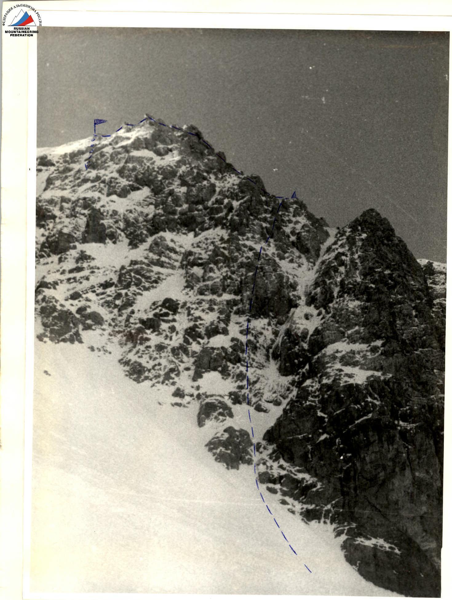
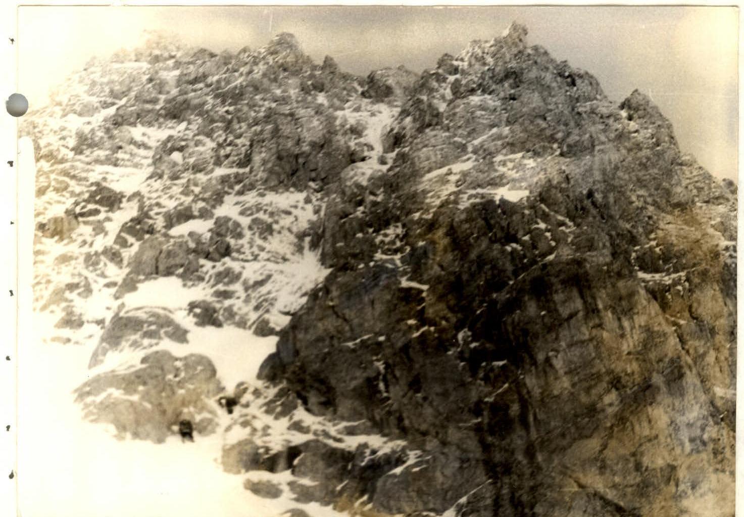
General view of the route
Route description to p. Kergely
via the northwestern counterfort 3B cat. diff. (approximately). From overnight stays near the "lower lakes" ascend along the trail through the Kergely river valley. Landmark — a characteristic jagged ridge leading to p. Kergely, clearly visible from the overnight stays. Before reaching the ridge, turn right and ascend along the snowy couloir. By passing the rock wall on the right, we enter a heavily snow-covered cirque between the peaks Kergely (on the left) and Kop-Tau (on the right). Total time from overnight stays is 3–3.5 hours.
Ascend a steep snowy slope to the counterfort, bypassing a steep reddish wall on the left. It is recommended to move near the rocks, as the slope is avalanche-prone.
The start of the route is at the base of a steep snowy inner corner leading to the upper part of the counterfort. The first belay point is from snow, through pitons driven into the rocks. The route passes along steep, heavily snow-covered rocks to the left of the inner corner. Belay is with pitons; various placed elements are well-suited. In the upper part, the counterfort becomes less steep, and a control cairn is built on a shelf near a notable rock outcrop. From the start of the rocky part of the route to the control cairn is 140–150 m, 3–3.5 hours.
Further, along easy rocks, 80 m to the ridge, 2–3 cat. diff. A gendarme on the ridge is overcome directly with piton belay. Along the ridge to the summit is 200–250 m, 1.5–2 hours.
Descent from the summit to the south along a snowy slope, which leads to the upper snowy cirque of the Kergely river valley, and further down along the trail. From the summit to the overnight stays, the descent takes 1.5 hours.
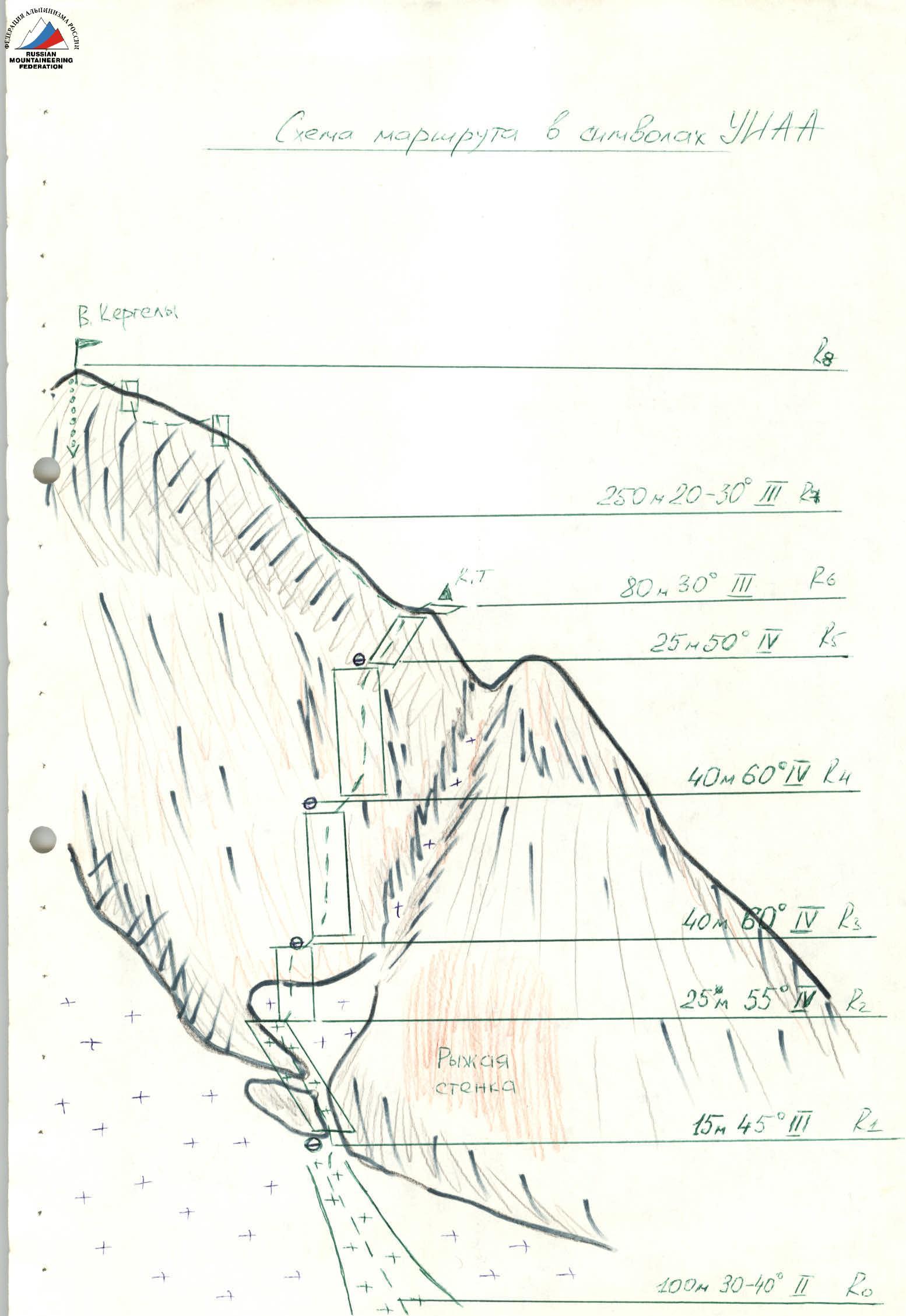
Route diagram in UIAA symbols
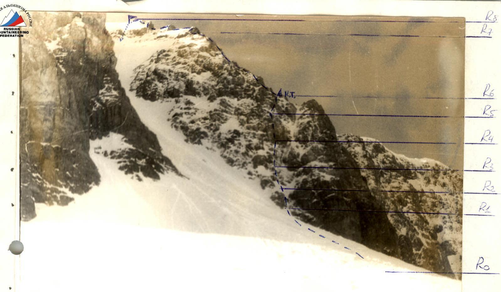
Table of route sections to p. Kergely via the northwestern counterfort
| Date | Designation | Average steepness in degrees | Length in meters | Terrain characteristics | Difficulty | Condition | Weather conditions | Rock pitons | Ice pitons | Bolted pitons |
|---|---|---|---|---|---|---|---|---|---|---|
| 05.05.1988 | R0–R1 | 35° | 100 m | Snowy slope | 2 | good | Sunny, warm | — | — | — |
| — | R1–R2 | 45° | 15 m | Snowy inclined rock shelf | 3 | — | — | 3 | — | — |
| — | R2–R3 | 55° | 25 m | Rock wall | 4 | Snowy rocks | — | 6 | — | — |
| — | R3–R4 | 55° | 40 m | Rock wall | 4 | — | — | 10 | — | — |
| — | R4–R5 | 60° | 40 m | Rock wall | 4 | — | — | 12 | — | — |
| — | R5–R6 | 50° | 25 m | Rock wall | 4 | — | — | 9 | — | — |
| — | R6–R7 | 30° | 80 m | Easy rocks | 3 | good | — | — | — | — |
| — | R7–R8 | 25.0° | 250 m | Ridge | 3 | — | — | 2 | — | — |
Photographs