7. II – Tian Shan, Ugam Ridge
Climbing Descriptions
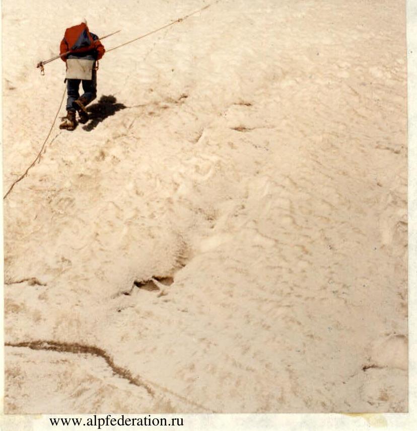
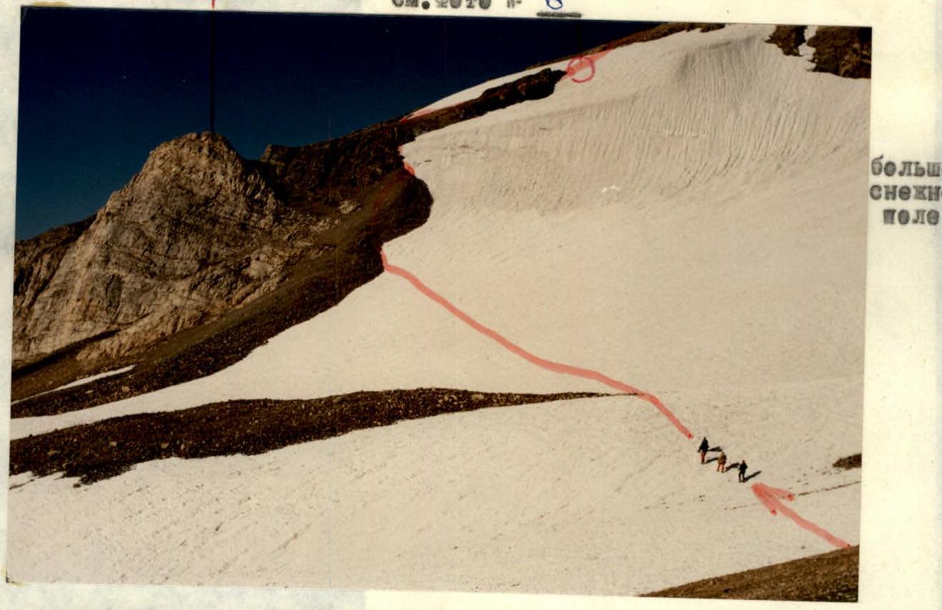
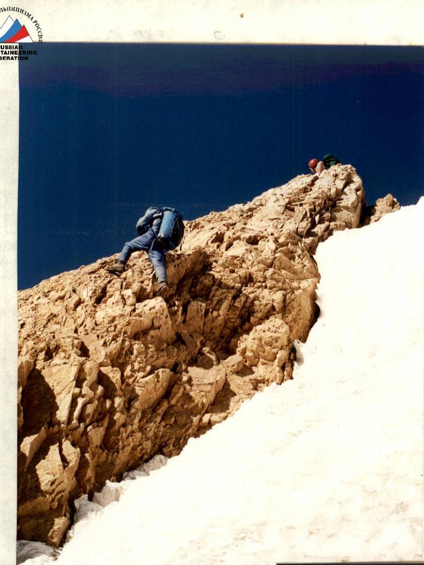
The trail leading up the right (hereinafter – orographically) bank of the Sayram-su River, in 40 minutes' walk from the rock with memorial plaques, turns left above the eastern tributary, which some call "CHIMBULAK", forester Benkov – "KOP-JAILYAU", and the gamekeeper names this "alley" of the Ugam Ridge "WILD CLIMBERS' GORGE". Walking along it upwards along occasionally interrupted paths, from the confluence (elevation 2000 m) to the lake below the Snezny Pass – 4–5 hours walking time. Above the lake on the scree there are good sites (elevation 3280 m). The ascent to the pass is on the right, where a scree island cuts through the cornice. The grassy hill rising to the west near the pass is the junction of three ridge crests. The ridge towards the majestic Kara-tau has not yet been classified, and the ridge towards the Druzhba massif rests against the alignment of rockfall-dangerous walls. But descending from this ridge to the left, you can cross the snowy "tie" and ascend along the eroded Eastern buttress to the southern shoulder of the massif. This buttress, closer to the pass, can be called "right", as to its left, on the other side of the large snow field (800 m to the South), a parallel buttress descends from the southern shoulder – "distant" or Southeastern. Both buttresses were climbed in 1996 by interacting groups of Ural climbers.
Vladislav Peak
Class: ROCK. Region: TIAN SHAN, UGAM Ridge.
Height: 3620 m (by altimeter from the 3360 m elevation of Snezny Pass indicated on the tourist map)

SW Ridge Route (1B cat. diff., first ascent)
Height difference: 350 m. Length: 1000 m ridge. Average steepness: 27°. Climbing hours: 3 (from the "3280" bivouac on the scree to the North of Snezny Pass). Leader: instructor LEVIN Mikhail Semyon. (MS) + instructor Karpenko Oleg Vas. (Pr.). Date: August 19, 1996.
Traverse from SE Route (2A cat. diff., first traverse)
Height difference: 350 m.
Length: 160 m traverse (without descents).
Steepness: technical sections up to 60°.
Climbing hours: 4 (from the "3280" bivouac on the scree to the North of Snezny Pass).
Leader: instructor KARPENKO Oleg Vas. (Pr.) + Andrienko Alexey Mikh. (zn.), instructor Askarov Samat Nurmukham. (CMS), Velichkov Al-dr Ivan. (zn.), instructor Galibuzov Ivan Pavl. (CMS), Dudkina Eug. Petr. (zn.), Korobkov Serg. Al-dr. (Sr.), Kungurova Olga Ivan. (zn.), Lifanov Vl-r Sr. (zn.), Makarov Serg. Vikt. (zn.), Novozhilov Roman Anat. (zn.), Semenova Nat. Nikol. (zn.).
Senior coach: LEVIN Mikhail Semyon. (MS).
Date: August 20, 1996.
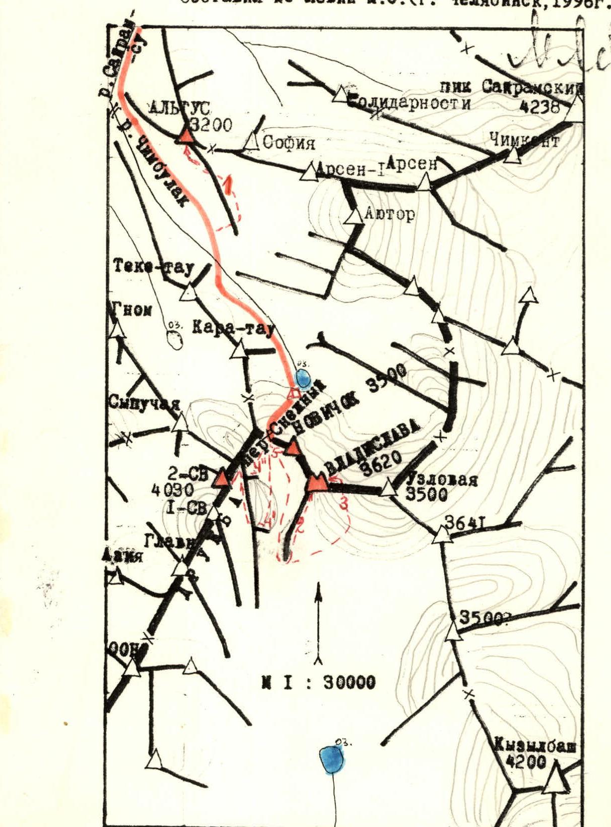
Druzhba Peak (2nd NE)
Class: ROCK. Region: TIAN SHAN, UGAM Ridge. Height: 4030 m (according to KTMGV). Route: via SE or E buttresses. Suggested cat. diff. for BOTH first ascents: 2B combined.
SE Buttress Route
Height difference: 770 m, including 380 m for the buttress. Length of wall section: 600 m. Average steepness of SE buttress: 35°. Pitons: 2 + 6 chocks. Climbing hours: 5 (from the "3280" bivouac on the scree to the North of Snezny Pass). Leader: instructor GALIBUZOV Ivan Pavl. (CMS) + Dudkina Eug. Petr. (zn.), instructor Karpenko Oleg Vas. (Pr.), Korobkov Serg. Al-dr. (Sr.), Makarov Serg. Vikt. (zn.), Novozhilov Roman Anat. (zn.), Semenova Nat. Nikol. (zn.). Senior coach: LEVIN Mikhail Semyon. (MS). Date: August 22, 1996.
Eastern Buttress Route
Height difference: 670 m, including 330 m for the buttress.
Length of wall section: 420 m.
Average steepness of E buttress: 40°.
Pitons: 6 + 4 chocks.
Climbing hours: 4 (from the "3280" bivouac on the scree to the North of Snezny Pass).
Leader: instructor ASKAROV Samat Nurmukham. (CMS) + Andrienko Alexey Mikh. (zn.), Velichkov Al-dr Ivan. (zn.), Kungurova Olga Ivan. (zn.), Lifanov Vl-r Sr. (zn.).
Senior coach: LEVIN Mikhail Semyon. (MS).
Date: August 22, 1996.
Southeastern Buttress Route
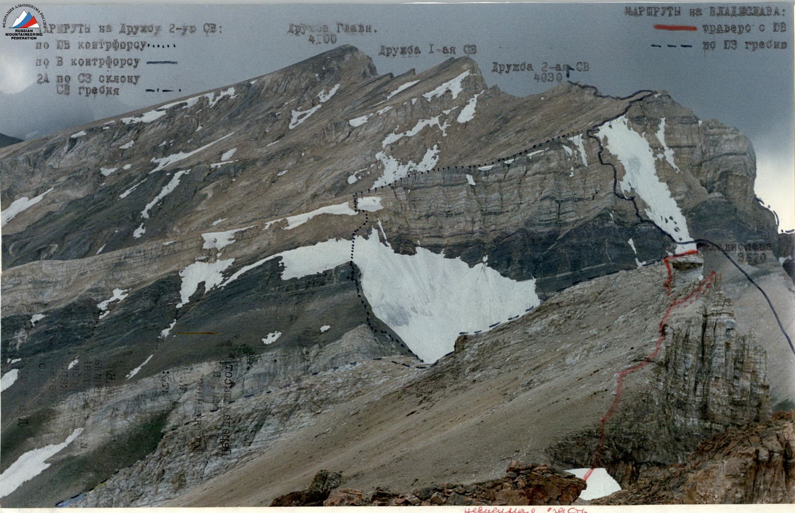
From Snezny Pass (3360 m) descend to the South along the slopes of Druzhba, orienting towards the triangular yellow tower of the first rock belt closest to the pass. From it begins the ridge of the SE buttress. The exit to the ridge is through a rock fall or along a steep snow slope (ice!), then along the ridge to the fall of black rocks. Behind them, along the snow field to the second yellow belt (rocks II–III cat. diff.) and a rock ascent (III cat. diff.), cutting through the snow slope below the last fall. Behind the fall (elevation 3730 m) turn right and along the slabs of the southern shoulder, a gentle ascent to the NE end of the Druzhba massif. Here (elevation 3960 m) turn left onto the main ridge of the massif to the 2nd NE summit (rocks II–III cat. diff.). The descent was made along the ascent route. Ascent time from Snezny Pass – 4 hours. The first ascent was made on August 22, 1996, by a group of Ural climbers led by I. Galibuzov + 6 people.
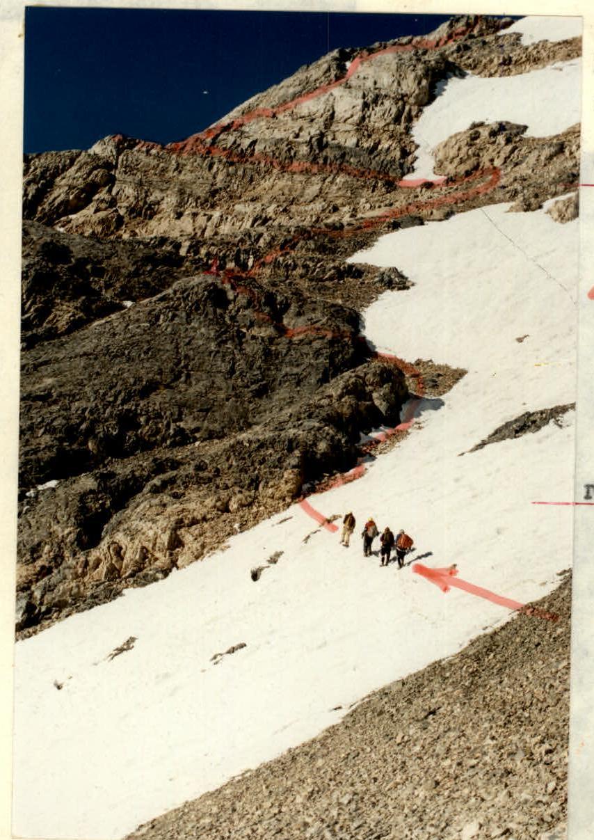
Eastern Buttress Route
From Snezny Pass, gain height to the right along an arc below the ridge of the Druzhba massif, orienting towards the "rocks" – islands in the snow of the "tie". On the other side of the "tie" begins the buttress – black rocks below, yellow rocks above. In the upper part of the black rocks (elevation 3600 m) – a control cairn. From it, parallel to the ridge of the buttress, gain 100 m in height almost to the end of the "rock claw" protruding into the snow "tie". From here traverse left to exit onto the ridge of the E buttress and up through a series of walls II–III cat. diff. to the last one, leading into a break in the snowy cornice onto the plane of the southern shoulder (elevation 3880 m). The path along the slabs of the S shoulder and to the summit is described ABOVE. Ascent time from Snezny Pass – 4 hours. Descent: via SE buttress or along the "tie" (ice!). The ascent was made on August 22, 1996, by a group of Ural climbers led by S. Askarov + 4.
The path along the slabs of the S shoulder and to the summit is described ABOVE. Ascent time from Snezny Pass – 4 hours.
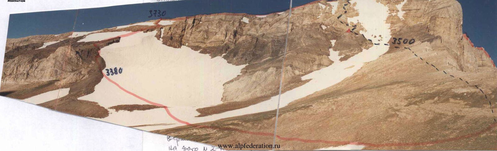
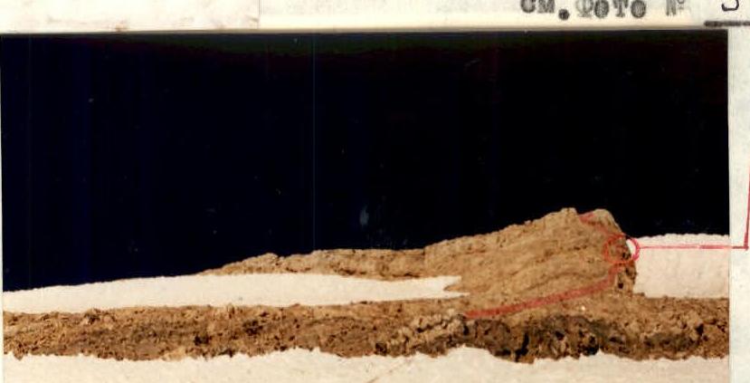
Triangular yellow tower
Start of the route on the Eastern buttress. Control cairn on black rocks.
Passing the rock ascent before the last fall.
Ascent to the 2nd rock yellow belt.