
Ascent Passport
- Area: Western Tien Shan, Ugam Ridge, 7.11.
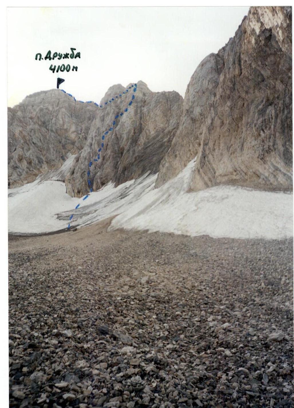
- Peak Name: Druzhba 4100 m, route: via the left part of the S bastion of the 3rd ridge.
- Difficulty category: presumably 5A, first ascent.
- Route characteristics: combined.
- Height difference of the wall section 500 m, route length 1280 m, length of sections: V difficulty category – 185 m, VI difficulty category – 35 m, average steepness of the bastion – 59°, total route – 49°.
- Pitons left on the route: total – 2, including bolted – 1.
Pitons used on the route:
- Rock: 12/2
- Bolted: 1/1
- Chocks: 79/2
- Ice screws: 6
- Team's total climbing hours: 10 hours.
- Climbing pair: Prudskikh A. – Candidate for Master of Sports, Nikitin A. – 1st sports category.
- Coach: Benkin V.S. – Master of Sports.
- Approach to the route: 9:00 August 5, 2001.
Reached the summit: 19:00 August 5, 2001. Returned to camp: 21:00 August 5, 2001.
General photo of the peak
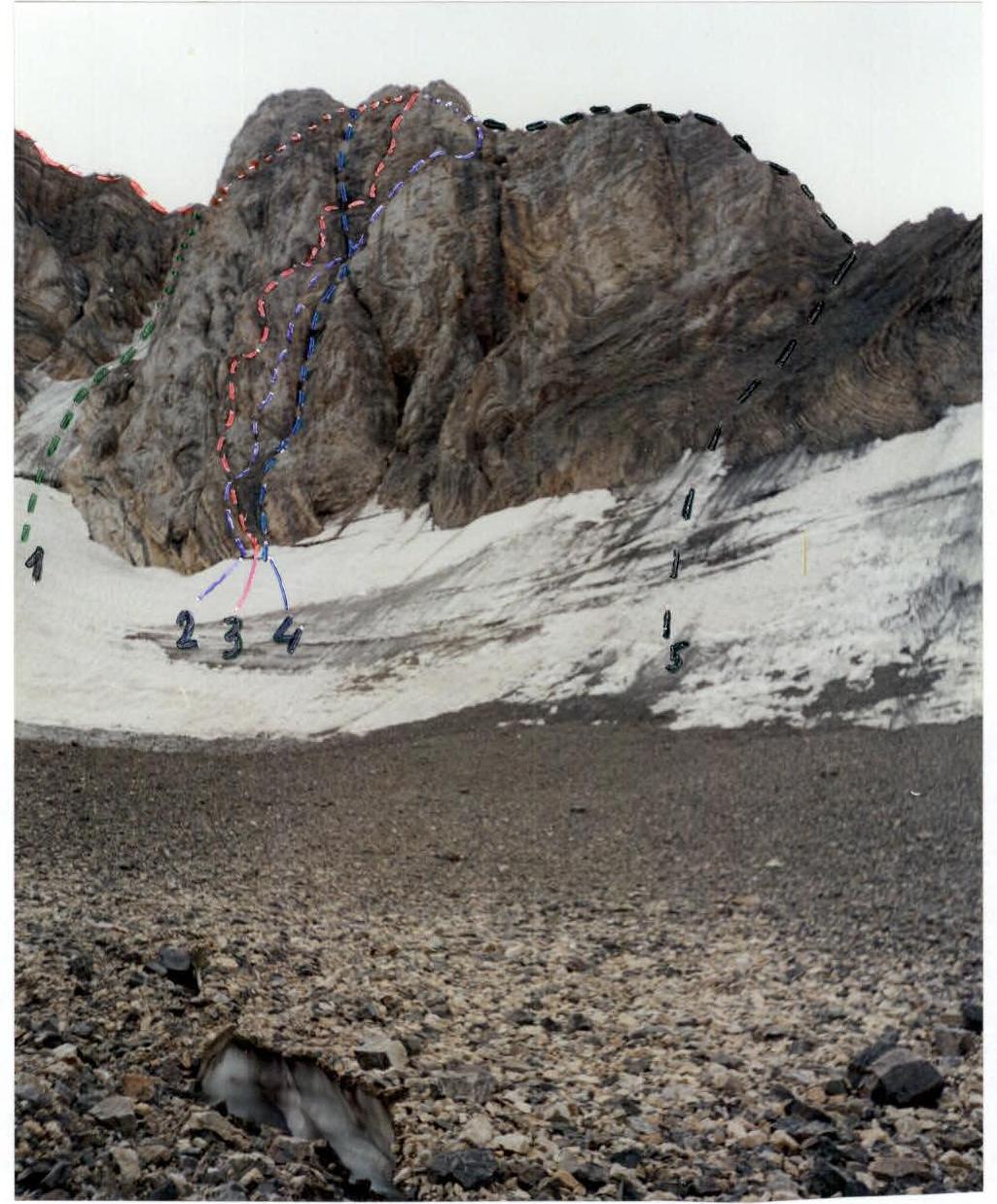
Date taken – August 5, 2001. Location – glacier in front of Druzhba peak.
-
- Via NW couloir of SW ridge, 4A (M. Galiev, 1987).
-
- Route climbed by the team.
-
- Via S bastion of the 3rd ridge, 5A (Sh. Rafikova, 1987).
-
- Via the "chimney" of S bastion of the 3rd ridge, 5A (F. Pyaček, 1988).
-
- Via W ridge 4A (G. Amal'in, 1987).
Photo of the wall profile from the left
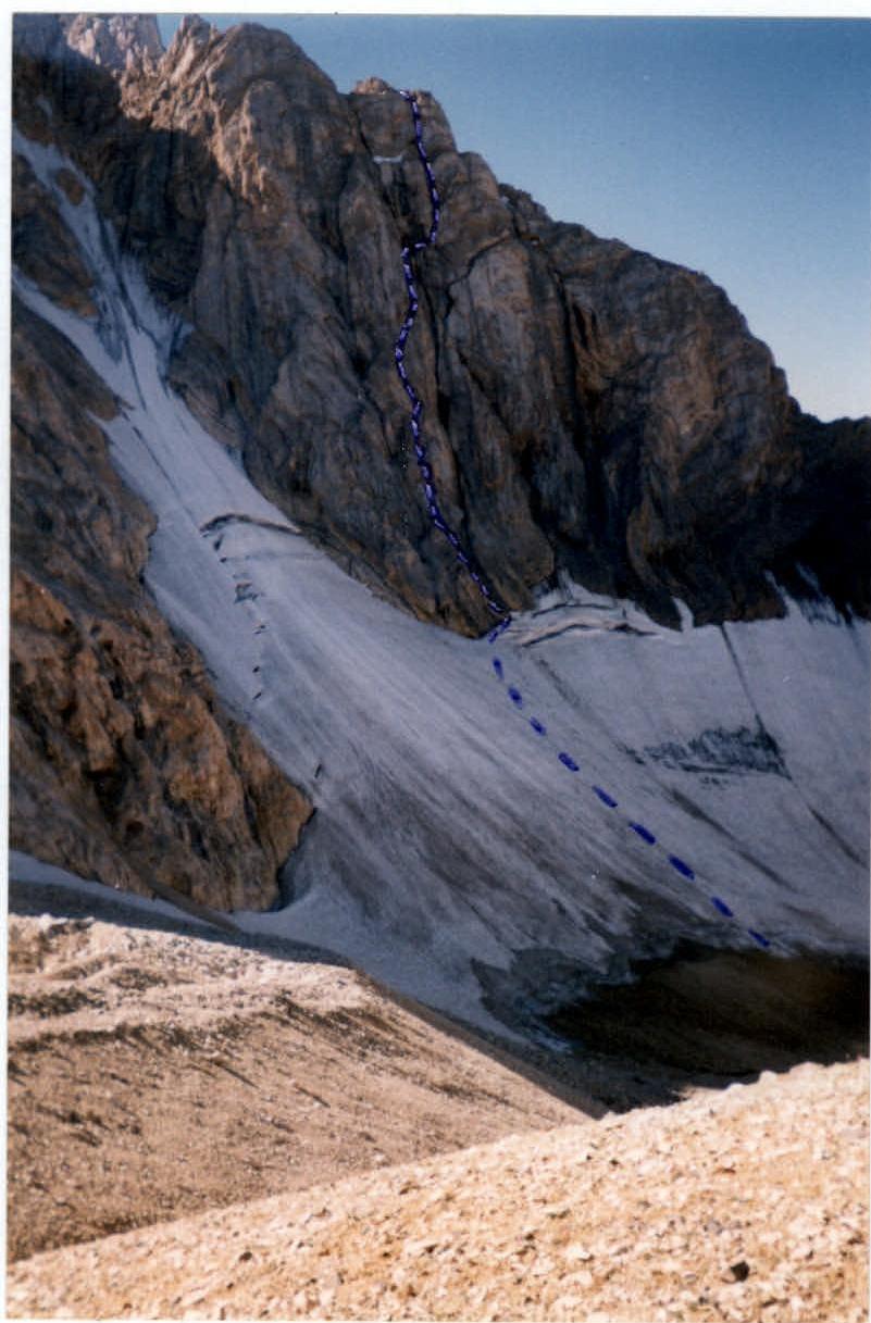
Photo of the wall profile from the right
Route diagram in UIAA symbols M1:2000
- R1: Rock anchors: 2, Chocks: 3. 3- 100 m 55°.
- R2: Chocks: 3. 4 35 m 60°.
- R3: Chocks: 2. 3 20 m 45°.
- R4: Rock anchors: 3. 4+ 15 m 70°.
- R5: Rock anchors: 5, Chocks: 2. 6 20 m 85° A2.
- R6: Chocks: 3. 5 15 m 80°.
- R7: Rock anchors: 2, Chocks: 3. 5 5 m 75°.
- R8: Chocks: 1. 3 15 m 0° (Traverse).
- R9: Chocks: 2. 3+ 20 m 45°.
- R10: Rock anchors: 1, Chocks: 2. 4 15 m 70°.
- R11: Rock anchors: 1, Chocks: 3. 4- 15 m 65°.
- R12: Rock anchors: 1, Chocks: 5. 5 35 m 80°.
- R13: Rock anchors: 5. 4 25 m 70°.
- R14: 3- 5 m 35°.
- R15: 4 10 m 55°.
- R16–R17: 3+ 5 m 95° A2.
- R18: Rock anchors: 5. 5 25 m 80°.
- R19: Rock anchors: 3, Bolted: 1. 5+ 10 m 70° A2 (Traverse).
- R20: Rock anchors: 2, Chocks: 3. 4- 25 m 45°.
- R21: Rock anchors: 1, Chocks: 1, Bolted: 1. 6 10 m 85° A2.
- R22: Chocks: 2. 5 15 m 75°.
- R23: Chocks: 4. 4- 15 m 65°.
- R24: Rock anchors: 1. 4 10 m 60°.
- R25: Rock anchors: 1. 2 10 m 40°.
- R26: Rock anchors: 1, Chocks: 2. 4- 15 m 65°.
- R27: Rock anchors: 1, Chocks: 2.
- R28: Chocks: 2. 2+ 10 m 60°.
- R29: Chocks: 1. 2 5 m 50°.
- R30: 2 15 m 35°.
- R31: Chocks: 3. 2–3 300 m 40°.
- R32: Rock anchors: 1, Chocks: 6. 5 60 m 80°.
- R33: Chocks: 4. 5- 20 m 80°.
- R34: 1 300 m 30°.
Photopanorama of the area
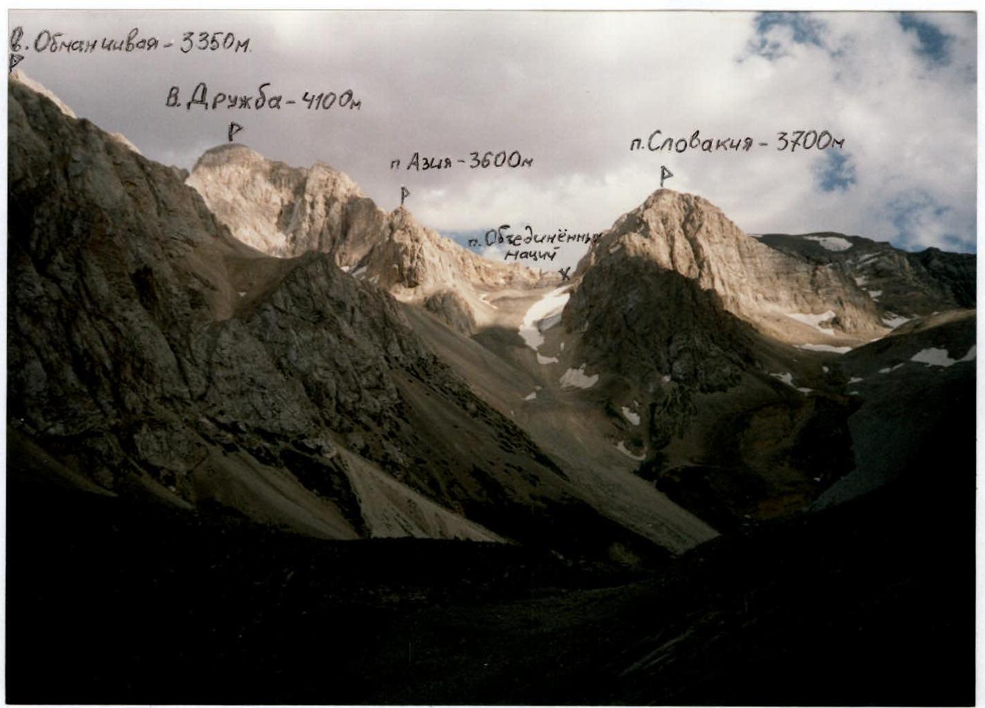
Date taken: August 6, 2001. Location: NE slope of Kergely peak.
Technical photo of the route
