ASCENT DOCUMENT
- Ascent class — rock climbing
- Ascent area — Western Tian Shan
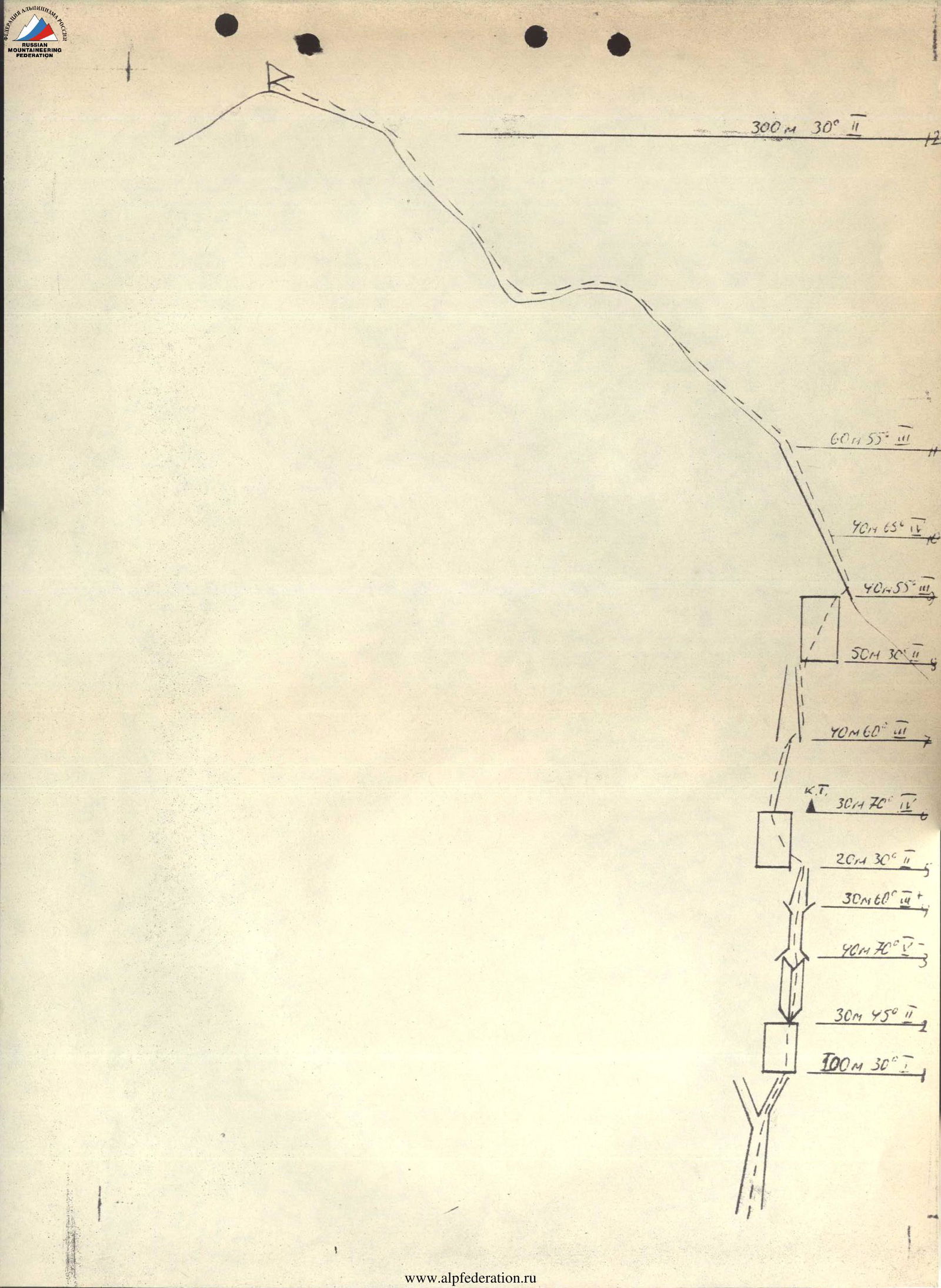
- Peak, its elevations, and ascent route — "Gnom" 3300 m via the right part of the western wall
- Proposed complexity category — 3B
- Route characteristics: elevation difference — 600 m average steepness — 60° length of sections — R2 350 m; R3 170 m; R4 70 m; R5 40 m.
- Pitons driven: rock — 18, chocks — 16
- Number of travel hours — 8 hours
- Participants' full names and sports qualifications — Gasanov Sh.G. — Candidate Master of Sports, Rafikov Sh.R. — Master of Sports
- Date of departure and return — September 15, 1988
- Organization — Kazakh Alpinist Club
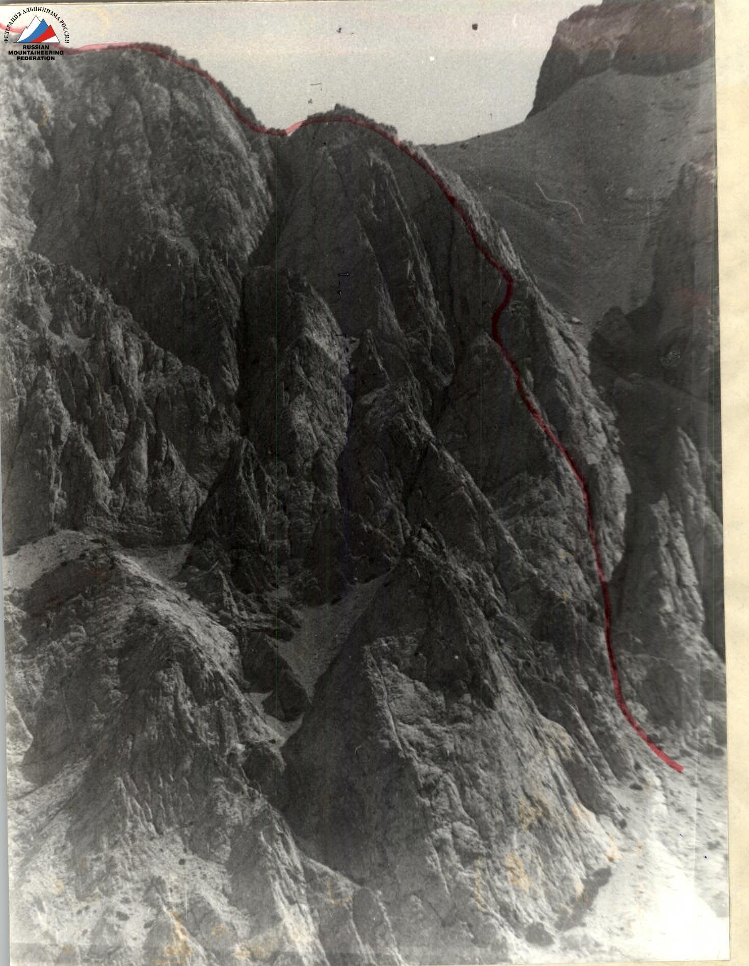
Technical photo
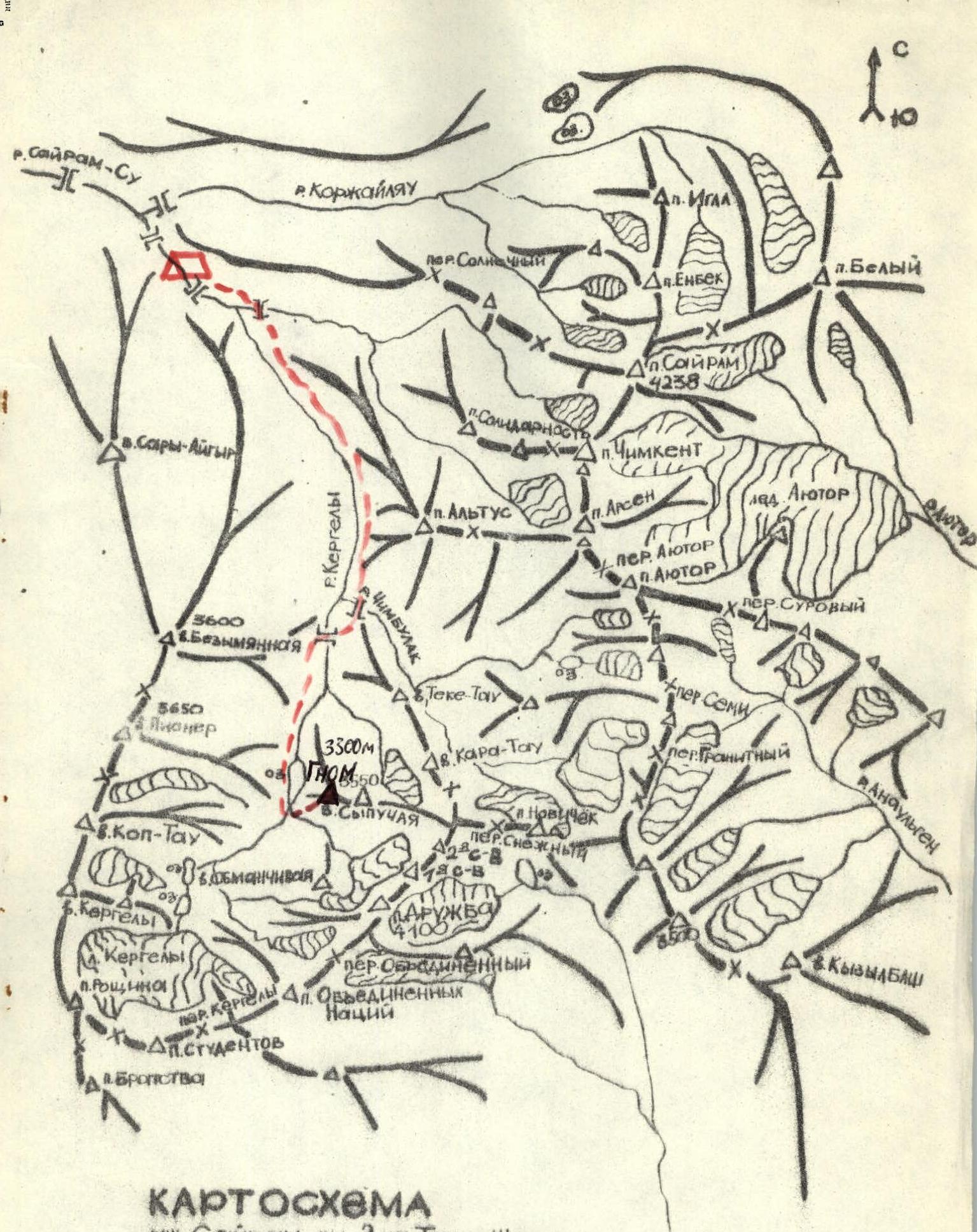
MAP of Sayram-Su valley, Western Tian Shan, Ugamsky ridge M 1:50,000

Ascent Route
Route 3A category
Route 2B category
Brief Description
The "Gnom" peak is located in a short unnamed spur of the Ugamsky ridge west of the "Druzhba" peak.
To the west, its slopes drop off with steep rock walls up to 500 m high.
From the base camp along a good trail along the Kergely River to the lower lake — 2.5 hours walk. From the lower lake along a wide couloir between "Obmannaya" and "Gnom" to the start of the route — 1 hour.
The route goes through the right part of the western wall, along steep rock ridges. The route is logical, in the upper part the rocks are ruined. It is advisable to complete the route in pairs.
There are sections of difficult climbing — it is advisable to have rock climbing shoes.
Descent to the south via the couloir.