Ascent Passport
- Region: Western Tian-Shan, Ugam ridge, 7.11.
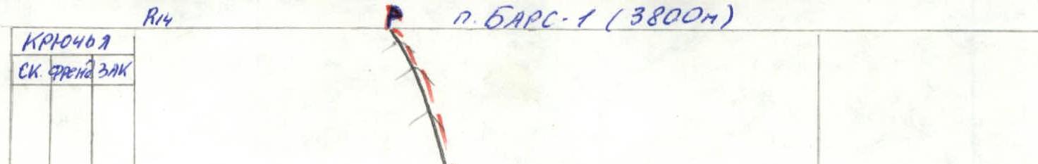
- Name of the peak: Bars-1 (3800 m), route name: via the left part of the N wall.
- Difficulty category: approximately 4A, first ascent.
- Route characteristics: rock.
- Height difference of the wall section: 520 m, route length: 1150 m, wall section length: 650 m, section lengths: 5th category – 130 m, 4th category – 150 m, average steepness of the route 59°.
- Pitons used on the route: Rock: 8, cams: 37, nuts: 19, ice screws: 0.
- Team's climbing hours: 6 h 30 min (pure ascent).
- Leader: Melnikov V.G. – Candidate Master of Sports. Participants: Varlamov N. – 2nd category.
- Coach: Benkin V.S. – Master of Sports.
- Departure for the route: 9:00 August 22, 1981. Reach the summit: 15:30 August 22, 1981. Return to camp: 17:00 August 22, 1981.
General photo of the summit.
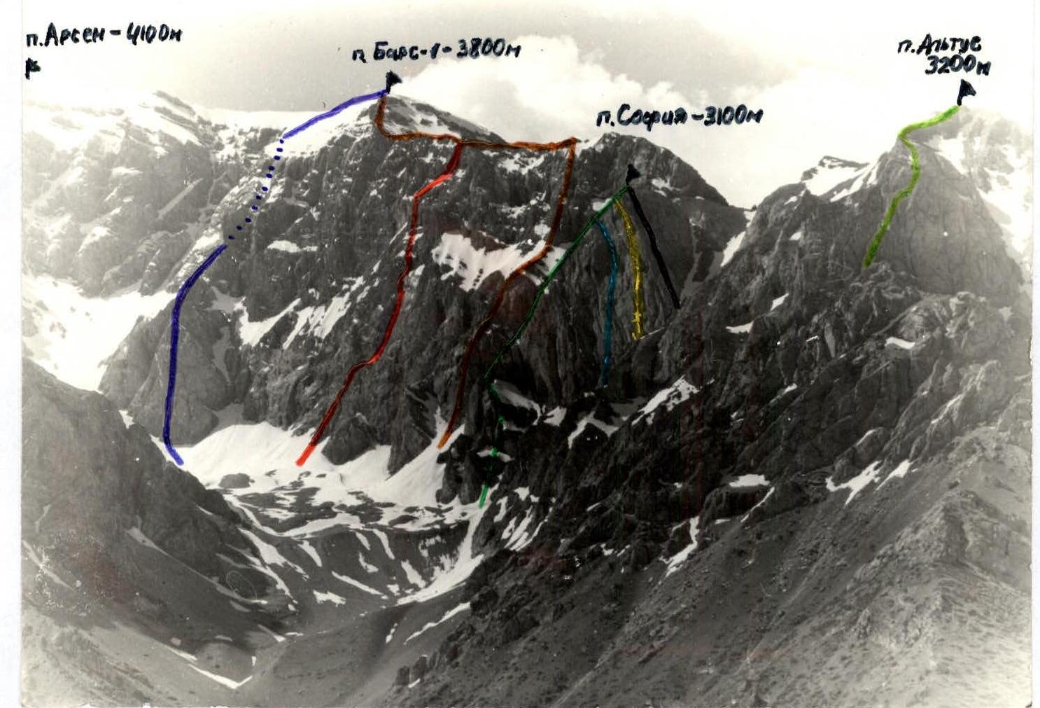
Photo from 1990 of the Eastern ridge of peak Altus
- p. Arsen 3B category via N ridge (Skrekhin, 1977)
- p. Bars-1 4A category via 3rd part of N wall (Denisenko, 1977)
- p. Sofia 3A category via NE ridge (Melnikov, 1989)
- p. Sofia 4A category via NW wall (Rafikov, 1989)
- p. Sofia 4A category via NW wall (Rezaev, 1990)
- p. Altus 2B category via E ridge, N slope (Rafikov, 1977)
- p. Bars-1, approx. 4A category, via left part of N wall – team's route.
- p. Sofia 3B category via 3rd ridge (Ruzaev, 1990)
General photo August 22, 2001
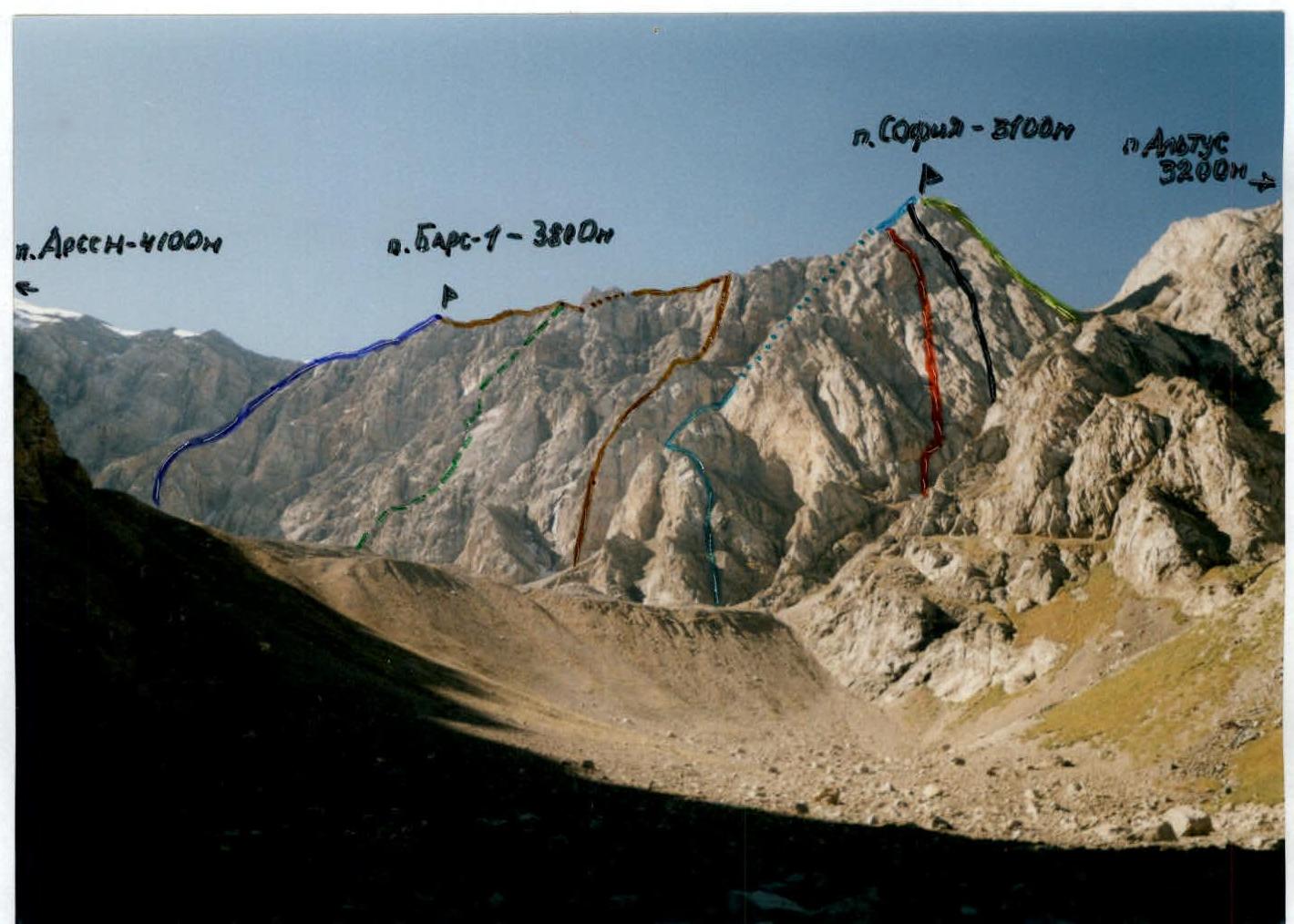
- p. Bars-1 3B category via N ridge (Skrekhin, 1977)
- p. Bars-1, approx. 4A category, via left part of N wall – team's route.
- p. Bars-1 4A category via 3rd part of N wall (Denisenko, 1977)
- p. Sofia 3A category via NE ridge (Melnikov, 1989)
- p. Sofia 4A category via NW wall (Rafikov, 1989)
- p. Sofia 4A category via NW wall (Rezaev, 1990)
- p. Sofia 3B category via 3rd ridge (Rezaev, 1990)
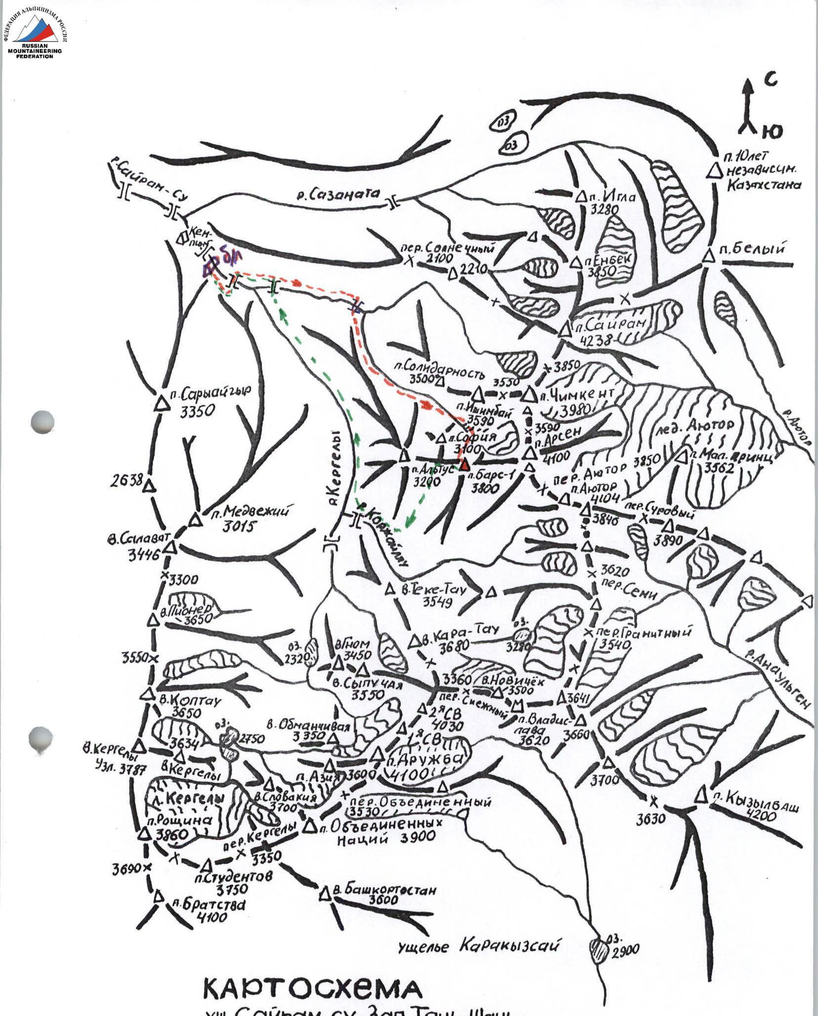
Map
Sairam-Su valley, Western Tian-Shan, Ugam ridge. Scale 1:50 000.
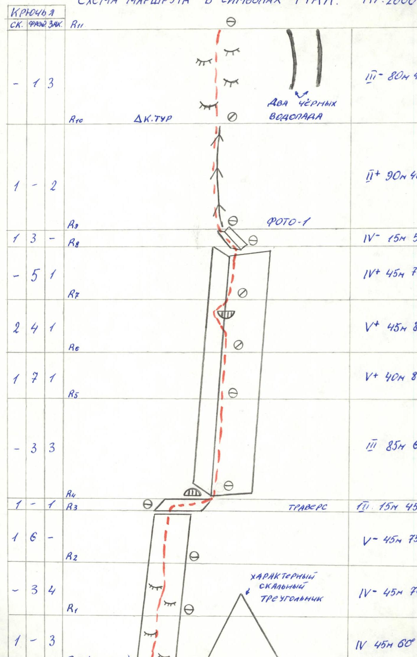
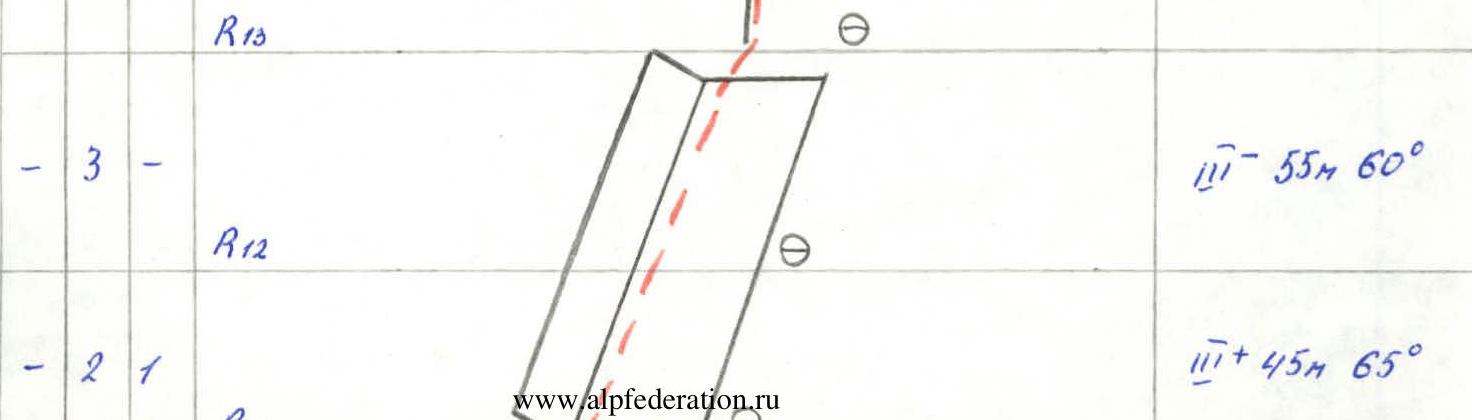
Route diagram in UIAA symbols. Scale 1:2000.


Route description by sections
Approach to the route:
From the base camp, follow a good path, bypassing the western slopes of p. Solidarnost on the right, ascend the moraine under the North wall of peak Arsen (3–4 hours).
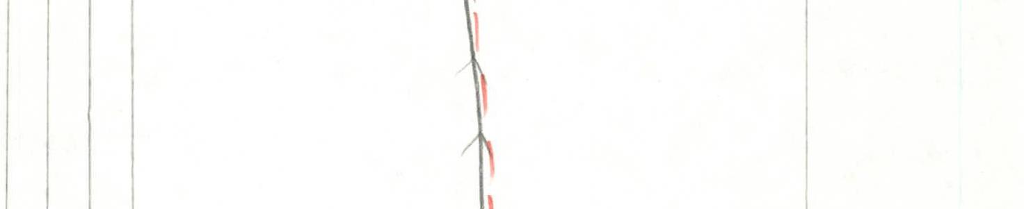
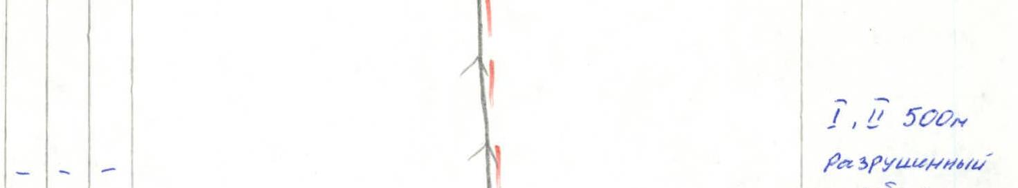
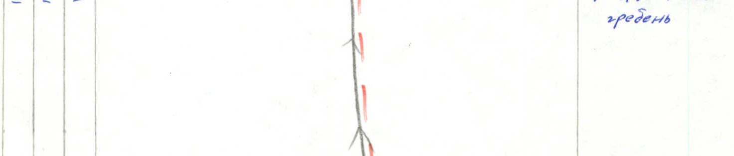
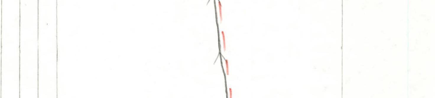
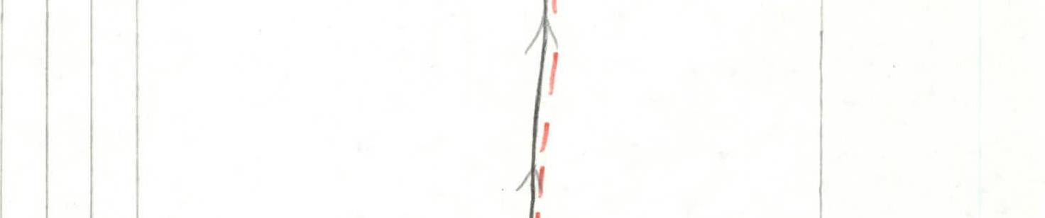
R0–R1. The route begins to the left of the prominent monolithic triangular massif at the base of the wall, bounded on the left by a scree couloir. Up the wall with "ram's foreheads". R1–R2. Up the wall with "ram's foreheads", trending left. R2–R3. Continue up the wall with "ram's foreheads", exit onto an uncomfortable ledge. R3–R4. Traverse left along the uncomfortable ledge to a niche. R4–R5. Behind the niche at the end of the ledge begins the "Book" (R4–R8). At the start of the "Book", climbing is not complicated, but there are "live rocks". R5–R6. The "Book" becomes steep 80–85°, rocks are monolithic. R6–R7. Up the inner corner to a cornice. R7–R8. Bypass the cornice on the left, then up the inner corner, trending left. R8–R9. A gentle inner corner formed by two monolithic slabs, trending left. R9–R10. Then exit onto a vaguely defined rib and up. R10–R11. The rib abuts "ram's foreheads", at the foot of the "ram's foreheads" is a control cairn, to the right of it – two black waterfalls. R11–R12. Climb the "ram's foreheads" to enter an inner corner. R12–R13. Up the inner corner to reach a scree ridge. R14 – summit. Along the broken ridge and scree slope 500 m – exit to the summit.
Description of the descent from the summit. Descent from the summit initially follows the ascent route along the ridge, then left-down (in the direction of travel) into the "Wild Climbers" valley.
Technical photo
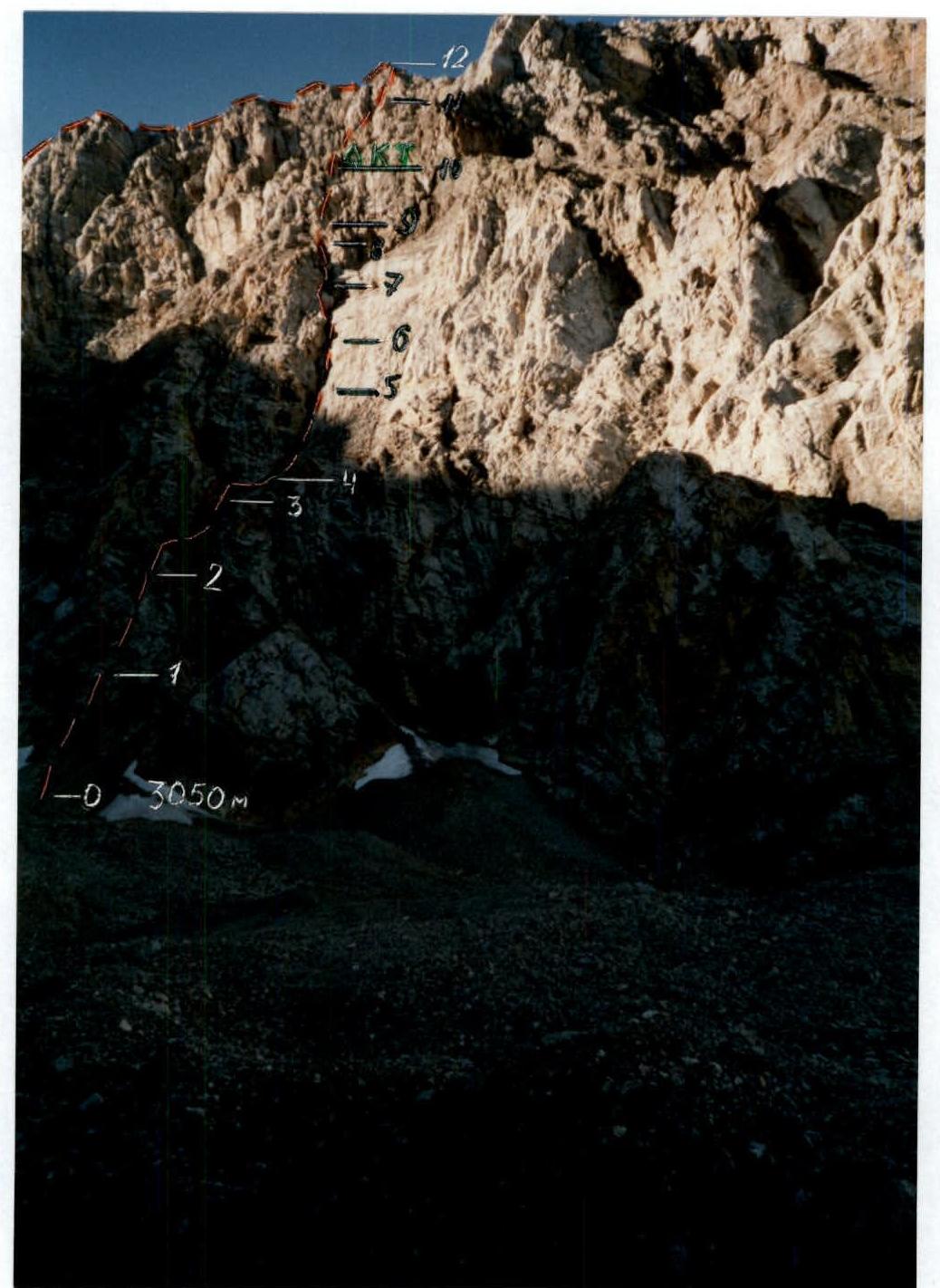

Photo-1. Section R9–R11