Passport
- Rock class
- Tian-Shan, Ayuter gorge
- Peak Mendeleevets along the left edge of the Northern wall of the triangle
- 5B category of difficulty
- Height difference: 840 m, length with the summit ridge - 1300 m, length of sections 5–6 category of difficulty - 380 m. Average steepness of main sections 75° (3400–3950), of which 5 category of difficulty 82° (3600–3950).
- Pitons hammered:
- rock: 102
- bolt: 20
- chocks: –
- ice: 16
- Team's walking hours: 16 hours and 1 day.
- Overnights: on the bank of the Ayuter river opposite the Mendeleevets peak.
- Leader: Lashkov A.K. – CMS.
Participants:
- Kozel V.M.
- Kovensky V.I.
- Gerasimov A.V.
- 1st sports category
- Coach: Kovensky G.I.
- Start of the route: August 14, 1984.
Summit: August 14, 1984.
Return: August 14, 1984.
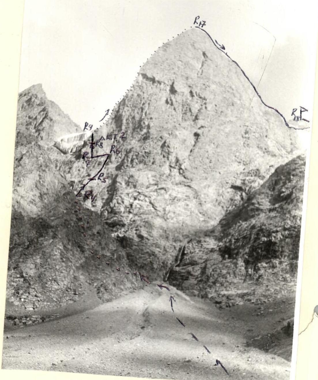
Photo from the opposite slope (3100). Overall distance – 2 km. Shooting point № 1. Photo of the summit. Lens T-22 F=75 mm.
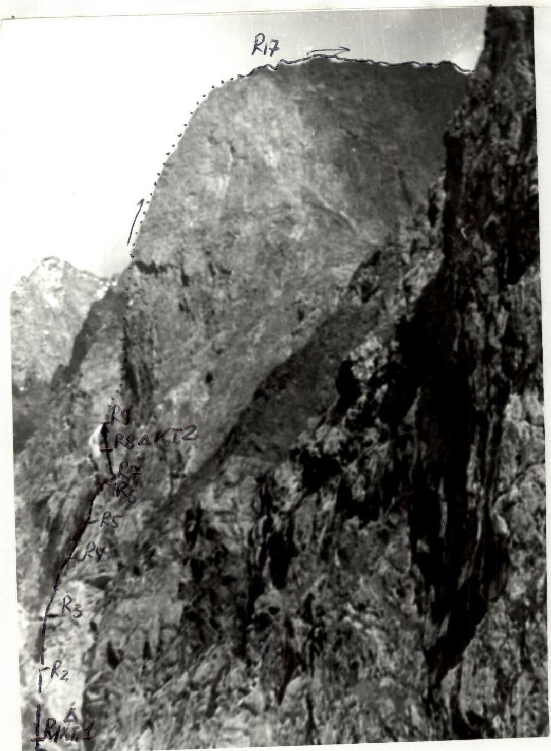
Photo 2. Profile of the wall on the right. The shot was taken from the glacier of peak Studentsov on August 3, 1984, 14:00, lens T-22 F=75 mm, distance to the object – 1.5 km, shooting point № 2, height – 3600 m.
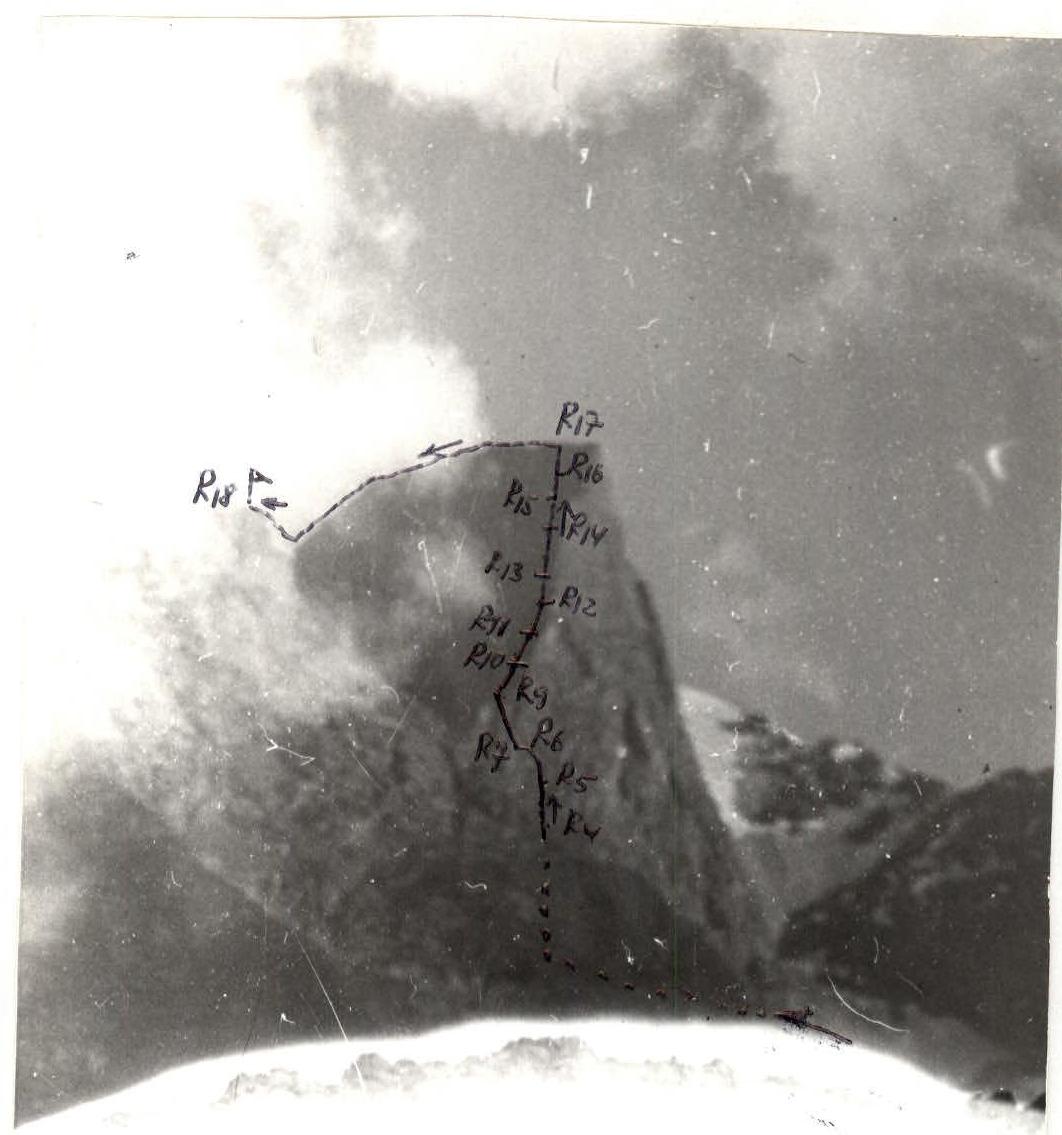
Photo 3. Profile of the summit on the left. The shot was taken from the opposite slope of the valley on August 1, 1984, 12:00. Lens T-22 F=75 mm, distance to the object – 2.5 km, shooting point – № 3, height – 2900 m.
Tactical Plan of the Ascent
Tactical actions of the team. The ascent of the team of Belsoviet DSO "Zenith" to the summit of peak Mendeleevets took place in conditions:
- stable weather during the day
- short-term heavy rains at night
Preliminary processing of the route was not carried out. The team did not deviate from the tactical plan. The route was completed in 16 hours, and there were no issues with organizing overnight stays.
There were no accidents or injuries among the participants. Communication with observers was stable, with communication sessions at 8:00, 12:00, 16:00, 19:00. Communication was carried out using the "Vitalka" radio station.
During the ascent, the group used the method: four people — four ropes. This method allows for increased speed of movement (in leader mode) when each athlete moves on a double rope. In addition, it ensures timely rest for the leader while the entire team continues to move continuously. With this method, numbers 2, 3, 4 move along the fixed rope using a clamp, with top rope protection, timely delivering the safety rope and providing protection for the leader.
The group used a clamp of original design with increased reliability.
To ensure the safety of the leader, an absorber (BEPU) was used, and safety (and protection of the second) was provided using a Sticht spring washer.
Despite not using bolt pitons, the group's equipment included:
- 5 bolt pitons
- 1 drill
This equipment was to ensure movement on complex rocks in conditions of moisture (in the absence of cracks) or for emergency descent.
Illustrations of the route
- View of the section (presumably R11–R18):

- View of the section (presumably R11–R12):
- View of the section (presumably R9–R11):

- View of the section (presumably R8–R10):


- View of the section (presumably R8–R9):


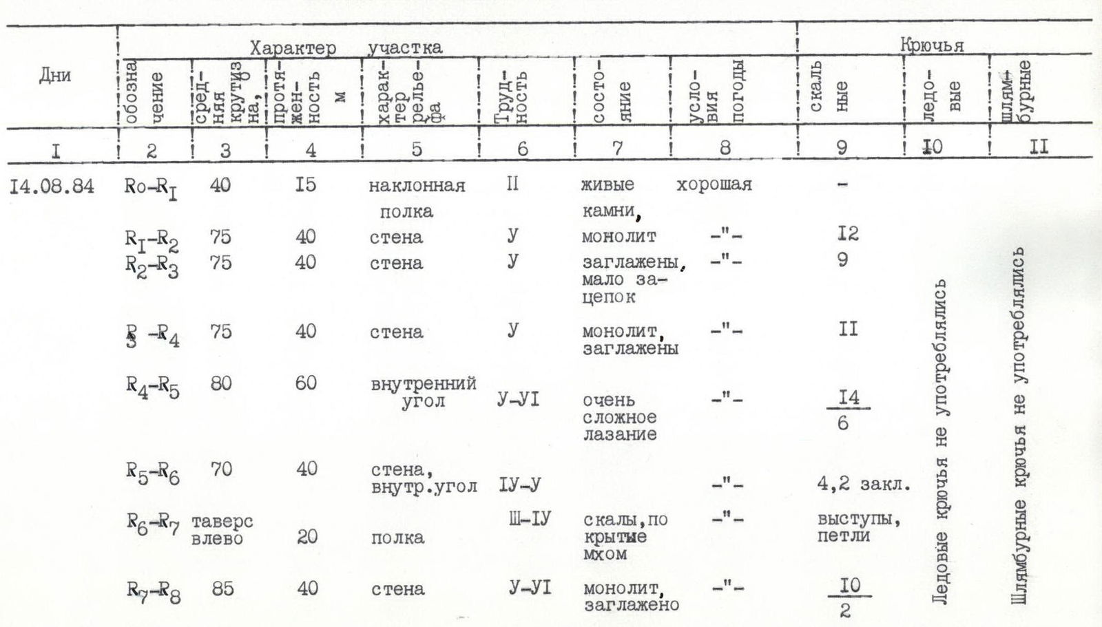
- View of the section (presumably R7–R8):

- View of the section (presumably R6–R7):
Description of the route by sections
After the rain that fell the day before and the night before the ascent, the condition of the route significantly complicated in its lower part (sections R0–R2) — on many small ledges, the ground, moss, and grass were saturated with water. As a result, the risk increased:
- slipping on these ledges
- moving in wet, dirty shoes on the rocks above them.
Throughout the entire wall section (R0–R16) of the route, the same scheme of interaction and organization of safety was used without changing the lead. Safety was provided through blocked pitons with a double rope for the lead climber. For the rest of the team members, one rope was fixed, and the second was used for safety. The first climber went without a backpack with a BEPU absorber to reduce the force of a potential fall.
Starting from section R16–R17, the movement was organized in pairs:
- Kovensky – Lashkov
- Gerasimov – Kozel
without interaction, first on a double rope (R16–R17), and then on a single rope (R17–R18).
The descent from the summit is not technically difficult — when moving along ledges and couloirs towards the Telety gorge, safety is not required. Therefore, during the descent, the group moved without being tied together, not allowing large gaps between participants.
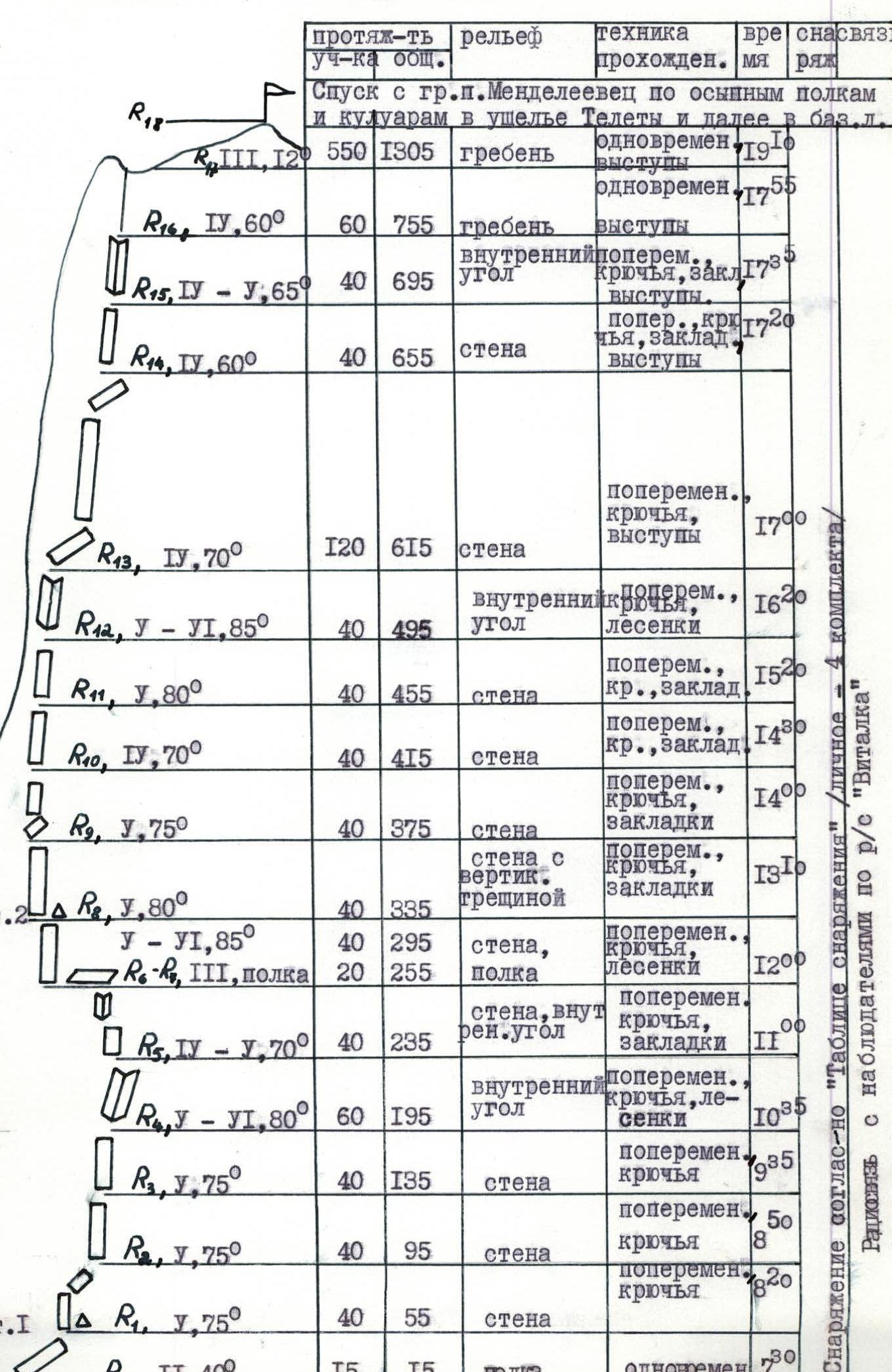
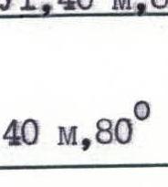
Table of main characteristics of the ascent route
| № | Designation | Average steepness, ° | Length, m | Character of relief | Difficulty | Condition | Weather conditions | Rock pitons | Ice pitons | Bolt pitons |
|---|---|---|---|---|---|---|---|---|---|---|
| 14.08.1984 | R0–R1 | 40 | 15 | inclined ledge | 2 | loose rocks | good | – | – | – |
| R1–R2 | 75 | 40 | wall | 5 | monolith | —"— | 12 | – | – | |
| R2–R3 | 75 | 40 | wall | 5 | worn, few holds | —"— | 9 | – | – | |
| R3–R4 | 75 | 40 | wall | 5 | monolith, worn | —"— | 11 | – | – | |
| R4–R5 | 80 | 60 | inner corner | 5–6 | very difficult climbing | —"— | 14, 6 | – | – | |
| R5–R6 | 70 | 40 | wall, inner corner | 4–5 | – | —"— | 4, 2 chocks | – | – | |
| R6–R7 | traverse left | 20 | ledge | 3–4 | rocks covered with moss | —"— | ledges, loops | – | – | |
| R7–R8 | 85 | 40 | wall | 5–6 | monolith, worn | —"— | 10, 2 | – | – | |
| R8–R9 | 80 | 40 | wall with vertical crack | 5 | monolith, exit to edges | —"— | 7, 3 chocks | – | – | |
| R9–R10 | 75 | 40 | wall | 5 | worn rocks, friction climbing | —"— | 5, 4 chocks | – | – | |
| R10–R11 | 70 | 40 | wall | 4 | worn rocks | —"— | 6, 1 chock | – | – | |
| R11–R12 | 80 | 40 | wall | 5 | wet rocks | —"— | 3, 6 chocks | – | – | |
| R12–R13 | 85 | 40 | inner corner | 5–6 | monolith | —"— | 12, 8 | – | – | |
| R13–R14 | 70 | 120 | wall | 4 | destroyed rocks | fog | 4 ledges | – | – | |
| R14–R15 | 60 | 40 | wall | 4 | destroyed rocks | fog gradually intensifies, from this moment | 3, 2 chocks, ledges | – | – | |
| R15–R16 | 65 | 40 | inner corner | 4–5 | destroyed rocks | occasional graupel, gusty wind | 2, 2 chocks, ledges | – | – | |
| R16–R17 | 60 | 60 | ridge | 4 | destroyed rocks | – | safety on ledges | – | – | |
| R17–R18 | 10–15 | 550 | ridge | 3 | destroyed rocks | – | safety on ledges | – | – |
Ice pitons were not used Bolt pitons were not used
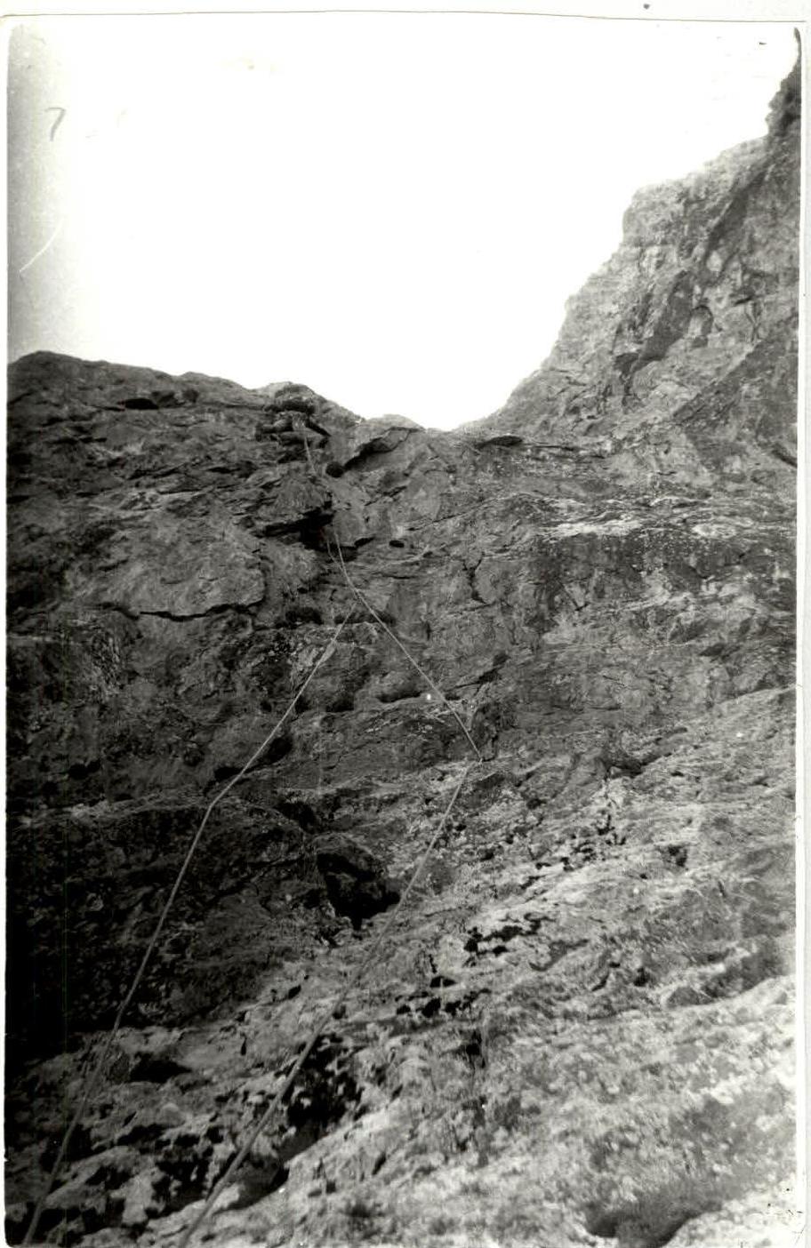
Photo № 6. Section R2–R8. Lens T=22 F=40 mm.
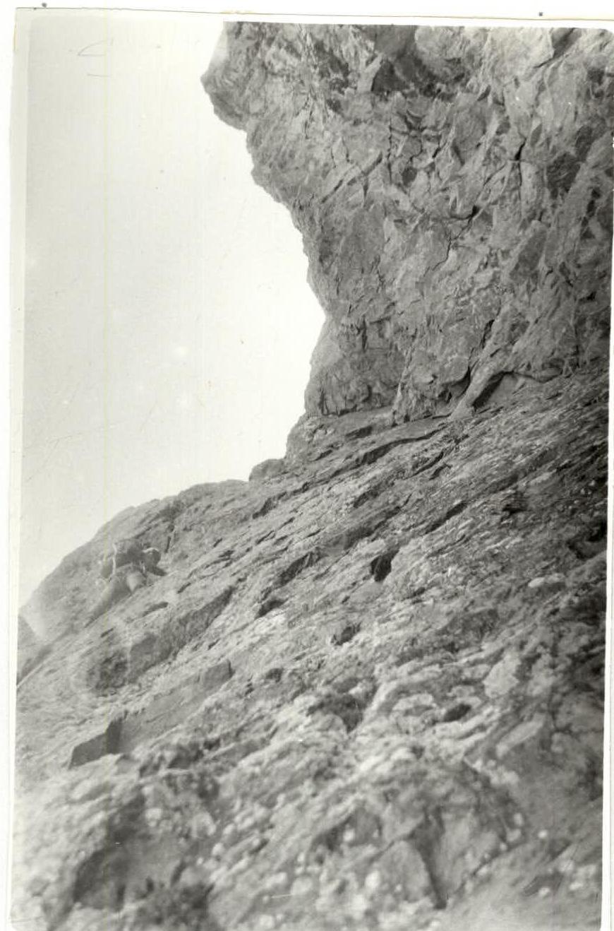
Photo № 7. Section R8–R9. Lens T=22 F=40 mm.