133 51
To the classification of Kyrgyzstan mountains Teskey Ala-Too Range
Compiled by Veryasov G.
FPTI
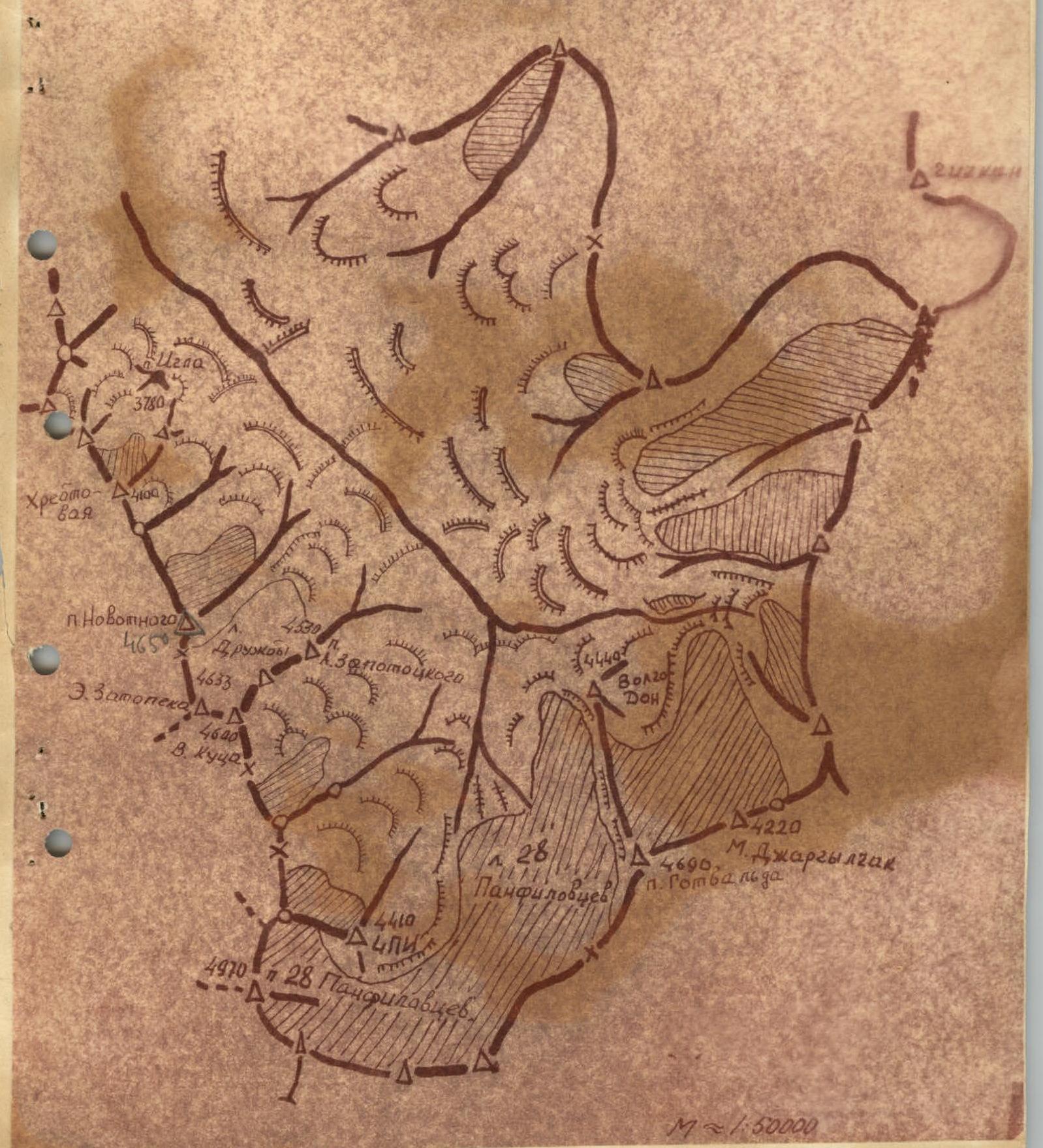
Location
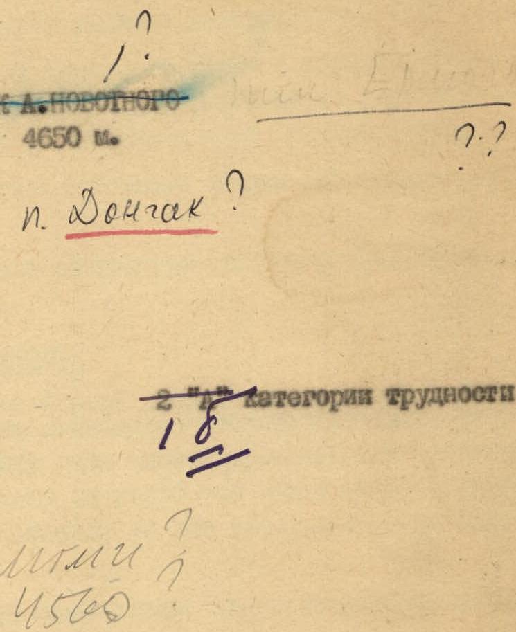
Novotny Peak is located in the watershed ridge of the Jargylchak spur of the Teskey Ala-Too Range, i.e. the spur that separates the basin of the Malaia (Kichi) and Bolshaya (Chon) Jargylchak rivers.
The southern slopes of its eastern buttress are covered with scree, which descends to the Zaporotzky Glacier cirque.
The watershed of the Jargylchak spur runs almost meridionally through the Novotny Peak:
— to the north — to Mak Duklo Peak; — to the south — to the Zapotoka-Kuts double peak.
The northern slope of Novotny Peak is covered with a hanging glacier of the same name.
The ridge of the eastern buttress is abundant with a large number of rock outcrops.
Approaches
From the village of Malaia (Kichi) Jargylchak on the highway along the southern shore of Lake Issyk-Kul you can drive to the farm by car.
From the farm along the eastern bank of the Kichi-Jargylchak River, you need to ascend to the alpine meadows. Ahead, across the river, the rocky peak of Igla (Itse) is visible all the time. Immediately behind it, a small gorge begins, leading to Novotny Peak.
The camp should be set up opposite the end of the eastern buttress of Novotny Peak.
Ascent Route
From the base camp, we cross to the left bank and immediately start ascending to the saddle in the eastern buttress. The path goes first along the ancient moraine, and then along the small and medium scree. The ascent is 380–400 m and takes 1 hour. The slope steepness is 30°.
From the saddle, we ascend 10–15 m along the destroyed slopes. The further path goes along the gently ascending southward slabs on the western side of the ridge. After 200–350 m, the ridge turns west and gently ascends. Traversing the slope, we enter the ridge of the buttress; the ridge consists of destroyed rocks. We continue along the ridge. Individual rocky sections are bypassed on the left.
After 100–150 m of ascent along the ridge, we turn right and ascend along a trough along rocks and snow. The steepness of the ascent reaches 25°. Along the trough, we go under a gendarme (80–100 m path). Before the gendarme, we pass to the left and move to the steep slope of the ridge.
Traversing the slope, we bypass several "sheep's foreheads" and reach the southwestern pre-summit ridge. The path from the gendarme to the exit to the ridge is 450–500 m.
We ascend to the summit along the southwestern ridge. The ridge consists of:
- large slabs,
- heavily destroyed rocks.
Characteristics of the ascent:
- steepness: 30–35°,
- path length: 120–150 m.
Total travel time from the camp to the summit: 4.5–5 hours.
Descent — along scree couloirs.
The difficulty of the route is assessed as 2A category of difficulty.
The route along the ridge line of the entire eastern buttress is more complicated, but less logical. Therefore, to confirm this route on more serious sections, control cairns should be set up. Orographic scheme of the Maly Jargylchak valley, Teskey Ala-Too Range