Ascent Log
-
Kyrgyzstan, Tian Shan, Teskey Ala-Too, category "7.10.(41)" according to the classification table
-
Peak name: Jigit (5170 m), route name: via the north face (Ryabukhin, 65)
-
Proposed category: 6A
-
Route type: combined
-
Route elevation gain: 1170 m (by altimeter); including wall section: 970 m. Route length: 1292 m. Length of sections: category V — 249 m, category VI — 185 m. Average steepness: main part of the route — 72°, entire route — 68°.
-
Pitons left on the route: total: 0, including bolted: 0. Pitons used on the route: Stationary bolted: 3, including for artificial support (AIDs): 2. Removable bolted: 0, including for AIDs: 0. Total artificial points of support (AIDs) used: Pitons — 8, chocks — 4.
-
Team's travel time: 31 hours, 3 days
-
Team leader: Igor N. Shapovalenko, CMS Team members: Alexander V. Krasnolutsky, CMS
-
Coach: I.N. Shapovalenko
-
Departure for the route: 5:00, June 25, 2003 Reaching the summit: 10:00, June 27, 2003 Return to base camp: 16:00, June 27, 2003
General Photo of the Peak
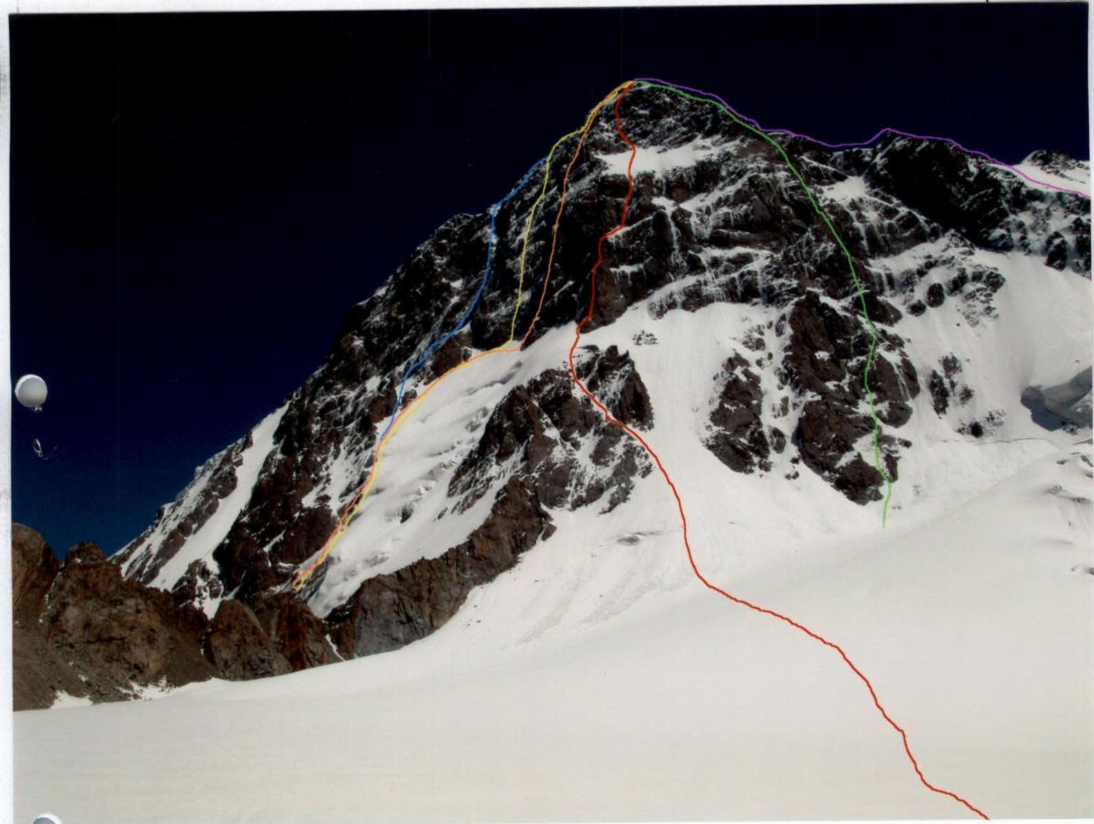
Decoding of route markings (left to right):
- blue — 6A "triangle" on the S wall by D. Sharashehenidze 76
- yellow — 6A center of the S wall by V. Vakurin 83
- orange — 6A center of the S wall by I. Slesov 75
- red — 6A N wall by A. Ryabukhin 65 (route taken by the team)
- green — 6A NW wall by A. Ryabukhin 66
- purple — 4A N ridge by S. Silchenko 66.
The photograph was taken on June 24, 2003, from the moraine opposite peak Jigit.
Sheet 2, page 4
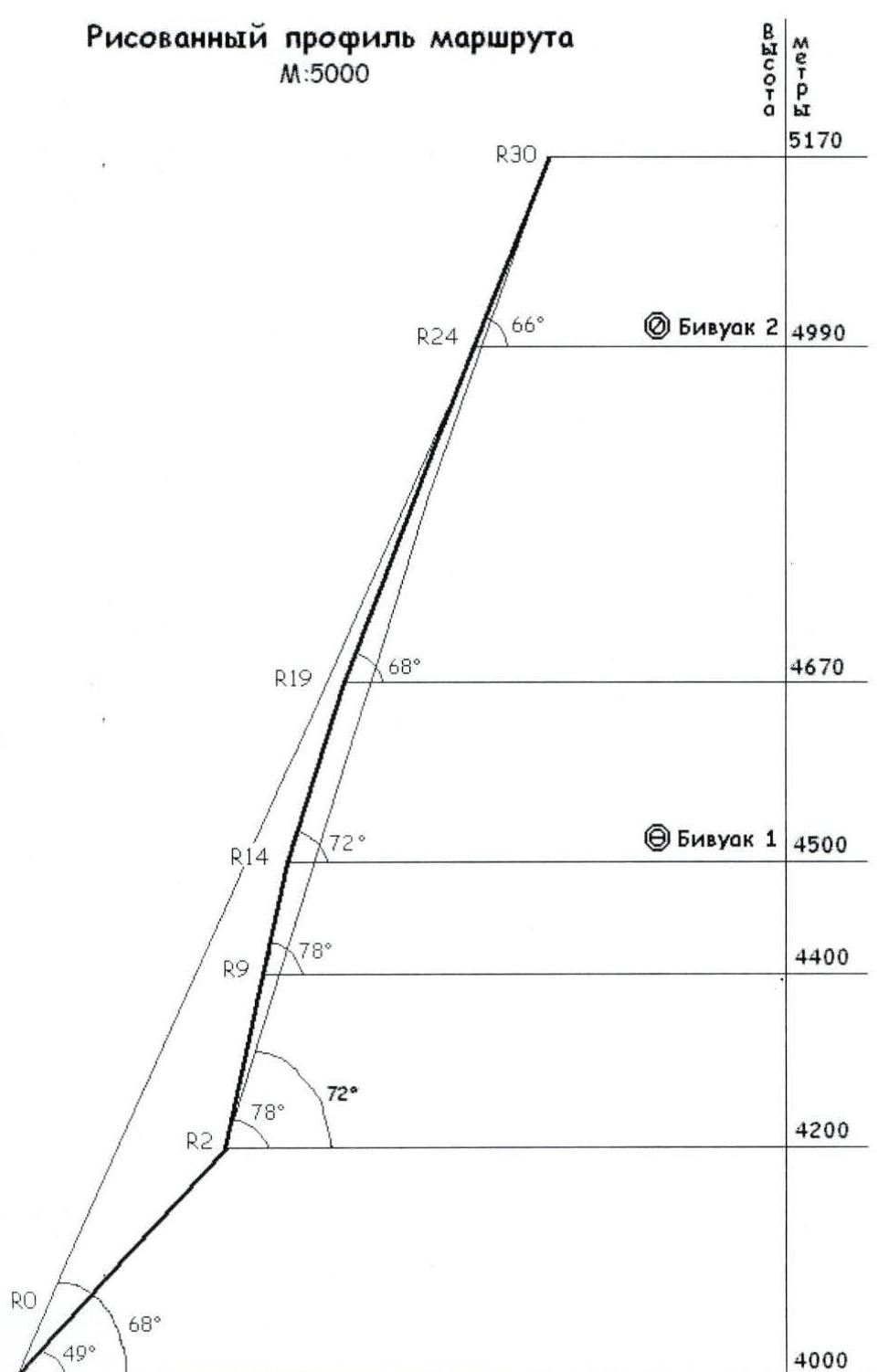
Hand-drawn Profile of the Route
M:5000
Sheet 4, page 8
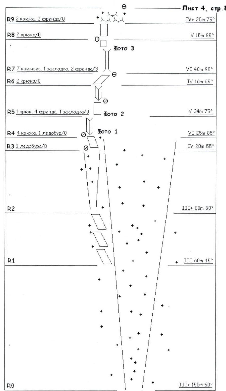
R9: 2 pitons, 2 friends / 0. IV+ 20 m 75° R8: 2 pitons / 0. V 15 m 85° R7: 7 pitons, 1 chock, 2 friends / 3. VI 40 m 90° R6: 2 pitons / 0. IV 16 m 65° R5: 1 piton, 4 friends, 1 chock / 0. V 34 m 75° R4: 4 pitons, 1 ice screw / 0. VI 25 m 85° R3: 3 ice screws / 0. IV 20 m 55° R2: III+ 80 m 50° R1: III 60 m 45° R0: III+ 150 m 50°
Sheet 4, page 8a
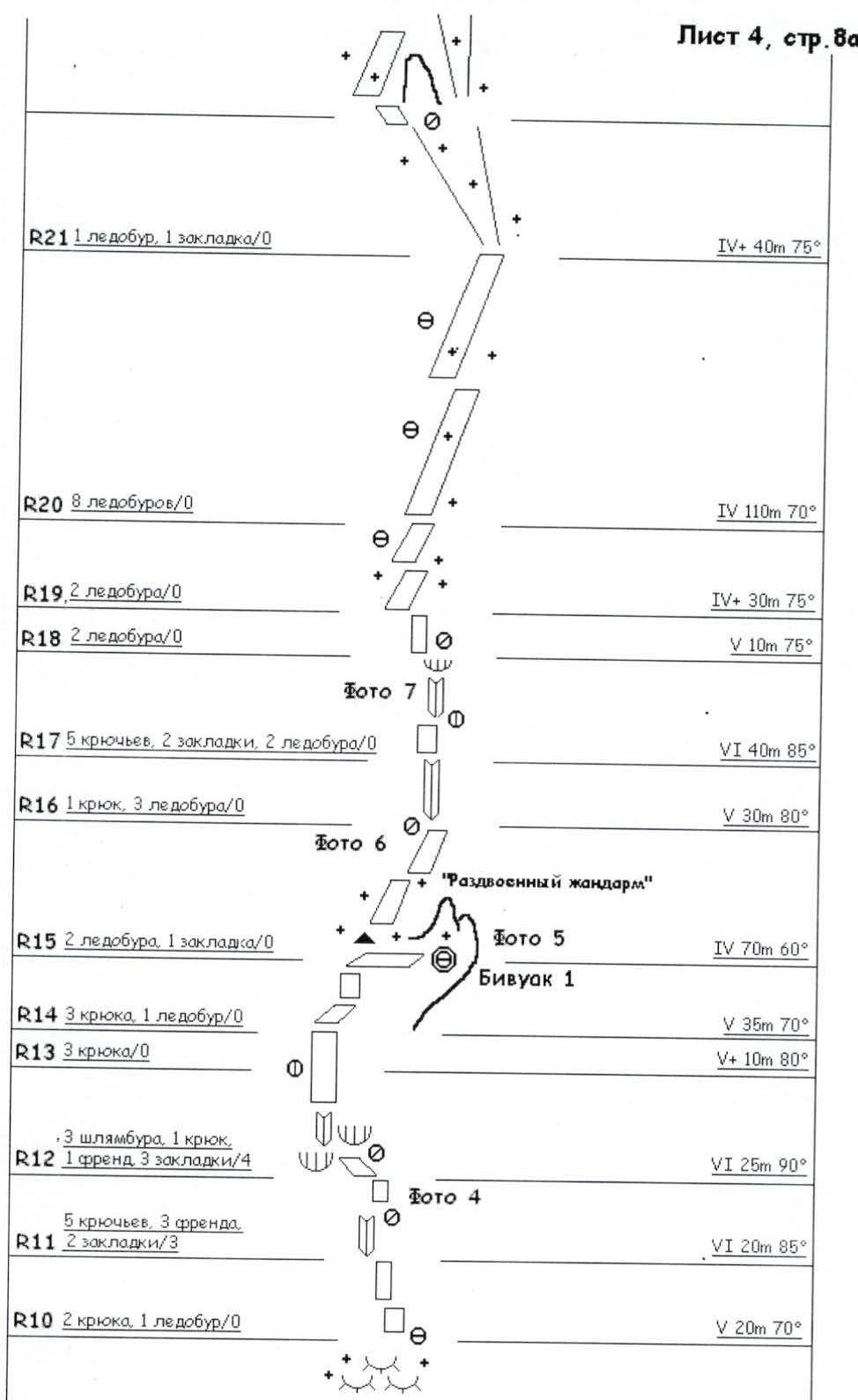
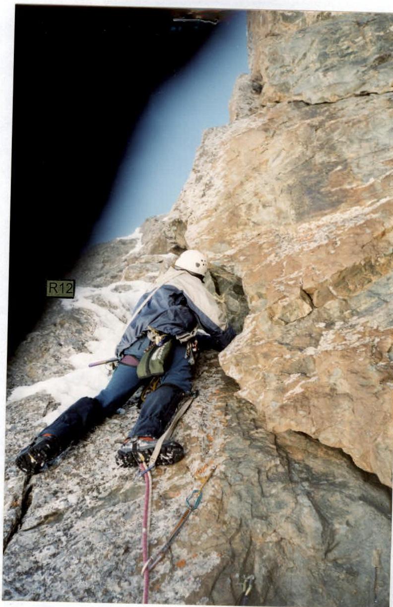
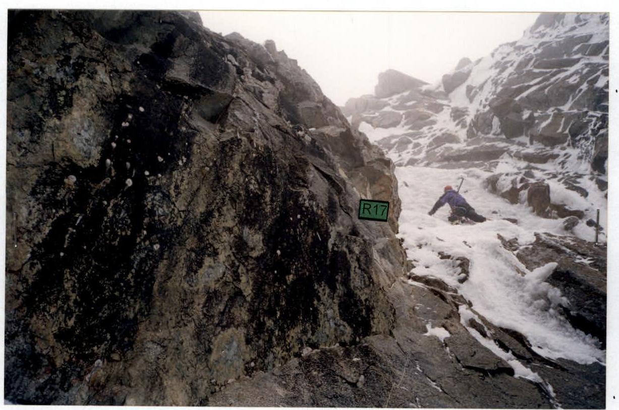
R21: 1 ice screw, 1 chock / 0. IV+ 40 m 75° R20: 8 ice screws / 0. IV 110 m 70° R19: 2 ice screws / 0. IV+ 30 m 75° R18: 2 ice screws / 0. V 10 m 75° R17: 5 pitons, 2 chocks, 2 ice screws / 0. VI 40 m 85° R16: 1 piton, 3 ice screws / 0. V 30 m 80° "Twinned Gendarme" R15: 2 ice screws, 1 chock / 0. IV 70 m 60° Bivouac 1 R14: 3 pitons, 1 ice screw / 0. V 35 m 70° R13: 3 pitons / 0. V+ 10 m 80° R12: 3 bolts, 1 piton, 1 friend, 3 chocks / 4. VI 25 m 90° R11: 5 pitons, 3 friends, 2 chocks / 3. VI 20 m 85° R10: 2 pitons, 1 ice screw / 0. V 20 m 70°
Sheet 4, page 8b
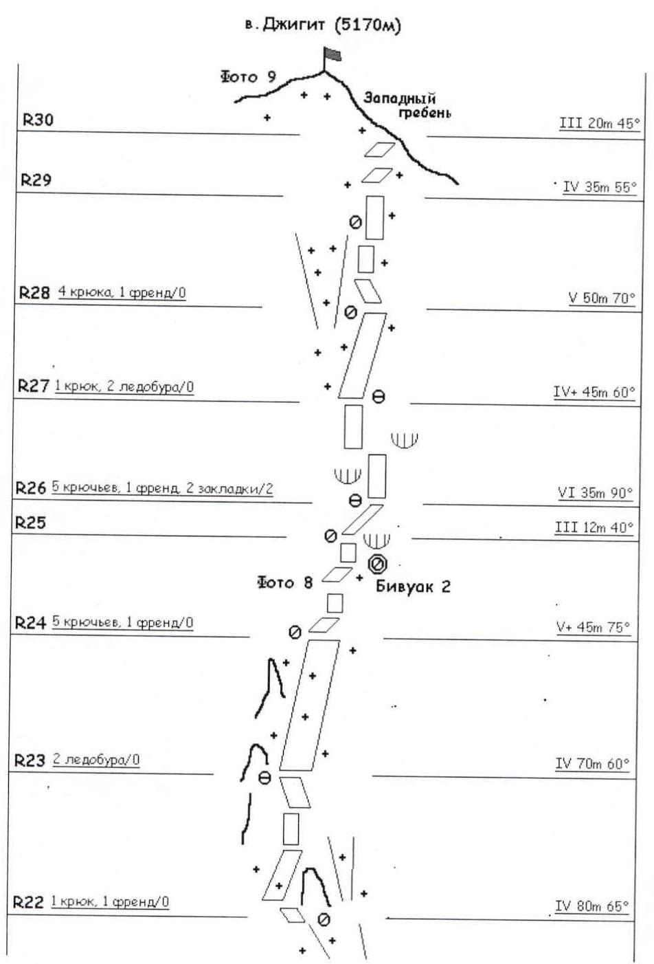
Peak Jigit (5170 m) West Ridge R30: III 20 m 45° R29: IV 35 m 55° R28: 4 pitons, 1 friend / 0. V 50 m 70° R27: 1 piton, 2 ice screws / 0. IV+ 45 m 60° R26: 5 pitons, 1 friend, 2 chocks / 2. VI 35 m 90° R25: III 12 m 40° Bivouac 2 R24: 5 pitons, 1 friend / 0. V+ 45 m 75° R23: 2 ice screws / 0. IV 70 m 60° R22: 1 piton, 1 friend / 0. IV 80 m 65°
Technical Photograph of the Route
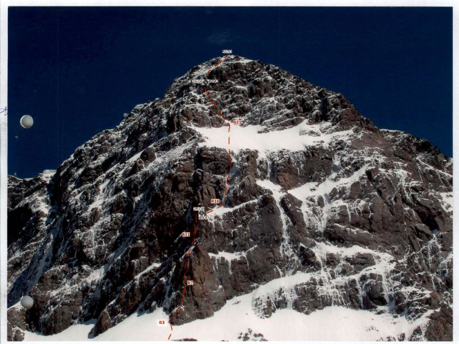
Photo 1
First rope of the main part of the route. Icy rocks of the inner corner lead to the wall, which is traversed from left to right.
Photo 2

First climber in crampons climbing through the destroyed inner corner.
Photo 3

One of the key ropes of the route — a snowy chimney with an overhang in the central part — has been passed. Visible are rotten rappel slings left by previous climbers.
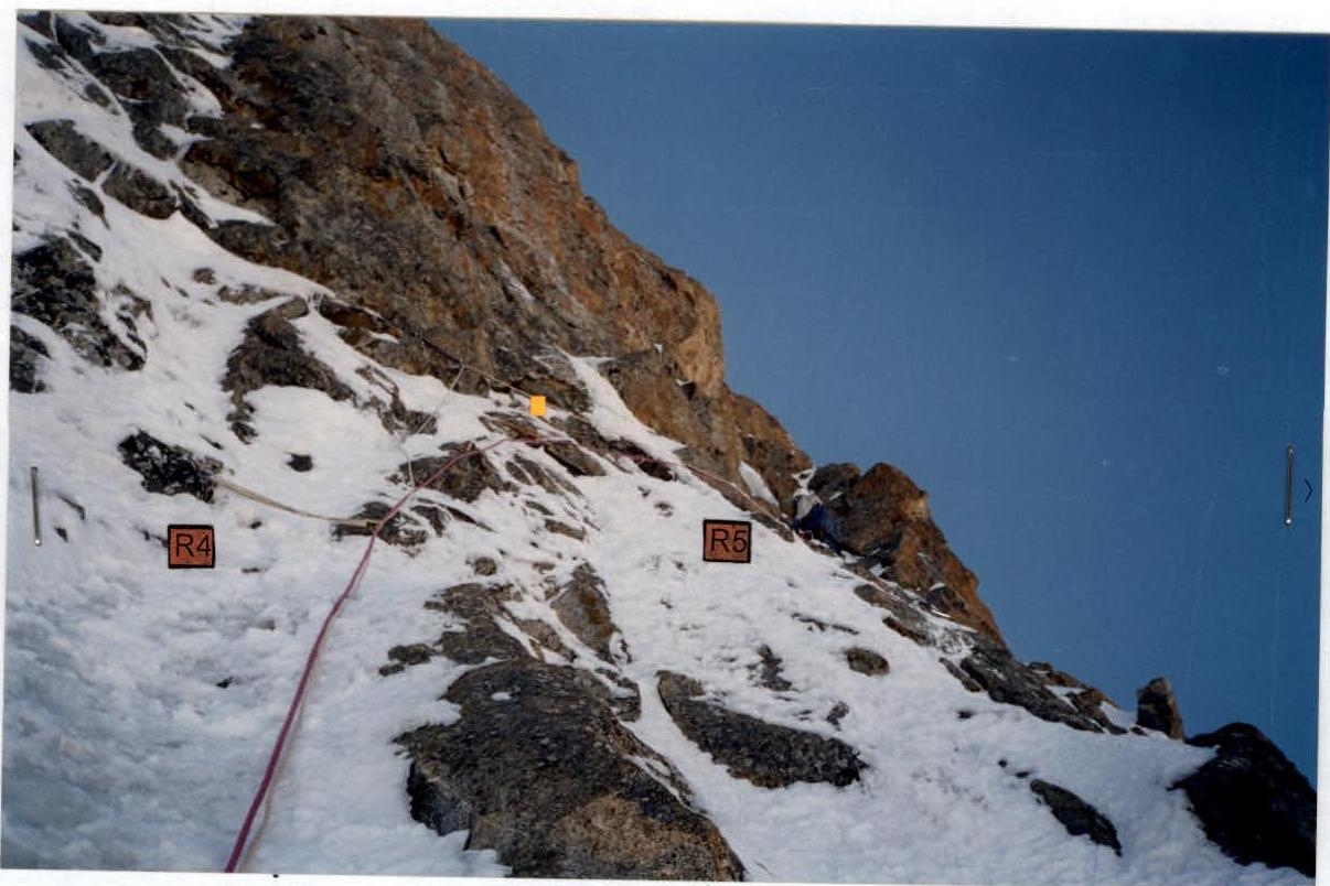
Photo 4
Eighth rope. Exiting from under a small overhang using VERY old bolted pitons. Further on — a smooth slab with cracks filled with snow and ice.
Photo 5
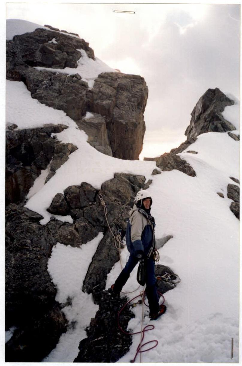
"Standard" overnight stay location on the summit of the second "bull" — a gendarme with a forked summit. The control cairn is also located here.
Photo 6
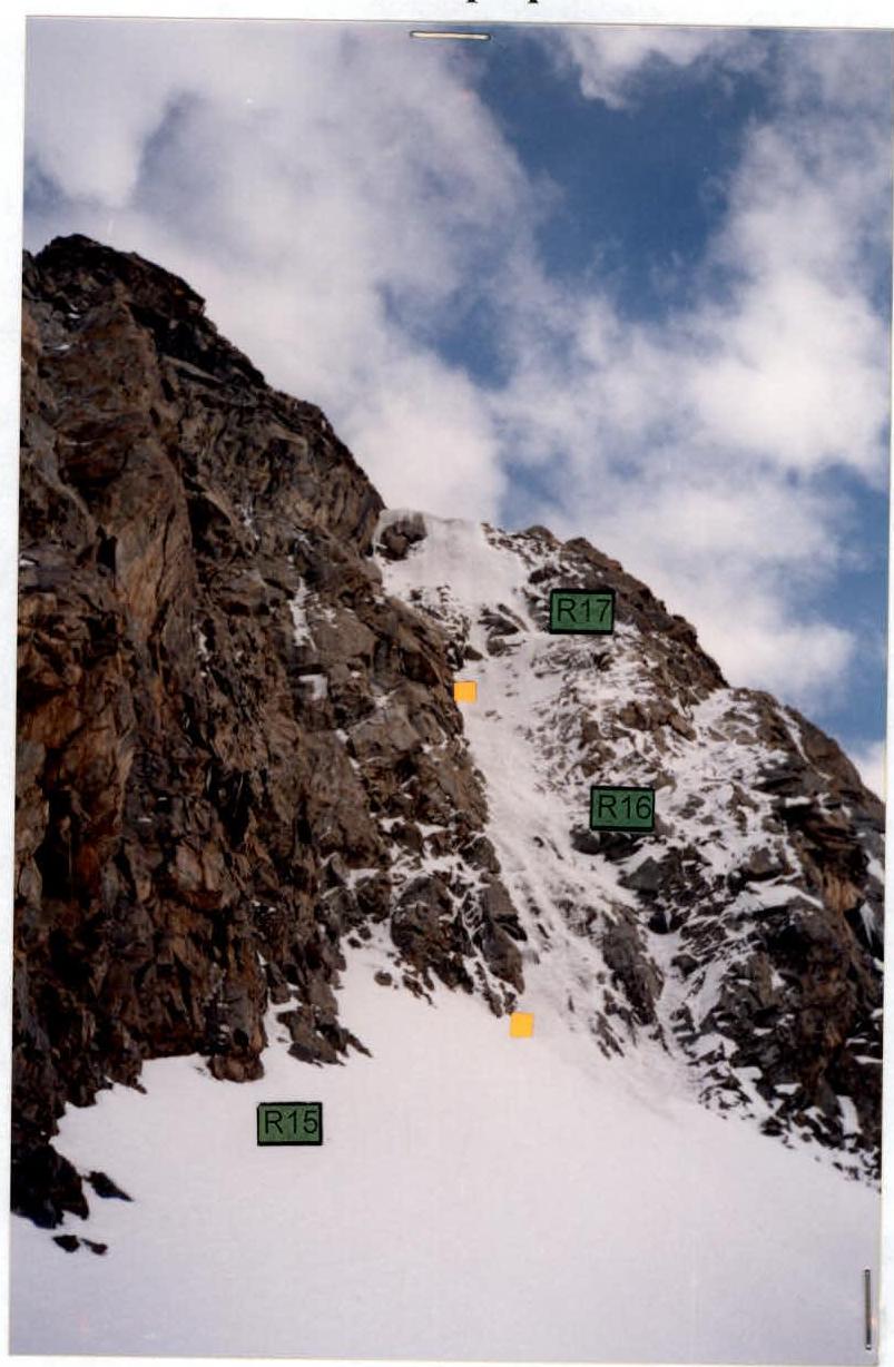
View from the first bivouac site towards the further path:
- Steep snow-ice field (R15)
- Transitioning into heavily iced, almost vertical rocks over 80 m.
Photo 7
Icy rocks of the third "bull" of the rock belt in the middle of the route.
Photo 8
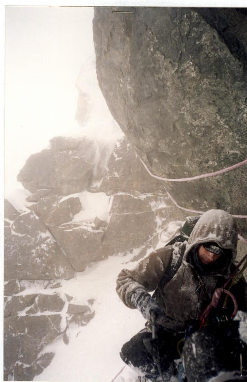
Preparing a spot for a sitting bivouac under a small cornice. Conditions:
- Strong wind
- Thunderstorm
- Continuous small avalanches coming down the wall.
Photo 9
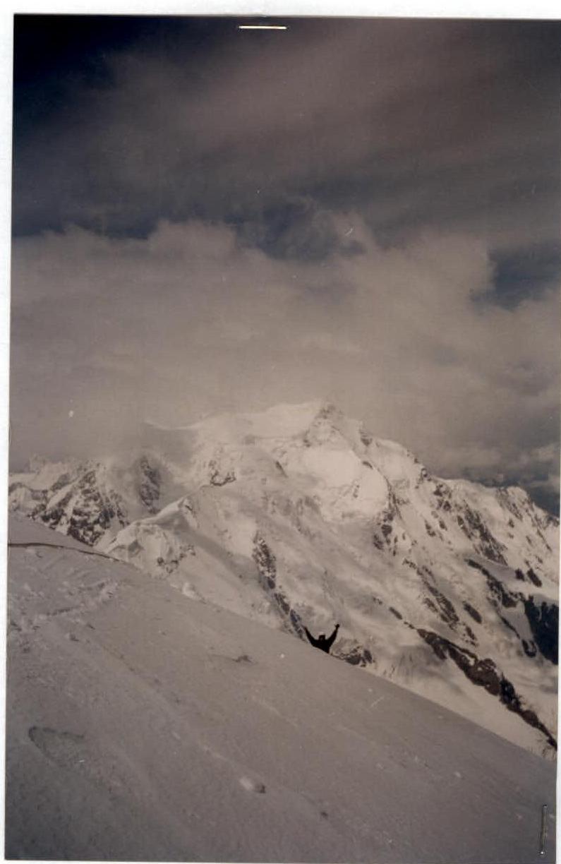
The climber with raised hands is near the summit cairn; the photographer is on the summit. In the background — the highest peak in the area — Karakolsky Peak (5281 m).