Ascent Passport
- Region — Tian Shan, Terskey Ala-Too ridge, 7.10
- Object — Jigit peak, 5170 m, via the "sickle" of the northern wall (V. Penchuk, 1973)
- Complexity category — 5B
- Route character — combined (actually — ice and snow)
- Route characteristics:
height difference — 1270 m route length — 1250 m (wall section) + 550 m (ridge section) length of sections with 5th category of complexity — 1050 m average steepness of the wall section — 52° total equipment used on the route: rock pitons — 0, закладок — 0, ice screws — 152 (including 6 for ИТО), shlymbur pitons — 0 piton left on the route — 0
- Duration — 21.5 hours, 2 days
- Leader — Valery Sergeevich Kudryashov, Candidate Master of Sports
Team members — Rail Ramilievich Badertdinov, 2nd sports category — Ilnar Minnekhanovich Ibragimov, 2nd sports category — Ildar Khakimovich Khabibullin, 2nd sports category
- Team coach — Valery Sergeevich Kudryashov, Candidate Master of Sports, 1st sports category
- Route entry — July 29, 2007 at 3:30 AM
Summit — July 30, 2007 at 12:45 PM
Return to base camp — July 30, 2007 at 7:00 PM
- Organization: Ministry of Youth, Sports and Tourism of the Republic of Tatarstan
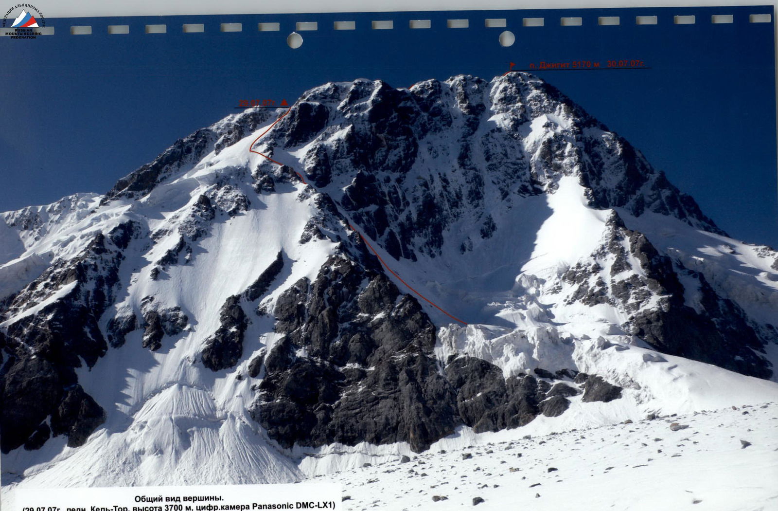
General view of the summit. (July 29, 2007, Kel-Tor glacier, 3700 m, Panasonic DMC-LX1 digital camera)
Team route: via the "sickle" of the N wall, 5B category (V. Penchuk, 1973)
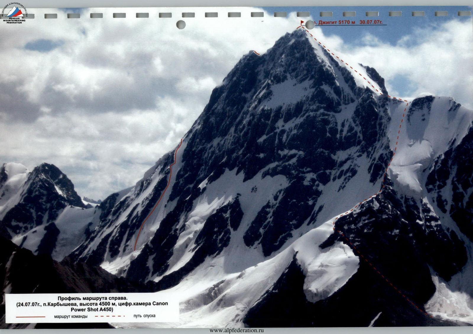
Route profile on the right.
(July 24, 2007, Karbysheva camp, 4500 m, Canon Power Shot A450 digital camera)
Team route
descent path UIAA symbol route scheme
Technical photograph of the wall section. (July 29, 2007, Kel-Tor glacier, 3700 m, Panasonic DMC-LX1 digital camera)
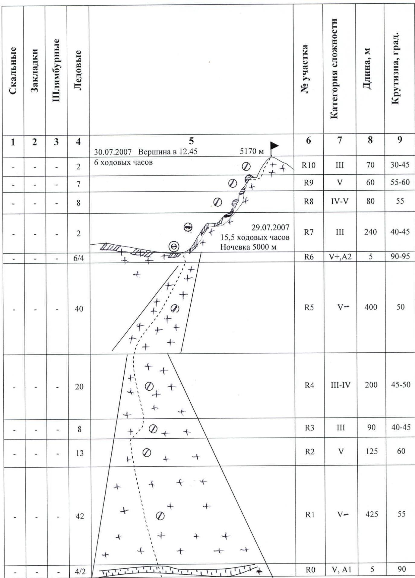
Route Description by Sections
July 29, 2007. Departure from base camp under the northern wall of Jigit peak at 3:30 AM. At 4:20 we start the route from the bergschrund (3900 m).
Section R0: we pass a vertical ice wall of the bergschrund (ИТО), then we move to a steep ice slope of the large couloir of the northern wall. Here and further, until the main eastern ridge of the summit, movement is alternating, belay via ice screws. The first person works with two ice axes.
Section R1 — extended ice slope, ice is hard, местами натёчный. Constant powder snow avalanches from the walls into the couloir.
Section R2 — we enter the couloir throat, where the steepness increases.
Section R3 — steepness of the ice slope decreases, we exit to a small snow-ice shoulder of the left rock ridge of the couloir.
Section R4 — further traverse to the right and again upwards along the couloir to the transition to the northern ice slopes of the E ridge, on the ice местами снег 5–10 cm, but under load it does not hold.
Section R5 — further along the northern ice slopes of the main eastern ridge of the summit. Steep hard натёчный ice, crampons are hammered with difficulty. We exit under the snow-ice cornice of the eastern ridge.
Section R6 — we overcome the cornice on ИТО, using both ice screws and an ice axe. Ice is loose, screws hold poorly, we block them. The upper half of the cornice has to be chopped through. After considerable effort, we exit to the ridge (5000 m). We organize a comfortable lying overnight stay, setting up a tent below the ridge in a fracture of the southern snow-ice slope.
July 30, 2007. Departure at 6:30 AM. We ascend again to the eastern ridge of the summit, which is a series of large cornices, hanging alternately to the north and south. Cornices are connected by sharp ridges of loose snow.
Section R7 — wide, steeply sloping to the south, ridge, snow is dense, movement is alternating, belay via ice axes. As on the previous day, we work in crampons.
Section R8 — we traverse the ridge from the south under the cornices along a steep snow-ice slope and exit again to the ridge, belay via ice screws, movement is alternating. Passage along the ridge on its northern side is dangerous: very steep loose snow, organizing reliable belay is problematic.
Section R9 — again we traverse the cornices from the south and already before the pre-summit slope we break through the ridge and cross over to the steep northern side. Here there is already ice, belay is reliable. Movement is alternating.
Section R10 — along the snow-ice slope at 12:45 PM we exit to the summit. We start descending at 1:15 PM along the 3rd ridge and further along the route 4A category to 7:00 PM, we descend to the insurance group on the Karakolsky glacier.
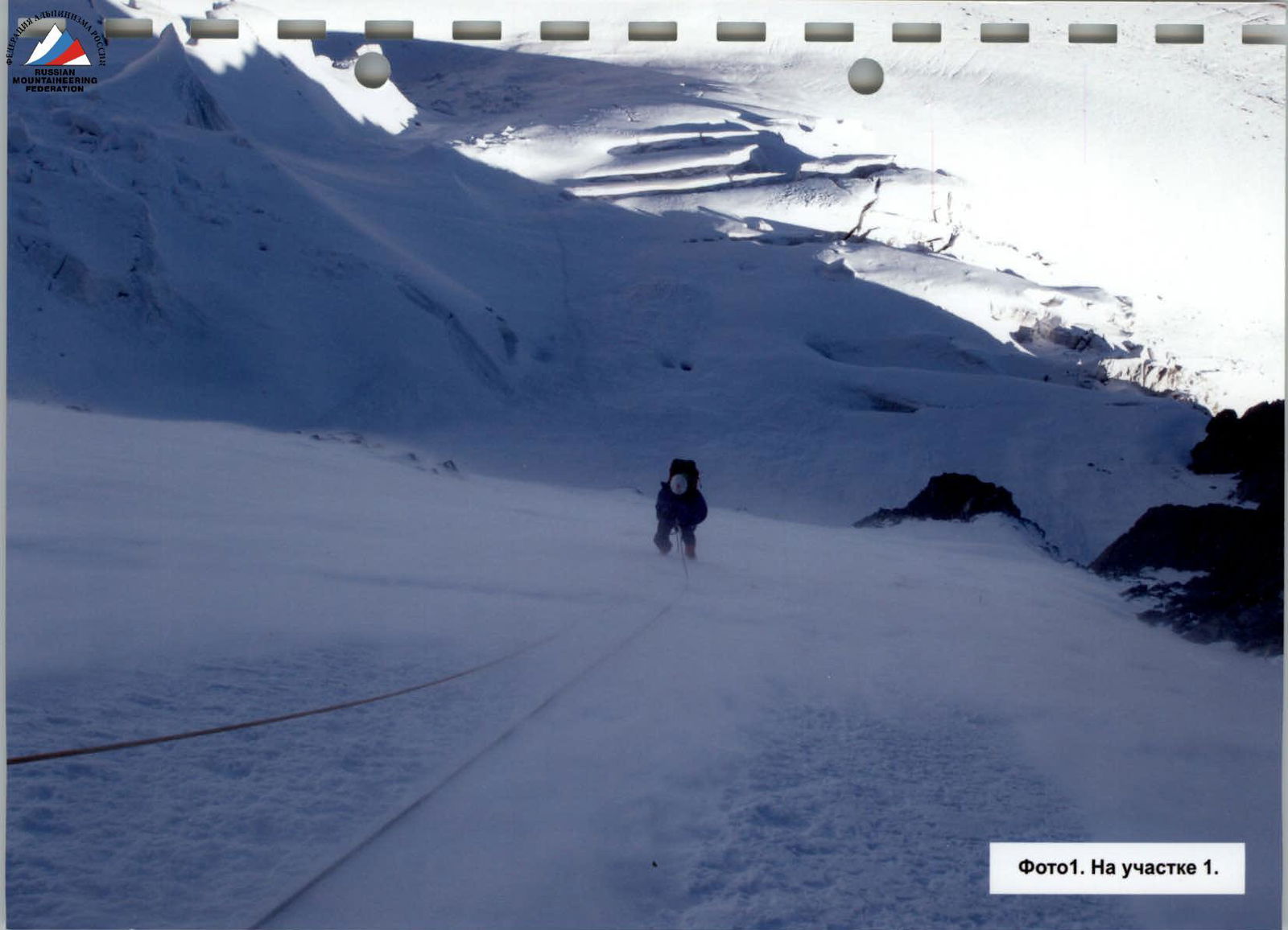
Photo1. On section 1.
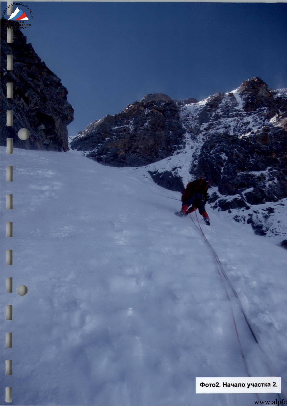
Photo2. Beginning of section 2.
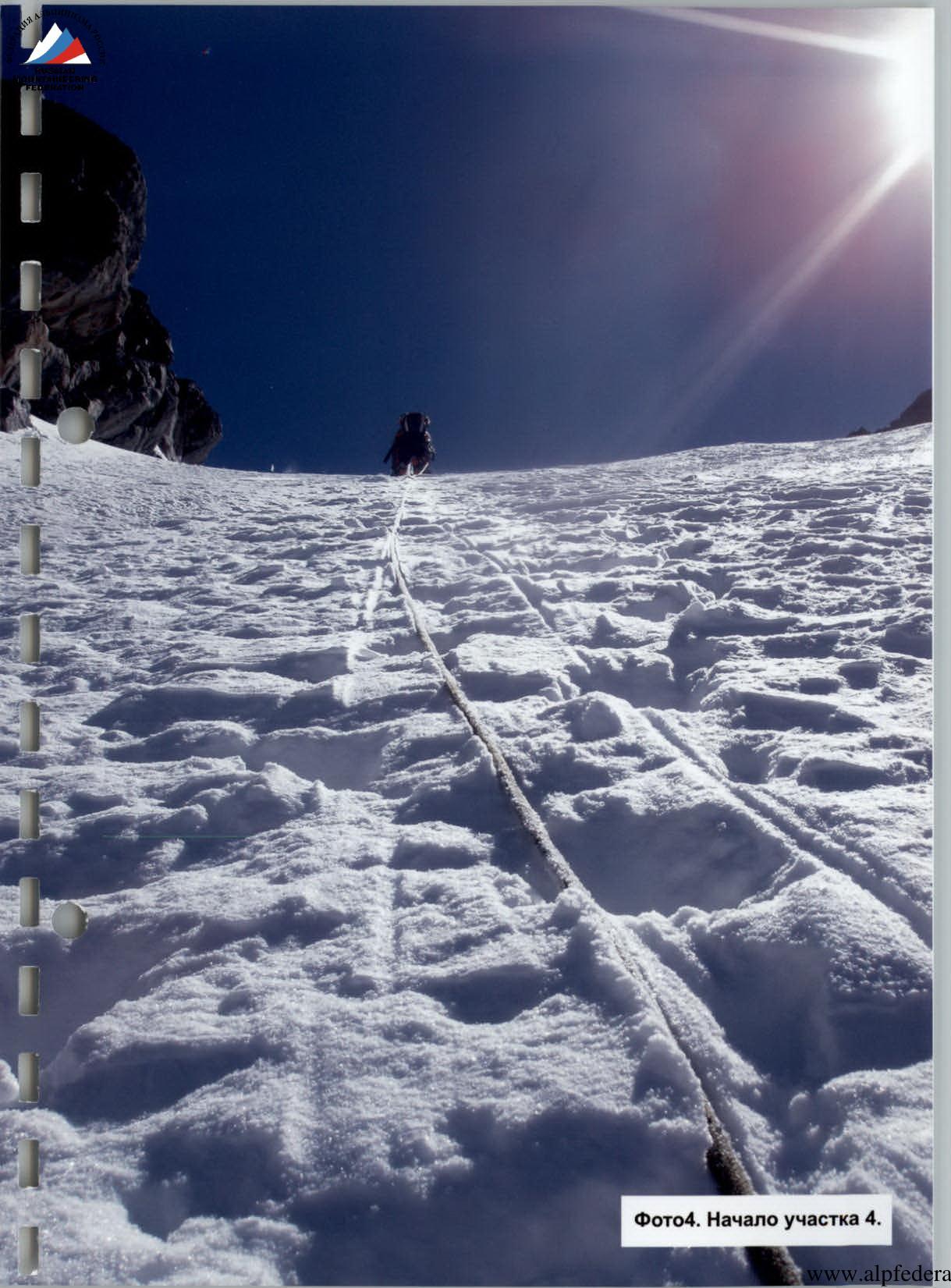
Photo4. Beginning of section 4.
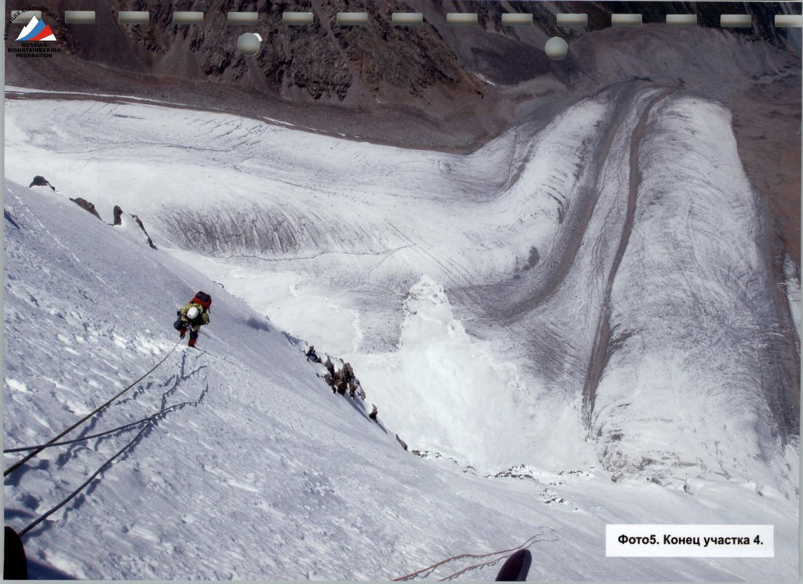
Photo5. End of section 4.
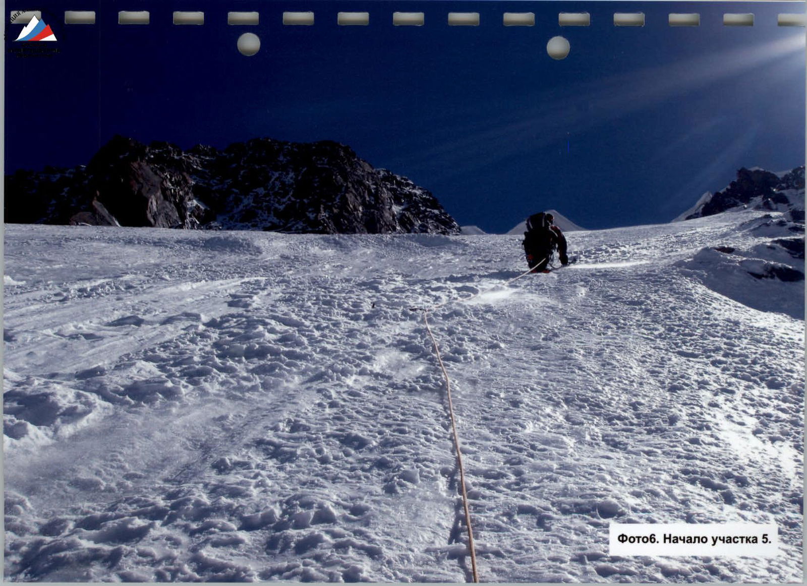
Photo6. Beginning of section 5.
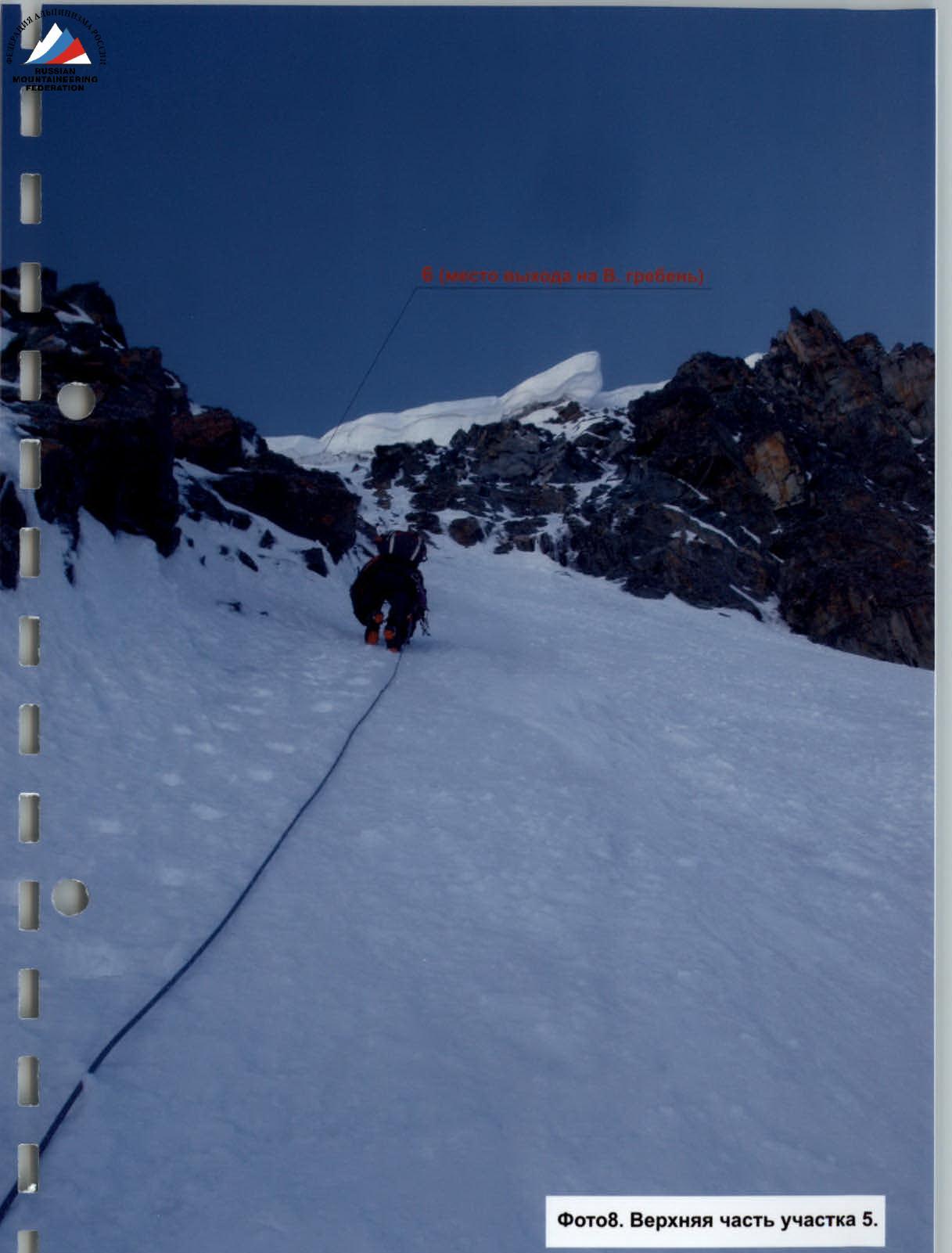
Photo8. Upper part of section 5.
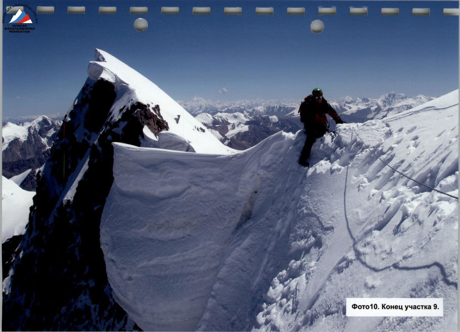
Photo10. End of section 9.


