
Ascent Log
- Region of ascent:
- Tian Shan,
- Terskey Ala-Too ridge, Karakol gorge
- Peak Dementyev 4202 m via the north slope of the eastern ridge
- Proposed 3A category of difficulty. First ascent.
- Nature of the route — combined
- Route elevation gain 500 m (by altimeter)
- Route length 800 m
- Used on the route: ice screws — 15, rock pitons and protection gear — 0, bolt hangers — 0
- Left behind pitons — 0
- Team's moving hours — 7
Exit from the base camp in the Telety gorge — August 8, 2011 at 6:00, start of work on the route — 8:30, summit — 11:30, descent to camp — 13:00
- Descent via the north-west ridge to the Ozerný pass
- Ascent made by a team of two: Salnikov Dmitry (1st sports category, instr. №1210), Shebeko Alexey (1st sports category)
- Coach: Sapunova Yulia Vladimirovna (Candidate Master of Sports, instr. II category №236)
- Organization: Tomsk Regional Public Organization "Tomsk Alpine Federation", Tomsk
- Compiled by: Salnikov Dmitry Gennadievich (d_salnikov@mail.ru)

Tomsk 2011
Peak Dementyev from the glacier. Distance to the start of the route 700 m (August 8, 2011). Breakdown by sections:
| Section № | Length | Steepness | Terrain character | Category of difficulty | Number of pitons |
|---|---|---|---|---|---|
| R0 | 300 m | 35–40 | Ice slope | II–III | 10 |
| R1 | 300 m | 20 | Snow-ice slope | II | — |
| R2 | 50 m | 50 | Frozen rocks | III | 2 |
| R3 | 10 m | 60 | Ice | IV | 3 |
| R4 | 70 m | 30 | Rocks | I | — |
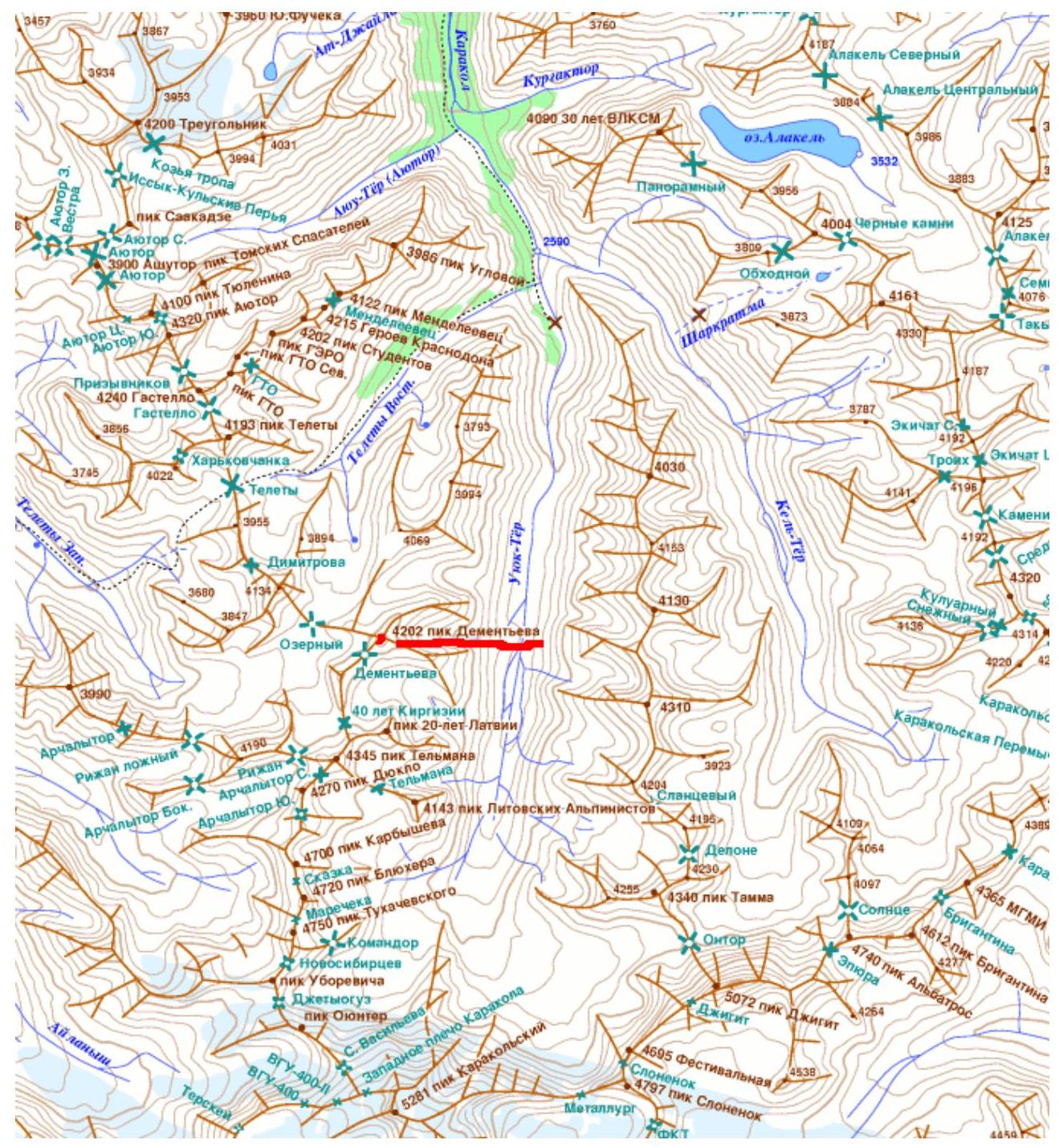
Map-scheme of the area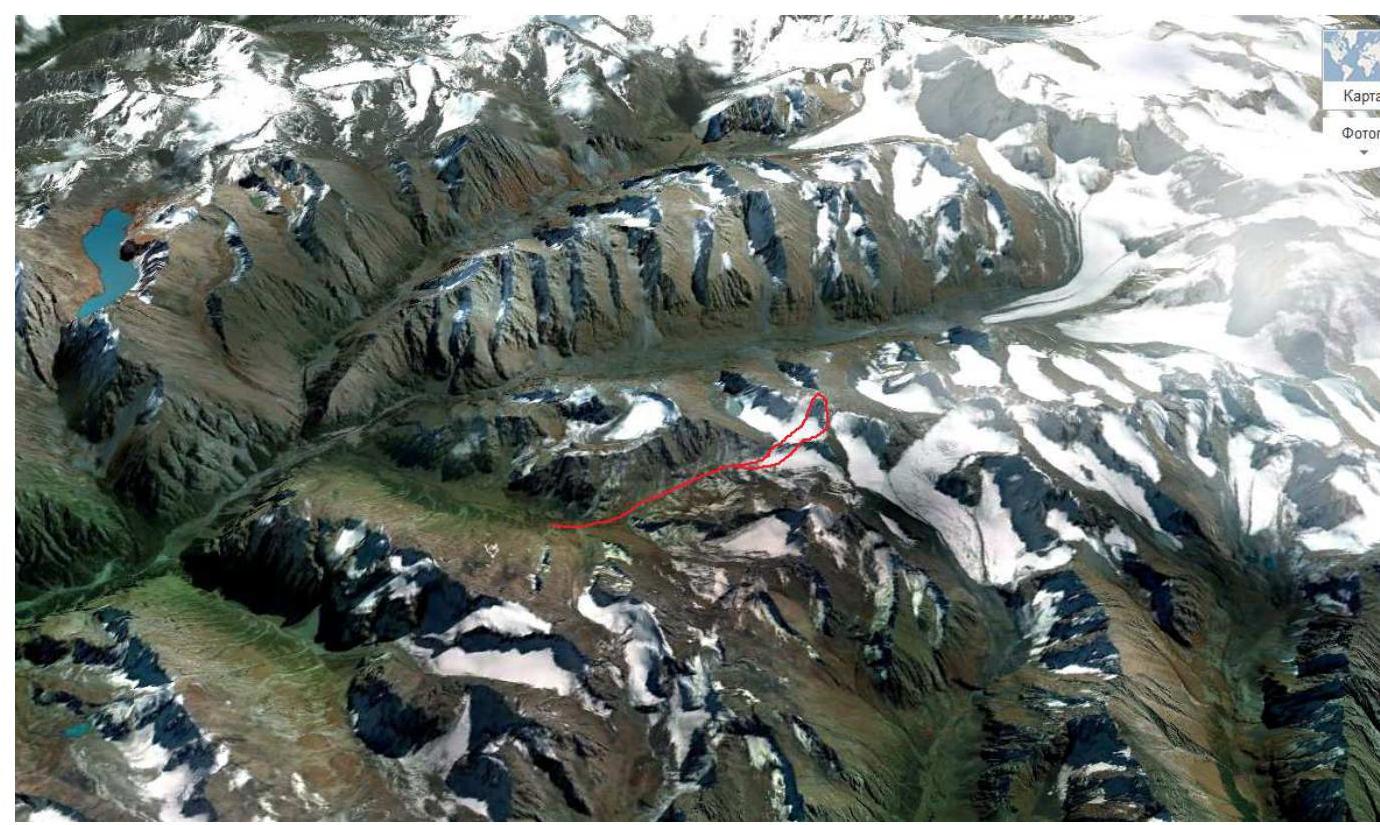
Description of the route passage
Peak Dementyev is a beautiful summit located in the southern cirque of the Telety gorge. The gorge is currently frequently visited by tourists on a trek from the Jeti-Oguz gorge to the Karakol gorge. The summit is adjacent to Peak Dmitrov, located to the north in the ridge, and is separated from it by the Ozerný pass. It is also adjacent to the "Litovskiy ugol" peaks located to the south.
The ascent began from a camp set up on grassy areas at the confluence of the left and right branches of the Telety gorge at an altitude of 3400 m. The exit from the camp was planned for dawn at 6:00. The approach to the summit is not lengthy and initially follows a trail. Then, keeping to the left (in the direction of travel) part of the moraine, in the direction of the left glacier cirque. The glacier tongue is sandwiched between steep rocks. Its steepness reaches 55°. (Photo 1) The exit to the glacier was made via a scree pocket on the left. After bypassing the steep rise of the glacier, we put on crampons and exited onto the glacier body. The glacier is flat, partially covered, without large crevasses. From the glacier, the route is clearly visible, not visible from below due to the rocks separating the northern and southern cirques of the glacier. For the ascent, the centre of the northern slope was chosen. To the left, a more gentle ascent along the rocks was visible, but the rocks lying below indicated the danger of this path. To the right of the chosen path, under the summit pinnacle, lies a snowy couloir, clearly avalanche-prone. The line of ascent along the centre of the slope was free of snow and rocks, which prompted us to pass that way. (Photo 2)
Sections R0–R1 were traversed simultaneously with protection via ice screws. After 300 m, the slope led us to a broad ridge. The exit to the top of the ridge is hindered by a large depression with large crevasses radiating from it, up to 2 m wide. From the depression, the ridge becomes narrower, and snow cornices hanging towards the south are visible on it. Before reaching the depression, we began to traverse the slope in the direction of the summit. The slope is snowy, with a steepness of no more than 20°. (Photo 3) Along the way, diagonally down the slope, there are crevasses that can be crossed via snow bridges.
Sections R1–R2 were traversed in a rope team with protection via ice axes. The general direction of movement is towards the rocks of the eastern ridge. An ascent directly along the ridge seems impossible due to the steepness and complexity of the gendarme's rocks. Therefore, the gendarme was bypassed via frozen rocks and icy trickles. The rocks are not complicated and are traversed with protection via rock outcrops. Ice screws go well into the ice.
After traversing the rocks, we exit into a steep icy gully leading to the pre-summit ridge. This is the key section of the route (R3–R4). The length is 10 m, the steepness is not less than 60°. (Photo 4) For the passage, two ice tools and piton protection were used. The rope is fixed to a rock outcrop.
Further to the summit, there is a simple and safe rocky ridge. (Photo 5) On the summit, a cairn without a note and many rusty tin cans were found.
Having reached the summit at 11:00, we began our descent along the north-west ridge to the Ozerný pass without delay due to the approaching thunderstorm.
The descent was via severely degraded rocks and then down a snowy slope to the glacier. The difficulty is approximately 1B. Then back to camp via the already familiar path in the rain.
The route we passed on Peak Dementyev made a very favourable impression with its logic, safety, and richness of technical sections. We can recommend the ascent to the summit to teams with a 3rd sports category and good ice climbing preparation.
Photographs
Photo 1. Approach to the route (descent path shown with a dotted line)
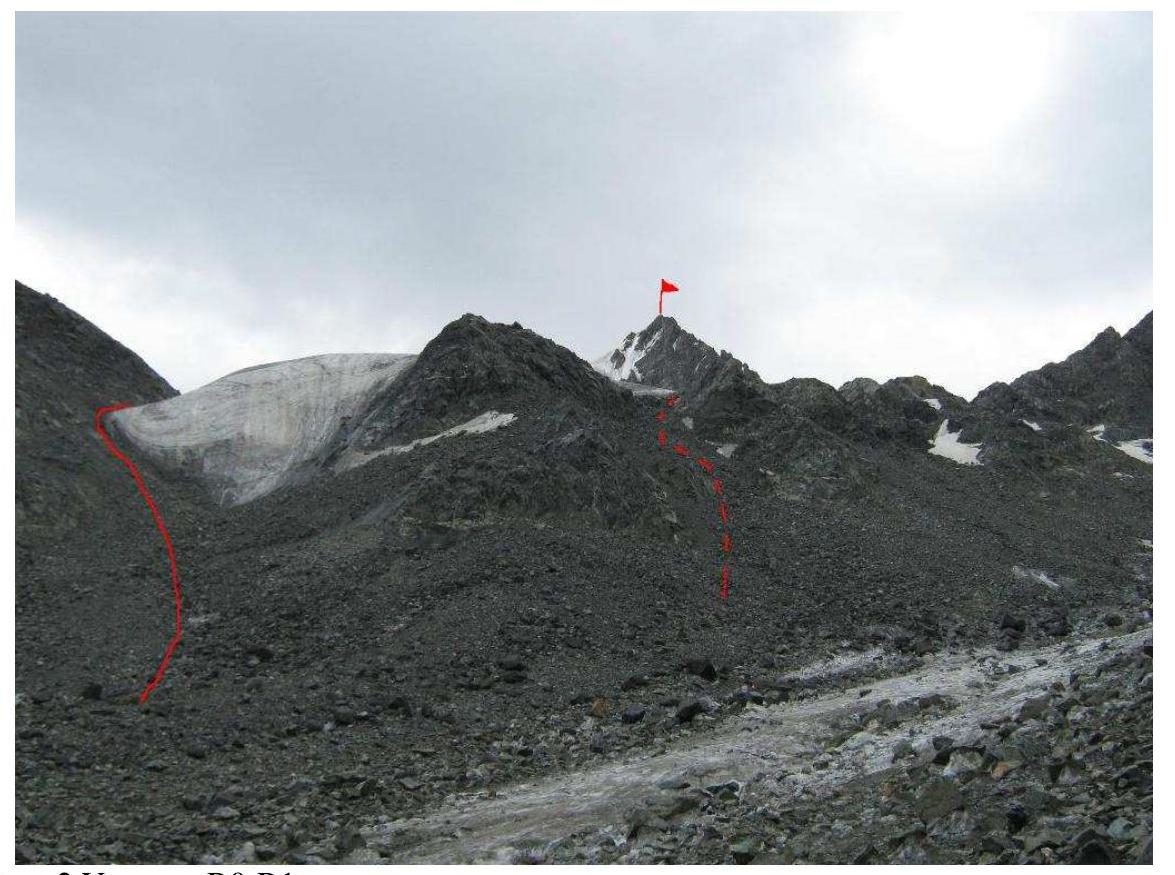
Photo 2. Section R0–R1
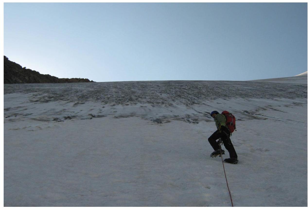
Photo 3. Section R1–R2
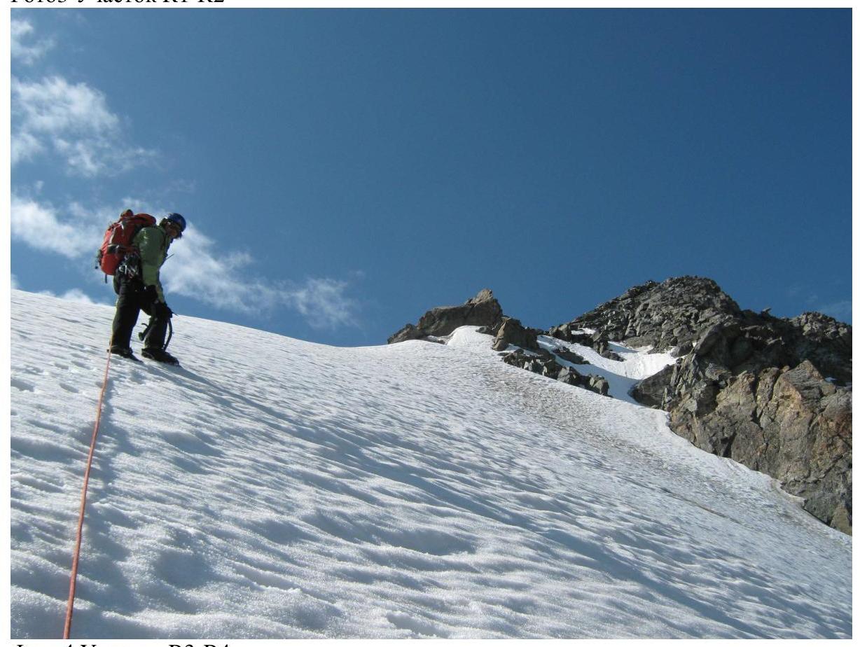
Photo 4. Section R3–R4
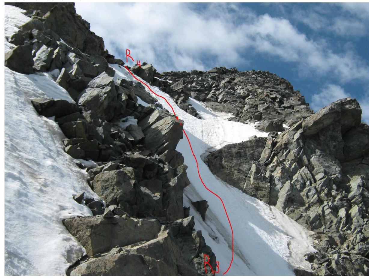
Photo 5. Section R4–Summit

Photo 6. Peak Dementyev from the Telety gorge
Comments
Sign in to leave a comment