Ascent Passport
- Tian-Shan, Terskey Ala-Too.
- p. Gastello, via the northern glacier.
Summit coordinates by GPS N 42°16.605′ E078°25.304′. Route start coordinates by GPS 3853 m N 42°16.840′ E078°25.125′.
- The route is proposed as 3B category of difficulty, first ascent.
- Route type: ice.
- Route elevation gain — 387 m.
Route length — 630 m. Section lengths:
- II — 150 m,
- III — 390 m,
- IV — 90 m.
Average steepness:
- main part of the route — 55°
- entire route — 35°
- Pitons used on the route:
- rock — 0 pcs., including artificial anchors — 0 pcs.;
- закладок — 0, including artificial anchors — 0 pcs.;
- ice — 20 pcs.
Total artificial anchors used — 0 pcs.
- Team's total climbing hours: 6 hours, 1 day.
- Participants:
- Temerev Ivan Mikhailovich — Candidate Master of Sports — team leader
- Savenkov Andrey — 3rd sports category
- Ivliev Andrey — 3rd sports category
- Pshenitsina Natalia — 3rd sports category
- Kireeva Maria — 3rd sports category
- Kryachko Maxim — 3rd sports category
- Zazdravnykh Kostya — 3rd sports category
- Mityaeva Yulia — 3rd sports category
- Coach: Novoselova G. V.
- Approach to the route: 06:00, August 11, 2006.
Reached the summit: 12:00, August 11, 2006.
Returned to Base Camp: 16:00, August 11, 2006.
- Organization: Tomsk Alpine Federation regional public organization.
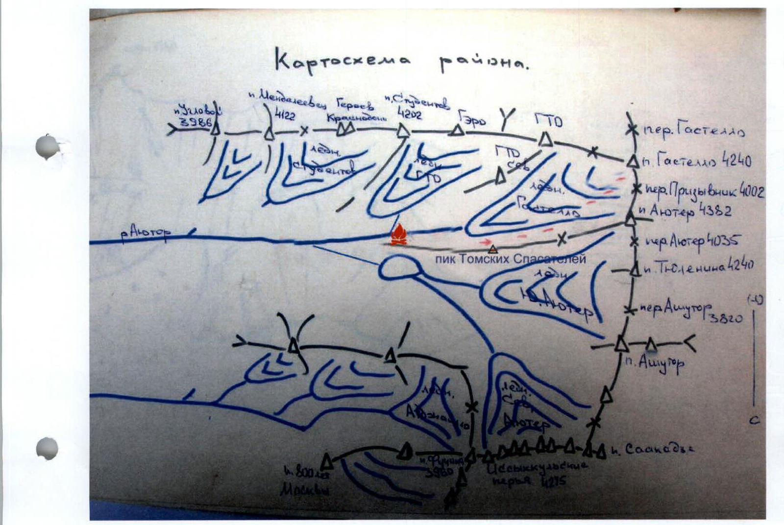
Photo #1. General view of the summit with neighboring routes.
Taken from the summit of Ayu-Tor.
- Blue line — 2A from Prisivnikov Pass
- Red line — 3B first ascent
- Green line — 3A traverse Gastello—GTO
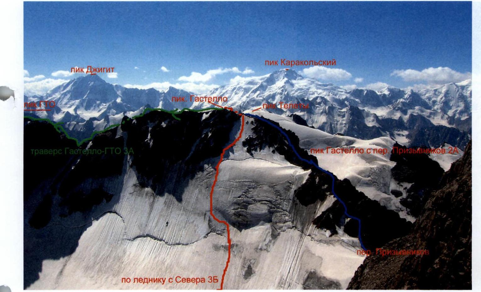 Photo #2. Photopanorama with neighboring peaks.
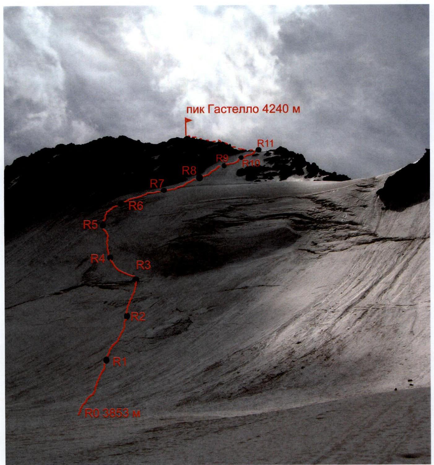
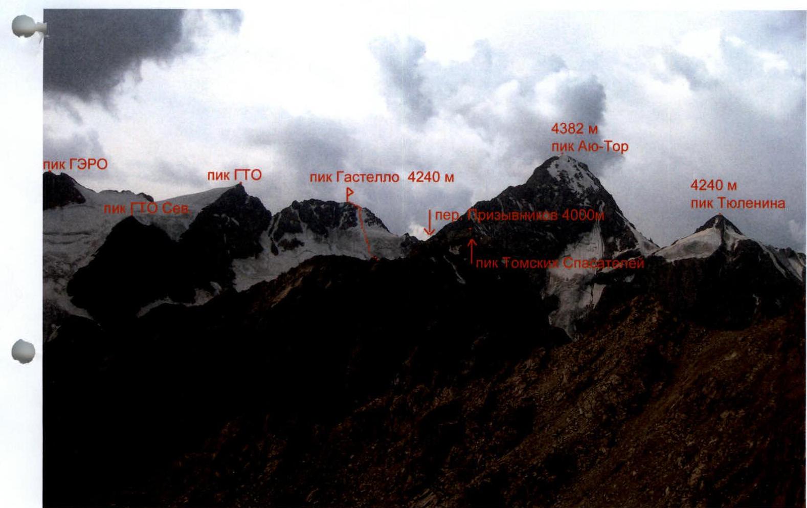 Photo #3. Route profile.
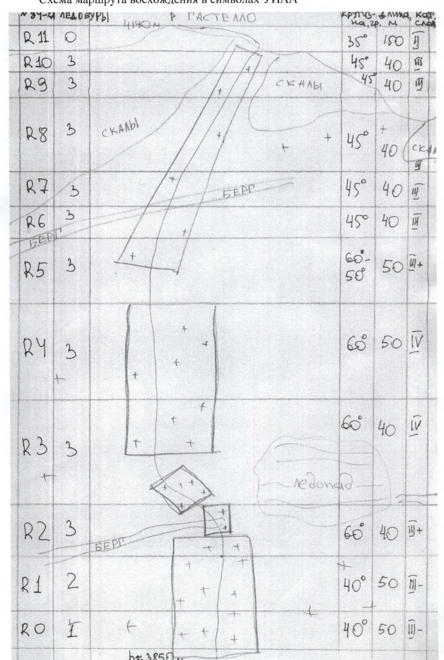
 Route diagram in UIAA symbols.
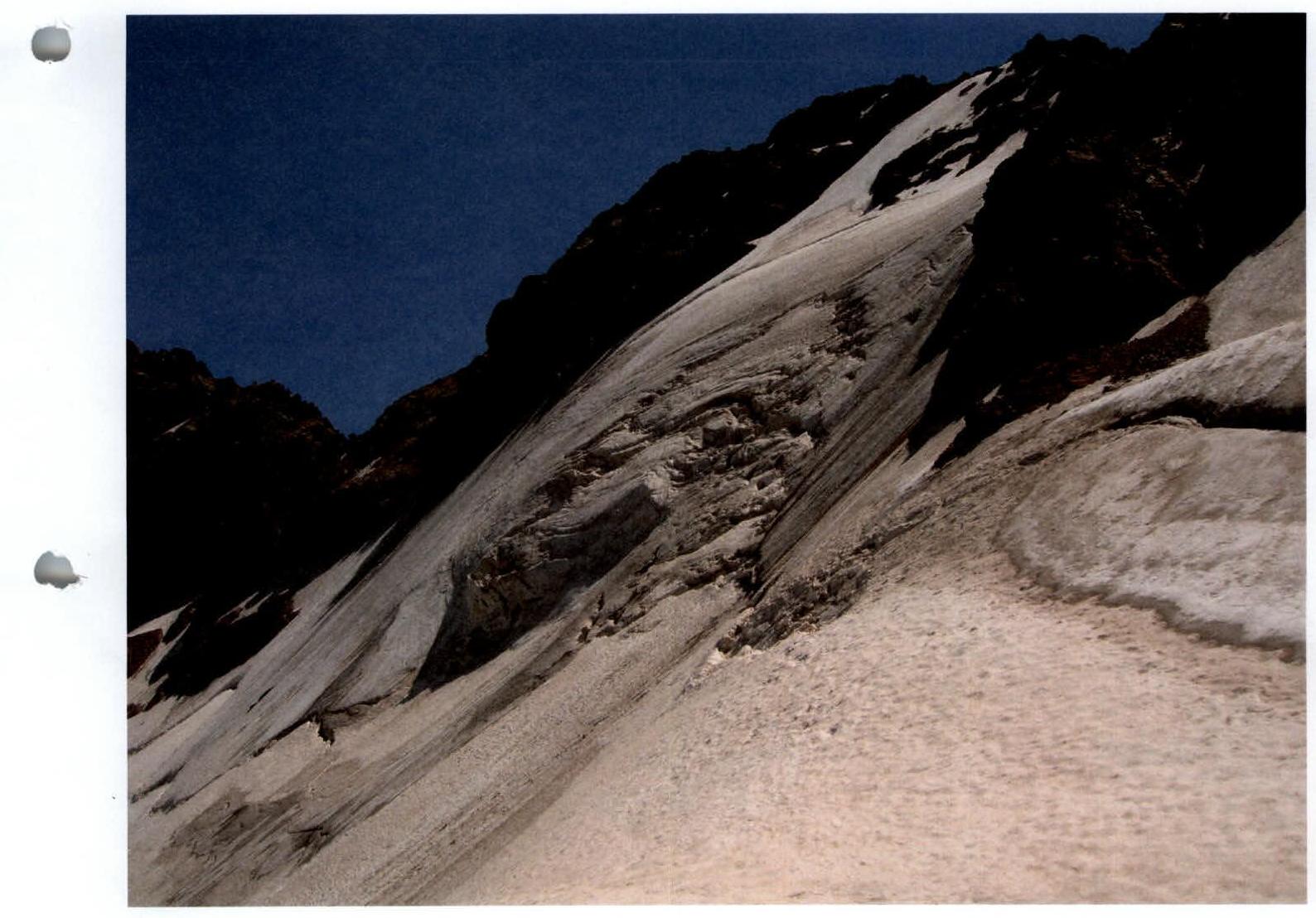
General view and route line from Gastello glacier below Prisivnikov Pass. Photo taken on August 7, 2006 at 11:50 with NIKON E5600 camera.
Route Description
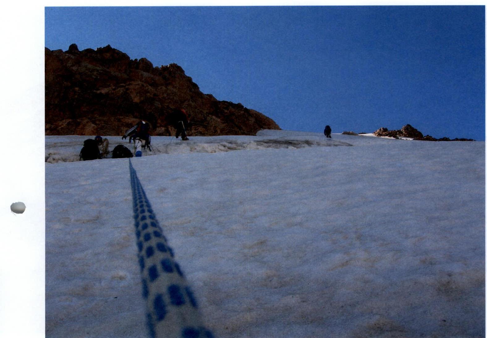
5:20 left the camp on the "baran'i lby" (ram's foreheads). 06:00 — under the route — got dressed. 06:30 — started moving. 11:40 — reached the rocky ridge 150 m from the summit. 12:00 — reached the summit. 13:00 — descended via 2A towards Prisivnikov Pass.
I believe that the route should be started as early as possible due to the presence of destroyed rocks on both sides of the glacier and embedded stones on the glacier.
R0–R2. On the right part of the glacier (in the direction of travel) under the protection of the icefall (from stones) we start moving up. We hang ropes. 100 m, 40°, III–.
R3–R4. Reached the bergschrund under the icefall. Moved to the right part (in the direction of travel) and continued moving up. 40 m, 60°, III.
R4–R5. Up and left, bypassing the icefall. 40 m, 60°, IV.
R5–R6. Up the ice. 50 m, 60°, IV.
R6–R7. Up the ice. 50 m, 60–50°, III+. Base near the bergschrund.
R7–R11. 160 m, 45–50°, III. Exit to the rocky ridge.
R11–summit. 150 m, 35°, II. Simultaneous movement along the ridge to the summit.
Descent via 2A.
Photos of Route Sections
Photo #5. Section R0.
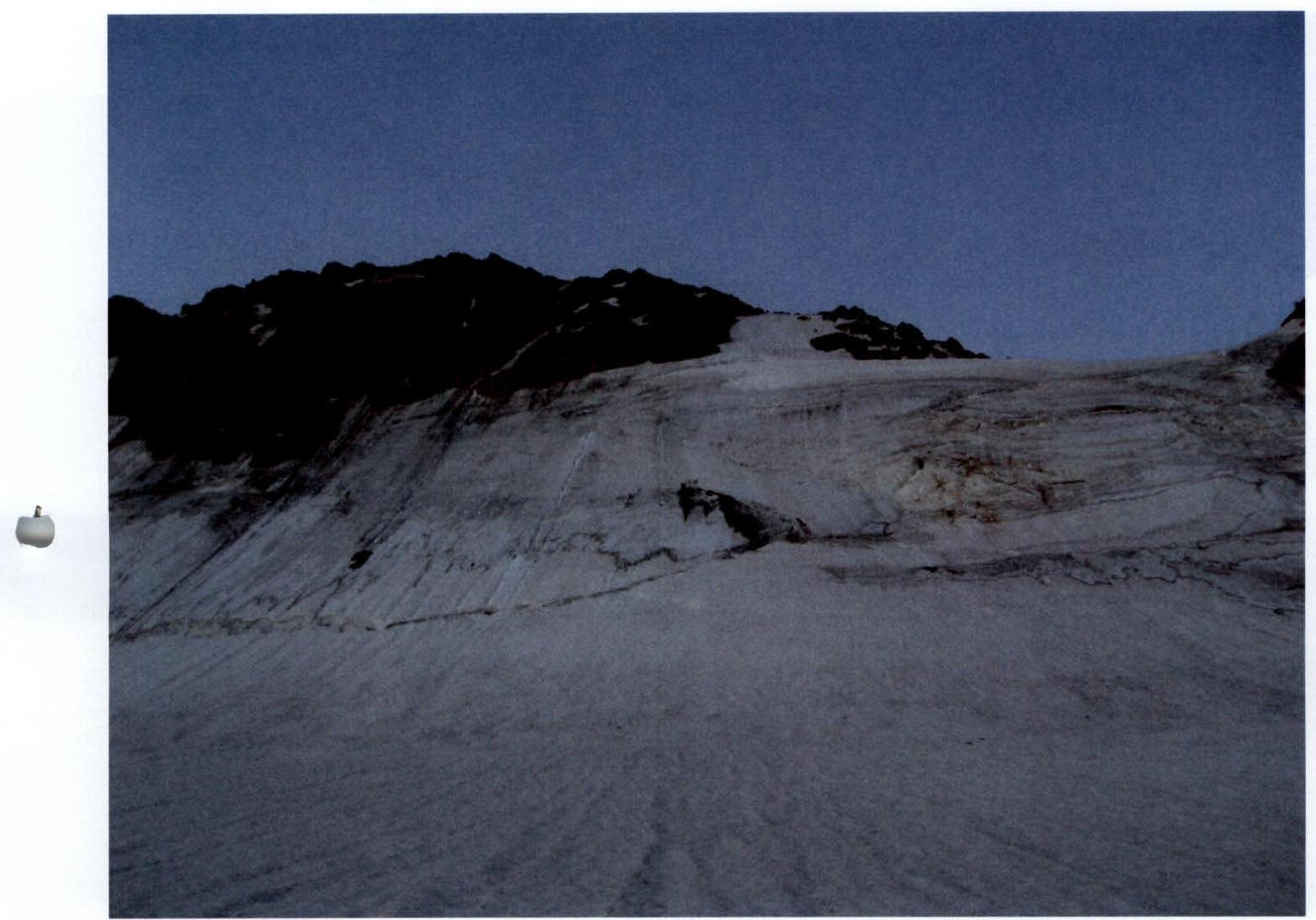
Photo #8. Section R3–R4.
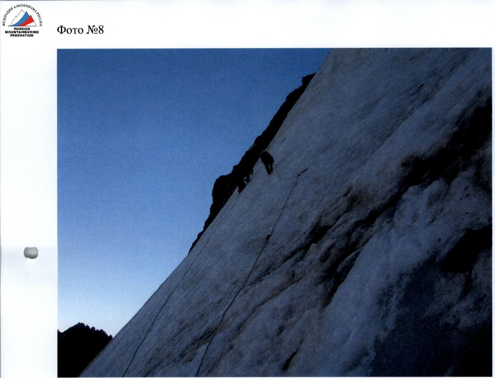
Photo #9. Section R4.
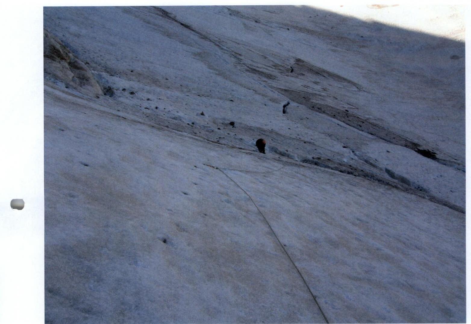
Photo #11. Section R5–R6.
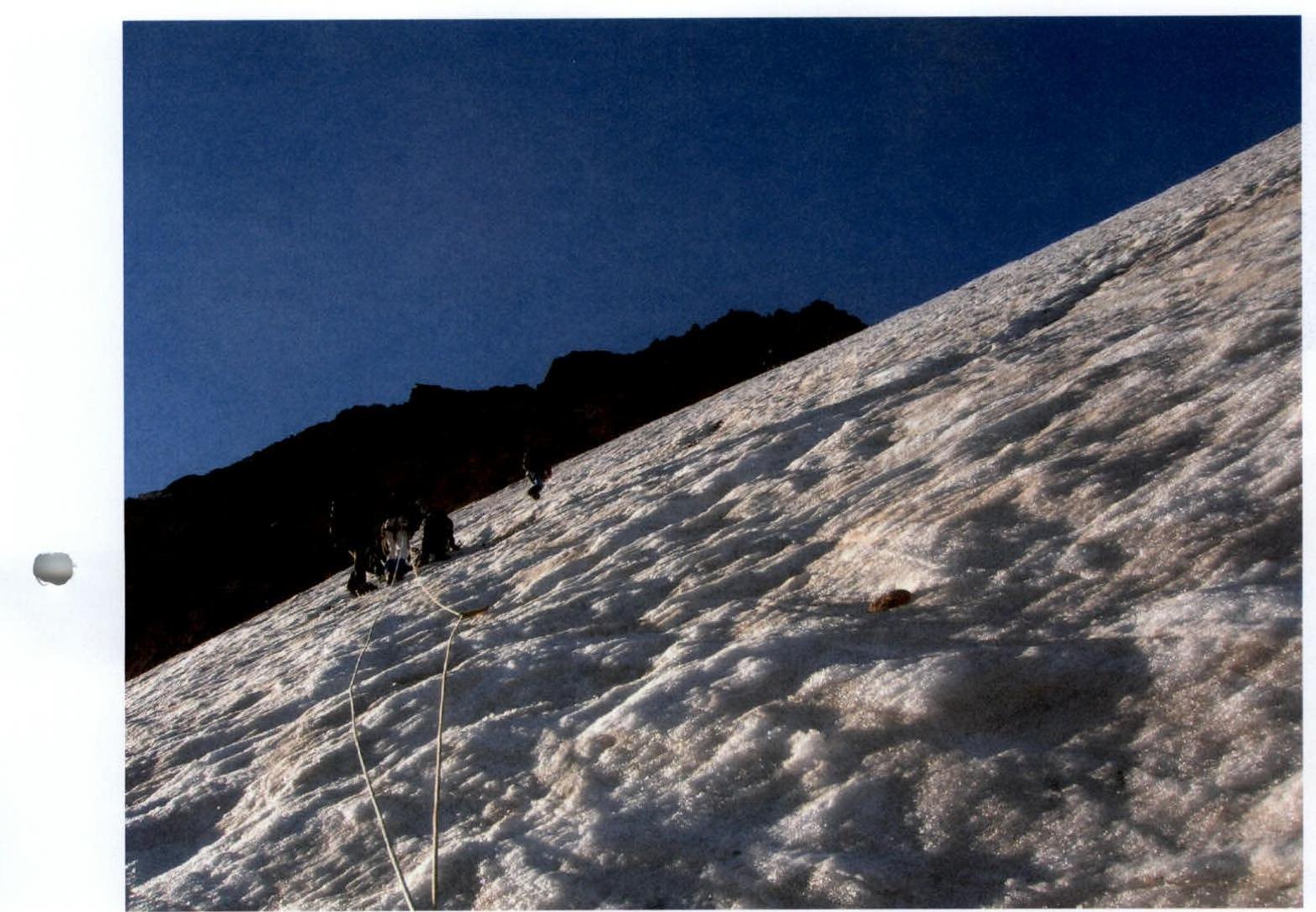
Photo #13. Section R6–R7.