
ASCENT to the summit of PIK AYUTER via the eastern slope
BelSoviet DSO "Zenit" Pik Ayuter via the eastern slope, category 5A complexity (first ascent)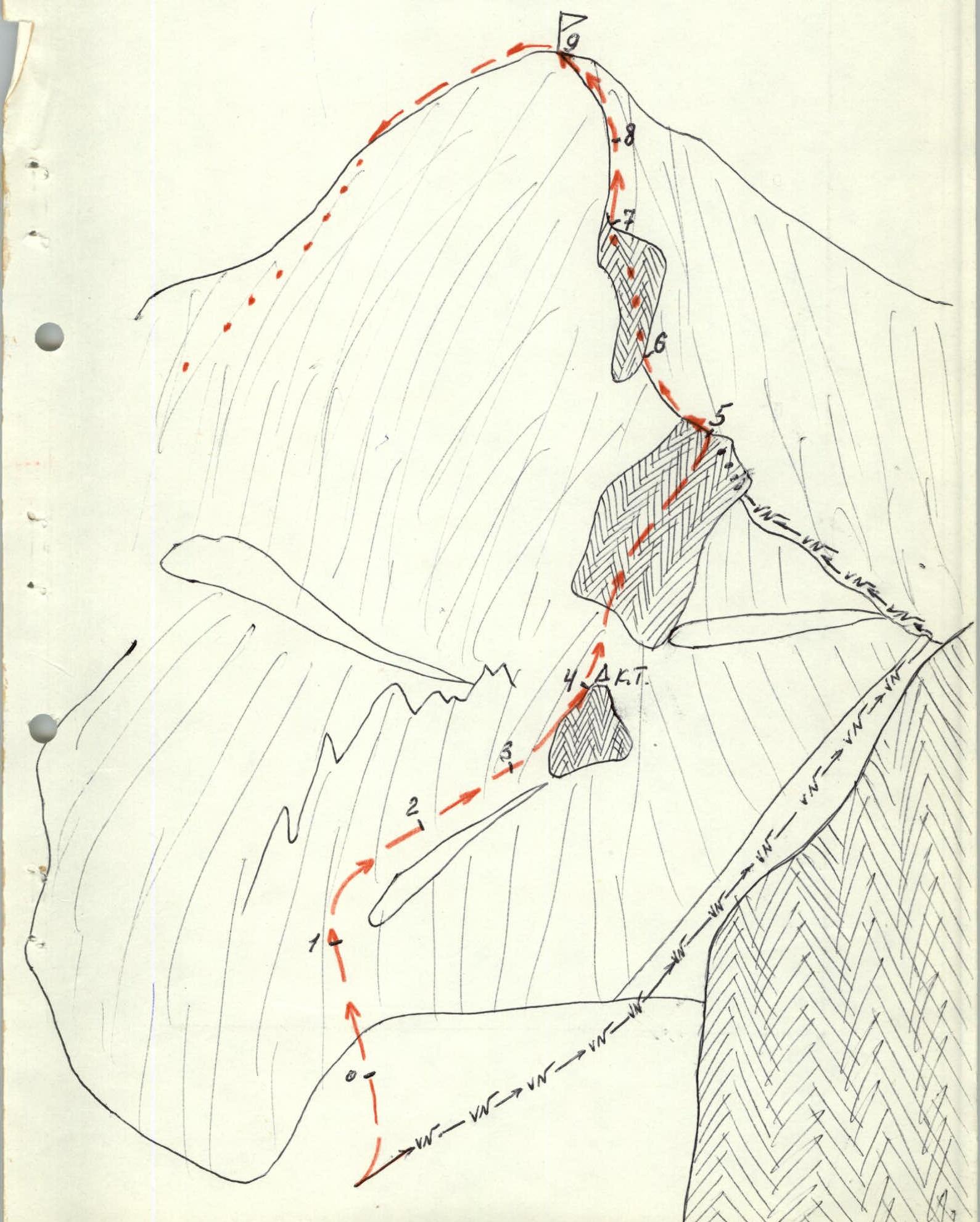
ROUTE AND ASCENT DESCRIPTION
From the base camp on the right bank of the Ontor River, cross to the left bank and move downstream along the Karakol valley until the Ayutor River meets the Ontor River. Then follow the trail upstream along the Ayutor valley to the lake. The journey from the camp takes 3 hours.
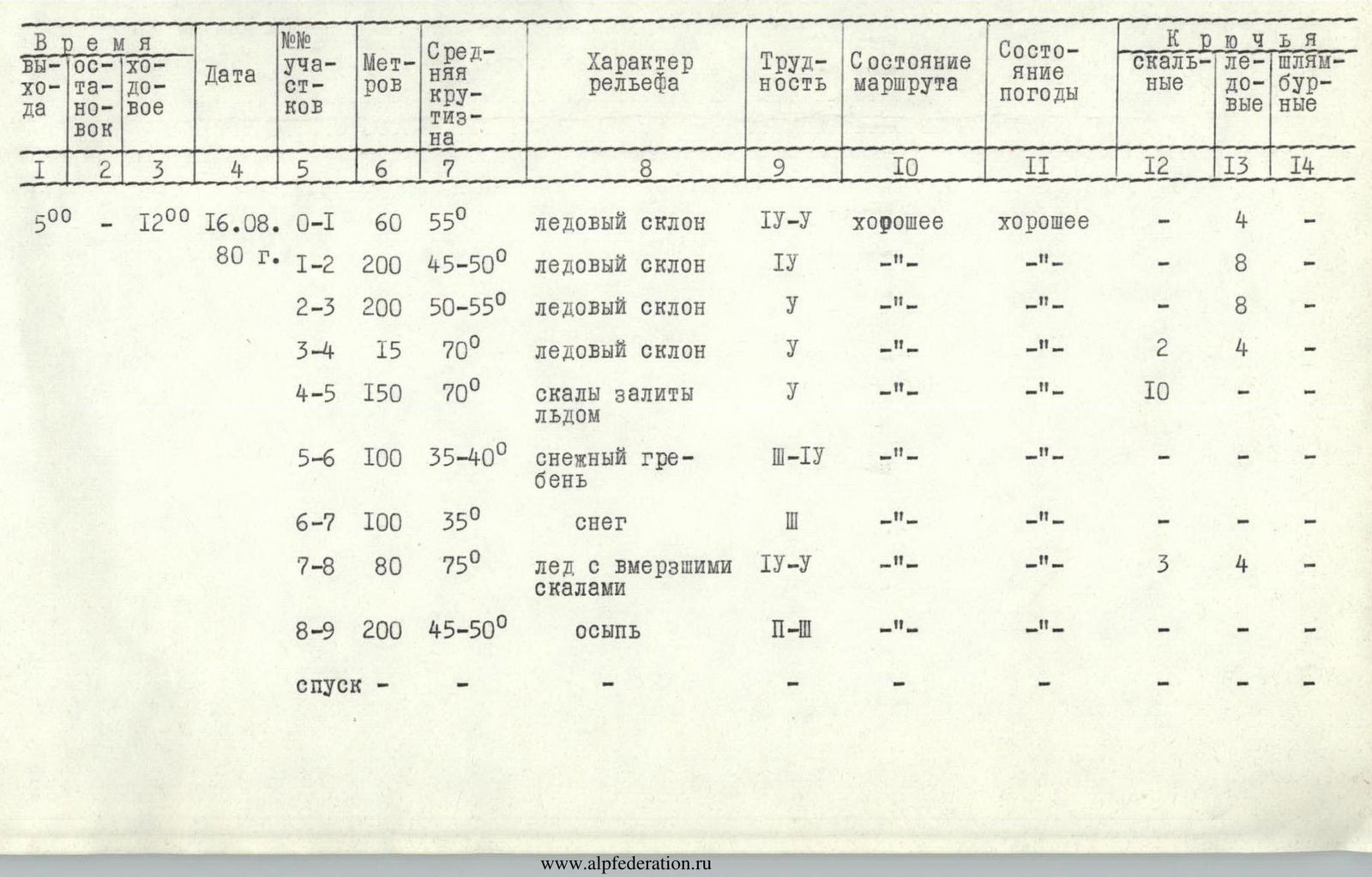
From the overnight stay near the lake, we move along the moraine to the glacier tongue (the moraine is on the right, orographically). It takes 1.5 hours from the overnight stay. We approach the glacier tongue from the right (orographically) side along the edge of the moraine and the glacier. Then, in teams, we move to the central part of the glacier (60 m, 55°, section R0–R1). Teams move independently; partners take turns leading, using front points of crampons and ice screw protection. 4 ice screws were used.
Then we move up to the right, leaving the icefall on the left (200 m, 45–50°, section R1–R2). Protection is used. 8 ice screws were used. Teams move independently; partners take turns leading.
Then we move up to the left into an ice funnel towards the central part of the base of the gendarme on the eastern ridge (200 m, 50–55°, section R2–R3). Ice screw protection was used; 8 ice screws were placed. The next section is the key part of the route - an ice pitch (15 m, 70°, section R3–R4). Ice screw protection is used. Teams move with interaction, using ascenders. For safety, 4 ice screws were placed, and 2 rock anchors were hammered at the exit from the pitch (after the ascent); a control cairn was left.
Then we ascend the gendarme wall (150 m, 70°, section R4–R5) to the eastern ridge. The rocks are covered in ice; ice screw protection is used. For safety, 10 rock anchors were hammered. After passing the gendarme, we move up to the left along a snowy ridge (100 m, 35–40°, section R5–R6) to the base of the second gendarme. The gendarme is bypassed on the right along the edge of rocks and snow (section R6–R7).
The summit tower follows. The first part (80 m, 75°, section R7–R8) consists of rock boulders frozen in ice. The movement is very cautious, with ice screw protection. 4 ice screws were placed, and 3 rock anchors were hammered. Then, along a snowy slope with scree (150–200 m, 45–50°, section R8–R9), we ascend to the summit.
The descent from the summit is along the southeastern ridge via a category 3A complexity route.
Team captain Kolen Kovensky G.I. Pik Ayuter via the eastern slope, category 5A complexity (first ascent)
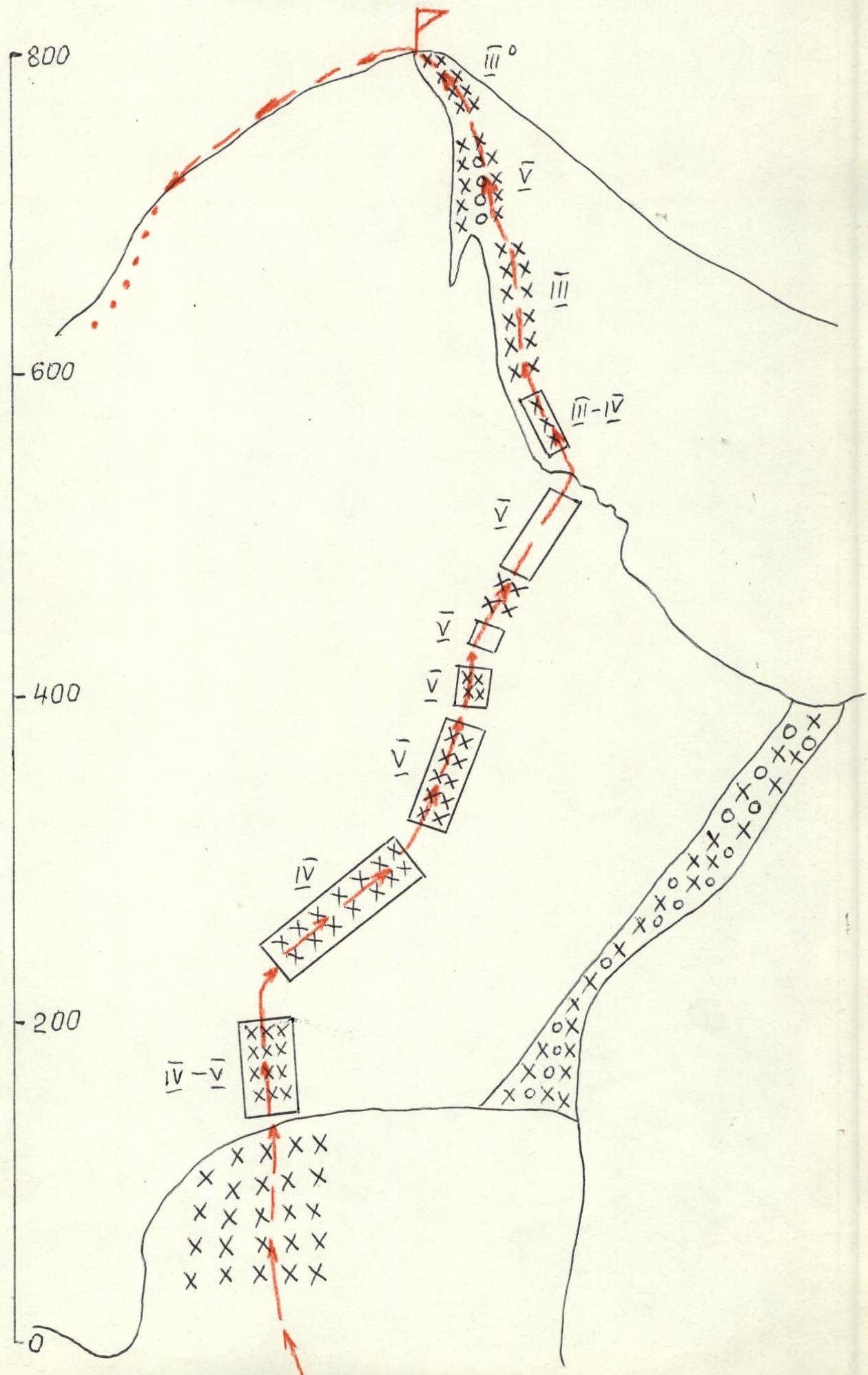
TABLE OF MAIN CHARACTERISTICS OF THE ASCENT ROUTE
Comments
Sign in to leave a comment