Ascent Passport
-
Ascent class — technical
-
Ascent area — Tian-Shan, Terskey-Alatau ridge
-
Peak — Albatros Western, 4740 m, via the counterfort of the northern wall, from Brigantina glacier
-
Proposed category of difficulty — 4B, combined
-
Route characteristics:
Height difference — 581 m, length — 840 m. Average steepness of the wall section — 68° (from 4212 m to 4706 m). Length of sections:
- Grade III — 420 m
- Grade IV — 182 m
- Steep terrain — 238 m
-
Pitons driven:
| for belay | for ITO | |
|---|---|---|
| rock | 17 | 1 |
| ice | 16 | - |
| bolt | - | - |
| chock stones | 22 | - |
-
Number of climbing hours — 11 hours
-
Number of overnight stays and their characteristics — none
-
Leader — Smirnov M.G., 1st sports category
Participants:
- Stepanov S.I., 1st sports category
- Ryabukhin A.G., CMS
- Karpenkov M.V., 1st sports category
-
Team coach — Ryabukhin A.G., Honored Coach of the RSFSR in mountaineering
-
Date of departure and return — July 6, 1984
-
Organization: Chelyabinsk Regional Council SDDO, "Burevestnik"
Routes
- via the North-West edge, 1965, V. Osipov, 4B category of difficulty, combined
- via the Northern wall, 1983, Kolchin, 4B category of difficulty, combined
- described route via the counterfort of the Northern wall, 1984, M. Smirnov
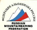
p. Albatros Eastern
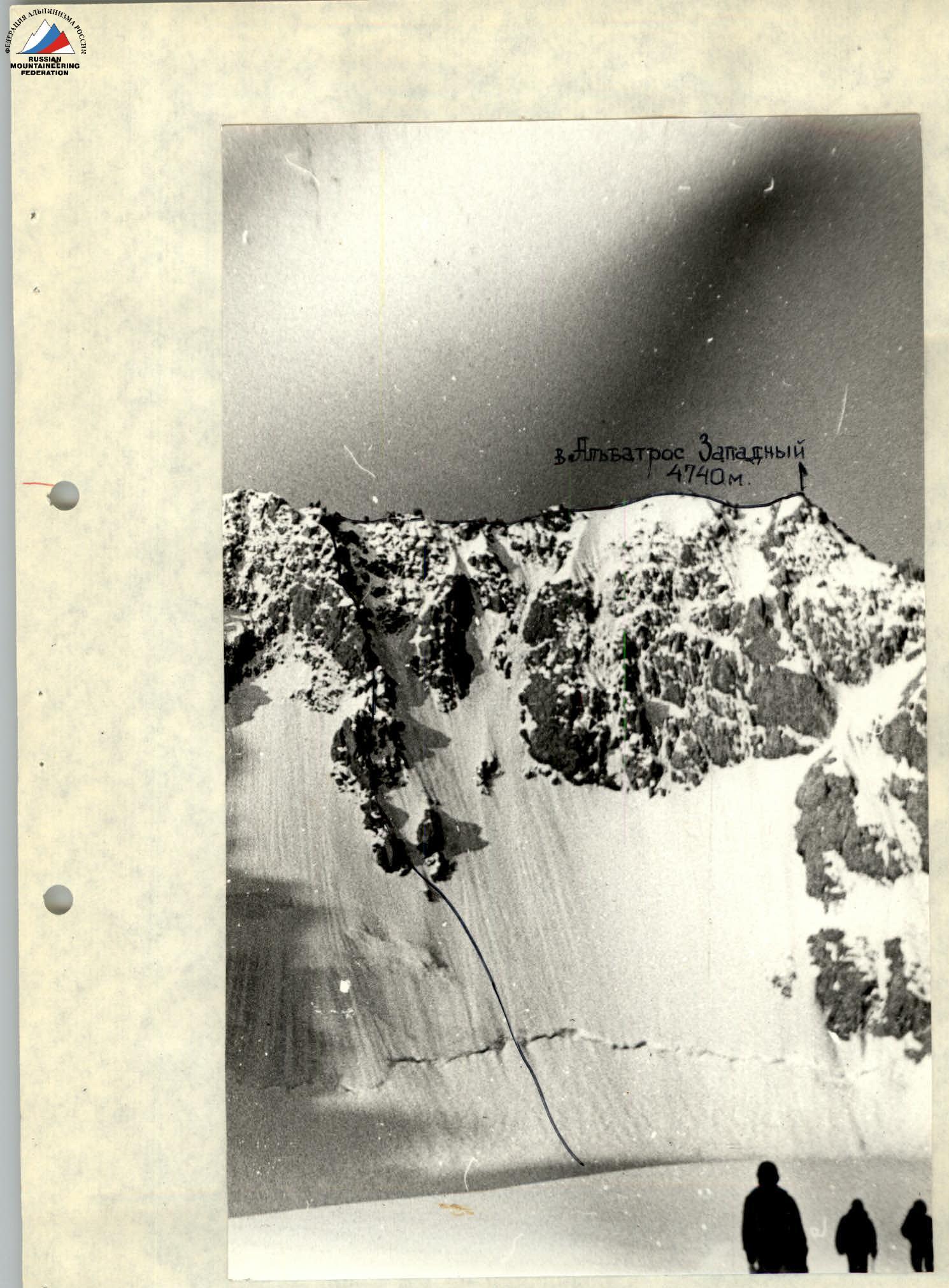
p. Albatros Western 4740 m
photo taken from Brigantina glacier with "Helios-44M" lens
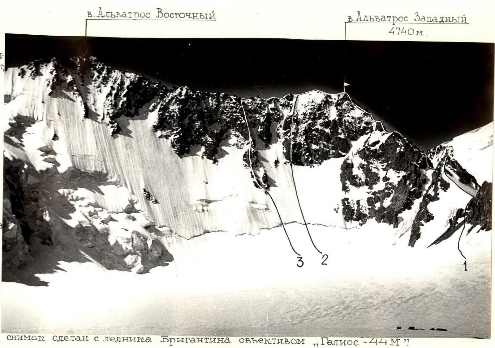
p. Albatros Western 4740 m
Photo #1. Left profile of the route.
Taken from Brigantina glacier with "Smena 8M" camera.
The right profile of the route could not be fully captured.
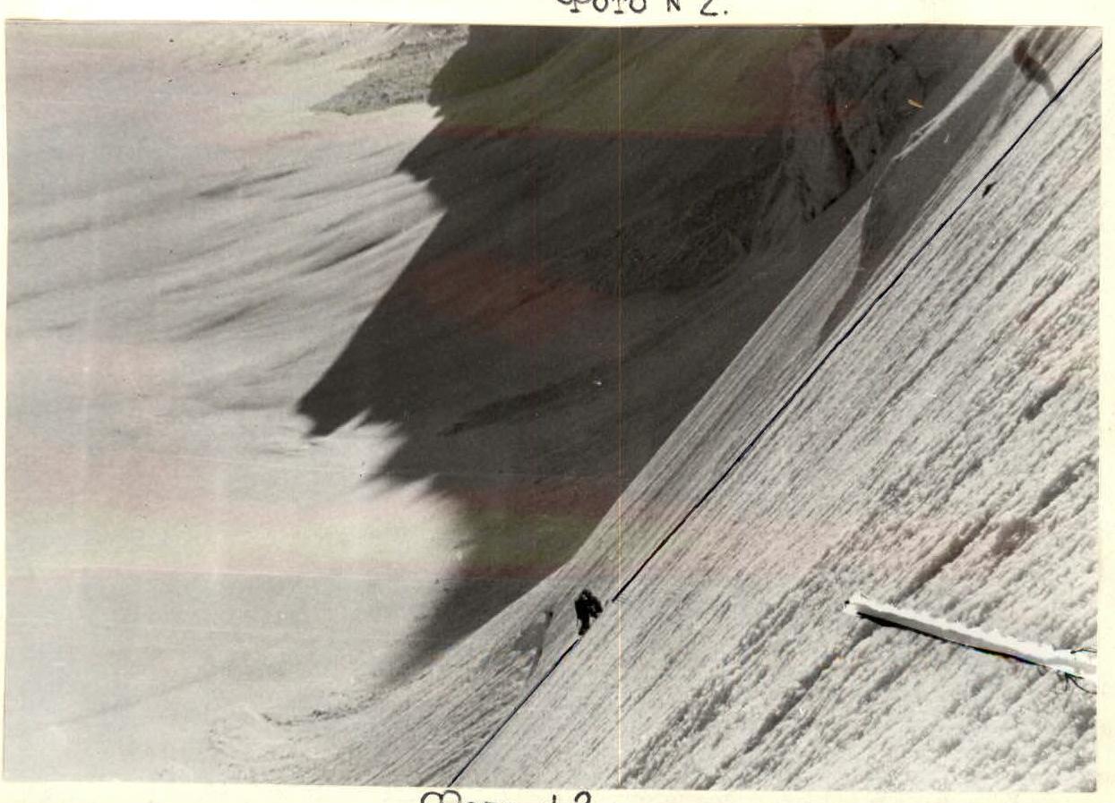
Photo #2.
Photo #3.
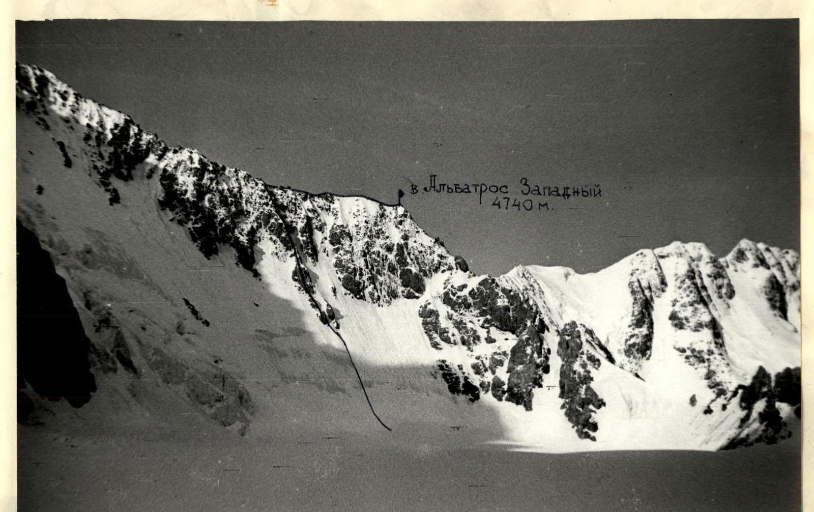
p. Albatros Western 4740 m.
Photo #4. General view of the route.
WESTERN ALBATROS 4740
| Section # | Category of difficulty | Steepness, ° | Length of section, m | Total length of route, m |
|---|---|---|---|---|
| R15–R16 | 10 | 200 | 840 | |
| R14–R15 | 3 | 60 | 20 | 640 |
| R13–R14 | 4 | 75 | 40 | 620 |
| R12–R13 | 5 | 80 | 40 | 580 |
| R11–R12 | 4 | 65 | 32 | 540 |
| R10–R11 | 5 | 90 | 8 | 508 |
| R9–R10 | 5 | 85 | 40 | 500 |
| R8–R9 | 4 | 75 | 40 | 460 |
| R7–R8 | 3 | 70 | 40 | 420 |
| R6–R7 | 4 | 75 | 40 | 380 |
| R5–R6 | 5 | 85 | 10 | 340 |
| R4–R5 | 4 | 65 | 30 | 330 |
| R3–R4 | 3 | 60 | 60 | 300 |
| R2–R3 | 5 | 60 | 60 | 240 |
| R1–R2 | 5 | 55 | 80 | 180 |
| R0–R1 | 3 | 35–45 | 100 | 100 |
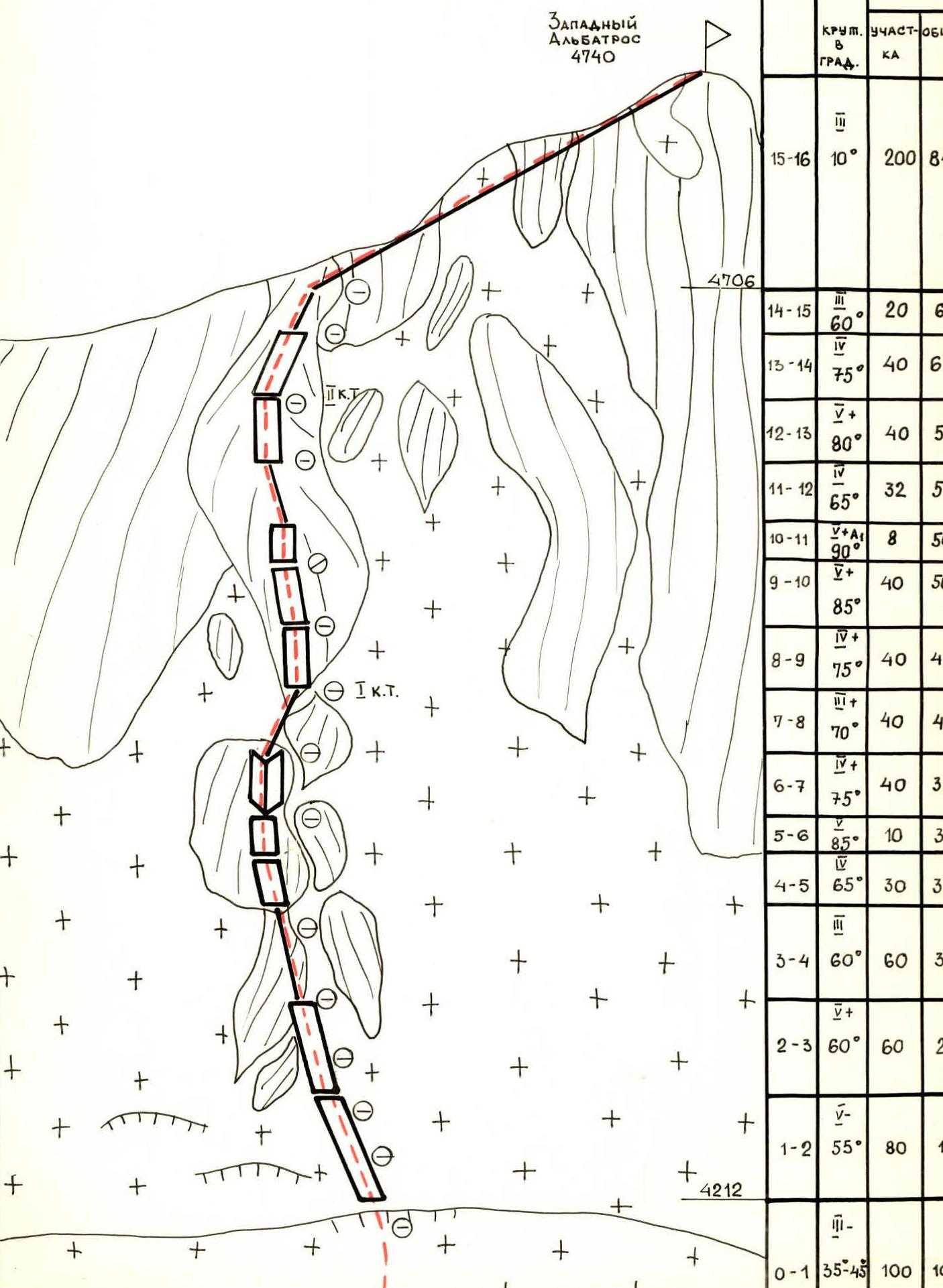
Photo #5.
Section R1–R2. Overcoming the bergschrund. Taken from point R1.
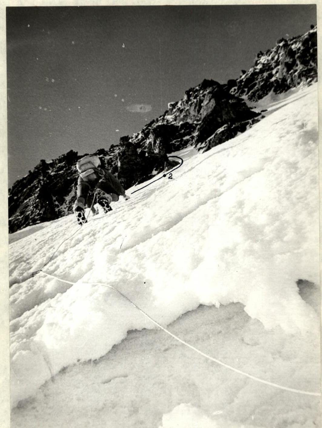
Table of main ascent characteristics
| Date, time | Section designation | Average steepness, ° | Length, m | Terrain characteristics | Difficulty | Condition | Weather conditions | Rock pitons | Ice pitons | Bolt pitons | Chock stones | Notes |
|---|---|---|---|---|---|---|---|---|---|---|---|---|
| July 6, 1984 | R0–R1 | 35 | 100 | snow slope | soft, deep snow | clear | ||||||
| R1–R2 | 55 | 80 | ice wall | 5 | ice covered with a thin layer | — | 8 | |||||
| 6:30–17:30 | R2–R3 | 60 | 60 | ice wall | 5 | — | — | 8 | ||||
| R3–R4 | 60 | 60 | rock edge | 3 | destroyed rocks covered with snow | — | 1 | 4 | ||||
| II climbing hours | R4–R5 | 65 | 30 | rock wall | 4 | rocks covered with ice | — | 1 | 2 | |||
| R5–R6 | 85 | 10 | rock wall | 5 | monolithic | — | 2 | |||||
| R6–R7 | 75 | 40 | inner corner | 4 | rocks with ice | — | 4 | |||||
| R7–R8 | 70 | 40 | rock edge | 3 | rocks with snow | — | 2 | 1 | 1 control cairn | |||
| R8–R9 | 75 | 40 | rock wall | 4 | rocks with snow | — | 4 | 1 | ||||
| R9–R10 | 85 | 40 | rock wall | 5 | monolithic rocks | — | 2 | |||||
| R10–R11 | 90 | 8 | rock wall | 5 | monolithic rocks | — | 2 | |||||
| R11–R12 | 65 | 32 | rock edge | 4 | rocks covered with snow | — | 2 | 1 | ||||
| R12–R13 | 80 | 40 | rock wall | 5 | rocks covered with ice | — | 3 | 2 | 2 control cairns | |||
| R13–R14 | 75 | 40 | rock wall | 4 | rocks with ice | — | 3 | |||||
| R14–R15 | 60 | 20 | rock edge | 3 | rocks with snow | — | ||||||
| R15–R16 | 10 | 200 | summit ridge | 3 | destroyed rocks with snow | — | summit cairn |
Descent from the summit of Albatros Western along the SW ridge to Epura pass via 2B category of difficulty route. Then to Dzhigita glacier to the base camp. Descent took 8 hours 30 minutes.
Photo #8.
Section R3–R4.
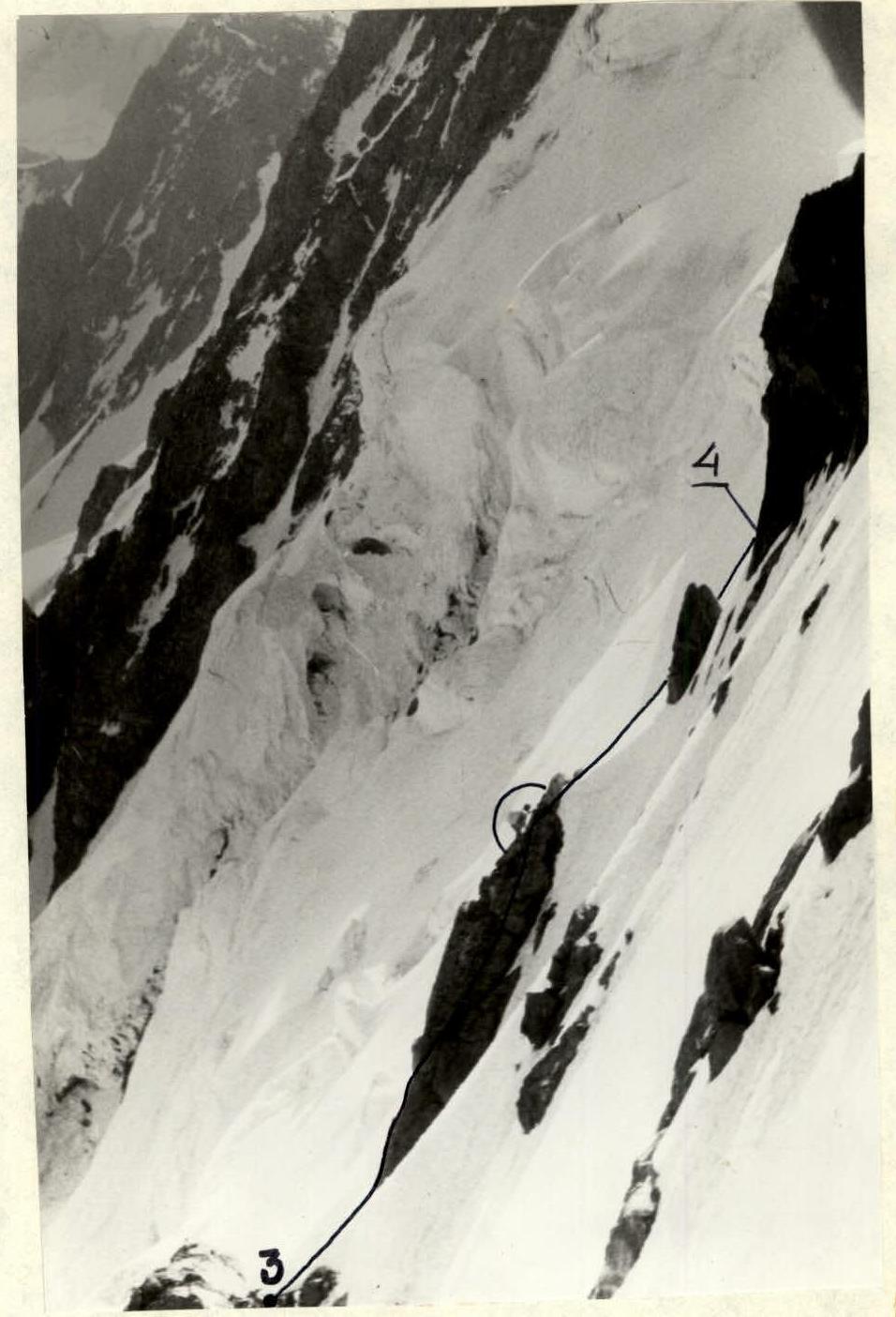
Photo #9.
Section R4–R5. Taken from point R4.
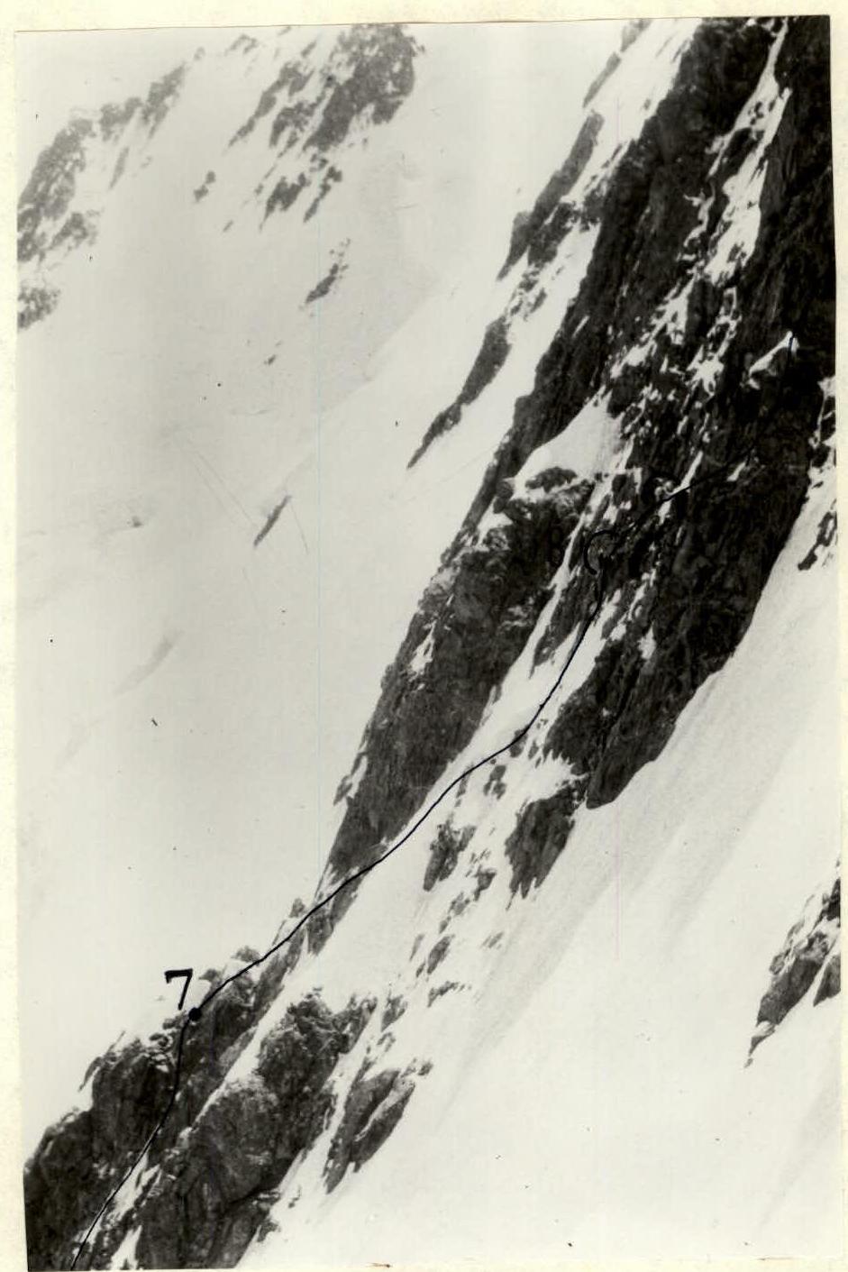
Photo #10.
Taken from the route on the Northern wall.
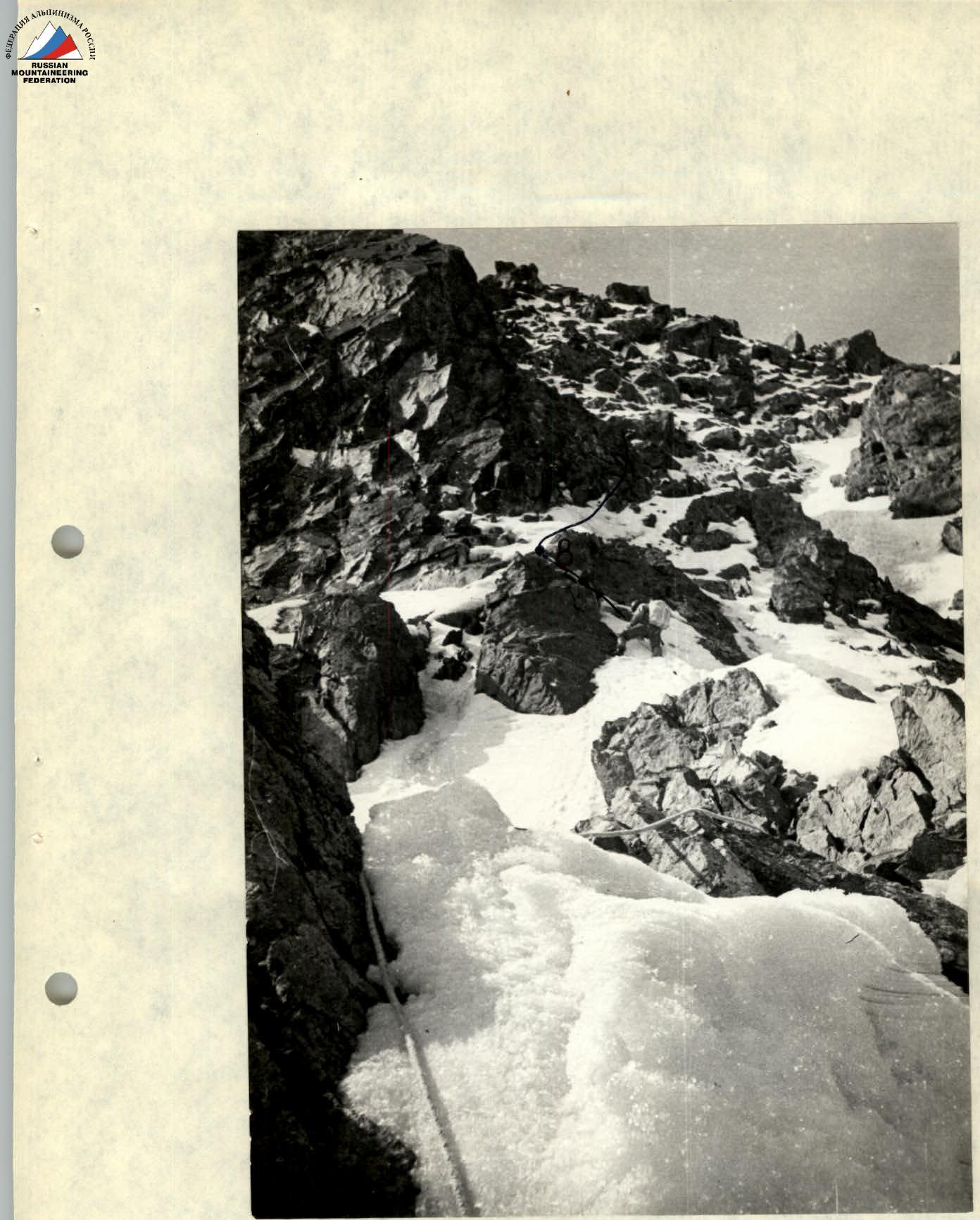
Photo #11.
Section R7–R8. Taken from point R7.
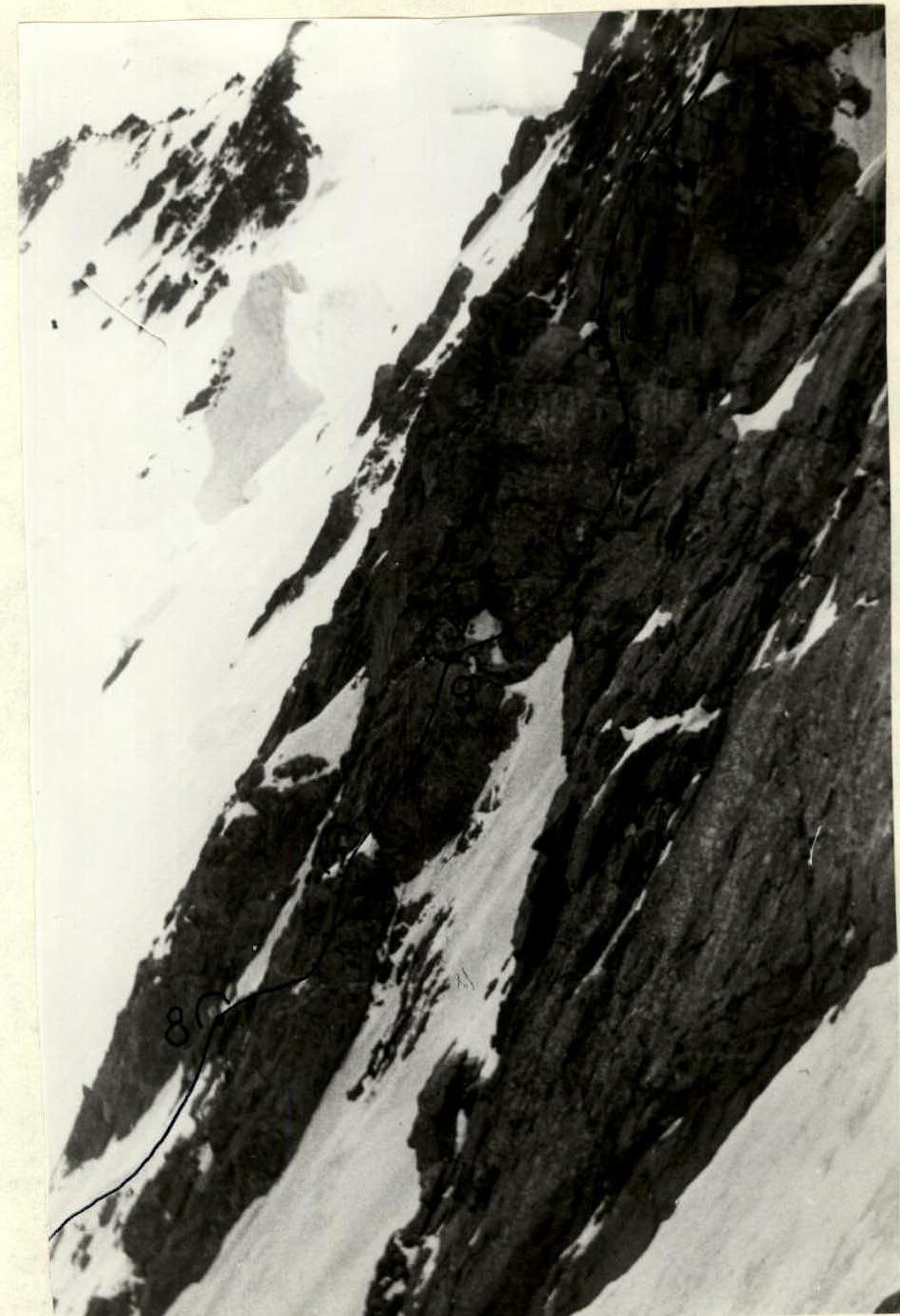
Photo #12.
Taken from the route on the Northern wall.
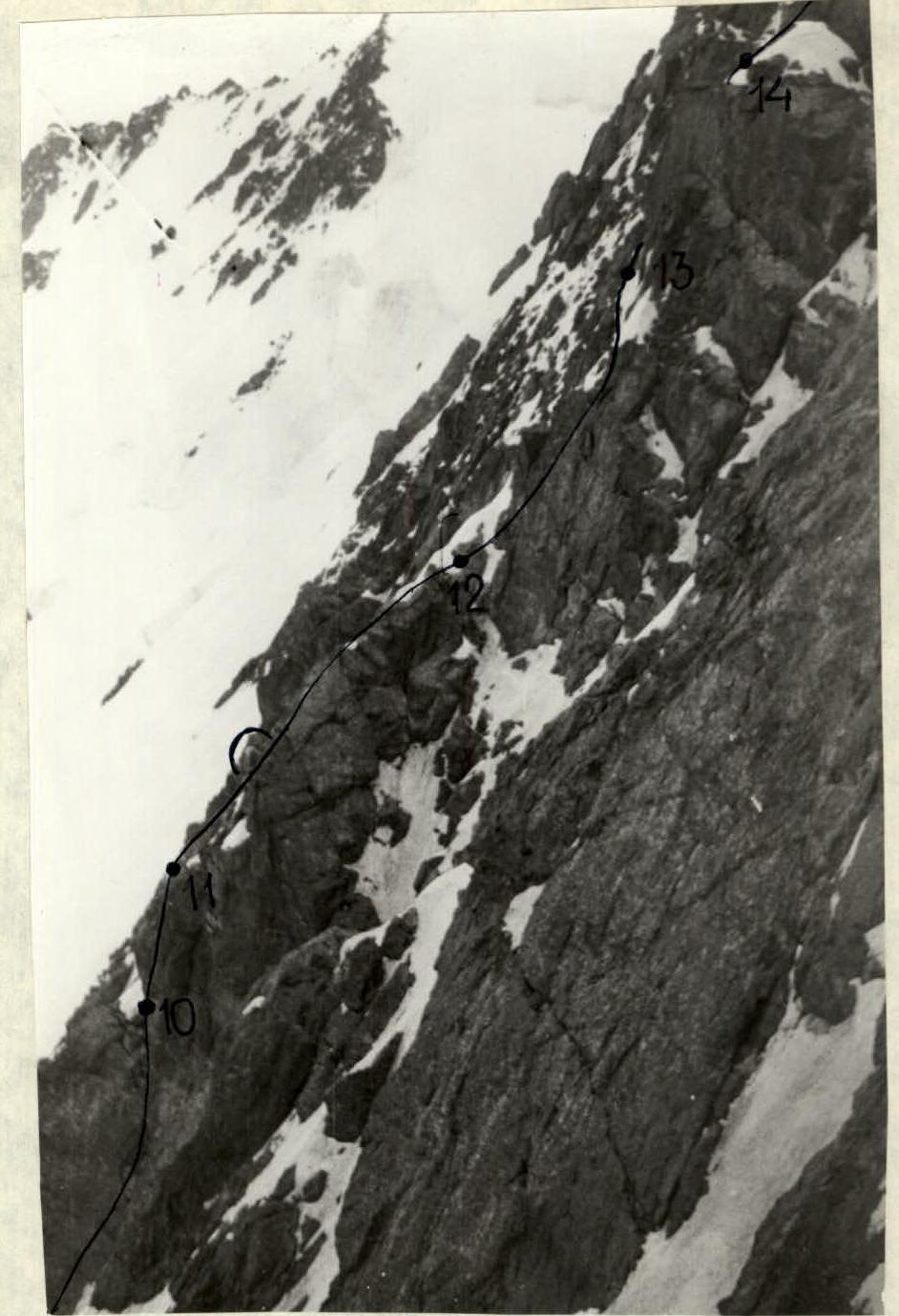
Photo #13.
Taken from the route on the Northern wall.
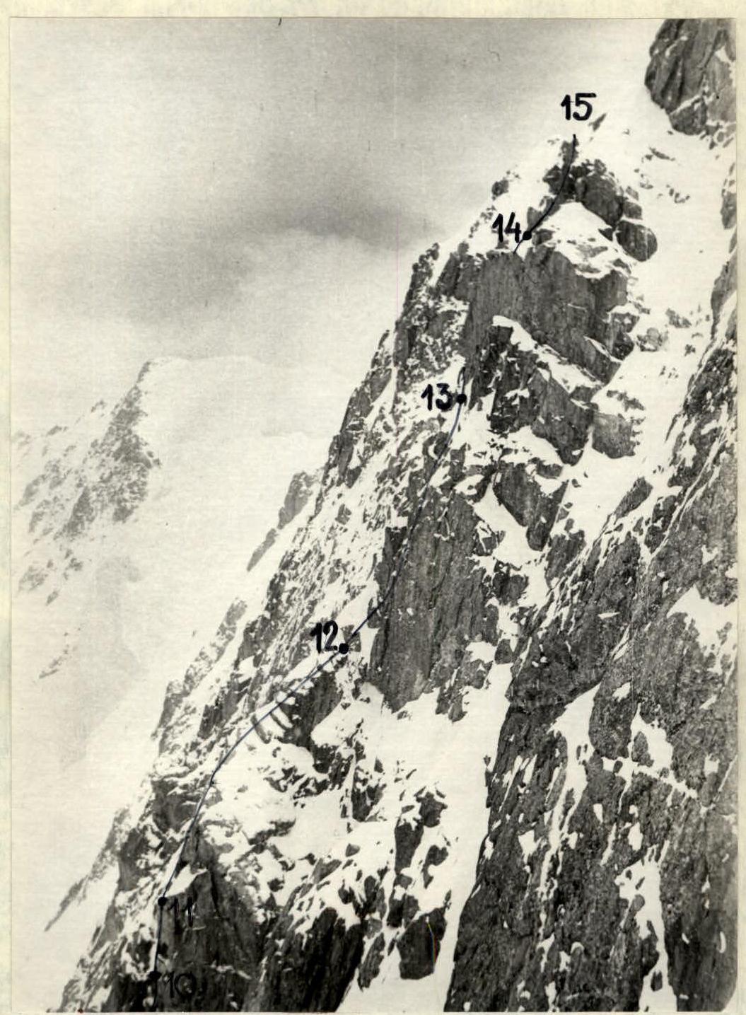
Photo #15. Upper part of the route before reaching the ridge. Taken from the route on the Northern wall.