ASCENT DOCUMENT
- Ascent category — technical
- Ascent area — Central Tien Shan, Teskey Ala-Too ridge, Jety-Oguz gorge
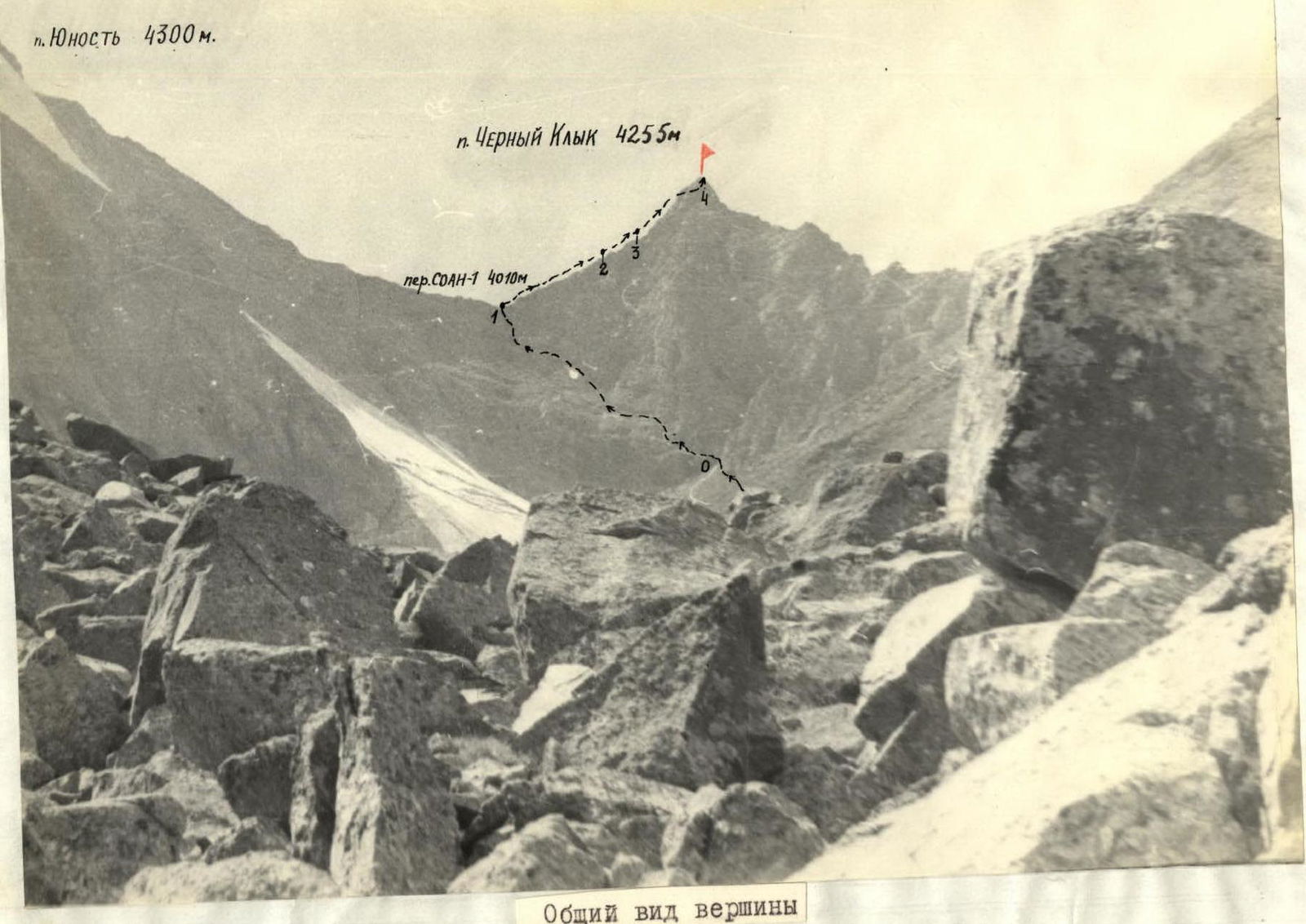
- Summit — Pik Chyorny Klyk, 4255 m, ascent route via the Southern ridge
- Estimated category of difficulty 2A
- Route characteristics: height difference — 525 m; length of sections with 2–3 cat. diff. — 680 m; average steepness 44°.
- Pitons driven: for belay: rock — 5; ice — 0; bolt — 0.
- Number of climbing hours — 8
- Number of nights and their characteristics — 0
- Surname, name, patronymic of the leader, participants, their qualification: BELNITSKAYA Galina Ivanovna — leader, II sports category; ZAVARZIN Yuri Timofeevich — participant, II sports category; CHERNOVA Svetlana Anatolyevna — participant, II sports category.
- Team coach BIRYUKOV V.N.
- Date: start of the route — July 26, 1978 end of the route — July 26, 1978
p. Yunost 4300 m. p. Chyorny Klyk 4255 m.
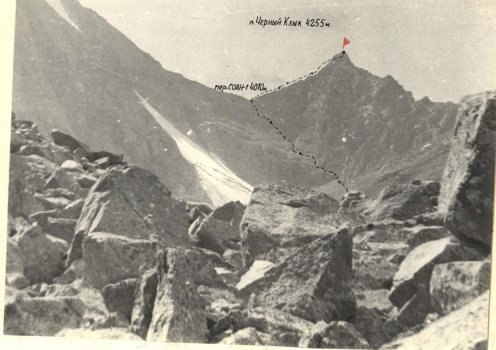
 General view of the summit.
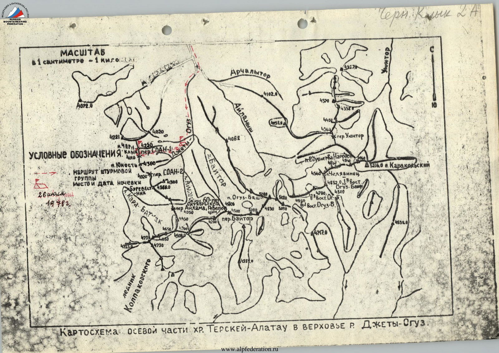
Map: central part of the Teskey-Ala-Too ridge in the upper reaches of the Jety-Oguz river.
BRIEF DESCRIPTION OF THE APPROACH TO THE ROUTE
Pik "Chyorny Klyk" — 4255 m. (the height of the peak is given based on topographic surveys. Scale 1:100000, published in 1962). It is located in the northern spur of the Teskey Ala-Too watershed ridge above the source of the left component of the Jety-Oguz river — the Baitor river, in the right part of the Baitor gorge (see map).
From the city of Przhevalsk by bus to the Jety-Oguz resort, then along the Jety-Oguz gorge to the Telety gorge by road. Then on foot up the gorge to the fork to the Baitor gorge. Ford to the left bank of the Jety-Oguz river, then cross a log to the left bank of the Baitor river at the fork. It is possible to cross the Jety-Oguz river at the Telety camp.
Along the Baitor gorge to the fork, then along the left bank of the Baitor river ascend to the Baitor camp. From Telety to the Baitor camp, the movement is everywhere along a horse trail and tourist trails. From Telety to the Baitor camp — 4–5 hours with full backpacks.
The camp has clean water and good grassy areas.
From the Baitor camp, the route is not visible. From the camp — 1.5–2 hours of walking along the right slope through grassy ascents along old moraines past 2 lakes to the route.
Thus, the approaches to the route take:
- 2 hours by car
- 4–5 hours on foot that is, one working day.
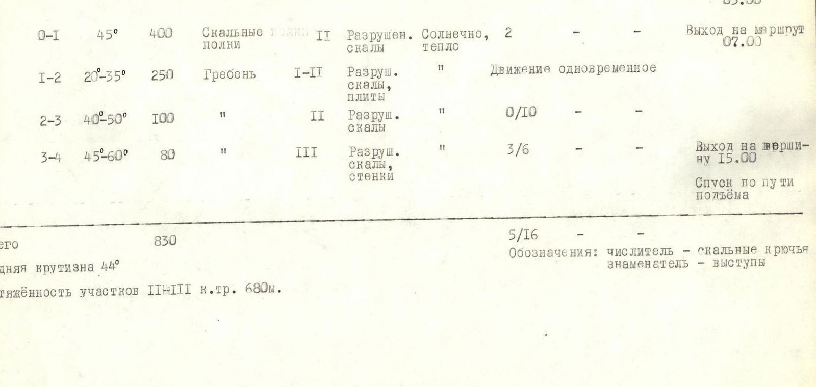
TABLE OF MAIN CHARACTERISTICS OF THE ASCENT ROUTE
| Date | Section | Average steepness, ° | Length, m | Relief type | Cat. diff. | Condition | Weather conditions | Rock | Ice | Bolt |
|---|---|---|---|---|---|---|---|---|---|---|
| July 26, 1978 | R0–R1 | 45 | 400 | Rock shelves | 2 | Broken rocks | Sunny, warm | 2 | — | — |
| R1–R2 | 20–35 | 250 | Ridge | 1–2 | Broken rocks, slabs | — | — | — | — | |
| R2–R3 | 40–50 | 100 | — | 2 | Broken rocks | — | 0/10 | — | — | |
| R3–R4 | 45–60 | 80 | — | 3 | Broken rocks, walls | — | 3/6 | — | — | |
| Total | 44 | 830 | 5 | 0 | 0 |
Length of sections with 2–3 cat. diff. — 680 m. Notation: numerator — rock pitons, denominator — protrusions.