ASCENT DOCUMENT
I. Ascent class — technical
II. Ascent area — Central Tien Shan, Terskey Ala-Too ridge, Jety-Oguz gorge
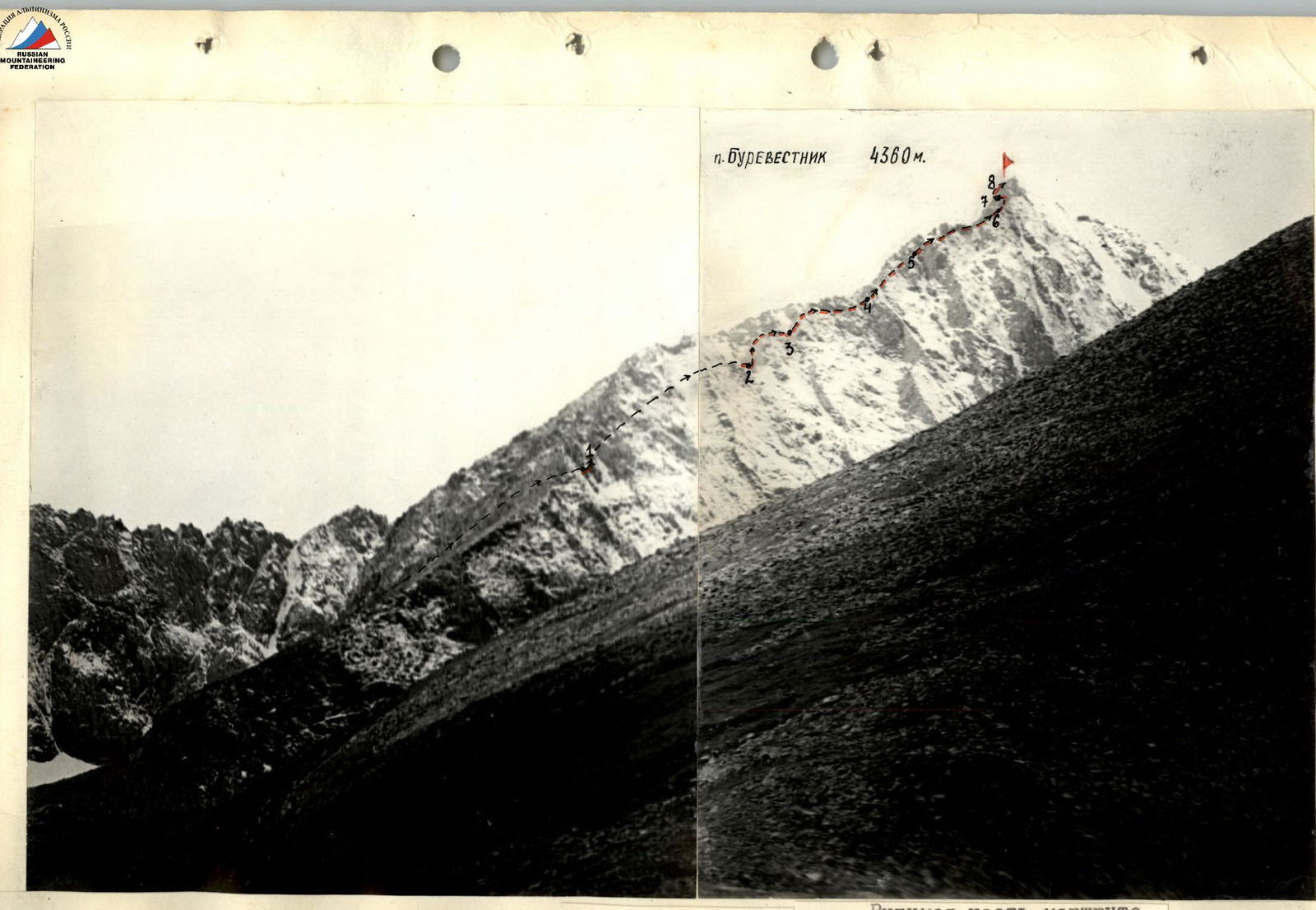
III. Peak — "Burevestnik" peak, 4360 m, ascent route — via the Eastern ridge
IV. Estimated complexity category 4A
V. Route characteristics:
height difference 764 m, length of sections with 4-5 cat. diff. 295 m, average steepness 51°
VI. Pitons driven:
for rock protection — 31, ice — 0, bolted — 0
VII. Number of climbing hours — 12
VIII. Number of overnight stays and their characteristics — 0
IX. Surname, name, patronymic of the leader, participants, their qualification:
DUIKO Vyacheslav Ivanovich — participant, 1st sports category, SAMOKHVALOV Anatoly Vladimirovich — participant, 1st sports category.
X. Team coach: BIRYUKOV V.N.
XI. Date: departure on the route — July 27, 1978
return from the route — July 27, 1978
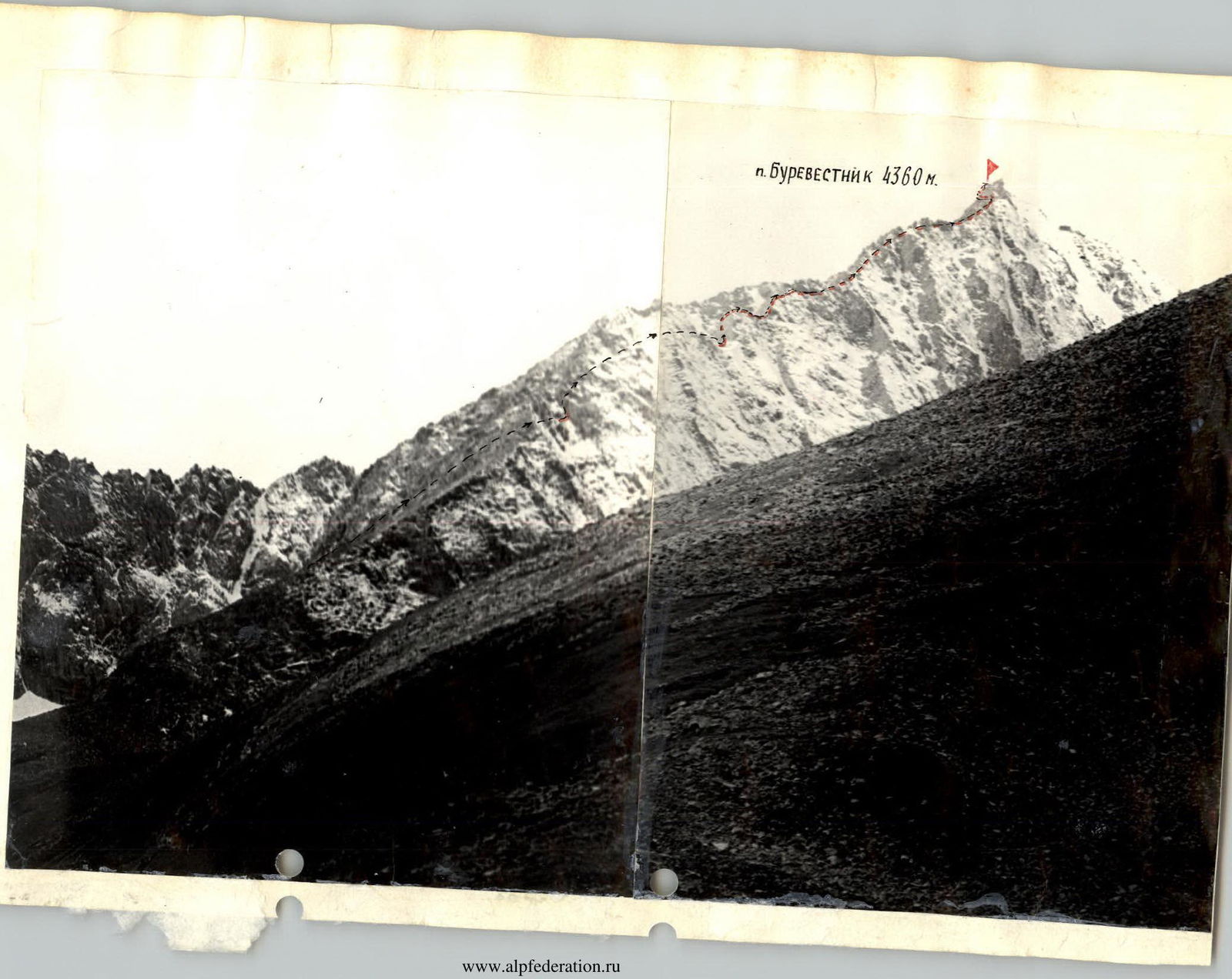

Panorama of the area
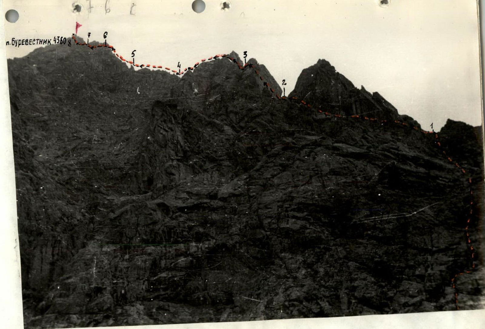
Route profile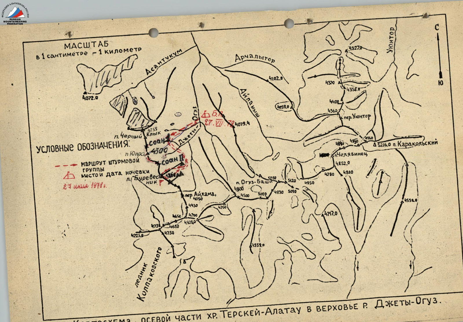
MAP OF THE CENTRAL PART OF THE TERSKEY-ALATAU RIDGE IN THE UPPER REACHES OF THE JETY-OGUZ RIVER.
BRIEF DESCRIPTION OF THE APPROACH TO THE ROUTE
Peak "Burevestnik" — 4360 m (the height of the peak is given based on a topographic survey at a scale of 1:100000, published — … year).
Located in the northern spur of the Terskey "Ala-Too" watershed ridge in the upper reaches of the left tributary of the Jety-Oguz river — the Baitor river, in the left part of the Baitor gorge (see map).
From Przhevalsk town by bus to the Jety-Oguz resort, then along the Jety-Oguz gorge along the road to the Telety gorge (12 km). Then on foot along the Jety-Oguz gorge to the fork leading to the Baitor gorge. Cross to the left bank of the Jety-Oguz river at the fork, then across a log to the left bank (or immediately at the Telety campsite).
Along the Baitor gorge to the fork, then along the left bank of the Baitor river ascend to the Baitor campsite.
The movement is everywhere along a horse trail, from Telety to the Baitor campsite takes about 4-5 hours with full backpacks.
The campsite has clean water; the entire campsite is a grassy area.
From the campsite — 2-2.5 hours of walking along grassy slopes and moraine to the route. The route is partially visible from the campsite.
Thus, the approach to the route takes:
- 2 hours by car.
- 6-7.5 hours on foot, i.e., one full working day.
TABLE OF MAIN CHARACTERISTICS OF THE ASCENT ROUTE

BRIEF EXPLANATION OF THE TABLE
R0–R1 Ascent to the ridge along a rugged rocky slope, through couloirs and ledges. The direction of movement is towards the saddle, to the sharp Red rock. R1–R2 Traverse of a pinnacle on the left. Then upwards to the ridge, to a monolithic slab. R2–R3 Difficult section — overcoming a slab with a steepness of 70°. Movement upwards and to the left. R3–R6 Movement along the ridge, pinnacles are bypassed on the left. The ridge is very rugged, there are separate very steep sections, on the R5–R6 section — a chimney with a plug. R6–R7 Bypassing on the left along the rocks a monolithic tower blocking the summit. R7–R8 Ascent along a wall, where individual sections reach a steepness of 70°. Having bypassed the last block on the left, we emerge onto the summit.