on Khan-Tengri via NE edge of Chapayev Peak shoulder, Tian Shan, September 7, 2013
Passport
-
High-altitude class.
-
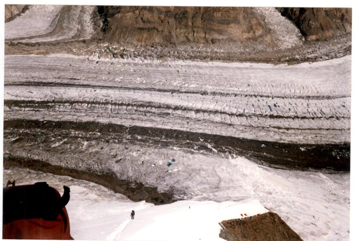
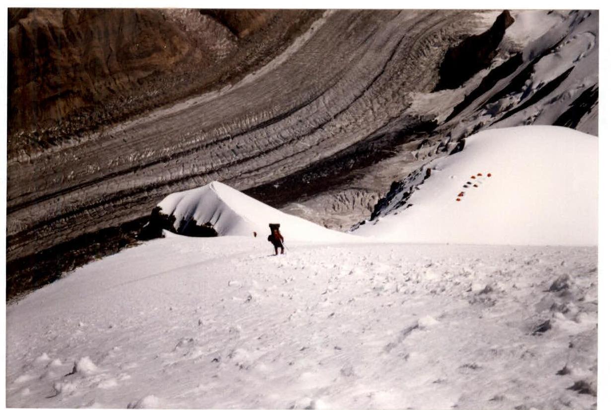
Tian Shan, North Inylchek glacier.
-
Khan-Tengri peak, via NE edge of Chapayev Peak shoulder.
-
5B category of difficulty, Grebenshchikova memorial route.
-
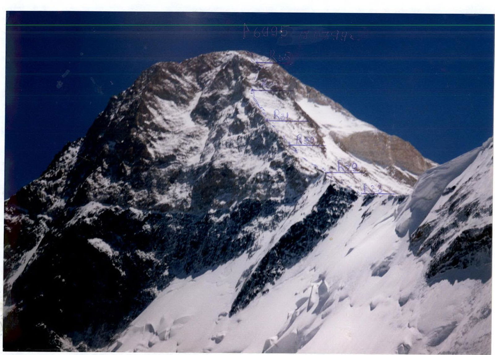
Height difference: 2950 m, length 5110 m.
Length of sections with 5th category of difficulty — 310 m. Average steepness of NE edge of Chapayev Peak shoulder — 44°, average steepness of the 3rd ridge of Khan-Tengri Peak — 43°.
-
Number of pitons used: rock — 30+10*; snow — 8*; ice — 1. Left on the route: rock — 10*; snow — 8*.
-
Team's total climbing hours: 20 h and days — 4.
-
Overnights: 1st — in a tent, 2nd — in a tent, 3rd — in a cave.
-
Participants: Popovich Vadim Vitalyevich — team leader, Candidate for Master of Sports; Korobkov Alexander Alexandrovich — Candidate for Master of Sports.
-
Coach: Mikhailov Alexander Alexandrovich — Master of Sports, Honored Coach of the RSFSR.
-
Departure to the route: July 15, 1999. Summit: July 18, 1999. Return to base camp: July 19, 1999.
-
"Voshozhdenie" Fund, Nizhny Tagil.

General view of Khan-Tengri peak from the north, via NE edge of Chapayev Peak shoulder. Photo taken from the base camp on North Inylchek glacier.

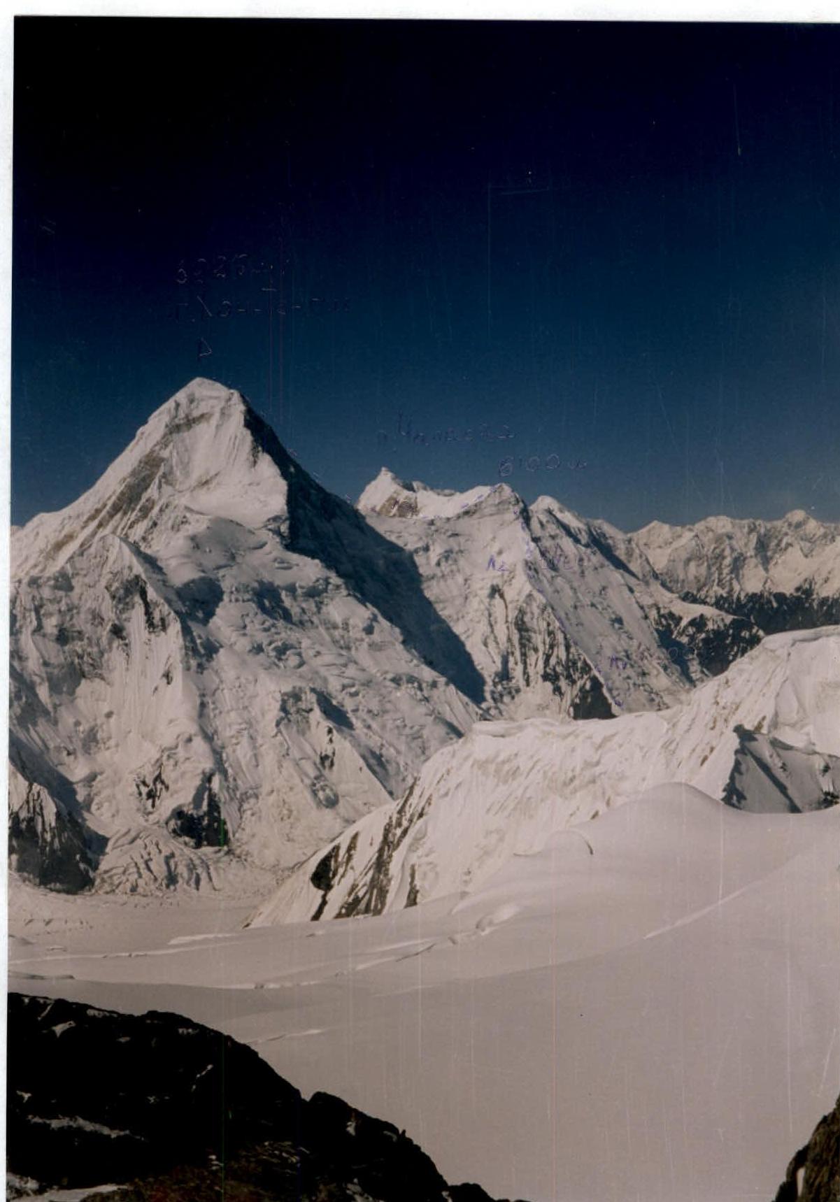
West ridge of Khan-Tengri peak and the ridge connecting Khan-Tengri and Chapayev Peak. Photo taken above the second camp at 5400 m. Section R20–R21.
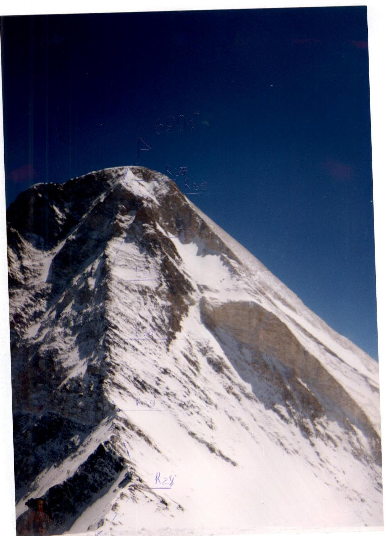
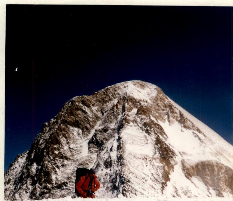
Khan-Tengri peak 6995 m and Chapayev Peak shoulder. Photo taken from the Marble Wall ridge.
Tactical actions of the team
July 15, 1999
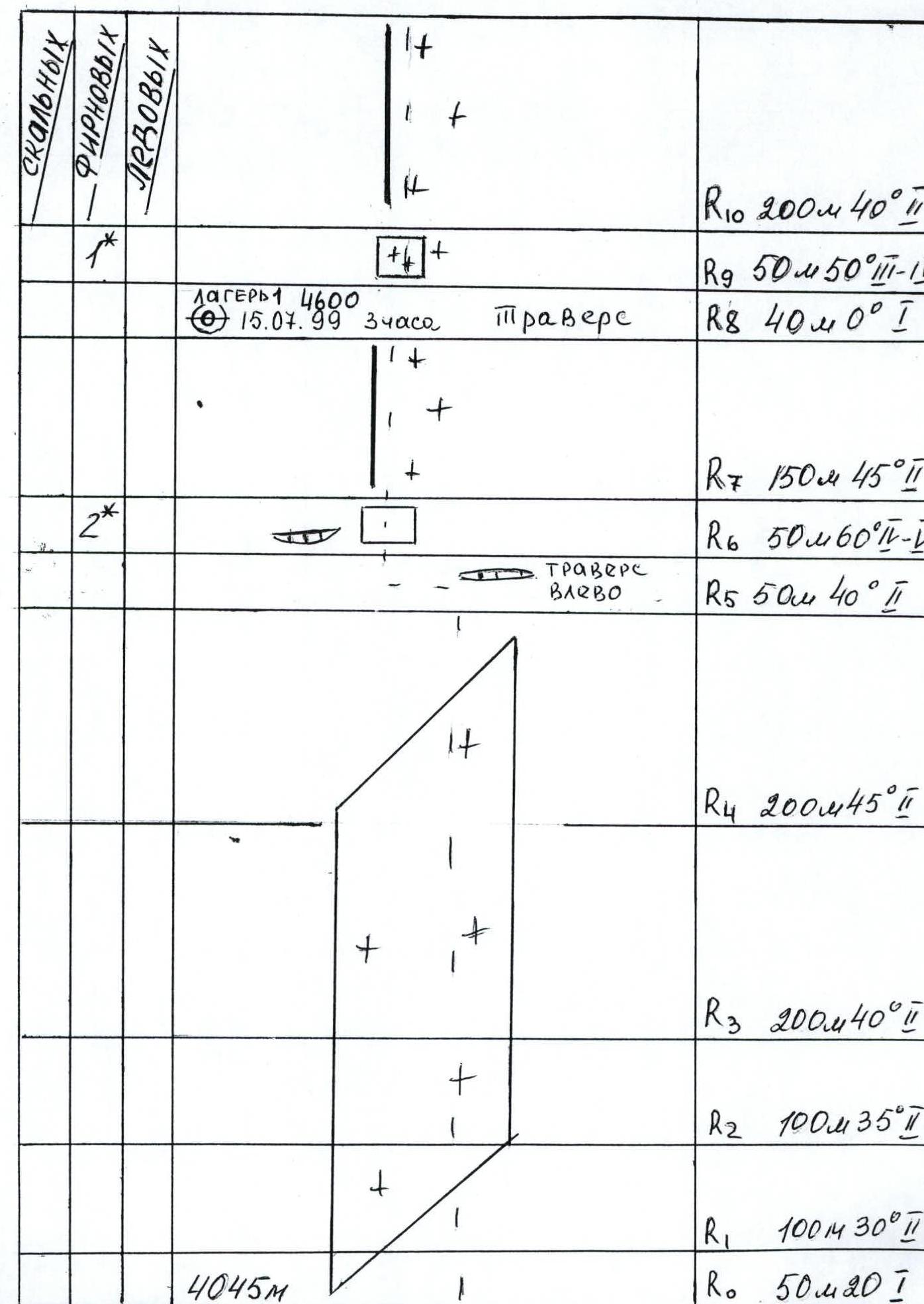
15:00 departure from the base camp on North Inylchek glacier. Approach to the start of the route. 16:00 start ascending the route. 19:00 arrival at the 4600 m site on the NE edge of Chapayev Peak shoulder. Setting up a bivouac. Overnight stay.
July 16, 1999
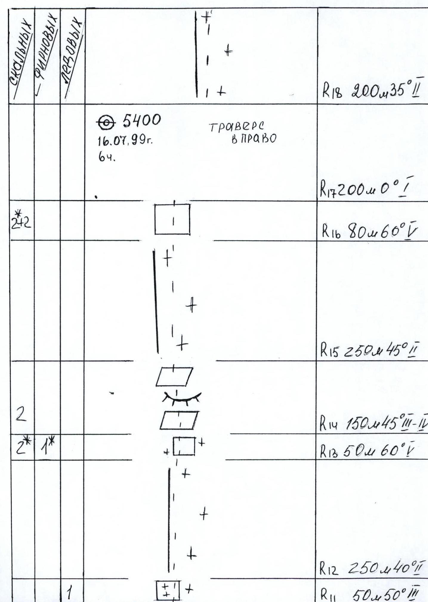
10:00 departure from the 4600 m bivouac. 16:00 ascent via the NE edge to the plateau at 5400 m. Setting up a bivouac. Overnight stay.
July 17, 1999
10:00 departure from the 5400 m bivouac. Ascent via the NE edge of Chapayev Peak shoulder. 14:30 arrival at the summit of Chapayev Peak shoulder (6100 m) and descent to the ridge connecting Chapayev Peak and Khan-Tengri.
15:00 setting up Camp 3 (5900 m) in a snow cave on the ridge.
July 18, 1999
8:00 — departure from Camp 3 (5900 m), ascent via the West ridge of Khan-Tengri. 14:00 — arrival at the summit of Khan-Tengri and start of descent. 17:30 — return to Camp 3 (5900 m). Overnight stay.
July 19, 1999
11:00 — departure from Camp 3 (5900 m). 20:00 — return to the base camp on North Inylchek glacier.
Summit height: 6995 m. Summit reached: July 18, 1999, 14:00. Climbing hours (to the summit): 20 h.
Route description by sections
- To the right of the NE edge — exit to the north-north-east slope. From the moraine — exit to crevasses and the bergschrund. The bergschrund is traversed via a snow bridge 50 m 20° 1.
- Up — via a snow-ice slope 100 m 30° 2.
- Snow-ice slope 100 m 35° 2.
- Snow-ice slope 200 m 40° 2.
- Snow-ice slope 200 m 45° 2.
- Traverse left towards the NE edge 50 m 40° 2.
- Up via a snow-ice wall. Exit to the NE edge 50 m 60° 4–5.
- Via a snow ridge on the NE edge, exit to a more gentle section of the NE edge — Camp 1 (4600 m). 150 m 45° 2.
- Traverse along a ledge 40 m 0° 1.
- Via a snow-ice wall, exit to a snow ridge on the NE edge 50 m 50° 3–4.
- Snow ridge on the NE edge and via a snow slope, ascent to sites on a more gentle section of the NE edge 200 m 40° 2.
- From a ledge via a snow-ice wall, exit to a snow ridge 50 m 50° 3.
- Via a snow ridge on the NE edge, ascent to slopes 250 m 40° 2.
- Via a rock wall (snow, ice), ascent 50 m 60° 5.
- Via the right part of snow-covered rocks (snow-covered slabs, roches moutonnées), exit to a snow ridge on the NE edge 150 m 45° 3–4.
- Via a snow ridge, exit to rocks 250 m 45° 2.
- To the right via a rock wall, exit to a plateau on the NE edge 80 m 60° 5.
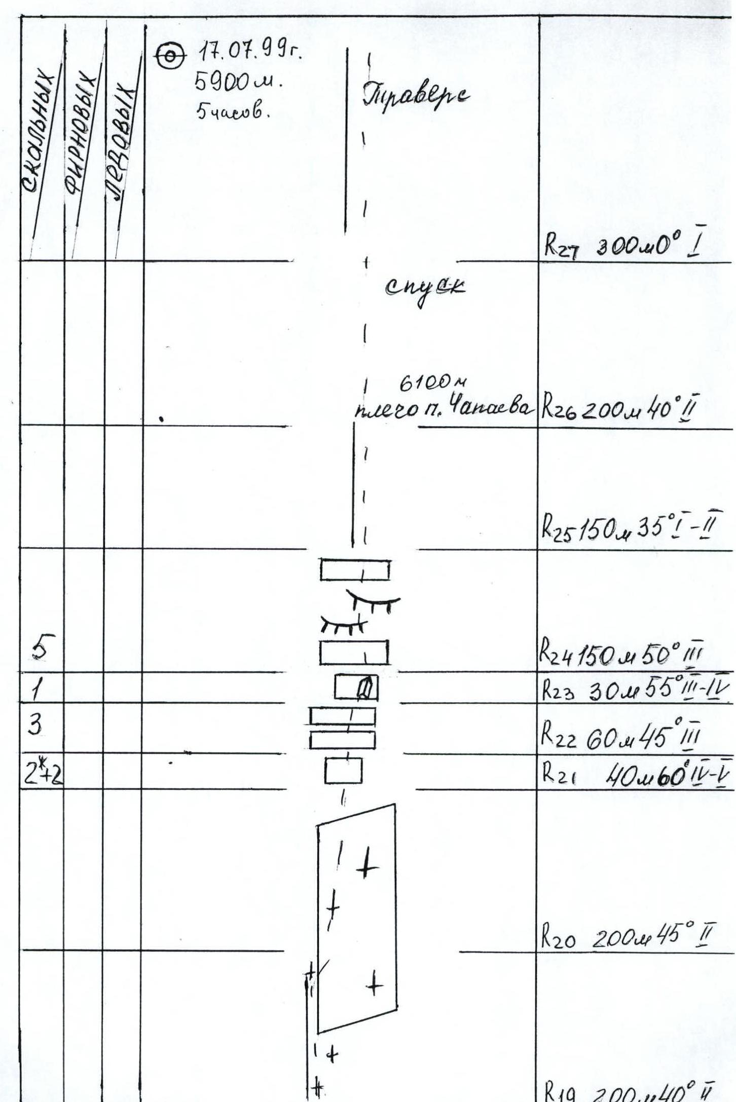
- A more gentle section of the NE edge. Plateau 5400. Traverse right. Camp 2 (5400 m). 200 m 0° 1.
- From the plateau via a snow ridge, ascent 200 m 35° 2.
- Via a snow ridge and a firn slope, ascent 200 m 40° 2.
- Via a firn slope, approach to rocks 200 m 45° 2.
- Rock wall. 40 m 60° 5.
- Via rock slabs left — exit below a wall with a poorly defined internal angle. 60 m 45° 3.
- Via the right part of a rock wall with an internal angle — ascent. 30 m 55° 3–4.
- Via rock slabs, roches moutonnées — to the right, exit to a snow ridge. 150 m 50° 3.
- Via a snow ridge — exit to the summit of Chapayev Peak shoulder (6100 m). 150 m 35° 2–1.
- Descent from Chapayev Peak shoulder to the ridge, in the lower part — an ice crevasse. 200 m 40° 2.
- Traverse along the ridge (large snow cornices on the northern side). Camp 3 (5900 m). Overnight stay in a snow cave. 300 m 0° 1.
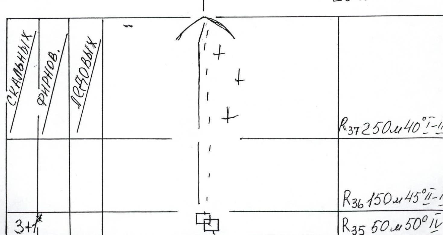
- Ascent via the West ridge of Khan-Tengri (firn ridge) 200 m 20° 1.
- Rock ridge 200 m 30° 2.
- Rock ridge. 250 m 45° 2.
- Via rock slabs to the base of a large rock couloir. 250 m 45° 2.
- Entrance to a large couloir. Via rock walls, ascent up the couloir. 100 m 60° 4.
- Via a series of rock walls, ascent. 100 m 65° 5.
- Via a wall with a poorly defined internal angle, to the right and up — exit from the couloir. 50 m 50° 4.
- Via a series of rock walls — exit to a rock ridge. 50 m 50° 4.
- Via a rock ridge — exit to the pre-summit slope of Khan-Tengri. 150 m 45° 2–3.
- Firn slope. Via a snow ridge, exit to the summit dome of Khan-Tengri. 250 m 40° 1–2.
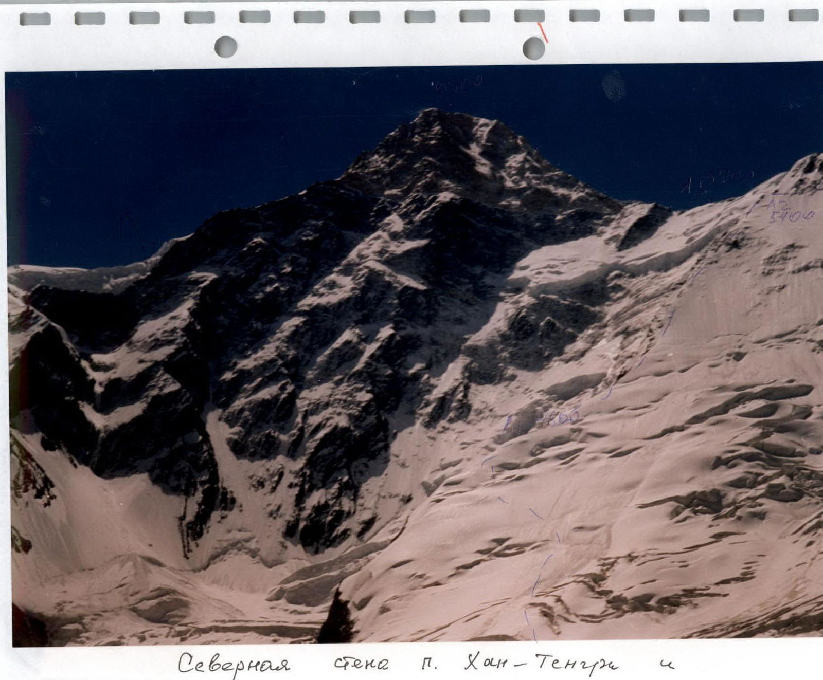
North face of Khan-Tengri and NE edge of Chapayev Peak.
West ridge of Khan-Tengri. Photo taken from Chapayev Peak shoulder 6100 m.
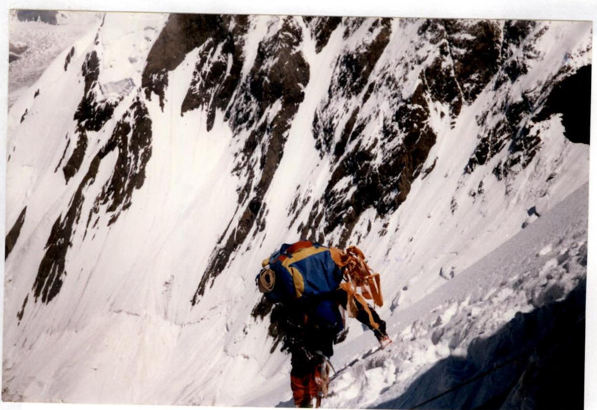
Section R9–R10. Ascent via the NE edge of Chapayev Peak shoulder. Above Camp 1.
Section R12–R13. Ascent via the NE ridge of Chapayev Peak. Below right, tents of Camp 1 (4600 m).

Section R16–R17. Ascent via rocks before Camp 2.
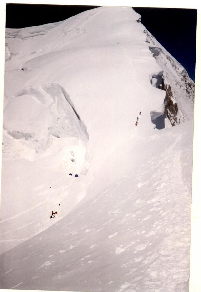
Section R19–R20. Ascent via a firn slope. Below right. Camp 2 (5400 m).
Section R26–R27. Summit of Chapayev Peak shoulder 6100 m. View of the West ridge of Khan-Tengri.
Section R27. Traverse of the ridge. Chapayev Peak shoulder and Khan-Tengri. View of Chapayev Peak shoulder. To the right — cornices on North Inylchek glacier.