
Climbing Passport
- Tian-Shan, Tengri-Tag ridge, 7.9.1
- Gorky (NE), 6010 m, via the left part of NW wall
- Proposed 6A category of difficulty, first ascent
- Route type: combined
- Route elevation gain: 1510 m
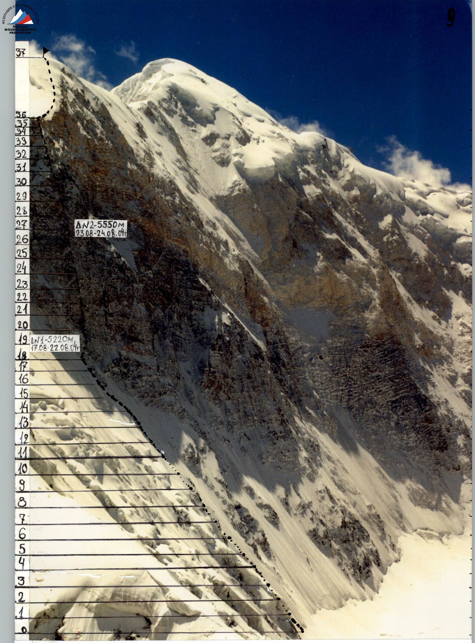
Route length: 2050 m Section lengths:
- V category of difficulty – 385 m
- VI category of difficulty – 335 m Average steepness:
- main part of the route (5220 m – 5900 m) – 63°
- entire route (4500 m – 6010 m) – 53°
- Pitons left on the route: total – 0; including bolted pitons – 0
Pitons used on the route: 333
- stationary bolted pitons – 0; including artificial climbing holds (ACH) – 0
- removable bolted pitons – 20; including ACH – 0 Total artificial climbing holds (ACH) used: 45
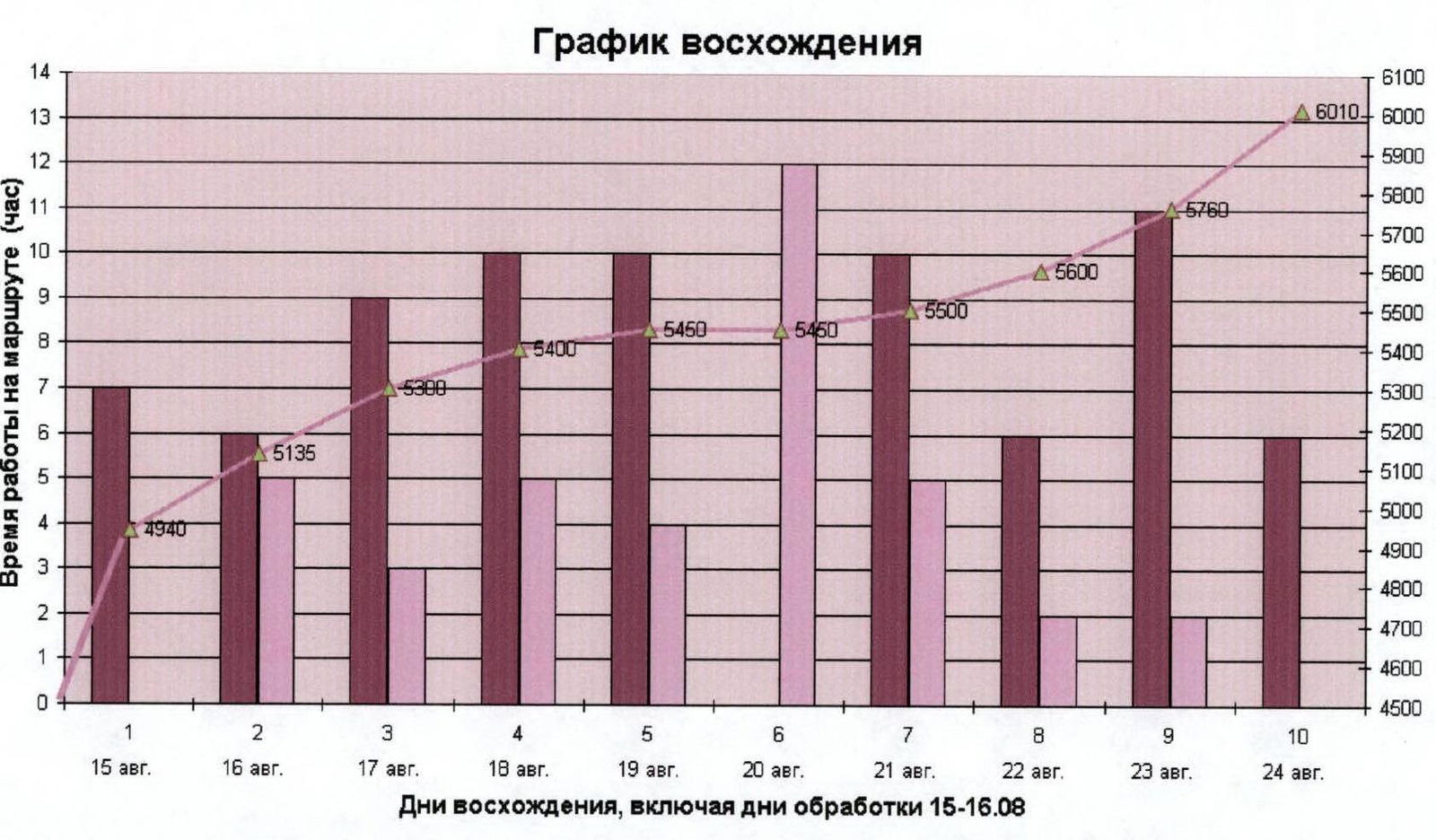
- Team's climbing hours (including 2 days of preliminary route processing): – 75, 10 days (including 2 days of preliminary route processing).
- Leader: Korobkov Alexander Alexandrovich, Master of Sports
Team members:
- Chernyavsky Alexander Nikolaevich, Candidate for Master of Sports
- Shabunin Alexander Anatolyevich, Candidate for Master of Sports
- Smagin Nikolai Vladimirovich, 1st sports category
- Coach: Mikhailov Alexander Alexandrovich, Master of Sports, Honored Coach of Russia
- Route start: 9:00, August 15, 2004
Summit reached: 15:15, August 24, 2004 Return to base camp: 23:30, August 25, 2004
General photograph of the Northwest wall of peak Gorky (NE)
Routes:
- 2001 team of the Ministry of Physical Culture and Sports of Sverdlovsk region
- 2004 team of the Ministry of Physical Culture and Sports of Sverdlovsk region
Photo August 2001, Guseva glacier
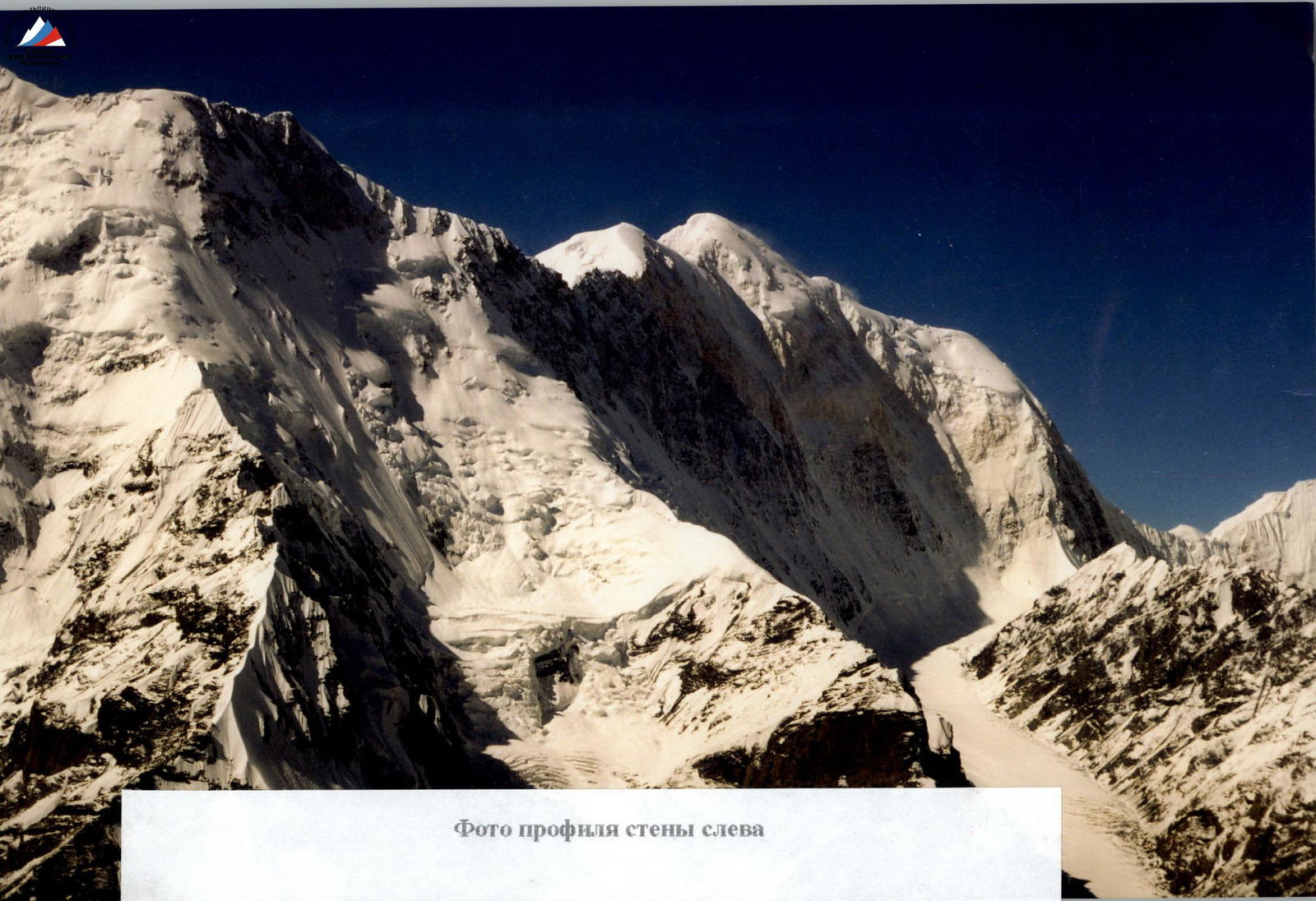
Photo of the wall profile from the left
Route Profile
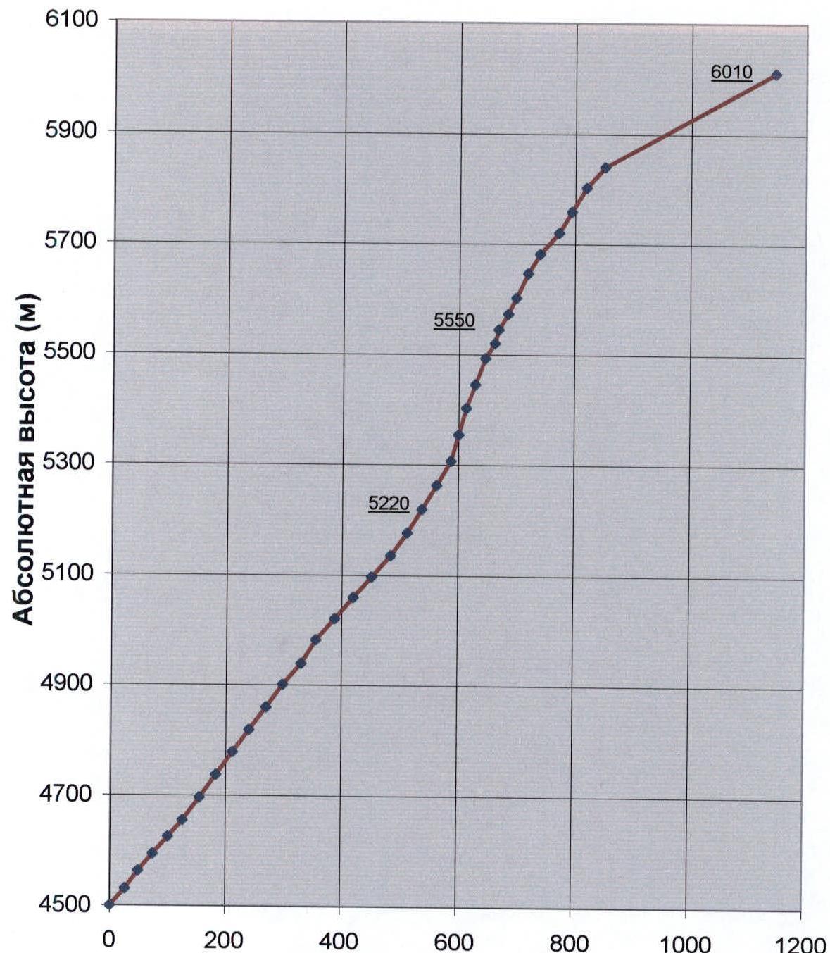
Scale 1:10000
- Khan-Tengri (6995 m)
- Chapayeva (6371 m)
Abalakova (5861 m)
Gorky (NE) (6010 m)
Gorky (Main) (6050 m)

Panorama of the area
Overview of the Climbing Area
Peak Gorky is located in the Tengri-Tag ridge of Central Tian-Shan. The Northeast summit of peak Gorky is part of the Gorky massif, with the main summit having an elevation of 6050 m. According to the General Staff map, the Northeast summit has an elevation of 6010 m. Two ridge routes of 5B category of difficulty have been ascended to the main summit from the South Inylchek glacier. The traverse of Gorky–Khan-Tengri has been completed twice.
To the north, peak Gorky is flanked by steep rock walls with an elevation gain of about one and a half kilometers. There is a known (according to Honored Master of Sports K. Valeev) unsuccessful attempt to ascend the Northwest wall by a Ukrainian team led by Honored Master of Sports Sergey Bershov.
Ascent of the Northwest wall:
- In 2001, a team from Sverdlovsk region (leader Yermachek Yu. V., coach Mikhailov A. A.) ascended a route through the center of the Northwest wall with a 6B category of difficulty. This was the first ascent of this wall.
- In 2004, the team continued to explore the Northwest wall, choosing a new logical route through its left part.
The approach to the observation camp on the Guseva glacier at the start of the route from the base camp under the north wall of Khan-Tengri peak takes about five hours.

Technical Photographs of the Route
| Section # | Ice pitons | Rock pitons | Protection | Difficulty | Length (m) | Steepness (°) |
|---|---|---|---|---|---|---|
| R9 | 4 | 0 | 0 | 4А | 50 | 55 |
| R8 | 4 | 0 | 0 | 4А | 50 | 55 |
| R7 | 4 | 0 | 0 | 4Б | 50 | 55 |
| R6 | 4 | 0 | 0 | 4Б | 50 | 55 |
| R5 | 4 | 0 | 0 | 4А | 40 | 50 |
| R4 | 4 | 0 | 0 | 4А | 40 | 50 |
| R3 | 4 | 0 | 0 | 4А | 40 | 50 |
| R2 | 4 | 0 | 0 | 4Б | 40 | 55 |
| R1 | 5 | 0 | 0 | 4А | 40 | 50 |
| R18 | 1 | 2 | 6 | 4Б | 50 | 55 |
| R17 | 3 | 2 | 2 | 4А | 50 | 50 |
| R16 | 4 | 0 | 0 | 4А | 50 | 50 |
| R15 | 4 | 0 | 0 | 4А | 50 | 50 |
| R14 | 4 | 0 | 0 | 4А | 50 | 50 |
| R13 | 4 | 1 | 0 | 4Б | 50 | 60 |
| R12 | 4 | 0 | 0 | 4А | 50 | 50 |
| R11 | 4 | 0 | 0 | 4Б | 50 | 55 |
| R10 | 3 | 0 | 0 | 4Б | 50 | 55 |
| R27 | 0 | 2 | 18 | 6А | 40 | 75 |
| R26 | 0 | 2 | 12 | 6Б | 50 | 60 |
| R25 | 0 | 3/1 | 15/10 | 6Б | 50 | 70 |
| R24 | 0 | 2 | 15/7 | 6А | 45 | 70 |
| R23 | 0 | 1 | 13/8 | 6Б | 50 | 75 |
| R22 | 0 | 1 | 20/10 | 6А | 50 | 75 |
| R21 | 0 | 3 | 10 | 5Б | 50 | 60 |
| R20 | 0 | 1 | 20 | 5Б | 50 | 60 |
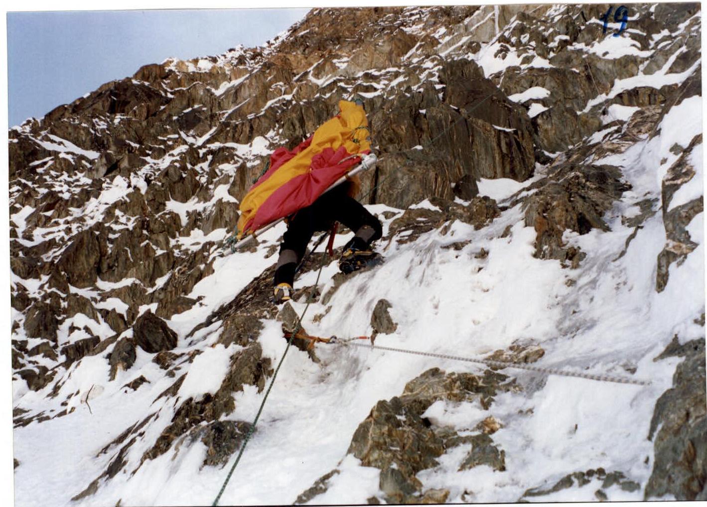
| R19 | 1 | 1 | 9 | 5А | 50 | 60 |
| R36 | 0 | 1 | 3 | 3Б | 30 | 50 |
| R35 | 0 | 2 | 4 | 4А | 50 | 50 |
| R34 | 0 | 1 | 8 | 5А | 50 | 60 |
| R33 | 2 | 2 | 5 | 5А | 45 | 60 |
| R32 | 0 | 1 | 8 | 4Б | 50 | 50 |
| R31 | 2 | 2 | 10 | 5А | 40 | 60 |
| R30 | 0 | 1 | 20/9 | 6А | 50 | 65 |
| R29 | 0 | 1 | 8 | 5А | 50 | 65 |
| R28 | 4 | 2 | 15 | 5А | 50 | 60 |
| R37 | 0 | 0 | 0 | 3А | 350 | 30 |
Photo 1. Midway through section R19

Photo 2. Ascending section R26
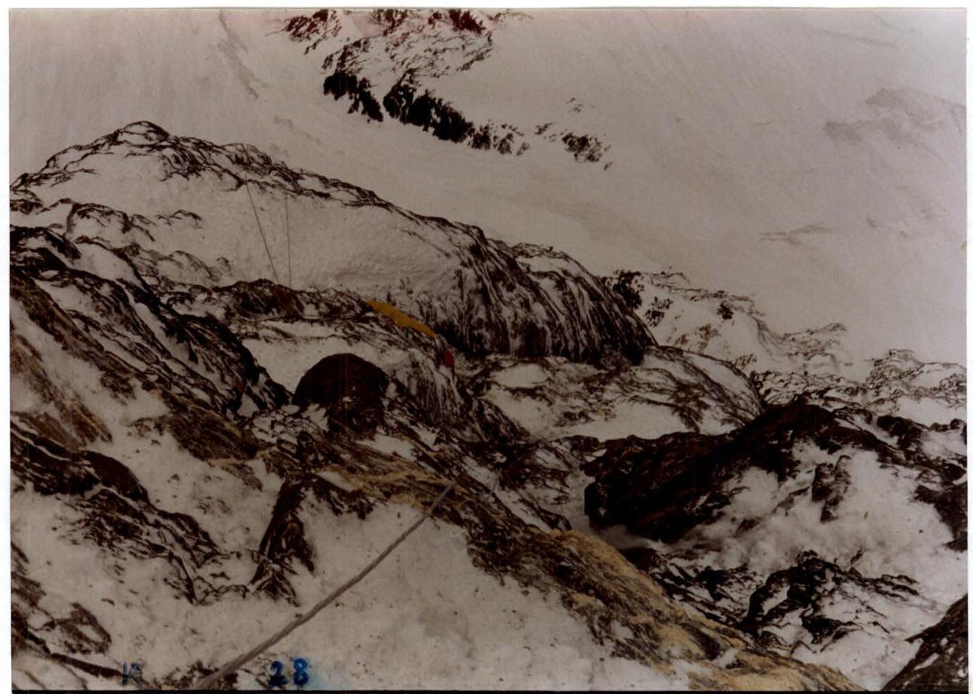
Photo 3. View of camp 2 from the end of section R28
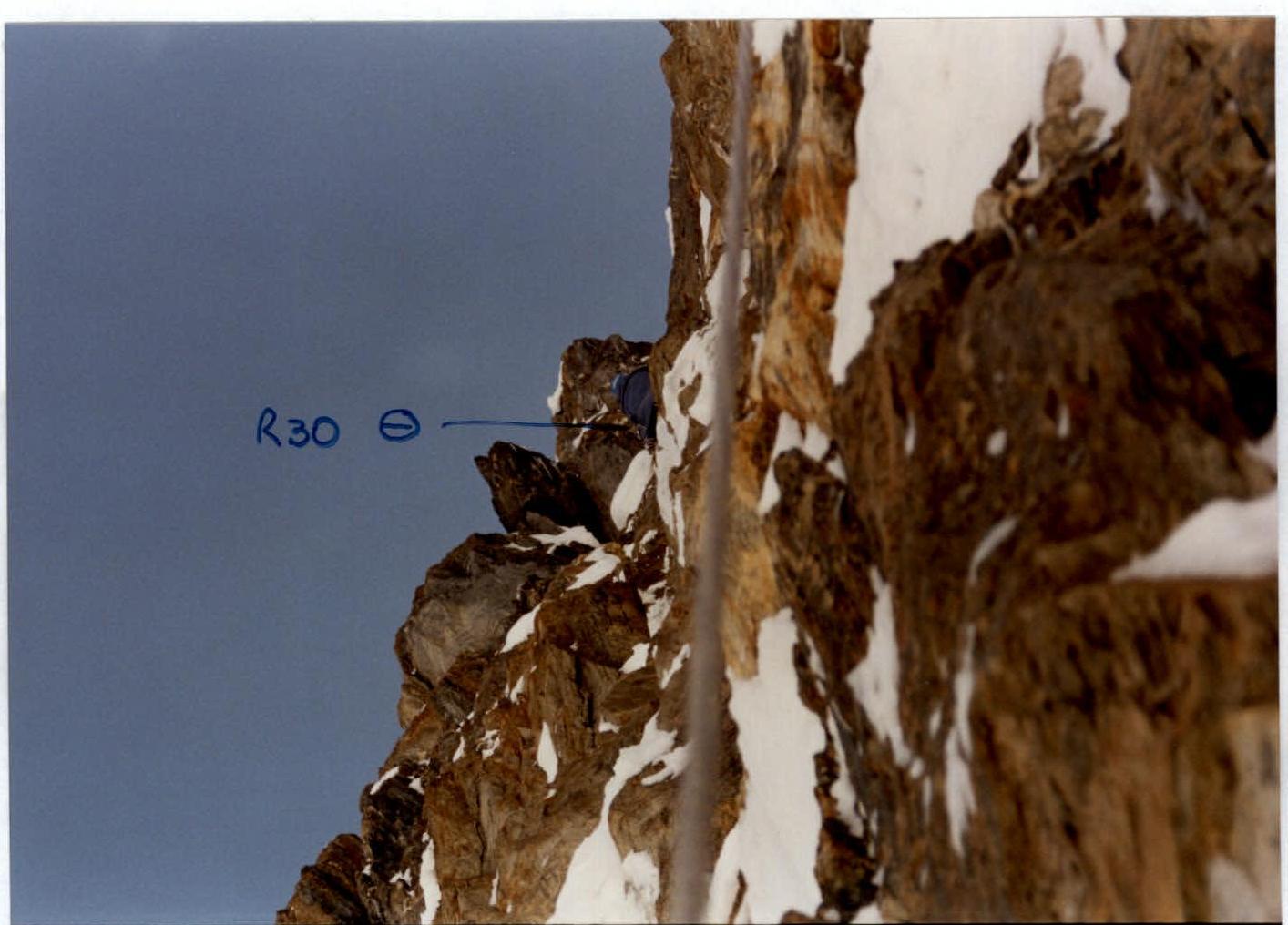
Photo 4. At the top of section R30
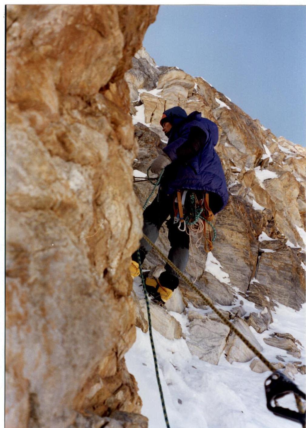
Photo 5. Organizing a station after completing section R31
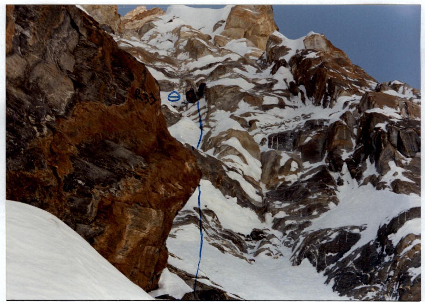
Photo 6. Station at the end of section R33
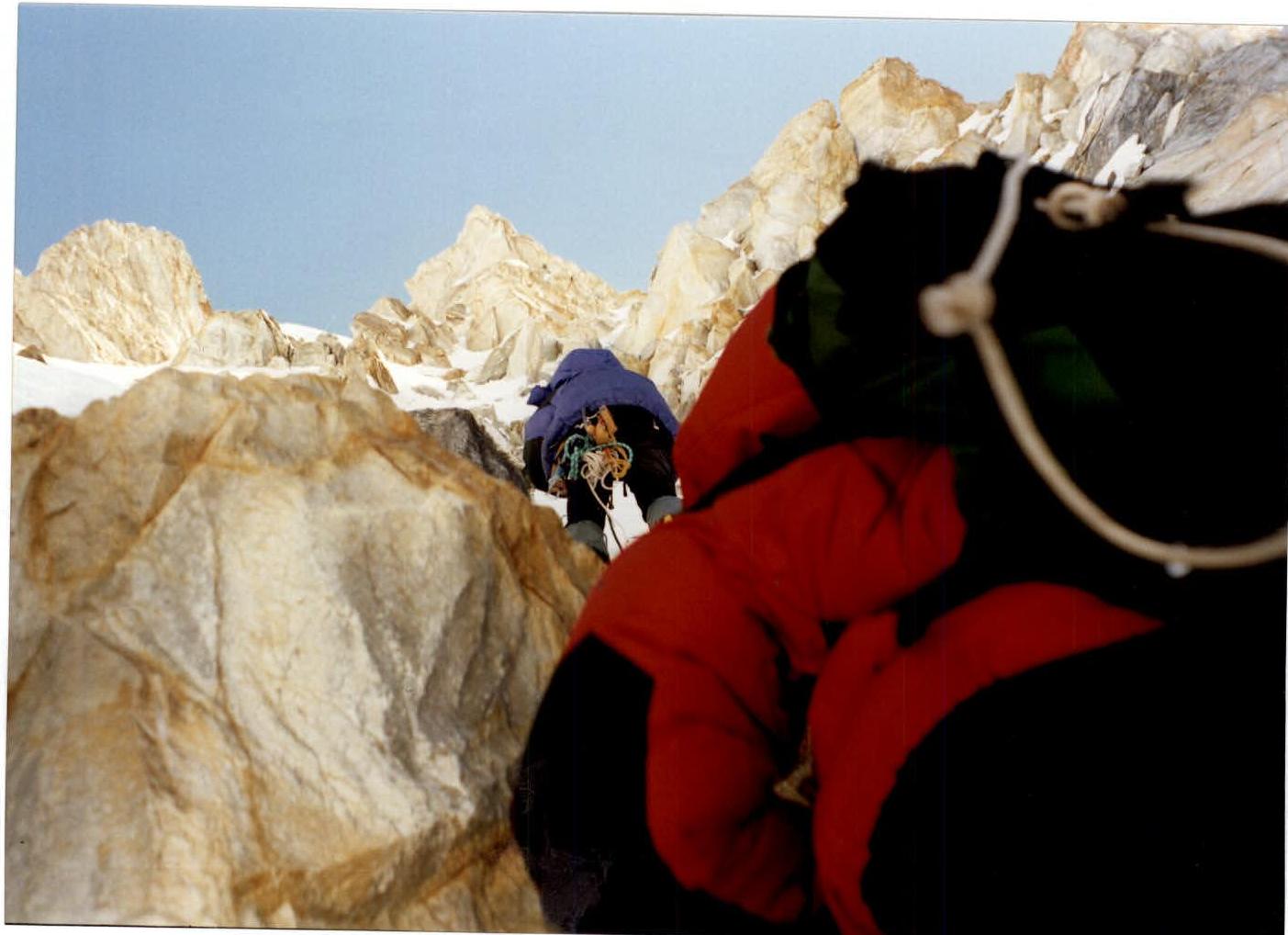
Photo 7. Beginning of section R35
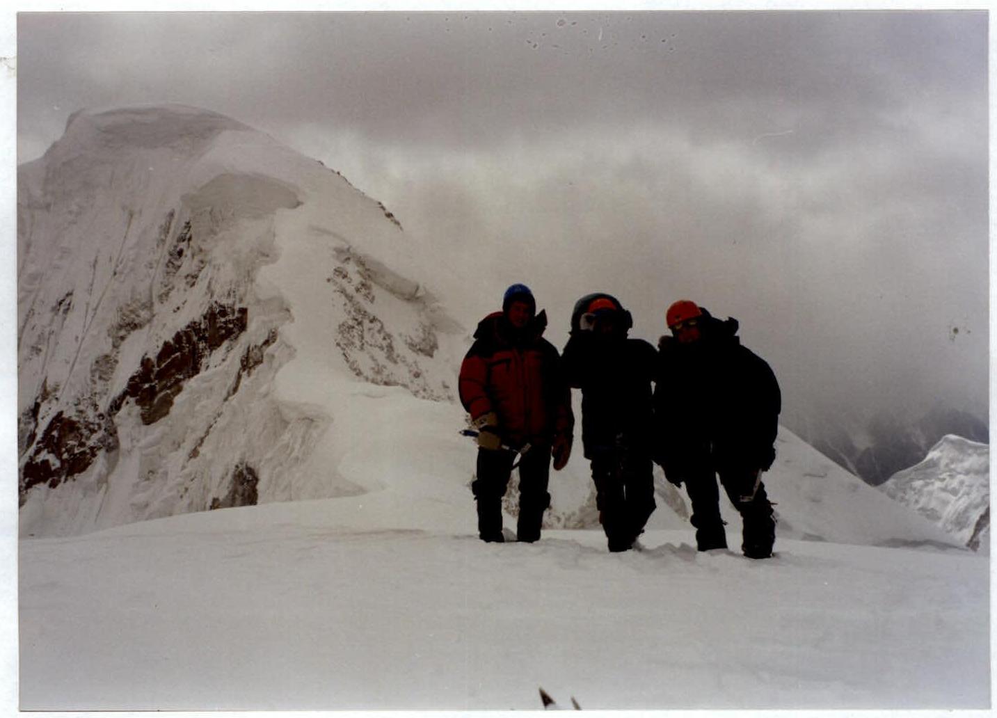
Photo 8. At the summit
(left to right: Smagin N., Chernyavsky A., Shabunin A., photo — Korobkov A.)