
Ascent Passport
- Tian-Shan, Tengri-Tag ridge, 7.9.1
- Gorkogo (NE), 6010 m, center of NW wall
- Proposed 6B category of complexity, first ascent
- Route type: combined
- Route height difference: 1510 m Route length: 2030 m Length of sections: V category of complexity — 830 m, VI category of complexity — 400 m Average steepness: main part of the route (4500 m–5900 m) — 60° total route (4500 m–6010 m) — 58°
- "Hooks" left on the route: total — 0; including pitons — 0 Hooks used on the route: stationary pitons — 0; including artificial climbing aids (ITC) — 0 removable pitons — 0; including ITC — 0 Total artificial climbing aids (ITC) used: 16
- Team's total climbing hours (including 2 days of preliminary route processing): — 89, 12 days (including 2 days of preliminary route processing).
- Team leader: Yermachek Yuriy Vladimirovich, Master of Sports Team members: Korobkov Aleksandr Aleksandrovich, Candidate for Master of Sports Popovich Vadim Vitalievich, Candidate for Master of Sports
- Coach: Mikhailov Aleksandr Aleksandrovich, Master of Sports, Honored Coach
- Departure to the route: 12:00, July 25, 2001
Reach the summit: 12:00, August 6, 2001
Return to Base Camp: 21:00, August 8, 2001
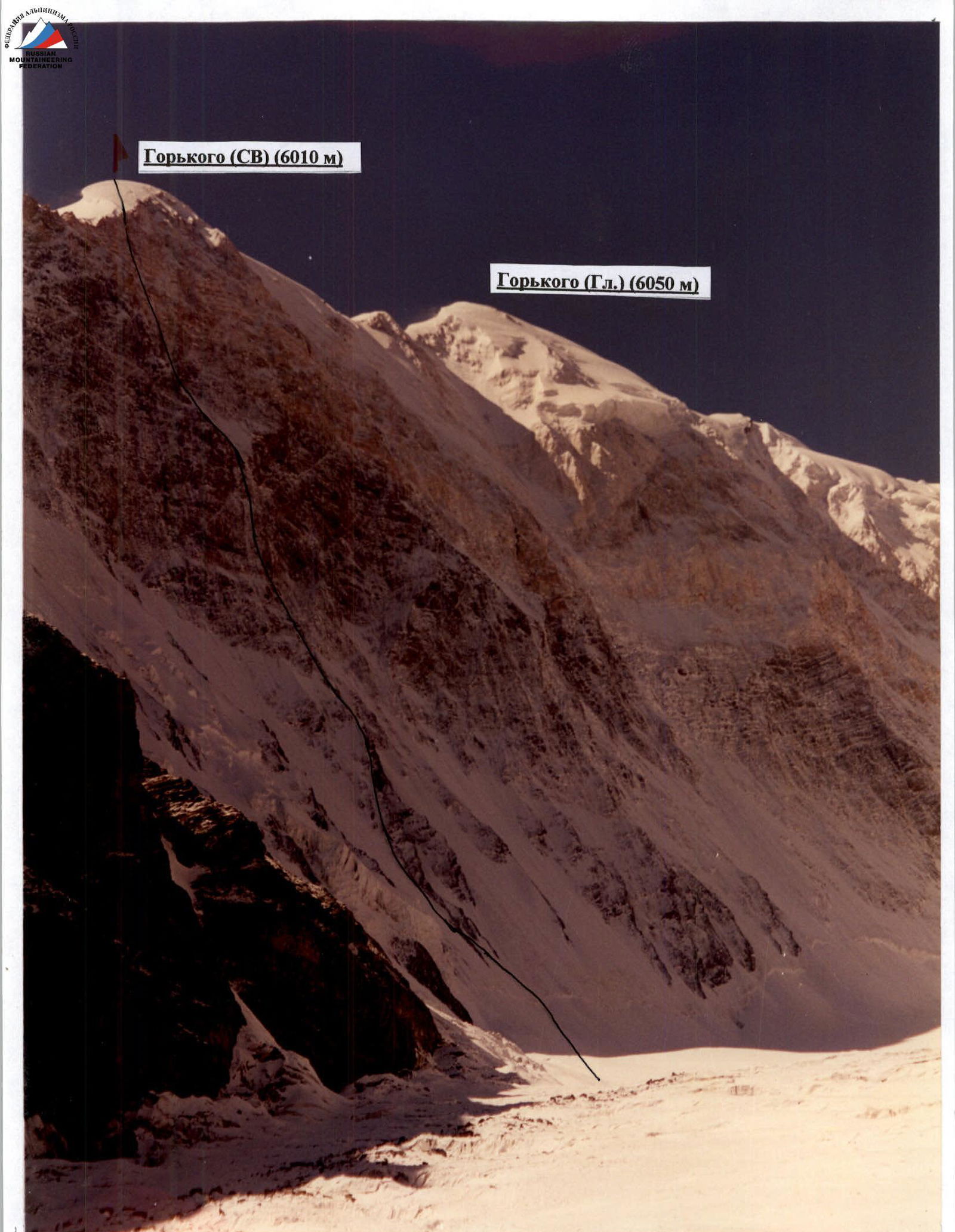
GENERAL PHOTO OF THE SUMMIT. ROUTE OF THE TEAM FROM THE MINISTRY OF PHYSICAL CULTURE, SPORTS, AND TOURISM OF THE SVERDLOVSK REGION. Taken on June 25, 2001, from the UPPER PART OF THE GUSEV GLACIER.
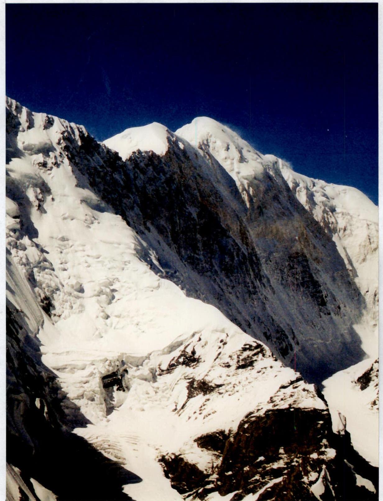
Photo of the wall profile from the left

Photopanorama of the area

Climbing days, including processing days 25–26.07
| Section # | Ice axes | Rock pitons | Anchor sets | ROUTE SCHEME in UIAA symbols M 1:2000 | Section complexity | Length (m) | Steepness (degrees) |
|---|---|---|---|---|---|---|---|
| 8 | 2 | 0 | 5 | 5А | 50 | 60 | |
| 7 | 3 | 0 | 2 | 5А | 50 | 60 | |
| 6 | 2 | 0 | 0 | 4Б | 30 | 55 | |
| 5 | 4 | 0 | 0 | 4А | 50 | 50 | |
| 4 | 4 | 0 | 0 | 4А | 50 | 50 | |
| 3 | 4 | 0 | 0 | 4А | 50 | 50 | |
| 2 | 4 | 0 | 0 | 4А | 50 | 45 | |
| 1 | 5 | 0 | 0 | 4Б | 50 | 50 |
| Section # | Ice axes | Rock pitons | Anchor sets | ROUTE SCHEME in UIAA symbols M 1:2000 | Section complexity | Length (m) | Steepness (degrees) |
|---|---|---|---|---|---|---|---|
| 24 | 2 | 3 | 8 | 6А | 50 | 60 | |
| 23 | 2 | 3 | 6 | 5Б | 50 | 60 | |
| 22 | 2 | 3 | 8 | 6Б | 50 | 70 | |
| 21 | 2 | 3/2 | 12/6 | 6А–6Б | 50 | 80 | |
| 20 | 0 | 2 | 8 | 5Б | 50 | 60 | |
| 19 | 1 | 2 | 5 | 6А | 50 | 75 | |
| 18 | 0 | 5/3 | 6/5 | 5Б | 50 | 60 | |
| 17 | 0 | 3 | 8 | 5Б | 50 | 65 |
| Section # | Ice axes | Rock pitons | Anchor sets | ROUTE SCHEME in UIAA symbols M 1:2000 | Section complexity | Length (m) | Steepness (degrees) |
|---|---|---|---|---|---|---|---|
| 16 | 1 | 5 | 6 | 5Б | 50 | 60 | |
| 15 | 0 | 2 | 10 | 6А | 50 | 70 | |
| 14 | 1 | 2 | 5 | 4Б | 50 | 50 | |
| 13 | 2 | 4 | 3 | 5А | 50 | 55 | |
| 12 | 2 | 3 | 4 | 5А | 50 | 50 | |
| 11 | 2 | 3 | 5А | 50 | 60 | ||
| 10 | 2 | 1 | 4 | 5А | 50 | 65 | |
| 9 | 2 | 0 | 4 | 5А | 50 | 55 |
| Section # | Ice axes | Rock pitons | Anchor sets | ROUTE SCHEME in UIAA symbols M 1:2000 | Section complexity | Length (m) | Steepness (degrees) |
|---|---|---|---|---|---|---|---|
| 32 | 2 | 1 | 6 |  | 6А | 50 | 70 |
| 31 | 2 | 2 | 9 |  | 6Б | 50 | 75 |
| 30 | 1 | 4 | 10 |  | 5Б | 50 | 70 |
| 29 | 2 | 1 | 5 |  | 4Б | 50 | 50 |
| 28 | 4 | 0 | 0 |  | 4А | 50 | 45 |
| 27 | 4 | 0 | 0 |  | 4А | 50 | 45 |
| 26 | 4 | 0 | 0 |  | 4А | 50 | 45 |
| 25 | 1 | 5 | 8 |  | 6Б | 50 | 65 |
| Section # | Ice axes | Rock pitons | Anchor sets | ROUTE SCHEME in UIAA symbols M 1:2000 | Section complexity | Length (m) | Steepness (degrees) |
|---|---|---|---|---|---|---|---|
| 37 | 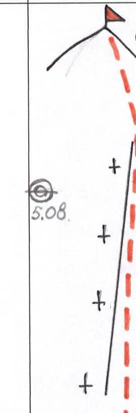 | 3Б | 260 | 30 | |||
| 36 | 1 | 0 | 5 | 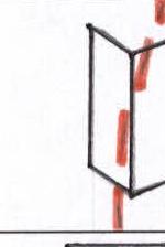 | 5А | 40 | 60 |
| 35 | 0 | 2 | 8 | 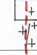 | 5Б | 50 | 60 |
| 34 | 0 | 1 | 4 | 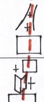 | 5А | 50 | 50 |
| 33 | 1 | 1 | 5 |  | 5Б | 50 | 60 |
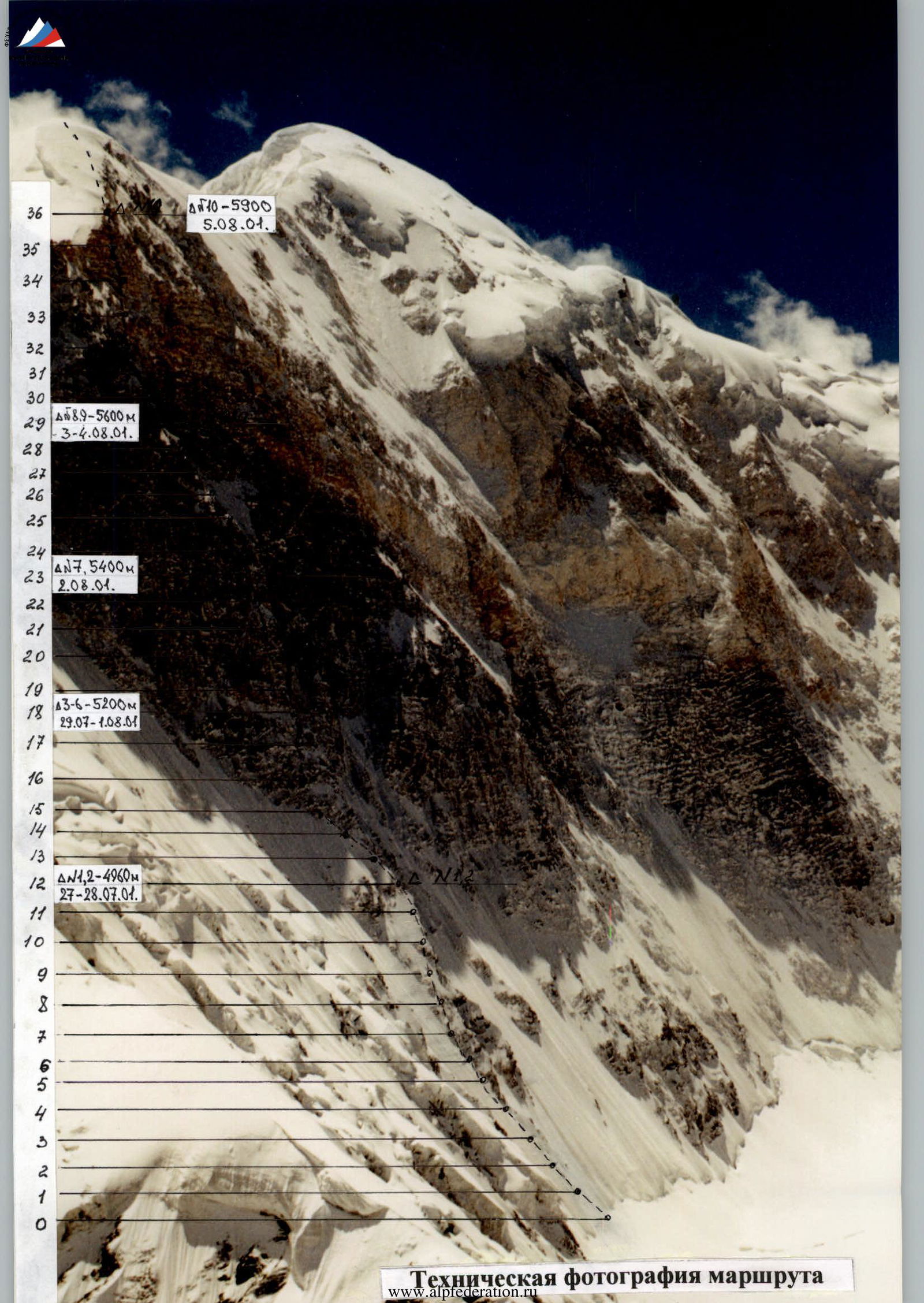
Technical photography of the route
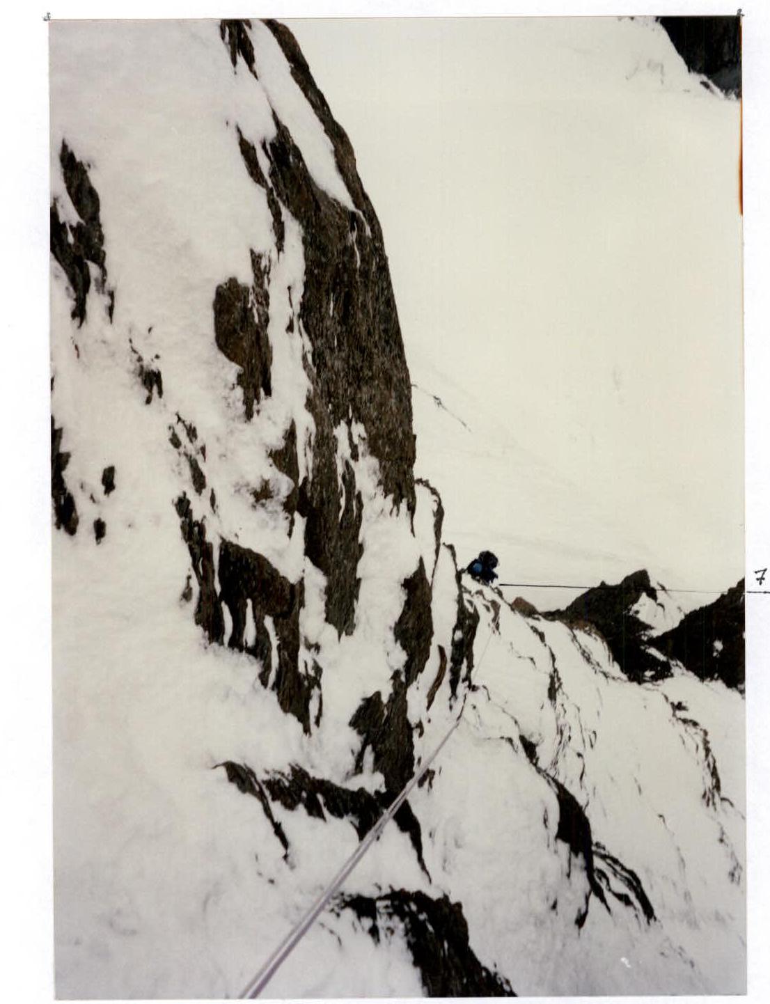
Photo 1 Section # 8.
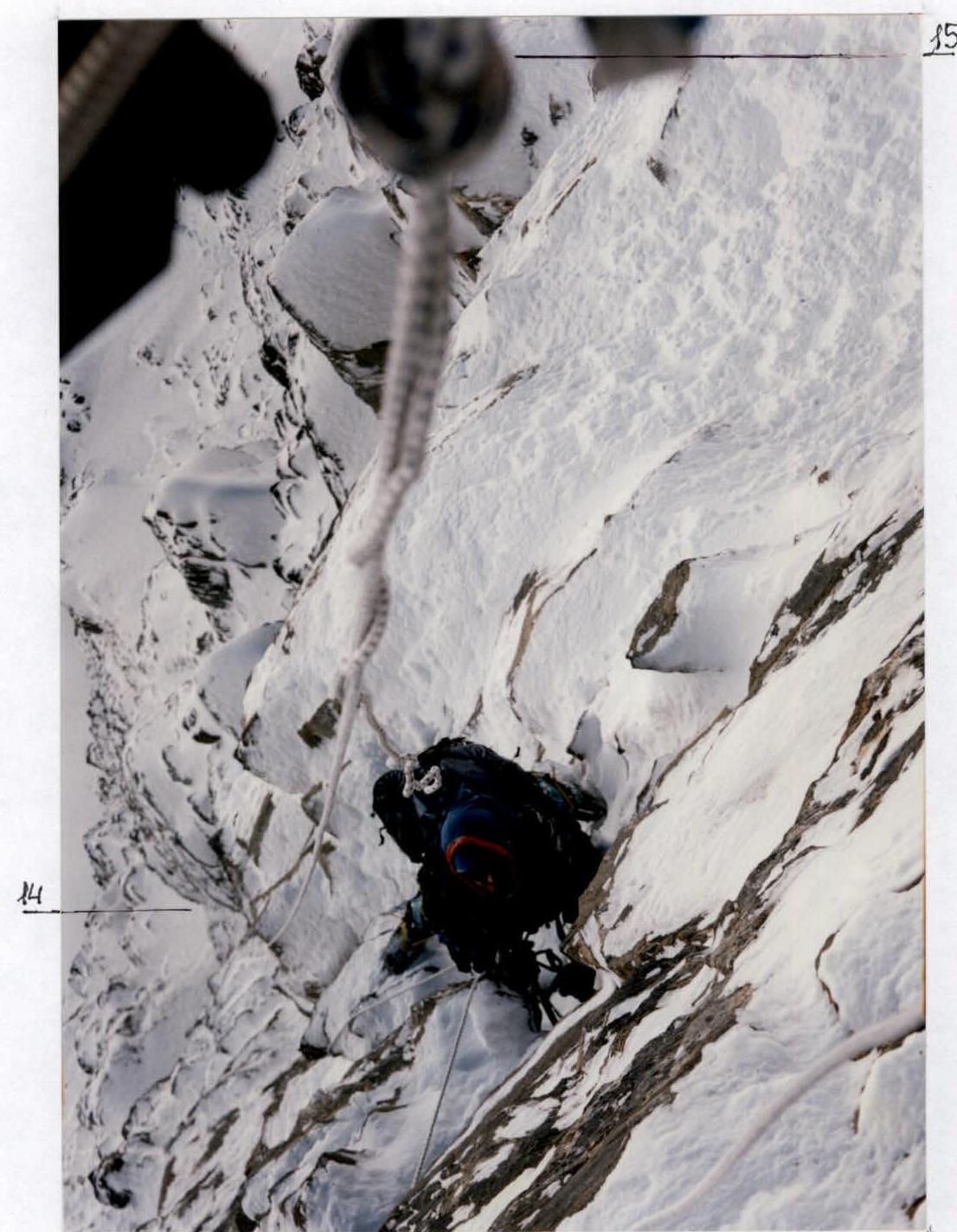
Photo 3 Section # 15.

Photo 4 Section # 18.
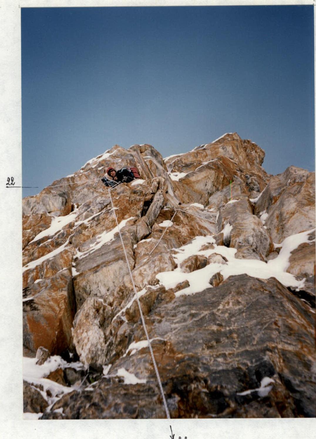
Photo 6 Section # 22.
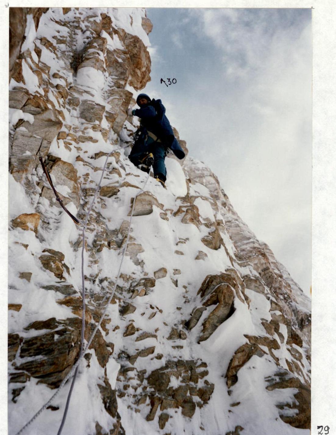
Photo 8 Section # 30.
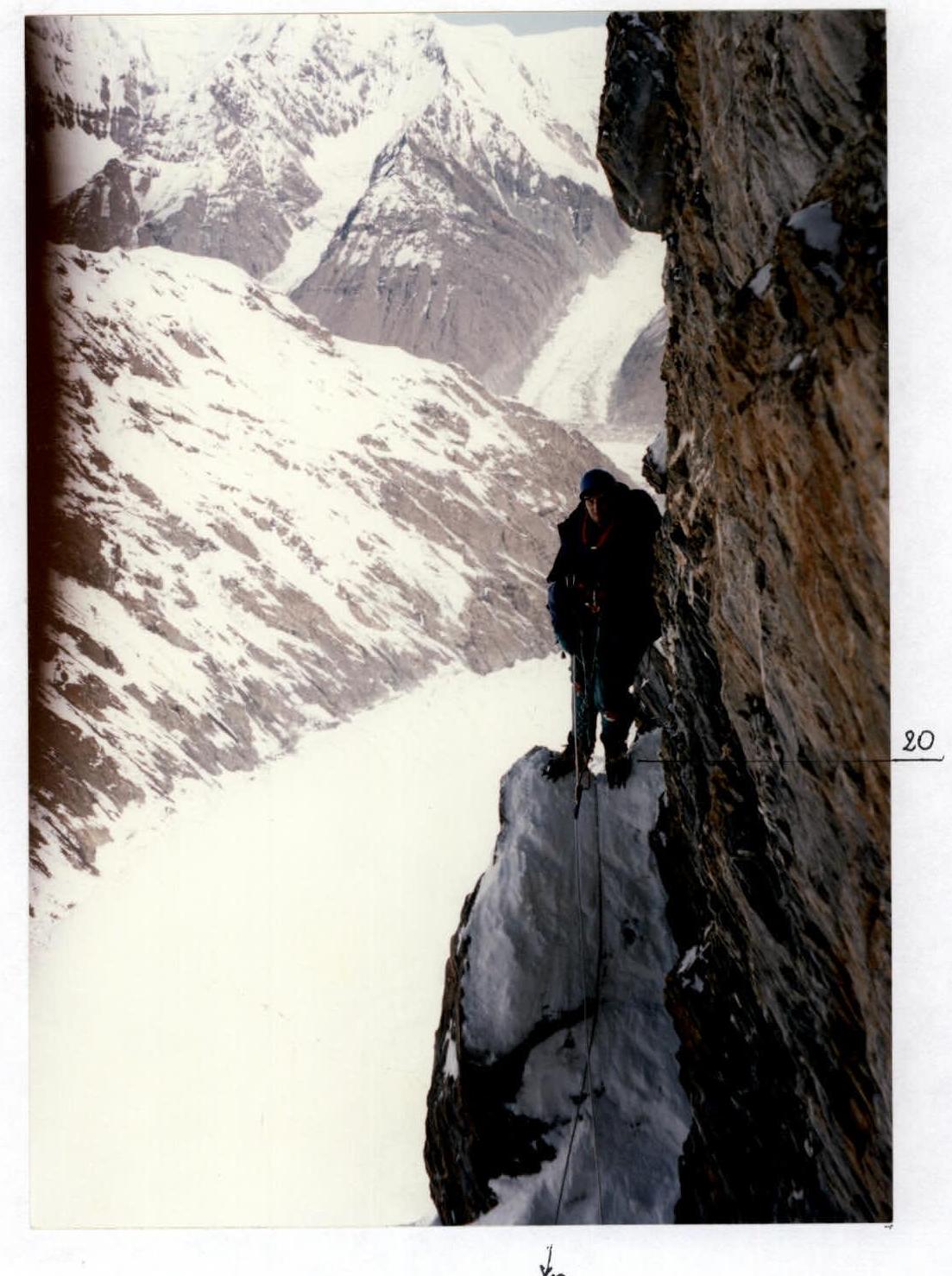
Photo 5 Section # 20.
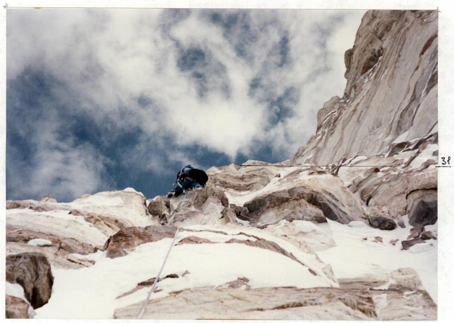
Photo 9 Section # 31.