Russian Mountaineering Championship
in the high-altitude class 2018
Report
of the Rostov Region team on the ascent of Pik Pobedy Gl. (7439) from the north via the Abalakov route, 6A category of difficulty
Climbing Passport
- Region: Central Tien Shan, Kokshaal-Too range
- Peak, route: Pik Pobedy Gl. (7439) from the north (V. Abalakov route)
- Category of difficulty: 6A category of difficulty
- Route type: ice and snow
- Route elevation gain: 2989 m Route length: 6800 m Pitons left on the route: 0
- Pitons hammered on the route: 4 (2 snow anchors and 2 ice screws)
- Team's climbing hours: 29.5 hours, 3 days (from Zvezdochka glacier to the summit)
- Leader: Vasiliev Andrei Sergeevich, Master of Sports — Rostov-on-Don
Participants:
- Osipov Ivan Dmitrievich, Master of Sports — Rostov-on-Don
- Shipilov Vitaly Viktorovich, Master of Sports — Rostov-on-Don
- Coach: Pyatnitsin Alexander Alekseevich, Vasiliev Andrei Sergeevich
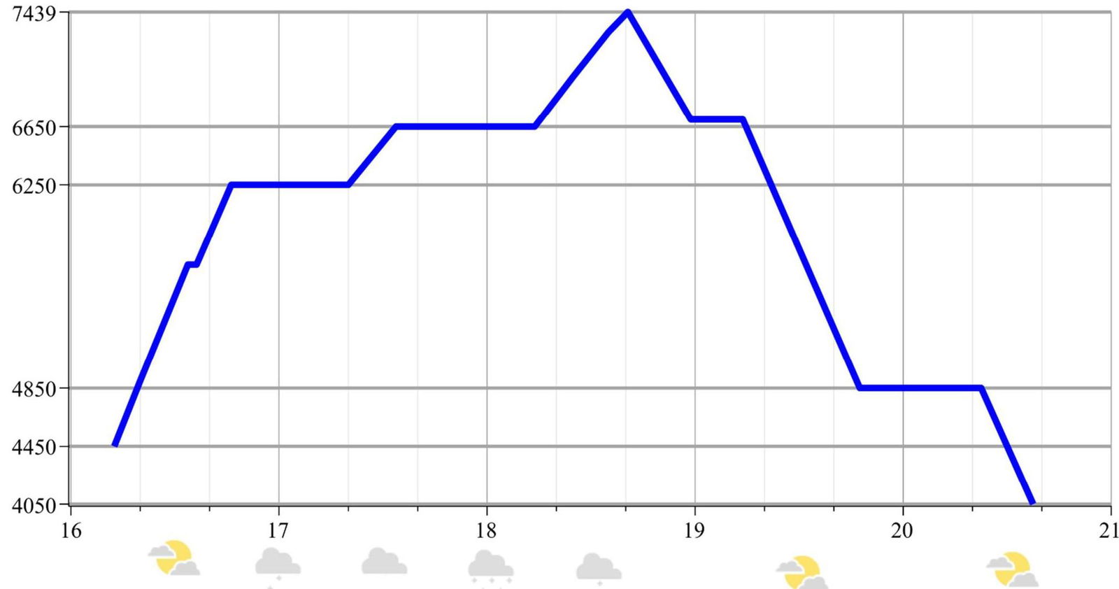
- Departure for the route: August 16, 2018, 5:00 Summit ascent: August 18, 2018, 16:10 Return to Base Camp: August 19, 2018, 14:00
Panoramic Photo of the Area
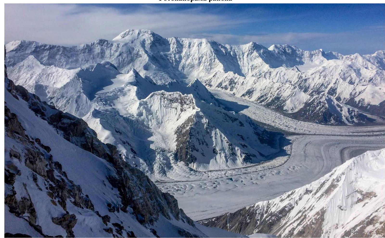
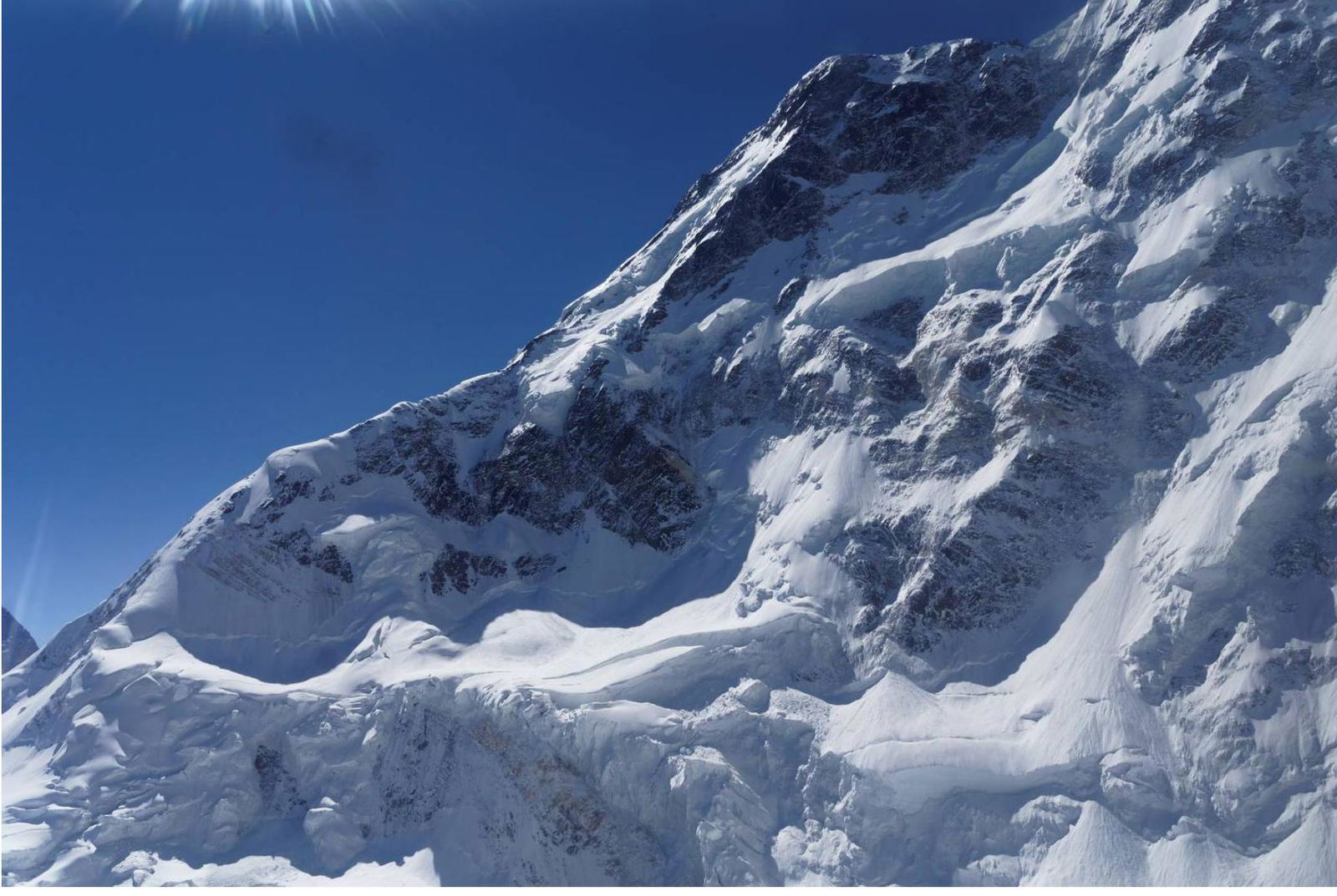
Photo of the Pik Pobedy massif, taken from Pik Khan-Tengri.
General Photo of the Summit
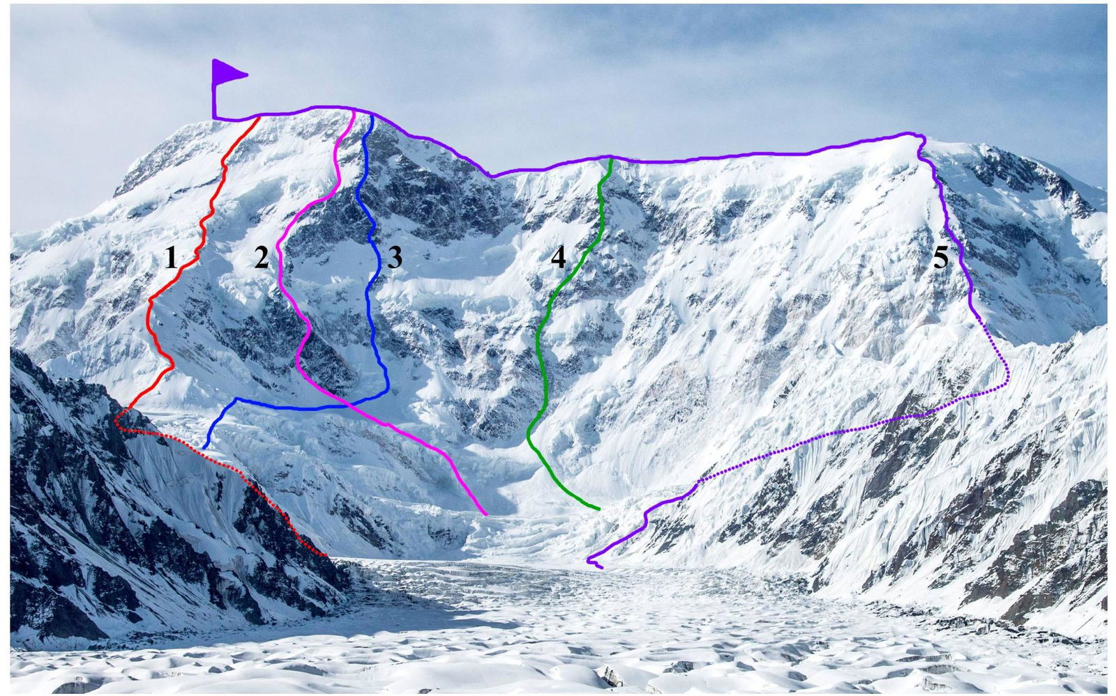
1 — Abalakov route, 6A, 1956; 2 — Smirnov route («by dollar»), 6B, 1982 3 — Urubko — Durov route («stick to dollar»), not in the 2011 classifier 4 — Sokolov route, 6B, 2009 5 — Medzmariashvili route, 5B, 1961
Technical Photo of the Route
Ascent Schedule
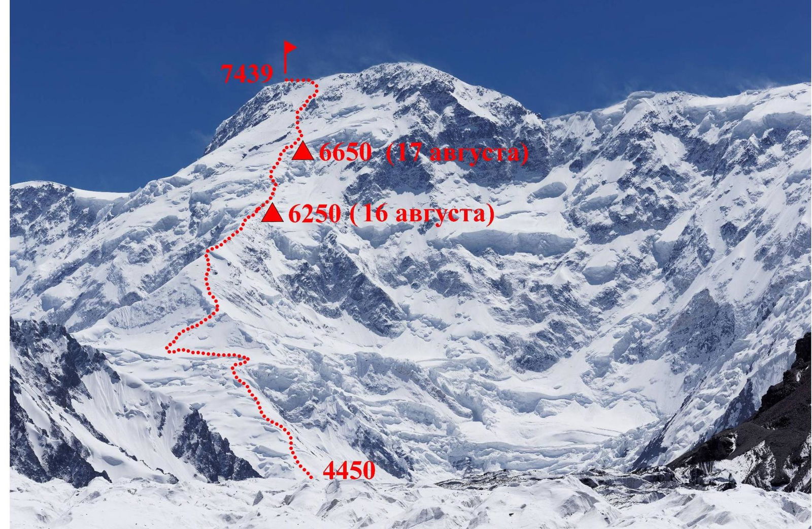
Route Profile
Profile of the upper part of the route. Taken from a helicopter.
Team's Tactical Actions
The team arrived at South Inylchek on foot from At-Jailoo. They covered a distance of 61 km in 3 days.
After that, they made two acclimatization ascents:
- to Pik Pesnya Abaya (~4950 m) with an overnight stay under the summit;
- to Pik Khan-Tengri with two overnight stays on the saddle (~5850 m) and a radial ascent to 6500 m.
Next, the team planned to ascend Pik Khan-Tengri via the Sviridenko route. However, after starting the route and climbing a few ropes on very broken rocks, they decided to retreat due to excessive danger.
The Abalakov route on Pik Pobedy is rarely climbed recently due to high avalanche danger. However, during the 3 weeks they were in the area, there were no significant snowfalls. The frequency of avalanches from the northern wall of Pik Pobedy was significantly lower than in previous seasons. Thus, the route conditions seemed non-avalanche-prone. The forecast promised another 6–7 days of good weather.
They started the route in a group of four, with the fourth participant being Dmitry Rybalchenko from Severodvinsk. He had already climbed Pik Pobedy this season via the Diky Pass and Pik Pobedy Zapadny. On the evening of the 15th, they approached the Zvezdochka glacier under the start of the Abalakov route. They began the route at 5:00 to climb as high as possible on firm snow. By 8:00, they were already on the "pedestal" at a height of approximately 4950 m. After 9:00, the snow became soft, and the ascent rate decreased — they had to trail-blaze a lot (see photo 3).
By 18:30, they decided to set up a tent on a flat, safe site under the rocks at 6250 m. That is, on the first day, they climbed approximately 1700 m.
At night, a significant amount of fresh snow fell, so they decided:
- not to attempt to reach the summit;
- to move the camp higher to the serac area around 6700 m.
They did not want to move the camp any higher because:
- their acclimatization was not ideal;
- in case of sudden bad weather, they could be in a risky situation.
They did just that — in a few hours, they reached a height of 6650 m, where they set up a relatively safe bivouac site under the cover of ice seracs. The limited work on this day allowed them to rest well and get a good night's sleep before the summit push. Strong winds forced them to delay the summit push by an hour. They departed around 5:30. It snowed lightly all day, and for a mountain like Pik Pobedy, it was very warm, and the wind died down. Shortly after leaving the tents, Dima Rybalchenko decided to abandon the ascent because:
- he had not fully recovered from his previous ascent;
- he felt he was not moving quickly enough.
However, he felt fine, and his condition did not raise any concerns. He returned to the tent, where he waited for the other team members.
The entire ascent to the summit ridge required trail-blazing through fresh snow. They had hoped that closer to the ridge, strong winds would have blown away the snow, but that did not happen, which made the ascent rate somewhat lower than planned. At a height of 7200 m, they deviated to the left of the rocky ridge along which the Abalakov route runs. The steepness and snow conditions were the same, but this allowed them to:
- shorten the route;
- reach the summit almost directly;
- avoid traversing the ridge.
Throughout the summit day, they recorded their path using a GPS tracker, and the track is available at http://www.movescount.com/ru/moves/move238321633↗.
The Abalakov route has virtually no technical difficulties. There are a few steep, short snow and ice walls that were overcome with protection, and two sections of несложных rocks: at heights of 6300 m and 7000 m. However, the route requires constant attention and concentration, especially during the descent. They descended via the same route they ascended. The relatively high slope steepness forced them to descend in three steps, slowly and carefully.
The team expresses gratitude to:
- Dmitry Grekov — for help in choosing the route and radio communication with base camp;
- Alexander Yakovenko and the "Height" project — for the provided equipment and invaluable experience from past expeditions;
- "Ozon" and "BVN-engineering" companies — for sponsoring the team!
Note and Photo from the Summit
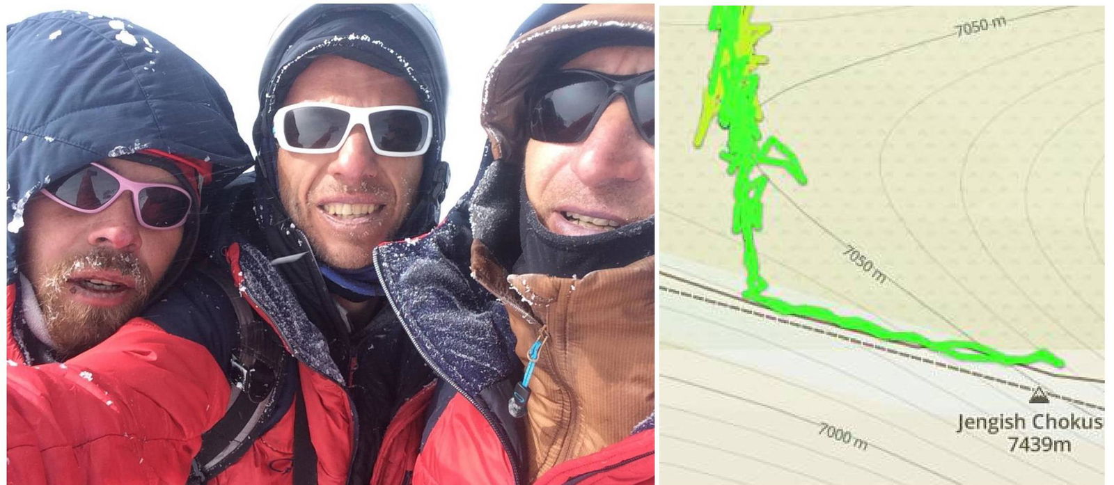
Photo of all team members at the summit. No note was found in the cairn. The line of their path, recorded using GPS. More information is available at http://www.movescount.com/ru/moves/move238321633↗
Photo Album
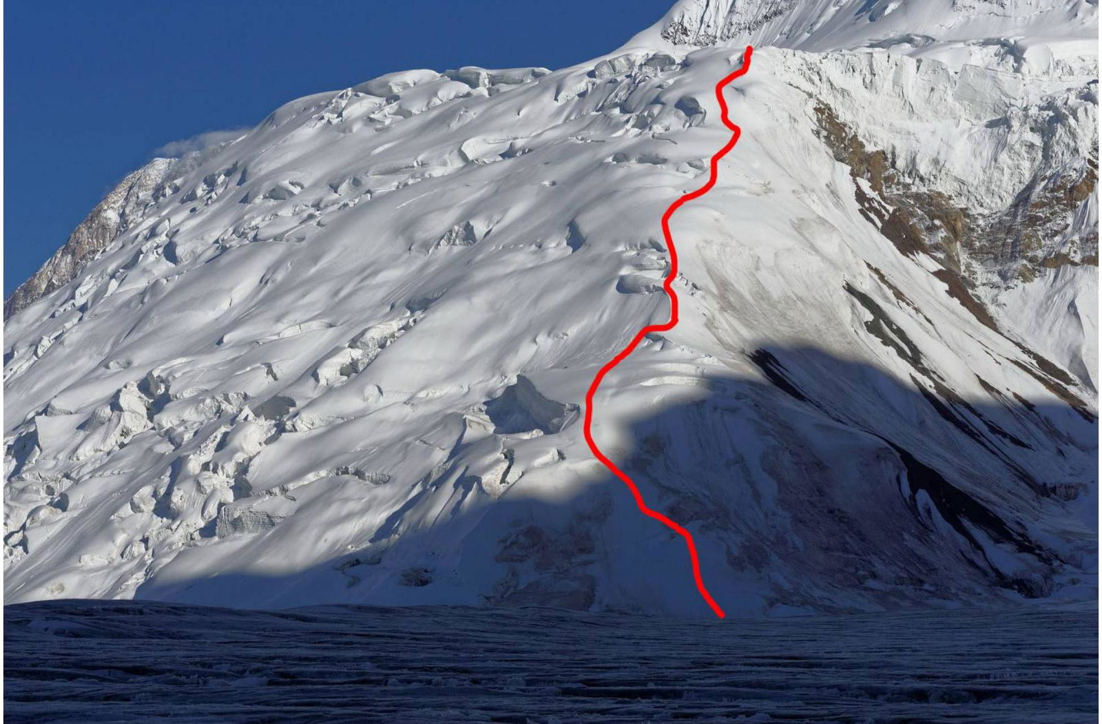
Photo 1. Lower part of the route from Zvezdochka glacier to the "pedestal".
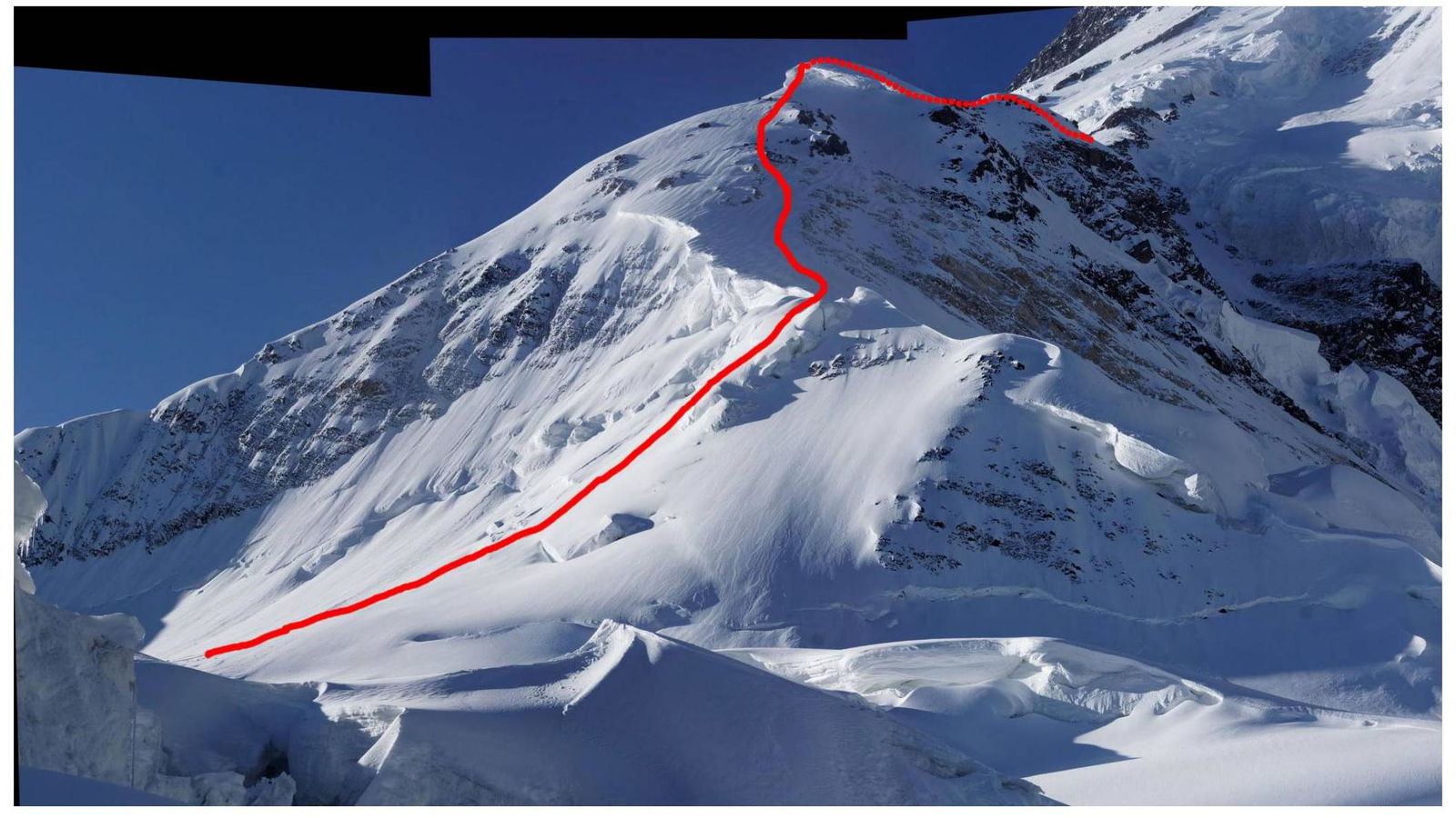
Photo 2. Continuation of the route above the "pedestal".
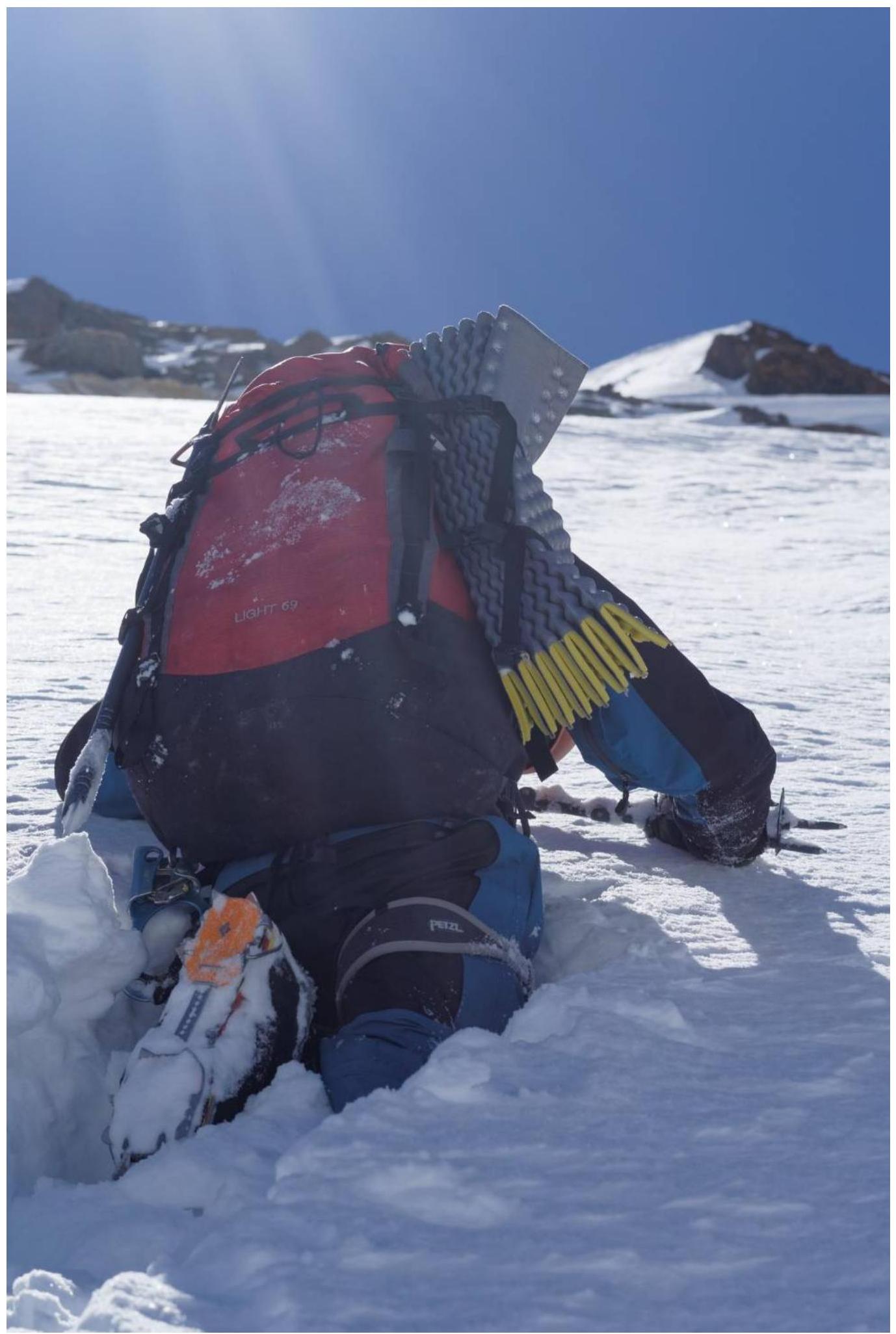
Photo 3. Deep snow at ~5300 m.
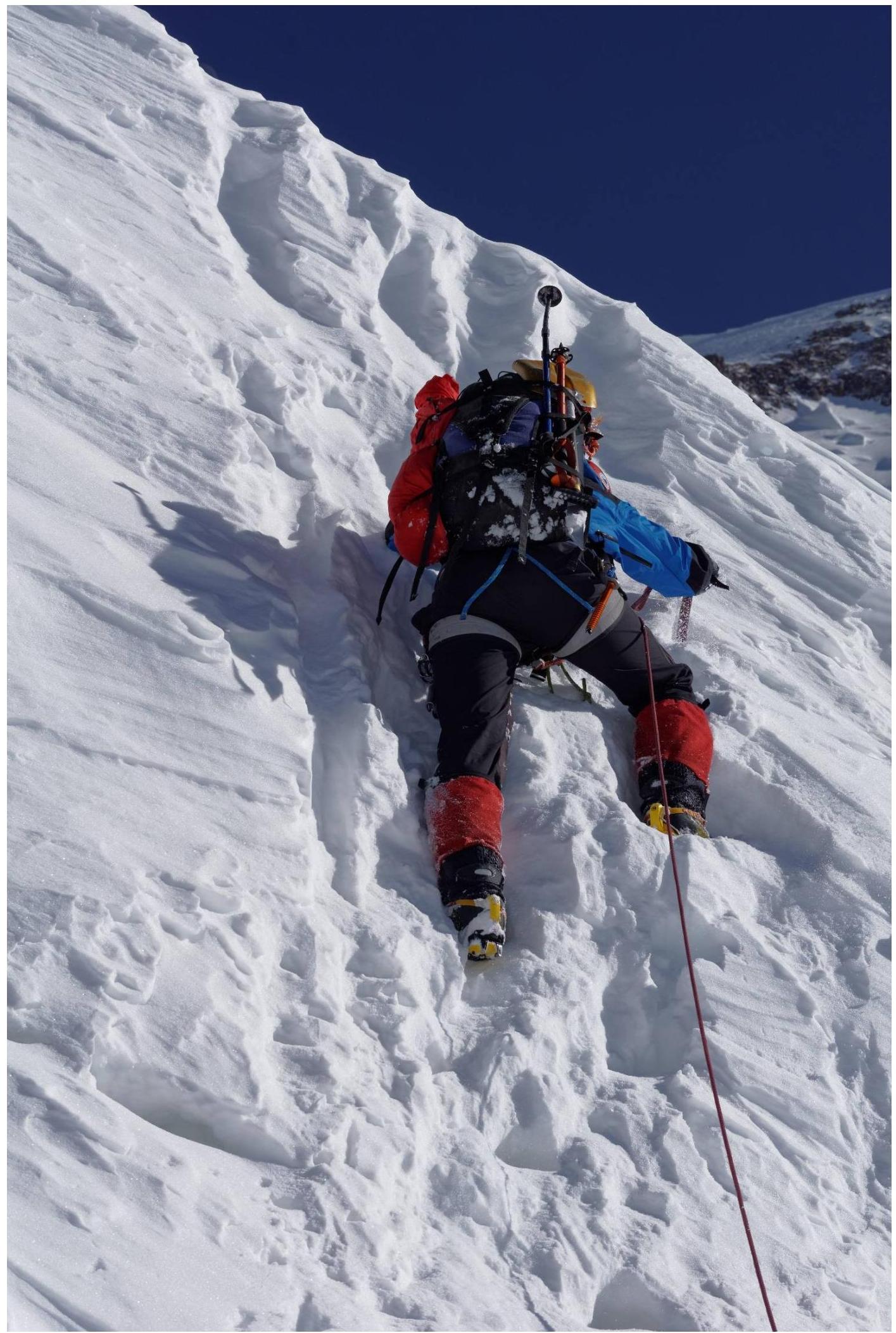
Photo 4. Steep step at ~6150 m.
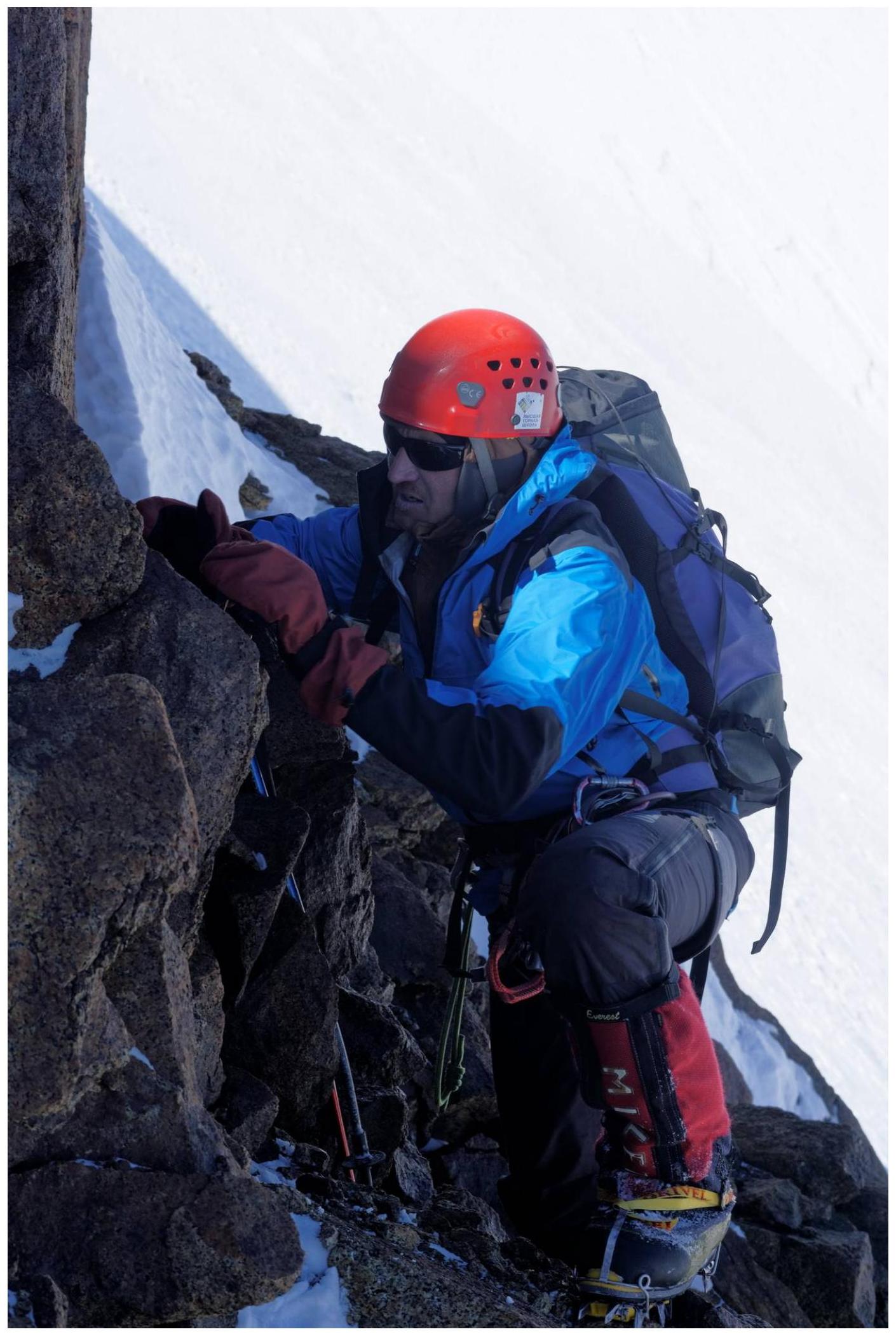
Photo 5. Rocky step at ~6300 m.
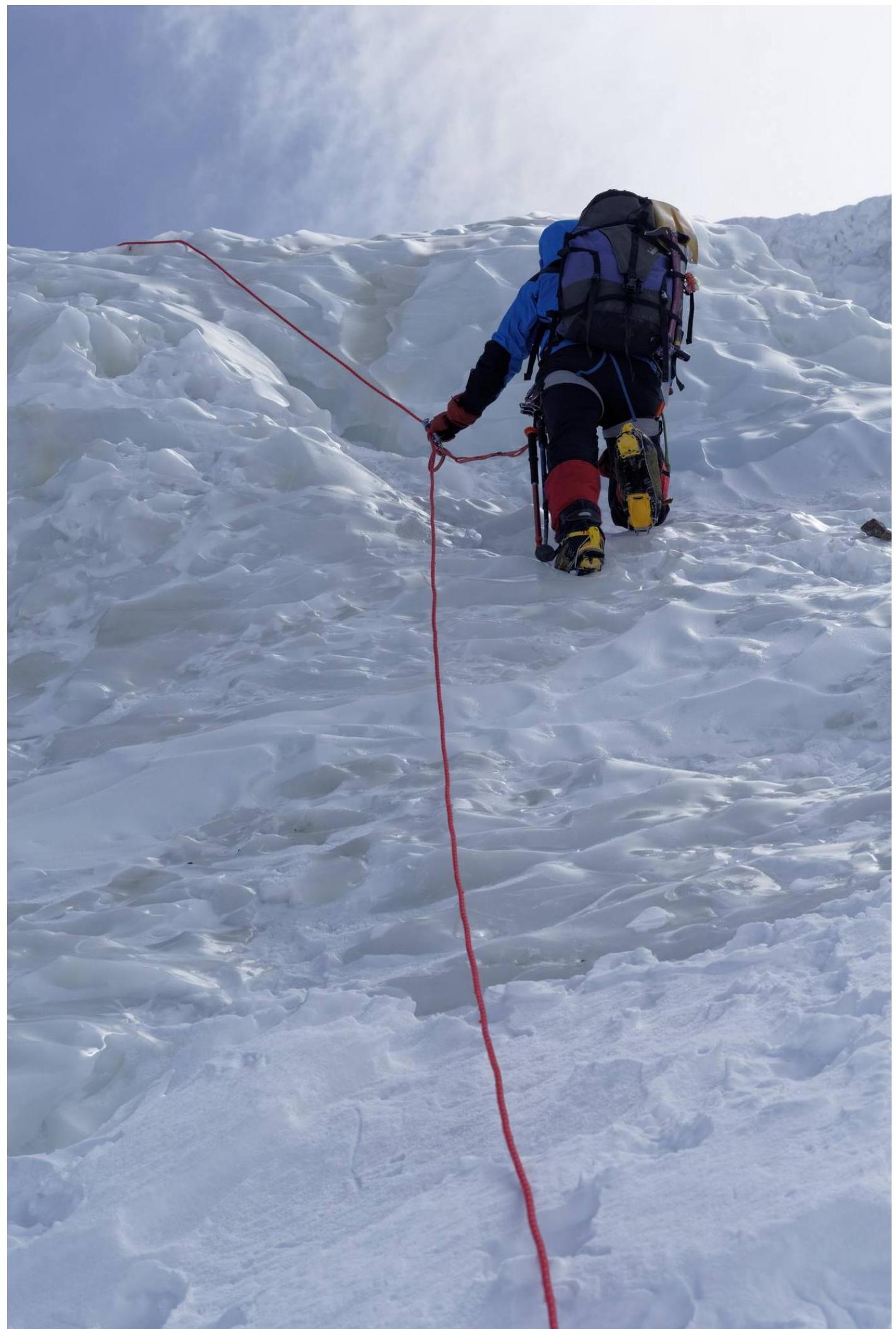
Photo 6. Ice wall at ~6500 m.
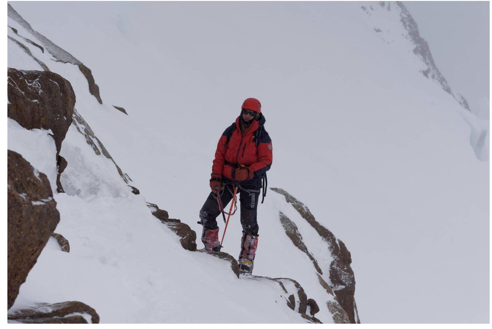
Photo 7. Crossing the rocky ridge at ~7000 m.
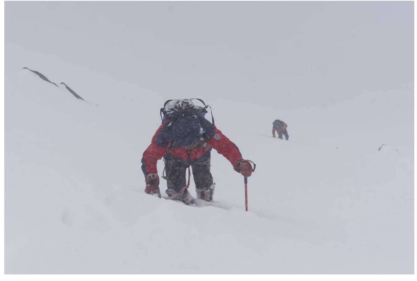
Photo 8. 7300 m.
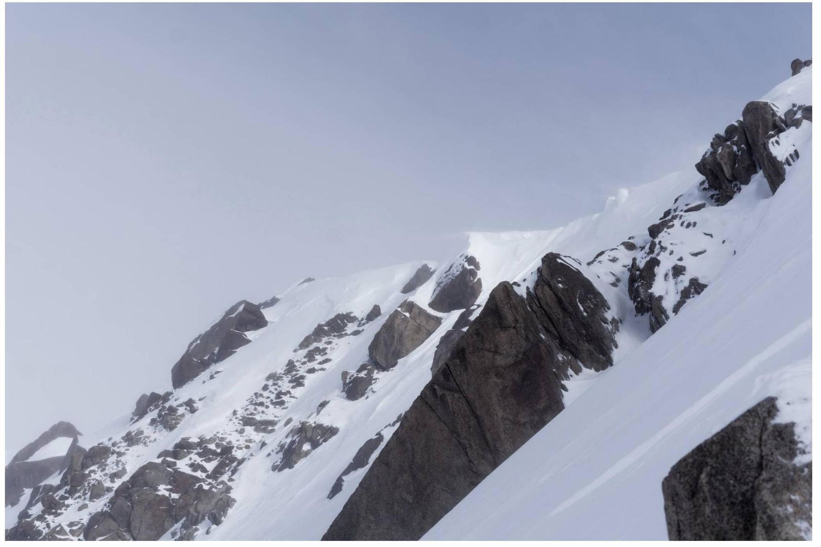
Photo 9. Almost reached the ridge, view of the summit, height ~7420 m.
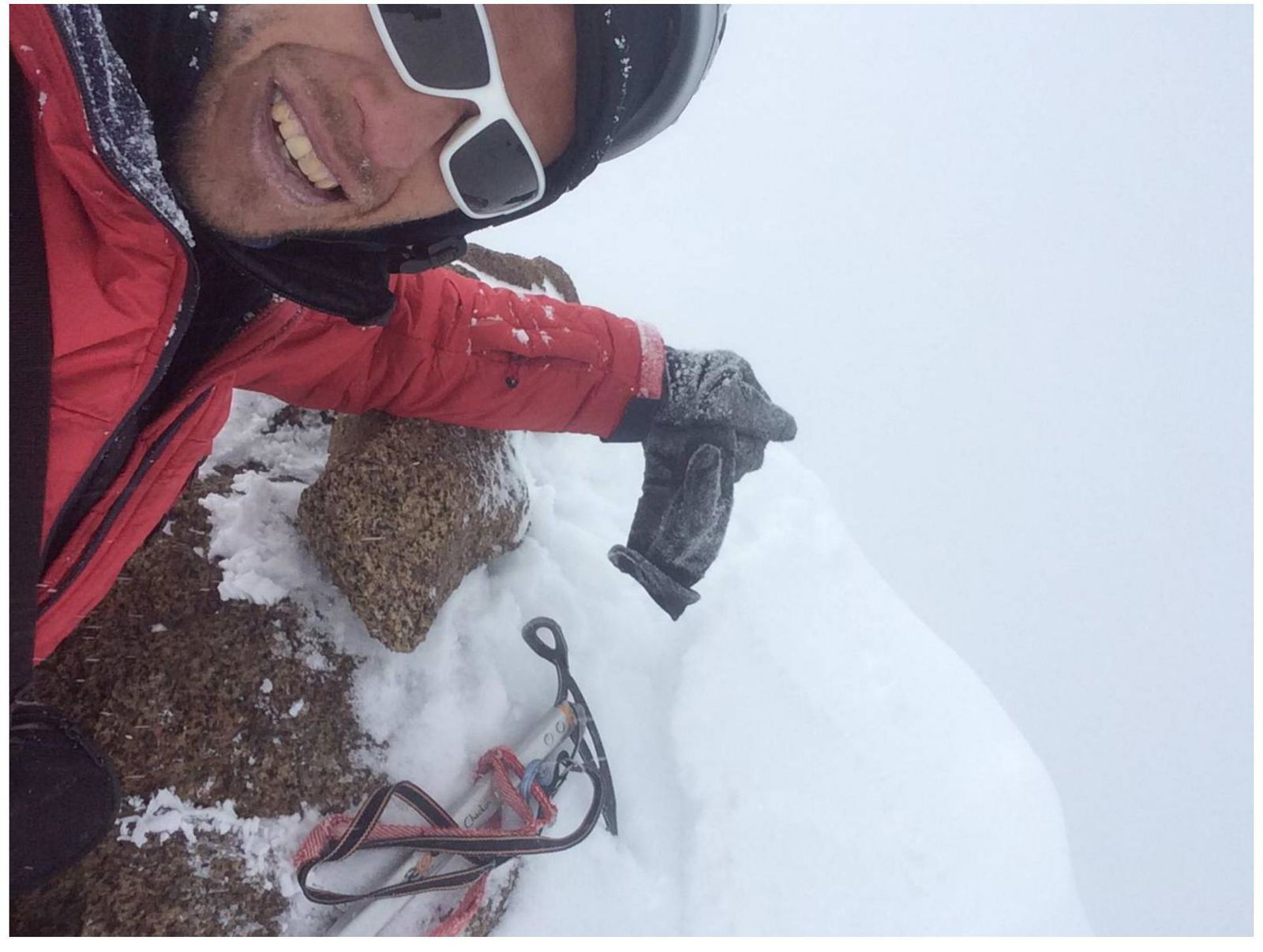
Photo 10. Something resembling a control cairn.
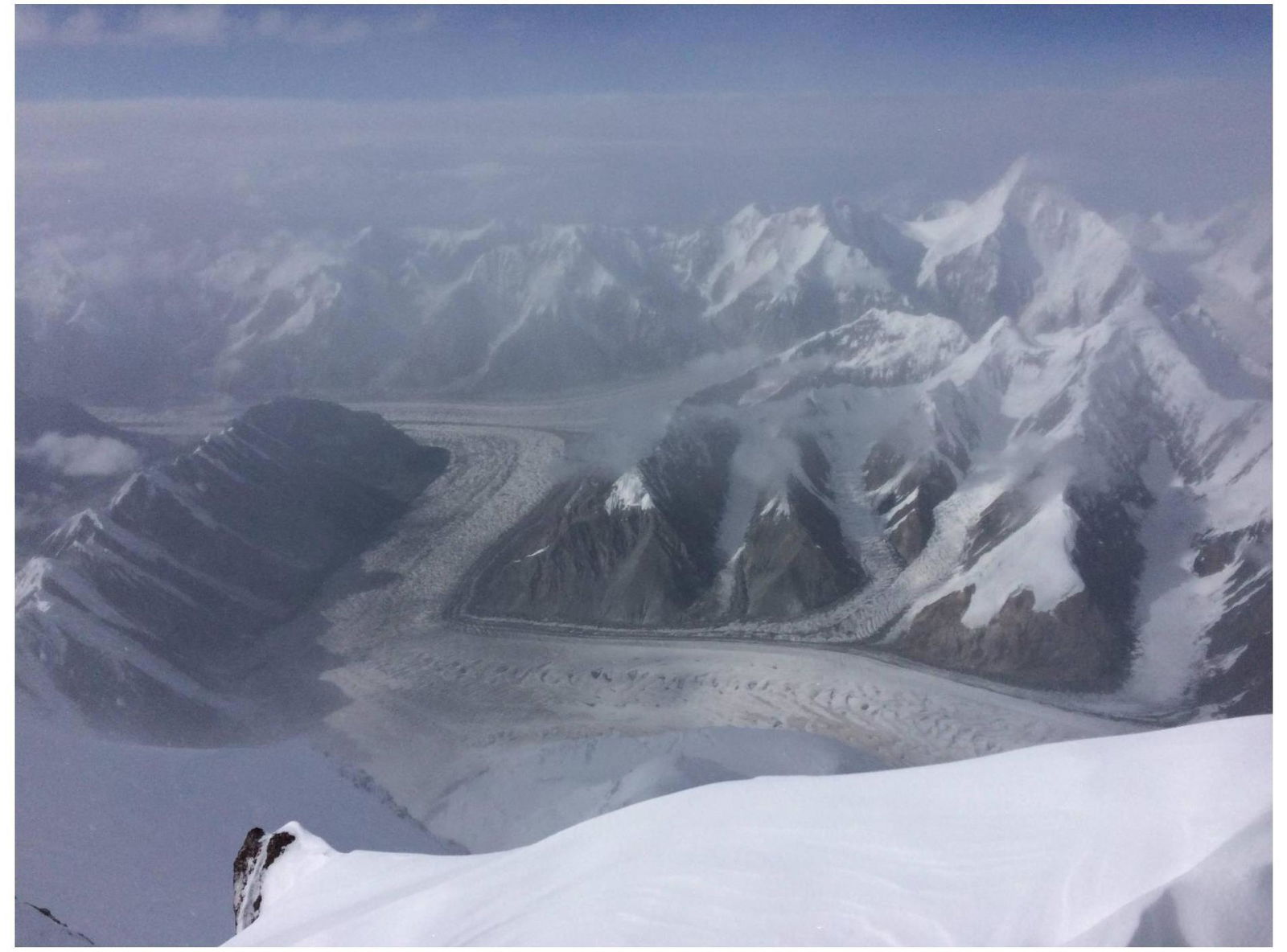
Photo 11. View from the ridge.
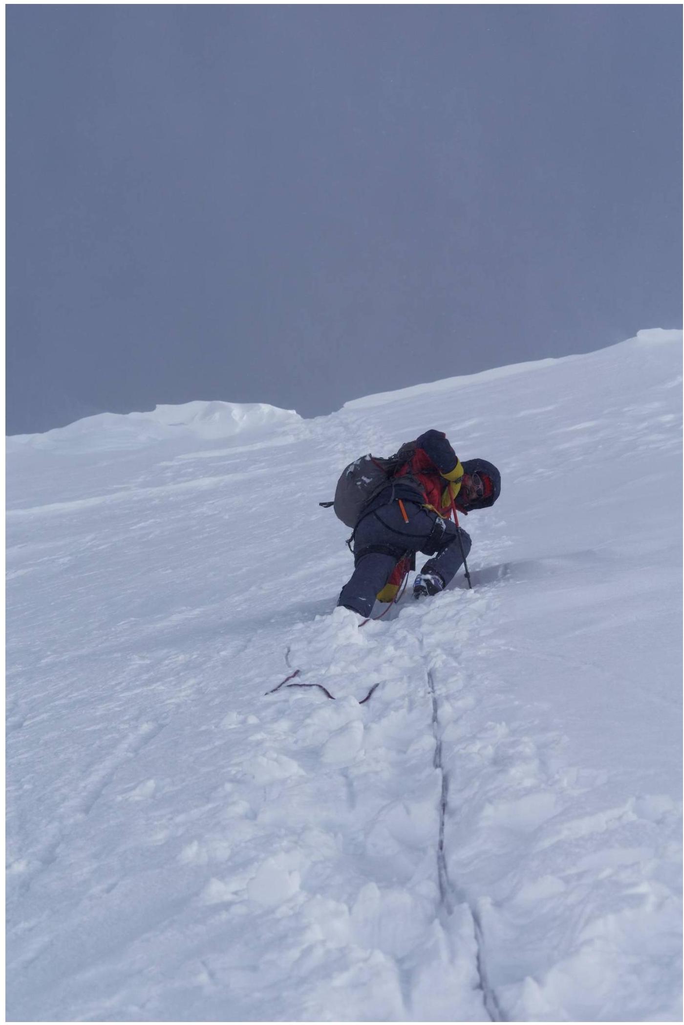
Photo 12. Beginning of the descent from the ridge.


