Report
On the first ascent of the St. Petersburg team to the summit of Kyzyl-Asker, 5842 m via the South Ridge (approximately 6B category)
Team Leader: Evgeny G. Murin Team Member: Ilya N. Penyayev Coach: Tatyana I. Timoshenko
St. Petersburg 2018
Climbing Passport
- General Information
1.1 Murin Evgeny G. Master of Sports 1.2 Penyayev Ilya N. Candidate Master of Sports 1.3 Coach – Timoshenko Tatyana I. Master of Sports 1.4 St. Petersburg Alpine Federation
- Characteristics of the Climbing Object
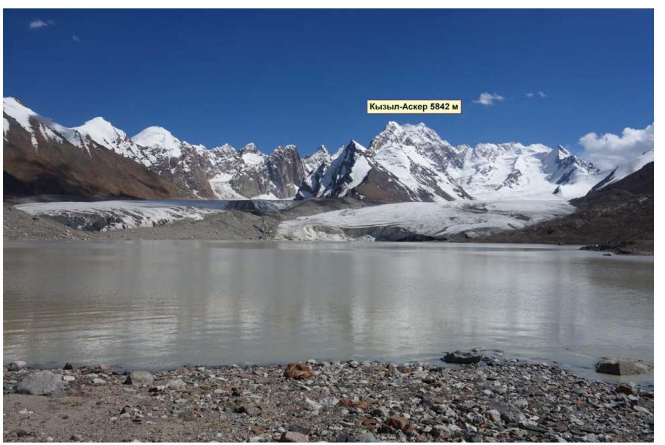
2.1 Region — Tian Shan 2.2 Kokshaal-Too Range 2.3 Section Number – 7.5 2.4 Peak Kyzyl-Asker, height 5842 m
- Route Characteristics
3.1 Via South Ridge 3.2 Estimated category – 6B 3.3 First ascent 3.4 Combined 3.5 Elevation gain 1170 m 3.6 Route length 1370 m 3.7 Sections of V category: 545 m, sections of VI category: 625 m 3.8 Average slope of the route 59° 3.9 Average slope of the main part 70° 3.10 Descent via the ascent route
- Team Actions Characteristics
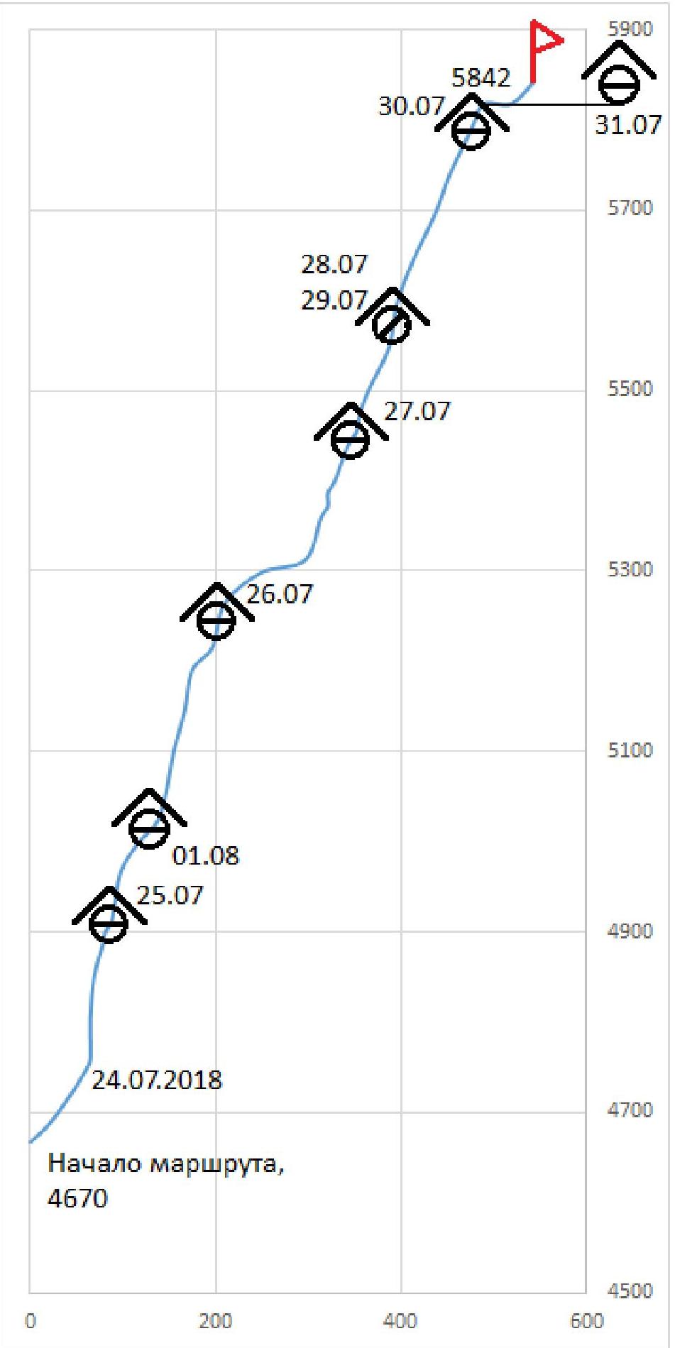
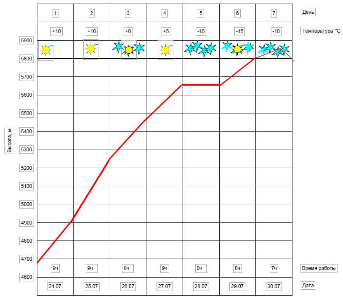
4.1 Movement time: 50 hours on the move, 7 days 4.2 Overnight bivouacs 4.3 Processing - 4.4 Route entry on July 24, 2018 4.5 Summit on July 30, 2018 4.6 Return to base camp on August 1, 2018
- Weather Conditions Characteristics
5.1 Temperature: from +10 to −15 °C 5.2 Wind speed: from 0–10 m/s 5.3 Snowfall – 4 days 5.4 Visibility: clear – 3 days
- Report Responsible
6.1 Murin Evgeny G., djonmyrin83@mail.ru
2. Climbing Description
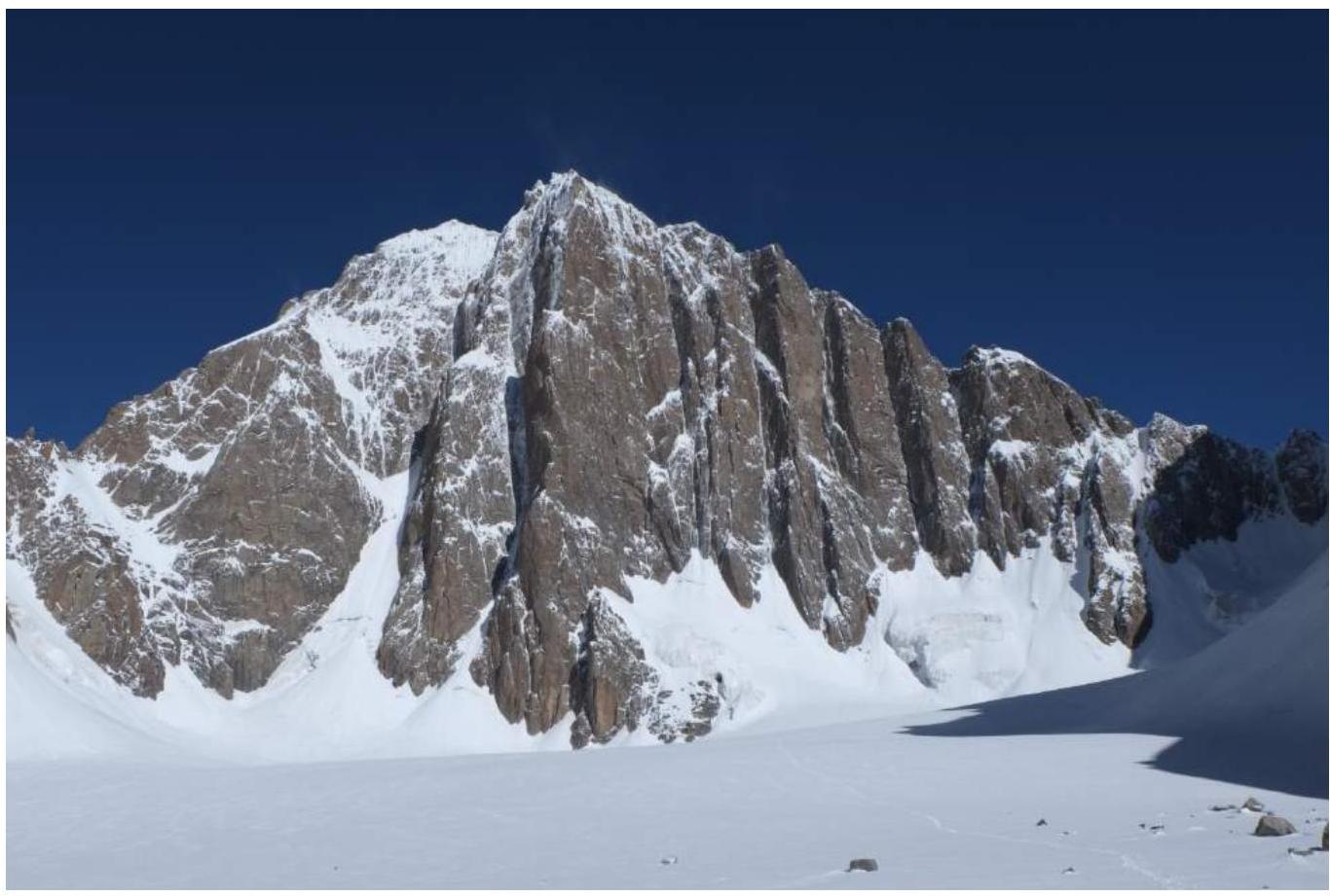
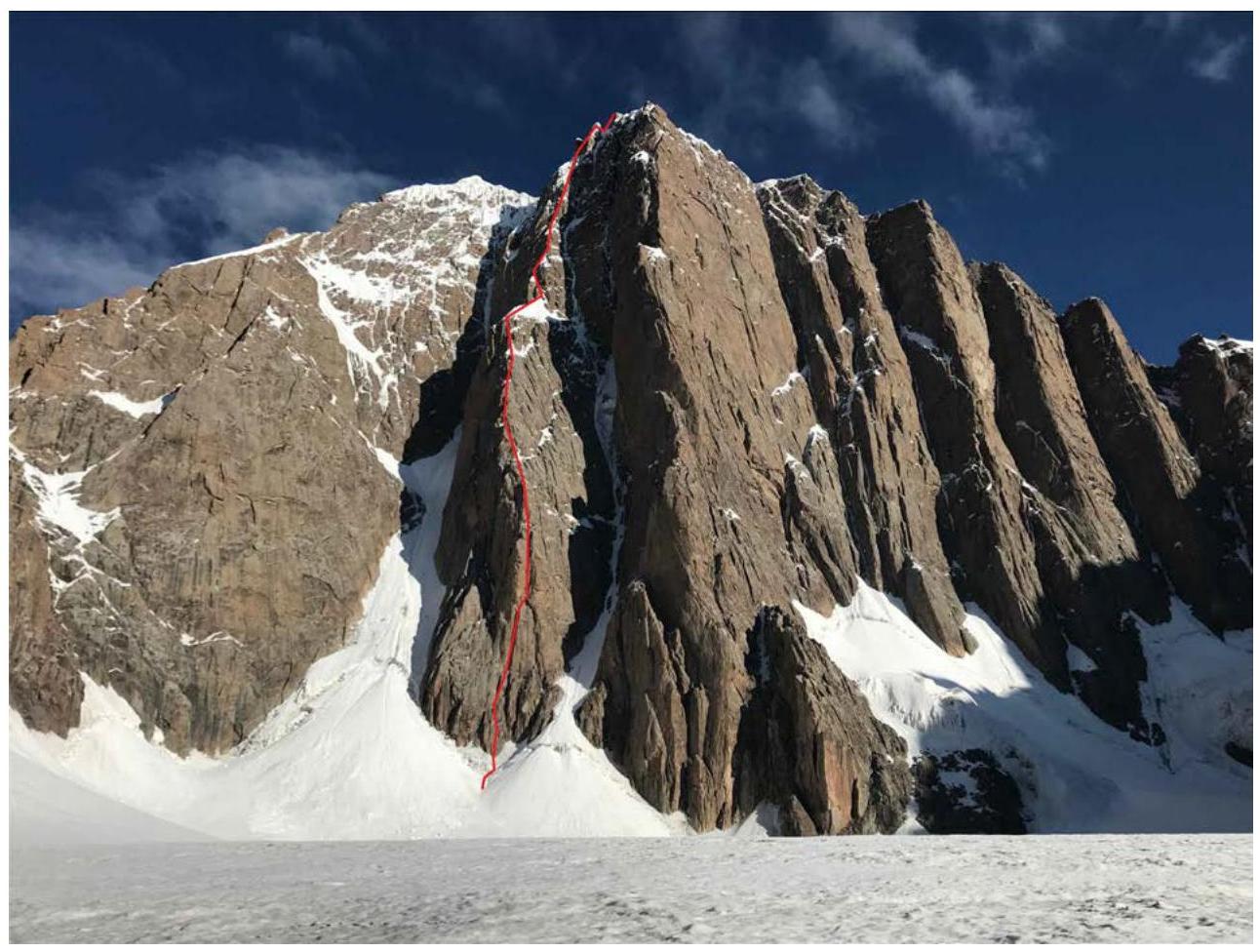
1.1 General Photo
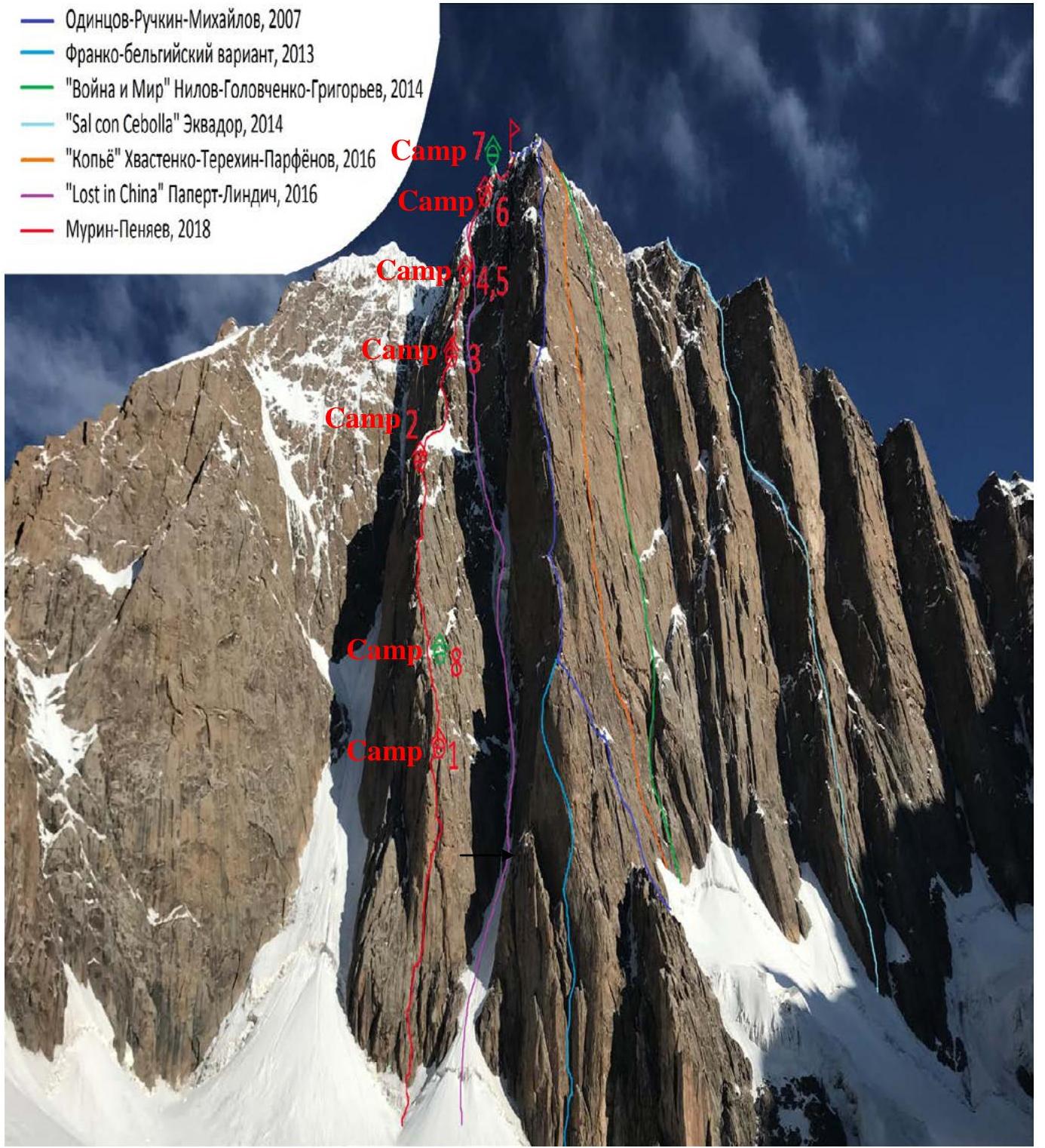
Route Profile
1.2 Profile Photo
 1.3 Area Photopanorama
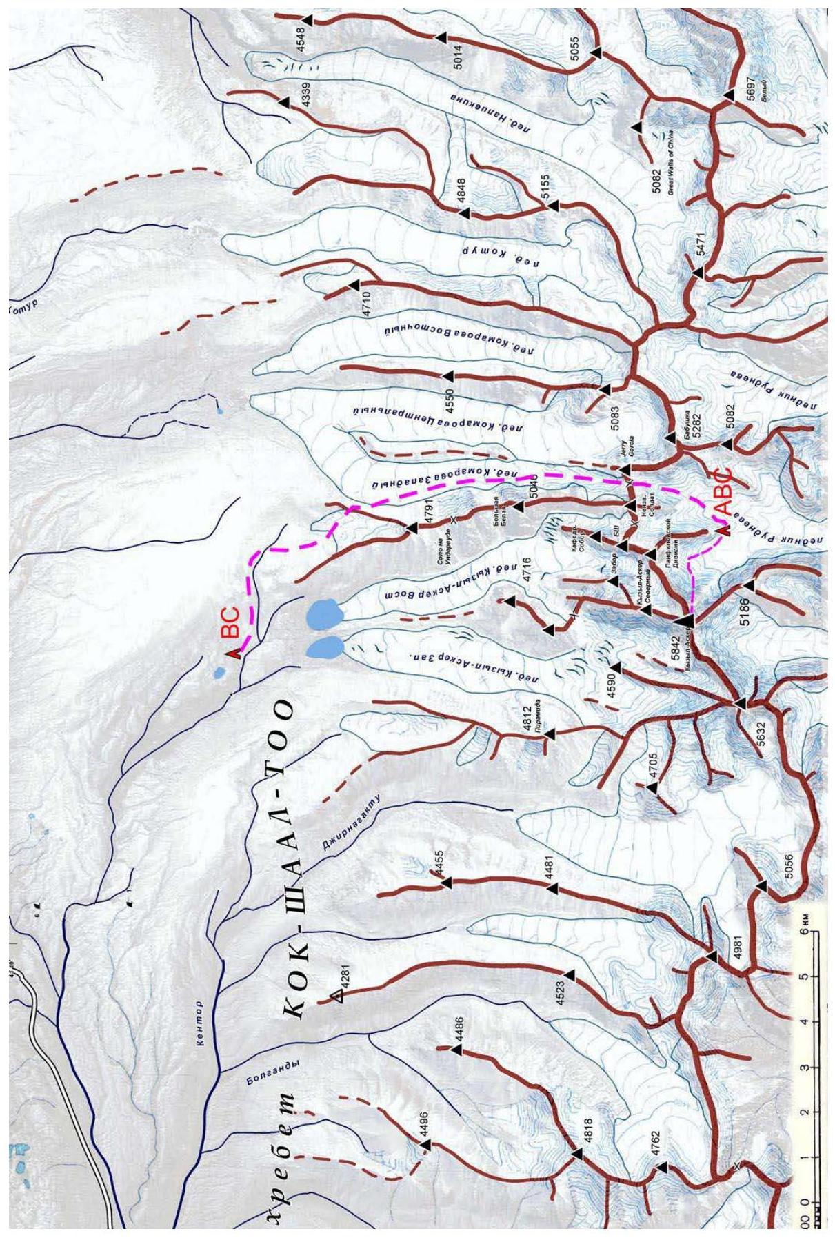
 1.4 Area Map
Area Description
The western Kokshaal-Too region is relatively undeveloped by climbers. There are many peaks around 6000 m in this area. The most interesting among them are Kyzyl-Asker (5842 m), Peak Krylya Sovetov (5800 m), Peak Shmidt (5954 m), Peak Dankova (5982 m), Peak Chon-Turasu or Joldash (5729 m), Peak Alpinist (5641 m), Peak Sergei Korolev (5816 m), and Peak Beliy (5697 m). This region is characterized by a combination of typical alpine forms (many vertical rock walls with a height difference of about 1–1.5 km) and significant glaciation. The entire area, including the lowlands, is a permafrost zone. Marshy areas are common up to elevations of 4000 m. The snow line is at an altitude of about 4000–4500 m above sea level. River valleys have high absolute heights of about 3000–3500 m above sea level. The climate in the valley is harsh, with unstable weather. Kyzyl-Asker translates from Kyrgyz as "Red Horseman" or "Red Army Soldier." The first ascent of this mountain was made by K. Vyaliev's team in 1985. The legendary team climbed the mountain via the northwest wall during the USSR Climbing Championship in the high-altitude technical class. The southeast wall of the peak is composed of strong, monolithic granites, with a height difference of 1000 m and a slope of about 70°. All cracks and corners are filled with ice, and snow lies on the ledges. Currently, four independent routes have been established on the main wall (Odnitsova, "War and Peace," "Spear," "Lost in China"), and another route (infrequently traversed via one of the eastern bastions). The approach to the southeast wall from the base camp on Lake Biwachnoye goes along the western Komarov Glacier, through a 4900 m pass, to the Rudnev Glacier. Closed crevasses are encountered. The approximate time on foot is 12 hours. Snowshoes are desirable.
2. Route Characteristics
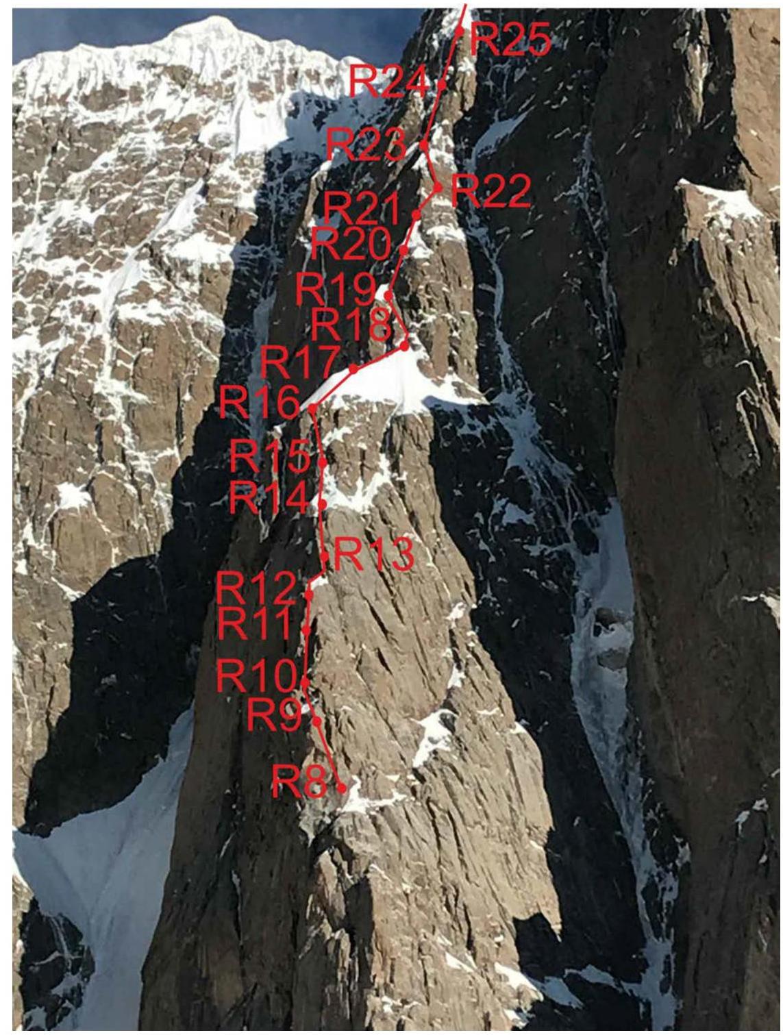
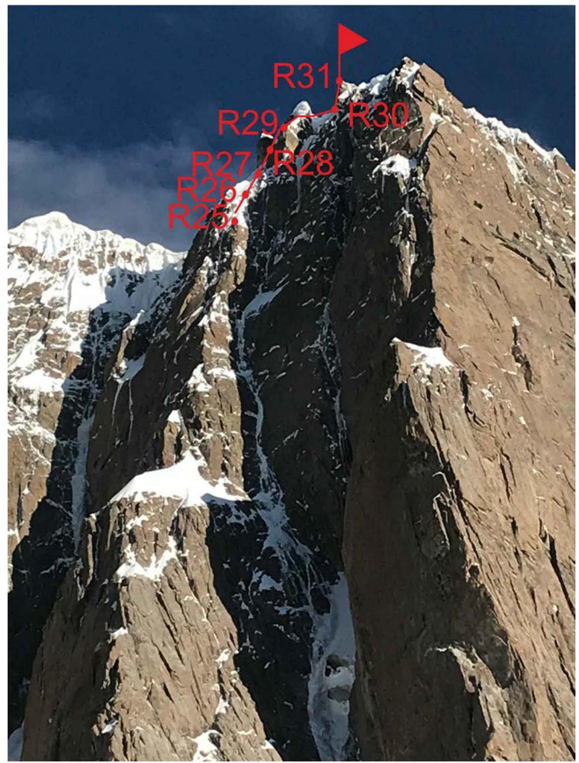
2.1 Technical Photograph
2.2 Section Numbers
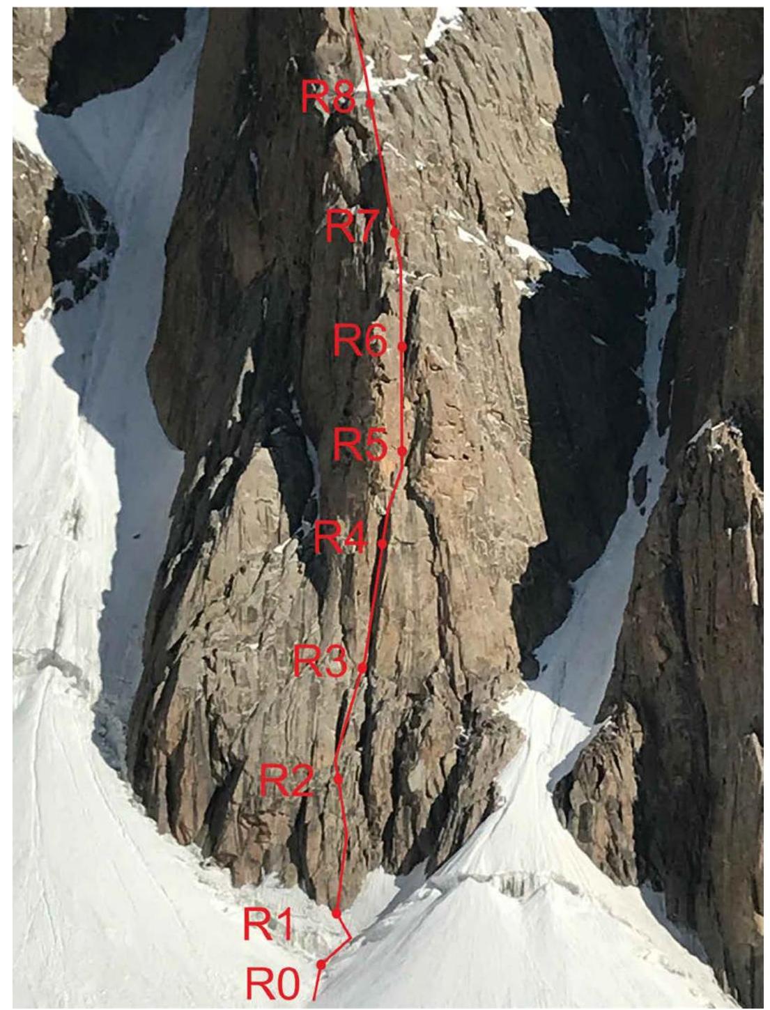
Route Start, 4670 m
Movement Schedule
2.3 UIAA Scheme
| Section | Length | Steepness | Difficulty | Camalots | Anchors and Fifis | Ice Screws | Skyhook |
|---|---|---|---|---|---|---|---|
| R0–R1 | 30 m | 45° | 2 | 2 | – | – | |
| R1–R2 | 45 m | 55° | 4 | 5 | 2 | ||
| R2–R3 | 20 m | 60° | 5 | 8 | |||
| 15 m | 60° | 4 | |||||
| R3–R4 | 50 m | 90° | 6, A2 | 14/7 | 4/3 | 1 skyhook | |
| 10 m | 76° | 5 | |||||
| R4–R5 | 50 m | 85° | 6, A2 | 18/14 | 3/3 | ||
| R5–R6 | 40 m | 75° | 6, A0 | 10/1 | |||
| R6–R7 | 15 m | 60° | 4 | 11 | 1 | ||
| 15 m | 80° | 6 | |||||
| R7–R8 | 45 m | 80° | 6, A1 | 10/2 | 4/3 | ||
| 15 m | 80° | 6 | |||||
| R8–R9 | 35 m | 60° | 4–5 | 5 | |||
| R9–R10 | 35 m | 50° | 4 | 4 | |||
| R10–R11 | 40 m | 75° | 6 | 7 | 1 | ||
| R11–R12 | 50 m | 80° | 6, A1 | 15/7 | 2/2 | ||
| R12–R13 | 45 m | 75° | 6, A1 | 8/4 | 1 | 1 skyhook | |
| R13–R14 | 55 m | 80° | 6, A1 | 14/10 | 3/3 | ||
| R14–R15 | 35 m | 50° | 4 | 5 | 1 | ||
| R15–R16 | 55 m | 75° | 5 | ||||
| R16–R17 | 60 m | 60° | 5 | 4 | |||
| R17–R18 | 60 m | 60° | 5 | 1 | 3 | ||
| R18–R19 | 50 m | 70° | 6, A1 | 7/5 | 4/1 | ||
| R19–R20 | 15 m | 60° | 6 | 4/2 | 3/3 | 3 | |
| 15 m | 90° | 6, A1 | |||||
| 15 m | 60° | 5 | |||||
| R20–R21 | 45 m | 70° | 5 | 2 | 2 | ||
| R21–R22 | 20 m | 80° | 6, A1 | 6/4 | 3/2 | 2 | |
| 25 m | 60° | 5 | |||||
| R22–R23 | 30 m | 70° | 6, A0 | 7/1 | |||
| R23–R24 | 50 m | 65° | 5 | 3 | 2 | ||
| R24–R25 | 55 m | 80° | 6, A1 | 8/2 | 10/7 | ||
| R25–R26 | 55 m | 70° | 6 | 3 | 3 | ||
| R26–R27 | 55 m | 65° | 5 | 1 | 1 | 3 | |
| R27–R28 | 55 m | 70° | 6 | 3 | 1 | 4 | |
| R28–R29 | 55 m | 65° | 5 | 2 | 3 | ||
| R29–R30 | 30 m | 65° | 5 | 2 | 4 | ||
| 30 m | 65° | 5 | |||||
| R30–R31 | 35 m | 60° | 5 | 4 | 3 |
3. Team Actions Characteristics.
R0–R1
R1–R2
R2–R3
R3–R4
R4–R5
R4–R5
R5–R6
R6–R7
R7–R8
R7–R8
R7–R8 Overnight

R12–R13
R13–R14
R15–R16
R17–R18
R19–R20
R21 Overnight
R22–R23
R24–R25
3.1 Route Description
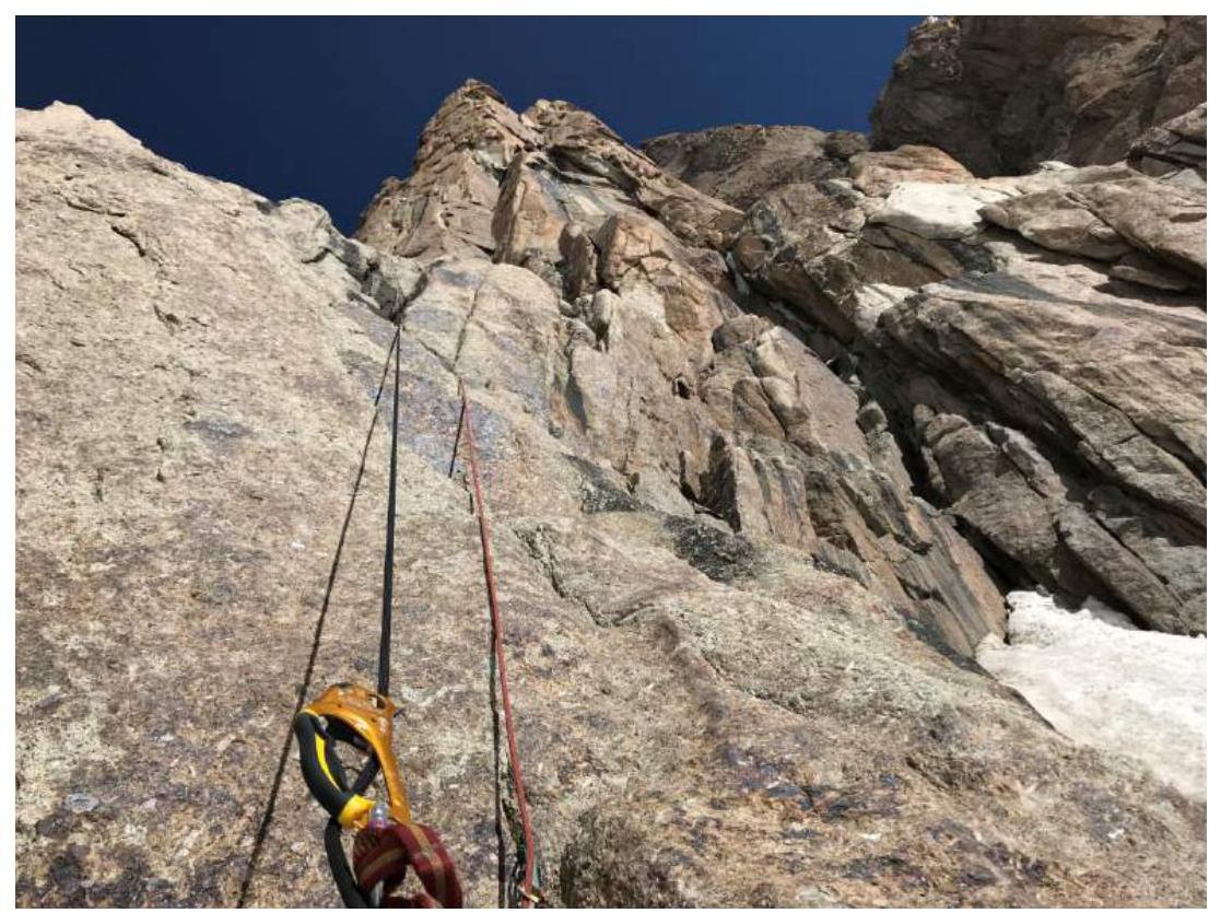
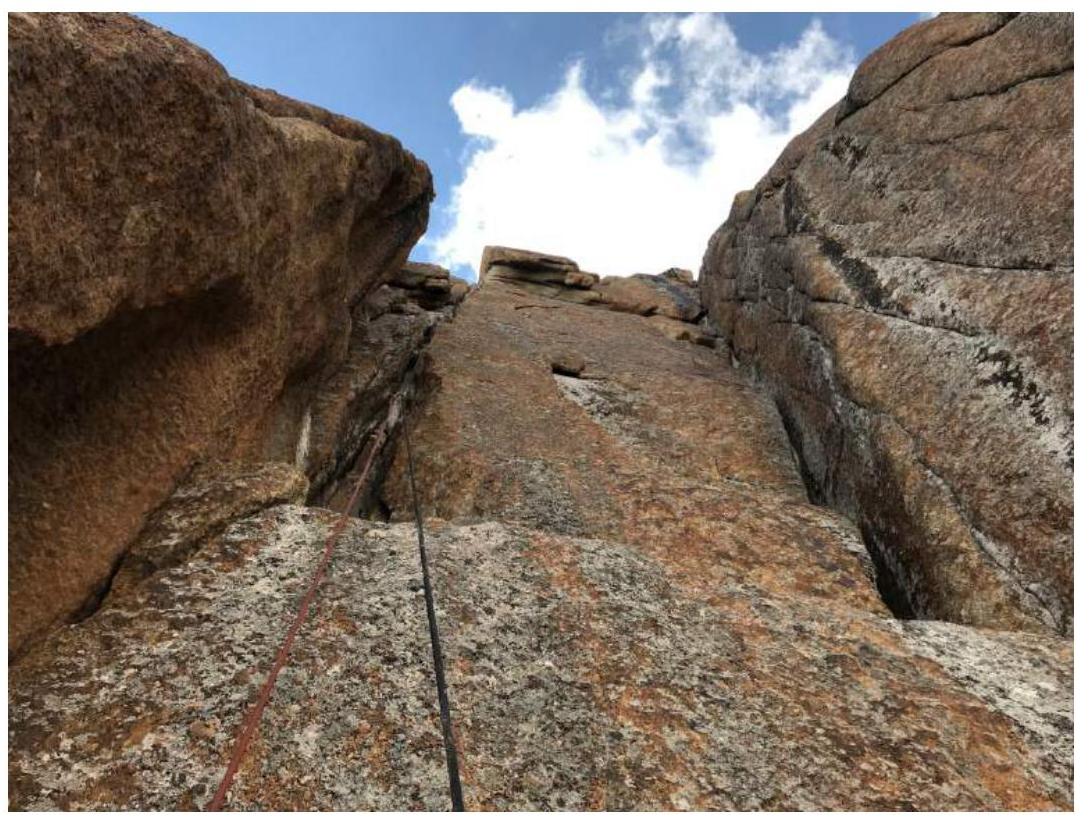
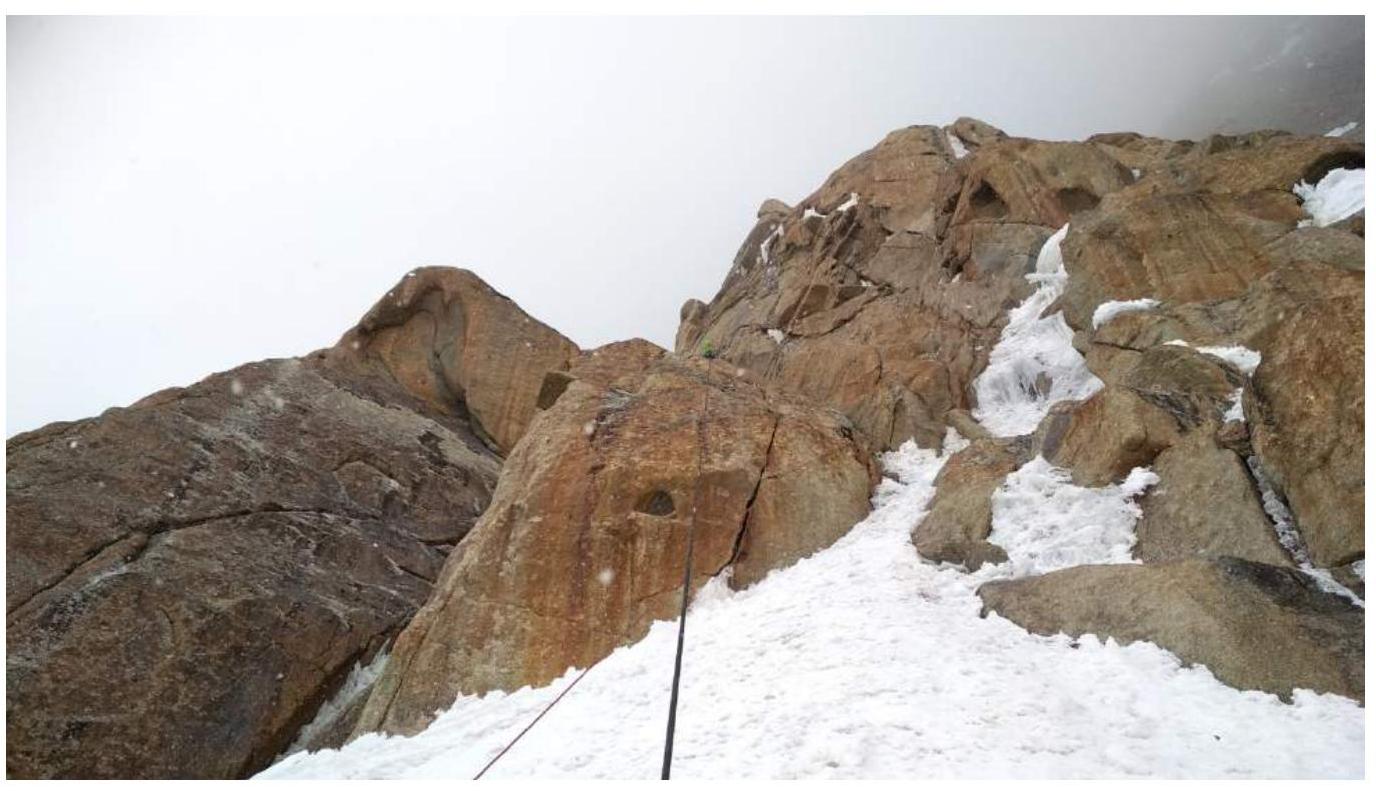
The route follows the south ridge of Kyzyl-Asker. The ridge is broad, slightly inclined to the left, and extends to the summit without a clear edge. Except for the first few ropes, the choice of route is not obvious. You can climb slightly to the left or right.
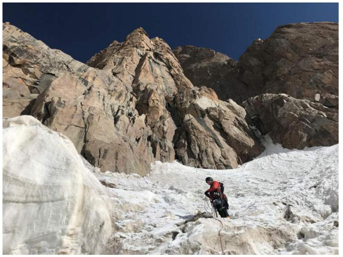
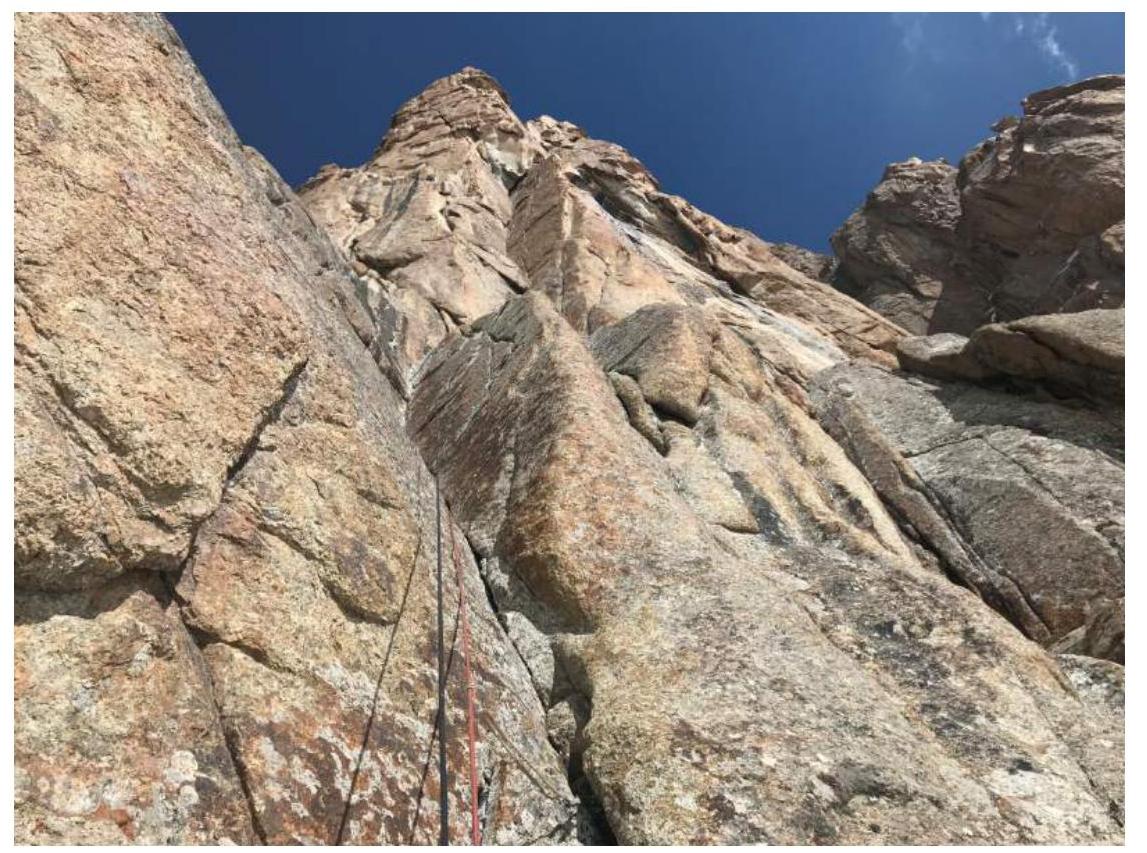
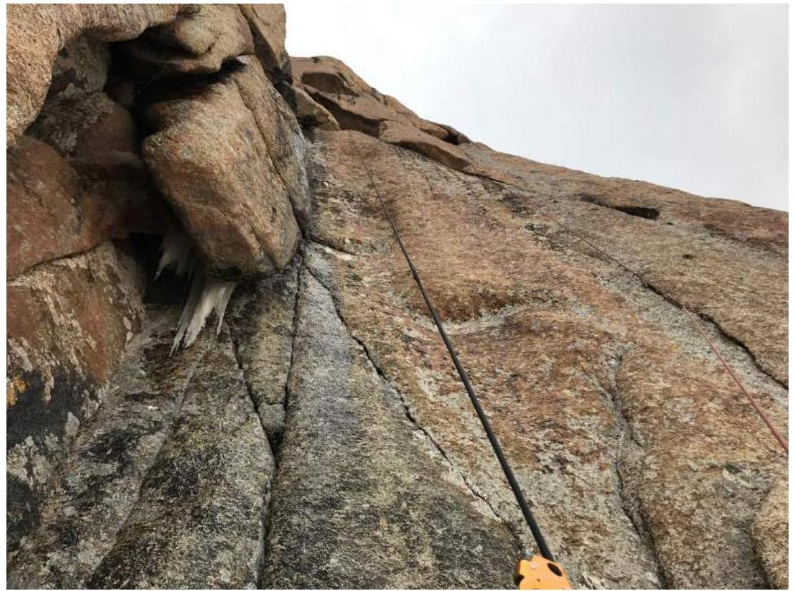
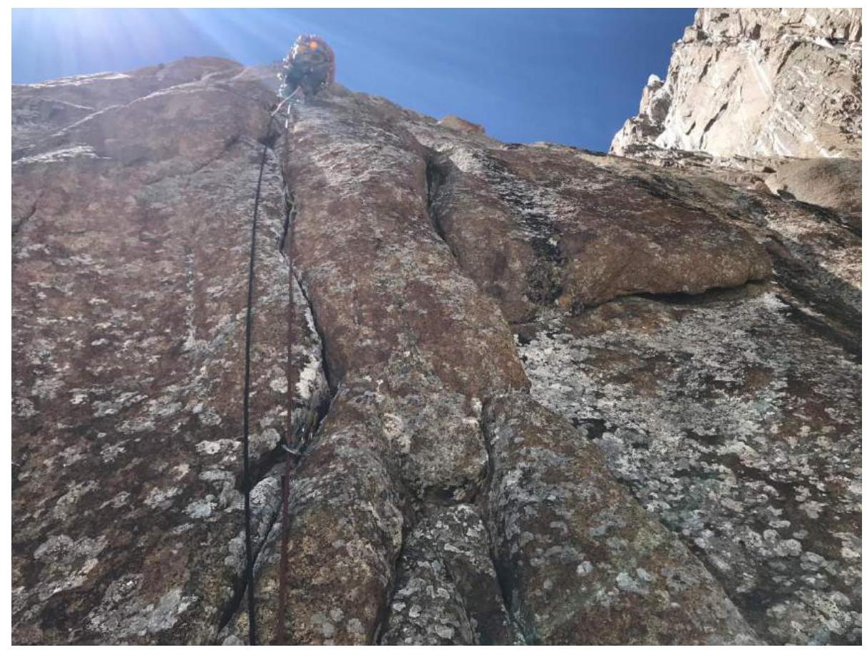
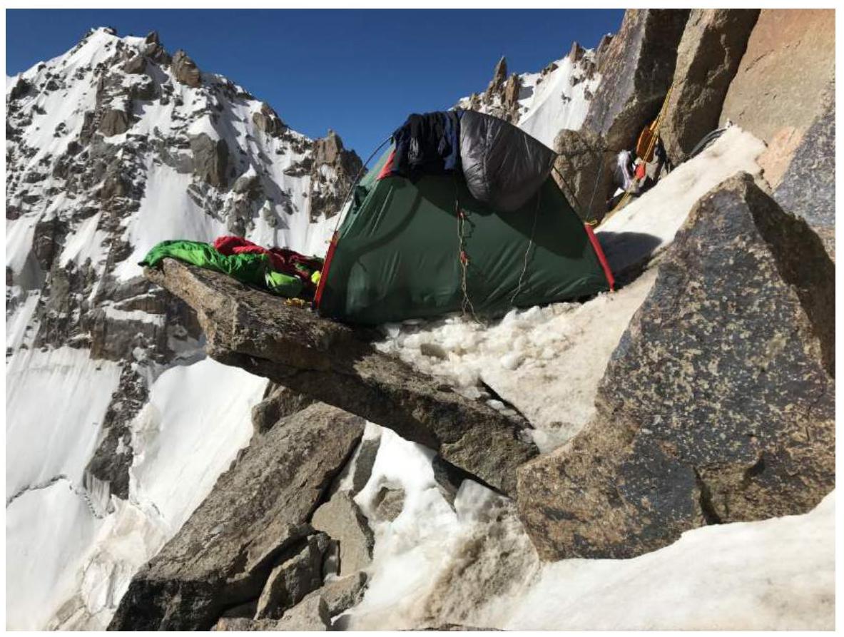
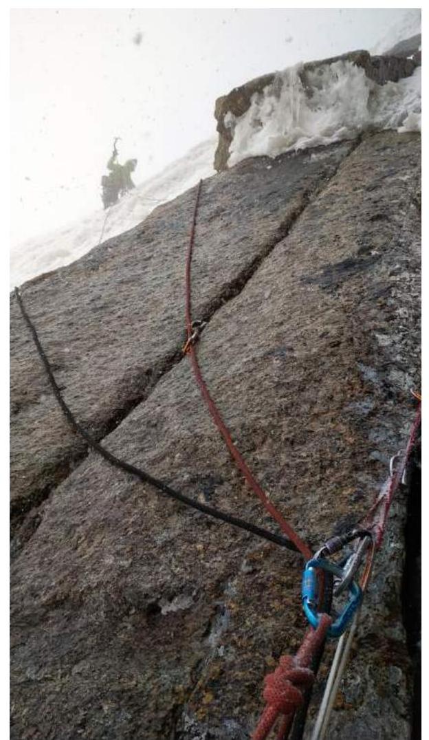
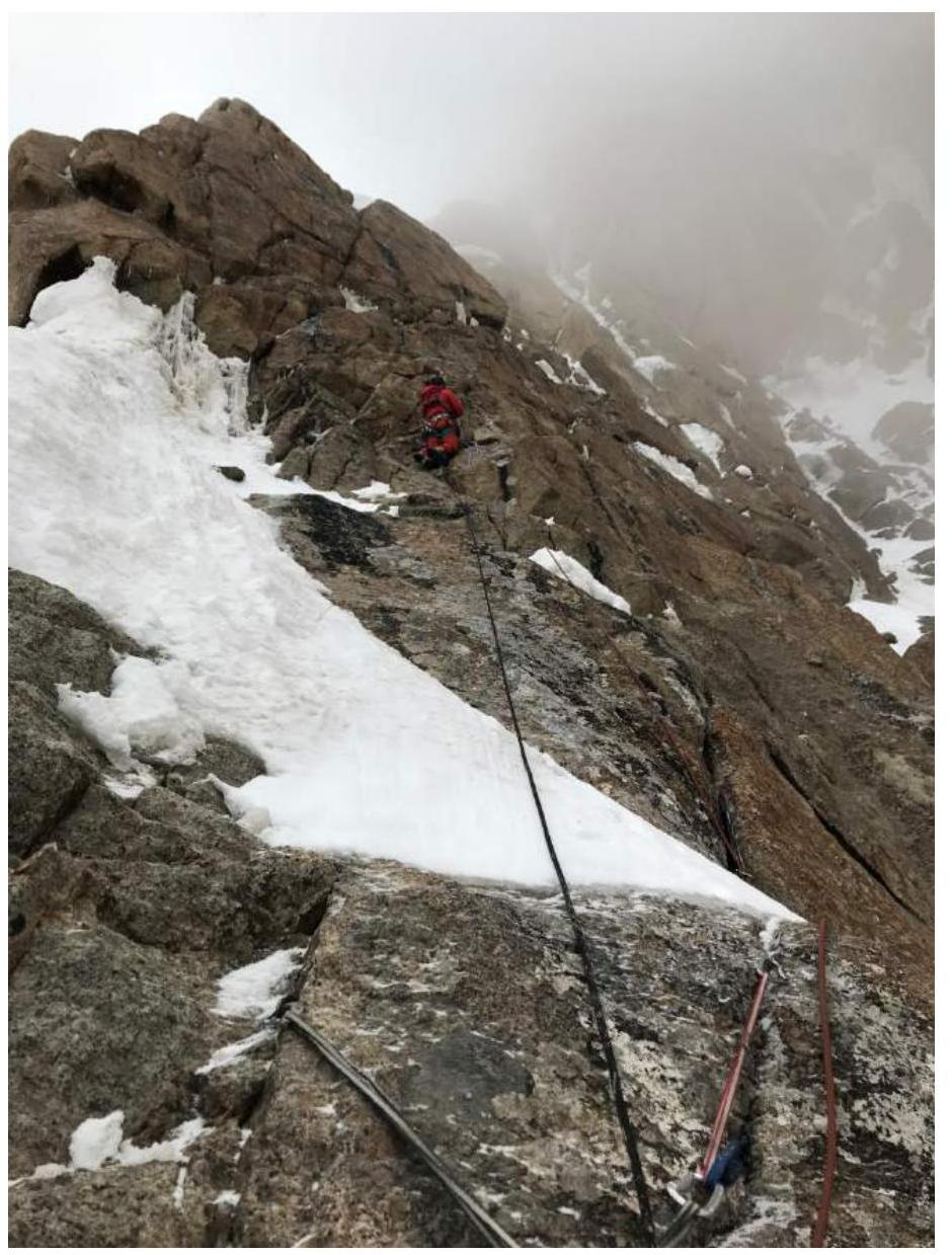
The route begins by overcoming the bergschrund under the ridge. The crevasse is small with bridges and does not present significant difficulties. Then, ascend a snowy slope under the rock (R1). Climb walls and ledges with easy climbing to reach an internal angle (R2). Continue up this and the next steeper angle to a large vertical internal angle (R3). We set a station just short of it, on a convenient ledge, and were 60 meters short of climbing it entirely. Closer to the middle, the crack in the angle becomes wide enough to wedge oneself in it. Station below an overhanging chimney (R4). Through the chimney and up a wall, then right along the wall with a crack and several cavities not typical for granite. Station in a crevice on a ledge to the left (R5). The route then generally goes slightly to the right of the ridge, sometimes returning to it. Upwards via cracks. The cracks on the route are peculiar, slightly opening, with chipped edges, but the camalots generally hold securely. Station R6 is on a ledge. A small wall up to ledges with snow, then it becomes steeper (R7). Up via cracks and fissures to a ledge with snow, here R8. There is no deep, loose snow on the route; under a thin layer lies ice. Although there are many rock ledges for overnight stays, reaching them requires effort. In the lower part of the route, this is easier. We spent the first night a rope length and a half below, on a protruding rock.
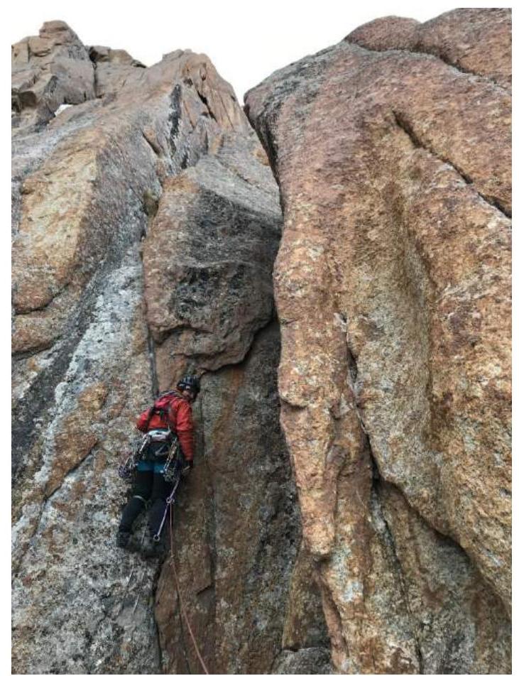
From R8, continue up a relatively easy crack to the next snow patch (R9). Via rock to the right of it under an internal angle (R10). Up this angle (R11) and further via cracks to a ledge (R12). From the station, left (using a skyhook) to another crack. Up this crack, exit to a ledge (R13). Another challenging rope length to a ledge with R14. Then, easy walls and snow under an internal angle (R15). Up this angle, then along a wall to the left to a ledge where we organized our second overnight stay and control checkpoint. Station R16 is 10 meters higher. Here, it becomes clear that the large snow ledge on the route is not a ledge; it's a sharp snow-ice ridge descending at an angle of 30 degrees, with steep slopes on both sides.
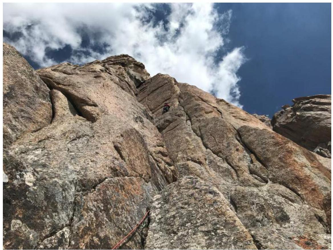
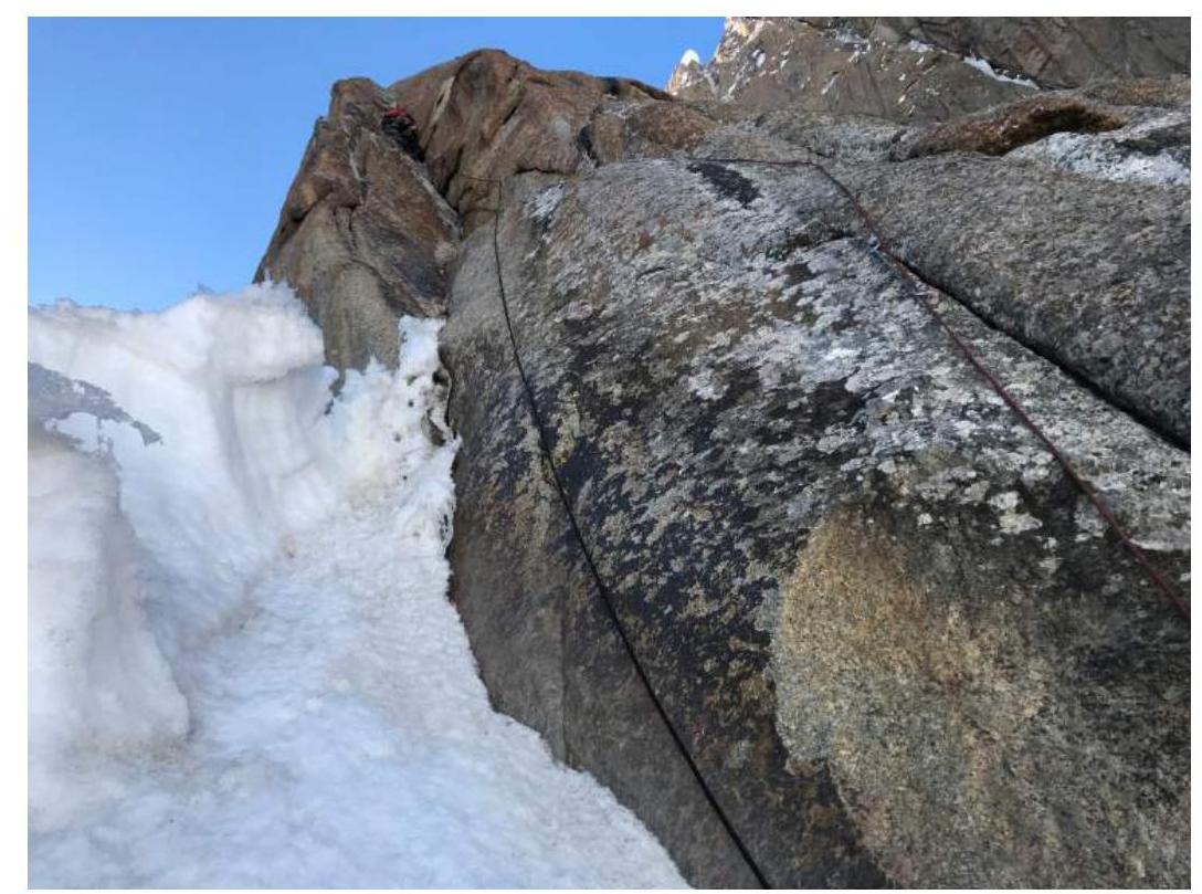
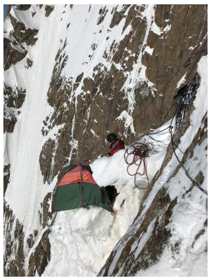
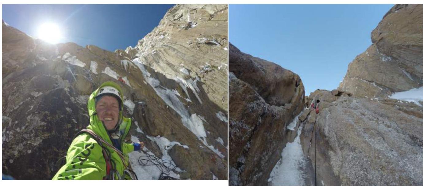
The mixed part of the route begins here. Ice appears in the cracks. Ledges free of ice for sleeping are no longer found. The weather, which had been favorable for the first two days, ended. Leaving spare gas and some unnecessary gear, we climbed upwards. The snow-ice ridge was two rope lengths long (R17, R18). The station is on rocks. We moved along its 60-degree slope. The layer of snow over the ice is uneven, making it easier to belay. Then, left upwards via a lying-down internal angle (R19). From it, left to snow and a vertical rock crack. Above, snow (R20). Another rope length via snow between rock walls (R21). Our first overnight stay, entirely carved into ice.
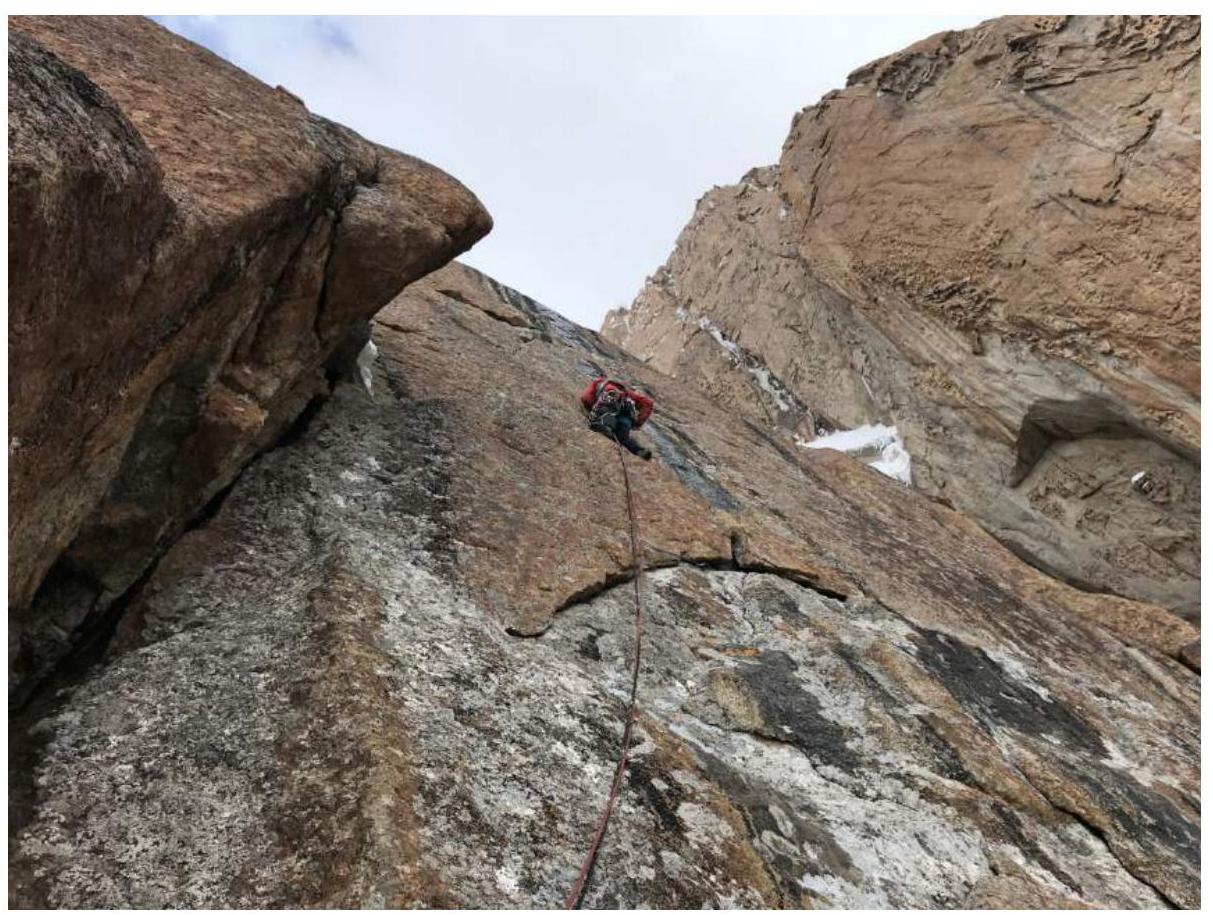
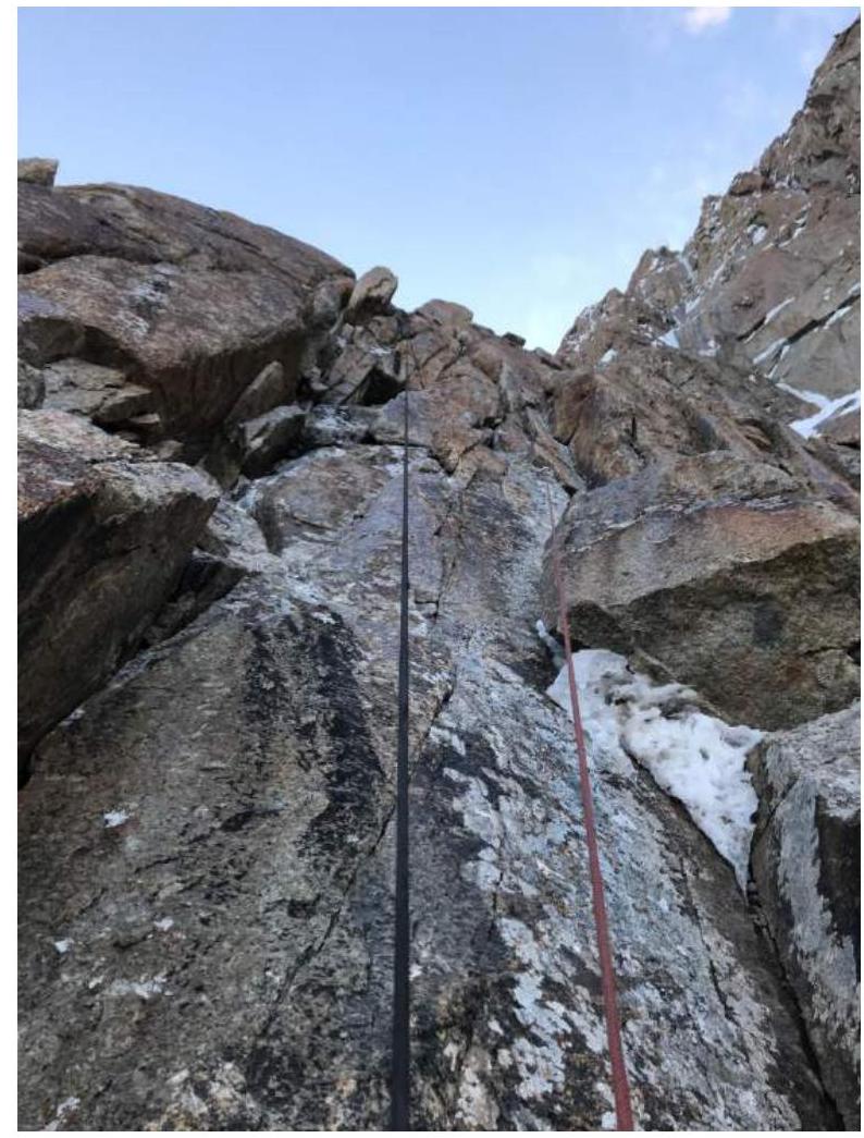
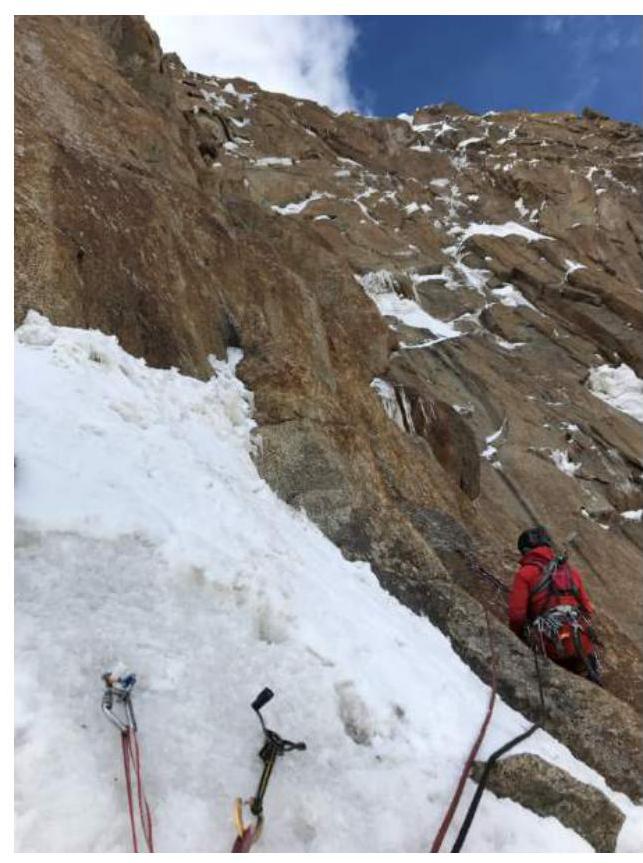
Up via rock, then snow, to the right around a bend. On a ledge R22. For the next 30 meters of rock, we swapped leads (R23). Another rope length of ice under a rock wall (R24). Further up the rock, right towards a large crevice. After a slightly overhanging section, a station at the base of a large snow couloir (R25). Here, the route converges with the "Lost in China" line. Whether they coincide further is unclear; the upper part of the previous route is not clearly marked in the materials found. Likely, they do coincide. Descending half a rope length in an ice ridge, we carved out the next overnight stay, losing a bolt from the beak of one of our tools in the process. We repaired the top of the route, wrapping it with tape. The ledge was small, the overnight stay was seated, and the next day had poor weather – the most unpleasant 34 hours on the route. In the morning, the sun appeared for two hours, and we managed to dry our wet clothes.
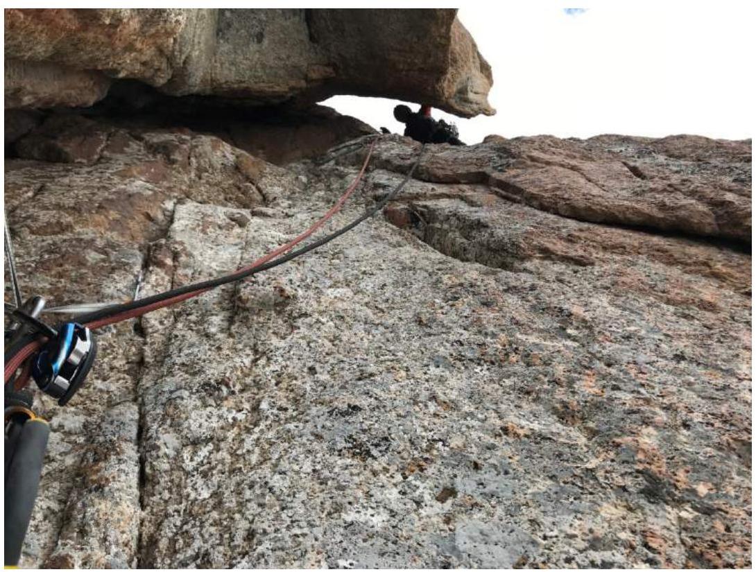
The next four rope lengths go via a snow-ice slope towards a large snow "mushroom" on the ridge. A large rock wall after R27 is bypassed on the left. Station R29 is on rock under the "mushroom." We overnighted on a ledge above. To the right, a snow "sleeve" goes up. Further via it and to the right under an ice cornice. We did not immediately choose this line and lost three hours searching for a path to the left. From under the cornice, the summit is visible. Traverse a steep slope for 30 meters to R30 on rock. Up left around a bend, and climbing in a spiral, reach the summit.
We reached the summit around 17:00 on July 30, 2018. We did not find a note on the rock wall visible in the photo or two meters higher on the summit itself. Only a driven anchor hook with a rappel loop was found 10 m below the summit. We hammered in a hook and left our can.
The weather was windy and cloudy. The valley on the Kyrgyz side was visible through breaks in the clouds.
We began our descent. We decided to overnight on a very convenient snow ledge near the summit. The descent via the ascent route took a day and a half. We rappelled, mostly slightly off the route. After descending, we ate and headed to the base camp. We reached the tents by 1 am.
3.2 Summit Photos
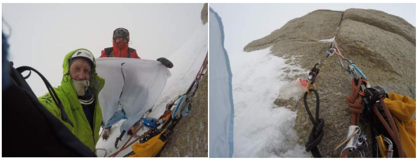
Summit Control Checkpoint
Descent

3.3 Conclusion
The route is very logical and safe. Rocks do not fall, and the probability of avalanches is very low, except for powder snow. The ice, covered with loose snow and crumbling, is somewhat unpleasant.
Communication. The radio works only under the mountain. The satellite phone works perfectly.
Descent. We considered descending via the other side but immediately dismissed it. Snowshoes and sleds were left on the glacier. Descending via the ascent route is logical and safe. 28 rappels of 60 m.
We believe that, considering the height, terrain character, and difficulty, the route fits category 6B.
Murin has two 6B ascents in his experience, one of them as a pair (Klenova's route on 4810 m), and three 6A ascents (one in winter, Dorro's route on Yerydag) (one in a pair, Klenova's route on P. Slesova). Also, about 30 routes of category 5.
Penyayev has two 6A ascents, one of which is a first ascent. And 13 routes of category 5.
3.4 Team Tactical Actions. We obtained permission for the first ascent from our coach, Timoshenko T. I. Several lines were drawn, but we leaned towards one. After thoroughly studying satellite images and photos from other teams, we decided on this line. Having coordinated and roughly outlined the tactics of movement.
The route line was approximately drawn in the city. In reality, it was fully confirmed. The route is 100% tied to the terrain. Without any unnecessary climbing or unclear moves. We worked without prior processing. Two days were sunny, and we understood that we needed to climb the rock as quickly as possible (16 rope lengths). The mixed part was climbed in a fierce battle with ice (crumbling).
Acclimatization overnight stays were at altitudes: 4900 m – 1 time, 4600 m – 2 times.
It should also be noted that there are almost 15 km between the base camp and the wall, and this is through two passes – 4200 m and 4900 m – on snowshoes and sleds.
Necessary equipment for a safe and successful ascent:
- Snowshoes – for each participant
- Sleds
- Crampons – for each participant
- Ice screws – 8 pieces
- Camalots – a set
- Anchors – 15 pieces
- Fifis
- Ice axes
- Rappel loops (cord)
4. Weather Conditions Characteristics.
The weather was good for this area. One day, heavy snow fell, and we decided not to get our gear and clothing wet. We stayed in the tent.