
MINISTRY OF SPORTS, TOURISM AND YOUTH POLICY OF KRASNOYARSK TERRITORY
KRASNOYARSK TERRITORY ALPINISM FEDERATION
2016 Russian Championship in Alpinism
Class of High-Altitude Technical Ascents
Report
On the combined team of Krasnoyarsk Territory: Peak Kyzyl-Asker 5842 m via the center of the southeast wall, "Kop'e" route
Proposed grade:
- 6B category of difficulty
- First ascent
Krasnoyarsk 2016
Ascent Passport
-
Region — Tian Shan, Kokshaal-Too ridge, 7.5.
-
Peak — Kyzyl-Asker, 5842 m via the center of the southeast wall, "Kop'e" route.
-
Proposed grade — 6B category of difficulty.
-
Route character — combined.
-
Route characteristics:
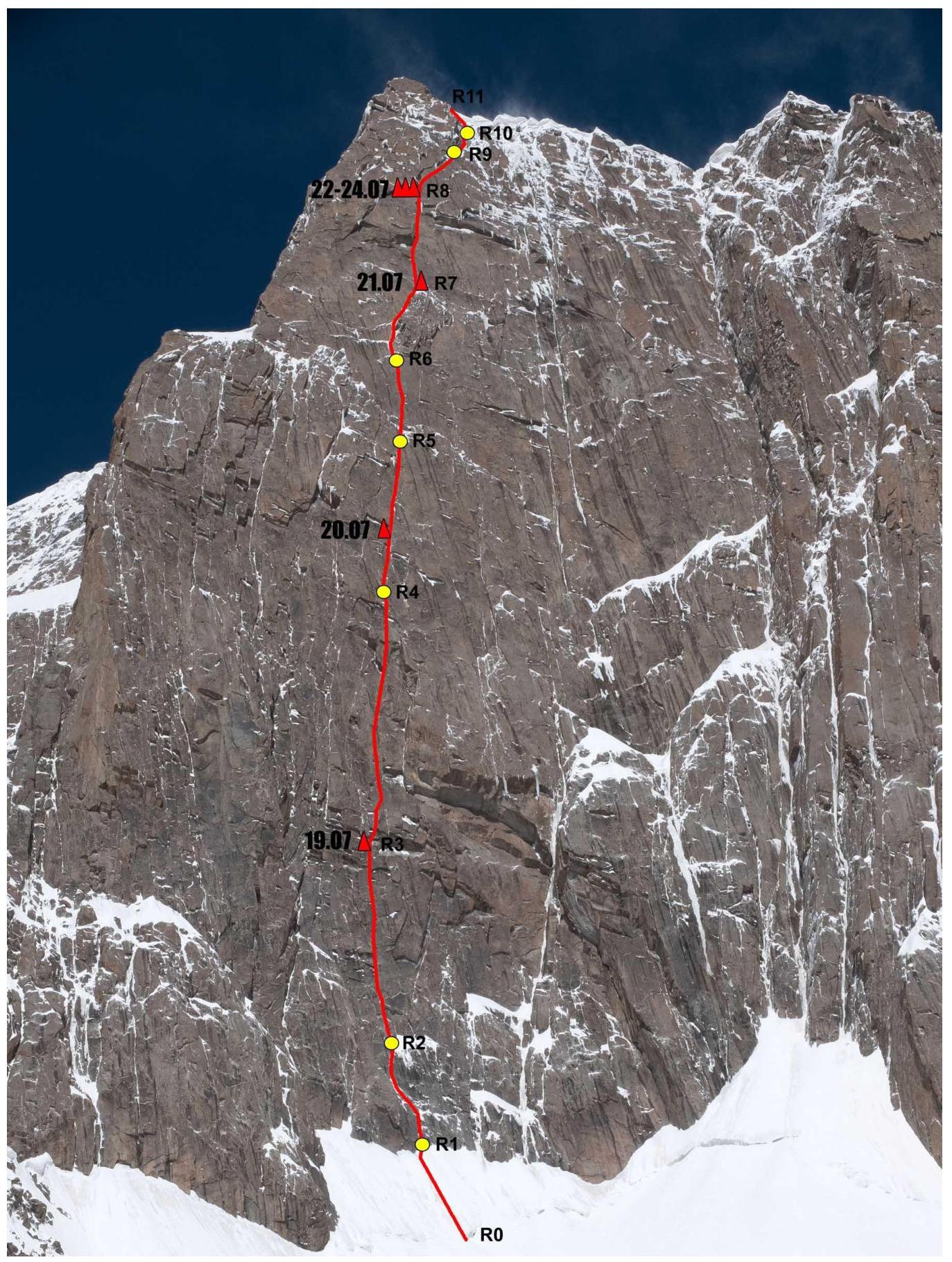
Wall section height difference — 1058 m, total route height difference — 1162 m. Route length — 1290 m, sections with 6th category of difficulty — 810 m, 5th category of difficulty — 150 m, average steepness of the wall section — 72°.
-
Left on the route: pitons — 9, including 9 bolts. Total ITC used — about 500.
-
Time to the summit — 53 hours, days — 5.5.
-
Leader — Khvostenko Oleg Valerievich, Master of Sports
Participants: Terekhin Vasily Andreevich, Master of Sports, Parfenov Alexander Alexandrovich, Candidate for Master of Sports
-
Team coaches: Zakharov Nikolai Nikolaevich, International Master of Sports, Honored Coach,
Balezin Valery Viktorovich, International Master of Sports
-
Departure date:
On the route — July 19, 2016, at 11:00, on the summit — July 24, 2016, at 13:30, return to the camp — July 25, 2016, at 14:00.
-
Organization: Ministry of Sports, Tourism and Youth Policy of Krasnoyarsk Territory
Description of the Region
The western Kokshaal-Too region is relatively undeveloped by climbers. The region has a large number of peaks with heights around 6000 m. The most interesting among them are:
- Peak Kyzyl-Asker (5842 m)
- Peak Krylya Sovetov (5800 m)
- Peak Shmidta (5954 m)
- Peak Dankova (5982 m)
- Peak Chon-Turasu or Joldash (5729 m)
- Peak Alpinist (5641 m)
- Peak Sergei Korolev (5816 m)
- Peak Bely (5697 m)
This region is characterized by a combination of typical alpine forms (many vertical rock walls with a height difference of about 1–1.5 km) and significant glaciation. The entire region, including the lowlands, is a permafrost zone. There are often swampy areas up to heights of 4000 m.
The snow line is at an altitude of about 4000–4500 m above sea level. The river valleys have heights of about 3000–3500 m above sea level. The climate in the valley is harsh, and the weather is unstable.
Kyzyl-Asker translates from Kyrgyz as "Red Horseman" or "Red Army Man." The first ascent on this mountain was made by K. Valiev's team in 1985. The legendary team ascended the mountain via the northwest wall as part of the USSR Championship in alpinism in the high-altitude technical class.
The southeast wall of the peak is composed of strong, monolithic granites, with a height difference of 1000 m and a steepness of about 70°. All cracks and corners are filled with ice, and snow lies on the ledges.
Currently, four independent routes have been established on the main wall:
- Odintsov's route
- "War and Peace"
- "Kop'e"
- "Lost in China"
and another route (Ecuadorian) passes through one of the eastern bastions.
The approach to the southeast wall from the base camp on Lake Bivachnoye goes via the Komarov West glacier, through the 4700 m pass, to the Rudnev glacier. Approximately 12 hours. Snowshoes are recommended.

Map of the
region 
- Odintsov — Ruchkin — Mikhailov, 2007
- Franco-Belgian variant, 2013
- "War and Peace" Nilov — Golovchenko — Grigoriev, 2014
- "Sal con Cebolla" Ecuador, 2014
- "Kop'e" Khvostenko — Terekhin — Parfenov, 2016
- "Lost in China" Papert — Lindich, 2016
Tactical Actions of the Team
The route was climbed in capsule style with a platform without prior processing. On July 19, we started from the forward camp in the Rudnev glacier cirque. Due to strong gusty winds and poor visibility throughout the night and morning, we were only able to start at 9:00. The approach to the start of the route took about 2 hours. We began working on the route at 12:00. Vasily Terekhin worked first. We covered about 300 m that day. Overnight stay under a large cornice (3 m hangout).
The leader changed every day thereafter: Parfenov, Khvostenko, Terekhin.
All overnight stays, except the third, were organized under cornices. The third overnight stay was on a snowy ridge, and the platform was compressed by snow flowing from the wall throughout the night.
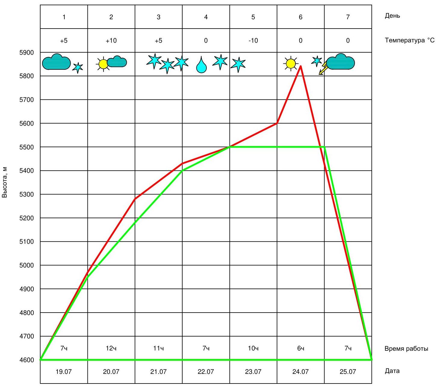
The weather during the ascent was changeable. It snowed almost every day.
On July 22, after lunch, heavy rain started (at an altitude of 5500 m!), turning into wet snow. As a result, we had to stop for the night under a large cornice at 15:00.
The night of July 23 was very cold. In the morning, all rocks, ropes, and equipment were covered with ice. This significantly slowed down our pace. We decided not to move the platform but to hang the available ropes.
On July 23, in almost winter weather conditions, Alexander Parfenov processed two and a half ropes (about 120 m).
On the day of the summit (July 24), the weather was excellent. We reached the summit at 13:30 and descended to the platform by evening.
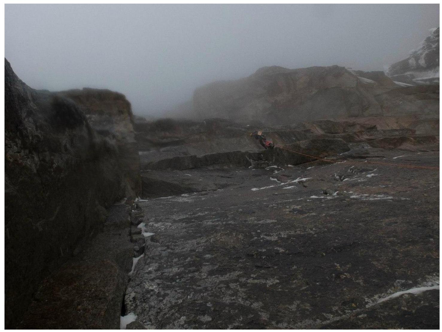
A thunderstorm hit on the night of July 25. In the morning, the descent via the ascent route took about 7 hours.
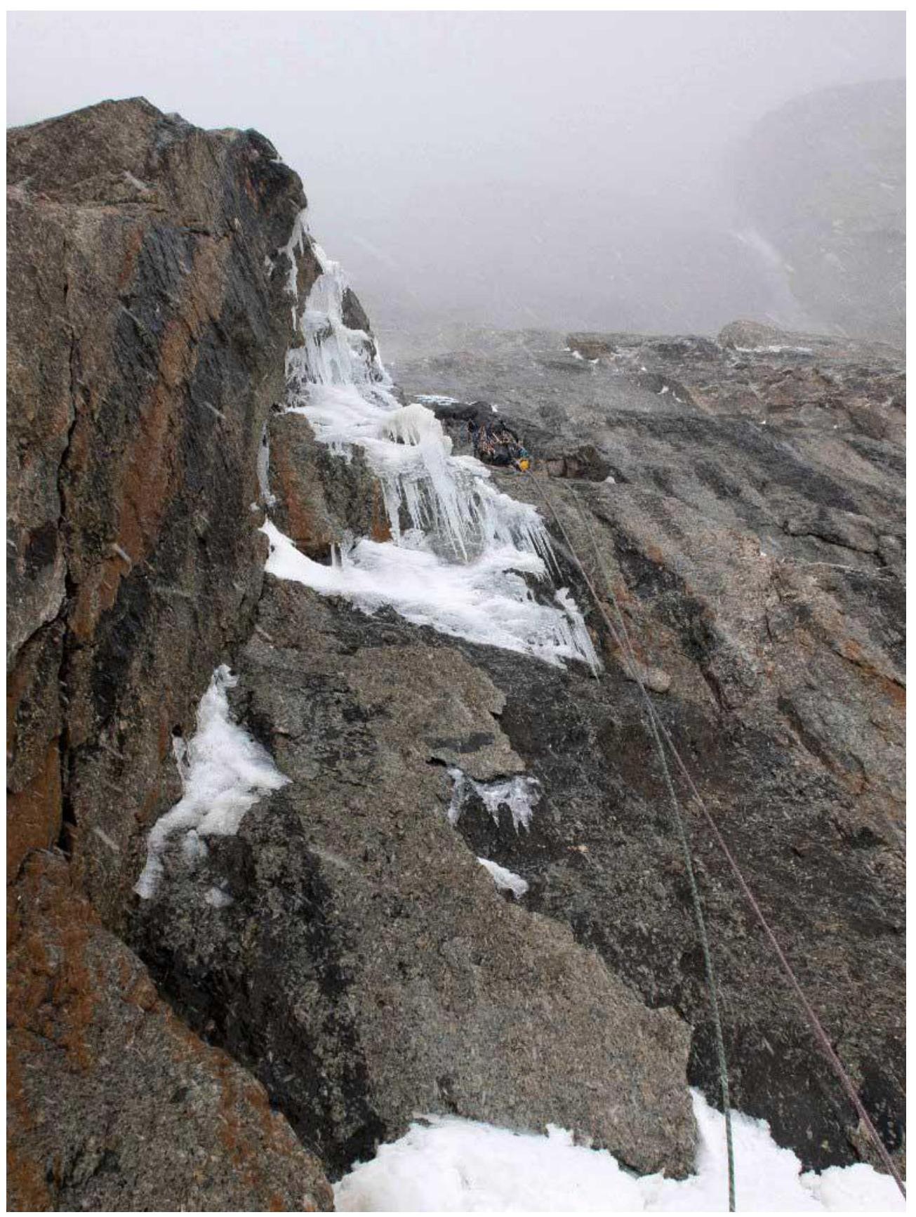
The main part of the route was climbed using ITC. With good weather, many sections could be climbed with free climbing. The terrain throughout the route is good, and the protection is reliable. Mixed climbing was complicated by extremely unreliable melting ice.
Technical photo of the
route 
Route profile
Route scheme in UIAA symbols
| № | Length, m | Angle | Category | |
|---|---|---|---|---|
| R12 | ||||
| R11 | 100 | 30° | IV | |
| R10 | 160 | 60° | III | |
| R9 | 80 | 65° | VI, M8 | |
| R8 | 80 | 70° | VI, A2 | |
| R7 | 100 | 80° | VI, A3 | |
| R6 | 80 | 60° | V, M6, A2 | |
| R5 | 90 | 75° | VI, A2 | |
| R4 | 100 | 75° | VI, A2 | |
| R3 | 200 | 80° | VI, A2 | |
| R2 | 160 | 80° | VI, A2 | |
| R2 | 70 | 70° | V, M7 | |
| R0 | 70 | 50° | II |
The approach from the assault camp to the start of the route via the glacier takes about 2 hours.
A landmark on the route is the characteristic rock outcrop — "Mashinka" — in the upper third of the wall. It is clearly visible from the foot of the wall. From above, "Mashinka" ends with a sharp snowy ridge — "Tip of the Spear."
Description of the Route by Sections
R0–R1 From the bergschrund upwards, a snowy-icy slope. 70 m, 50°. R1–R2 A system of internal corners and ledges, mixed climbing. 30 m, 75°. R2–R3 A system of cracks and internal corners with ice, sometimes with cornices. Overnight stay under a cornice. 160 m, 80°.
R3–R4 Through a cornice directly and then up and slightly right via cracks towards a large internal corner turning into a chimney. Many cornices are encountered along the way. 200 m, 80°.
R4–R5 A large internal corner with ice, turning into a chimney. Overnight stay before the start of the chimney on the left wall of the corner under a cornice. The chimney ends with an overhang. Exit through the overhang to the bend. 100 m, 75°.
R5–R6 After the bend, several ledges with snow. Then up the wall with good cracks in the direction of "Mashinka," bypassing it on the left. 90 m, 75°.
R6–R7 "Mashinka" is bypassed on the left via icy internal corners. In the lower part, there is a hanging icy cornice; after the cornice, the terrain becomes more gentle. Mixed climbing. Exit onto the sharp snowy ridge "Kop'e." Overnight stay. 80 m, 60°.
R7–R8 Up the wall with cracks in the direction of an internal corner leading to a large cornice with huge icicles. Through the cornice directly (caution, live blocks!). Exit through the bend via ice; one icicle needs to be cut.
15 m up the crack to the next cornice.
A convenient and safe place for an overnight stay.
100 m, 80°, A3.
R8–R9 Via the internal corner to the right of the cornice, then move right via cracks towards the wall's bend.
80 m, 70°.
R9–R10 Mixed terrain, corners with unreliable ice. 80 m, 65°. R10–R11 Snowy-icy couloirs to the exit onto the ridge. 160 m, 60°. R11–R12 Gentle firn ridge, gradually becoming steeper. Before the summit, a 5 m rock wall. 100 m, 30°.
Descent via the ascent route.
Movement Schedule
Section
R1–R2 
View upwards from station
R2 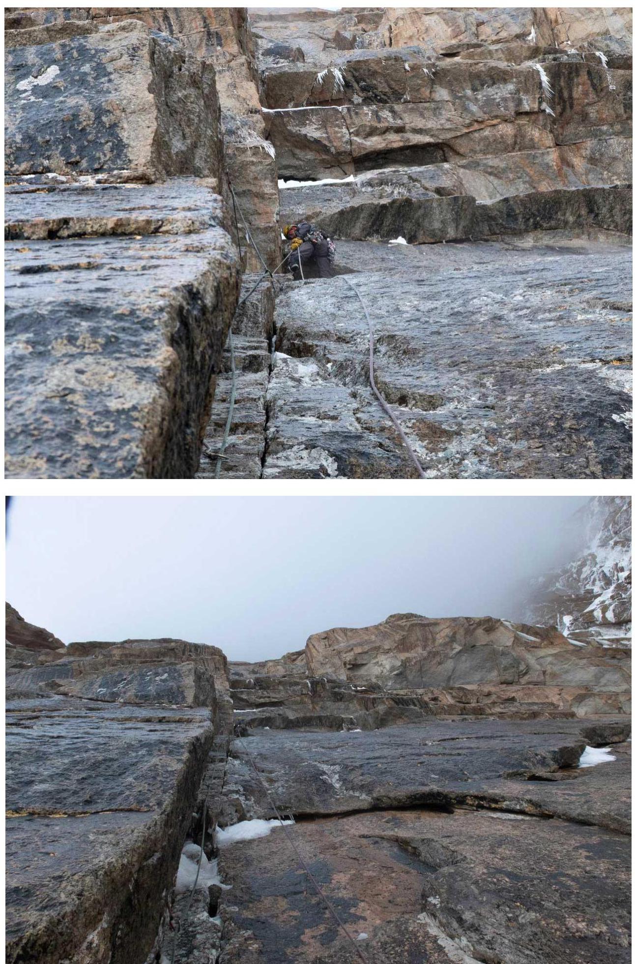
Section R2–R3. Ahead is a belt of
cornices 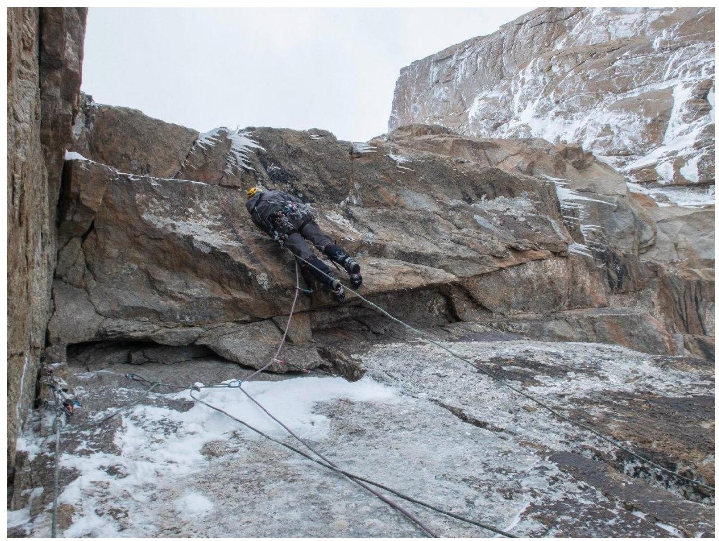
Station R3, start of section R3–R4. Vasily Terekhin passes a "small" cornice. Here was Camp
1 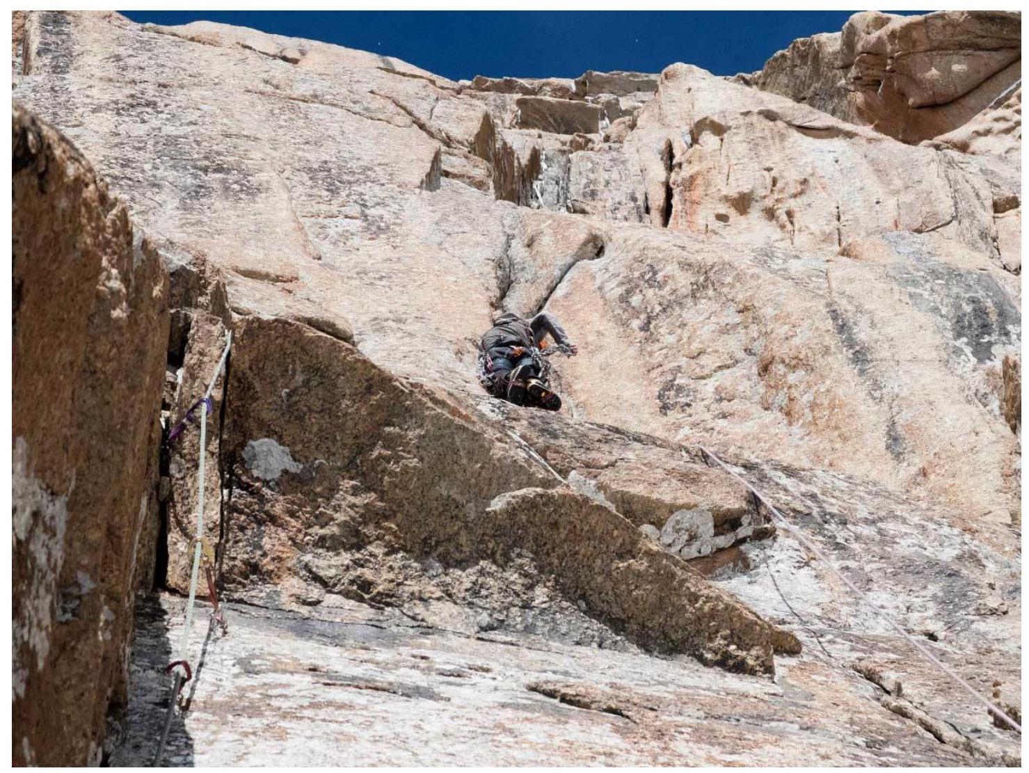
Section R3–R4. Second day of ascent. Alexander Parfenov is leading
Section R3–R4. Alexander Parfenov passes a series of
cornices 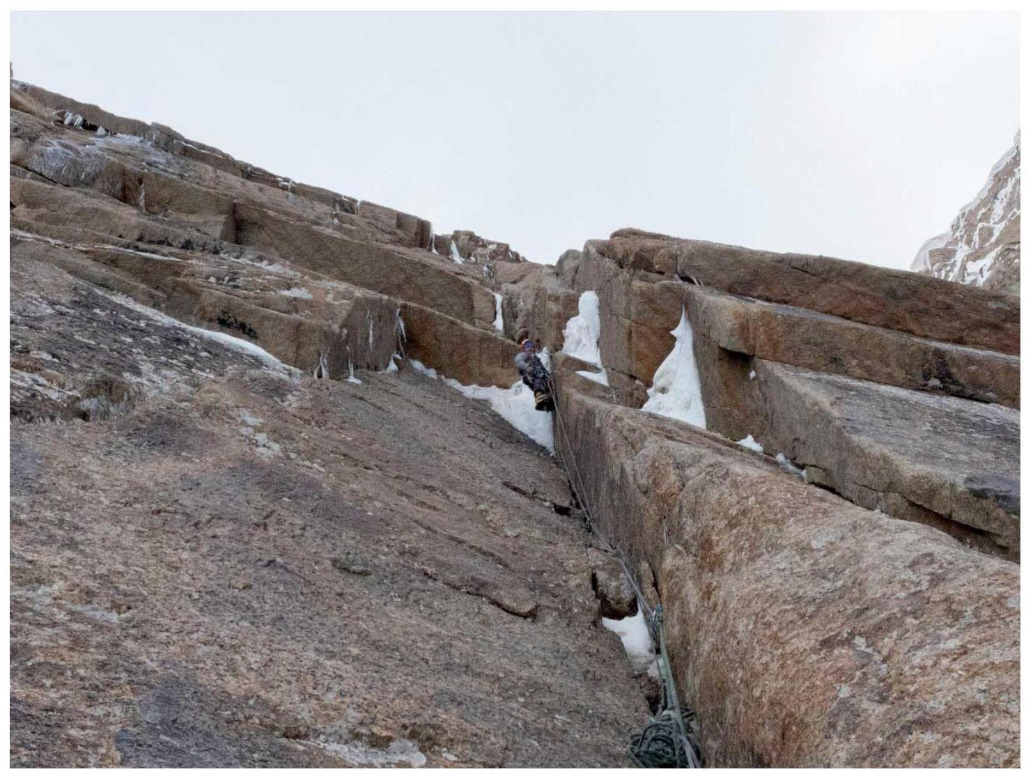
Section R4–R5. Large internal
corner 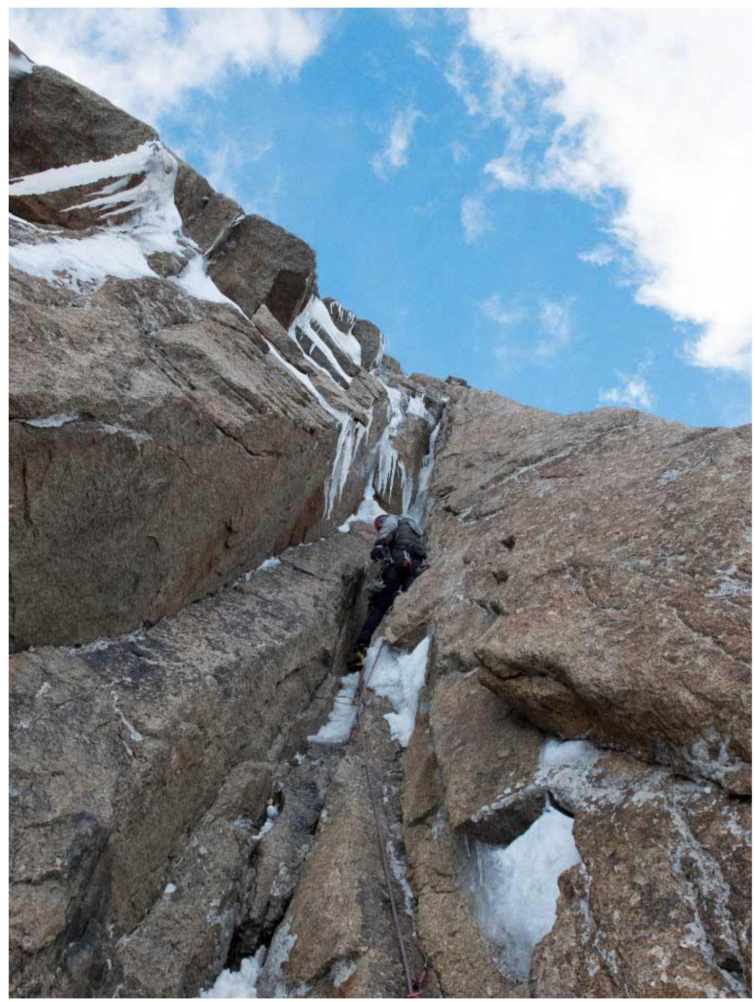
Section R4–R5. Upper part of the chimney; the exit beyond the bend is
visible 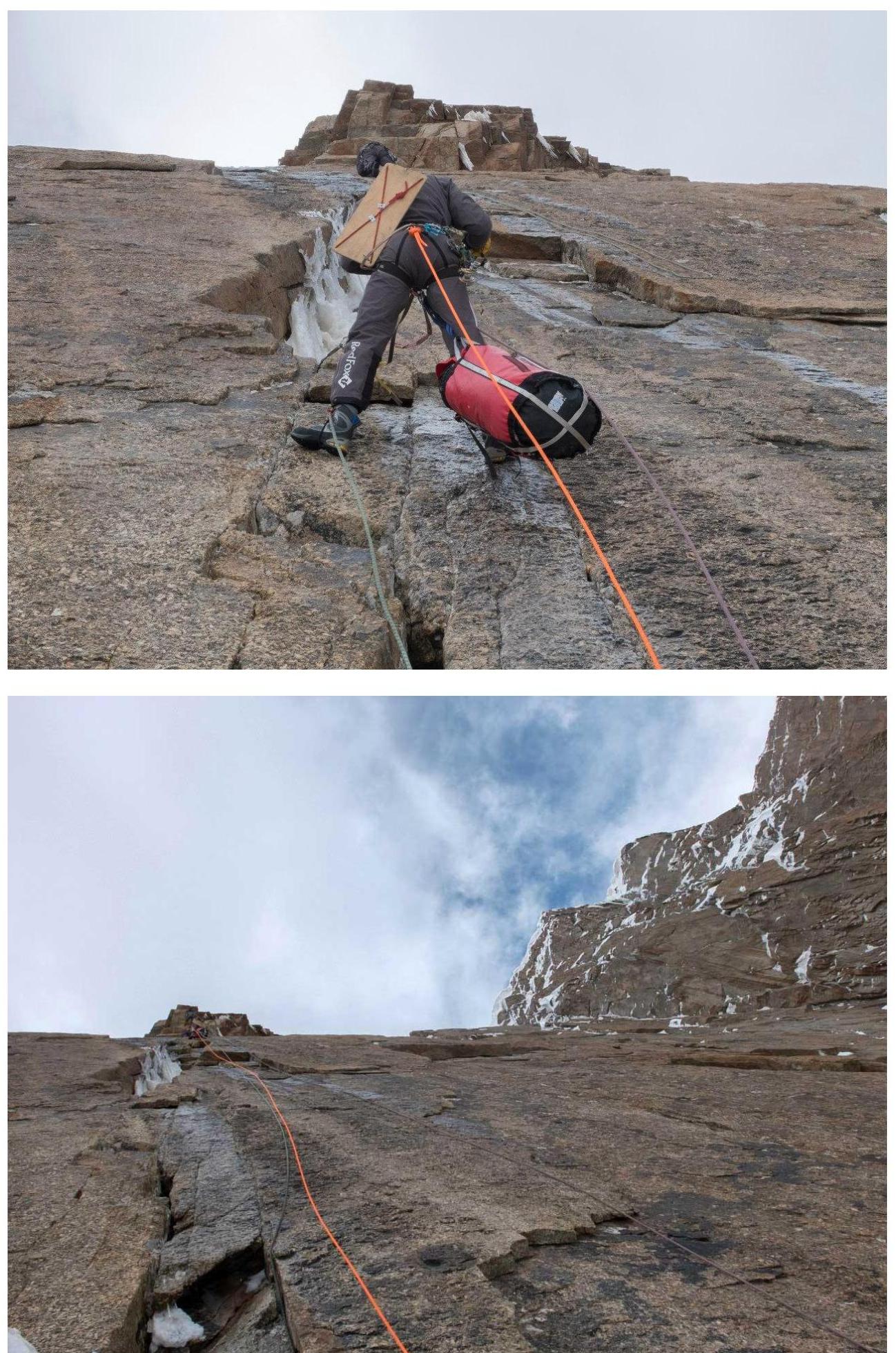
Section R3–R4. Third day of ascent. Ahead is "Mashinka"
outcrop 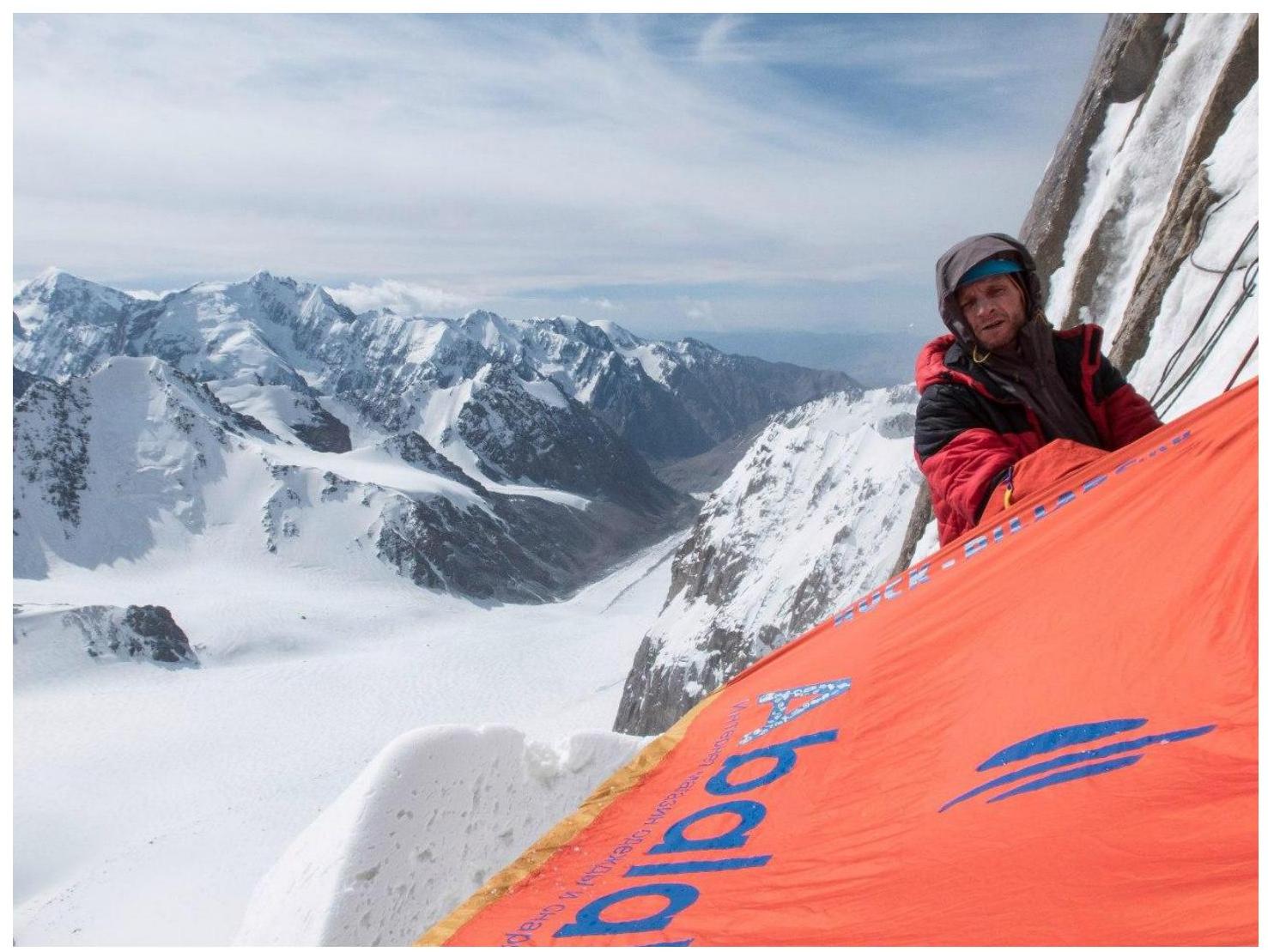
Station R7. Overnight stay on "Tip of the Spear." Start of the fourth day of
ascent 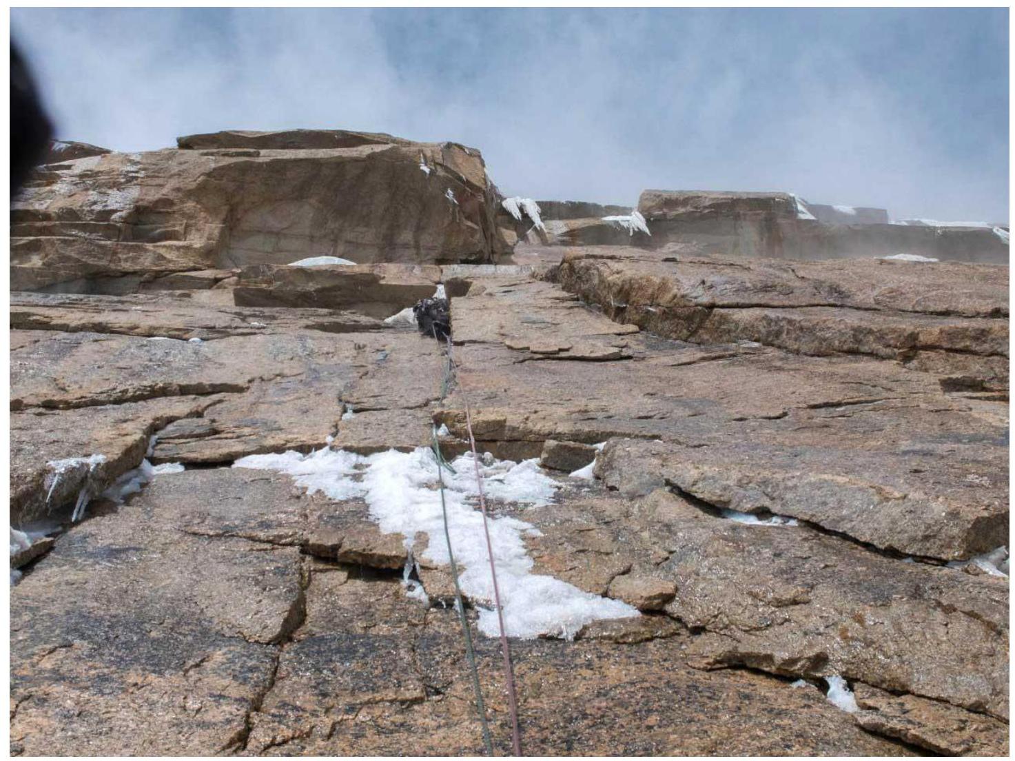
Section R7–R8. Vasily Terekhin approaches a large cornice with two
icicles 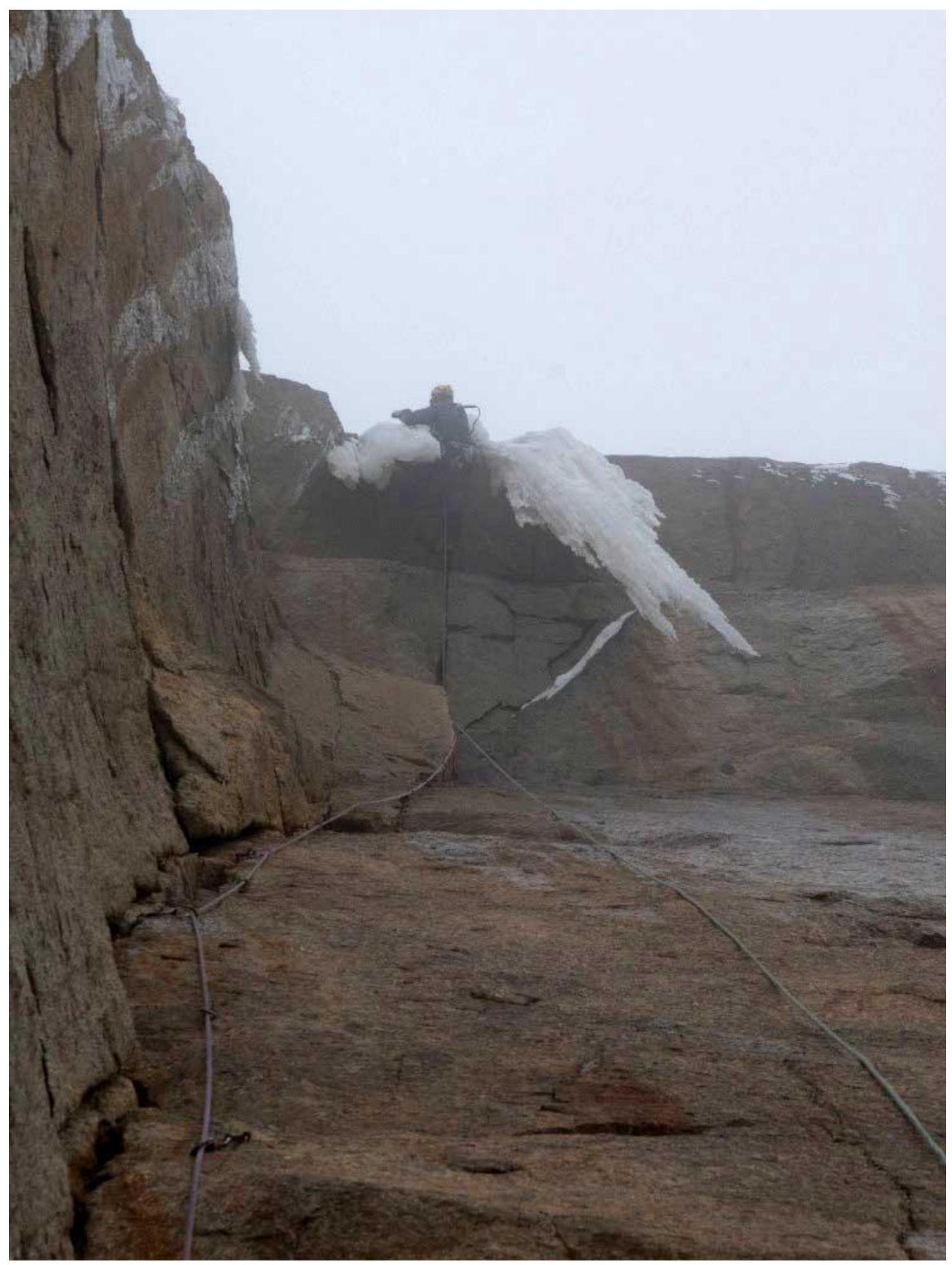
Section R7–R8. Vasily Terekhin passes the "large"
cornice 
Station R8. Camp 4 under the
cornice 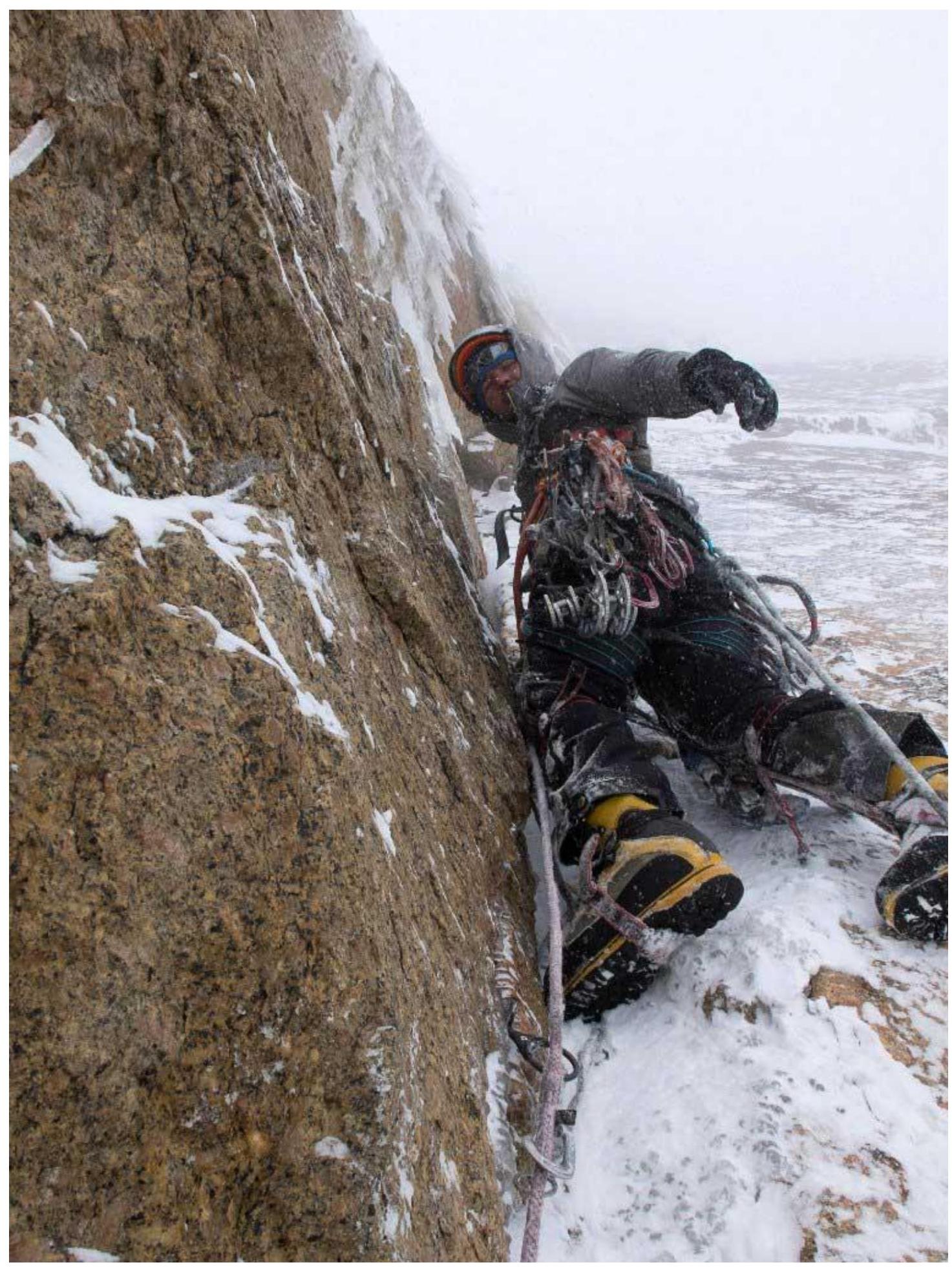
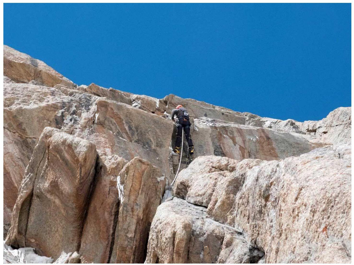
Start of section R8–R9. Alexander Parfenov — climbing in winter
conditions 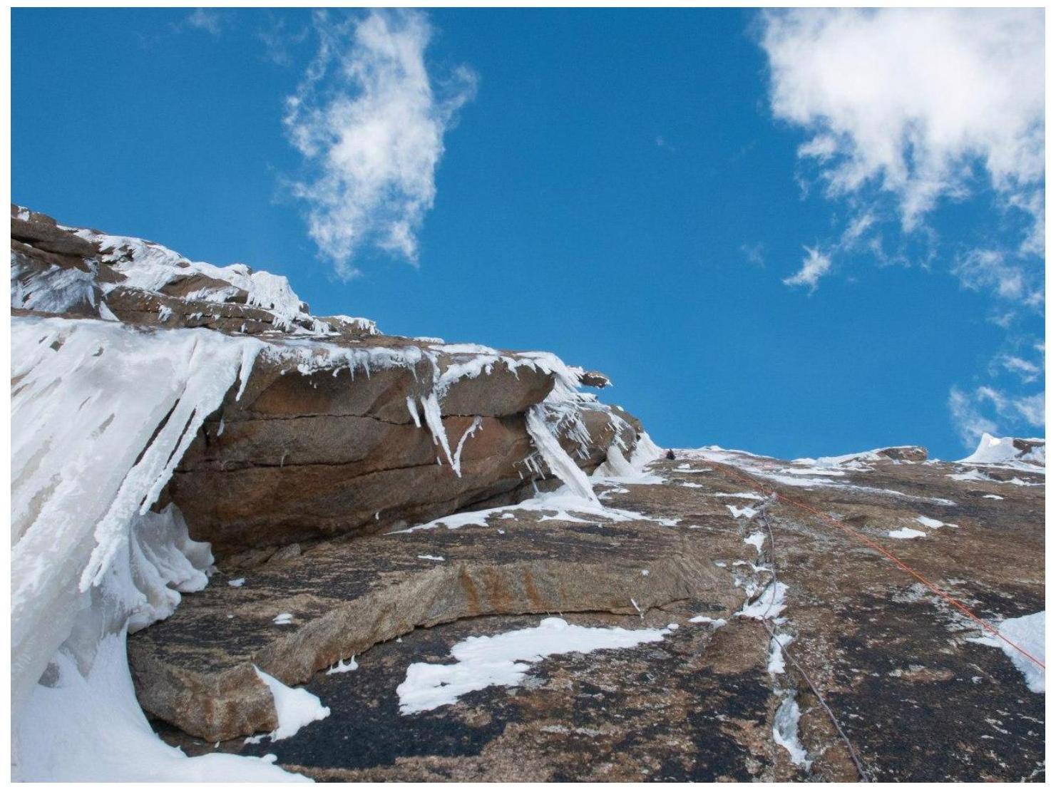
Upper part of section
R8–R9 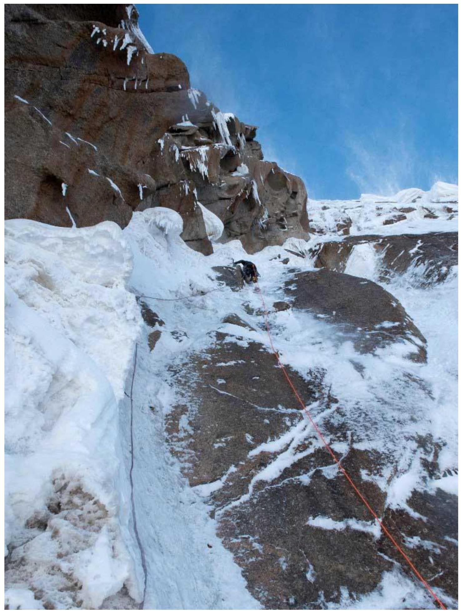
Section
R9–R10 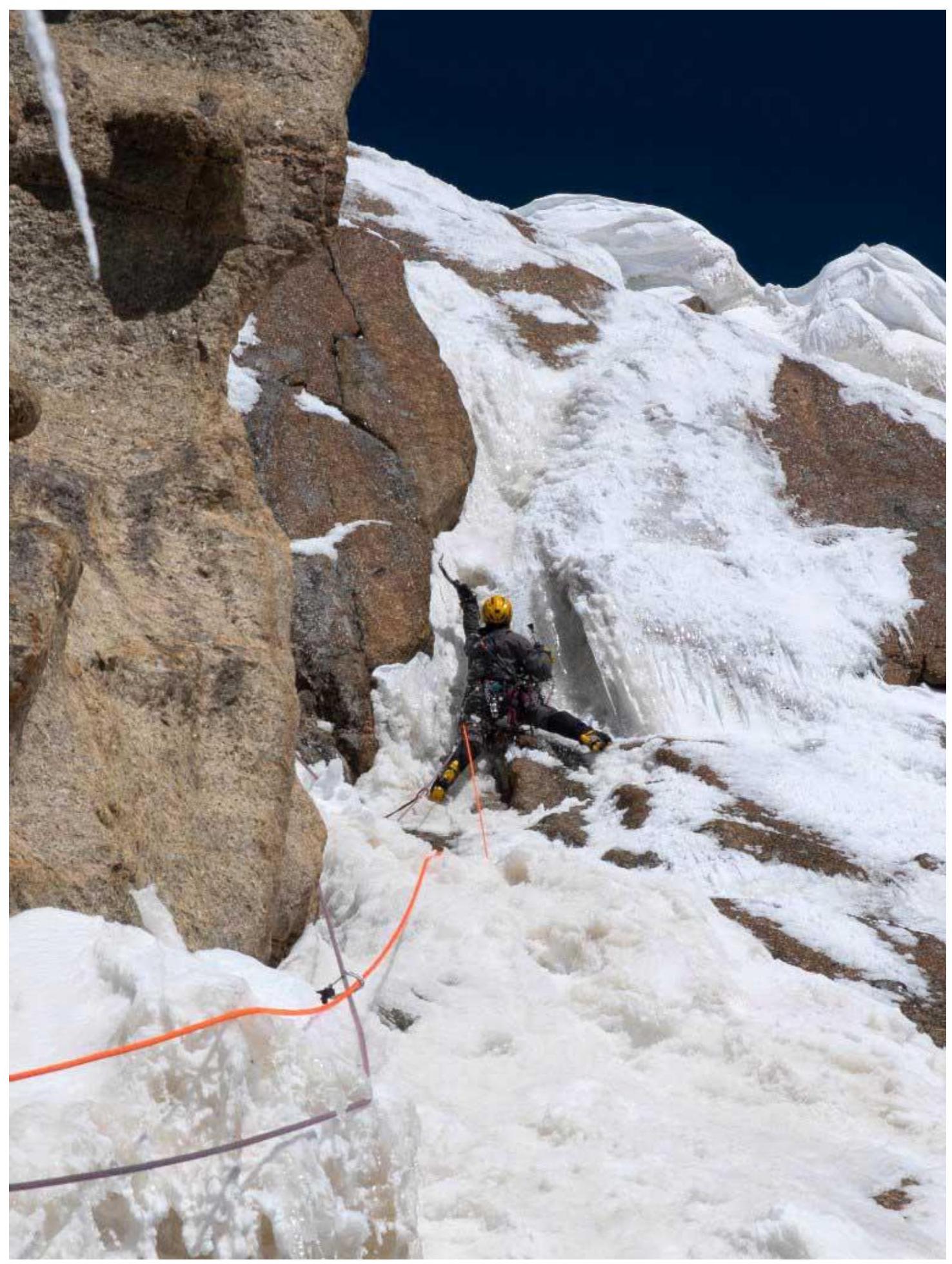
Upper part of section R9–R10. Sixth day of
ascent 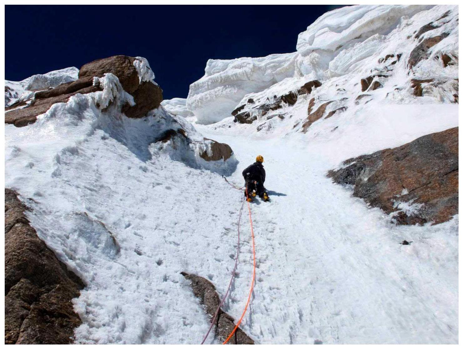
Section R10–R11. Vasily Terekhin is
leading 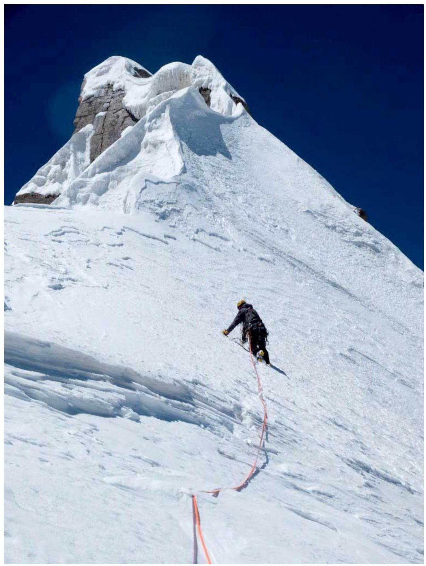
Section
R11–R12 
On the summit: Oleg Khvostenko, Vasily Terekhin
Descent via the ascent route