MOSCOW ALPINISM AND ROCK CLIMBING FEDERATION
Report
On the ascent of the CSKA team named after Demchenko
To the peak Gronki (Bolshaya Belaya) 5050 m. Central Tien Shan, Western Kokshaal-Too
via the northern ridge through the peaks:
- Beggar
- Ekstazi
- Yurnos
Presumably 4A category of difficulty. First ascent
Grigoryev D.R. - team leader Golovchenko D.N. Nilov S.A.
Central Tien Shan, Western Kokshaal-Too 2014
Participants of the ascent
-
Team leader — Grigoryev Dmitry Rurikovich. 1st sports category.
Coach: Kuznetsova E.V. Address: 115193, Moscow, 6th Kozhukhovskaya st., 18, bld. 1, apt. 19. rurikovichd@gmail.com, +7 903 145 88 61
-
Golovchenko Dmitry Nikolaevich. Candidate Master of Sports.
Coach: Kuznetsova E.V.
-
Nilov Sergey Alekseevich. Master of Sports.
Coach: Kuznetsova E.V.
Route 4A to peak Gronki via the northern ridge through peak Beggar, peak Ekstazi, and peak Yurnos
Ascent passport
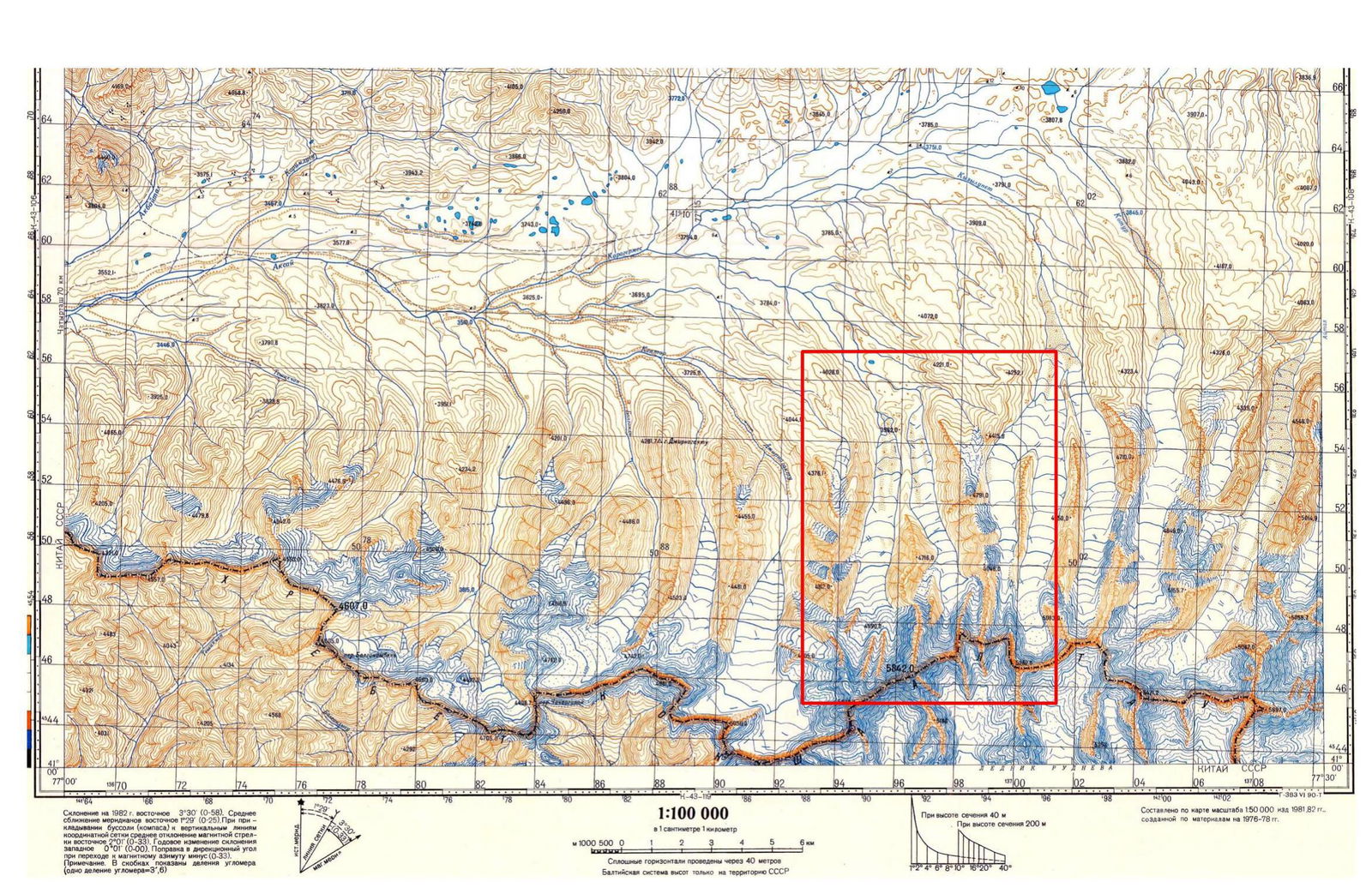
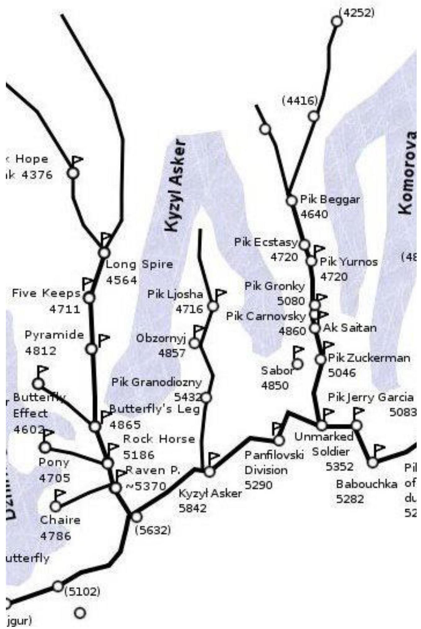
- Central Tien Shan, Western Kokshaal-Too region, Kyzyl-Asker gorge, classifier section: 7.5.
- Peak Gronki 5050 m via the northern ridge.
- Proposed — 4A category of difficulty, first ascent.
- Route type: combined.
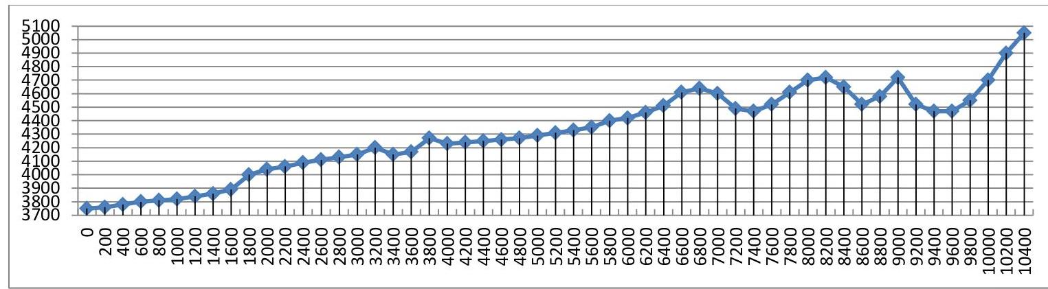
- Route height difference: 1300 m according to the altimeter. Route length: 10400 m. Average slope: main part of the route — 38°; entire route — 6°.
- Pitons left on the route: total — 0; including bolted pitons — 0.
- Team's total climbing hours: 29 hours, 3 days.
- Team leader: Grigoryev D.R. — 1st sports category, instructor № 1110.
Participants:
- Golovchenko D.N. — Candidate Master of Sports;
- Nilov S.A. — Master of Sports.
- Coach: Kuznetsova E.V.
- Departure from Base Camp: July 20, 2014, 6:00. Route started: July 20, 2014, 6:00. Summit reached: July 22, 2014, 16:00. Return to Base Camp: July 23, 2014, 15:00. Descent from the summit: via the pass to the Komarov glacier.
- Organization: Moscow Alpinism and Rock Climbing Federation, CSKA named after Demchenko.
- Person responsible for the report — Grigoryev Dmitry Rurikovich. rurikovichd@gmail.com, +7 903 145 88 61.
General photo of the summit
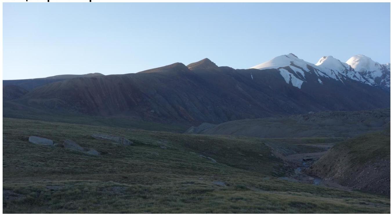
Photo 1. View from the observation point "Big Stone" to the eastern spur with peak Yurnos behind peak Ekstazi. June 17, 2014.

Photo 2. View from the plateau of the eastern spur to the eastern spur with peak Yurnos. June 17, 2014.
Photos of the route profile from the right and left
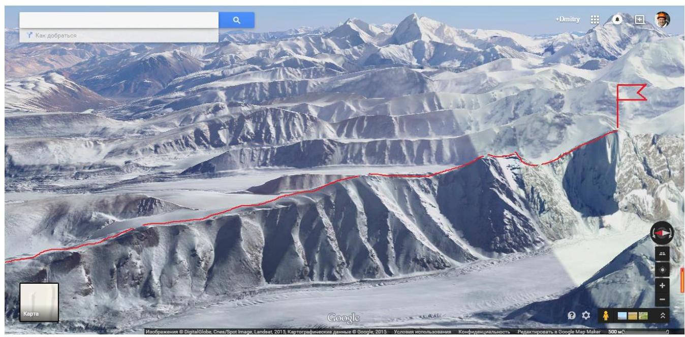
Fig. 3. Route profile, view from the west (GOOGLE MAP) https://www.google.ru/maps/place/Hapыn.+Киргизия/@41.099633,77.3320818,4872m/data=!3m1!1e3!4m2!3m1!1s0x38906bac89c2f9cb:0xb400cbc7951a0aa4?hl=ru↗
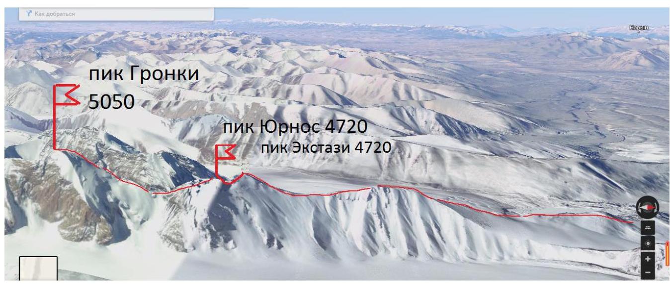
Fig. 4. Route profile, view from the east (GOOGLE MAP)
Photopanorama of the region
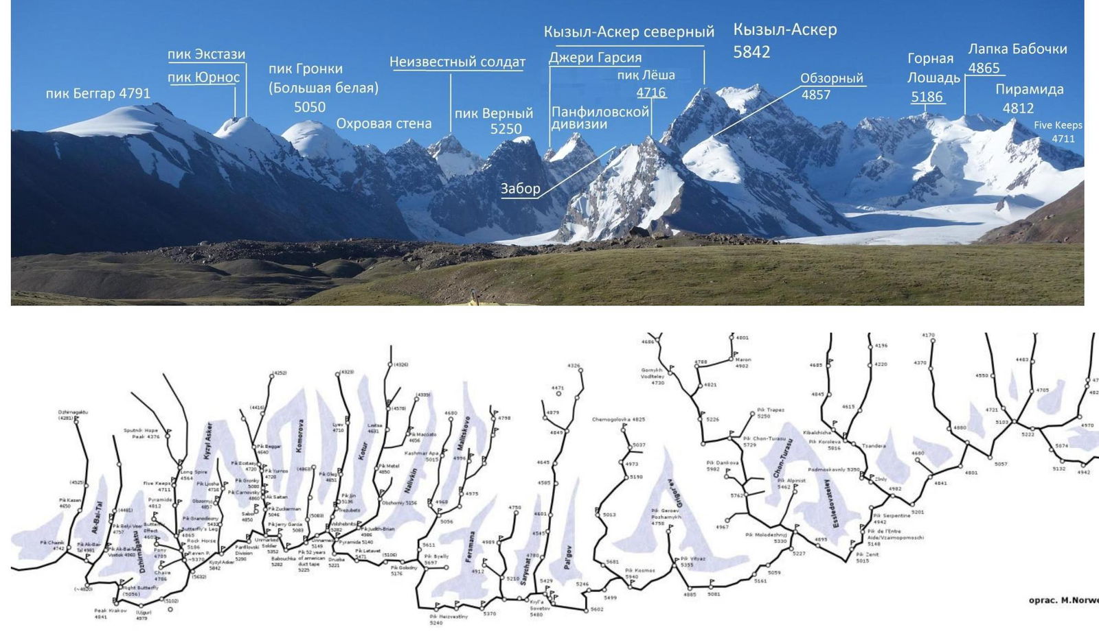
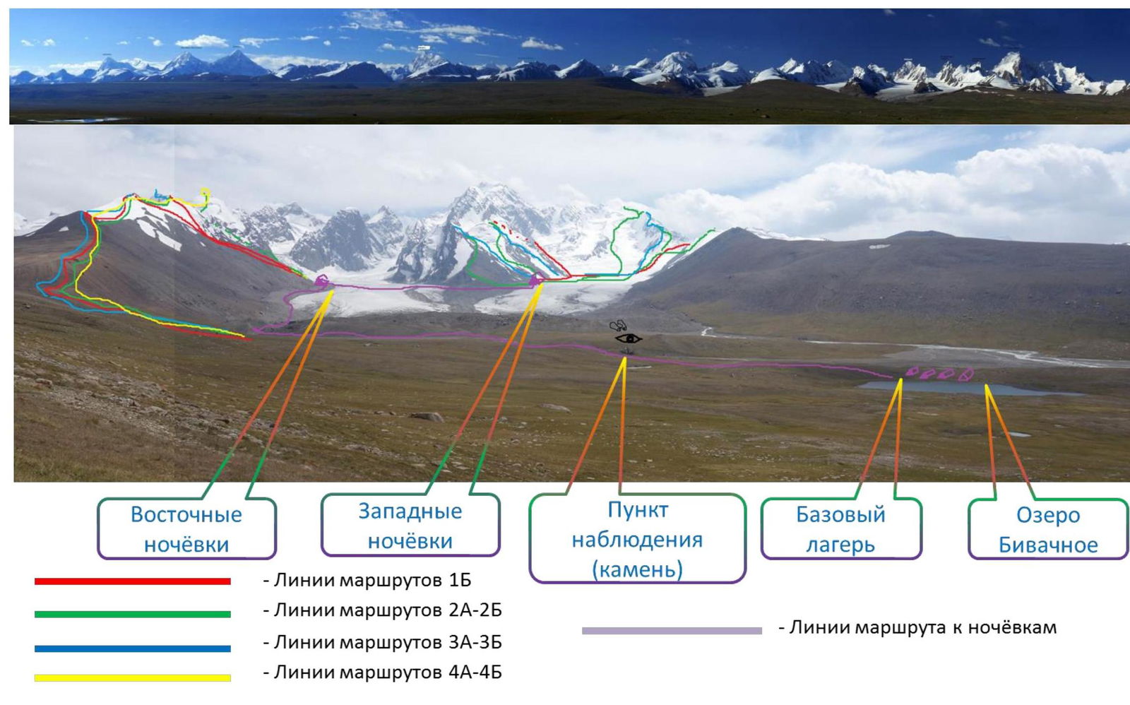
- Routes of 1B category
- Routes of 2A–2B category
- Routes of 3A–3B category
- Routes of 4A–4B category Observation point (stone) Base camp Biwak lake
- Lines of the route to the campsites
Central Tien Shan, Western Kokshaal-Too ridge, Kyzyl-Asker peak region (5842 m)
Brief characteristic of the region
Western Kokshaal-Too is the southernmost ridge in Kyrgyzstan. This ridge is located in the Central Tien Shan between Lake Issyk-Kul and the Takla-Makan desert, on the border of Kyrgyzstan and China. To the north, the Kokshaal-Too ridge borders the Uzengy-Kuush and Mudyurum rivers, to the south — the Kokshaal river.
There are many peaks around 6000 m in this region. The most interesting among them are: peak Kyzyl-Asker (5842 m), peak Krylya Sovetov (5800 m), peak Shmidt (5954 m, not climbed), peak Dankova (5982 m), peak Chon-Turasu or Joldash (5729 m), peak Alpinist (5641 m), peak Sergey Korolev (5816 m). This region is characterized by a combination of typical alpine forms (many vertical rock walls with a height difference of about 1.5–2 km) with vast glaciation, second only to the glaciation in the peak Pobeda region in Tien Shan. The entire region, including the lowlands, is a zone of permafrost. There are often swampy areas up to altitudes of 4000 m.
The snow line is at an altitude of about 4000–4500 m above sea level. River valleys have a high absolute height of about 3000–3500 m above sea level. The climate in the valley is harsh. The average monthly temperature in summer is about 5–8 °C, the weather is unstable.
Approach
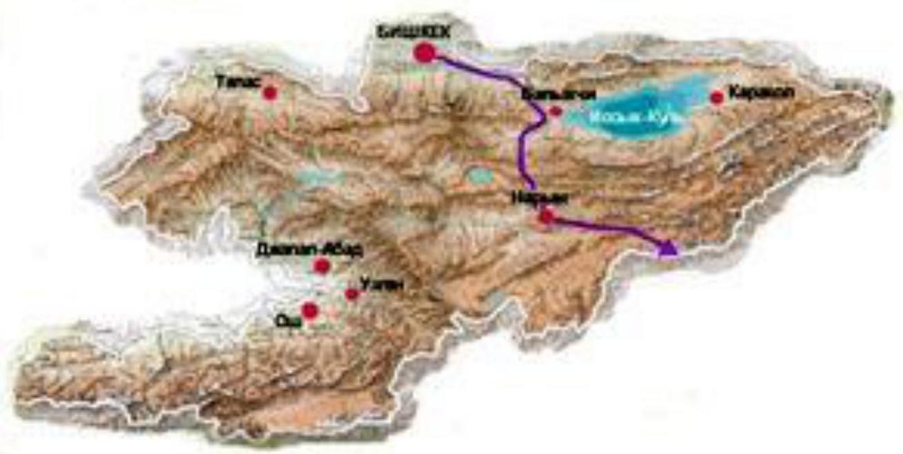
Approach by car. It takes two days, with an overnight stay in the city of Naryn. Continuous change of landscapes through three passes and finally — a road through the Aksai valley. Past the settlement of Orto-Kashka-Suu (one residential house), where there is also a border outpost (the area is a border zone and it is necessary to order permits in advance), the path goes along a crumbling road along:
- remnants of barbed wire fencing,
- remnants of telegraph poles, and
- a barely noticeable control track (KSP).
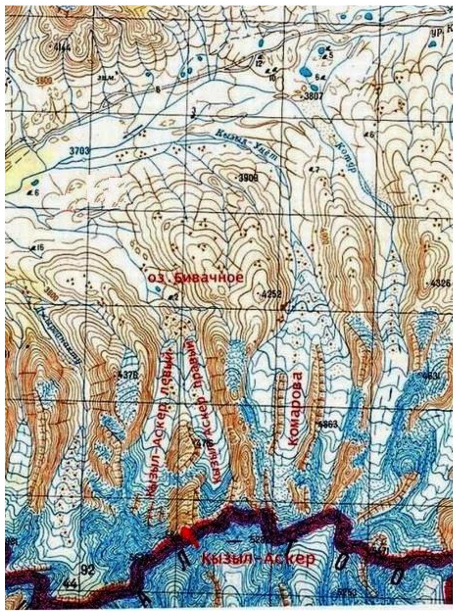
The space between the Borkoldoy ridge and Kokshaal-Too west of the Kubergentty pass is commonly referred to as the Aksai syrts or the Kagalyachap tract. It is a vast, flat surface like a table with an indistinct watershed between the Aksai and Uzengy-Kuush basins. The Aksai syrts are a harsh high-mountain desert, elevated to a height of 3500 m above sea level: areas of cracked clay alternate with tufts of dry grass. In small depressions, there are dried-up lakes, and the soil is covered with a crust of salt. Previously, there was a border outpost near the confluence of Kyzyl-Unet and Karagermes; now it is abandoned, and hunters live there in the summer. The main problem of the approach to peak Kyzyl-Asker is the swampiness of the Kagalyachap plateau.
A little above the remains of the border outpost, the map indicates OTF; we turned off the road and began to cross the plateau from north to south, towards Biwak lake. We crossed it, sending scouts ahead, who literally probed the ground. Meandering, often driving along the beds of numerous rivers, we spent several hours on this.
One of the optimal options for setting up a base camp is on the shore of Biwak lake. It is possible to set up 20–30 tents on the lake's beach, sheltered from the wind by hills near the lake.
Approach by car to Biwak lake is possible along the arms of the river flowing from the Kyzyl-Asker glacier. You need to turn off the road approximately opposite a large stone. However, there is always a risk of getting stuck in the swamp. A more reliable approach is considered to be with two cars:
- The first car pulls a rope behind,
- The second car is always ready to help.
It is also possible to set up a base camp near a large stone, against which the wide part of the riverbed from the Kyzyl-Asker glaciers rests. 1 km upstream from Biwak lake. It is possible to set up no more than 7–10 tents behind the stone's leeward side.
The Kyzyl-Asker peak region is geographically remote from any habitation. The nearest habitation (not counting Chinese settlements) is the Orto-Kashka-Suu outpost.
Weather
The optimal time for expeditions here is considered to be the second half of July to the first half of September. The weather is extremely unstable. Within one day, it is sometimes possible to observe several seasons: winter, summer, autumn, and spring. Moreover, there is no particular pattern. Rain or wet snow can start in the morning, afternoon, or evening. However, there can also be several consecutive days of good weather. The main thing is that prolonged bad weather did not occur during our stay here — a maximum of 14 hours (most often — from 2 to 6 hours).
Bad weather is short-lived, almost always accompanied by strong stormy winds. Due to this, there are certain requirements for the base tent: it must be sufficiently wind-resistant. Especially if the camp cannot be set up near Biwak lake — the winds there are not as harsh because the lake is located in a small depression.
It is concluded that in August, the weather cannot drastically affect the ascents, considering the nature of the routes. It gets quite cold even in good weather when the wind starts blowing from the Kagalyachap plateau. Considering all this, it is necessary to have:
- appropriate clothing and
- the corresponding mindset.
Ascent schedule
| Section № | Description of the route section | Length | Height difference | Slope | Terrain characteristics | Category of difficulty | Number of pitons |
|---|---|---|---|---|---|---|---|
| 1 | from camp to Beggar peak | 6800 | 890 | 8 | scree, snow | 1 | 0 |
| 2 | descent from Beggar peak | 600 | -170 | -17 | snow | 1 | 0 |
| 3 | ascent to Ekstazi peak | 800 | 250 | 19 | snow | 2 | 0 |
| 4 | descent from Ekstazi peak | 400 | -200 | -31 | snow | 3 | 0 |
| 5 | ascent to Yurnos peak | 400 | 200 | 31 | snow | 3 | 0 |
| 6 | descent from Yurnos peak | 400 | -250 | -41 | rocks, ice, stones | 3 | 10 |
| 7 | ascent to Gronki peak | 1000 | 580 | 38 | snow, rocks | 3 | 10 |
Route description
Departure from Biwak lake. Ascend to Beggar peak via the northern ridge. A more detailed description of the route is in the report 1B "Ascent to Beggar peak via the northern ridge". 7 hours walking.
Descend from Beggar peak, ascend to Ekstazi peak along the snowy ridge (crampons). Belay via ice axe and terrain (ridge). A more detailed description of the route is in the report 2A "Ascent to Ekstazi peak via Beggar peak". 9 hours walking from Biwak lake.
Descend from Ekstazi peak along the ridge to the southeastern side. Set up a campsite in a bergschrund protecting the campsite from the valley wind.
From the campsite: descend along a simple snowy ridge to the slope of Yurnos peak; ascend to the peak along a steep snowy ridge (crampons). Belay method: via ice axe, terrain (ridge). From the campsite to Yurnos peak — 1.5 hours walking.
Traverse Yurnos peak to the west to the beginning of the ice chimney. Descend three rappels with anchor points on outcrops. Descend to the pass along rocks and scree. Set up a bivouac on the pass. Ascend to Gronki peak along a snowy slope. The summit has rocks of 4th category of difficulty. From Yurnos peak to Gronki peak — 6 hours of work.
Descent to the pass via the ascent route. On rocks, belay on outcrops, on snowy slope belay via ice axe. Descent along the snowy slope with anchor points on ice axe, in "three steps". Descent from the summit to the pass — 1.5–2 hours.
From the campsite under Yurnos peak to the descent from Gronki peak to the pass — 10 hours of work. There is a good campsite in the bergschrund on the eastern slope below the pass.
Descent from the pass is possible both east to the Komarov glacier and west to the Kyzyl-Asker glacier.
- When descending to the east, the descent will go along a steep snow-ice slope, then from the Komarov glacier ascend to the ridge (gain 400 m), cross the small glacier from Beggar peak, and follow the stream from the glacier to the start of the route.
- When descending to the west, descend along a stony slope, then descend to the camp along the moraine stones or the glacier.
From the pass to Biwak lake — 4–6 hours.
Route length 10400 m, height difference 1300 m.
Route photos
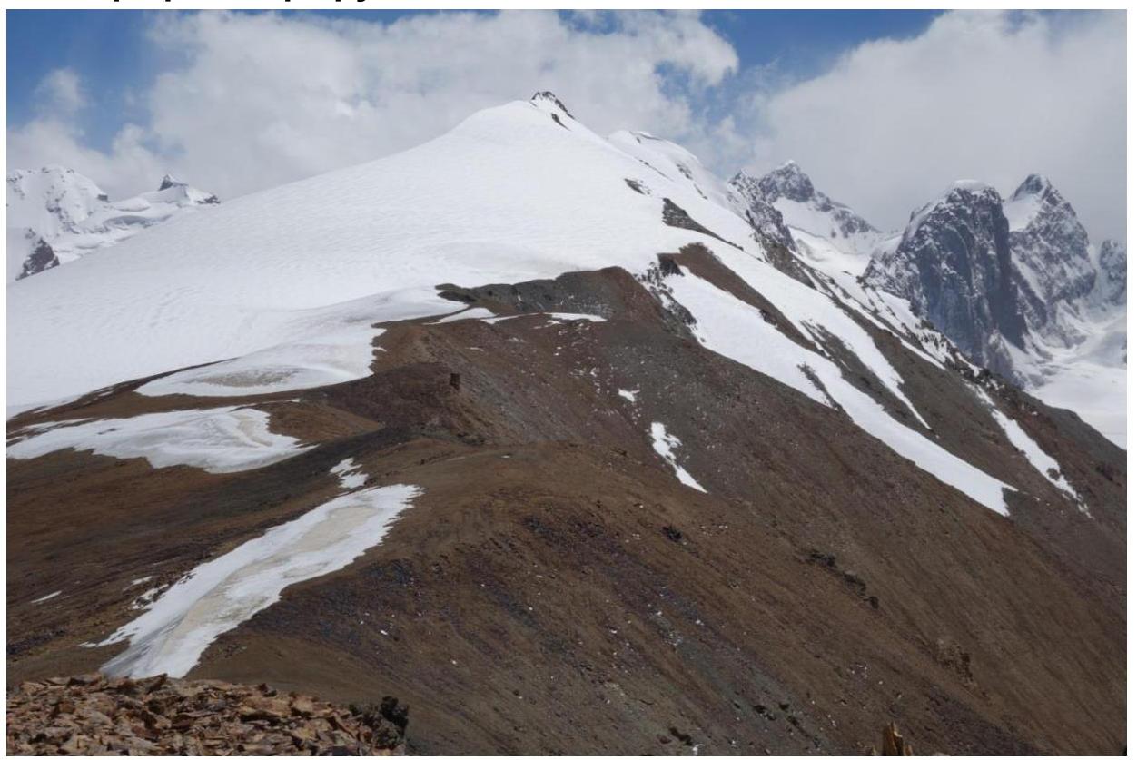
Photo 5. Ridge to Beggar peak.
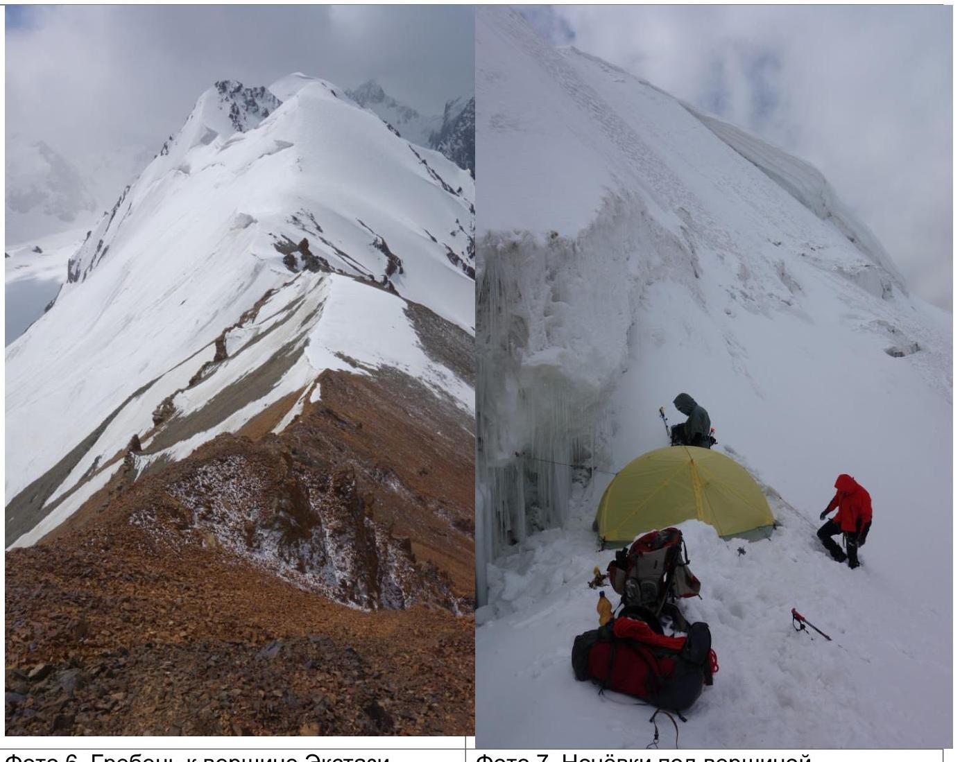
Photo 6. Ridge to Ekstazi peak.
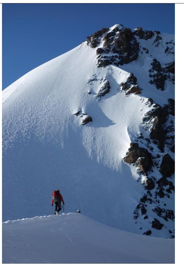
Photo 7. Campsite under the peak.
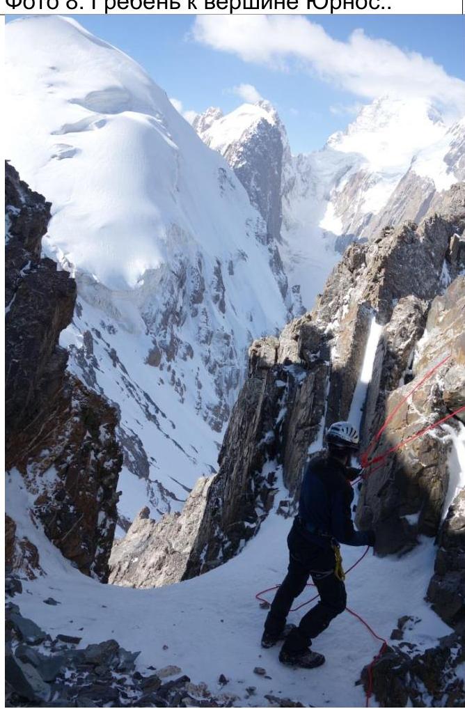
Photo 8. Ridge to Yurnos peak.
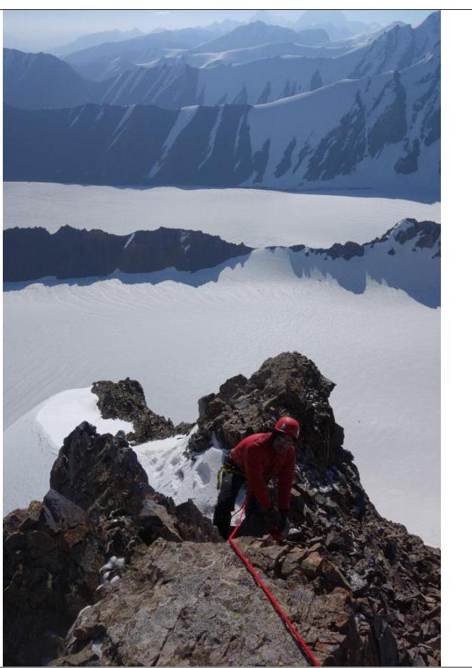
Photo 9. Yurnos peak.
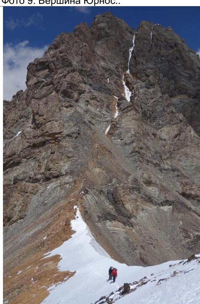
Photo 9. Chimney from Yurnos peak.
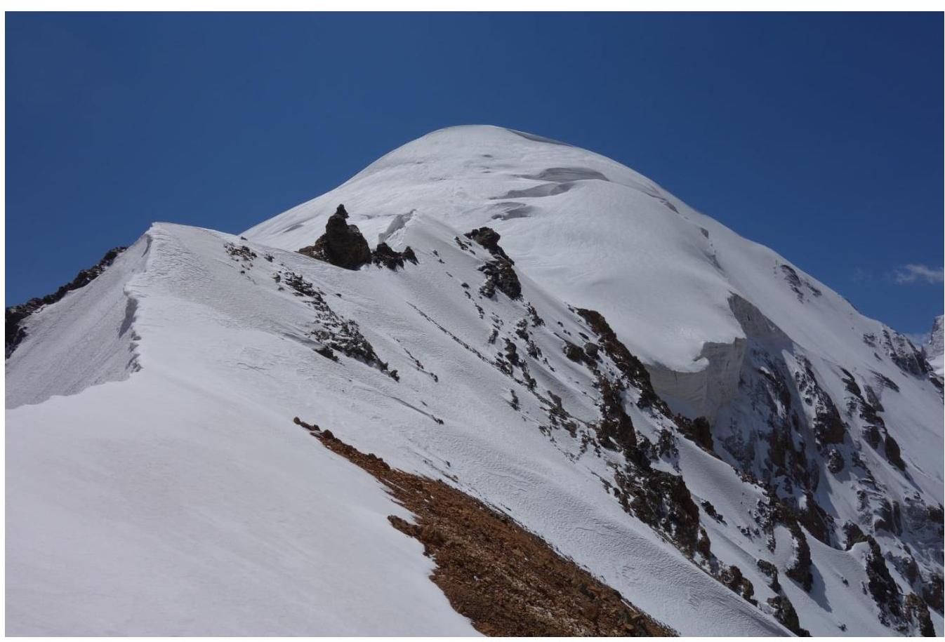
Photo 10. Southern ridge from Yurnos peak.
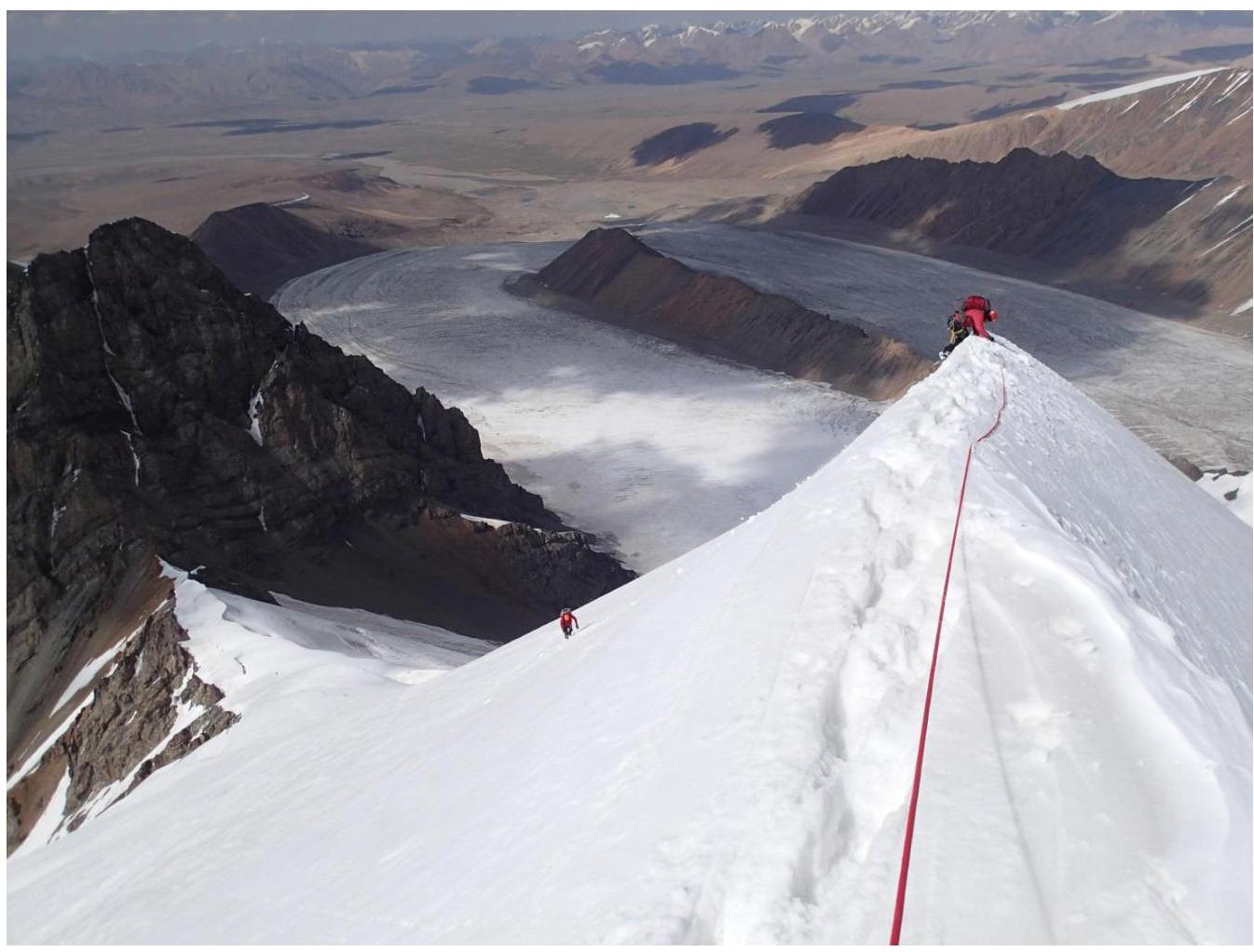
Photo 11. Ridge to Gronki peak. Taken from the pass.
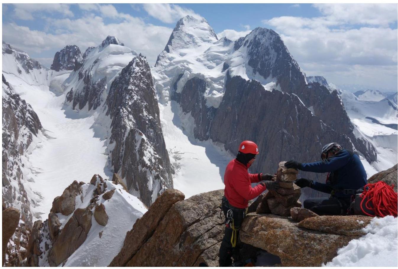
Photo 12. Ridge to Gronki peak.
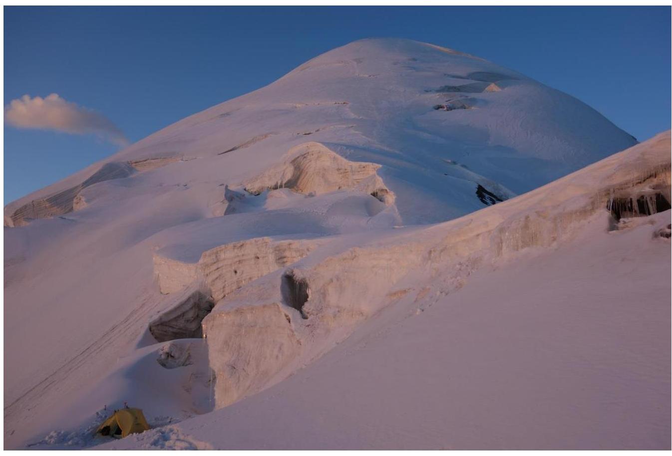
Photo 13. Gronki peak.
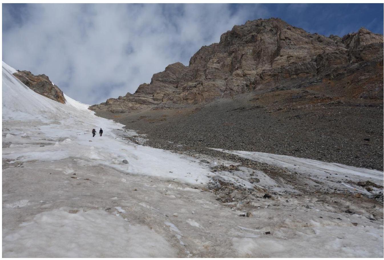
Photo 14. Campsite in the bergschrund (eastern slope) on the pass between Gronki and Yurnos peaks.

Photo 15. Descent from the pass between Gronki and Yurnos peaks to the east to the Komarov glacier.