
Moscow Alpine Championship 2015
High-Altitude Technical Class
Report on the ascent of the Moscow Alpine and Rock Climbing Federation team to the peak Granitsa (5370 m), first ascent, approximately 5A category.
- Climbing class: high-altitude technical
- Climbing area: Tian Shan, Western Kokshaal-Too
- Peak, its height, ascent route: Granitsa (5370 m) via the ice stream, left of the large couloir.
- Difficulty category: 5A (first ascent)
- Route characteristics:
| Length | ||
|---|---|---|
| route: | 1260 m | |
| wall section: | 410 m | |
| Height difference | V–VI sections: | 410 m |
| route: | 1070 m | |
| Average steepness | wall section: | 410 m |
| route: | 53.7° | |
| wall section: | 67.5° |
- Pitons left on the route (including bolted): 0
- Team leader: Nilov Sergey — Master of Sports
Team members:
- Golovchenko Dmitry — Candidate for Master of Sports
- Sharifullin Ruslan — 1st sports category
- Team coach: Kuznetsova E. V.
- Departure from base camp: August 25, 2014
Summit ascent: August 25, 2015. Return to base camp: August 26, 2015.
- Demchenko Central Sports Club of the Army (CSKA), Moscow
Technical photo with the ascent route thread
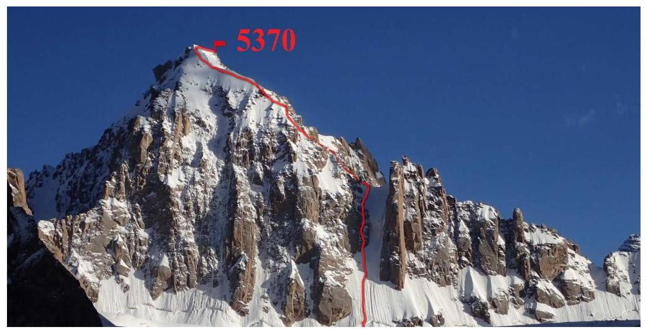
Photo 1. Taken from the Federman Glacier on approach.

Photo 2. Overall photo of Granitsa peak with the route thread. Taken from the Sedoy Strazh peak (5481 m).
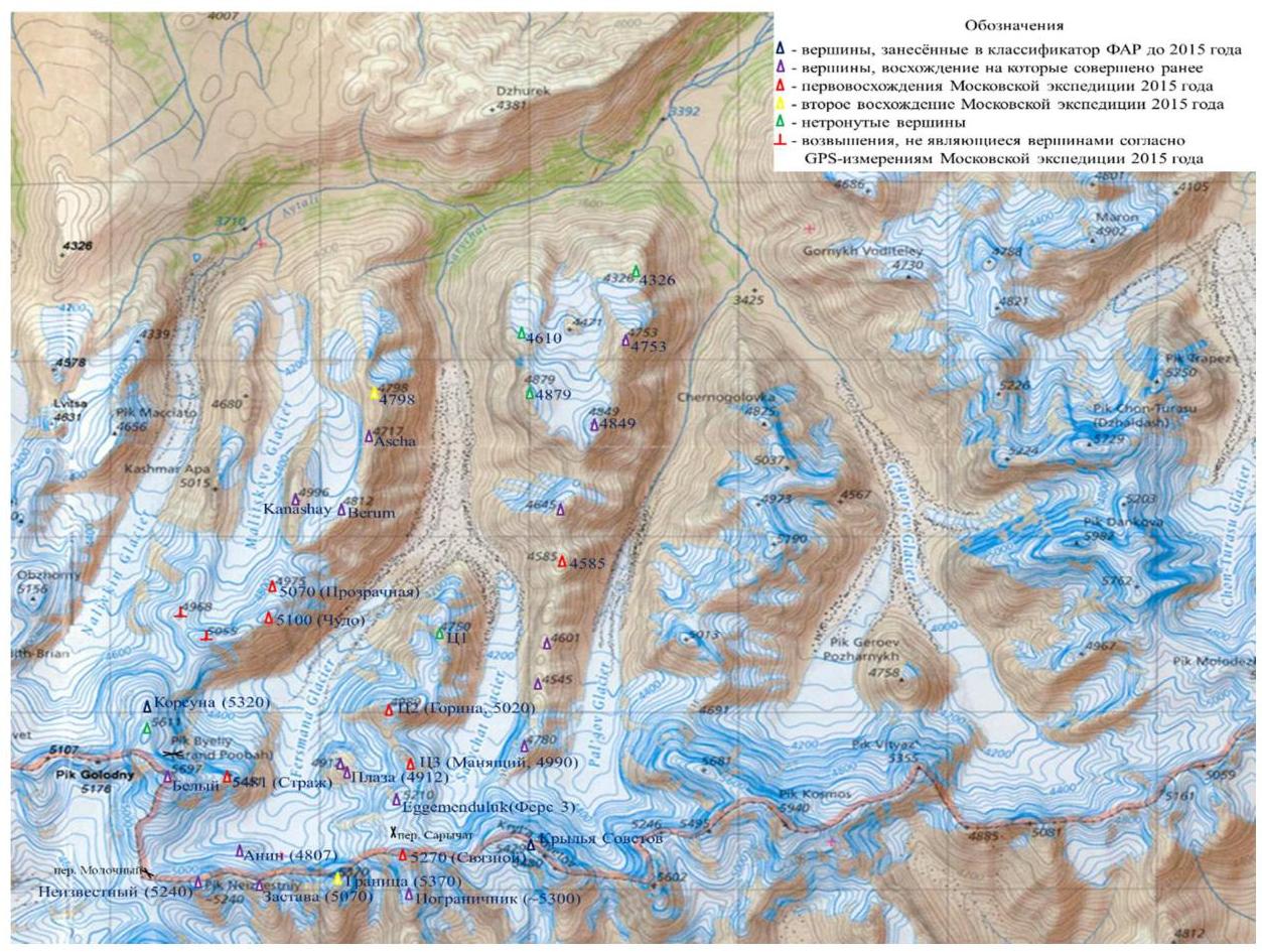
Area overview. (The overview is taken from "Alpinistskie rayony Kyrgyzstana").
Author: Komissarov Vladimir Anatolyevich
The western part of one of the longest (about 500 km) and highest ridges of Tian Shan — Kokshaal-Too, referred to as "Western Kokshaal-Too," is one of the most interesting alpinism areas in Tian Shan. Administratively, this territory belongs to two districts of Kyrgyzstan:
- To the east of the Kotur gorge lies the Jety-Oguz district of Issyk-Kul region,
- To the west — the At-Bashi district of Naryn region.
If we approach it strictly geographically, the area is not the westernmost part of the Kokshaal-Too ridge. It is rather the western extremity of its highest part, where elevations exceed 5000 m. The area is located closer to the central part of the ridge. If you draw a line south from the central part of Lake Issyk-Kul, the area is where this line intersects the Kokshaal-Too ridge on the border with China.
The area's length in the latitudinal direction from 78° E longitude to 79°15′ E longitude is about 100 km. The axial part of the ridge here runs fairly strictly in the latitudinal direction. From the axial part of the ridge, gorges stretch in the meridional direction, filled with glaciers. The glaciation of the area is quite extensive. Glaciers flow down the slopes of the ridge and lie on remnants of the ancient peneplain on some of its peaks. There are about forty glaciers here. The largest one, the Chon-Turasyu glacier, is about 18 km long. Glacier beds are typically flat, making it relatively easy to move around.
Elevations in the area reach up to 5982 m (Dankova peak). Height differences reach up to 1500 m. There are many walls about 1000 m high. Glaciers in the gorges lie at elevations of 4000–4500 m.
The climate of the area is typical for Central Asia and Tian Shan — sharply continental. This is one of the harshest places in Tian Shan, known as the "Kyrgyz Arctic," where temperatures can drop to –60 °C in winter. Summer here lasts only one month — August. This is the best time for ascents. May–July often see storms, while September has relatively stable weather but is significantly colder than August, and snow that falls in September does not melt.
Average temperatures:
- July – +4 °C,
- August – +6 °C,
- September – +2 °C.
Annual precipitation is 420 mm.
The lower parts of gorges and watersheds represent alpine deserts located on an ancient peneplained surface, sometimes with slope boggy areas — saz. Tree and shrub vegetation is absent.
Among mammals, one can find:
- high-altitude argali "Marco Polo"
- Siberian ibex "Teke"
- wolves
- foxes
- rodents.
There are many birds of prey.
In the lower parts of valleys, one can occasionally encounter nomadic shepherds with sheep, yaks, horses, and camels.
*Peneplain, peneplained surface – a leveled land surface where mountains once existed; leveling occurred due to erosion.
The area is poorly developed for several reasons, the main ones being:
- Harsh climate
- Poor natural resources
- Remoteness and inaccessibility
- Border location with China
For many years during the Soviet era, the area was completely closed to visits due to complicated political relations between the Soviet Union and China. The first descriptions of the area were made in 1869 by the Russian geographer A. V. Kaulbars. Subsequently, the area was visited several times by various researchers.
The first ascent in the area was made in 1934 by an expedition led by A. A. Letavet to a 4900 m peak in the Chon-Turasyu glacier area, named peak Marona after one of the climbers. The first alpinist expedition was organized in 1938 but ended in failure due to bad weather. The next expedition took place only in 1969. It was an expedition of the Moscow region and the city of Kaliningrad led by A. Korsun. The expedition made six first ascents in the Chon-Turasyu glacier area.
Subsequently, in the pre-perestroika period, alpinist expeditions were conducted in 1972, 1980, and 1985. During this time, ascents were made to the main peaks of the area, located in the eastern (Chon-Turasyu glacier) and western (peak Kyzyl-Asker area) parts. Other gorges in the area remained unexplored due to inaccessibility.
A new stage of exploration began in 1993 when Mikhail Lebedev organized a large expedition of Moscow region alpinists. In 1995, A. Korsun organized another expedition with the participation of Western alpinists. This expedition was again directed to the Chon-Turasyu glacier area. In subsequent years, expeditions to Western Kokshaal-Too were organized by alpinists from the USA and Great Britain. In 1996, the first Anglo-American expedition, led by Lindsay Griffin and Christian Beckwith, conducted reconnaissance and made several ascents in the western part of the area.
In 1997, there were two expeditions to this area:
- An Anglo-American expedition led by Lindsay and Christian to the same area;
- An expedition of the International School of Mountaineering (ISM) led by Pat Littlejohn to the Chon-Turasyu glacier area.
Pat's expedition traversed new routes in the area and conducted an aerial survey of the entire area by helicopter to prepare for future expeditions.
In 1998, the second Kokshaal Expedition ISM took place, but this time in the central, completely unexplored part of the area, on the Kotur glacier. Due to snow, which fell about one meter in the first two days of the expedition, alpinists were only able to make three first ascents in the lower part of the Kotur glacier.
The ISM 1999 expedition to the same glacier was highly successful. Six first ascents were made in the upper reaches of the Kotur glacier. Only the onset of bad weather prevented alpinists from ascending the remaining two unclimbed peaks of this glacier. Expedition members explored neighboring gorges to the east of the Kotur glacier to study access paths for future expeditions.
In 2005, a successful expedition by Poles with an ascent to the Granitsa peak.
(Article link: http://publications.americanalpineclub.org/articles/12201024300/Pik-Plaza-4912m-Northwest-Face-Z-K-Pik-Granitsa-5370m-North-Face-Nordic-Walking↗)
By today, the main part of the gorges has been more or less explored; much less explored are the gorges Karagerme, Kyzyluynet, Kichi-Turasyu, located in the central part of the ridge, and gorges to the east of the Chon-Turasyu gorge.
How to reach this area?
- To the western part of the area, which lies west of the Sarychat gorge, the road approaches from the city of Naryn, through the village of Akmuz and the Kindyk pass to the upper reaches of the Mudyryum river.
- From Naryn to the Kindyk pass — a good dirt road.
- Further to the upper reaches of Mudyryum — about 80 km of bad, and sometimes very bad, road.
- From the road to the locations of base camps — 10 to 20 km of off-road terrain, lying across river floodplains and hill slopes, where only high-clearance vehicles can pass.
- These approaches are complicated by the presence of many slope bogs (saz), where vehicles can easily get stuck (Photo 46).
The road to the eastern part of the ridge passes:
- Through the Barskoon gorge, located on the southern shore of Lake Issyk-Kul.
- Then through the Barskoon and Suek passes — to the Karasai settlement.
- Then through the Ashusu pass and the Kichi-Uzengugush gorge — to the Uzengugush river.
- Further along the Uzengugush river to its upper reaches.
Along the road that follows the Uzengugush river, up to the Chon-Turasyu gorge, lie unexplored gorges. The road mainly follows the northern bank of the river, and the unexplored gorges approach the river from the south. There are no bridges or crossings here, so it's necessary to organize a rope or cable crossing.
Another obstacle to traveling along the road is that the right bank of the Uzengugush river, along which the road partially passes, was ceded to China according to the Kyrgyz-Chinese treaty in 2002, and passage along it is permitted only for Kyrgyz border guards and transport servicing Kyrgyz border outposts, according to interstate agreements.
The area is located in a border control zone, and access to it requires a is required.
Map-diagram of the area.
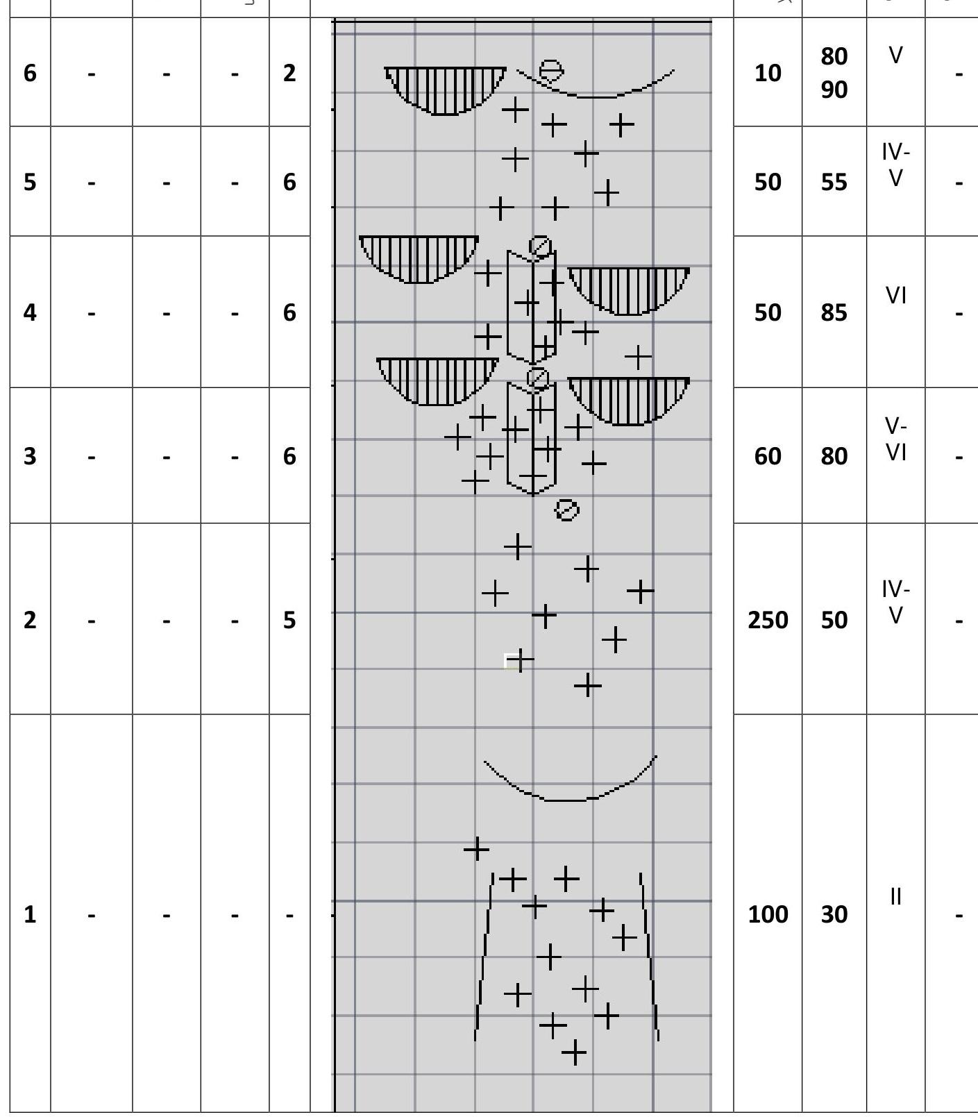
Route diagram in UIAA symbols
Verbal description by sections
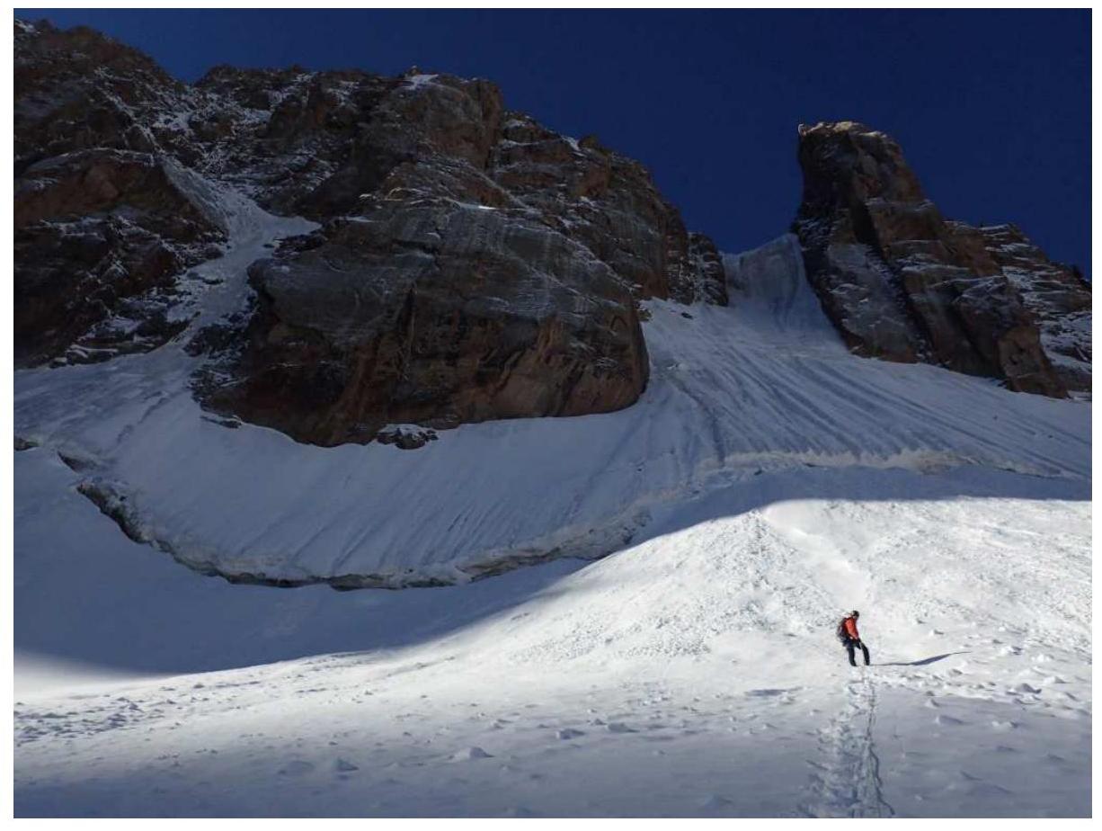
From the glacier, the route is partially visible — only part of the route up to the saddle (key ropes) and part of the ridge are visible. See Photo 1. The true dimensions of the ridge and its length are visible in Photo 2. Approach to the route is in rope teams (crevasses).
Due to the route's great length, it's better to climb with a bivouac on the saddle (a large convenient platform). The route is avalanche-prone.
The entire route from the glacier to the summit is traversed in crampons. Under the snow, there are often sections of hard ice.
R1 — Initially, traverse 30-degree snow to the bergschrund. 100 m, 30°
R2 — Then, 5 ropes on ice and snowy gullies with a steepness of 55° to the ice stream left of the couloir. It's reasonable to set a belay station to the right of the entrance to the ice stream to protect against falling ice and rocks.
Warning! During the ascent, small powder avalanches descended from the left and right into the large couloir!!! 250 m, 55°, IV–V
R3 — Move up the ice stream bounded by rocks on the left and right. Belay on ice screws. By the end of the rope, there might be a thin layer of rime ice for setting a belay station. It's better to use a 60-meter rope. 60 m, 80°, V–VI
R4 — Move up the ice stream bounded by rocks on the left and right. Organizing a belay in heavily damaged rocks is problematic. Belay on ice screws. местами крутизна 90°. Complex ice climbing, a short mixed climbing section is possible. There are two obvious key sections on this rope. Dangerous for the belayer — all rocks and ice pass through them. Also, by the end of the rope, there might be a thin layer of rime ice for setting a belay station. It's better to use a 60-meter rope. 50 m, 85°, VI
R5 — Exit into a snowy-icy funnel. Up and right to the saddle. 50 m, 55°, IV–V
R6 — Reach the saddle through a snowy cornice (hack a window in the cornice). 10 m, 80°, 90°, V
R7 — From the large flat saddle, where a bivouac can be set up, bypass the boulder and ascend a relatively easy snowy-icy couloir to the ridge. 150–200 m, 30°, III–IV
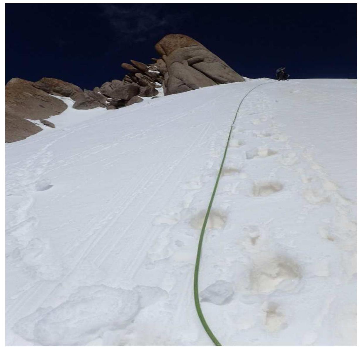
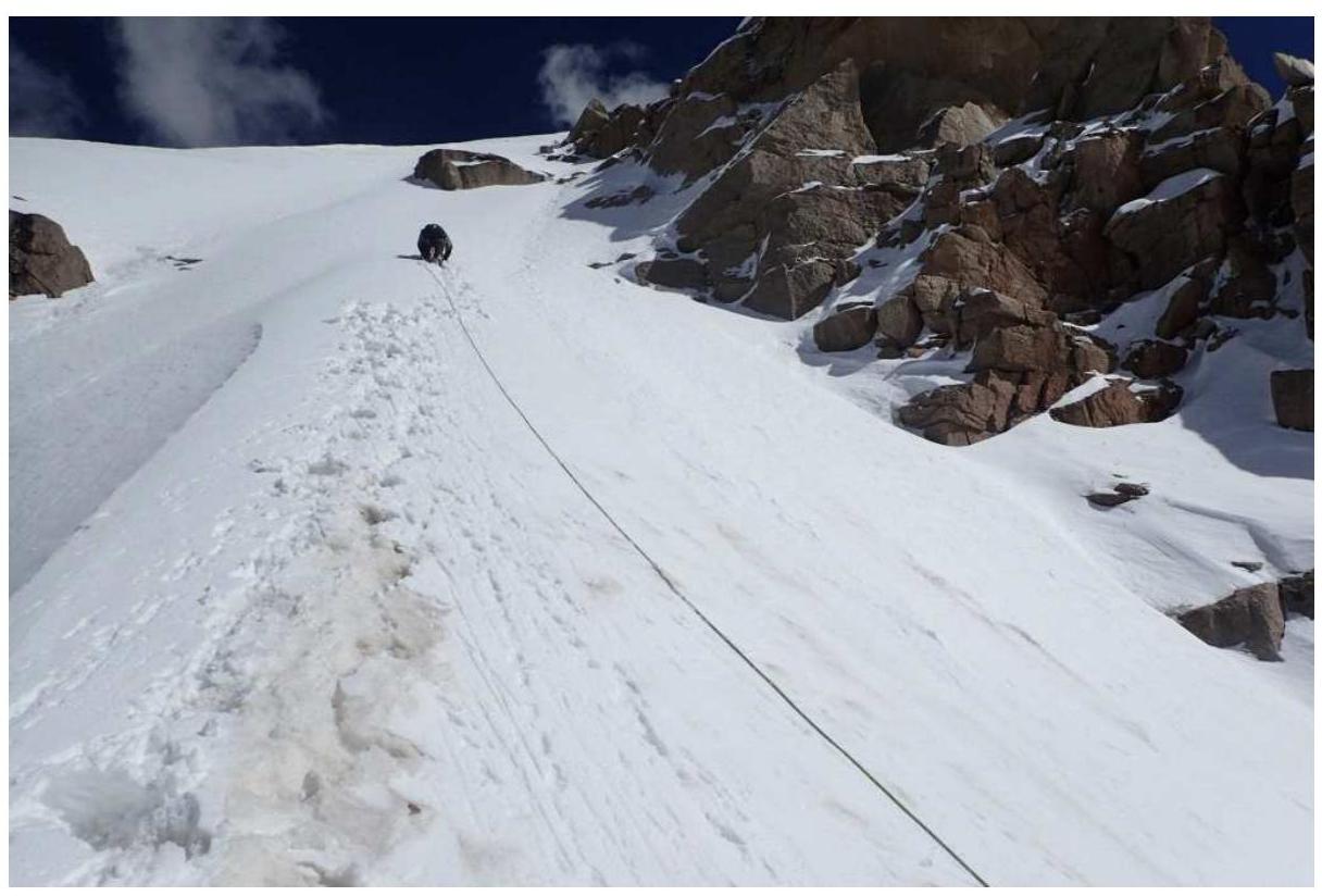
R8 — Traverse a snowy-icy narrow endless ridge with cornices for several hours to the summit. Setting a reliable belay on the ridge is often impossible. Steepness varies from 30° to 50°. 700 m, 30°, 55°, II, III, IV
| Equipment used: | |
|---|---|
| Dynamic ropes: | 2 × 50 m. |
| Belay loops: | 6 pcs. |
| Climbing harnesses: | 15 pcs. |
| Jumar: | 3 pcs. |
| Quickdraws: | 8 pcs. |
| Ice screws: | 8 pcs. |
| Ice axes: | 6 pcs. |
| Crampons: | 3 pcs. |
| Helmets: | 3 pcs. |
| Reepschnur (expendable): | 10 m. |
| Abalakov thread hook: | 1 pc. |
Radio: YAESU. Communication schedule:
- 9:00
- 12:00
- 15:00
- 18:00
- 21:00 and further as needed.
Team's tactical actions
Woke up at 5:00 on August 25, 1953. Had breakfast. Left the tent around 7:00. Approach to the route took 30–40 minutes. Reached the saddle by 15:00. Were at the summit at 17:50. Began descent and were back on the saddle by 22:00, already in the dark. Reached the tent by 1:00 on August 26.
Technical photo of the route.

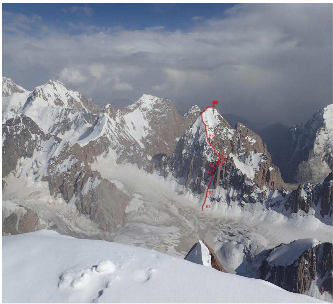
Photo illustrations.
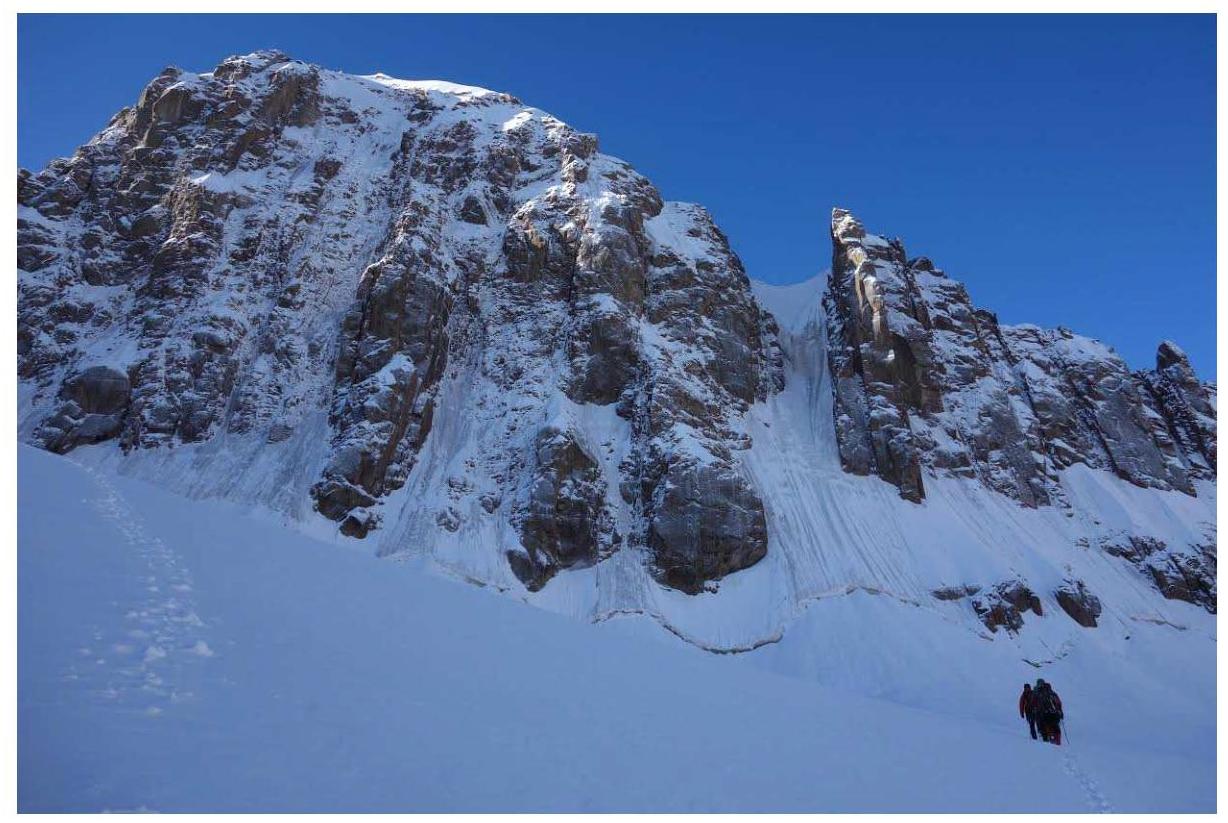
On approach. The first sections of R1–R2 are clearly visible.
Section R1.
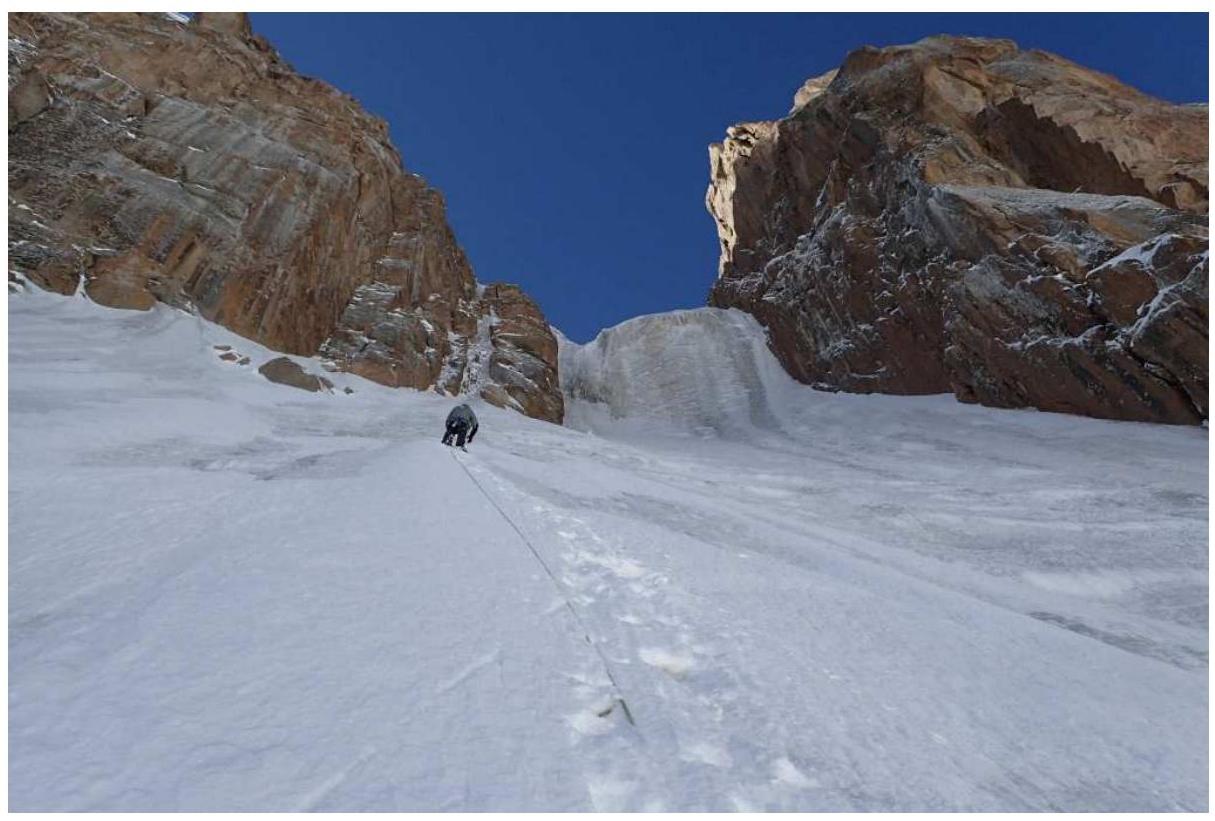
Section R2.
From the station, entry into the ice stream.
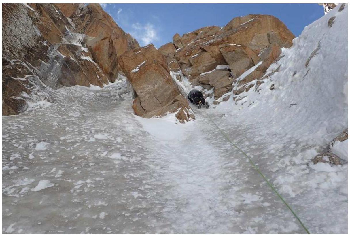
On the second rope of the ice stream. Section R4.
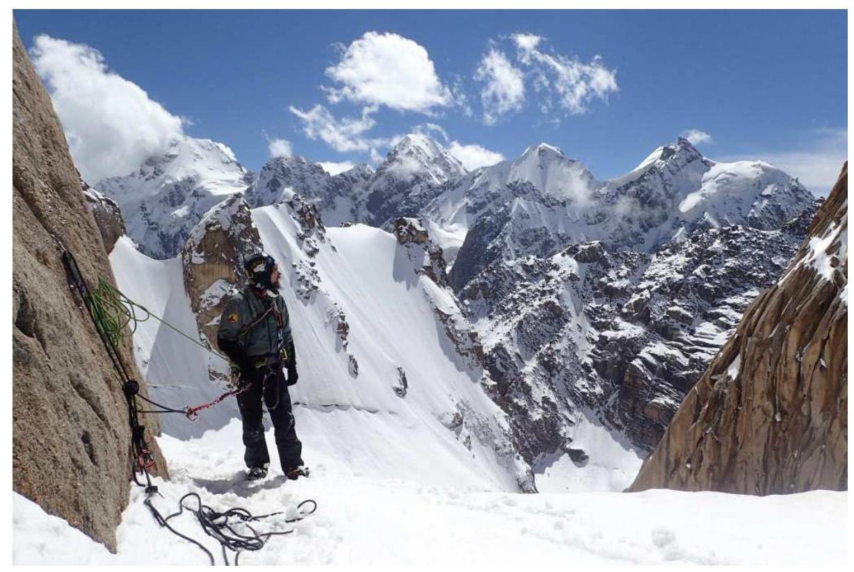
On the saddle.

On the saddle. The route goes around the boulder.
On the saddle.
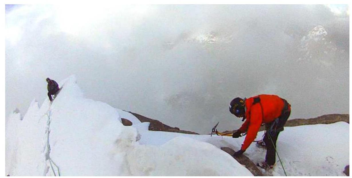
Leaving the saddle upwards to the ridge. Section R7.
Exit to the ridge. Section R7.

One of the sections of the endless ridge. Section R8.
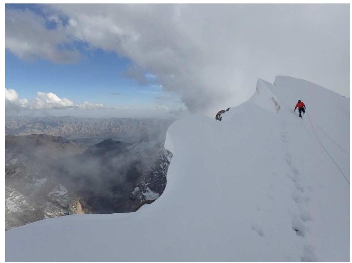
To the summit along the endless ridge. Section R8.
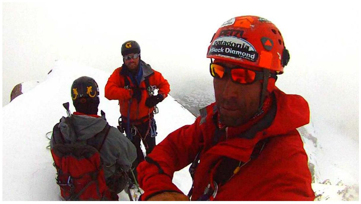
At the summit.
Building a cairn at the summit.