
To the judging panel of the high-altitude and technical class of the PFO Championship 2023
Report
on the ascent to the summit of Baychechekhey 4516 m via the left edge of the central buttress of the western wall, 5A category of complexity (D. Pavlenko's route, 2010), 2nd passage, made by the team of the Ministry of Sports of the Republic of Tatarstan on August 10, 2023.
Leader: Grishin Sergey Vasilyevich, CMS Participants:
- Kudryashov Valery Sergeyevich, CMS
- Ogorodnikov Roman Valeryevich, 1st sports category
Coach: Kudryashov Valery Sergeyevich, CMS, 1st category
I. Ascent Passport
| № | 1. General Information | |
|---|---|---|
| 1.1 | Full name, sports rank of the leader | Grishin Sergey Vasilyevich, CMS |
| 1.2 | Full name, sports rank of the participants | Kudryashov Valery Sergeyevich, CMS, Ogorodnikov Roman Valeryevich, 1st sports category |
| 1.3 | Full name of the coach | Kudryashov Valery Sergeyevich, CMS, 1st category |
| 1.4 | Organization | Ministry of Sports of the Republic of Tatarstan |
| 2. Characteristics of the Ascent Object | ||
| 2.1 | Region | Tian Shan, Kyrgyz Range |
| 2.2 | Gorge | Ak-Sai gorge |
| 2.3 | Section number according to the 2020 classification table | 7.4. Kyrgyz Range |
| 2.4 | Name and height of the summit | Baychechekhey, 4516 m |
| 2.5 | Geographical coordinates of the summit (latitude/longitude), GPS coordinates | 42.529 ° N 74.556 ° E |
| 3. Characteristics of the Route | ||
| 3.1 | Route name | via the left edge of the central buttress of the western wall |
| 3.2 | Proposed category of complexity | 5A |
| 3.3 | Degree of route exploration | 2nd passage of D. Pavlenko's route, 2010 |
| 3.4 | Nature of the route terrain | rock climbing |
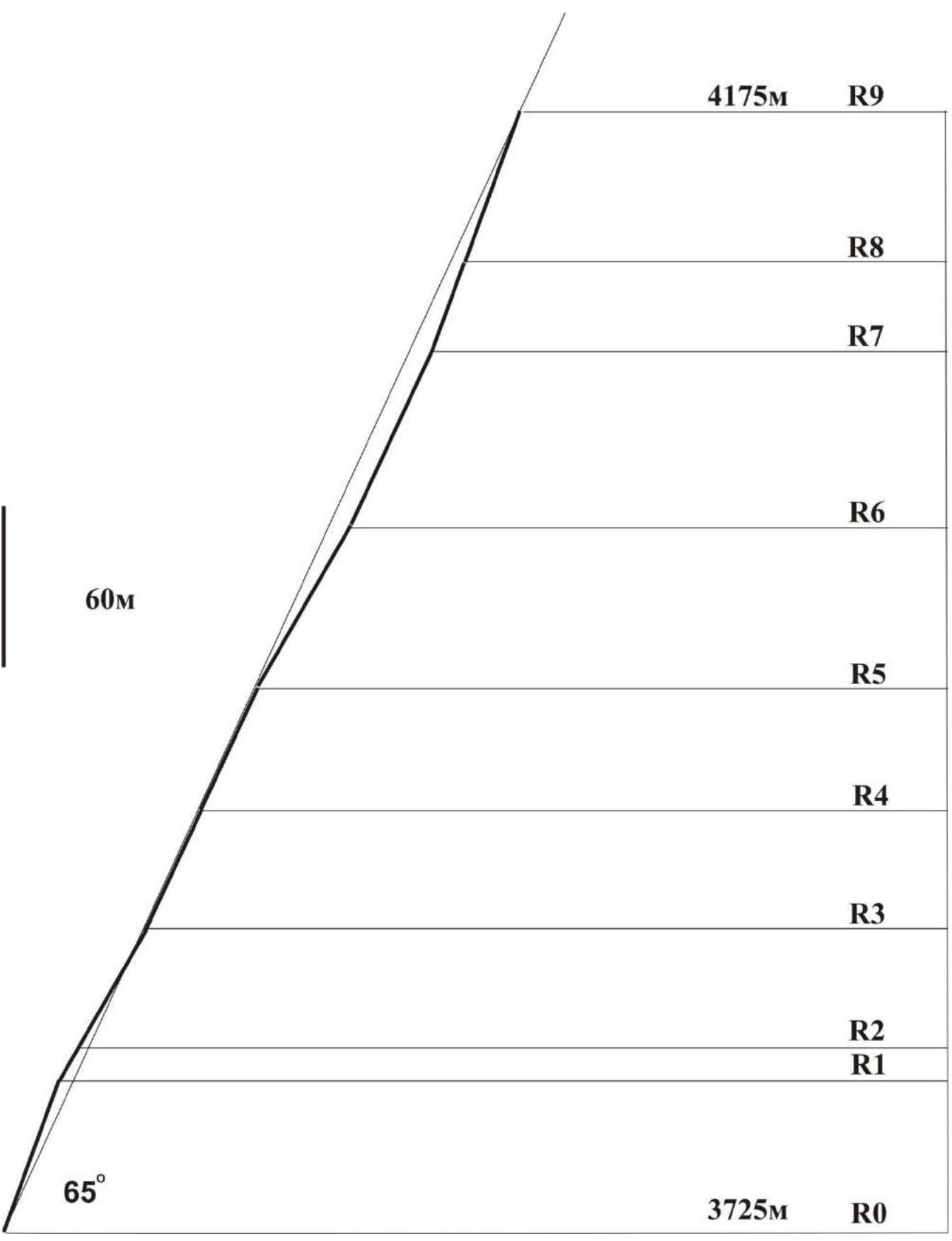
| 3.5 | Height difference of the wall part of the route (altimeter or GPS data) | 450 m |
| 3.6 | Route length (in meters) | 1040 m (500 m wall part) |
| 3.7 | Technical elements of the route (total length of sections of various complexity categories with terrain type indication (ice-snow, rock)) | Category I (rock) – 500, Category II (rock) – 40, Category III (rock) – 55 m, Category IV (rock) – 195 m, Category V (rock) – 250 m. Of which: V,A1 – 10 m, VI,A2 – 10 m |
| 3.8 | Average steepness of the route, (°) | - |
| 3.9 | Average steepness of the wall part of the route, (°) | 65° |
| 3.10 | Descent from the summit | via route 1B category |
| 3.11 | Additional route characteristics | There are no convenient places for overnight stays throughout the route, only after completing the wall part. |
| 4. Characteristics of the Team's Actions | ||
| 4.1 | Time of movement (climbing hours, days) | 11 climbing hours, 1 day |
| 4.2 | Overnight stays | None |
| 4.3 | Route processing time | - |
| 4.4 | Departure on the route | 08/10/2023 5:30 |
| 4.5 | Reaching the top of the buttress | 08/10/2023 14:40 |
| 4.6 | Reaching the summit | 08/10/2023 16:30 |
| 4.7 | Return to the base camp | 08/10/2023 18:10 |
| 5. Weather Conditions | ||
| 5.1 | Temperature, °C | +7 °C |
| 5.2 | Wind speed, m/s | 4 m/s |
| 5.3 | Precipitation | Cloudy, no precipitation |
| 5.4 | Visibility, m | Full |
| 6. Responsible for the Report | ||
| 6.1 | Full name, e-mail | Kudryashov V. S., kudr_fart@mail.ru |
II. Ascent Description
1. Characteristics of the Ascent Object
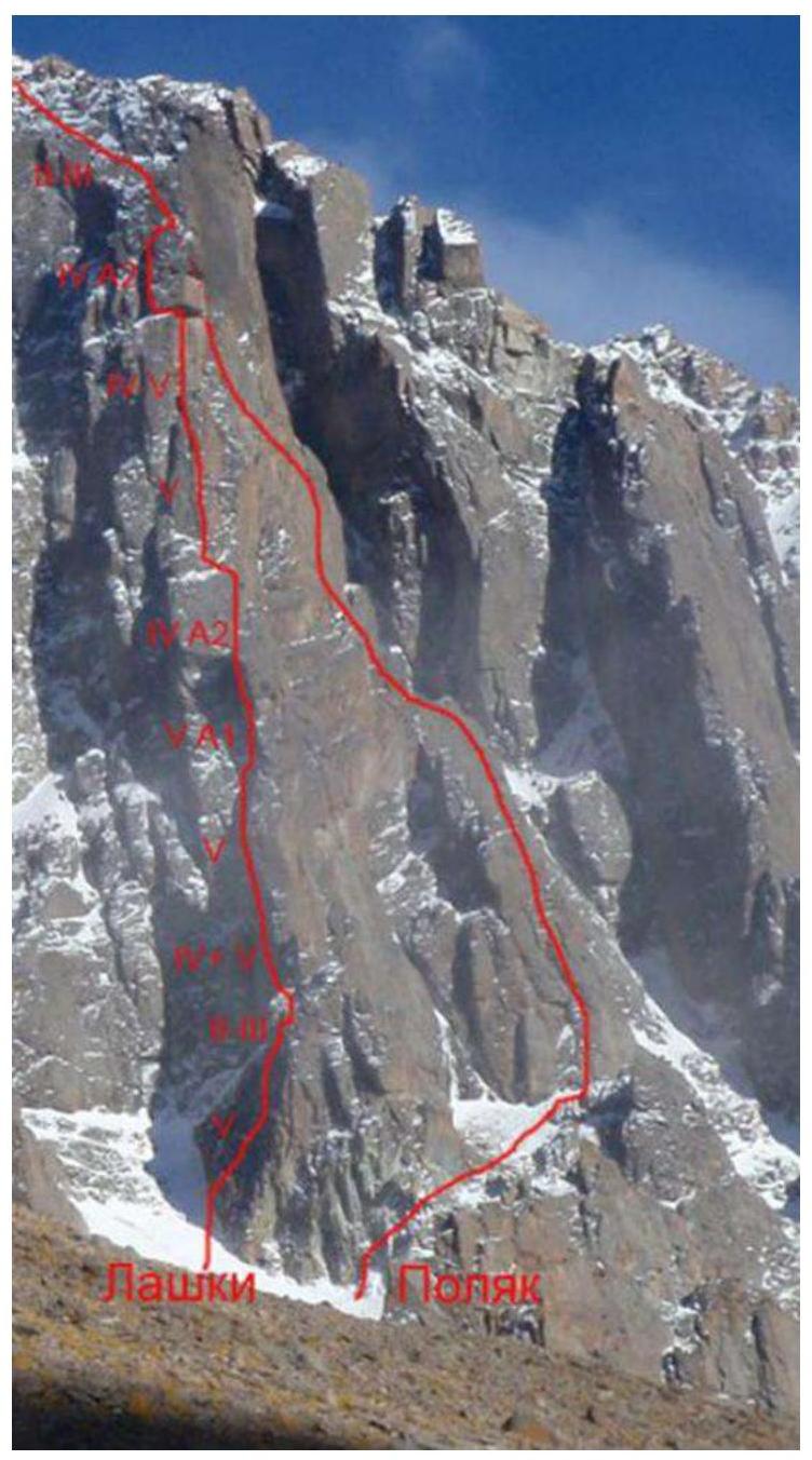
General photo of the central buttress. (taken from D. Pavlenko's report, 2010 http://www.mountain.ru/people/DmitryPavlenko/ ↗ note "Lashki" is the name of D. Pavlenko's route)
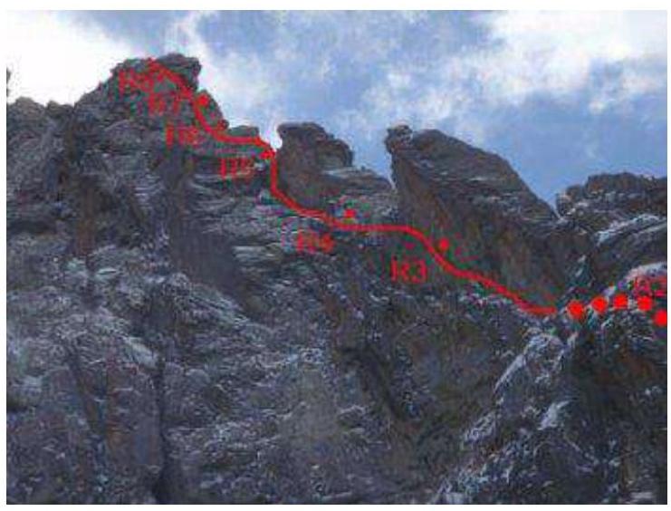
Photo of the route profile from the left, upper part. (taken from D. Pavlenko's report, 2010 http://www.mountain.ru/people/DmitryPavlenko/ ↗)
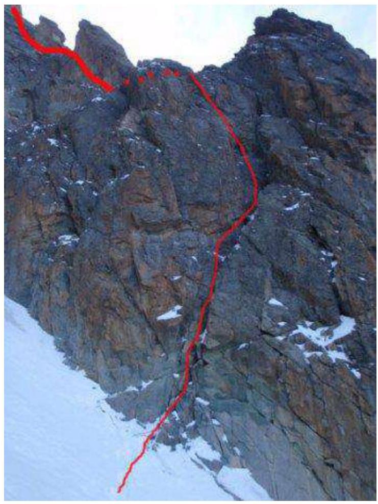
Photo of the route profile from the left, lower part (taken from D. Pavlenko's report, 2010 http://www.mountain.ru/people/DmitryPavlenko/ ↗)
Drawn route profile
2. Characteristics of the Route
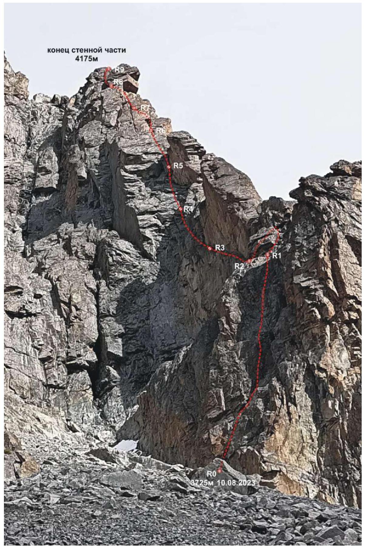
Technical photograph of the route. (taken on August 9, 2023, height 3700 m)
| Section № | Anchors/hooks | Friends | Aids | Belay Stations | Route diagram in UIAA symbols | Category of complexity | Length, m | Steepness, degrees |
|---|---|---|---|---|---|---|---|---|
| R9–R10 | 2 | 3 | Ө | III | 40 | 40 | ||
| R8–R9 | 4 | 5 | 4 | V–VI,A2 | 60 | 65–70 | ||
| R7–R8 | 1/3* | 5 | Ө | V+ | 35 | 70 | ||
| R6–R7 | 7 | 6 | Ө | IV–V+ | 65 | 60–65 | ||
| R5–R6 | 5 | 5 | Ө | IV | 60 | 60 | ||
| R4–R5 | 6 | 5 | Ө | V | 50 | 65 | ||
| R3–R4 | 6 | 4 | 3 | V,A1 | 50 | 65 | ||
| R2–R3 | 5/1* | 5 | Ө | IV–V | 50 | 60 | ||
| R1–R2 | 3/1* | 3 | Ө | III–IV | 30 | 60 | ||
| R0–R1 | 6/2* | 5 | IV+ | 60 | 70 |
Note: 3/1* – 3 anchors and 1 local hook
3. Characteristics of the Team's Actions
| Section № | Description | Photo № |
|---|---|---|
| R0–R1 | The approach from the "Light House" hut to the start of the route takes 1.5–2 hours. Start on August 10 at 5:30. Sergey Grishin leads. A vertical wide destroyed crack leading to an internal corner turning into a wall, along the wall to a convenient shelf under a cornice, 60 m. Station on two local hooks, plus one anchor. | Photo 1. |
| R1–R2 | To the right of the cornice, through a series of cracks, exit to a shelf in front of the edge, 15 m. Then traverse left, around the corner, to a shelf leading to an internal corner formed by the overhanging wall of the rib and steep slabs under the rib, 20 m. One local hook. Station on a small shelf at the base of the corner. | |
| R2–R3 | Up the steep slabs of the internal corner to a small overhang, 50 m. Rich terrain, one local hook. Station on a sloping shelf under the overhang. | Photo 2. |
| R3–R4 | The first key section. The overhang is bypassed on the left. Further up through a system of cracks and fissures, through cornices, we exit under the bridge between two large gendarmes of the rib, 50 m, A1. | Photo 3. |
| R4–R5 | Further up through stepped slabs with small walls to an inclined shelf at the base of the overhanging internal corner, 50 m. | Photo 4. |
| R5–R6 | Along the left vertical wall of the corner, bypassing the overhang, we exit to the main rib behind the second large gendarme, 10 m. Further along the rib to a convenient horizontal shelf at the base of a wide extended internal corner going under a large trapezoidal cornice in the upper part of the rib, 50 m. | Photo 5. |
| R6–R7 | Up the right side of the corner with good terrain 40 m, then a complex pendulum exit from the corner to the left through an overhanging wall 2 m. Then 15 m up (caution, live rocks and blocks!) to a small shelf under the base of a steep smooth internal corner leading under the trapezoidal cornice. Hanging station on own gear. | Photo 6, 7. |
| R7–R8 | The second key section. Difficult climbing along the internal corner with a wide crack (large cams) to the cornice. Caution, live rocks in the upper part! Further exit to the left from under the cornice to a good shelf, 35 m. Station on local gear, three hooks. | Photo 8. |
| R8–R9 | The third key section. From the shelf, climb down through a heavily destroyed chimney, then left to steep slabs with dangerously positioned large live rocks (difficulties in organizing belay!). Further on A2 aid to a vertical wall, along it to a large convenient shelf in the upper part of the main rib, 60 m. End of the wall part. Good place for overnight stay. | Photo 9, 10, 11. |
| R9–R10 | From the shelf 40 m of simple grade III climbing to the junction with the Poliak 5A route. Exit to the pre-summit simple rock and scree slopes. |
This route was first climbed by Dmitry Pavlenko's team in October 2010 and named "LASHKI," meaning "Best Alpine School of Kyrgyzstan." According to Maxim Cherkasov, a participant in that ascent, Pavlenko came up with this name. Based on Maxim's information, we made the 2nd passage (we discussed the route sections and found hooks and friends they left during the first ascent in detail after our climb).
The route is logical, mostly monolithic, and not prone to rockfall, except for sections R6–R7, R7–R8, and R8–R9, where there are sections with live large rocks and blocks. We cleaned some of them on the last section.
The terrain is rich for creating reliable intermediate belay points;
- friends of various sizes go well
- anchor hooks
In some places, there are VCSSP hooks from the first ascenders, which, according to Maxim, they actively used on the route without much effort to extract them. We did not leave our own hooks on the route.
The route corresponds to the stated category of complexity. The team participants have climbed other 5A category routes on Baychechekhey peak. We consider this route to be perhaps the most challenging among them.
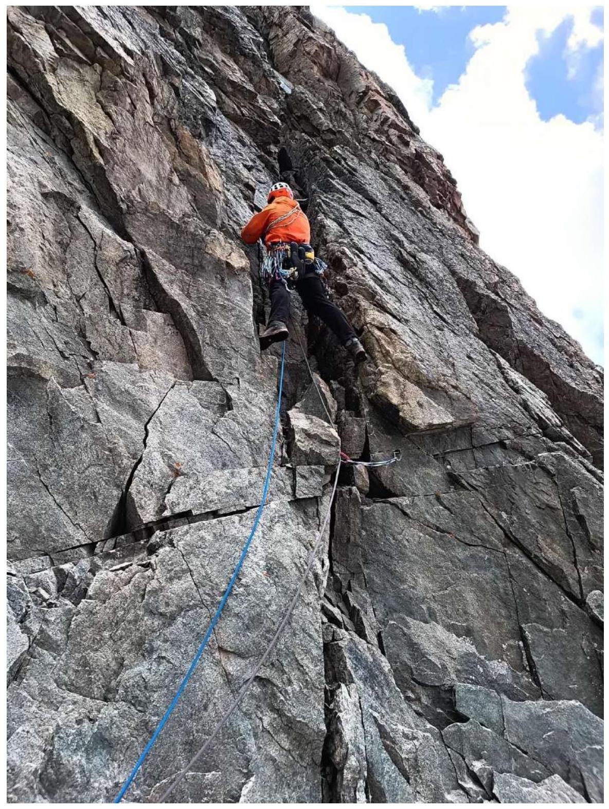
Photo 1. Start of section R0–R1 (S. Grishin leads).
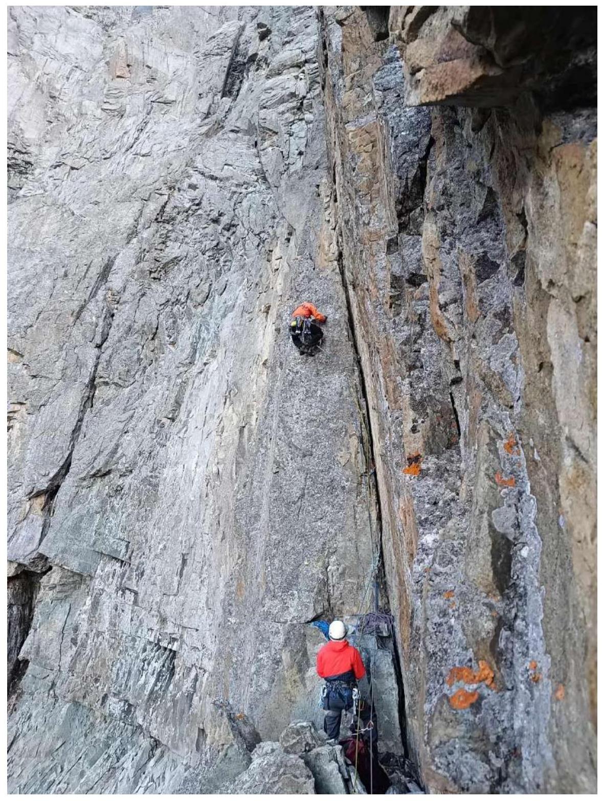
Photo 2. Start of section R2–R3.
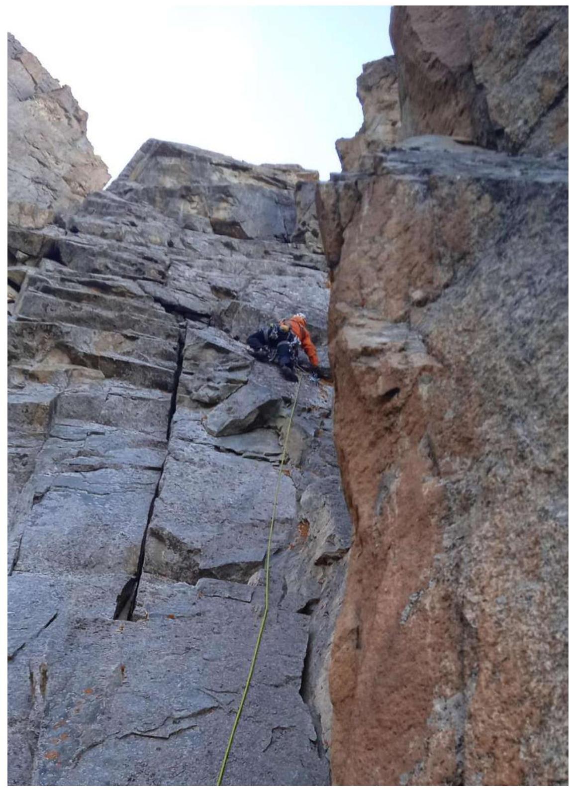
Photo 3. On section R3–R4.
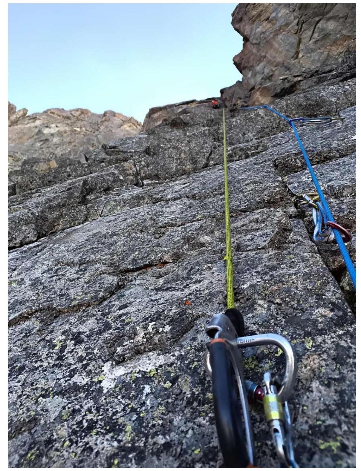
Photo 4. Section R4–R5.
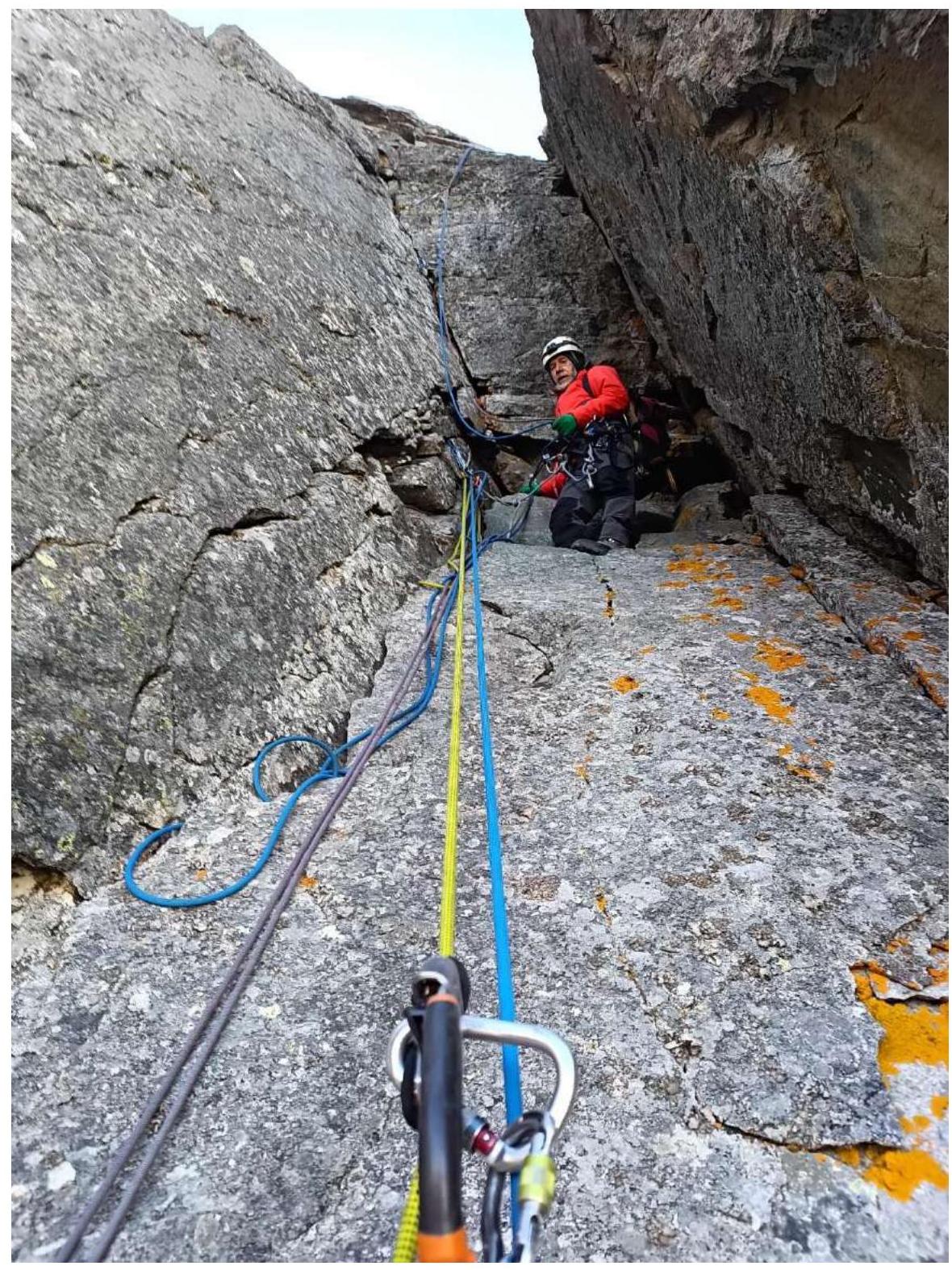
Photo 5. Start of section R5–R6.
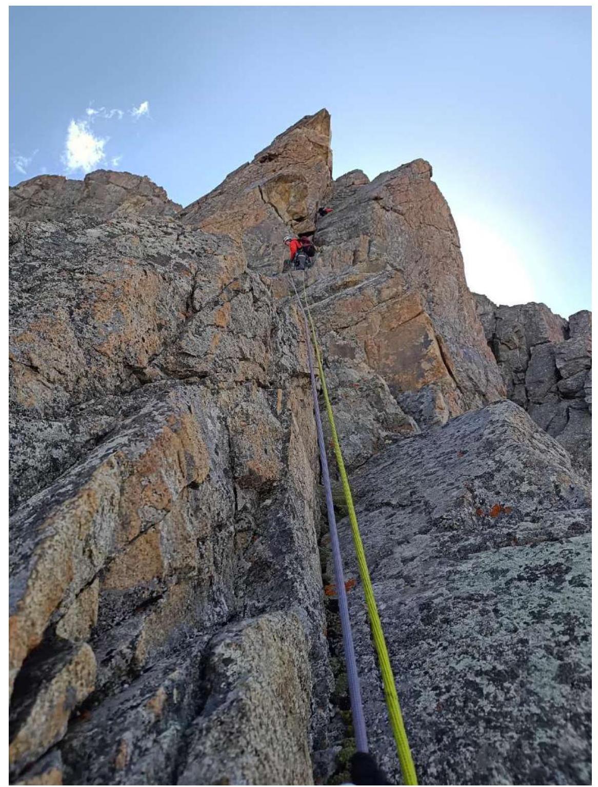
Photo 6. Sections R5–R6–R7.
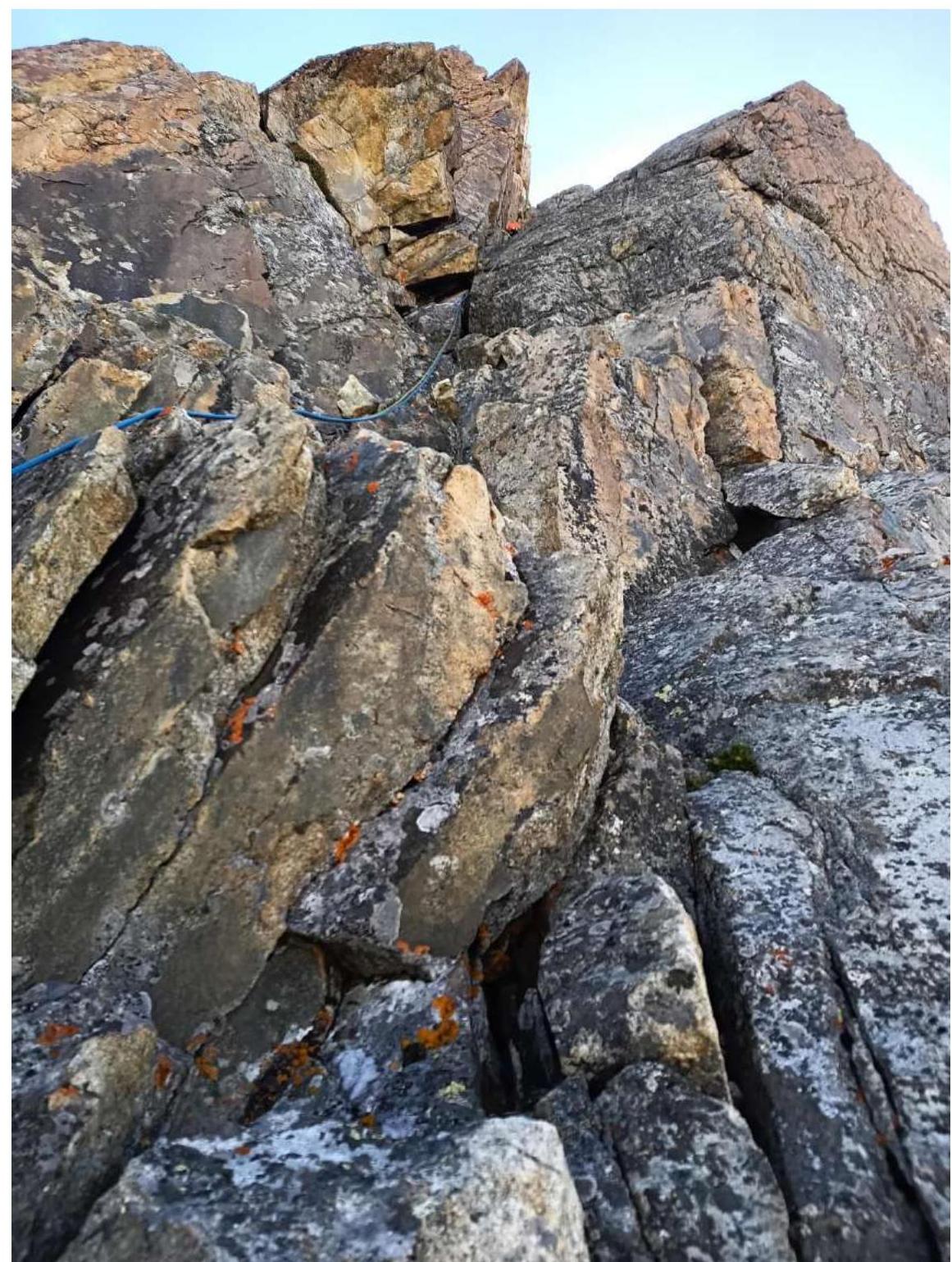
Photo 7. Section R6–R7.
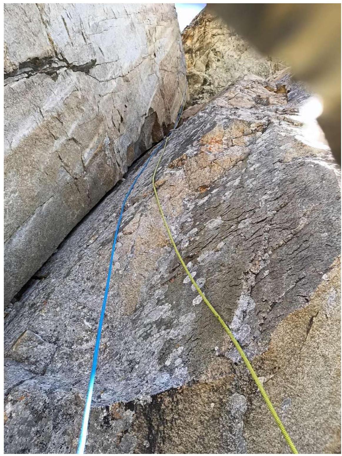
Photo 8. Section R7–R8.
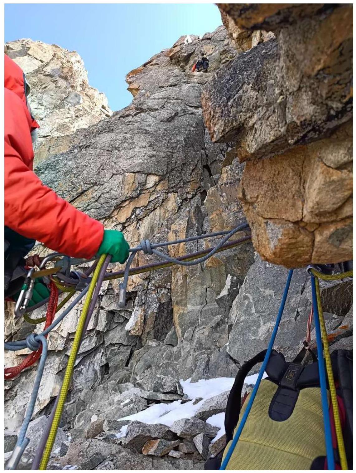
Photo 9. Section R8–R9.
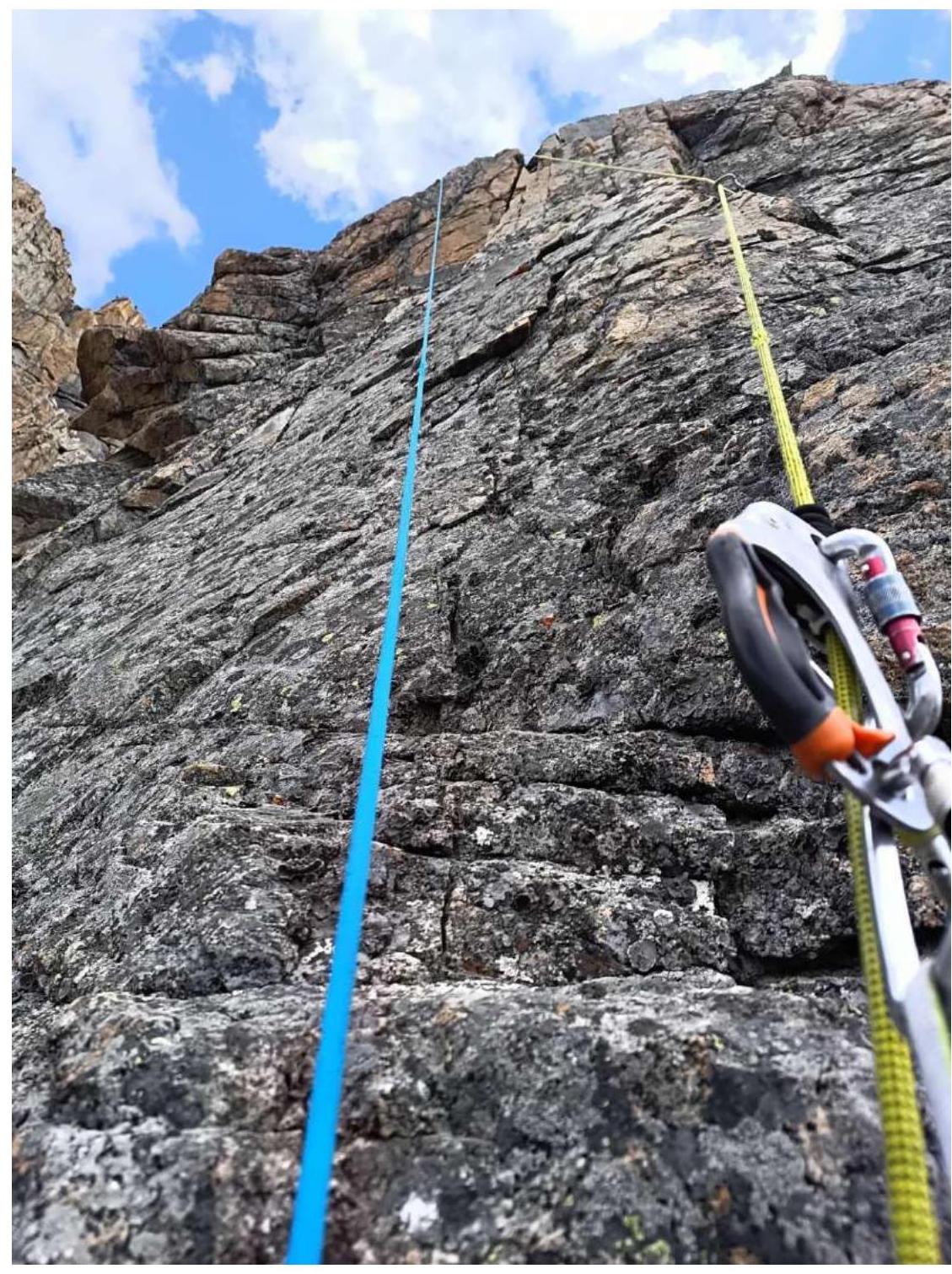
Photo 10. Wall on section R8–R9.
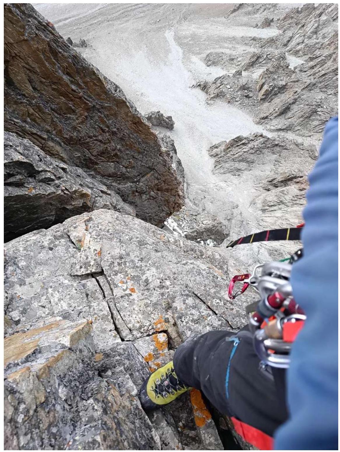
Photo 11. View down from the end of section R8–R9.
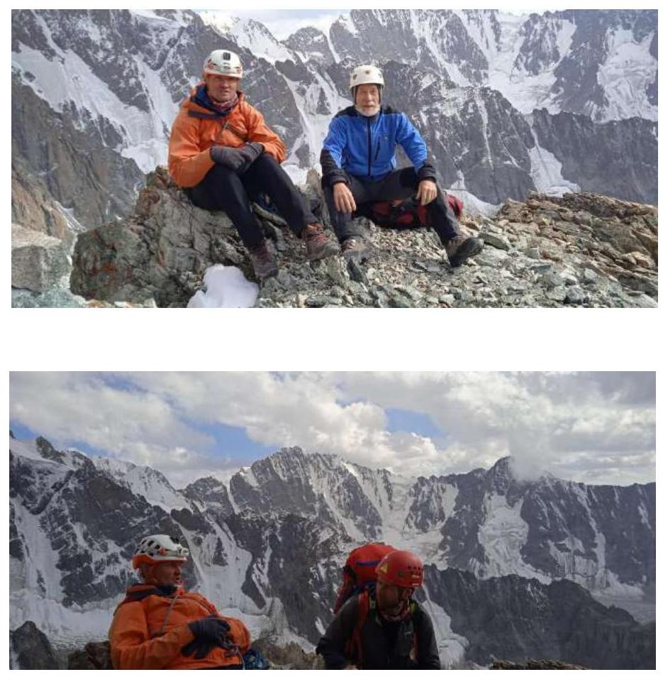
Photo of the team on the summit. (on the upper left - S. Grishin, V. Kudryashov, on the lower - S. Grishin, R. Ogorodnikov)
We did not find any intermediate tours or notes.
4. Characteristics of Weather Conditions
Weather conditions were favorable: cloudy, no precipitation, temperature within +10 °C, moderate wind.
Comments
Sign in to leave a comment