Report
On the first ascent to the summit of Pik Ratzek via the eastern counterfort, route 2B category, by the Ak-Sai Travel team from 1.10.2023 to 1.10.2023.
I. Climbing Passport
| №№ p.p. | 1. General Information | |
|---|---|---|
| 1.1 | Full name, sports rank of the leader, date of birth | Khomenyuk Mikhail Yuryevich, 1st sports rank, date of birth: January 5, 1973. |
| 1.2 | Full name, sports rank of participants, date of birth | Ignashev Ilya Sergeyevich, 3rd sports rank, date of birth: November 9, 1980. |
| 1.3 | Full name of coach | Grekov Dmitry Mikhailovich |
| 1.4 | Organization | Ak-Sai Travel |
| 2. Characteristics of the Climbing Object | ||
| 2.1 | Region | Tian Shan, Kyrgyz Range |
| 2.2 | Valley | Ala-Archa |
| 2.3 | Section number according to the 2020 classification table | Section 7.4 according to the 2017 classification table. |
| 2.4 | Name and height of the summit | Pik Ratzek, 4150 m (3980 m by GPS) |
| 2.5 | Geographical coordinates of the summit (latitude/longitude), GPS coordinates | 42°31′21.281″ N, 74°32′23.294″ E |
| 3. Characteristics of the Route | ||
| 3.1 | Route name | Via Eastern Counterfort |
| 3.2 | Proposed category of difficulty | 2B |
| 3.3 | Degree of route exploration | First ascent |
| 3.4 | Relief characteristics of the route | Rocky |
| 3.5 | Elevation gain of the route | 250 m |
| 3.6 | Route length | 500 m |
| 3.7 | Technical elements of the route | I category. Rocks — 335 m. II category. Rocks — 70 m. III category. Rocks — 85 m. IV category. Rocks — 10 m. Movement on closed glacier — 0 m. Descent by rappel (on descent) — 2 ropes, 100 meters. |
| 3.8 | Descent from the summit | Via 2B category on the side of the Uchitel glacier. |
| 3.9 | Additional characteristics of the route | No water. Snow in winter time. |
| 4. Characteristics of Team Actions | ||
| :--: | :--: | :--: |
| 4.1 | Movement time | 4 hours |
| 4.2 | Overnights | No overnight |
| 4.3 | Exit to the route | 9:30, 1.10.2023 |
| 4.4 | Summit attainment | 13:30, 1.10.2023 |
| 4.5 | Return to base camp | 18:00, 1.10.2023 |
| 5. Responsible for the Report | ||
| 5.1 | Full name, e-mail | Khomenyuk Mikhail Yuryevich, khomenyuk@ya.ru |
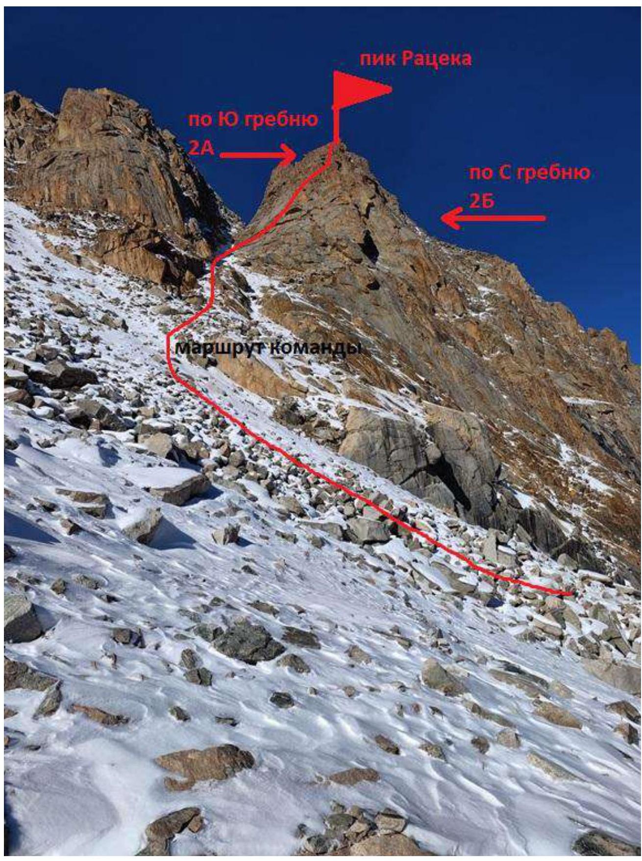
General photo of the summit. Date taken: October 1, 2023. Location — Uchitel glacier. Taken before the start of the route.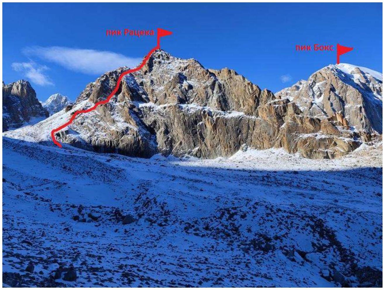
Photo of the route from the right. Taken on October 1, 2023, from the Uchitel glacier.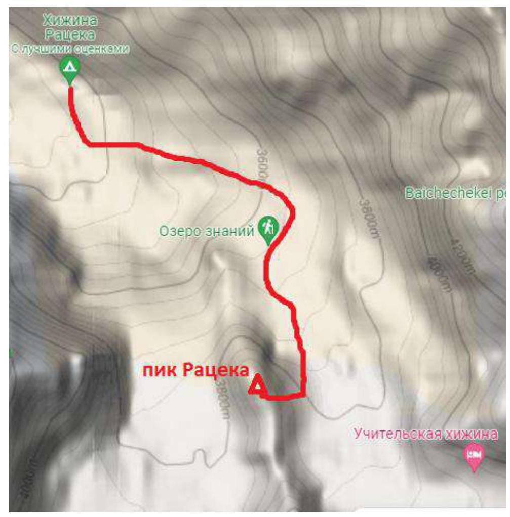
Scheme of approaches from Ratzek hut.
| Section № | Length | Steepness | Relief characteristics | Category of difficulty | Number of pitons |
|---|---|---|---|---|---|
| 1 | 300 | 40 | Scree couloir | I | 0 |
| 2 | 50 | 70 | Rock wall | III | 6 |
| 3 | 50 | 40-60 | Couloir, rocky ridge | II–III | 2 |
| 4 | 50 | 30-80 | Inner corner | II–IV | 5 |
| 5 | 50 | 30-70 | Inner corner, summit dome. | III | 2 |
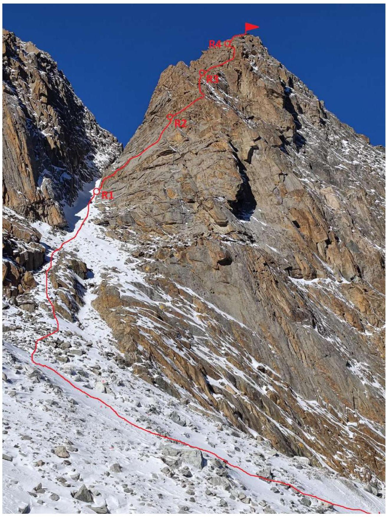
Technical photo of the route.
| Section № | Description | Photo № |
|---|---|---|
| 0 | Approaches: from the base camp of Ratzek hut, move along a good trail to Lake Znaniy. Bypass the lake on the right and continue moving under the eastern wall of Pik Ratzek to the scree couloir leading to the saddle. Time taken for approaches is 2 hours 00 minutes. | |
| 1 | 300 m, I. Scree couloir 30–40°. Bypass the sheer rocks of the Eastern wall on the left and move up the couloir to the characteristic narrowing. The length of the section is about 300 m. Simultaneous movement without a rope. The beginning of the technical part of the route is a small ledge on the right before the narrowing of the couloir. | |
| 2 | 50 m, III. Rock wall, steepness 60–70°. Pleasant climbing, firm rocks, reliable protection with stoppers and medium friends. Station on a convenient ledge, or slightly higher at the base of the couloir, leading to the ridge of the counterfort. | 1,2,3 |
| 3 | 50 m, II–III. Up the couloir 20 m to the ridge. Along the ridge to the left upwards, sticking to the left side of the ridge. In the couloir, protection with medium friends, further along the ridge protection through ledges. Station on a ledge, at the base of the inner corner going upwards to the right. From here, by traversing to the left, one can exit onto route 2A along the South ridge. | 4 |
| 4 | 50 m, II–IV. To the right — up the inner corner. In the middle part — the key section, passed on the right side of the corner, 10 m IV. Reliable protection with stoppers and friends. After the key, the route exits onto the line of 2A along the South ridge. Station on a stationary loop at the base of the inner corner, leading to the summit. | 5 |
| 5 | 50 m, III–I. Up the inner corner 15 m III, then on foot to the summit. | 6,7 |
General impression: a beautiful, pleasant educational route. Reliable insurance. Not rockfall-prone. Reliable radio communication with Ratzek hut throughout the entire route. Mobile communication is absent. The route is more even and concise than the route to Pik Ratzek via the North ridge 2B.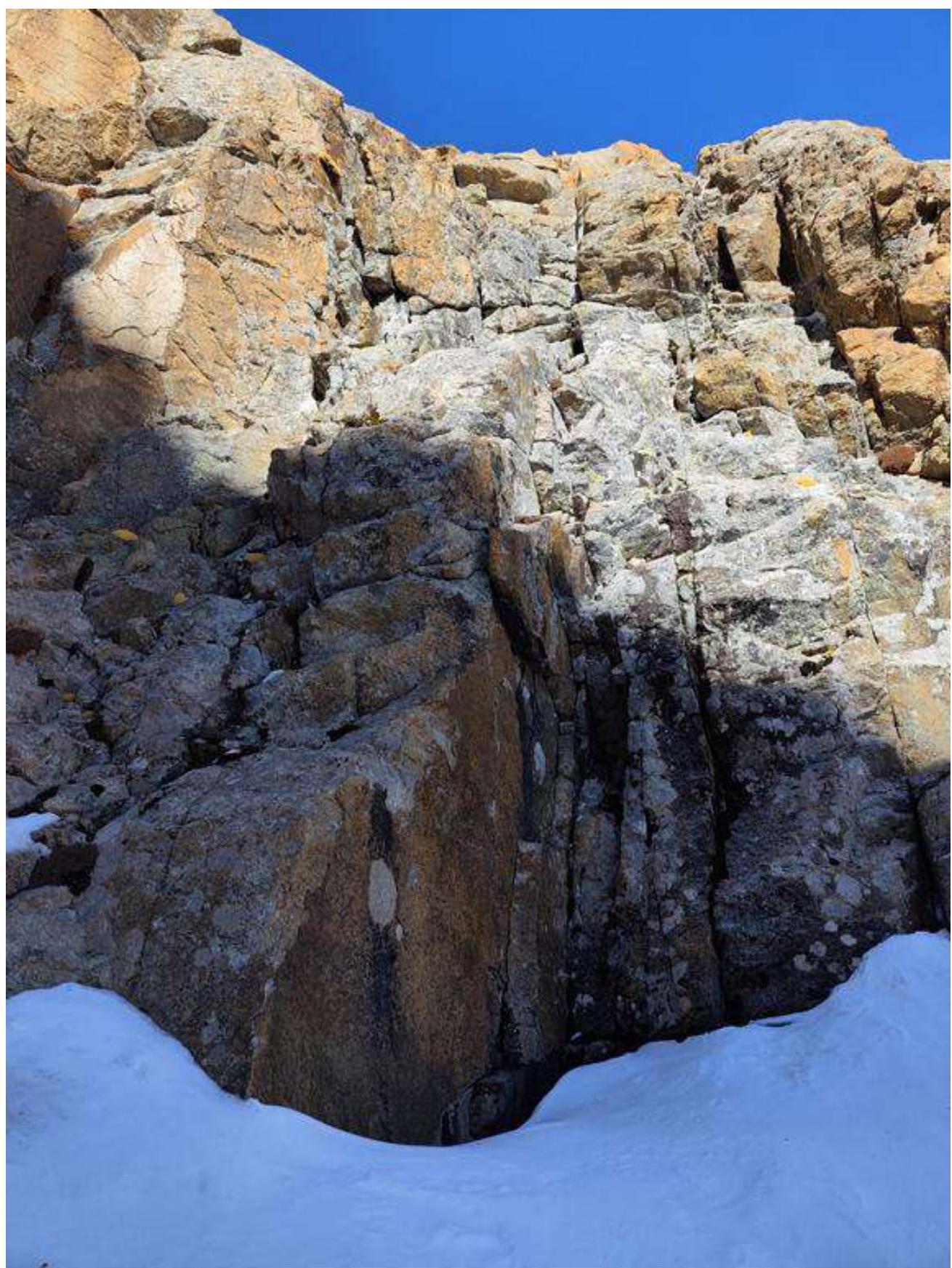
Photo №1. Section 1. Beginning of the technical part of the route.
Photo №2. On the ledge, before the start of the technical part of the route.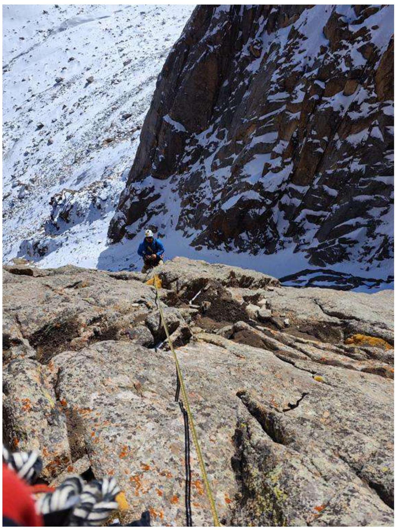
Photo №3. Section 2, first rope, exit to the station.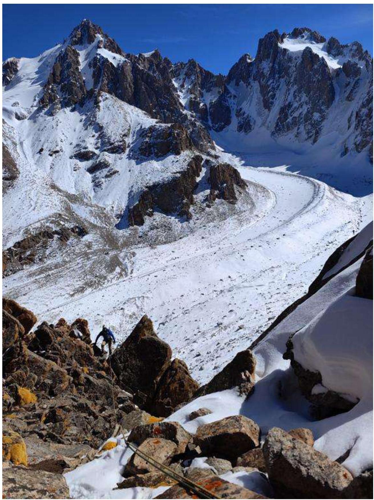
Photo №4. Section 3, along the ridge to the station.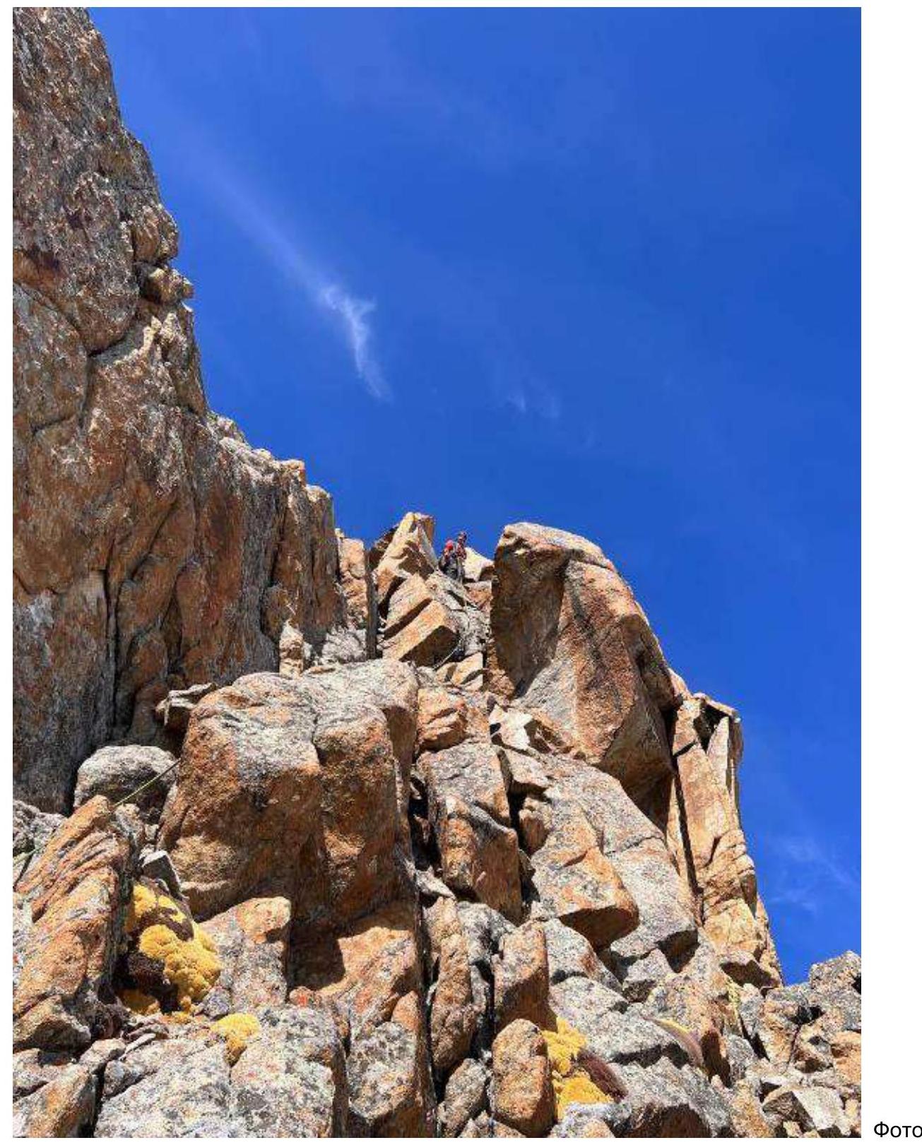
Photo №5. Section 4. Key part of the route.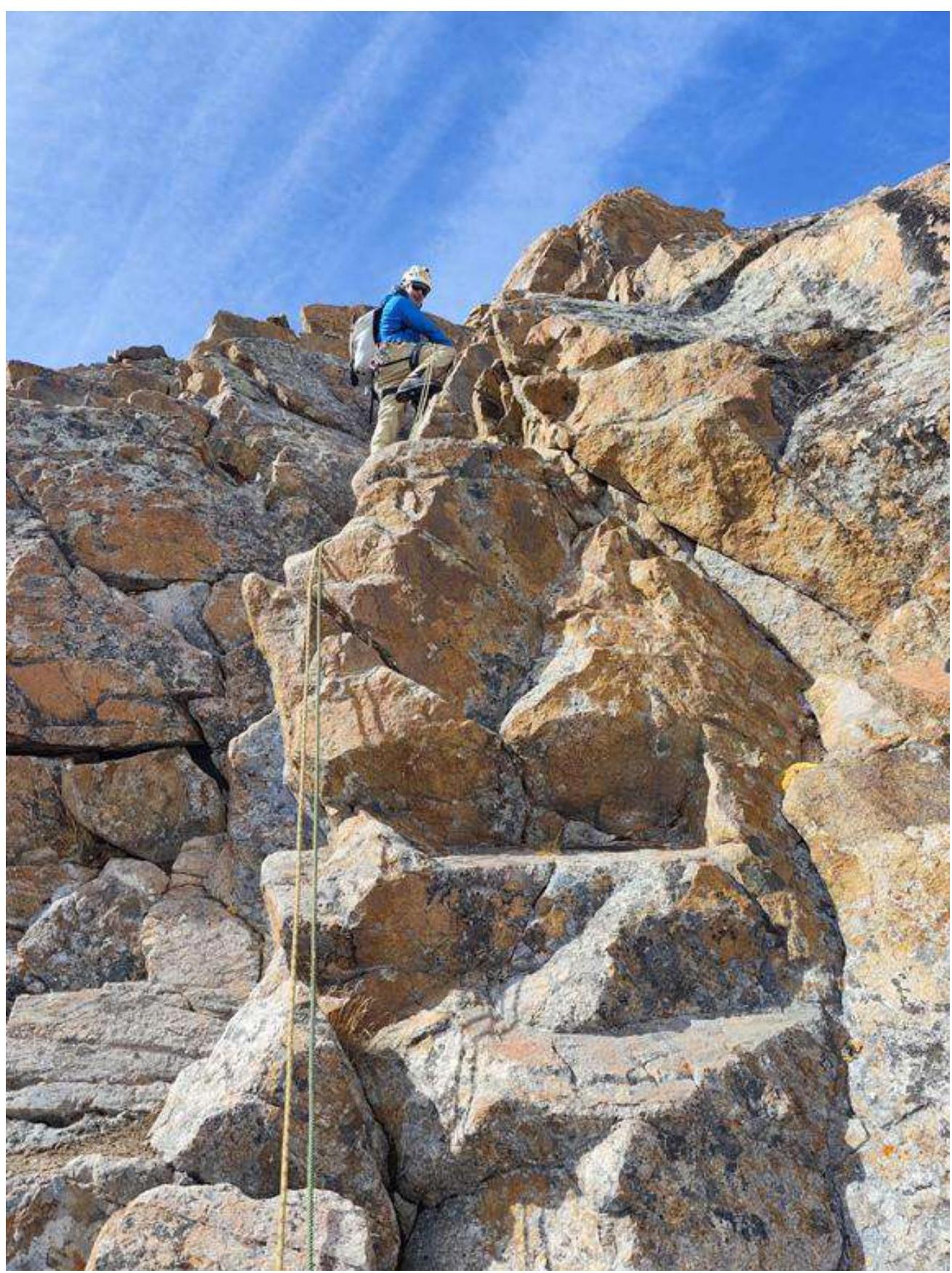
Photo №6. Section 5, exit to the summit.
Photo №7. Photo at the summit.