
Report
ON THE FIRST ASCENT OF THE 3800 PEAK (IFMGA) VIA ROUTE 2A CAT. DIFF. BY THE TEAM OF а\к Политехник FROM JULY 27, 2023 TO JULY 27, 2023.
I. Climbing Passport
| № | 1. General Information | |
|---|---|---|
| 1.1 | Full Name, Sports Rank of the Leader | Ibragimov Ilnar Minnekhanovich, CMS |
| 1.2 | Full Name, Sports Rank of Participants | Arlantseva Anastasia Viktorovna, no rank Garina Alina Vitalyevna, 3rd sports rank Romanova Anna Sergeyevna, 3rd sports rank Smirnova Alyona Vitalyevna, 3rd sports rank Frolova Maria Sergeyevna, 3rd sports rank |
| 1.3 | Full Name of Coach | Molodozhen Vladimir Aleksandrovich |
| 1.4 | Organization | а\к Политехник, St. Petersburg |
| 2. Characteristics of the Climb | ||
| 2.1 | Region | Tian-Shan, Kyrgyz Range |
| 2.2 | Valley | Aksai |
| 2.3 | Number of Section According to the 2013 Classification Table | 7.4 |
| 2.4 | Name and Height of the Peak | IFMGA, 3800 m |
| 2.5 | Geographical Coordinates of the Peak (Latitude/Longitude), GPS Coordinates *(1) | 42.521764, 74.540171 |
| 3. Route Characteristics | ||
| 3.1 | Route Name | From the South |
| 3.2 | Proposed Category of Difficulty | 2A |
| 3.3 | Degree of Route Exploration | First ascent, first passage, 2nd passage, 3rd passage, variation, combination — (choose), in other cases, a dash is placed |
| 3.4 | Relief Characteristics of the Route | Rocky |
| 3.5 | Height Difference of the Route (data from altimeter or GPS) | |
| 3.6 | Route Length (in meters) | 250 m |
| 3.7 | Technical Elements of the Route (total length of sections of various difficulty categories with indication of relief characteristics (ice-snow, rocky)) | 1st cat. diff. rocks — 100 m 2nd cat. diff. rocks — 250 m 3rd cat. diff. rocks — 50 m Dülfer descent (on descent) — 2 ropes, 75 m |
| 3.8 | Descent from the Summit | Via the ascent route |
| 3.9 | Additional Route Characteristics | |
| 4. Characteristics of Team Actions | ||
| 4.1 | Time of Movement (team's walking hours, in hours and days) | 11 hours |
| 4.2 | Overnight Stays | Platform, shelf — (choose) |
| 4.3 | Departure onto the Route | 4:00, July 27, 2023 |
| 4.4 | Summit Attempt | 9:20, July 27, 2023 |
| 4.5 | Return to Base Camp | 15:00, July 27, 2023 |
| 5. Person Responsible for the Report | ||
| 5.1 | Full Name, e-mail | Ibragimov I.M., medsh7@gmail.com |
II. Climbing Report
1. Characteristics of the Climb
1.1. General Photo of the Summit
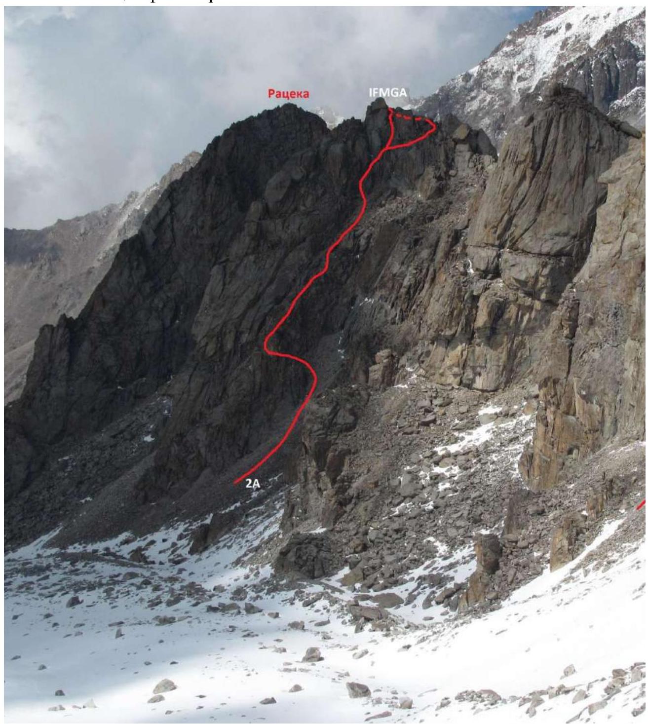
Photo taken by Dmitry Pavlenko
1.2. Map-Scheme of the Region
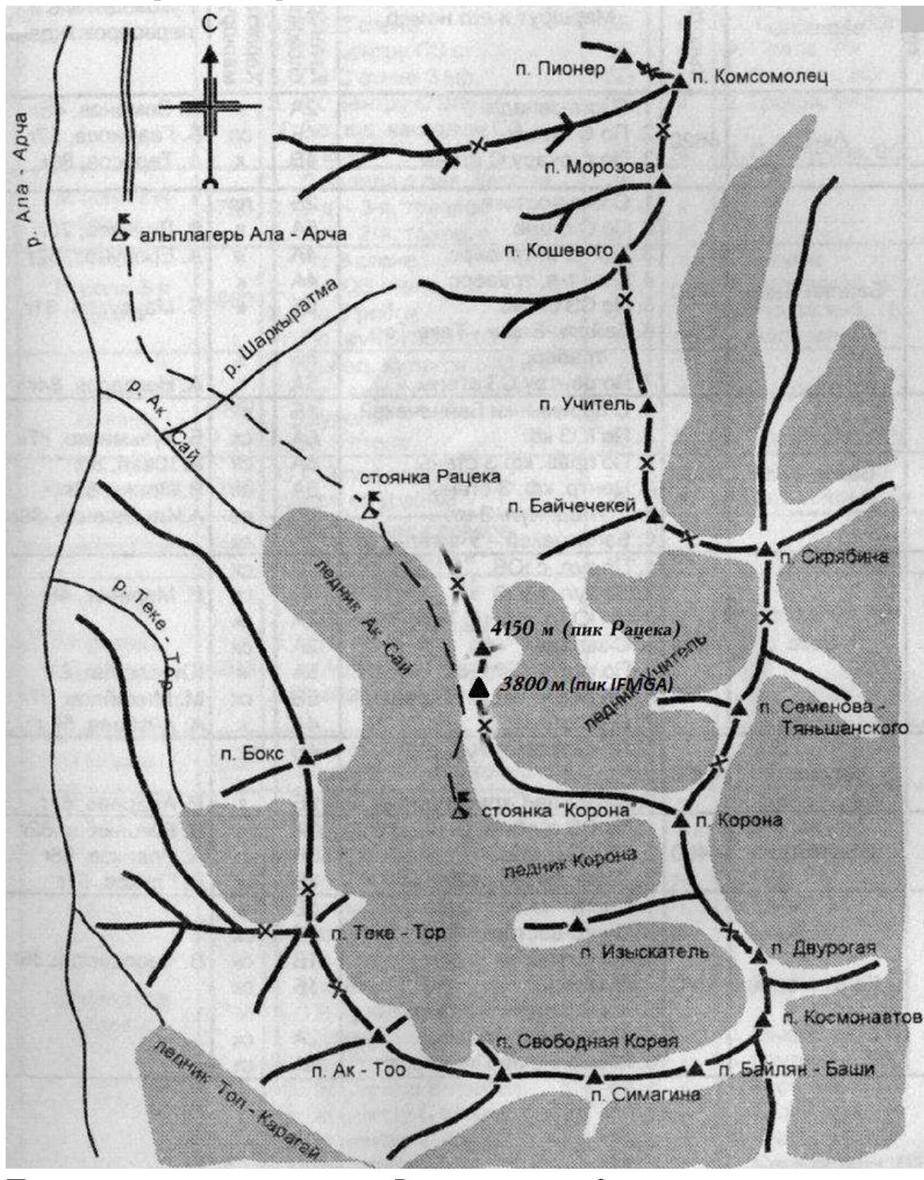
Approach to the route from Ratsek camps takes 3 hours
2. Route Characteristics
2.1. Technical Photograph of the Route
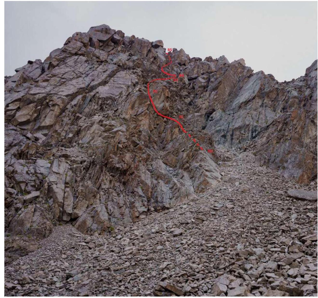
2.2. Technical Characteristics of Route Sections.
| Section № | Relief Characteristics | Cat. Diff. | Length, m | Type and Number of Pitons |
|---|---|---|---|---|
| R0–R1 | Rocky, small inner corner | 2 | 10 | 2 chocks |
| R1–R2 | Rocky, small wall | 2 | 10 | 2 chocks |
| R2–R3 | Rocky ridge leading to a scree shelf under the route's key | 2 | 230 | 10 chocks, 5 slings |
| R3–R4 | Scree shelf | 1 | 100 | - |
| R4–R5 | Series of inner corners. The right one leads to | 3–3+ | 50 | 8 chocks, 3 slings |
| summit |
3. Characteristics of Team Actions
3.1. Brief Description of Route Passage.
At 4:00, the team left Ratsek camps. At 6:30, they were under the route, got dressed, tied in, and started working at 7:00. At 9:20, they were on the summit in full composition and began descent at 9:30. At 12:00, they descended into the starting couloir. At 15:00, they returned to base camp.
The entire lower part of the route up to section R5 was climbed simultaneously. Section R5 was climbed in turns.
On the Route
| Section № | Description | Photo № |
|---|---|---|
| R1 | From Aksai glacier, it's necessary to ascend into a large scree couloir. In its left part, there's a small inner corner leading under a small wall | Photo 1, 2 |
| R2 | The inner corner leads under a small wall. From the exit of the corner to the right in the direction of the ridge | |
| R3 | The small wall leads to a ridge. To the left of it is a couloir with many loose rocks, to the right are drops into the starting large couloir. The ridge leads to a large scree shelf. On the ridge, there's a rappel anchor from which one can descend into the large couloir. Rappel 40–45 m | |
| R4 | We proceed in the direction of a series of inner corners. | Photo 3 |
| R5 | Series of inner corners. We ascended via the left one and traversed to the right. Climbing is quite tense, 3–3+, the key section of the route. At the base of the right inner corner, there's a rappel anchor. Rappel length 30 m | Photo 4, 5 |
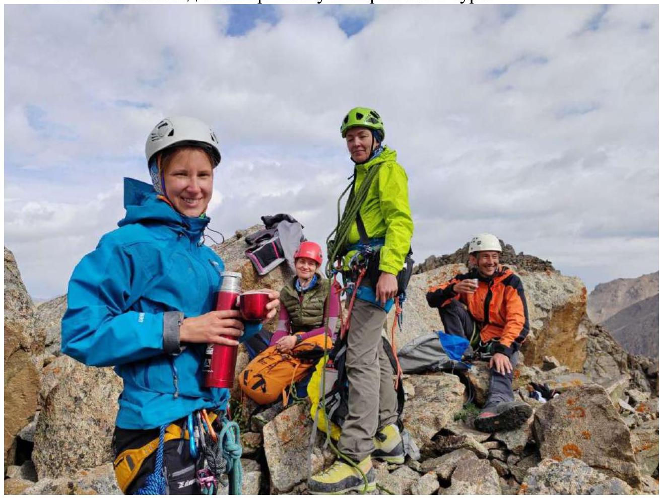
3.2. Photo of the Team on the Summit near the Control Tour.
3.3. The route is relatively safe with due care. In the middle part, if one deviates from the ridge to the left into the couloir, it's possible to trigger rockfall, as well as when exiting onto the scree shelf. In winter, there's a possibility of a large amount of snow in this couloir.
For descent, there's no rappel anchor on the summit, but one can traverse along the ridge towards the crown and make a detour to the nearest rappel anchor.
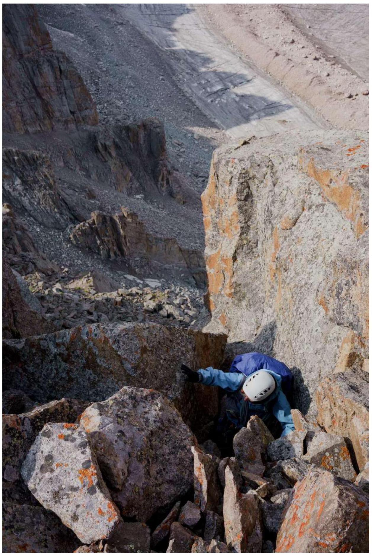
Photo 1. Inner Corner
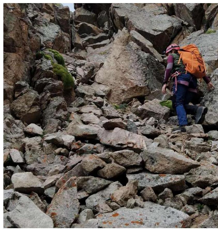
Photo 2. Second participant above the inner corner
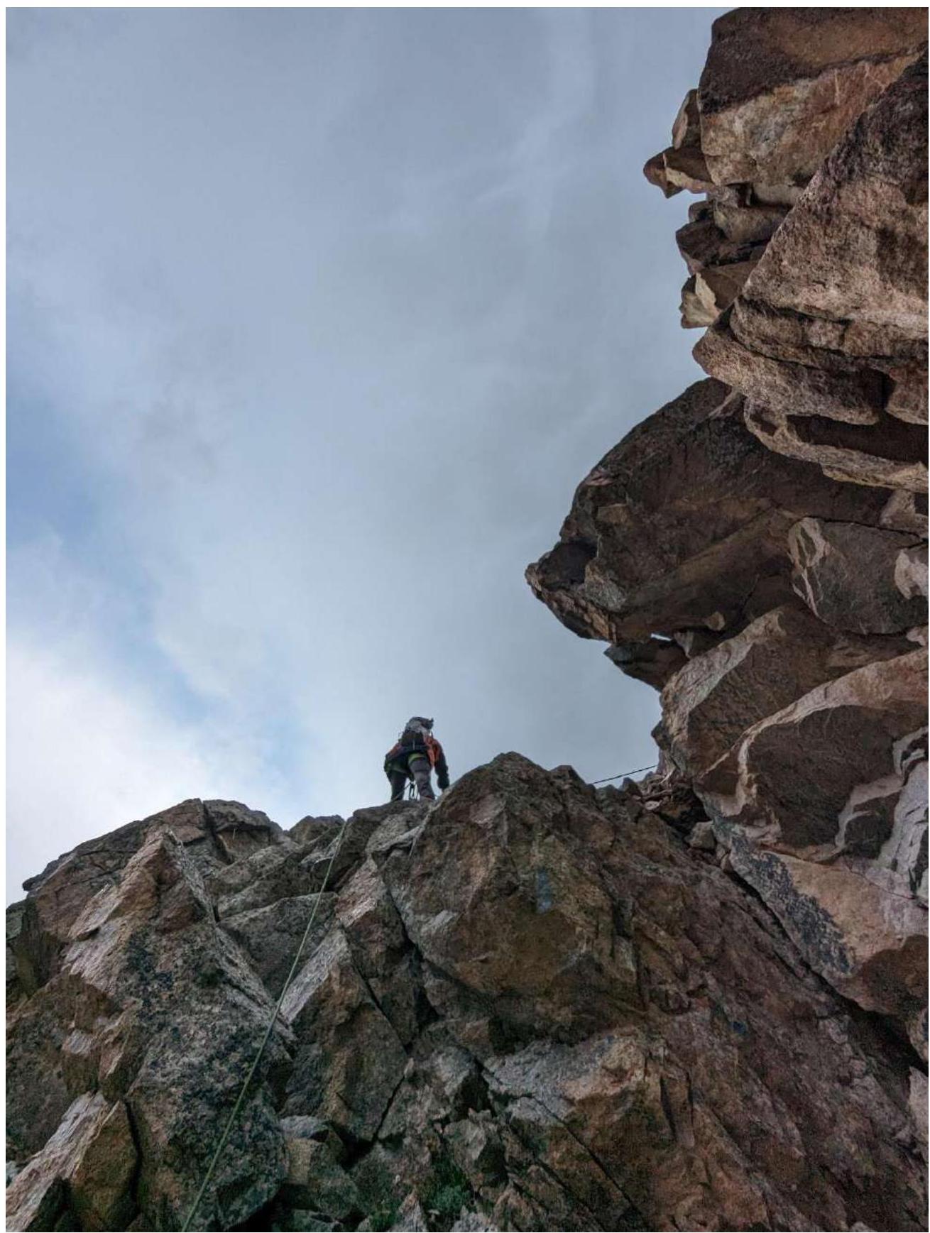
Photo 3. Towards the key section. Overhanging large rock, to the right of it is an inner corner
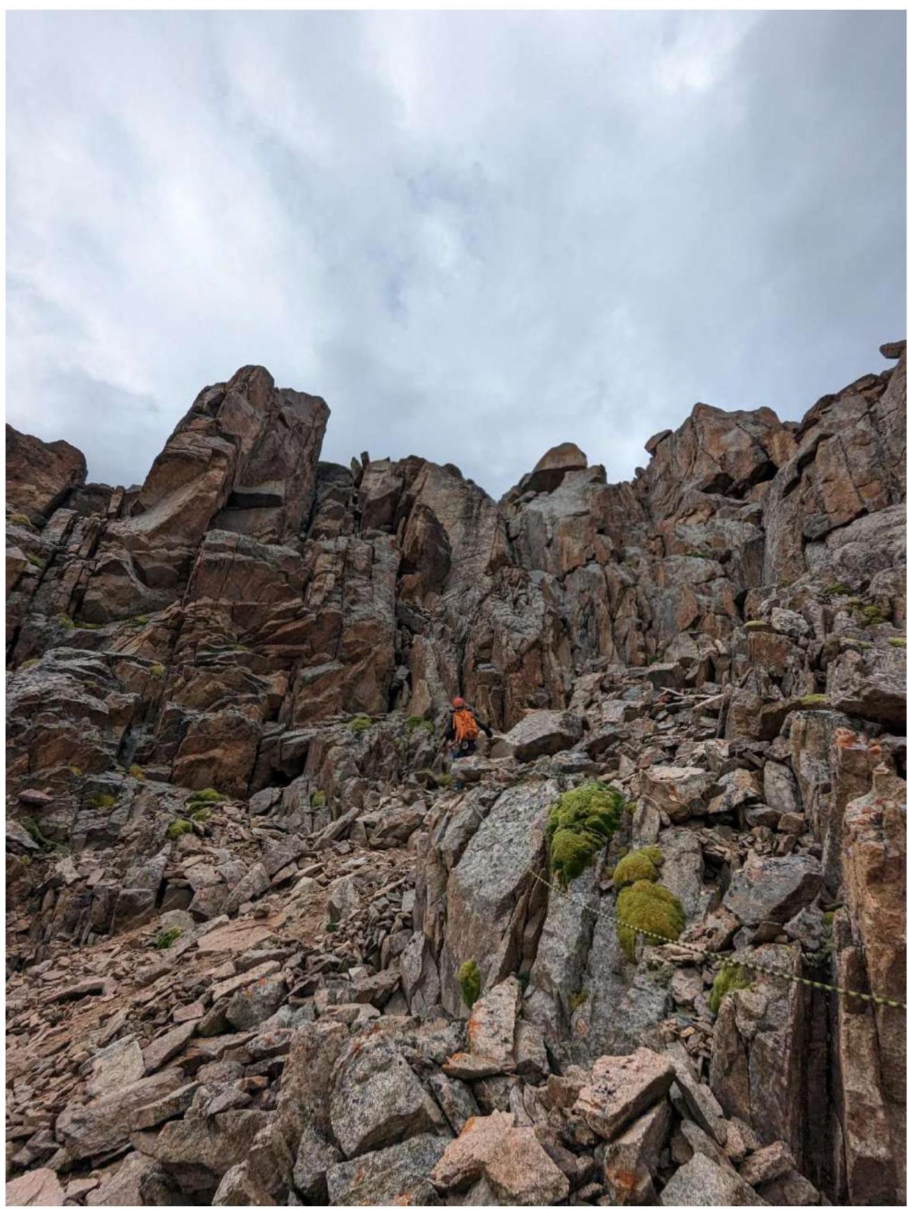
Photo 4. Leader working in the left inner corner
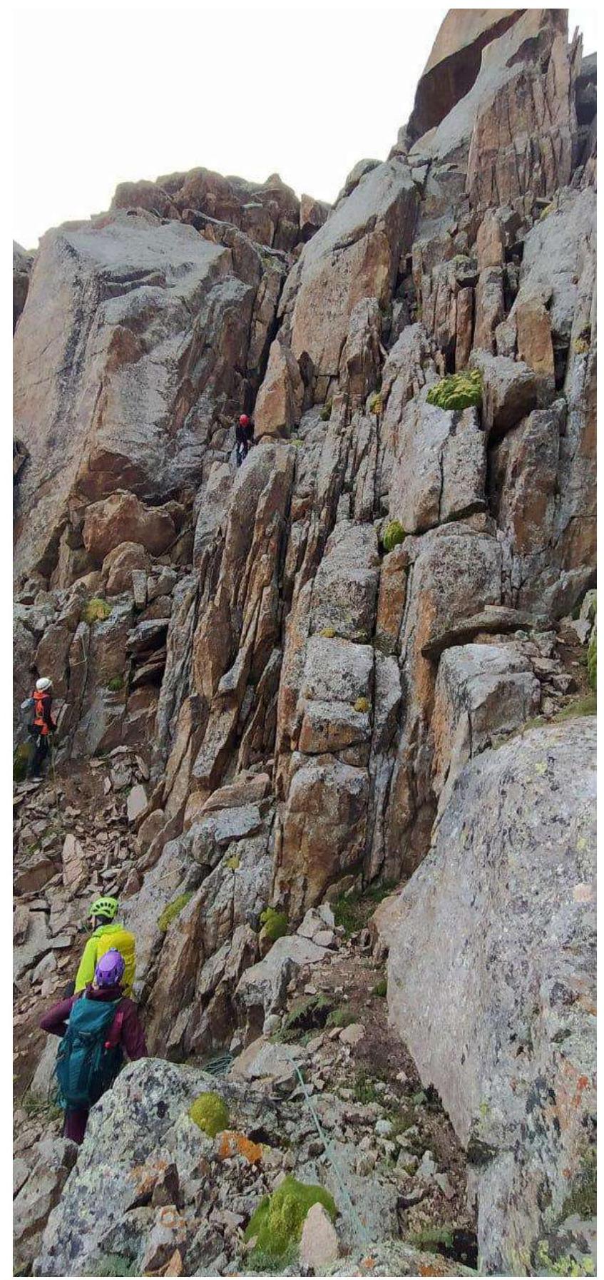
Photo 5. Participant climbing to the summit
Comments
Sign in to leave a comment