
MOUNTAINEERING FEDERATION OF KRASNODAR REGION
Report
ON THE FIRST ASCENT TO THE SUMMIT PIK KOCHEVNIKOV 3460 m VIA THE WESTERN RIDGE "A20", CARRIED OUT BY THE TEAM OF THE REGIONAL PUBLIC ORGANIZATION "MOUNTAINEERING FEDERATION OF KRASNODAR REGION"
presumably 4B cat. diff. FIRST ASCENT
Foygel M. R. Sushko D. S.
2022
Table of Contents
Table of Contents – 2 Route Passport – 3 General Photo of the Summit – 5 Panorama of the Area – 6 Area Map – 7 Information about the Climbing Object and Team Actions – 8 Recommended Equipment Set – 9 Route Diagram in UIAA Symbols – 10 Technical Photograph of the Route – 11 Route Description by Sections – 12 Descent from the Route – 14 Photographs of Route Sections – 15
Route Passport
| № | 1. General Information | |
|---|---|---|
| 1.1 | Leader | Foygel Maxim Rafailovich (CMS) |
| 1.2 | Participants | Lange Alexander Sergeevich (MS) Sushko Denis Sergeevich (MS) |
| 1.3 | Coach | - |
| 1.4 | Organization | Regional Public Organization "Mountaineering Federation of Krasnodar Region" |
| 2. Characteristics of the Climbing Object | ||
| 2.1 | Area | Tian Shan, Kyrgyz Range |
| 2.2 | Valley | Upper Ala-Archa |
| 2.3 | Section Number | 7.4. |
| 2.4 | Summit | Pik Kochevnikov 3460 m (summit name given by the team) |
| 2.5 | Coordinates | 42.47996° N, 74.47557° E |
| 3. Route Characteristics | ||
| 3.1 | Route Name | via the western ridge "A20" |
| 3.2 | Proposed Category of Difficulty | 4B |
| 3.3 | Area Exploration Level | first ascent |
| 3.4 | Terrain Type | rock |
| 3.5 | Height Difference | 250 m |
| 3.6 | Route Length | 380 m |
| 3.7 | Section Lengths | N/C – 10 m I cat. diff. – 50 m II cat. diff. – 115 m III cat. diff. – 75 m IV cat. diff. – 85 m V cat. diff. – 20 m VI cat. diff. and above – 23 m A1 – 2 m Rappel descent (on descent) 1×40 m |
| 3.8 | Average Slope of the Route | - |
| 3.9 | Average Slope of the Main Part of the Route | - |
| 3.10 | Descent from the Summit | To the Upper Ala-Archa valley via a non-classified route (see "Descent from the Route" section) |
| 3.11 | Additional Route Characteristics | Water is absent on the route |
| 4. Characteristics of Team Actions | ||
| 4.1 | Travel Time | 5.5 h – 1 day |
| 4.2 | Overnights | - |
| 4.4 | Route Preparation | - |
| 4.5 | Departure to the Route | 08:15, September 8, 2022 |
| 4.6 | Summit Arrival | 13:45, September 8, 2022 |
| 4.7 | Return to Base Camp | 16:00, September 8, 2022 |
| 5. Weather Conditions | ||
| 5.1 | Temperature, °C | - |
| 5.2 | Wind Speed, m/s | - |
| 5.3 | Precipitation | - |
| 5.4 | Visibility, m | - |
| 6. Responsible for the Report | ||
| 6.1 | Foygel Maxim Rafailovich, m.foygel@gmail.com, +491781818303 |
General Photo of the Summit
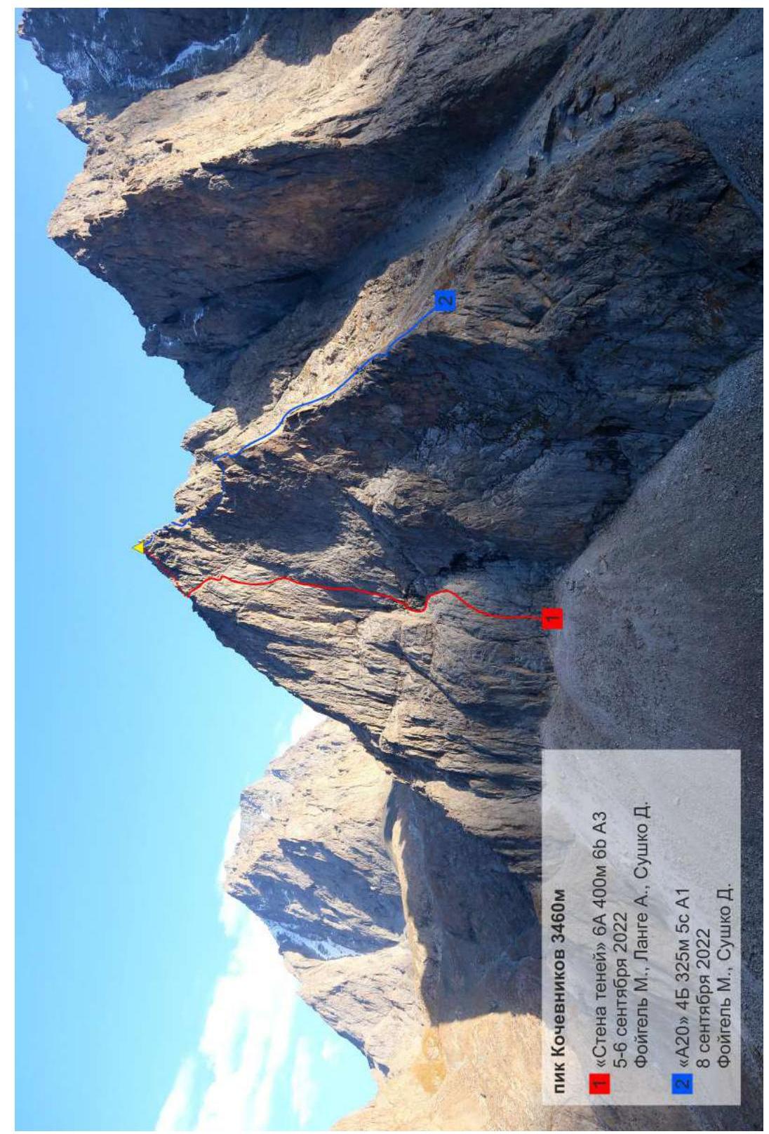
Pik Kochevnikov 3460 m "Wall of Shadows" 6A 400 m 6B A3 September 5–6, 2022 Foygel M., Lange A., Sushko D. "A20" 4B 325 m 5C A1 September 8, 2022 Foygel M., Sushko D.
Panorama of the Area
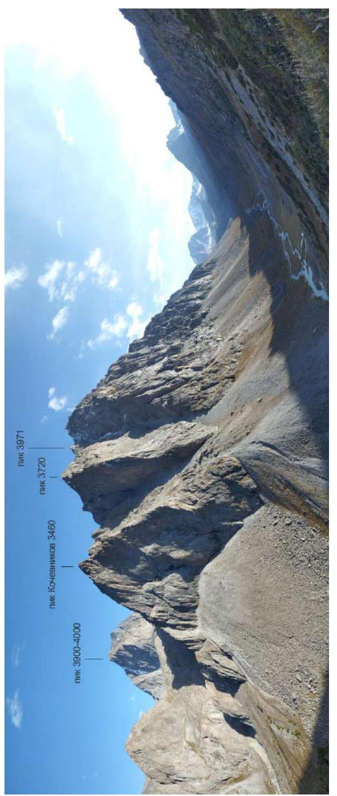
Pik 3971 Pik 3720 Pik Kochevnikov 3460 Pik 3900–4000
Area Map
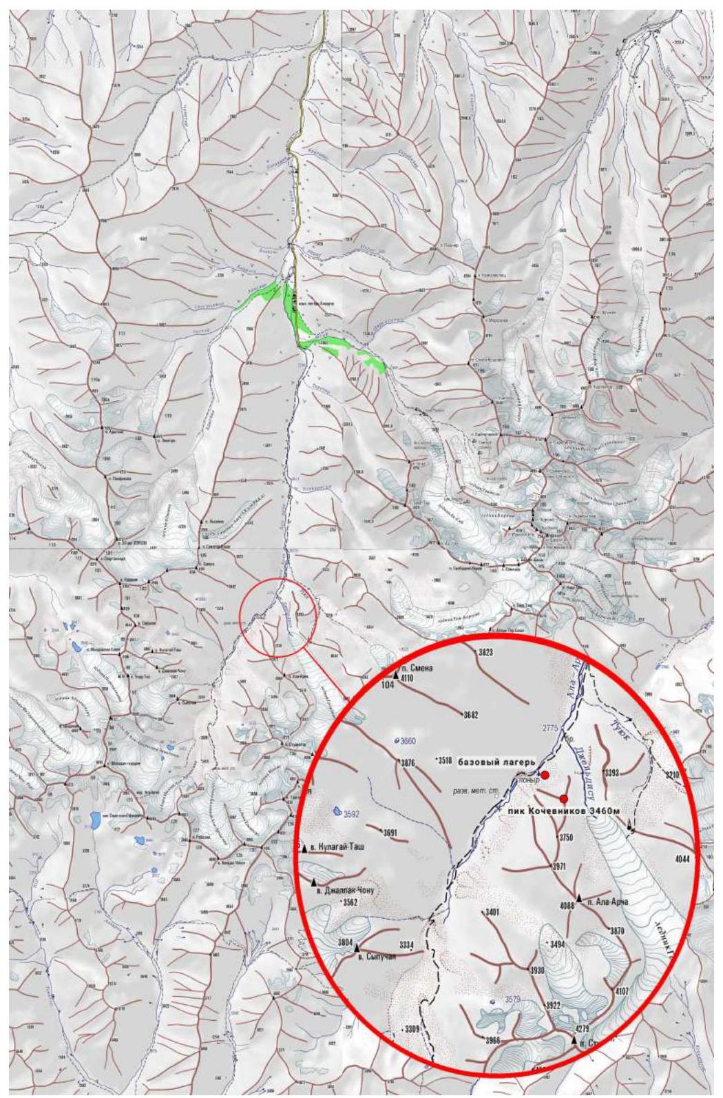
Area map compiled by Alexander Purikov. Original borrowed from www.westra.ru ↗
Information about the Climbing Object and Team Actions
The Upper Ala-Archa area belongs to the Ala-Archa National Park, where a well-known mountaineering area is located. Despite the close proximity of these two areas, Upper Ala-Archa is visited much less frequently, mainly by:
- mountain tourists;
- and very rarely by mountaineers.
In the past, during the USSR era, simple routes were laid on the main summits. Probably, the absence of "big walls" influenced the further development of the area, as climbing here did not promise prize places in mountaineering championships.
Despite this, the Upper Ala-Archa area has been and remains interesting for mountaineers of various levels. In addition to existing training routes, several interesting sport lines can be laid on the walls and ridges to summits up to 4000 m. At the same time, relatively simple logistics allow for a quick arrival at the base camp locations.
In April 2021, one of the participants in this ascent (Foygel) visited the Upper Ala-Archa area. The spurs of Pik Ala-Archa, namely the northernmost unnamed peak, attracted great interest.
Over the following months, information on this area was gathered, consultations were held with local mountaineers, and existing routes were studied. It was discovered that the object of our ascent had neither a name nor any information about attempts to climb it.
At the beginning of September 2022, our team consisting of Maxim Foygel (leader), Alexander Lange, and Denis Sushko gathered in Bishkek. On September 2, a detailed reconnaissance was carried out, and the line of the main ascent was planned. On September 4, we moved from Bishkek and set up a base camp near the object of the ascent.
From September 5 to 6, the team worked on the NW wall and successfully completed a complex first ascent to the summit. The route was named "Wall of Shadows" and preliminarily rated as 6A. A report on the first ascent was submitted to the FARM. Since we were likely the first mountaineers to ascend the summit, it was decided to name it Pik Kochevnikov. The approximate height of the summit according to GPS is 3460 m. The coordinates of the summit are: 42.47996° N, 74.47557° E.
After a day of rest, the duo Foygel-Sushko made another ascent to the same summit via the 3rd ridge (the route is presented in this report).
The route via the 3rd ridge turned out to be an interesting training route of moderate category of difficulty. The rocks are quite monolithic for most of the route. However, there are two small sections with destroyed terrain. This will be mentioned separately in the description below.
The climbed line can be characterized as an interesting training route that, in our opinion, corresponds to routes of 4B category of difficulty.
Recommended Equipment Set
The recommended equipment set is given for a team of two:
- Rope 1×50 m (a second rope is necessary for rappel descent)
- Cams (camlots) 1 set (7–8 pcs) from small to large sizes
- Stoppers 3–4 pcs from small to medium sizes
- Quickdraws 60 cm (with carabiners) 6–8 pcs
- Anchor slings 180 cm 2 pcs
- Set of carabiners for gear placement and belay station rigging
- Anchor hooks 3–4 pcs and rock hammers (optional)
Route Diagram in UIAA Symbols
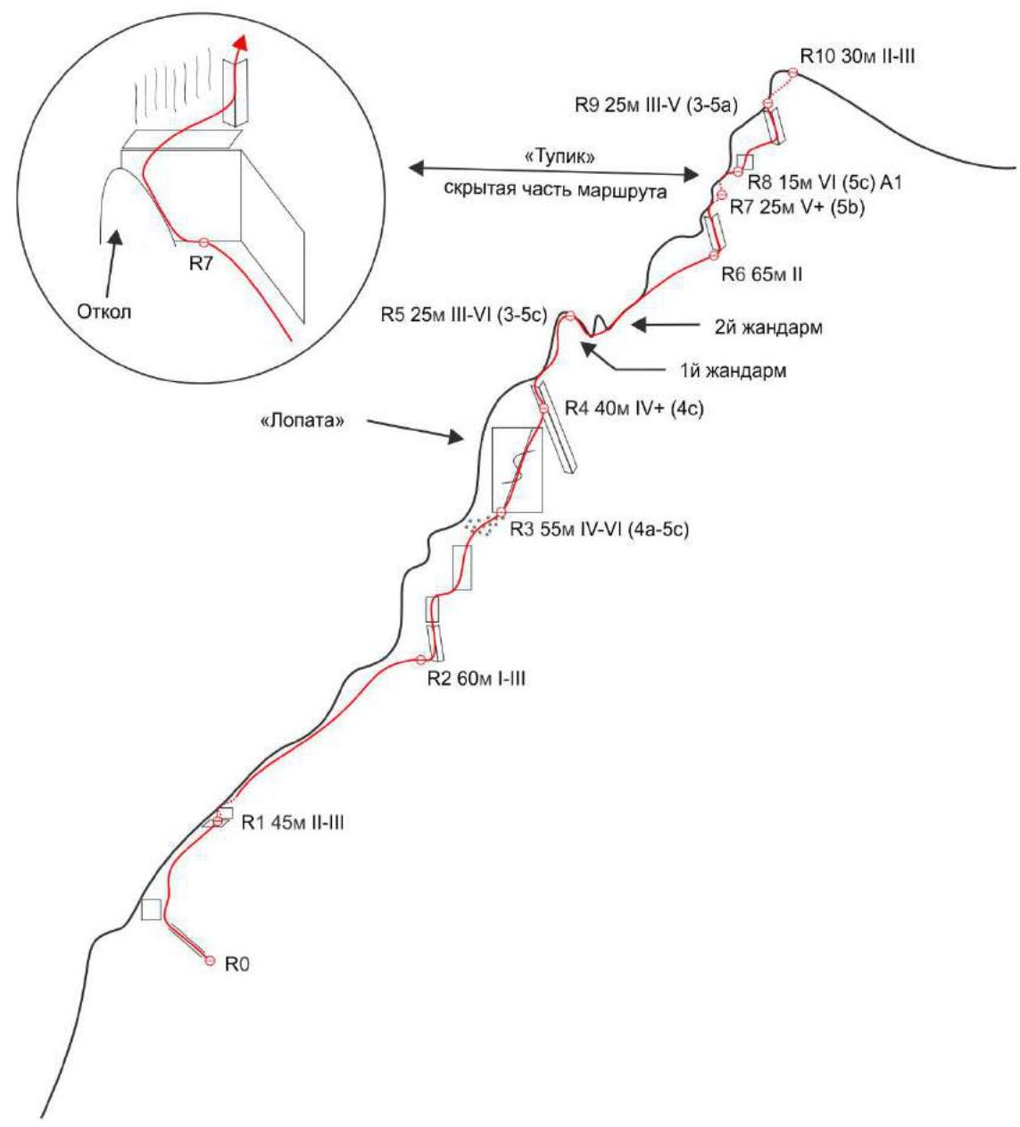
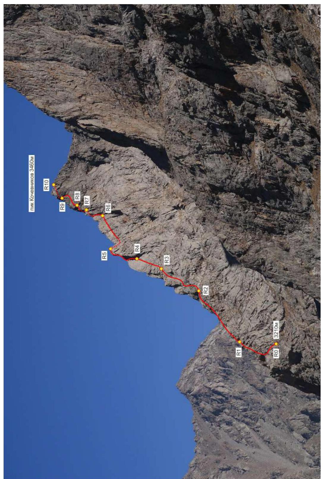
R10 30 m II–III R9 25 m III–V (3–5a) "Dead end" hidden part of the route R8 15 m VI (5c) A1 R7 25 m V+ (5b) R6 65 m II 2nd gendarme 1st gendarme R4 40 m IV+ (4c) R3 55 m IV–VI (4a–5c) R2 60 m I–III R1 45 m II–III R0 Flake "Spatula"
Technical Photograph of the Route
Route Description by Sections
From the base camp, move up the valley (along the trail) to where the river is blocked by a large boulder scree. From here, start ascending left-upwards along the scree slopes into a small steep valley between Pik Kochevnikov and the unnamed peak 3750 m. Approximately at the level of 3100 m, turn left and start moving towards the 3rd ridge, traversing small rock counterforts. The landmark for the direction is the characteristic shoulder of the 3rd ridge. The route begins just before this shoulder. The traverse and the start of the route are marked with cairns. The approach takes 45 min – 1 h.
R0–R1 45 m II–III (2–3)
Up a wide crack onto the ridge. Along the right side of the ridge (slabby rocks) up to a large ledge under a steep wall of reddish color. Just below this ledge, there is a small section of rocks (~5 m) III cat. diff. One anchor hook is left here.
R1–R2 60 m I–III (1–3)
From the belay station, move to the left part of the ridge and up a short wall back onto the ridge (5 m III). Continue moving along the right side of the ridge and exit onto simple rocks (5 m III). Then, upwards under the steep rise of the ridge. Under it – a belay station.
R2–R3 55 m IV–VI (4a–5c)
From the station, move right around the bend into an internal corner and up it, then up a small wall onto a ledge, traverse 5 m right (25 m IV+). From here, difficult climbing directly upwards (5 m VI); move up easier terrain onto a large terrace (10 m IV–). It's more convenient to belay the partner at the edge of the terrace, but for further movement, it's convenient to transfer the station higher to the base of the monolithic slab "Spatula" with a characteristic wide crack (10 m N/C).
R3–R4 40 m IV+ (4c)
Up a wide inclined crack under the reddish overhanging rocks. Under them – a belay station on a large block.
R4–R5 25 m III–VI (3–5c)
From the station, move left-upwards up the internal corner formed by a gentle slab on the left and overhanging reddish rocks on the right, onto the ridge (10 m VI). Up it a bit, then move to its right side and climb onto the summit of the gendarme (15 m III).
R5–R6 65 m II (2)
From the gendarme, down the ridge to the next small gendarme. Bypass it on the right and exit back onto the ridge behind it. An anchor hook is left here. Further along the sharp monolithic ridge to the next steep rise. From here, along the ledges on the right side of the ridge, move up-right (parallel to the ridge) to approach under an internal corner.
R6–R7 25 m V+ (5b)
Up the corner (there are loose blocks in the corner) onto the ridge (15 m V+), move to its left side and along an osypy ledge approach under a steep wall (10 m II). Here – a belay station. This place can be described as a "dead end": the station is surrounded by steep walls on three sides, and the partner is hard to hear. Loose blocks in the internal corner can be thrown down. This will make the route safer and much more pleasant for subsequent ascents.
R7–R8 15 m VI (5c) A1
From the "dead end" left-upwards along a flake (3 m VI). Then move to the main wall and move up-right towards a destroyed internal corner (5 m VI). Up the corner beyond the bend onto easier terrain (2 m A1). From here, onto the right side of the ridge a bit up and right onto a small ledge (5 m III). The internal corner is generally monolithic, there is a good crack for cams of medium size, but the approach under the corner and climbing it are complicated by loose blocks that can be thrown down. If this section is cleaned of loose stones, the section will be passed without problems by free climbing, making the route significantly safer and more pleasant for subsequent ascents.
R8–R9 25 m III–V– (2–5a)
From the station, along a small wall up onto easier terrain (5 m V–). Further up-right to an internal corner, along it left-upwards onto a col in the ridge (20 m III). Belay station on large blocks.
R9–R10 30 m II–III (2–3)
From the col, move to the left side of the ridge along simple rocks, climb onto the summit.
Descent from the Route
The descent from the summit is quite simple. Except for one rappel (40 m), everything is walked. Only in a couple of places is it necessary to carefully descend along "ram's foreheads" by climbing.
From the summit, along the simple ridge in a southerly direction to the first gendarme in the ridge. Bypass it on the left and start descending from the saddle behind it along scree slopes in a southwesterly direction. Descend onto a large terrace, just above the rock belt that obstructs further descent, move to its left part (relative to the direction of descent) to a rappel anchor on a large ledge. The path to the anchor is marked with cairns.
From here, rappel 40 m onto the scree slope. Further on foot along scree slopes, interrupted by outcrops of "ram's foreheads" (climbing sections 1–2), to exit onto the trail by the river.
 Pik Kochevnikov 3460 m, descent path from the summit
Photographs of Route Sections
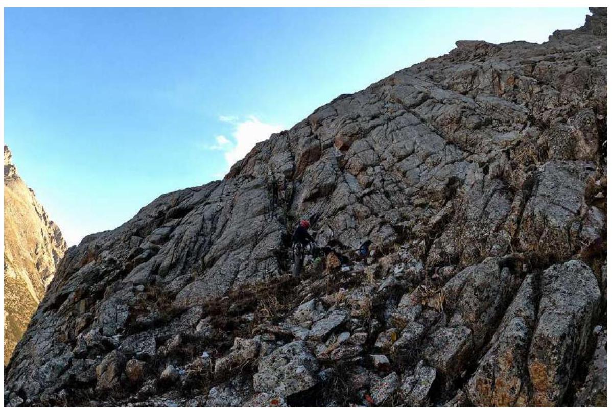
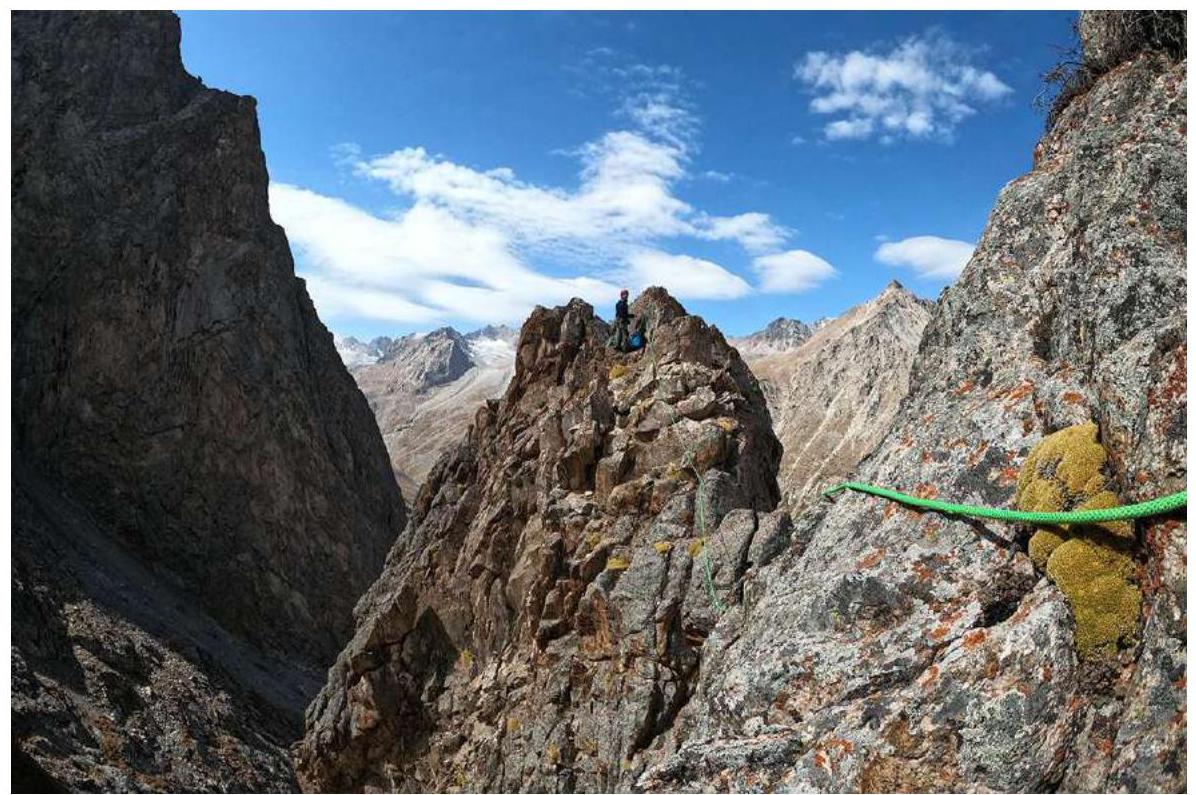
Start of the route
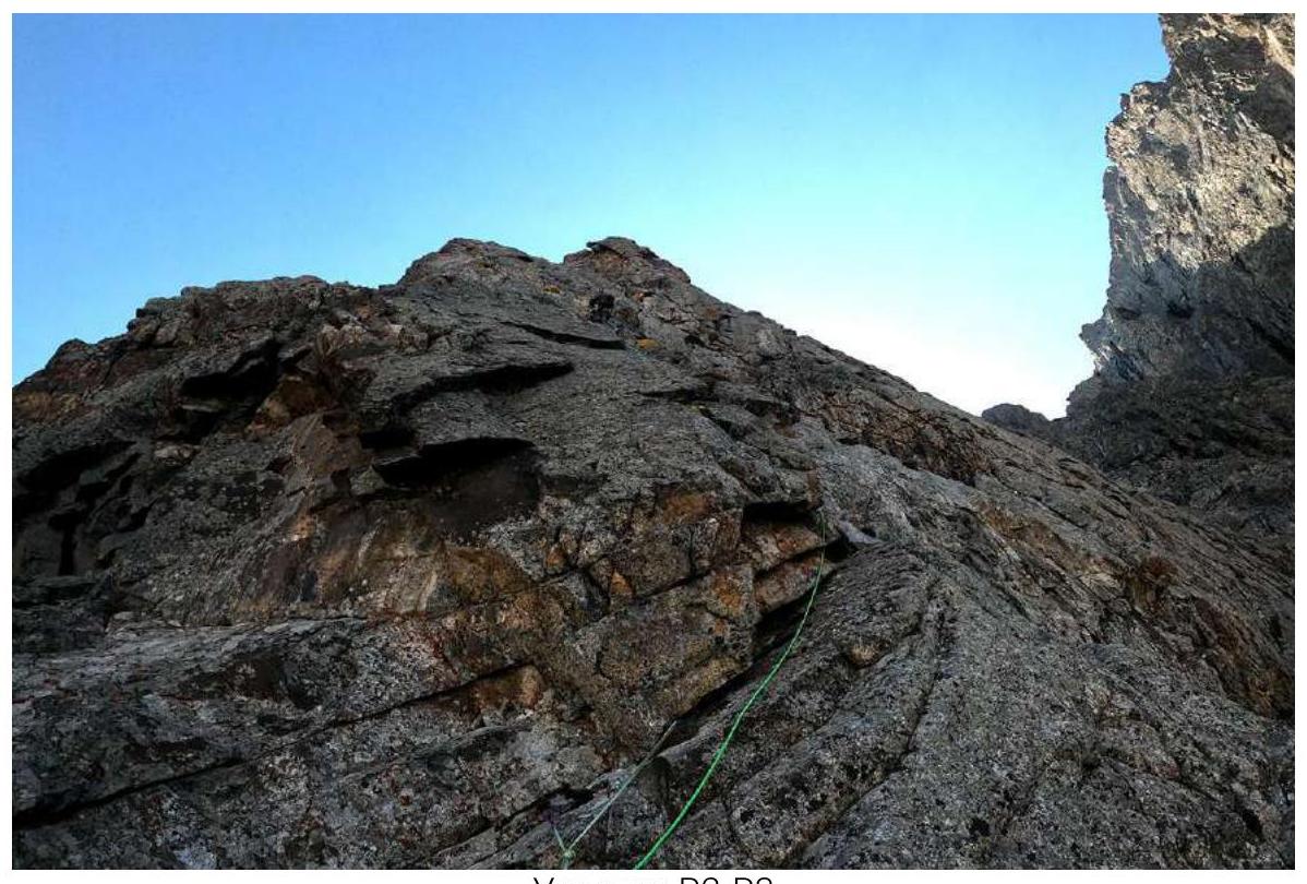
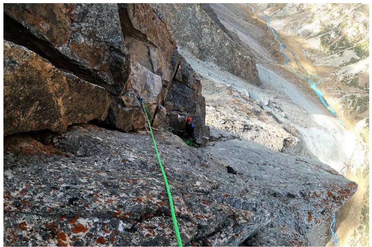
Section R2–R3
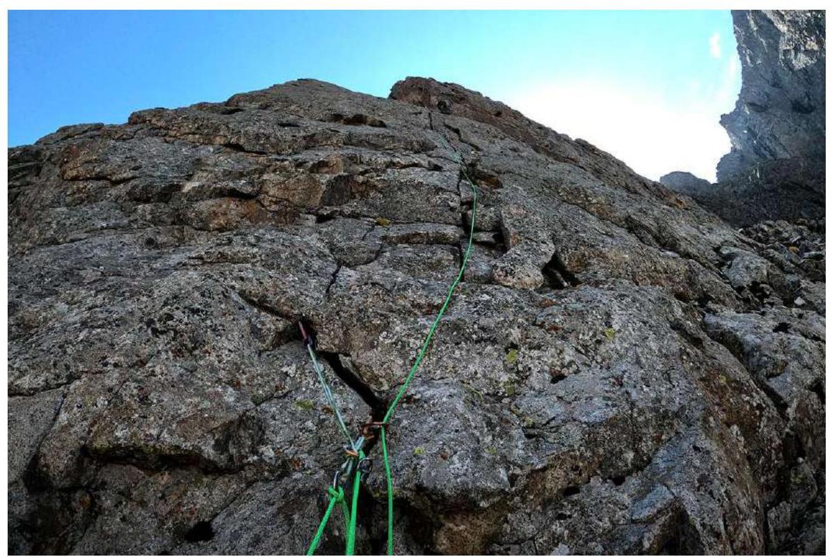
Section R3–R4
Belay station R4
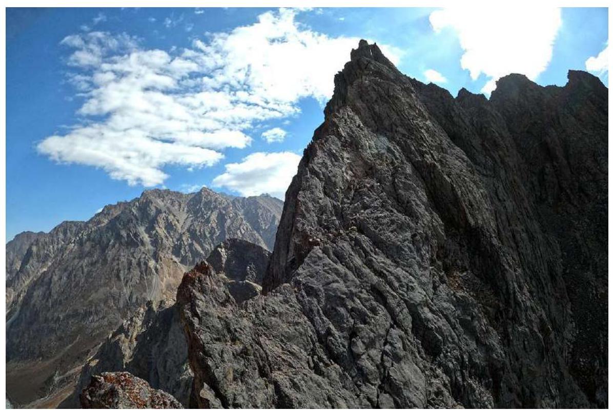
View from 1st gendarme (R5) on the further path and summit
View from section R5–R6 on 1st gendarme
Comments
Sign in to leave a comment