
Russian Championship 2021
Ice and Snow Ascent Category
Report
Combined team of Nizhny Novgorod and Novosibirsk Pik Svobodnoy Korei 4777 m via north wall, Ruchkin's route 2001, 6A category, winter ascent
Climbing Passport
- Region — Tian-Shan, Kyrgyzsky ridge, 7.4.
- Peak — Svobodnaya Korea, 4777 m via North wall, A. Ruchkin 2001.
- Category — 6A.
- Route type — combined.
- Route characteristics:
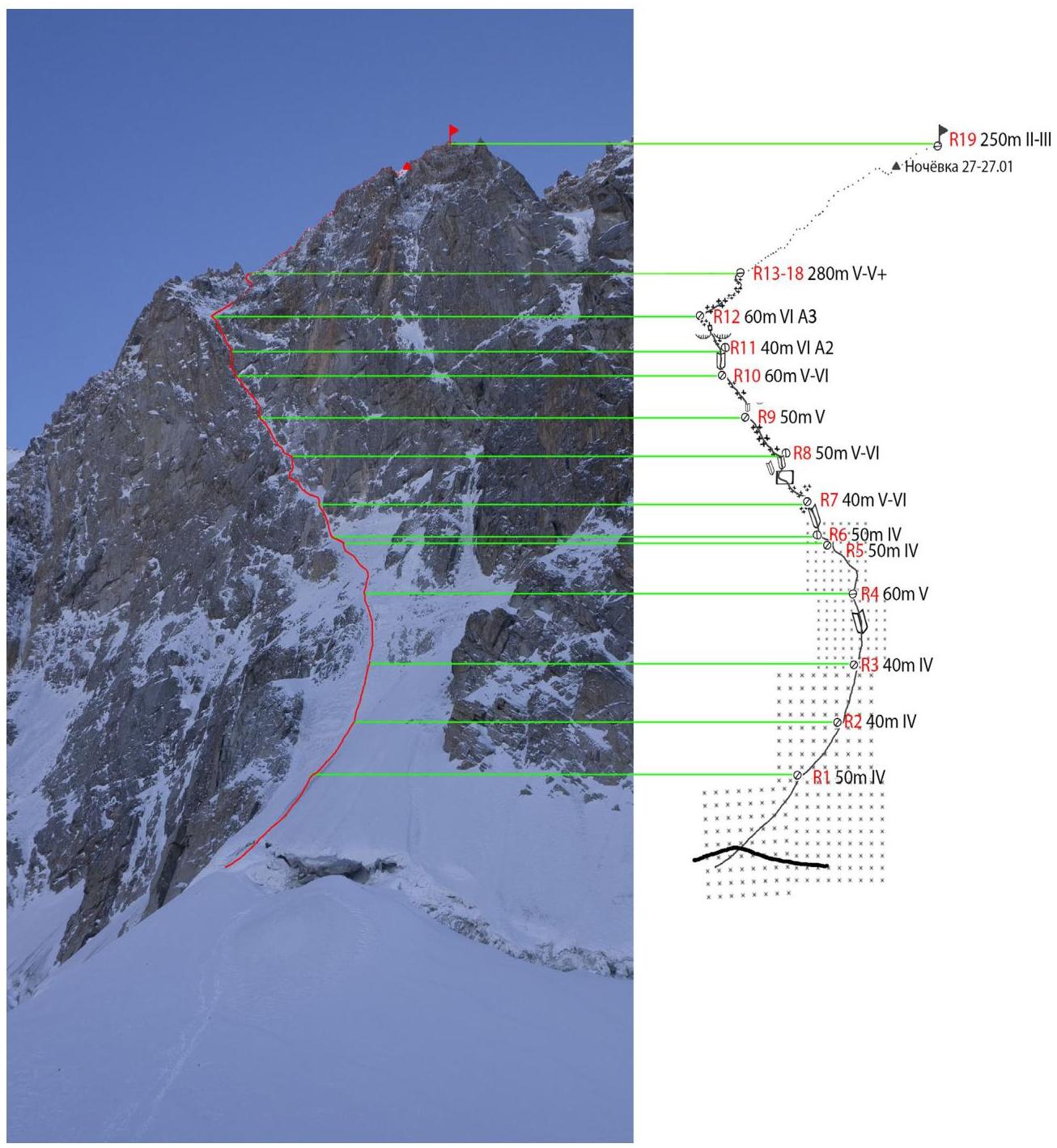
wall elevation gain — 600 m, total route elevation gain — 720 m.
Route length — 1100 m.
Section lengths:
- 6th category — 175 m
- 5th category — 445 m Average steepness:
- main part of the route — 70°
- main part of the wall — 50°
- Left on the route: pitons — 1, including bolted pitons — 0; friends — 0. Pitons used on the route (including ITO): Friends — 45/30; Ice screws — 65/0; Pitons — 5/1; Stationary bolted pitons — 2/1;
- Time taken to climb the wall — 19 h 30 min, total route time — 21 h 30 min, days — 2.
- Team leader: Ryndyk Aleksandr Pavlovich, 1st sports category Team member: Kalikin Vadim Eduardovich, 1st sports category
- Departure date: started the route — January 26, 2021 at 5:00, reached the summit — January 27, 2021 at 11:25, returned to Base Camp (Ratseka) — January 28, 2021 at 15:00.
General photo of the mountain with the UIAA scheme
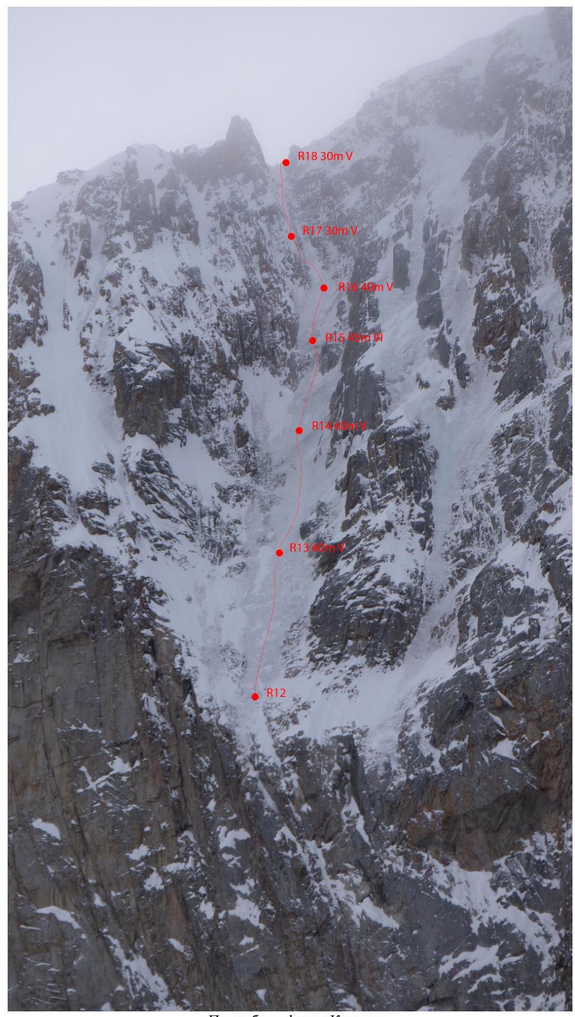
Detailed photo of the "Roof"
Description of the Region and Route
The Aksay glacier region is well-developed. Due to the large ice cover area, the weather in the region is cold and unstable. In the upper part of the glacier, there are peaks with a large number of routes of 5B-6A category:
- Svobodnaya Korea
- Baylyan Bashi
- Korona
The north wall of Svobodnaya Korea is one of the most challenging and thus attractive walls in the Aksay area. Its average length is 18 ropes. The lower part of the wall is typically ice-covered, the middle part is rocky, and the upper part features ice streams leading to the ridge. A characteristic feature of Svobodnaya Korea is the lack of a simple descent from the mountain. Typically, everyone descends via one of two ice routes:
- G. Barbera (5B)
- D. Lou (5A)
This route was first ascended by Alexander Ruchkin (Soviet and Russian mountaineer, Master of Sports of the USSR, Honored Master of Sports of Russia, Master of Sports of Russia International Class) in 2001 as a solo ascent, which is why the report was not submitted for classification and is still missing from the route classifier. The only official information about the ascent of this route was published on the mountain.ru forum http://www.mountain.ru/world_mounts/tien-shan/2001/ruchkin_popenko/ ↗.
Quotes from Ruchkin's article:
«...in February, I solo-climbed Svobodnaya Korea via 5B on Barbera, and in May, I solo-climbed Svobodnaya Korea via a variant route of Popenko. Popenko ascended it in 1975, but many years later, people started to follow the ice stream. My variant follows this stream and bypasses Popenko's cornice (bolted) from the left; it does not coincide with Popenko's route and is done without bolts. I don't have the right to consider it my route, as there are only 2 ropes of first ascent, the rest is what people had already climbed on one route or another or simply bypassed Popenko's route. I propose to call it a "folk" route, although I climbed it myself, combining pieces. It's not much easier than Popenko's, so it's safe to give it 6A...»
«If you compare the line of Popenko's route and my line now — there's nothing in common. It intersects with the route only once. Paying tribute to the hard work of the pioneers, I didn't want to spoil the beautiful route of Popenko. And if a team climbs a route, it should stick to the main line of the pioneers. That's why the idea was born to try to climb my own variant.»
At the time of our ascent, information about five ascents of this route and two non-stop ascents of the wall (without overnight stay and processing) was known:
- Brothers Glazunov, Evgeny and Sergey, 15 hours to the summit in September 2014; (For comparison: Evgeny Glazunov and Alexey Tyulyupo climbed Ruchkin's "Direct" route on the same peak, with a category of 6A, in 17 hours in January 2013.)
- Kirill Belotserkovsky and Maxim Ten, 14 hours to the ridge in July 2014.
According to the currently available information, our team was the first to climb the wall of this route in winter in one day (19.5 hours) without prior processing.
The route was climbed:
- by the first ascender — with an overnight stay on the wall, 2 days
- by the Buryatia team — 5 days (52 hours), overnight stays on a platform, March 2012, overnight stay on the wall in a hammock
Route Description by Sections
R0-R4: Bergschrund step and then an ice slope, steepness 50-65°.
R4-R6:
- Up and left traverse through a large snow-ice field with rock outcrops to a steep internal corner.
- Exit to a steep internal corner.
R6-R7:
- Up a complex steep internal corner filled with ice.
- Exit to a snow-ice field (ice is thin, with a cavity and rock underneath, unreliable protection).
- Station on ice screws.
R7-R8:
- Traverse left, then left-up along an ice stream to a small intersecting wall.
- Overcoming a small intersecting wall:
- tense dry tooling on the left part;
- then movement on ice and mixed terrain on the right internal corner.
- Station on a bolt at the end of the corner.
Throughout this section, protection is difficult: ice is either too thin for screws or resembles firn.
R8-R9:
- Left along the ice stream with small sections of mixed terrain to a fork.
Here, there are two options for continuing, depending on which the next section's passage will vary:
- Left mixed terrain to the base of a steep internal corner-chimney, station on a local piton and own points.
- Right mixed terrain to a bolt on the wall to the right, here is the station.
R9-R10: Depending on the end of the previous section, there will be two options for the start of this one:
- From the station up a steep internal corner, complex mixed terrain, initially protection is an anchor, then left along a diagonal stream to its end, old pitons are encountered, station on a piton and own points.
- From the station up left under a small cornice, ITO, then mixed terrain left and as in the previous variant. Ice in many places turns into firn, protection is difficult. If the second climber moves on ropes, it's necessary to leave sufficient protection points because the section is very diagonal.
R10-R11: From the station left around the corner, to the base of an overhanging internal corner (bolts on the left). Up ITO on friends and anchors to a bolt at its end, station.
R11-R12: Dry tooling to a thin steep firn-ice stream, along it to the base of two cornices separated by a crack, ITO on friends along the crack in the cornice on the left, and then through a small cornice — exit to mixed terrain with poor protection, along it and the internal corner on the left — exit to the "roof".
R12-R18: "Roof" shared with Semiletkin's route. Up along the ice river through a steep ice wall in the second third, and then left — up mixed terrain to the ridge.
R18-R19: Ridge, moderately complex. The summit is snowy, no cairn, and there's nothing to build a new one from.
Team's Tactical Actions
Before the ascent, the team spent about three weeks in the area, acclimatizing and climbing ice routes from 3B to 5A category.
Since there's no possibility to organize a bivouac on the wall without using a platform or hammocks, and the start of the route is not technically complex (processing the route is impractical), the only tactic for a team of two in winter is to climb the route in one go from start to ridge. That's what our team did.
On the day before the ascent, the path to the base of the bergschrund was trodden.
5:00 — departure from Koronskaya hut. 6:00 — the team started working on the route. Ryndyk Aleksandr worked first. 9:20 — the team was at station R6, which can be considered the start of the wall section of the route. 14:30 — the team gathered under the key part of the route at station R10. 20:00 — the team gathered at station R12, where the leader was changed. Vadim Kalikin went first. 1:30 — the team reached section R18 and exited onto the ridge. 3:00 — the team reached the "Popenkovsky" bivouac sites and set up a bivouac, carving out a platform in a firn drift, near the summit. 11:10 — warmed up by the sun, the team started moving. 11:25 — the team reached the summit of Pik Svobodnoy Korei. 11:50 — the team started descending via Ruchkin's 6A "Direct" route, as at that moment it was equipped with rappel loops and ropes by another team in the area. This descent option was chosen as faster after consulting with that team before the ascent. 15:30 — the team was at the foot of the mountain and by 16:00 reached the hut.
Movement was done alternately, the leader worked on two dynamic ropes with a light backpack. All sections, except R10-R12, were climbed by the first climber free-climbing in crampons and with ice tools; the second climber moved on ropes with top-rope protection, with a backpack. There were no falls, injuries, or frostbite.
In the wall photos, one can see the ropes of another team going up 6A Ruchkin's "Direct"; these ropes were not used during our ascent.
Weather Conditions
During the ascent, the outside temperature at the hut was -22°C on both days on the mountain. There was no wind or precipitation.
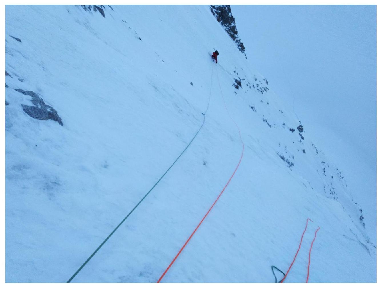 Photo 1. Section R5 from station R5
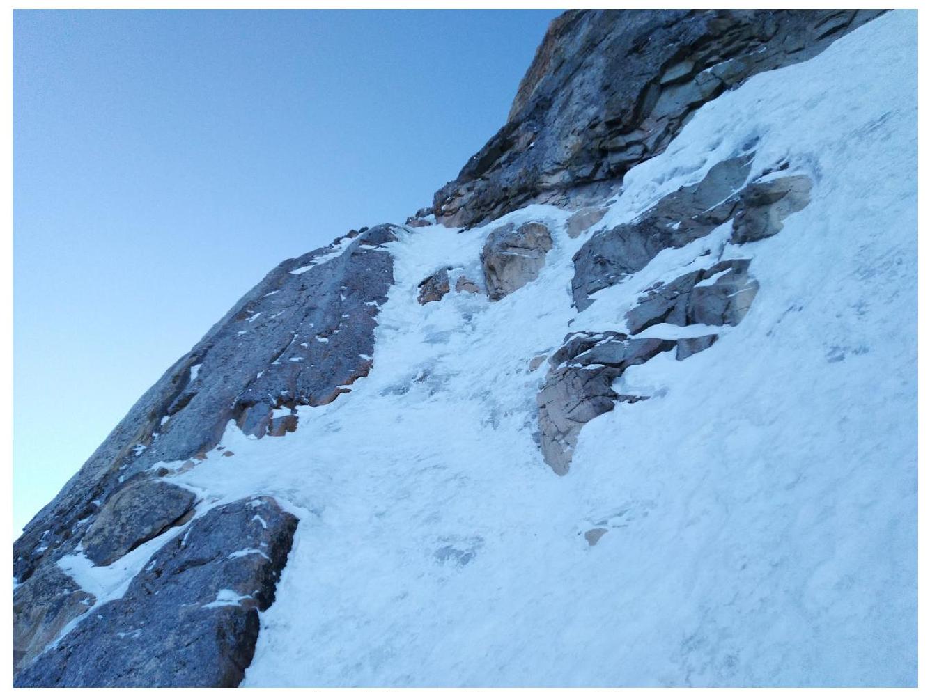 Photo 2. Section R7 from station R6
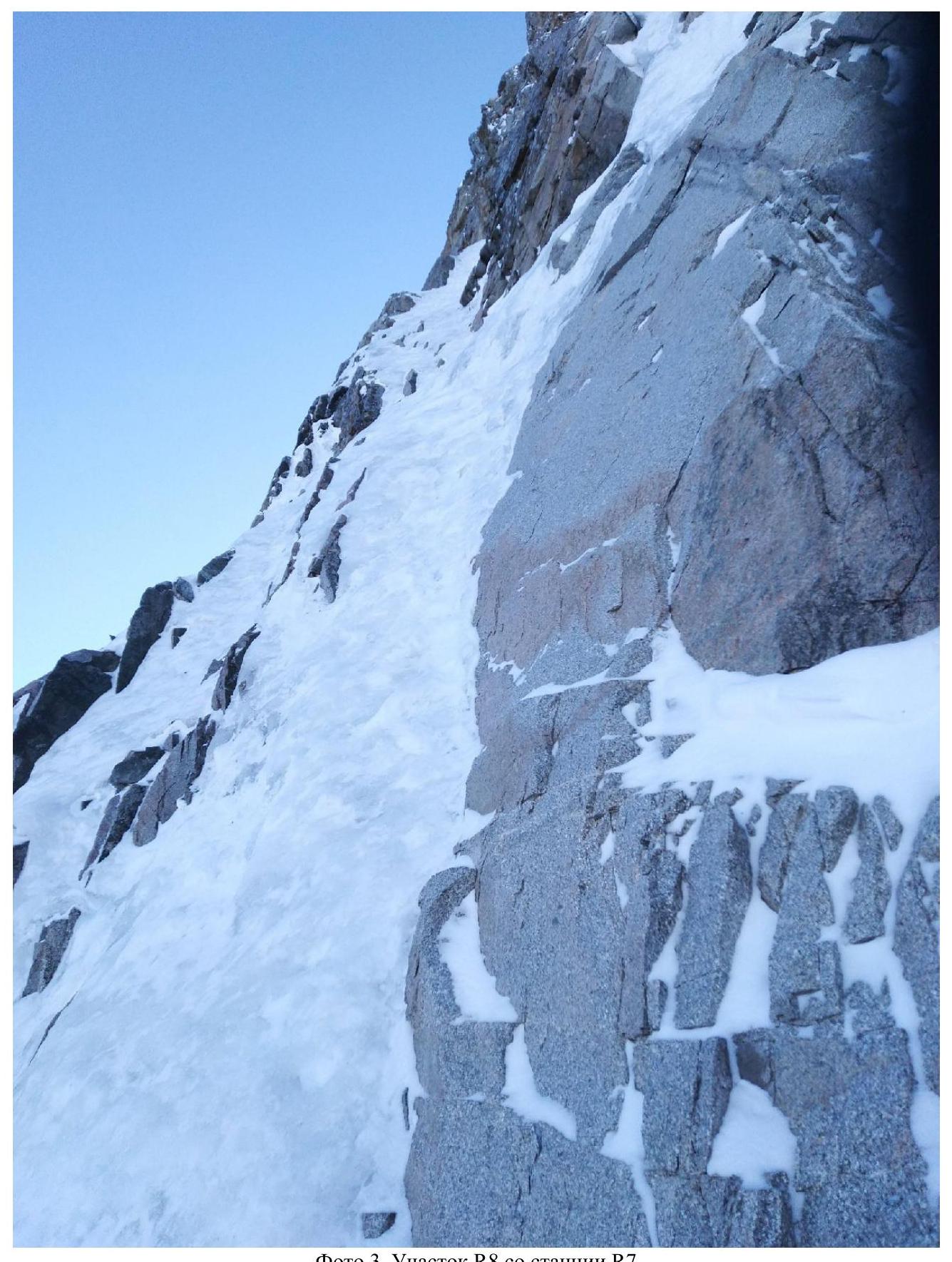 Photo 3. Section R8 from station R7
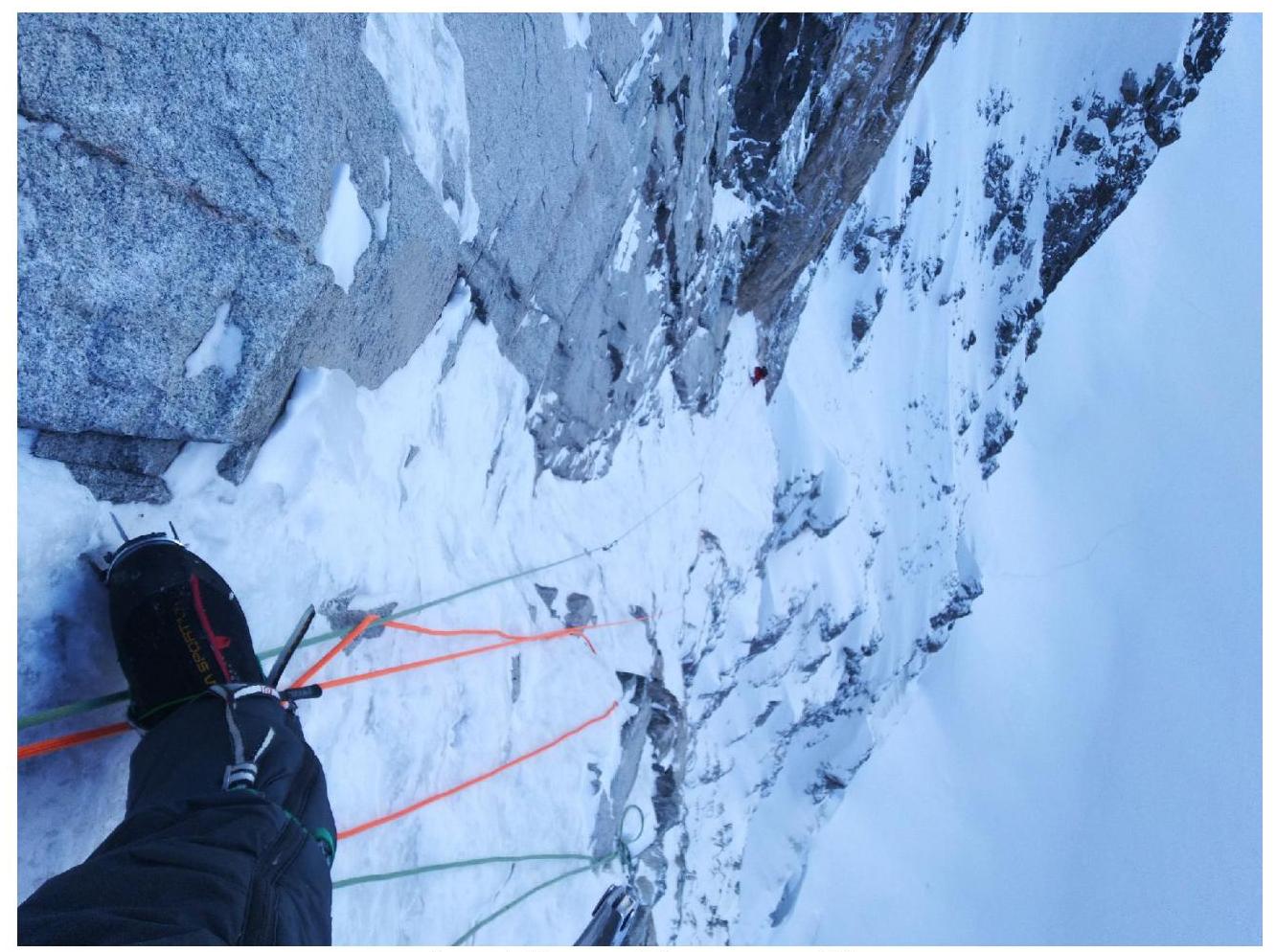 Photo 4. Section R8 from station R8
 Photo 5. Section R9, middle
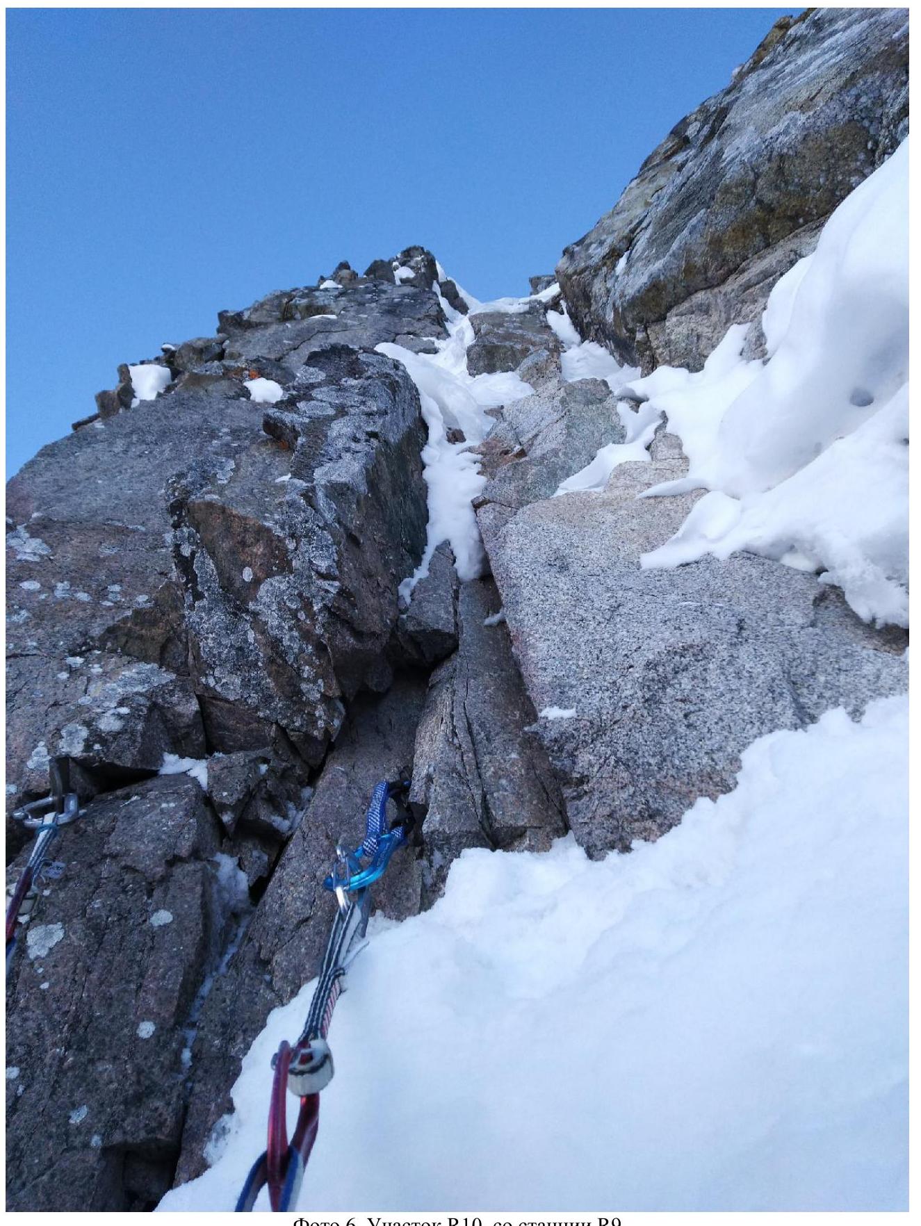 Photo 6. Section R10, from station R9
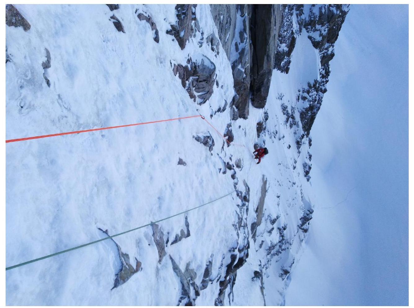 Photo 7. Section R10, from station R10
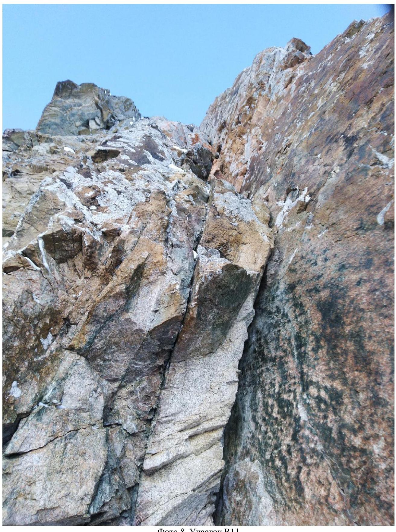 Photo 7. Section R10, from station R10
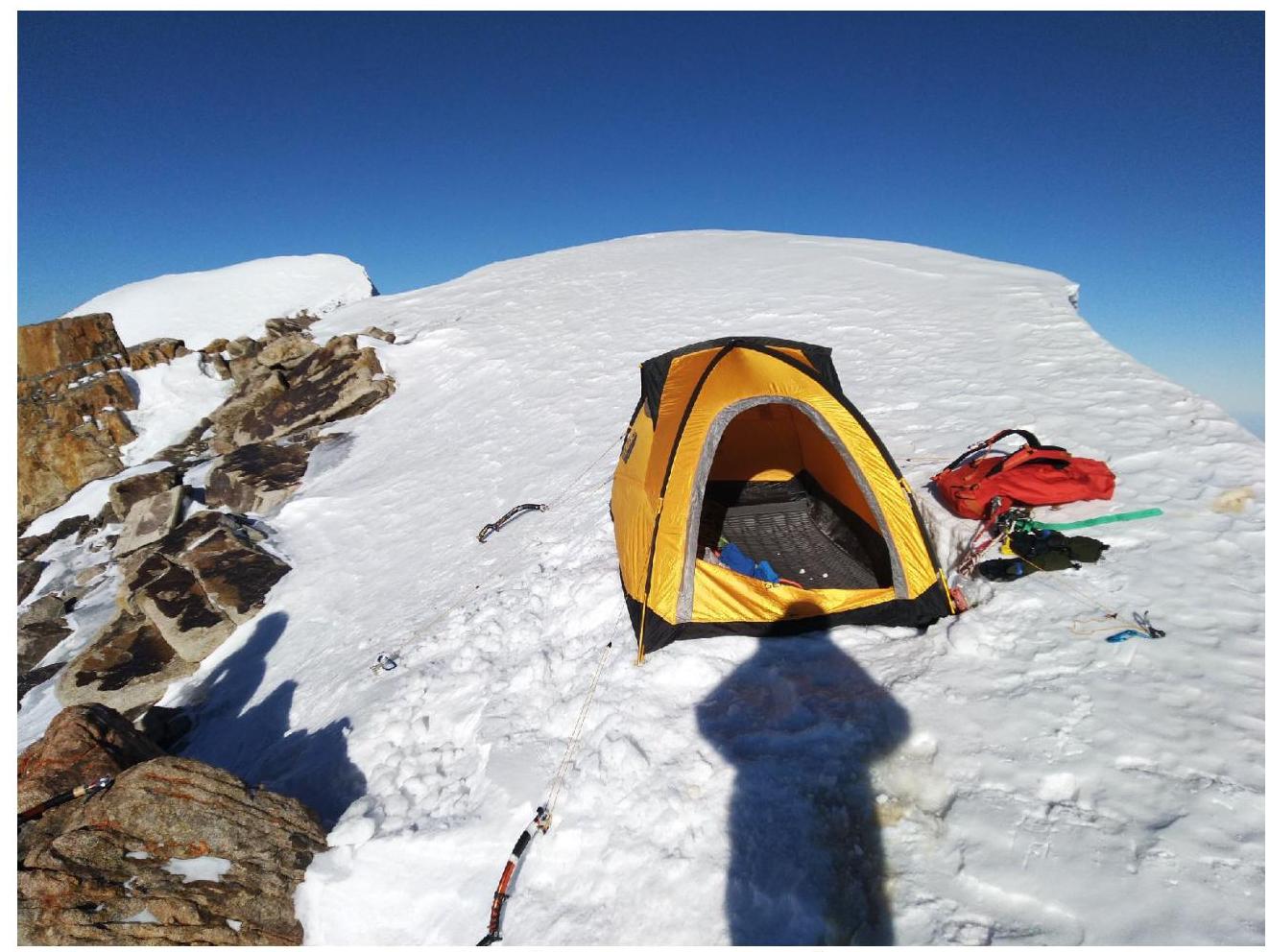 Photo 8. Section R11
 Photo 9. Bivouac under the summit
Comments
Sign in to leave a comment