
MINISTRY OF SPORT TOURISM AND YOUTH POLICY OF KRASNOYARSK TERRITORY
KRASNOYARSK TERRITORY SPORTS FEDERATION OF ALPINISM
Championship of Russia
2013 year
Class of altitude-technical ascents
Report
Combined team of Krasnoyarsk Territory Peak Svobodnoy Korei 4777 m via north wall Semiletkin's route 1988 6A cat. dif., winter ascent Krasnoyarsk 2013
Passport of the ascent
-
Region — Tian-Shan, Kyrgyz ridge, 7.4.
-
Peak — Svobodnoy Korei, 4777 m via North wall, S. Semiletkin 1988.
-
Proposed — 6A cat. dif.
-
Character of the route — combined.
-
Characteristics of the route:
height difference of the wall section — 600 m, total route — 720 m, route length — 1000 m, sections of complexity:
- 6B cat. dif. — 250 m
- 5B cat. dif. — 450 m, average steepness of the wall section — 72′, main part of the wall — 86′
- Left on the route: pitons — 1, including drilled — 0; " закладок" — 0.
Used pitons on the route:
- drilled stationary — 0;
- total ITO — about 200.
- Number of working hours — 32, days — 3.
- Leader — Khvostenko Oleg Valerievich, MS
Members: Prokofiev Denis Evgenievich MS, Pugovkin Anton Nikolaevich MS, Loginov Igor Alexandrovich MS
- Team coaches: Zakharov Nikolai Nikolaevich MSMK, ZTr
Balezin Valery Viktorovich MSMK
- Date of departure:
on the route — February 26, 2013 at 7:00, on the summit — February 28, 2013 at 10:00, return to BL (Ratsek) — February 28, 2013 at 20:00.
- Organization: Ministry of Sport Tourism and Youth Policy of Krasnoyarsk Territory 2013
Tactical actions of the team
Semiletkin's route on the north wall of p. Svobodnoy Korei is considered one of the most difficult on this wall. The route has been passed many times, so it is well освоен.
The team chose an alpine style of ascent, without preliminary processing.
Starting the ascent at 7:00 am on February 26, by 13:00 we passed the lower part of the route (300 m of ice and combined relief) and reached the proposed bivouac site (good shelf under the cornice).
By the end of the first day, 70 m of the main part of the wall were processed, including the key rope — "Big Cornice".
Weather conditions on the first day of ascent were normal:
- cloudy,
- weak wind,
- −15°C.
After spending the night on the shelf, we folded the camp and at 8:00 began to ascend along the fixed perilims. It took 13 hours to pass the remaining rock part of the route (about 180 m).
In the second half of the day the weather worsened:
- snow started falling,
- gusty wind began.
By the beginning of the upper ice part of the route, we approached already in the dark, around 21:00. The upper part of the route (ice couloir 200 m) was passed at night with lanterns in conditions of poor visibility and heavy snowfall for about 4 hours. Reached the ridge at 1:00 on February 28.
On the ridge:
- strong, gusty wind.
In total, it took about 30 working hours to pass the wall part of the route. The tent was installed on the pre-summit ridge, on a good shelf.
On the morning of February 28, we reached the summit along the ridge in 1 hour. Strongest wind, but sunny. Descent along Lowe's route 5A.
The story of the ascent can be found at http://www.risk.ru/users/xboct/198352/ ↗ Approach from Koronskaya hut through Ak-Sai glacier — 1.5 hours.
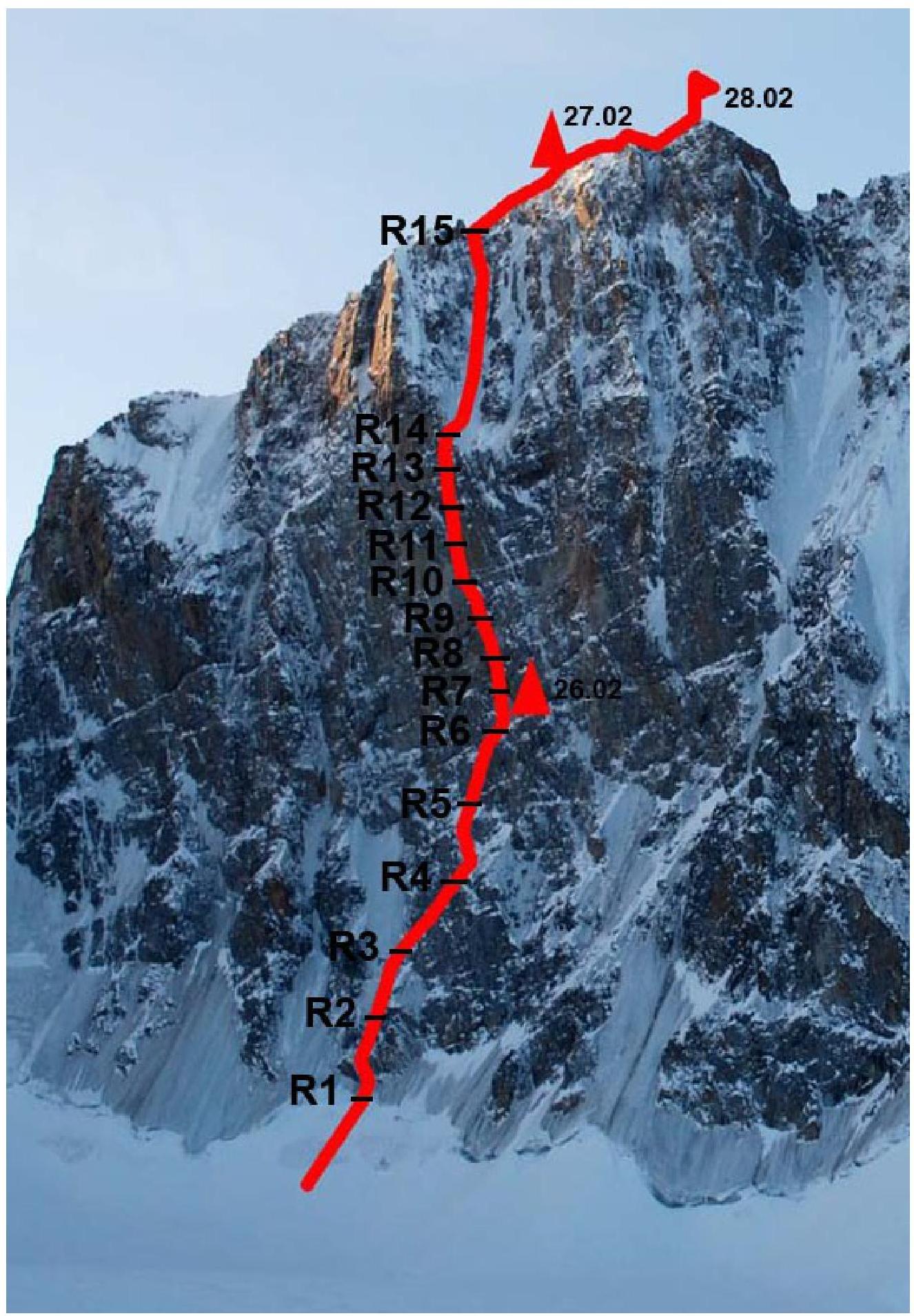
Description of the route by sections
R0–R1. Snow slope 60 m, 45° to the bergschrund. Bergschrund is overcome along the snow bridge. R1–R2. Rocks, flooded with ice, 60 m. R2–R3. Ice slope 60 m, movement up and to the right. R3–R4. Internal corners, flooded with ice, 60 m, up and to the right. R4–R5. Ice slope ("Sole"), movement up and to the left, 60 m. R5–R6. Internal corner with snow and ice, movement up and to the right, 60 m. Exit to the shelf. Along the shelf traverse to the right. Under the cornice, a bivouac site.
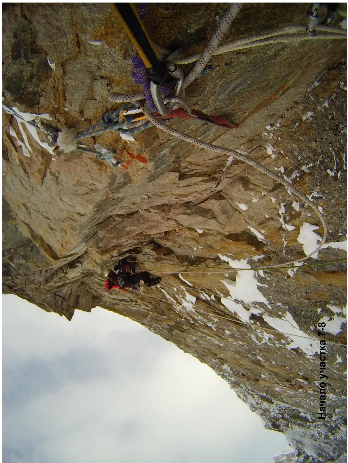
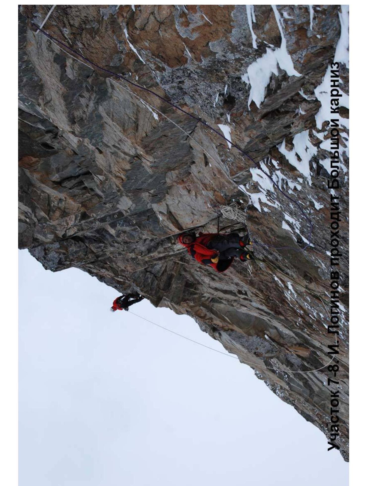
6–7. Wall with slots 40 m, approach to "Big Cornice". 7–8. Big Cornice, outreach 2 meters. After the cornice, a rock plate, along it to the inclined slots. Total 30 m.
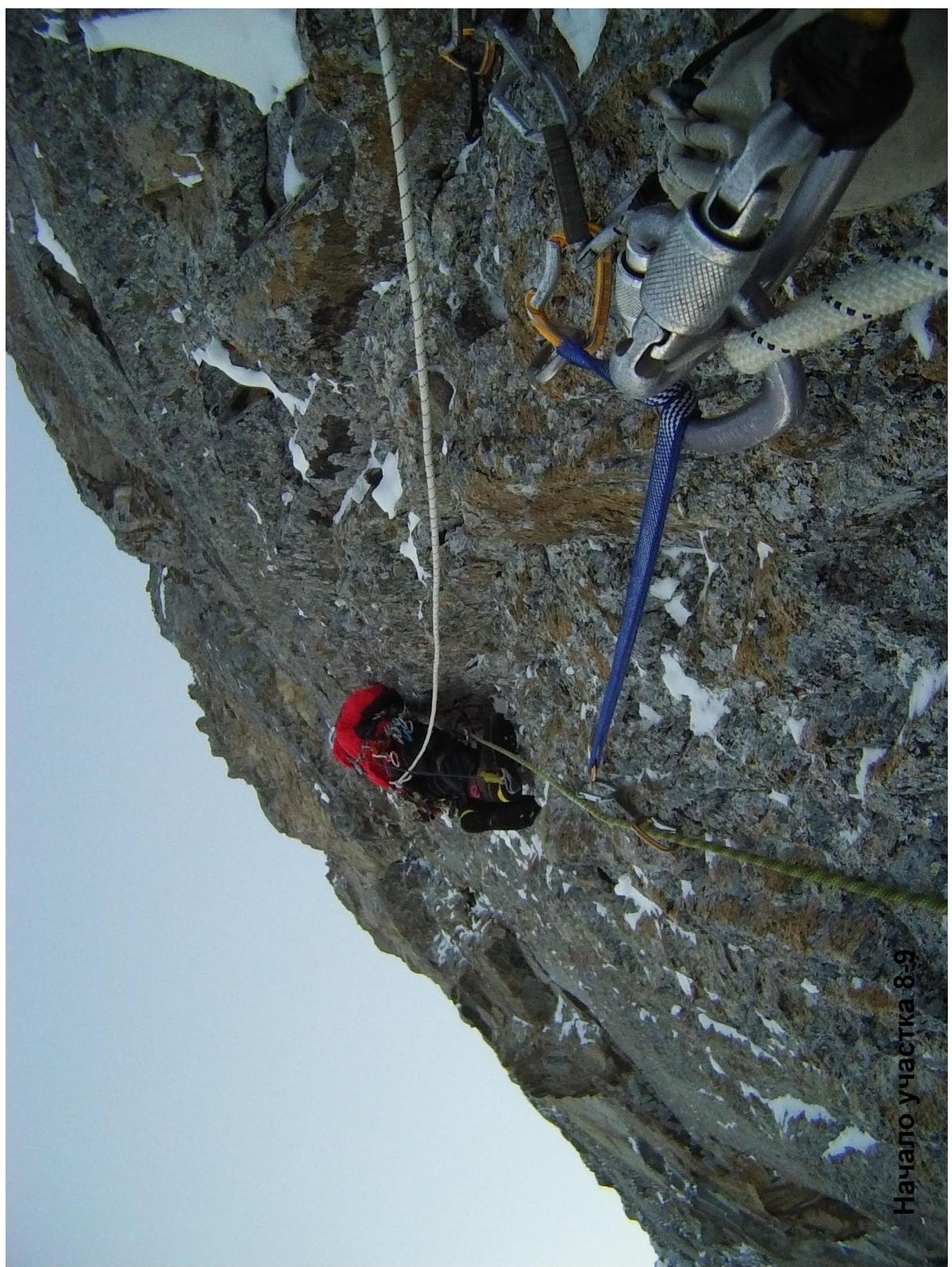
8–9. Wall with slots, then internal corner, movement left — up 30 m. Exit left around the corner to the inclined shoulder.
9–10. Wall with slots, live blocks, movement up left 30 m. 10–11. Rock
wall, up left 30 m, exit to a sloping shelf. 11–12. Up along the monolithic
vertical internal corner 30 m. Exit beyond the bend. 12–13. Along the internal
corner turning into a chimney 30 m. 13–14. Along the chimney through the cornice — plug 30 m,
then along the wall, exit to the ice slope. 14–15. Ice slope 200 m, average
steepness 65°. Exit to the ridge. 15–16. Along the ridge to the summit 200
m.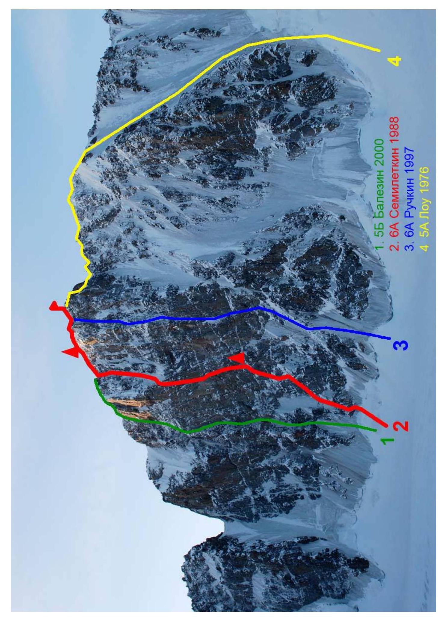
- 6А Balezin 2000
- 6А Semiletkin 1988
- 6А Ruchkin 1997
- 5А Lowe
1979
Technical photo
of the route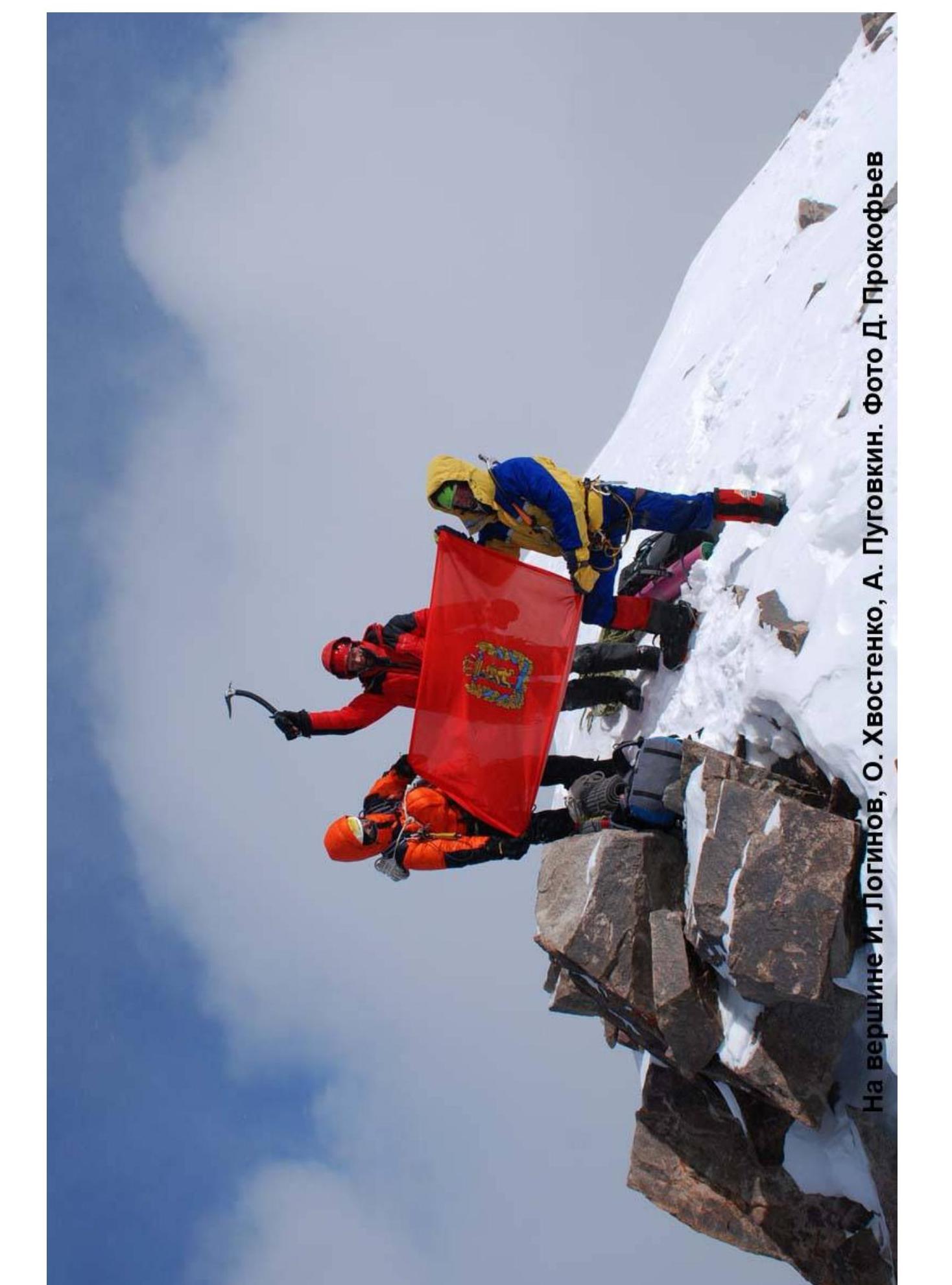
On the summit I. Loginov, O. Khvostenko, A. Pugovkin. Photo by D.
Prokofiev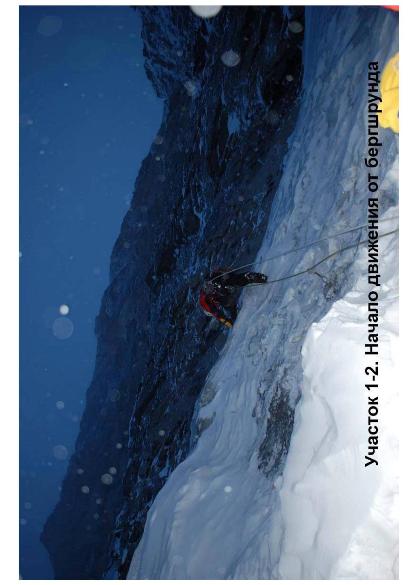
Section 1–2. Start of movement from
bergschrund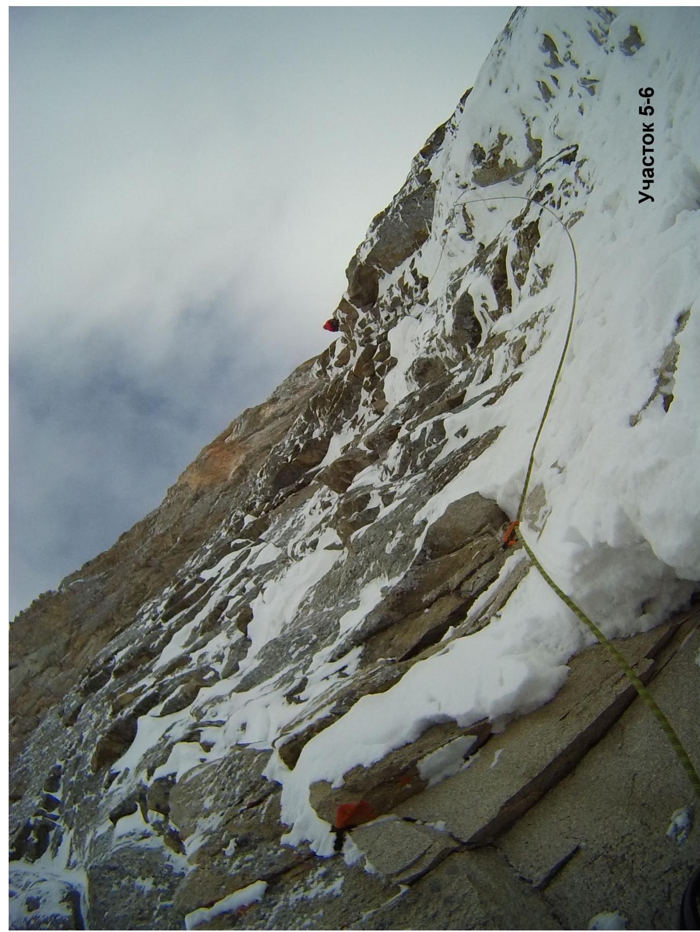
Section
5–6 □
□
Upside Down
2018
Havario y Nebrna
3–9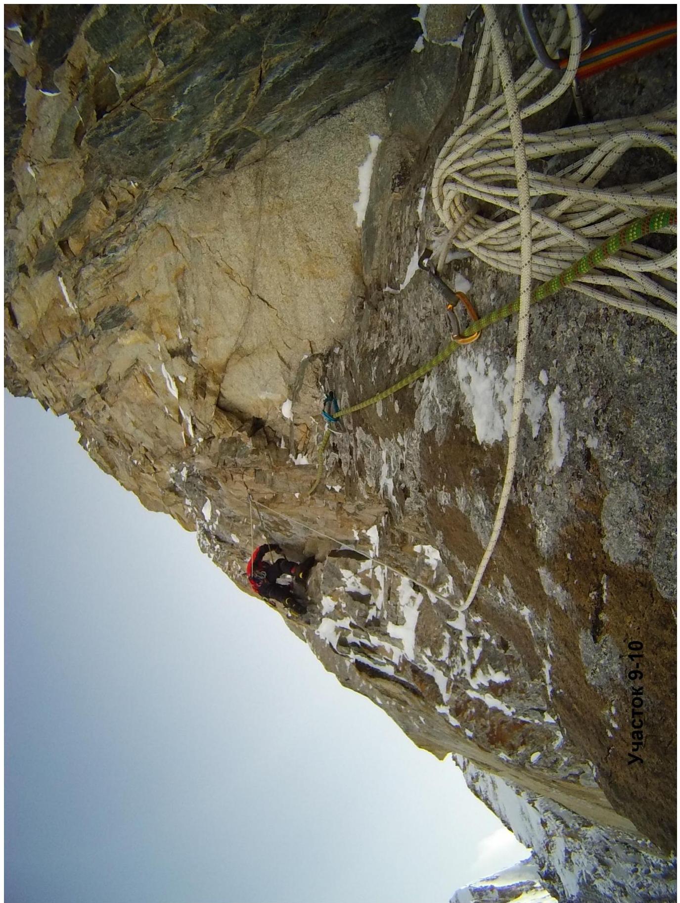
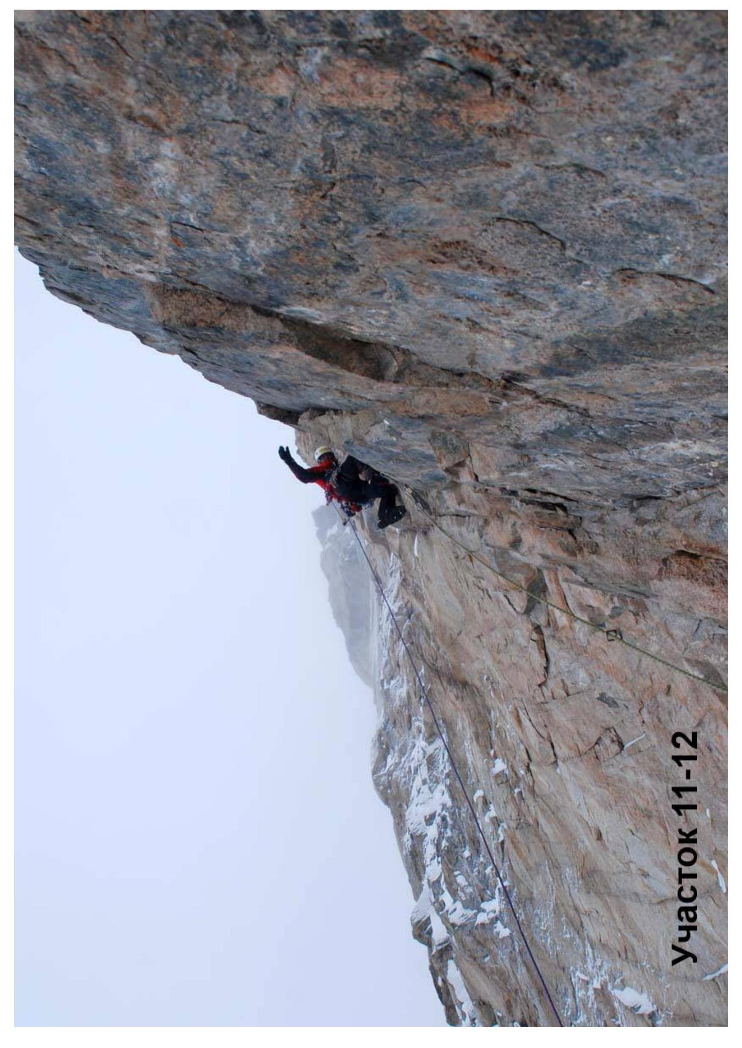
Section 11–12
| 4777 м | |
|---|---|
| R15 4700 м | |
| R14 4660 м | |
| 860 | R6 4320 м |
| 600 | R1 4100 м |
Comments
Sign in to leave a comment