Ascent Passport
- Winter ascent category
- Tian Shan, Kyrgyz Range, Ak-Sai gorge
- Peak Svobodnaya Korea, via N wall, W ridge, 4740 m
- A. Kustovsky's route, 6A category; second ascent, first winter ascent
- Route height difference 640 m
- Total route length 924 m,
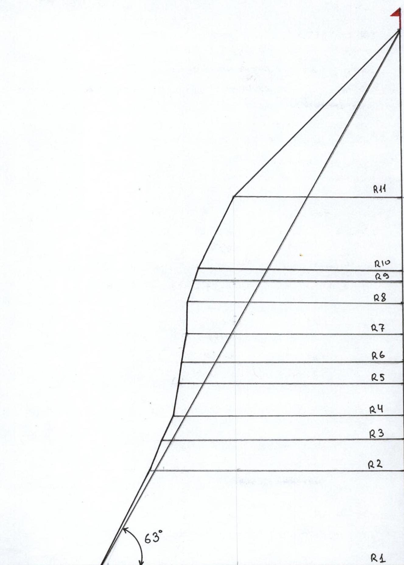
including 625 m of wall section 7. Length of 6th category sections 204 m 8. Average route slope 63° 9. Average wall section slope 84° 10. Pitons driven/ of which ITC:
| Bolted | Rock | Cams | Ice |
|---|---|---|---|
| 7/5 | 40/20 | 91/61 | 27 |
- Climbing hours – 57.5; days – 6, including preliminary processing and descent
- The route was completed with preliminary processing. All overnight stays were in a hut.
- Team leader: Novoseiltsev Evgeny Leonidovich – Candidate Master of Sports
Team members:
- Gutnik Nikolay Nikolaevich – Candidate Master of Sports
- Kazakov Andrey Eduardovich – Candidate Master of Sports
- Kolesnikov Mikhail Rudolfovich – Candidate Master of Sports
Coach: Volodin Viktor Gennadievich – Master of Sports
- Departure for the route: January 18, 2002
Reached the summit: January 24, 2002. Returned from the route: January 24, 2002
- Organization:
Central Sports Club of Alpinists named after A.S. Demichenko
General photo of the summit
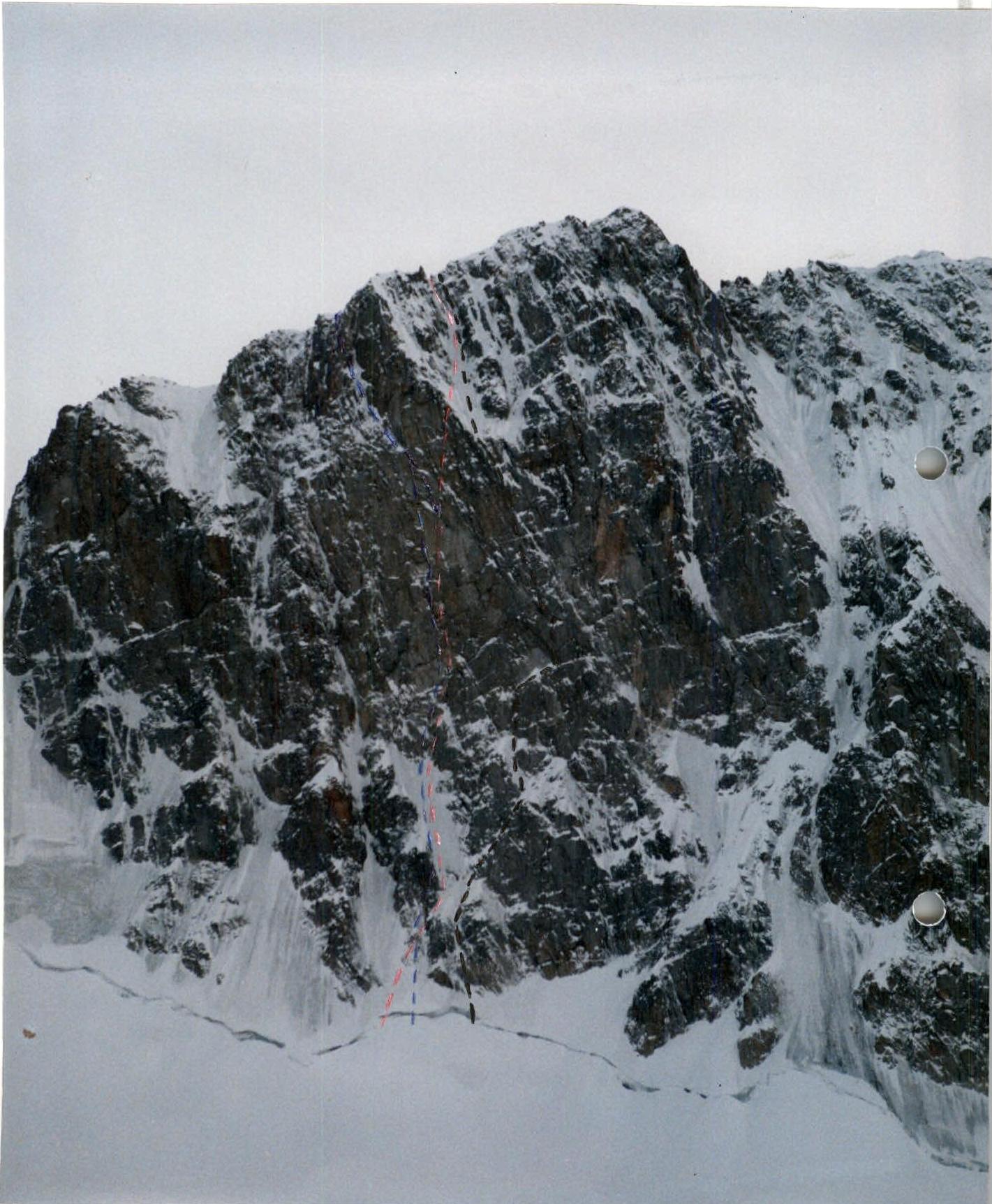
- — team route
- — A. Kustovsky's route
- — S. Semiletkin's route
Route profile
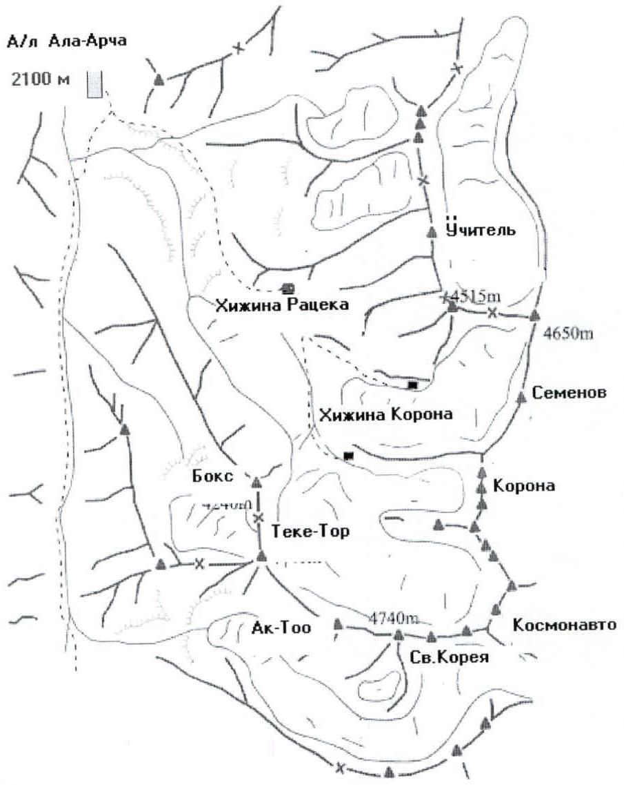
Area Overview and Map
Ala-Archa is a mountainous region in the Northern Tian Shan, known to many climbers. The area began to be explored over 40 years ago. The upper reaches of the Ak-Sai glacier feature the most interesting walls of the Kyrgyz Ala-Too range, forming the highest section of the Central Kyrgyz Range, known as the Ak-Sai horseshoe.
The high altitude of this area (4000–4800 m), the orientation of the ridges protecting it from warm southern winds, and other factors have resulted in significant glaciation. The Ak-Sai glacier largely determines the microclimate of the region – harsh and cold. The Ak-Sai gorge has over eighty categorized routes ranging from 1B to 6A in difficulty. About 30 of these are routes of 5th to 6th category difficulty. The rocks forming the range belong to the metamorphic group, predominantly granites and gneisses. The rocks are generally monolithic and solid, although some sections are heavily weathered.
Good access roads make this area one of the most frequented by climbers in the Tian Shan mountains. A paved road from Bishkek, the capital of Kyrgyzstan, extends 4 km to the "Ala-Archa" base camp, located at an altitude of 2100 m. A trail through the forest on the left side of the slopes leads to the foot of the Ak-Sai glacier, at "Ratsek" campsite, within three hours. Here is a convenient stone hut at an altitude of 3200 m. A few hours' walk from "Ratsek" are three more small huts.
The walls of Svobodnaya Korea and Korona are the most attractive in the Ak-Sai gorge. The north wall of Svobodnaya Korea is the most serious in the area, with a height difference of 900 m. The first ascent of the North wall of Svobodnaya Korea was made by Andreev's team, which pioneered a route via the right counterfort in 1959. To date, 13 routes have been ascended on the North face of Korea, with hundreds of ascents.
The weather can be excellent from mid-June to mid-September. The best time for serious ascents is July–August. In winter, it's January–February. Climbing is possible year-round. Characteristics of the area include:
- Weather deterioration in the afternoon and improvement by night;
- Prolonged weather deterioration with snowfalls, snowstorms, and fogs lasting several days.
The proximity of huts allows climbers to wait out bad weather and resume their ascent.
Ascent Schedule
| Time (hours) | January 18 | January 19 | January 20 | January 21 | January 22 | January 23 | January 24 |
|---|---|---|---|---|---|---|---|
| 18:30 | |||||||
| 18:00 | Descent | ||||||
| 11:00 | Cloudy | Variable | Cloudy | Snowstorm | Heavy | ||
| Cloudiness | Heavy wind | Hurricane | Snowfall | ||||
| Cloudy | Cloudy | Strong | Poor | ||||
| wind | visibility | ||||||
| 9:00 | -10–12 | -15–17 | -17 | -22 | -19 | -24–27 | -17 |
| 8:00 | |||||||
| 7:30 | |||||||
| 1:00 |
January 23 – a day of forced wait due to stormy weather conditions.
Team Tactics
The team's tactical plan was developed based on available information about the route and climbing conditions in the area.
The main challenge in developing the tactical plan was the very limited information about Kustovsky's route. Unlike most routes on the North wall of Svobodnaya Korea, this route had never been repeated.
Having studied Kustovsky's route, we decided to deviate from it. Specifically, in the upper third of the wall, we chose not to turn left onto the broken rocks as Kustovsky's team did, but to attempt to climb straight up the monolithic slab and then via the ice couloir, transitioning into a groove that leads to the ridge.
We were guided by two reasons for this decision.
Firstly, on the section climbed by Kustovsky's team, the wall's steepness decreases, but the rocks are heavily weathered and thus hazardous. This made preliminary processing impossible. In winter, they are also heavily snowed under, making quick passage very challenging. As a result, our team could have faced significant problems with safety on this section during winter.
Secondly, our chosen variation appears more aesthetically pleasing and logical. It eliminates the need for pendulum moves to the left part of the wall and allows for a direct ascent along the line of water fall.
Another challenge was the unstable weather and very low temperatures in January in this area. During the ascent, the air temperature fluctuated from -15°C to -27°C, and on the final day of the climb, there was a heavy snowfall with minimal visibility. To address this and maximize safety, we decided to preliminarily process the main part of the wall, aiming to complete the ascent in a short timeframe with a minimum number of bivouacs on the wall. All belay stations were set up with maximum reliability, sometimes using bolted pitons left by Kustovsky's team. Each rope was secured to an independent anchor and linked to adjacent ropes. The wall was processed up to point R9.
For the previously unclimbed section, we used removable bolted pitons and skyhooks.
The pairs Novoseiltsev – Gutnik and Kazakov – Kolesnikov worked alternately. All team members took turns leading on the route.
All overnight stays were organized at the base, in a hut.
The descent followed the ascent route.
This tactic allowed our team to complete the route within a tight timeframe, ensuring maximum safety and a significant margin of strength, under conditions of unstable weather and severe frosts (down to -27°C).
Route Diagram in UIAA Symbols
| № | Pitons | Cams | Bolted Pitons | Diagram in UIAA Symbols | Length (m) | Slope (°) | Category |
|---|---|---|---|---|---|---|---|
| R11 | - | - | - | 12 h; 11 pitons | 300 | 45° | III |
| R10 | 11 | - | - |  | 120 | 70–90° | V |
| R9 | 6 | 7/3 | - | 9 h; 43 pitons | 25 | 80° | V–VI, A1 |
| R8 | 10/8 | 20/17 | - | R8 | 45 | 80° | V–VI, A1 |
| R7 | 6/4 | 21/20 | 5/5 | R7 | 45 | 90–95° | VI, A2e |
| R6 | 5/3 | 14/12 | 6/5 | R6 | 45 | 80° | VI, A1e |
| R5 | 2/1 | 3/2 | 14/12 | 7 h; 30 pitons R5 | 35 | 80° | VI, A1e |
| 4/4 | 7/7 | - | 9 | 90° | VI, A2 | ||
| R4 | 2 | 6 | - | 10:30; 23 pitons | 50 | 70–80° | V |
| R3 | 3 | 4 | - | R3 | 30 | 60–70° | IV–V |
| R2 | 2 | 6 | - | R2 | 50 | 70–80° | V |
| R1 | 14 | 3 | - | 9 h; 17 pitons | 170 | 60–70° | IV–V |
Route Description by Sections
R1 – The route begins from the bergschrund. It's better to cross it via a snow bridge. From the bergschrund, a steep ice slope begins, transitioning into a couloir with rock outcrops. A challenging passage through rocky outcrops.
R2 – Rocks covered in ice. Inclined shelves. Tense climbing. Challenges in ensuring safety.
R3 – Rock walls alternating with ice-covered, gently sloping shelves. Difficult climbing.
R4 – Steep, snow-covered rock wall. Very challenging climbing. The R5 station is under a cornice, 9 m away (photo № 7). There are two old bolted pitons.
R5 – A wide crack (10–15 cm) passing through a steep, weathered rock wall under a cornice. The cornice is bypassed on the left. Challenging ITC. Then a steep monolithic slab with very poor relief. There are old bolted pitons from Kustovsky's team (in good condition). The R7 station is under a small cornice, bypassed on the right.
R6 – A steep monolithic slab with very poor relief. Challenging ITC. Occasional old bolted pitons from Kustovsky's team. A series of cornices. After point R7, Kustovsky's route turns left. To follow it, a pendulum move (30–40 m) is required across a very steep and smooth slab. Our team climbed straight up.
R7 – A steep wall (90–95°), a slab with very poor relief. Climbed by our team for the first time. Challenging ITC using skyhooks and removable bolted pitons. Several small cornices are climbed directly on ITC.
R8 – Steep, weathered rocks. Movement on ITC.
R9 – Steep, weathered rocks. A weathered crack with a plug is passed on ITC. Exit via the crack through the plug into an ice couloir.
R10 – Ice couloir transitioning into a steep ice groove. A steep ice wall (75–80°).
R11 – The ridge is heavily snowed. Simultaneous movement.
Technical photo of the route
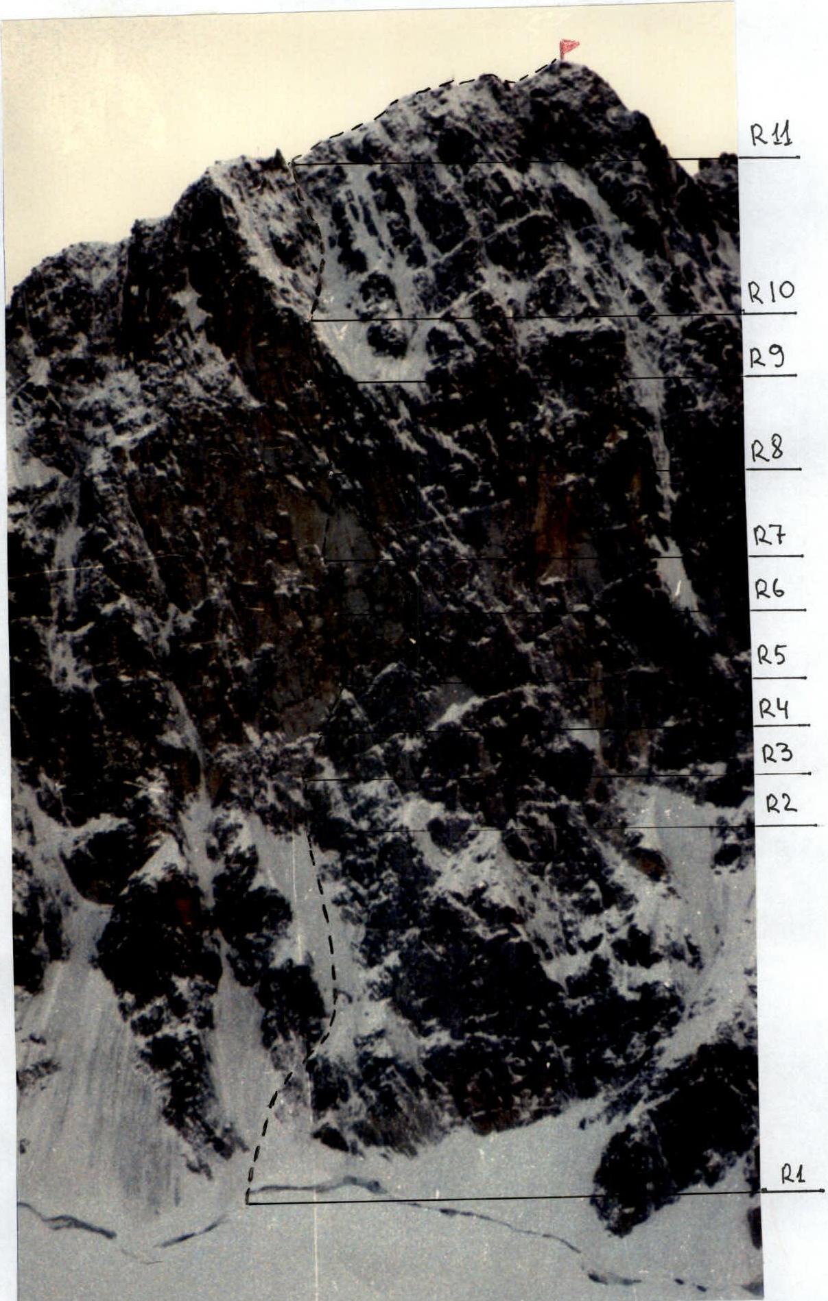 Photo illustration of the report.
Photo № 1. Start of the route. Crossing the bergschrund
Photo № 2. Section R1 – third rope

Photo № 3. Section R2
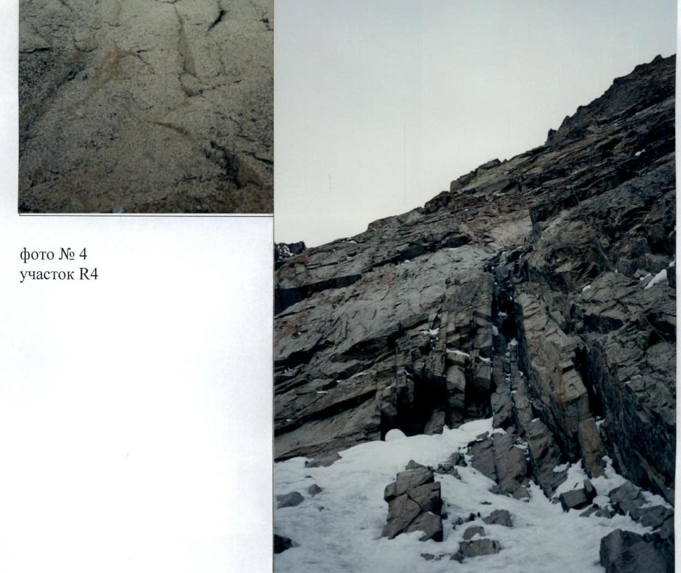

Photo № 5. Point R5
Photo № 6. Section R5
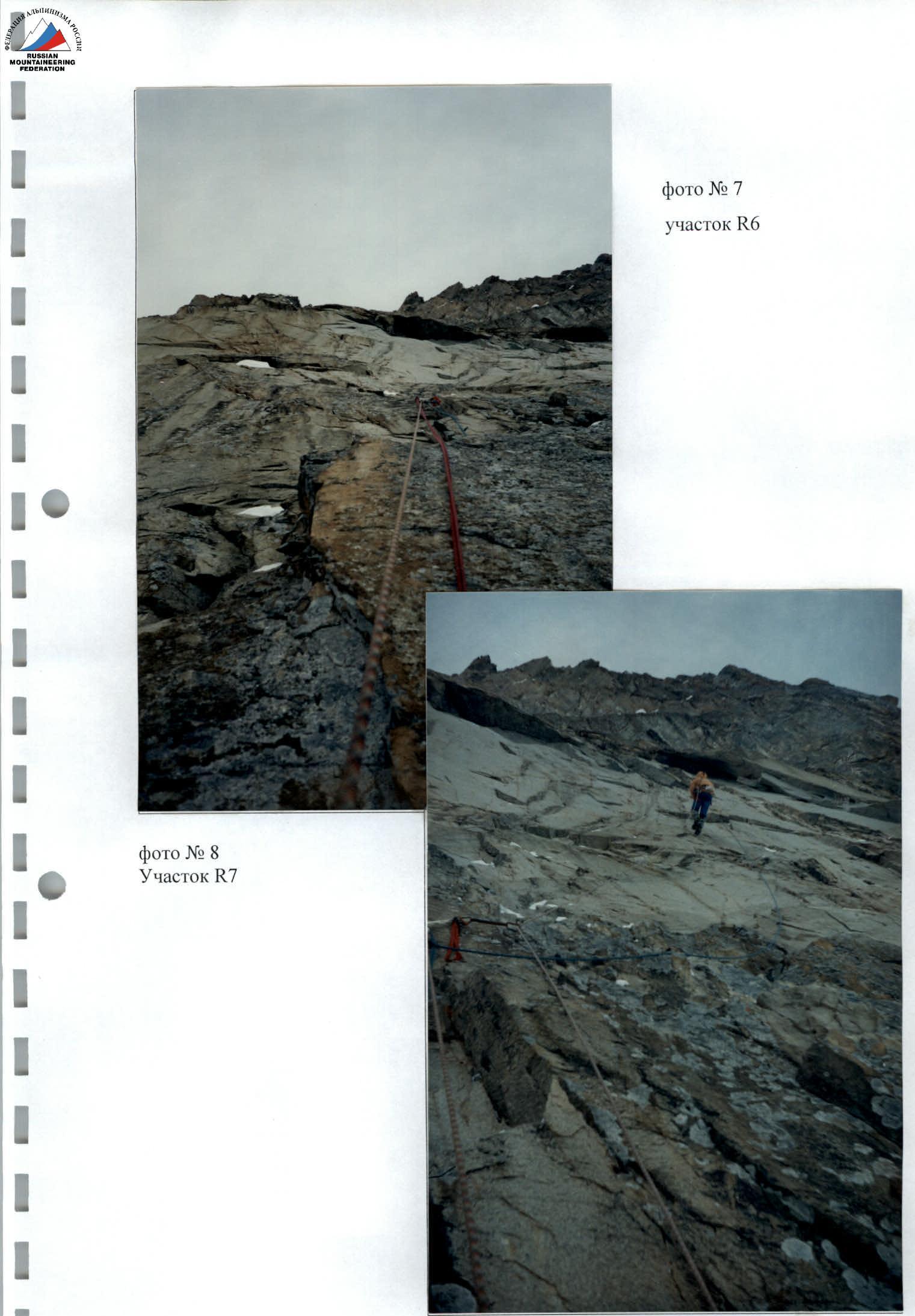
Photo № 9. Work on section R8
Photo № 10. Section R10
Photo № 11. Section R11 – ridge
Photo № 12. Movement along the ridge
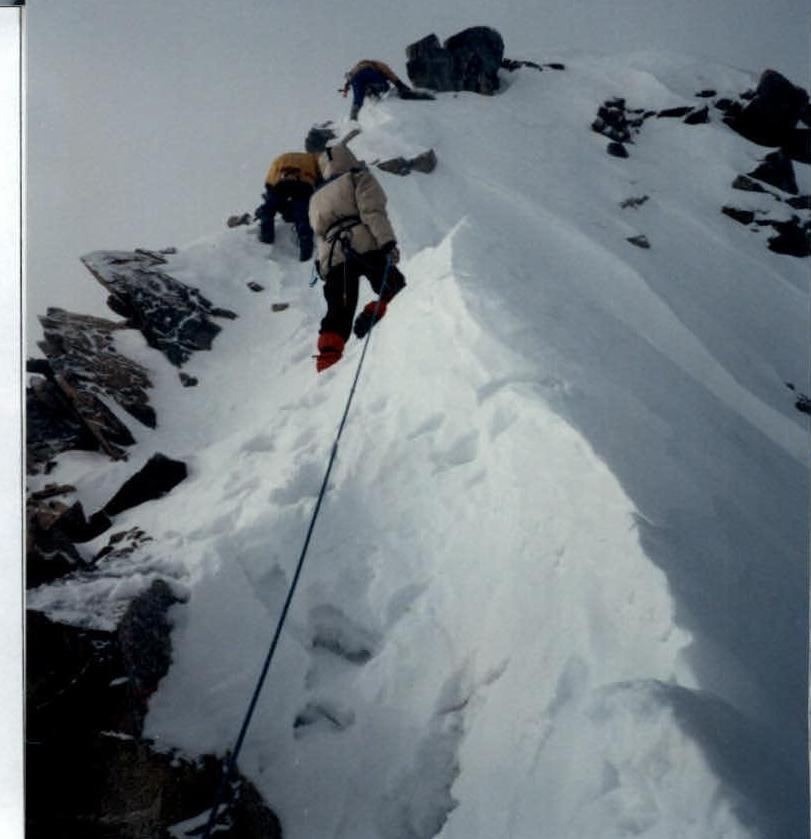
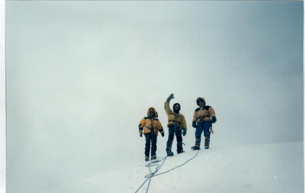
Photo № 13. Summit (the control tour is marked with a flag).
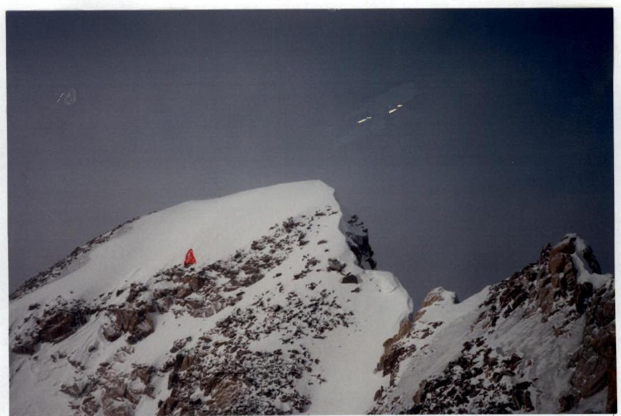
Photo № 14. Team at the summit