Climbing Passport
-
Climbing category — winter.
-
Region — Tian Shan, Kyrgyz Ala-Too.
-
Peak — Sv. Korei 4777 m, via the left part of the north face.
-
Category — 6B, first ascent.
-
Route characteristics:
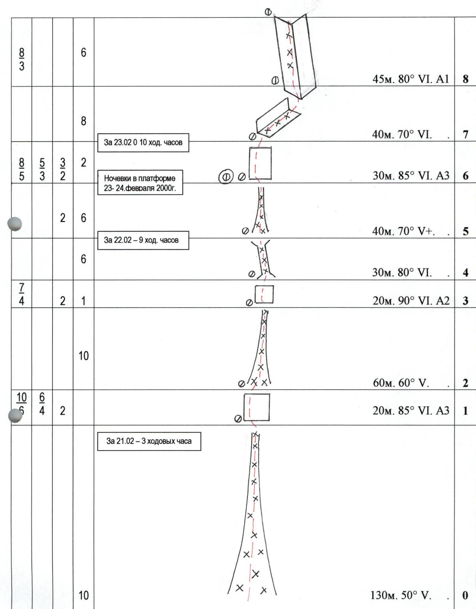
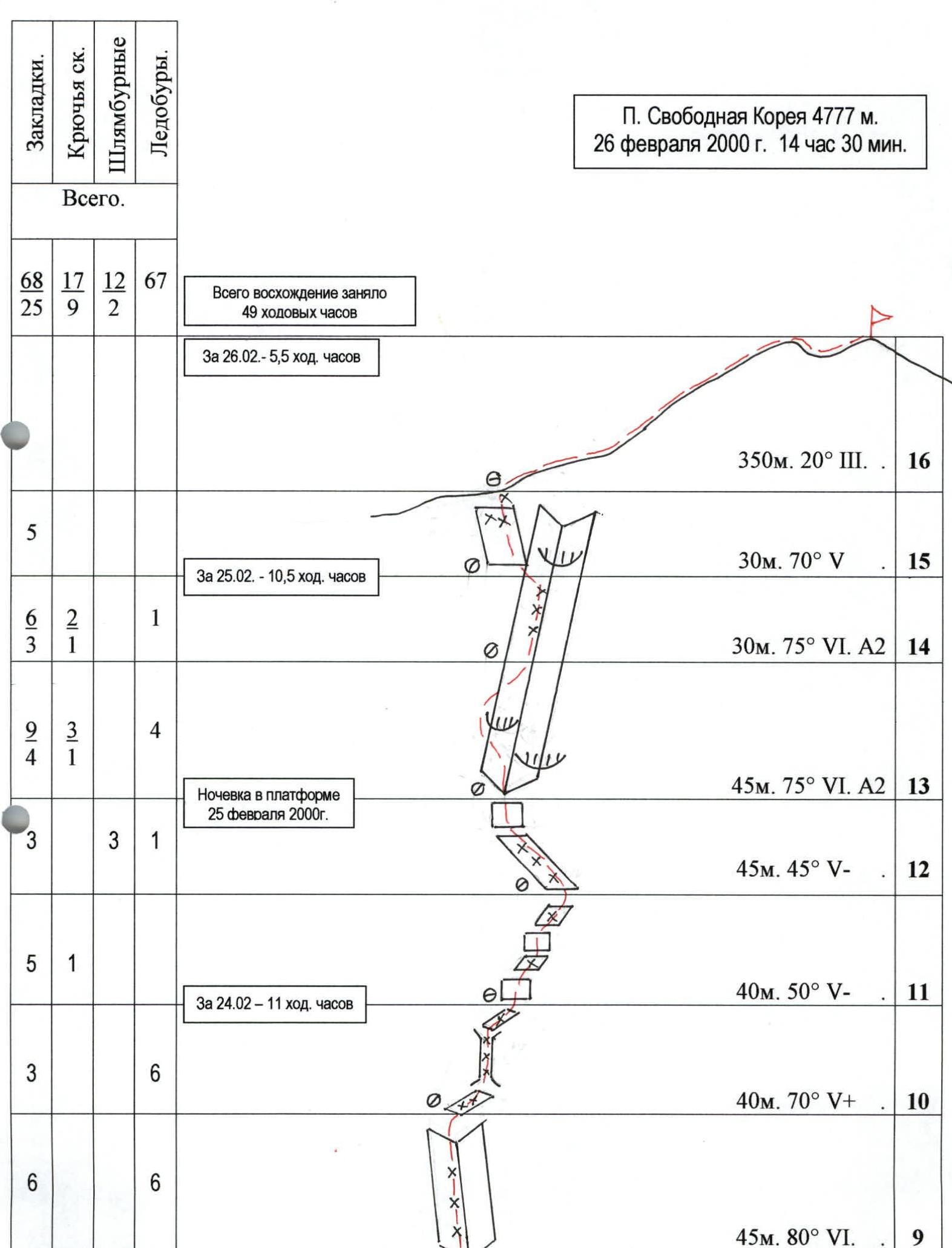
height difference: to the ridge — 530 m, to the summit — 650 m; distance: to the ridge — 680 m, to the summit about 1000 m; distance of 6th category sections — 300 m, 5th category — 380 m; average slope to the ridge — 65°; slope of the main wall section — 77°.
-
Equipment used on the route:
| Chocks 68 (25) | Rock pitons 17 (9) | Bolts 12 (2) | Ice screws 67 |
|---|
-
Total climbing hours — 49, days — 6.
-
Overnights — 3, +1 on descent.
All bivouacs during ascent were on a platform.
9. Team composition:
Valery Balezin (MSMK) — leader, Vladimir Alexandrov (MS), Andrei Zakrepa (MS), Yuri Stepanov (CMS), Alexander Terentyev (CMS), Sergey Cherezov (CMS)
10. Team coaches:
- Nikolai Zakharov (MSMK)
- Valery Balezin (MSMK)
11. Departure dates:
on route — February 21, 2000, on summit — February 26, 2000, return — February 27, 2000.
12. Organisation: Krasnoyarsk Committee for Physical Education and Sports
Year 2000
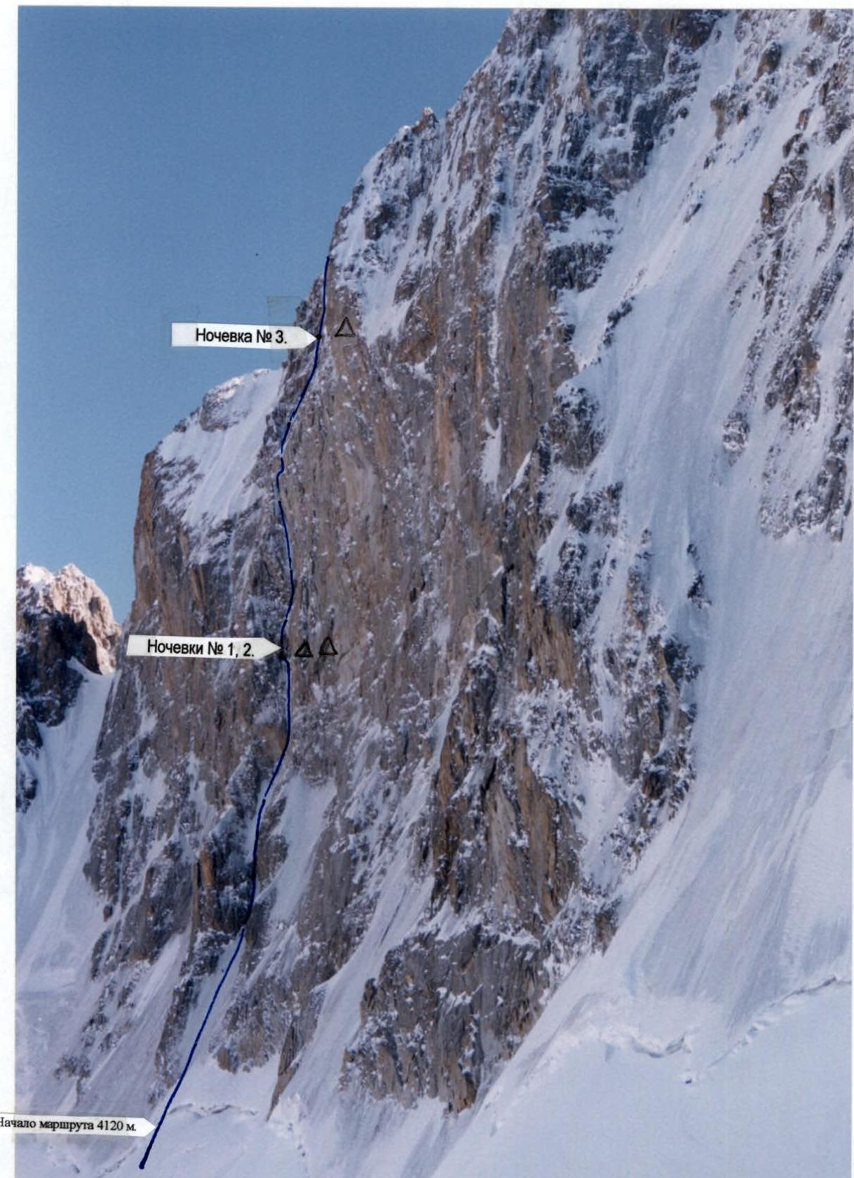
View of the route from the right. Taken on February 22, 2000.

Photo panorama of the area
Tactical Actions of the Team
We planned this route as a winter first ascent back in 1995. It goes through the left part of the wall between two unrepeated routes by Schwab (1982) and Studenin (1966). Like all routes on Korei, it consists of three parts: lower ice section (50°), then a wall section (about 80°), and a heavily snowed roof leading to a sharp, snow-covered, and heavily destroyed ridge about 350 m long.
This route can only be climbed in winter, as it's very prone to rockfall in summer.
On February 21, we ascended to the Koron bivouac site, prepared the trail to the route, and in the evening, the pair Terentyev — Alexandrov processed the bergschrund and three rope lengths of ice in three hours.
February 22 — continuation of route processing. The pair Zakrepa — Stepanov worked ahead. They processed 4 rope lengths (up to section #5). The two vertical rock belts (sections 1–2 and 3–4), each 20 meters high, presented particular difficulties. The upper part of the section is a steep (about 80°) icy chute.
February 23. At 7:00, the team started the ascent in full composition. The pair Terentyev — Cherezov worked ahead. They covered two rope lengths (up to point 7) during the day. The third rock belt (section 6–7) proved particularly challenging. The other participants lifted and set up a platform under a cornice, at the start of the third rock belt.
February 24. The pair Balezin — Alexandrov moved ahead. They processed four rope lengths of the upper wall part and reached the roof (point 11). They bivouacked at the same place, on the platform.
February 25. The pair Stepanov — Balezin moved ahead. Contrary to our expectations, the roof turned out to be more challenging than we thought: the rocks were covered with a thin layer of ice and sprinkled with loose snow. Therefore, we managed to cover three and a half rope lengths, stopping 30 meters short of the ridge. Meanwhile, the other team members dismantled the platform and moved it higher, to section #13, setting it up two rope lengths below the ridge, under a cornice, at the start of a steep inner corner.
February 26. At 9:00, the team, having dismantled the platform, began the ascent. At 12:30, we reached the ridge. At 14:30, we reached the summit. Up to the ridge, the pair Zakrepa — Cherezov worked ahead. We traversed the ridge in three autonomous pairs. We descended via the western ridge and the Lowe route (5A category).
Throughout the route:
- The first climber used a double rope;
- The second and last climbers used top-rope belays;
- On particularly rockfall-prone sections, all participants were provided with additional insurance.
Major belay points were organized on at least three anchors (chocks, pitons, or bolts), blocked with a local loop. A mid-rope block was made on the running belay rope.
The ascent employed winter tactics based on organizing comfortable overnight bivouacs from which the route was processed. The tent-platform was relocated from one convenient and safe location to another as they were reached during the ascent, or when there was absolute confidence in reaching the next bivouac site in the shortest possible time. This tactic significantly increased the safety of the ascent, as at any moment, a pair could rappel down to the tent or call for help from the other four.
Since there were no ledges suitable for bivouacs on the route, we had to use a platform. The team used a foldable, six-person tent-platform for the first time, which, with the help of two hinges, folds in half, significantly easing its transportation.
During the ascent, a rescue team was stationed in the camp under the wall as observers: Arkhipov V. (MS); participants returning from the ascent from the second team: Railko Yu. (CMS), Karyukin I. (CMS), Obednin K. (MS), Khvostenko O. (1st sports category), Glazyirin Yu. (1st sports category), Muravyov V. (CMS), and a doctor. Regular radio contact was maintained with the observers.
The team used the full arsenal of modern equipment on the route. For rock belays, we tried to use chocks, and pitons were hammered in only when chocks couldn't be used. All bolt anchors were removable and not left on the route. "Fifis" were frequently used for artificial climbing on rocks. During the ascent, the team had a sufficient supply of fuel and food.
There were no falls, injuries, or frostbites during the ascent, despite continuing to move along the route during bad weather rather than waiting it out.
Brief Description by Sections
Section R0–R1. The section starts with a laborious bergschrund, followed by a wide ice couloir with steep side walls. In the upper part, the couloir narrows and abuts the first rock step.
Section R1–R2. The first rock step is steep, with some parts heavily destroyed. It's climbed on the left side, with difficult climbing, largely on artificial aids.
Section R2–R3. An ice chute — couloir, initially steep (about 75°), then easing to 50°.
Section R3–R4. The second rock step marks the beginning of the main wall section of the route. A steep wall in the throat of the chute, difficult climbing, artificial aids.
Section R4–R5. A wide, ice-covered chimney.
Section R5–R6. A steep ice chute — couloir.
Section R6–R7. The third rock step. A steep, partly heavily destroyed wall, climbed on the left side, difficult climbing, artificial aids. At the start of the section, under an overhang, a platform was hung.
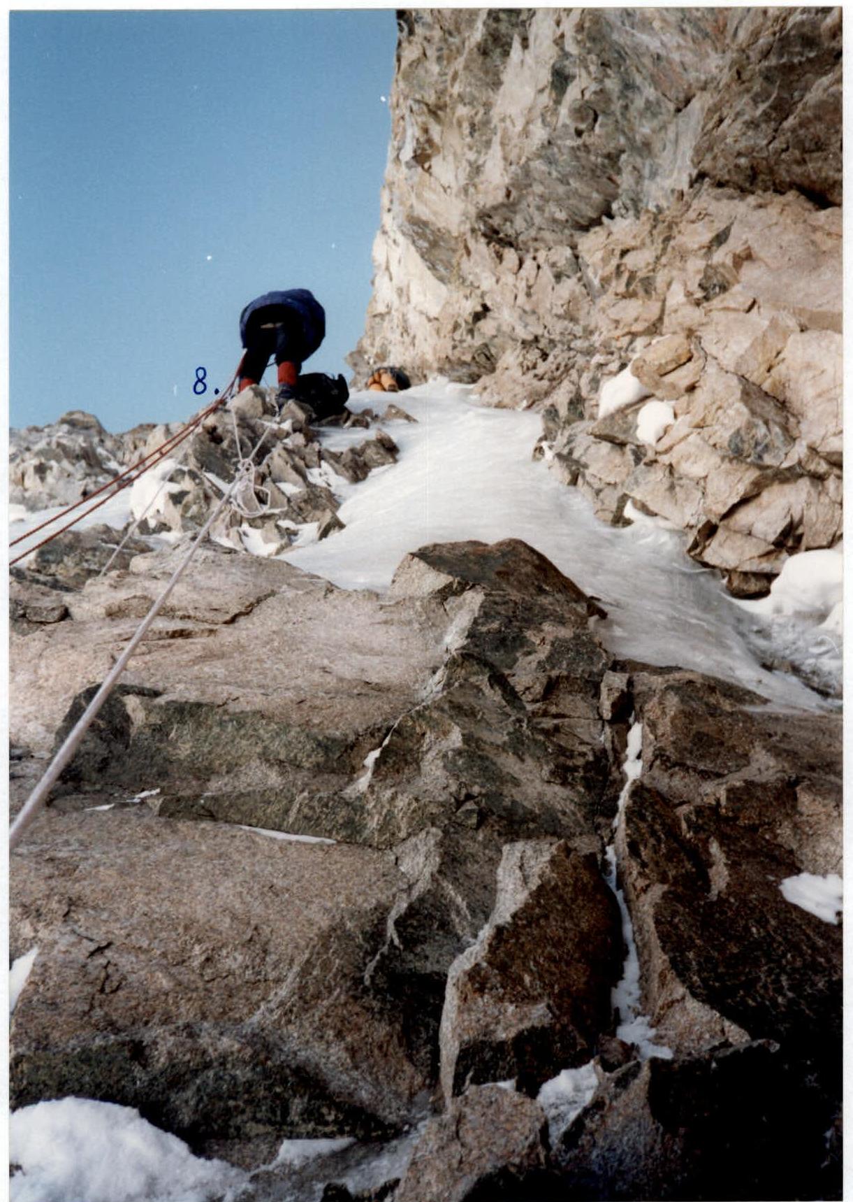
Section R7–R8. An inclined inner corner to the right, covered in ice.
Section R8–R10. A large, almost vertical inner corner, filled with ice.
Section R10–R11. Traverse along a steep ice ledge to the right, followed by a vertical ice-filled chimney leading to a steep ice ledge. Start of the roof.
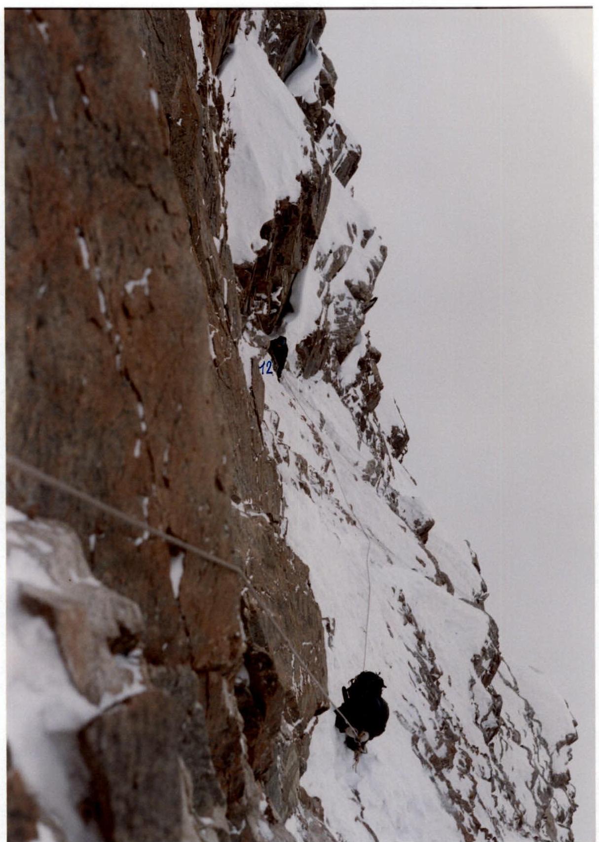
Section R11–R12. A series of rock walls and inclined ice ledges.
Section R12–R13. Traverse with height gain at about 45° along ice-covered slabs, under the start of a large inner corner. Belay organization on bolt anchors.
Section R13–R14. A large, steep inner corner with a cornice at the start. The cornice is bypassed on the left, difficult climbing, partly on artificial aids.
Section R14–R15. An inner corner filled with a thin layer of ice.
Section R15–R16. A heavily snowed and destroyed wall leading left to bypass a cornice onto the ridge.
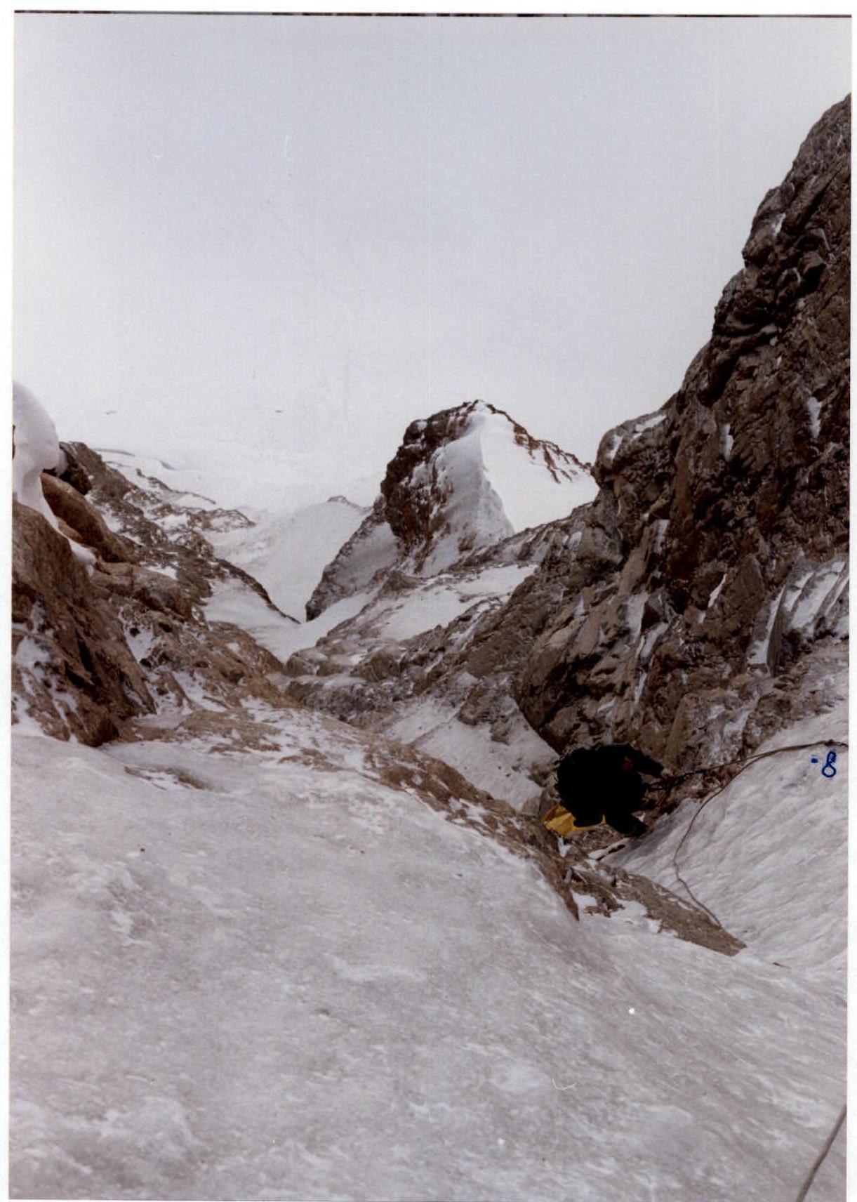
Section R16–R17. A sharp, snow-covered, and destroyed ridge.

Start of the route, section R0–R1.

Upper part of section R0–R1, approach to the first rock step.

Transporting the folded platform on section R1–R2.
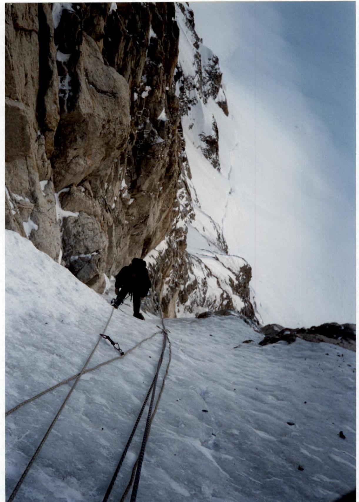
Moving along the fixed ropes on section R2–R3.
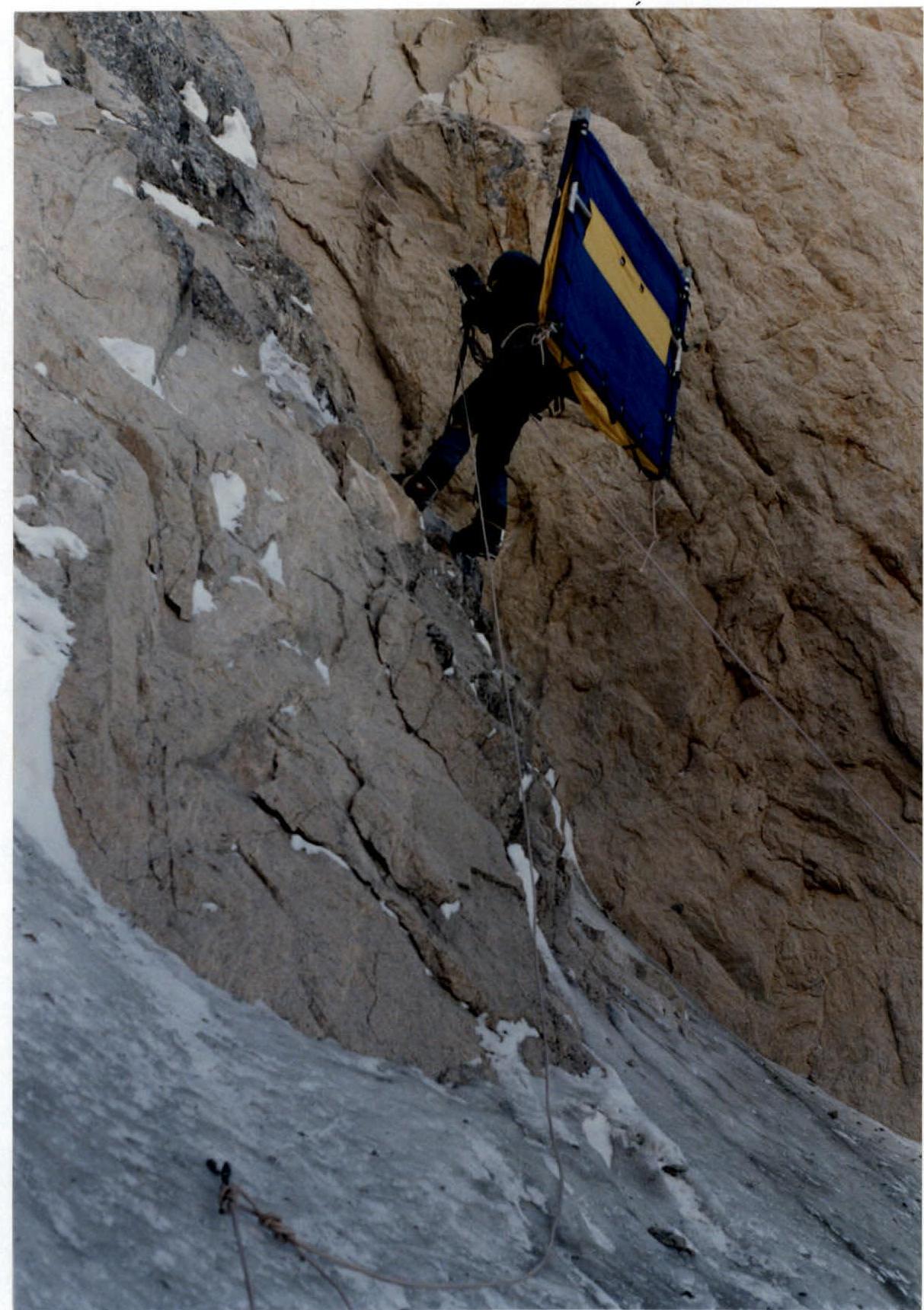
Transporting the platform on section R3–R4 (second rock step).
Start of section R7–R8. The edge of the platform set up at point 6 is visible below.
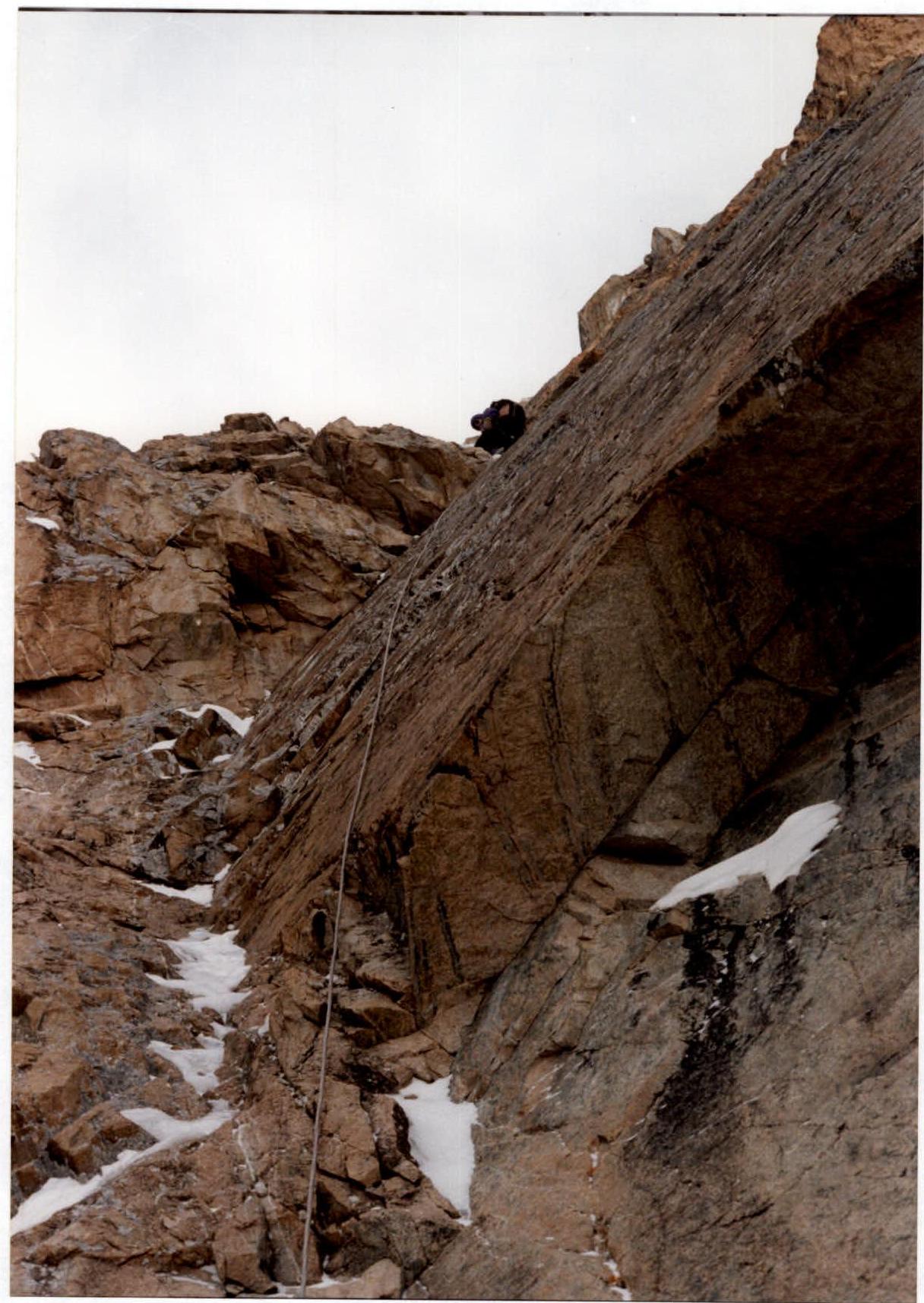
Start of the large inner corner, section R8–R9.
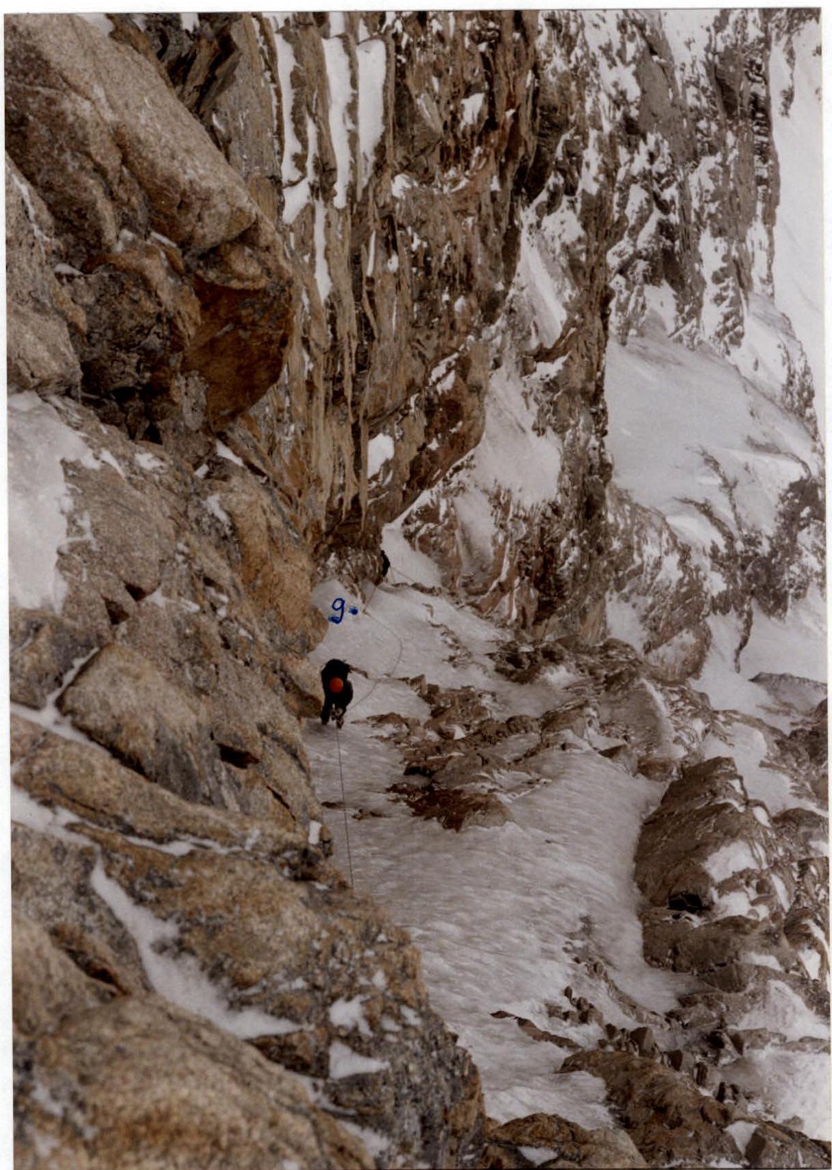
Upper part of the large inner corner, section R9–R10.
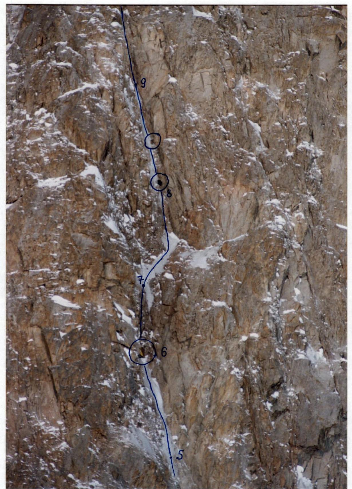
Sections R5–R10. Photographed by observers with a telephoto lens (F = 200 mm) from the glacier under the Izyiskatel slopes. The edge of the platform is visible under the overhanging rocks, and the processing is ongoing above: one person is working as the first climber, and two are standing on the belay point below.

The "roof" of the route, sections R11–R16. Photographed by observers with a telephoto lens (F = 200 mm) from the glacier under the Izyiskatel slopes. The leading pair is visible on section R11–R12.
Moving along the fixed ropes on section R12–R13. Photographed from point 13.
Moving along the fixed ropes at the start of section R13–R14. Photographed from point 13.

Upper part of section R13–R14.

Exiting the inner corner, section R14–R15.
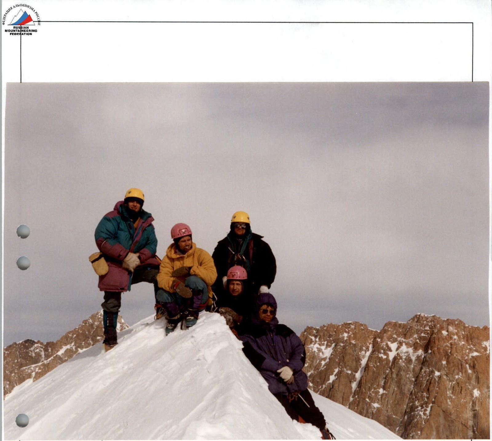
The team on the summit. From left to right: Zakrepa, Balezin, Stepanov, Cherezov, Terentyev. Alexandrov took the photo. On the right in the background: "Korona" 4th and 5th towers.