Ascent Passport
- Ascent category — winter
- Region — Tian-Shan, Kyrgyzsky Ridge, Ak-Sai gorge
- Object — Pik Svobodnaya Korea
- Category of difficulty — 5B, KTM 148 (B.Bogaev, 74)
- Height difference — 1124 m, length 1345 m, length of ice axe terrain sections 100 m, average steepness of the route 58° (bergschrund — ridge), average steepness of the wall 64° (3700–4580)
- Pitons driven
| rock | stoppers | ice |
|---|---|---|
| 36 | 28 | 45 |
| 24 | 12 | 0 |
-
Moving hours: 30, days 4, including 2 days of processing
-
Overnights: 1 on the ridge, sitting
-
Participants: Selivanov Andrey Fedorovich (CMS), Pucinian Andrey Albertovich (CMS)
-
Coach: Mikhailov Alexander Alexandrovich (MS)
-
Exit to the route — January 23, 1999, summit — January 26, return — January 26.
-
Organization: Tyumen Regional Alpine Federation
| pitons | ROUTE diagram in UIAA symbols M 1:2000 | Section NN | cat. diff. | length (m) | steep. (deg.) | ||
|---|---|---|---|---|---|---|---|
| rock | stop. | ice | |||||
| 0 | 0 | 0 | 6 | A | 230 | ||
| 0 | 12 | 14 | 5 | B | 320 | ||
| 0 | 0 | 26 | +1+ | 4 | 5A | 320 | |
| 30 | 2 | 0 | 3 | 6A | 100 | ||
| 2 | 10 | 2 | 2 | 5B | 95 | ||
| 0 | 6 | 2 | 1 | 5B | 80 | 65° | |
| 0 | 0 | 2 | + | 0 | 2B | 180 | 50° |
P. Svobodnaya Korea 4740 m
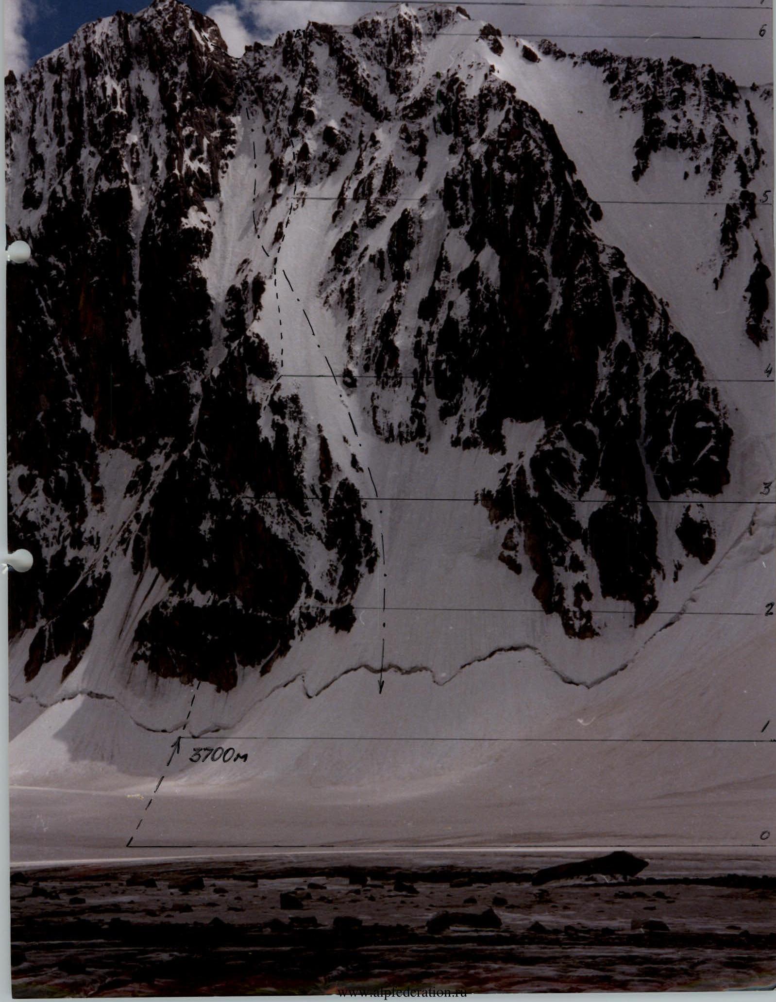 3700 m
Route description by sections
Section R0–R1. Snow-ice ascent to the first bergschrund.
Sections R1–R2:
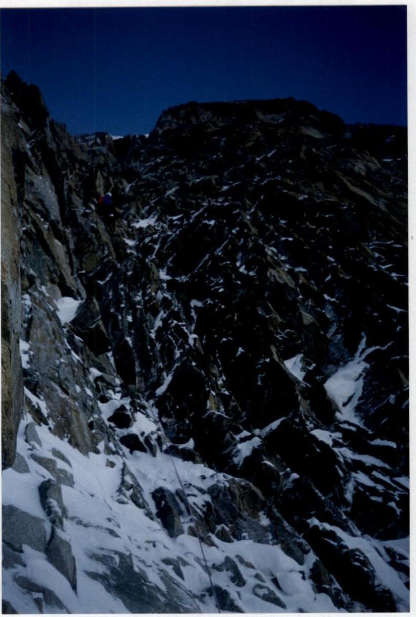
- After passing the bergschrund, movement on ice terrain with steepness of 45–65 degrees to the base of the rock bastion.
- Further — on snow-covered rocks to the ice slope.
Section R2–R3: Ice river on a vertical rock section about 50 m long.
Section R3–R4: After passing the ice gully-crack, passable on ITO. In the upper part, the cornice is bypassed on the right.
Section R4–R5: Ice slope with steepness of 60 degrees.
Section R5–R6: Rock-ice bastion, leading to the pre-summit ridge.
Section R6–R7: Ridge leading to the summit.
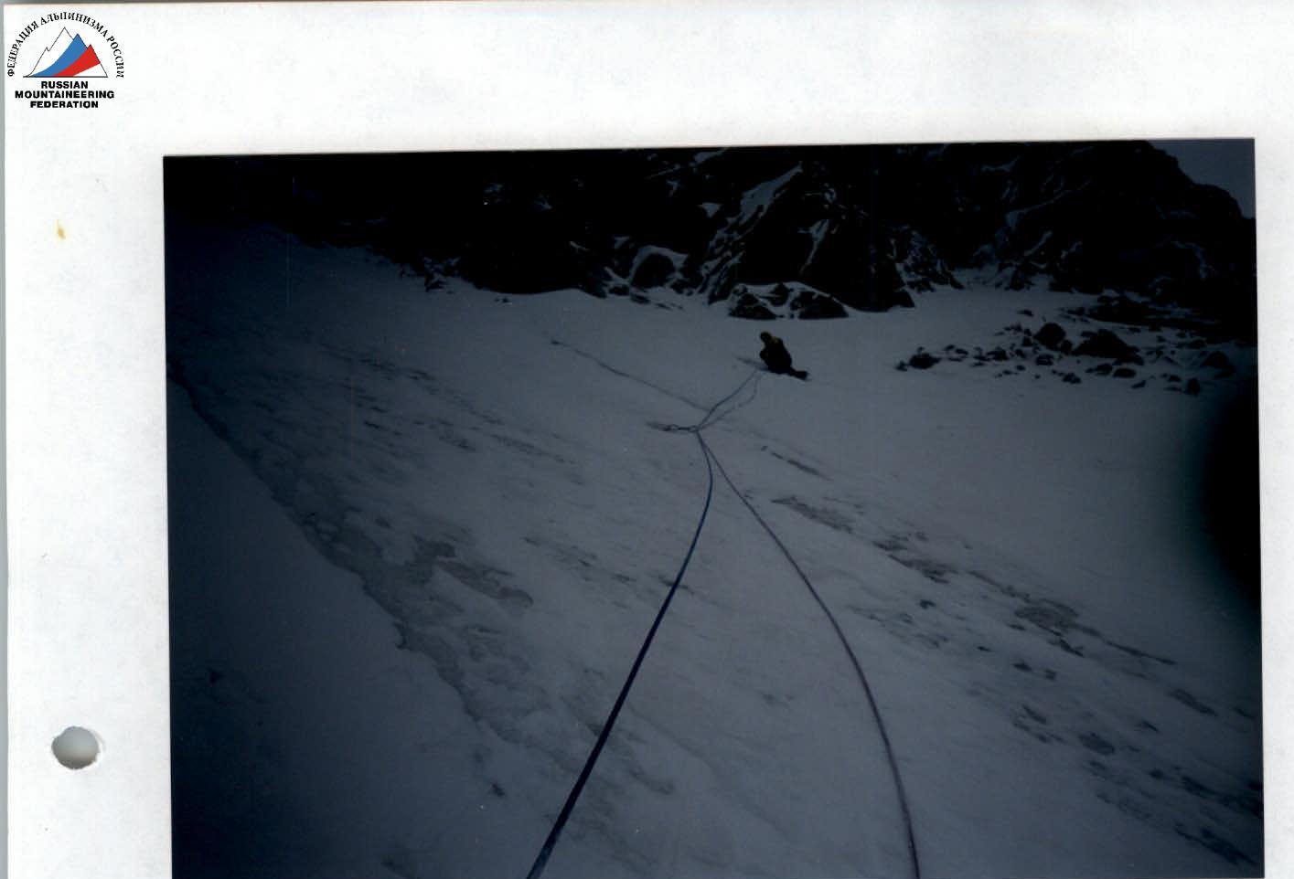
Photo 1. Section R1–R2. Beginning of the rock bastion
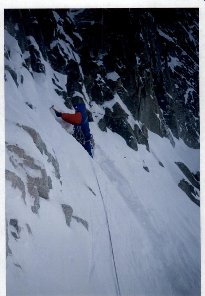
Photo 2. Section R2–R3. Beginning of the second rock belt