PASSPORT
- Technical class.
- Tian Shan, Kyrgyz Range, Ak-Sai gorge.
- Peak Svobodnaya Korea (4740 m) via the central ice couloir on the S wall.
- Difficulty category — 5A (reference).
- Height difference — 820 m, length — 1675 m. Length of sections with 5–6 difficulty category — 535 m. Average steepness of the main part of the route — 60°.
- Pitons driven:
| rock | bolt | chockstones | ice screws |
|---|---|---|---|
| 20 / 0 | 0 / 0 | 5 / 0 | 60 / 0 |
- Climbing hours — 24, days — 2, preparation — 1 day, 2 hours.
- Overnight stay — 1, lying, on a rock shelf.
- Leader — Terekhov Alexander Nikolaevich — Candidate Master of Sports.
Participants:
- Klyunin Oleg Ivanovich — Candidate Master of Sports
- Dobrusin Mikhail Efimovich — 1st sports category
- Fomin Oleg Nikolaevich — 1st sports category
- Coach: Vasiliev Boris Petrovich, Master of Sports of International Class.
- Preparation — February 7, 1985.
Departure on the route — February 8, 1985. Summit and return — February 9, 1985.
Mt. Svobodnaya Korea (4740 m).
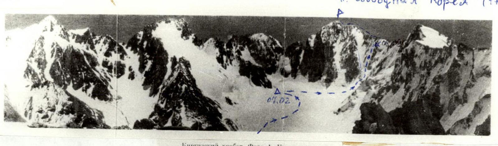
Photograph of the route. (-------) — group route. Δ — overnight stay locations.
P. Sv. Korea (4740 m).
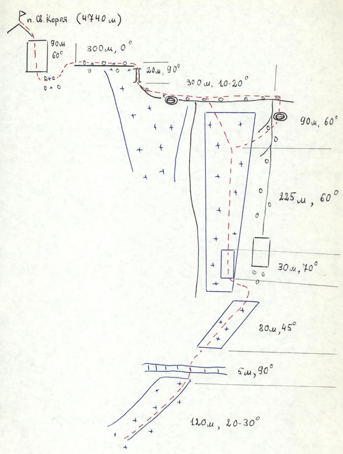
Route diagram in UIAA symbols.
EXPLANATION OF THE DIAGRAM
The route starts from the glacier at the confluence of three ice couloirs on the S wall. From the glacier — up the snow-ice slope to the bergschrund (120 m, steepness 20–30°, possible ice exits). The bergschrund is tackled "head-on" or via a snow-ice bridge in the central part. Then straight up the ice to the rocks separating the central and right-hand couloirs (80 m, 45°). In this section, the ice is not very hard. From under the rocks, 10–15 m to the left and up, and then 30 m up — an ice wall with a steepness of about 70°, leading into the couloir. The ice is hard, refrozen, and breaks off in "lenses".
Further movement is up the couloir to the ridge leading to the summit. In winter, the ice is hard. It is desirable to use crampons of the Muraviev design. In summer, due to possible rockfall, movement up the couloir is along its middle or left-hand part.
In the upper part of the couloir, it is possible to exit onto the scree slopes (80 m before the ridge) on the right-hand buttress. On the upper part of the buttress, there is a rock shelf for 1 tent. From here to the ridge — 20 m.
On the ridge leading to the summit, at the junction of the central and left-hand couloirs, there is a convenient place to bivouac (if there is no strong wind).
After passing the couloir, exit onto the ridge and move along it to the summit tower. In the middle of the ridge, there is a rock wall with a "chimney" (20 m, 90°). Then about 300 m of broken ridge lead to the summit tower. The tower is climbed "head-on" (90 m, 60–70°).
Descent from the summit — via the ascent route or down the right-hand (orthographically) ice couloir using rappel devices or "stoppers", or into the Teke-Tor gorge.
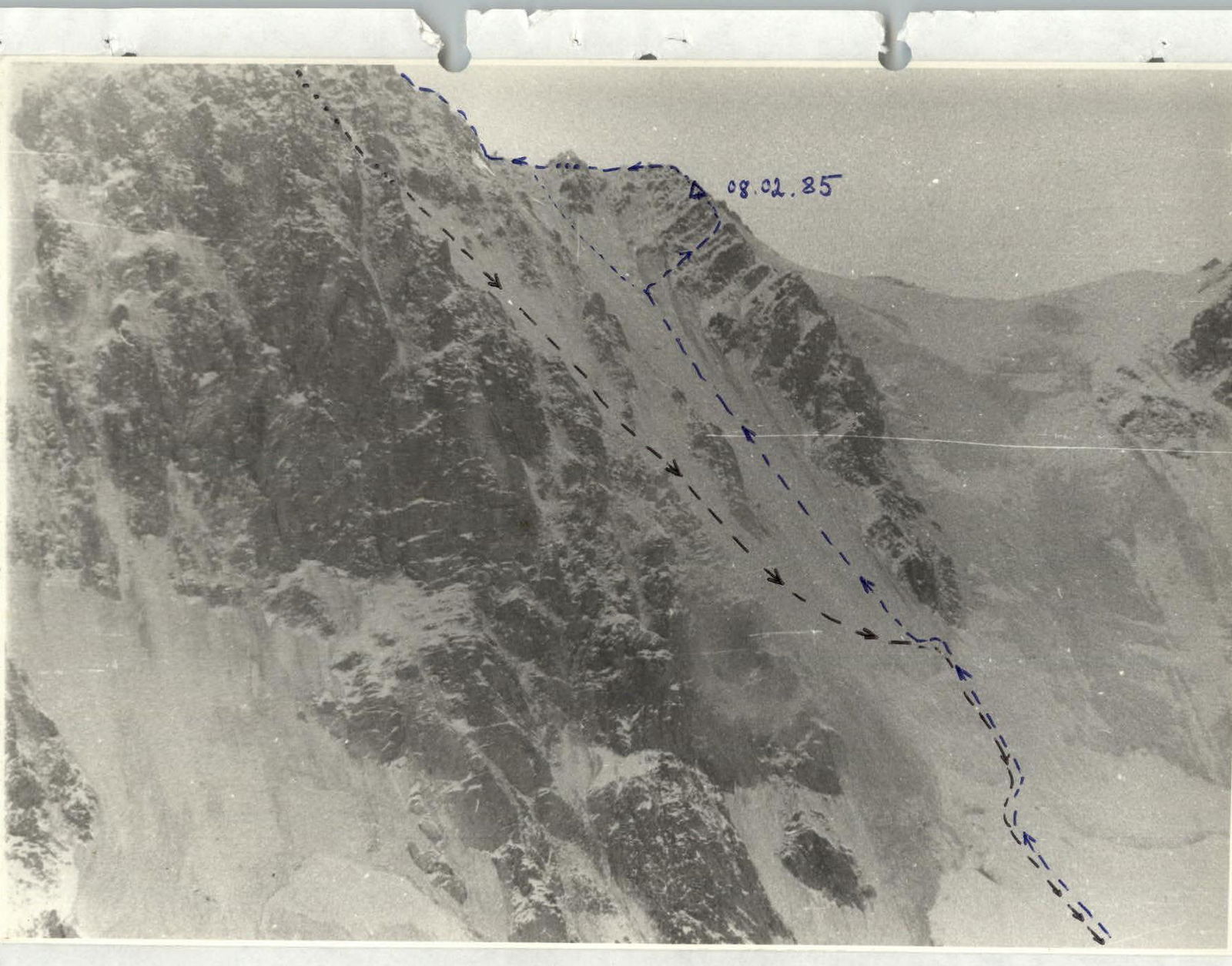
February 8, 1985
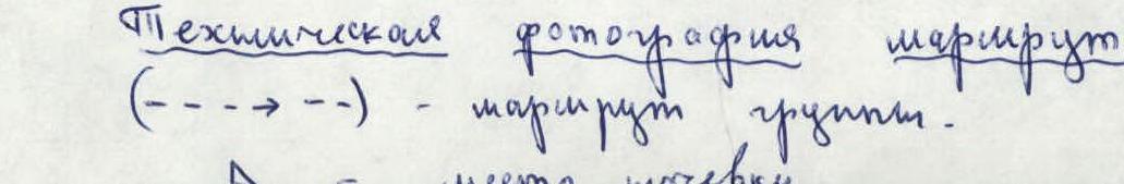
Technical photograph of the route. (-----) — group route. Δ — overnight stay locations.