
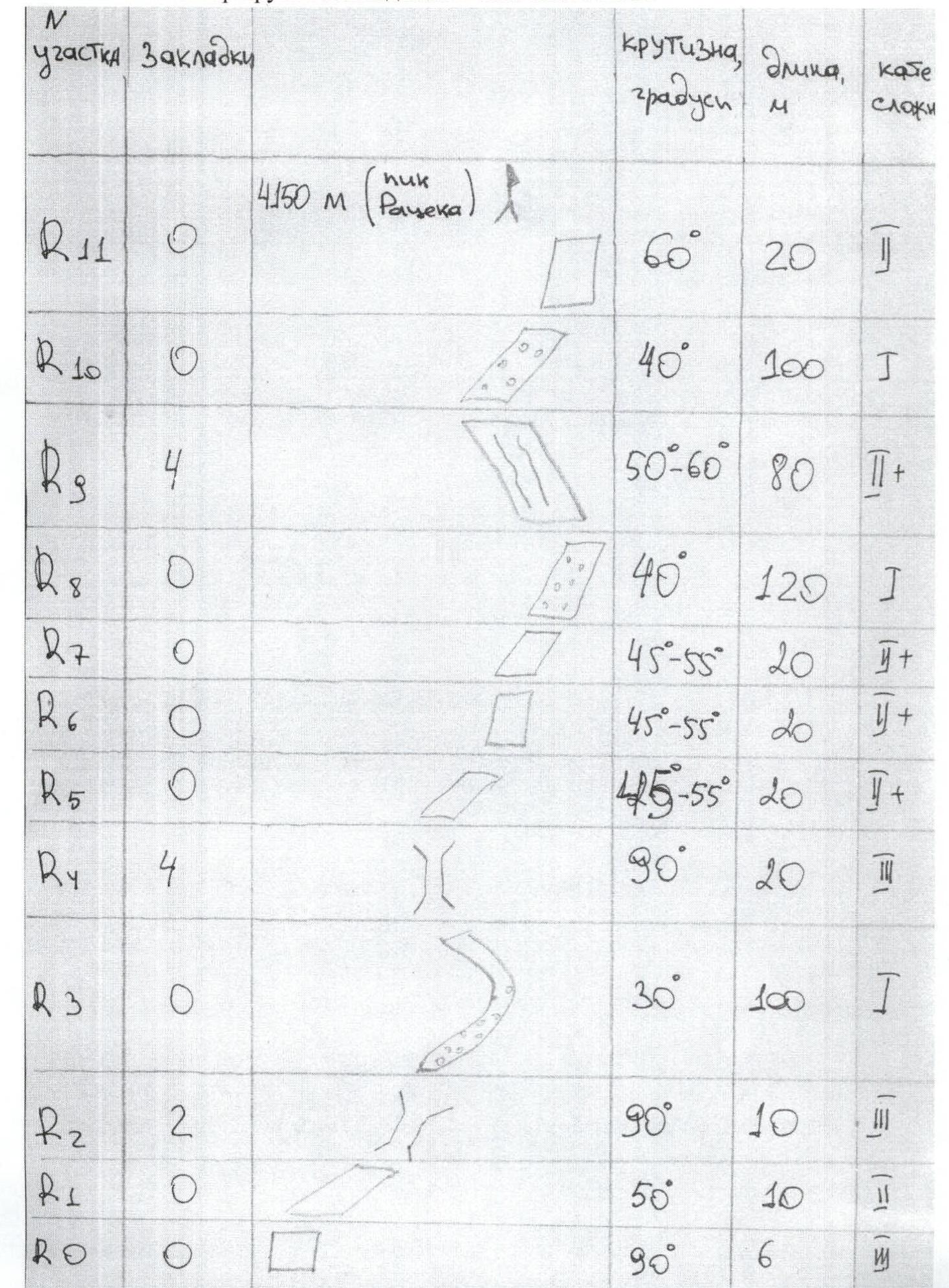
Ascent Passport
- Tian-Shan, Kyrgyzsky ridge, Ak-Sai gorge.
- 4150 m (Ratséka peak), via the North-West ridge.
- The route is proposed as 2A category of complexity, first ascent by a Russian team.
- The nature of the route is rocky.
- Height difference of the route — 350 m.
Route length — 520 m. Length of sections:
- 1B category of complexity — 320 m,
- 2A category of complexity — 170 m,
- 3A category of complexity — 36 m.
Average steepness:
- main part of the route — 45°
- entire route — 30°
- Number of pitons used on the route:
- rock pitons — 0 pcs., including artificial aids — 0 pcs.;
- chocks — 10, including artificial aids — 0 pcs.;
- ice screws — 0 pcs.
Total number of artificial aids used — 0 pcs.
- Team's climbing hours: 2.5 hours, 1 day.
- Participants:
- Temerev Ivan Mikhailovich — Candidate Master of Sports — team leader
- Smaikina Svetlana Vladimirovna — 1st sports category
- Coach: Novoselova G. V.
- Departure to the route: 11:00, September 3, 2006.
Reached the summit: 13:30, September 3, 2006. Returned to the base camp: 16:00, September 3, 2006.
- Organization: Tomsk Alpinism Federation. Map of the area
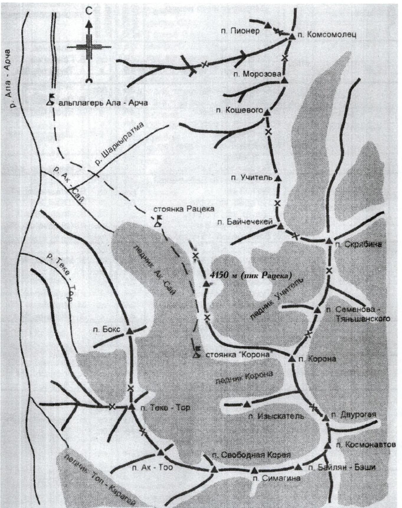 Photo #1. General view of the summit
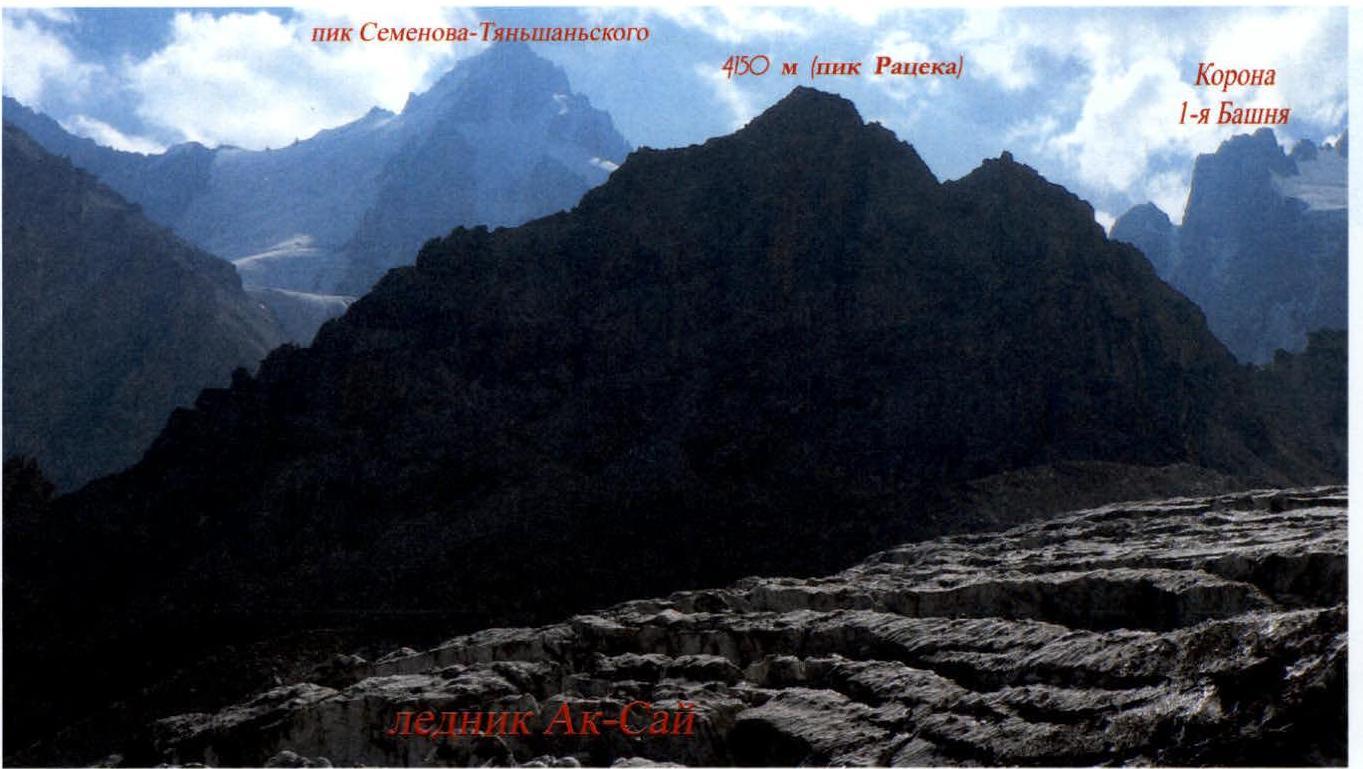
Photo #2. Photopanorama with neighboring peaks
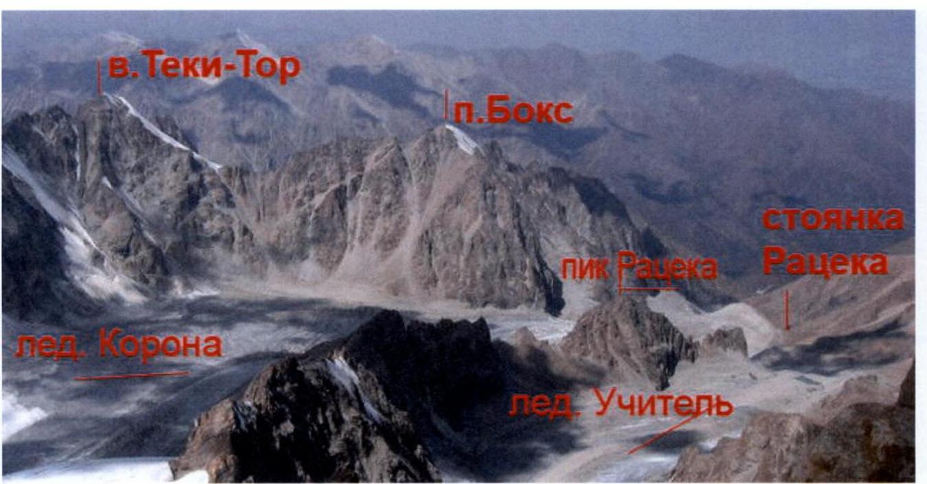
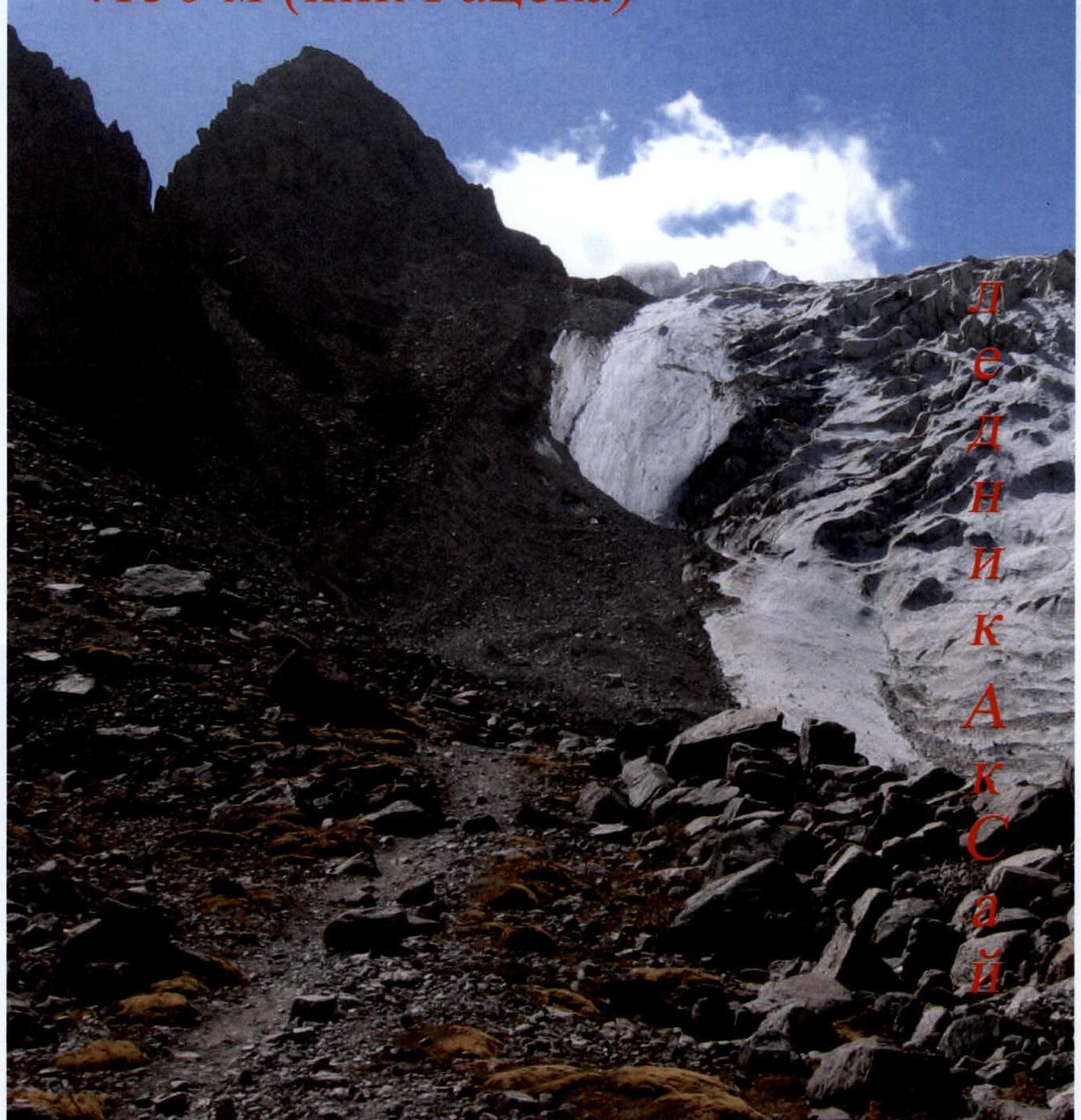
Photo #3. Route profile
4150 m (Ratséka peak)
 Route ascent diagram in UIAA symbols
Route description
10:00 left the camp from the "Ratséka" bivouac. 11:00 — at the col under the route — got dressed. 11:15 — started climbing. 13:30 — reached the summit. 14:00 — descended via the ascent route. 16:00 — returned to the base camp. Approached via a trail leading to the Koronskie camps along the Ak-Sai glacier. About halfway up, turned left towards the col. Further movement was across a large moraine.
R0–R1. At the col, put on gear and climbed in a belayed team. From the scree ledge, ascended 6 m up a 90°, 3 wall.
R1–R2 — 10 m, 50°, 2. Inclined slab.
R2–R4. Chimney 10 m, 90°, 3. Belay using chocks.
R3–R5 — 100 m, 30°, 1. Movement across slabs with scree.
R4–R6. Chimney 20 m, 90°, 3. Belay using chocks.
R5–R8. Series of inclined wall ledges 60 m, 45–55°, 2+.
R8–R9. Inclined slab with rocks 120 m, 40°, 1.
R9–R10. Inclined wall with a series of parallel cracks 80 m, 50–60°, 2+. Belay using chocks.
R10–R11. Inclined slab with rocks 100 m, 40°, 1.
R11–summit. Wall 20 m, 60°, 2+.
Descent was via the ascent route.
Photos of route sections:
- Photo #6
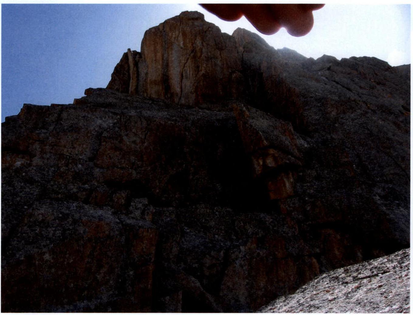
- Photo #6

Section R3
Comments
Sign in to leave a comment