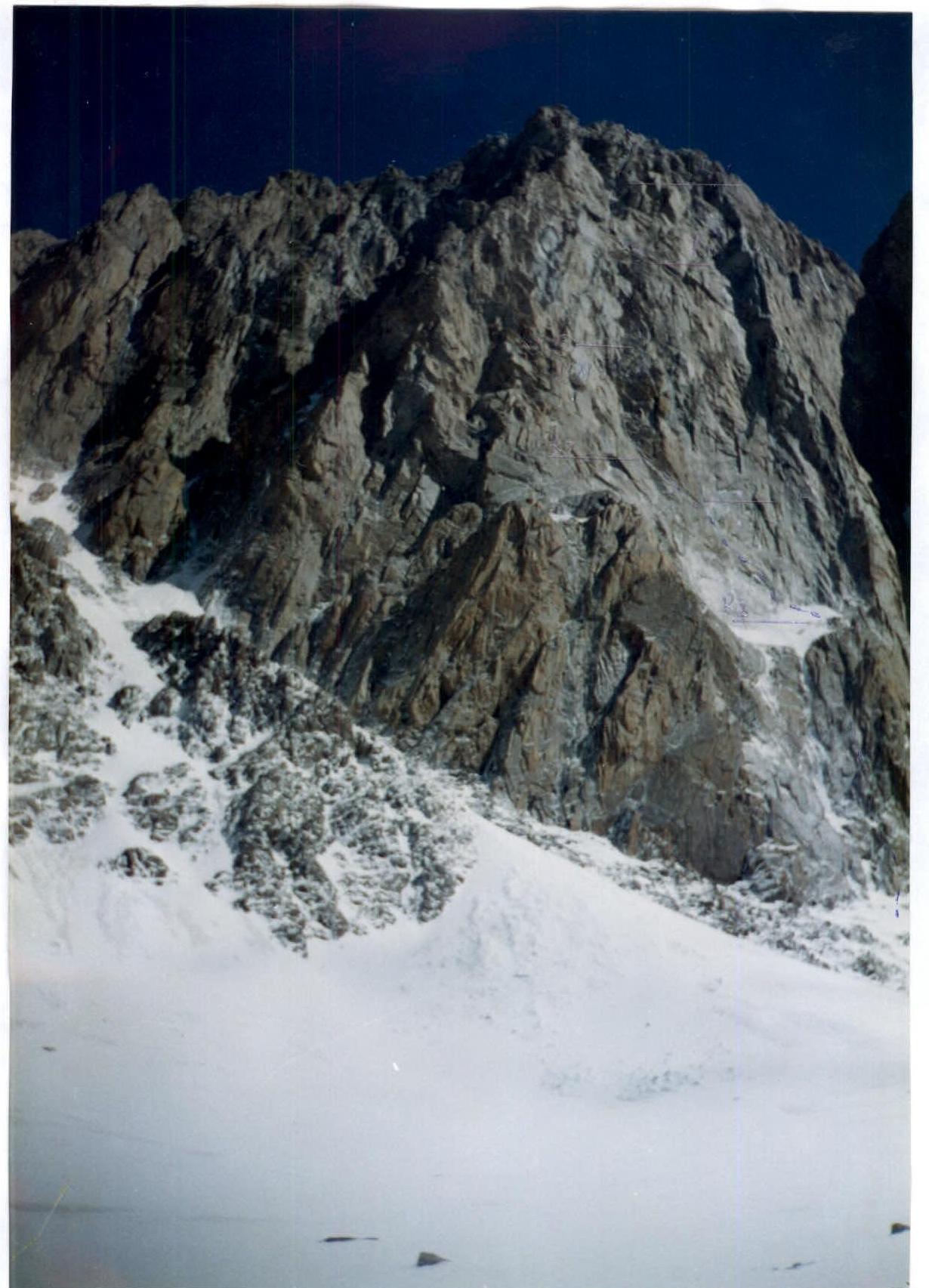
v. Korona, 5th tower in the center of SW wall, V. Balezina route, Tian-Shan, April 7, 1996
PASS:
- Technical class.
- Tian-Shan, "Ak-sai" gorge.
- v. Korona, 5th tower, in the center of SW wall.
- 6A category of complexity, V. Balezina route.
- Height difference 640 m.
Distance 720 m. Distance of sections: * 5 category of complexity — 420 m. * 6 category of complexity — 70 m. Average steepness of the entire route — 65°.
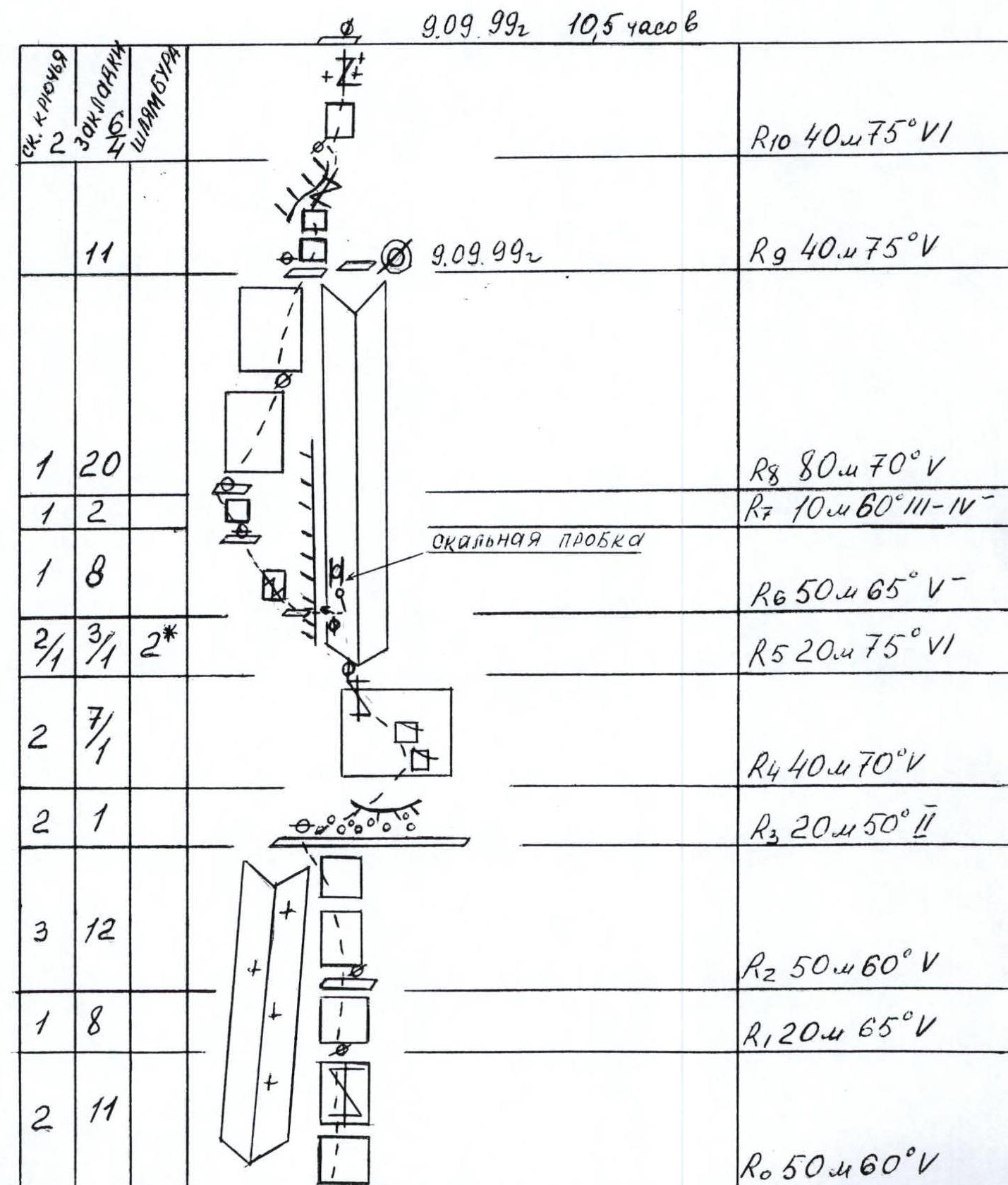
- Driven pitons: rock 28, chocks 39, bolted 2*. Left on the route: rock 2, chocks 3, bolted 2.
- Team's walking hours: 21 hours and 3 days.
- Overnights: 1st — two on a site, one on a ledge, September 9, 1999; 2nd — on a site in a tent, September 10, 1999.
- Leader: Popovich Vadim Vitalievich CMS. Participants: Korobkov Alexander Alexandrovich CMS, Chernyavsky Alexander Nikolaevich CMS.
- Coach: Mikhailov Alexander Alexandrovich MS, Honored Trainer of the RSFSR.
- Exit to the route: September 9, 1999. Summit: September 11, 1999. Return: September 11, 1999.
- Organization: Nizhny Tagil branch of the Sverdlovsk regional Association "Children's health through physical culture and sports".
- N. Tagil, Lebyazhinskaya st., 15.

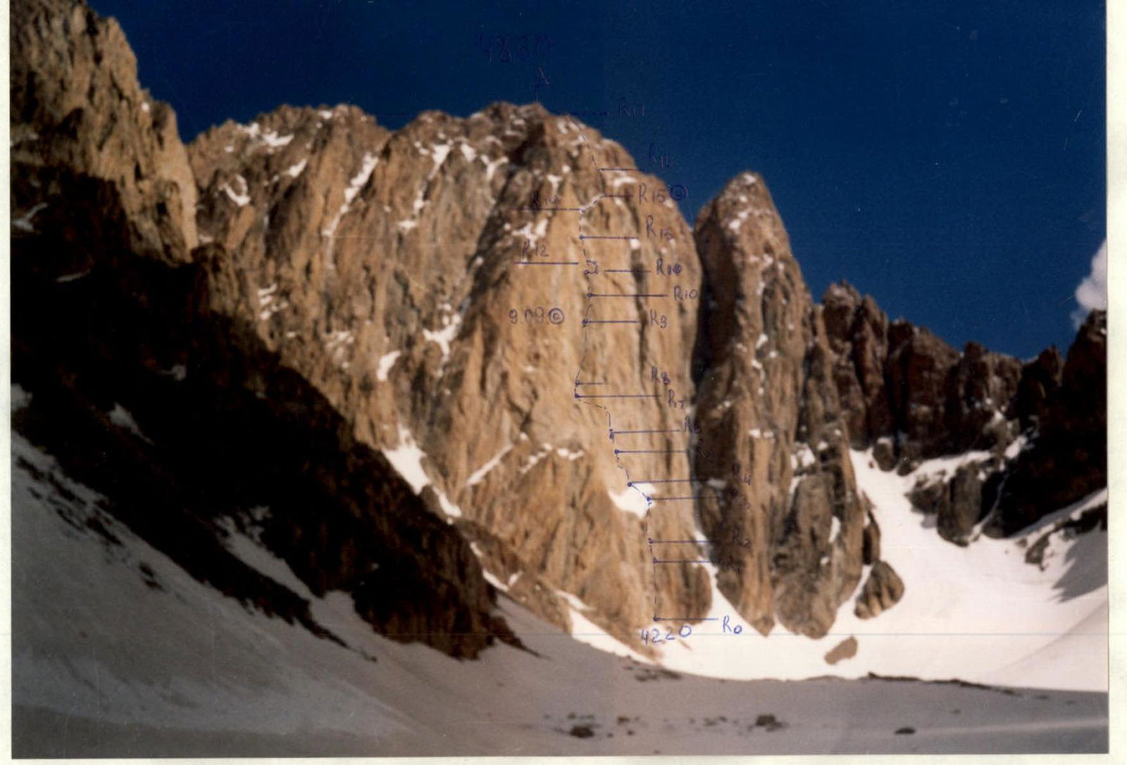
Drawn profile of the route
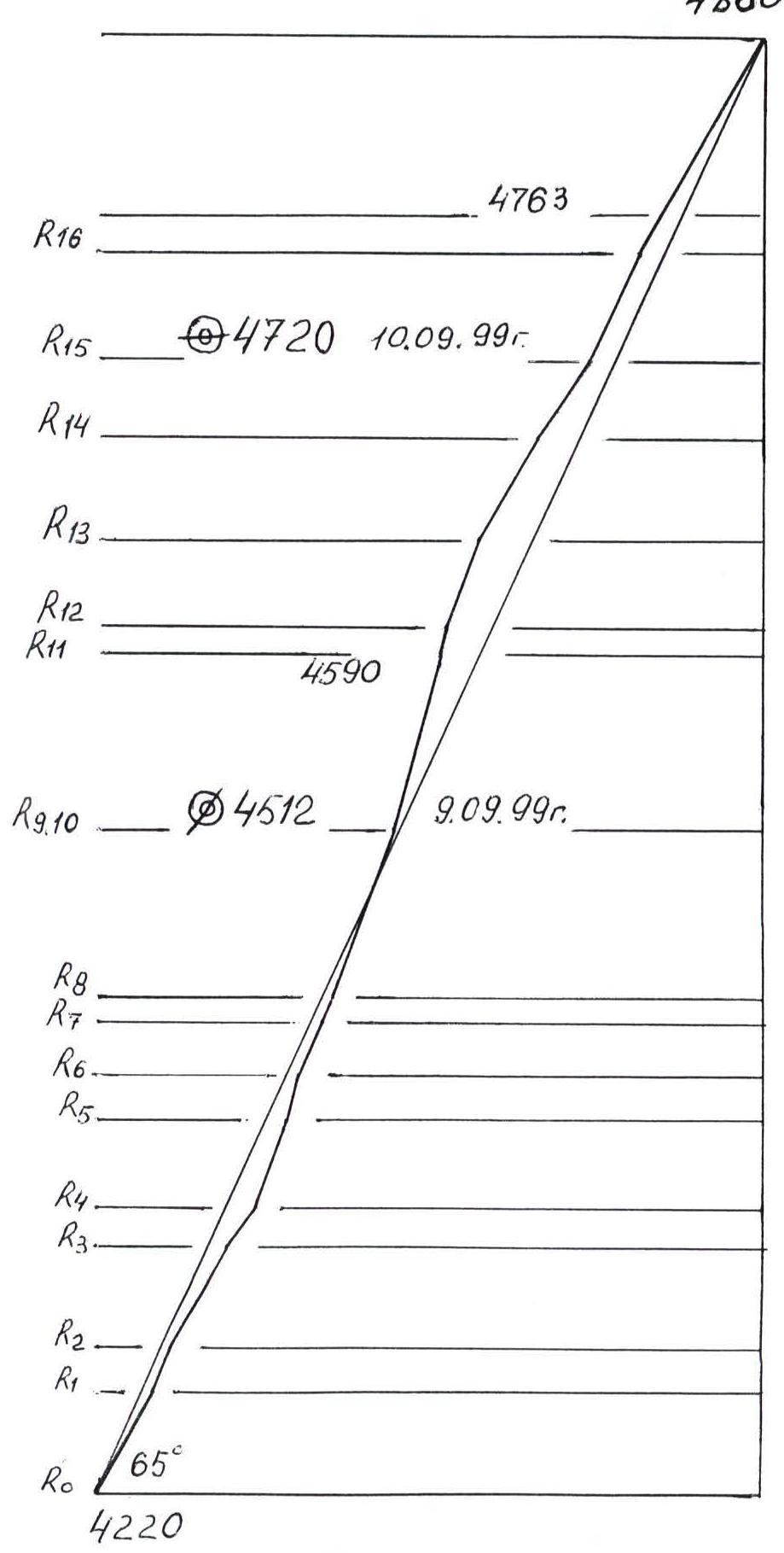 M 1:3000
Team's Tactical Actions
September 9, 7:00 — departure from Koronskie overnight, 9:00 — exit to the route. The first pair to work is Chernyavsky — Korobkov. Exit to a large scree ledge on the SW wall. From the ledge — exit to the main part of the route.
The pair Popovich — Korobkov ascend to 4590 m and descend at 19:30. The bivouac site, overnight is inconvenient, semi-reclining on two small ledges, no problem with water — there is ice in the crevices.
When passing the route, the following are often encountered:
- "live" stones;
- wet rocks with ice accretions.
September 10, 12:00 — start of ascent via the fixed ropes. The first pair to work is Popovich — Korobkov.
18:30 — overnight on a large scree ledge, near the beginning of the chimney — 4720 m, there is snow.
Overnight is comfortable, in a tent, lying down. The route is processed up to 4763 m.
September 11, 9:00 — exit to the route, start of ascent via the fixed ropes, movement towards the summit ridge.
12:30 — exit to the ridge. The first pair to work is Korobkov — Chernyavsky, movement along the ridge is simultaneous.
13:00 — exit to the summit with the entire team, descent between the 4th and 3rd towers.
17:00 — return to Koronskie overnight.
Sheet 8. Scheme of the route in symbols M 1:2000.

Route Description by Sections
The V. Balezina route on the V-th tower of v. Korona via the center of the South-West wall can be divided into three parts:
- Lower rock section to the scree ledge (R0–R3).
- Main part via the center of the South-West wall to the chimney before the roof (R4–R14).
- Roof — gradual ascent from the chimney to the top of the ridge and the ridge itself (R15–R18).
R0–R1. The route starts from a snowfield along the slopes to the right of the inner corner, covered with ice. 50 m 60° 5.
R1–R2. Movement along the inner corner via a series of walls and ledges. 20 m 65° 5.
R2–R3. Movement along the inner corner towards a large scree ledge in the lower part of the SW wall, exit to the ledge near the inner corner. 50 m 60° 5.
R3–R4. Along the scree ledge, "ram's foreheads" and then via a snowfield (ice under the snow), exit to the wall. 20 m 50° 2.
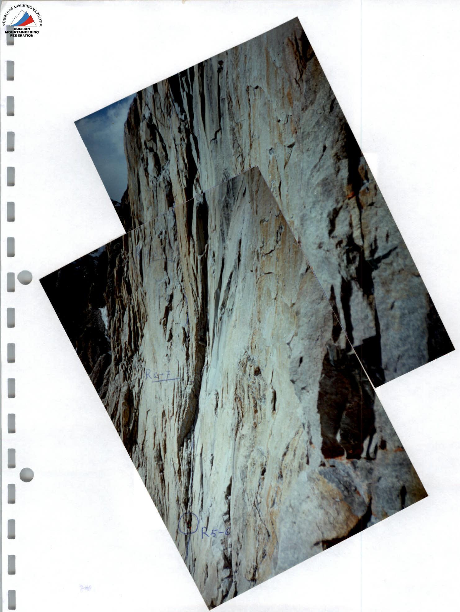
R4–R5. From the snowfield up the wall via a system of ledges and flakes in the form of scimitars — movement towards a large inner corner. 40 m 70° 5.
R5–R6. Up the right part of the inner corner — ascent to a rock plug in the form of a flake. 20 m 75° 6.
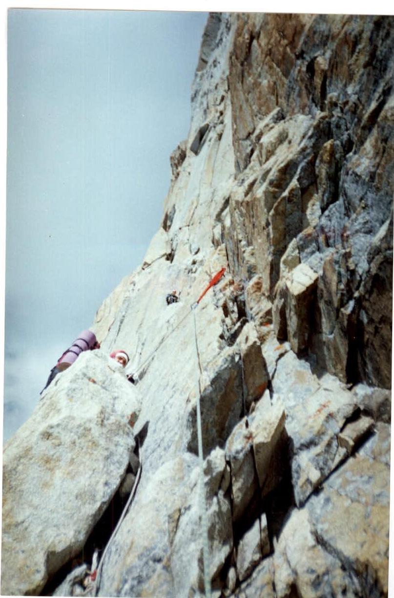
R6–R7. Below the rock plug (5 m, using a pendulum) — traverse through the left overhanging part (edge) of the inner corner. Then traverse left towards a crevice, up the crevice left towards a series of ledges. 50 m 65° 5.
R7–R8. From the ledge left and up — exit to a ledge at the base of a not clearly defined inner corner, rocks are rust-colored. 10 m 60° 3–4.
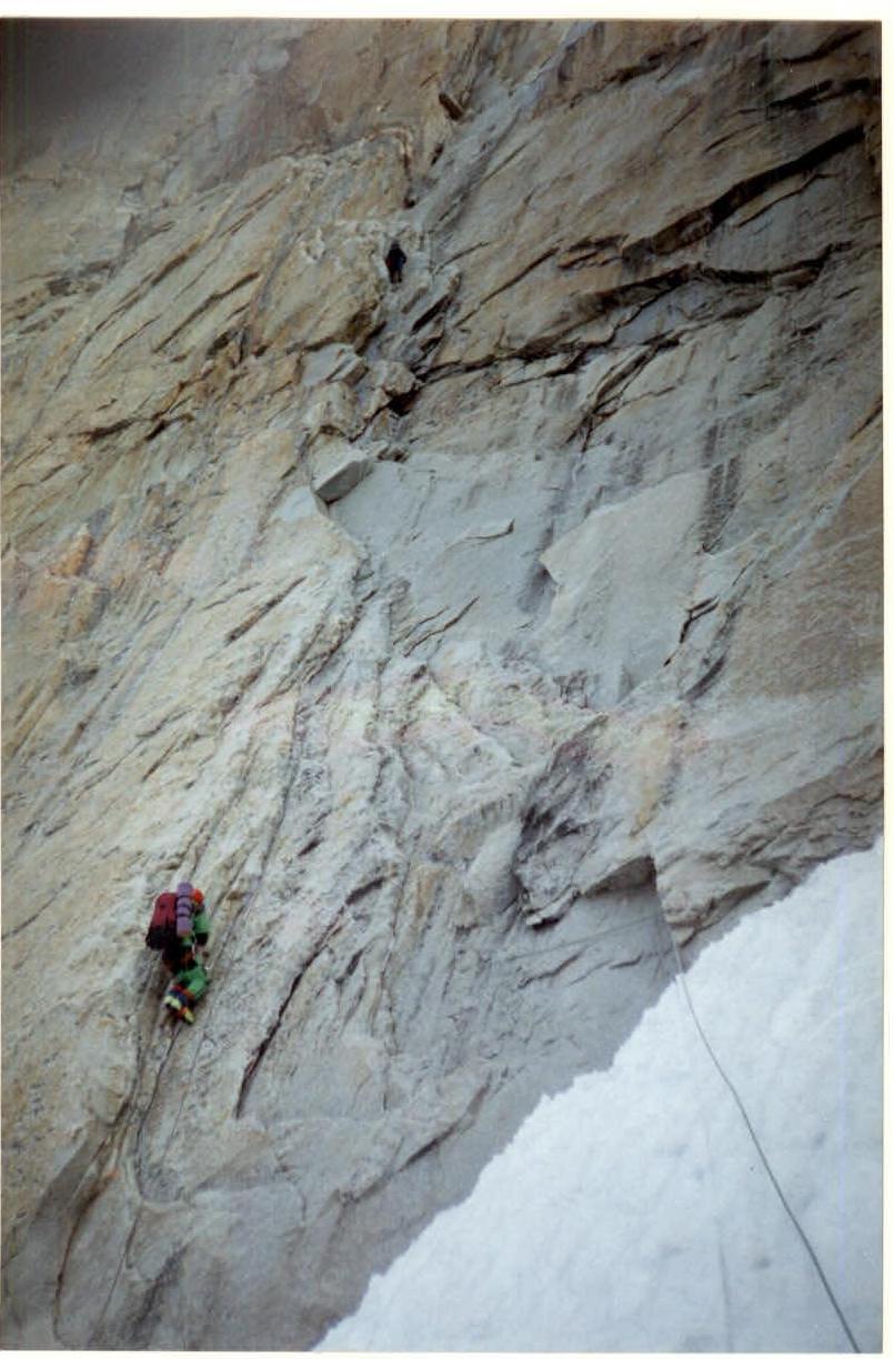
R8–R9. Up the right part of the not clearly defined inner corner (rust-colored rocks) — exit to a series of small ledges. (Many live stones). (Overnight site). 80 m 70° 5.
R9–R10. From the ledge up towards the overhang. Bypassing the overhang on the right, via a crevice — exit to a small sloping ledge. 40 m 75° 5.
R10–R11. Right and up the wall, and then via a crevice (water, ice accretions in the cracks) — exit to a small ledge with a rock flake. 40 m 75° 6.
R11–R12. From the ledge with a flake — traverse right along a horizontal crack (bypassing the overhang with wet rocks) — 10 m. Ascent up the wall and traverse left to a crevice. 10 m 80° 6.
R12–R13. Via the crevice, passable by free climbing, and a wall — exit to a chimney. (Water, ice accretions.)
R13–R14. Up the chimney — exit to snow-covered rocks. (Water, ice accretions.) 50 m 60° 4.
R14–R15. Via snow-covered rocks and "ram's foreheads" — exit to a scree ledge with snow under the chimney. Overnight site. 40 m 55° 2–3.
R15–R16. Up the chimney (live stones) — exit to a ledge. 50 m 65° 5.
R16–R17. Via flakes, a system of walls and a series of ledges — movement up towards the summit ridge. 110 m 60° 4.
R17–R18. Along the ridge — traverse left. Snow-covered rocks, firn. Movement is simultaneous. 80 m 1–2.
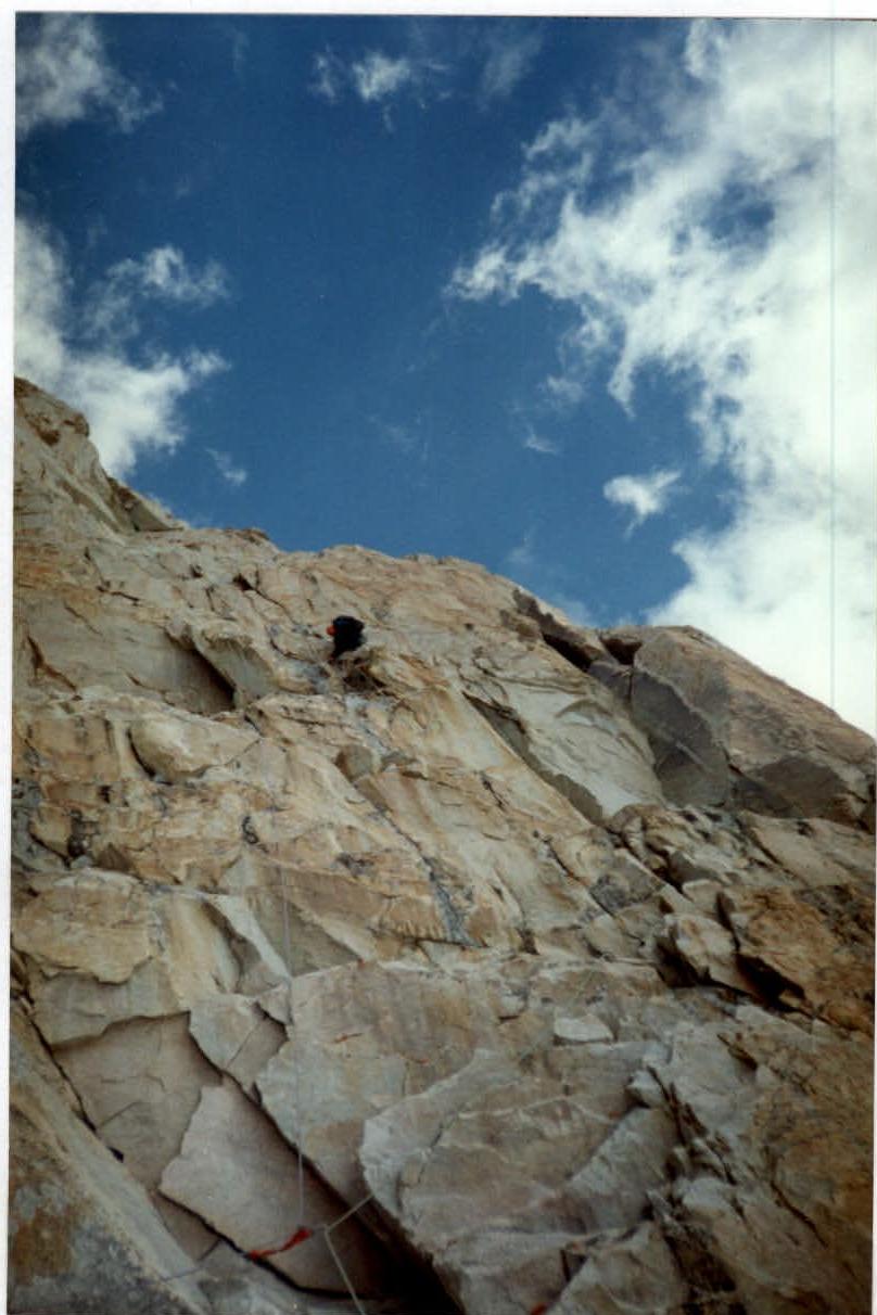
Section R4–R5, section R5–R6. Beginning of the main part of the SW wall.
Section R4–R5, R4–R6. Photo taken from the Ruzhevsky route 55 via Zereben.
Section R6–R7.
Section R8–R9, R9–R10.