Ascent Passport
- Region, Northern Tian-Shan, Kyrgyz Ala-Too Range, 7.4.
- Peak Korona (5th) via 3rd ridge.
- Category of difficulty: 5B.
- Route type: combined
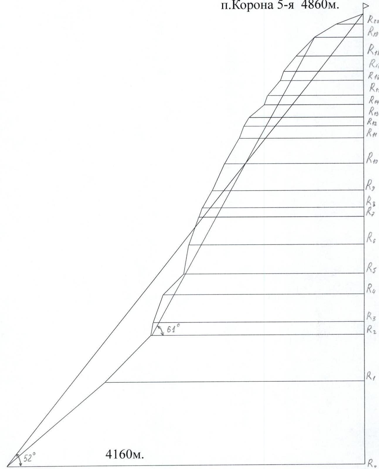
- Route elevation gain — 700 m. Route length — 920 m. Length of sections with 5th category of difficulty — 160 m. Average slope of the route: main part of the route — 61°, entire route — 52°.
- Hooks left on the route: total — 0 pcs. Hooks used on the route: Hooks — 8 pcs., including ITO — 0 pcs. Protection elements — 97 pcs., including ITO — 9 pcs. Previously left protection points — 6 pcs., including ITO — 2 pcs. Total ITO used — 11 pcs.
- Number of climbing hours — 18 h, days — 1.
- Team leader — Varlamov Nikita Olegovich, 1st sports category Team members:
- Evstifeev Vladislav Vladimirovich, Candidate for Master of Sports
- Shikin Yuri Mikhailovich, Candidate for Master of Sports
- Remenyuk Alexander Vladimirovich, 1st sports category
- Team coach: self-coached
- Departure to the route: 4:00 AM, August 14, 2006
Reached the summit: 10:00 PM, August 14, 2006
Returned to Base Camp: 9:00 AM, August 15, 2006
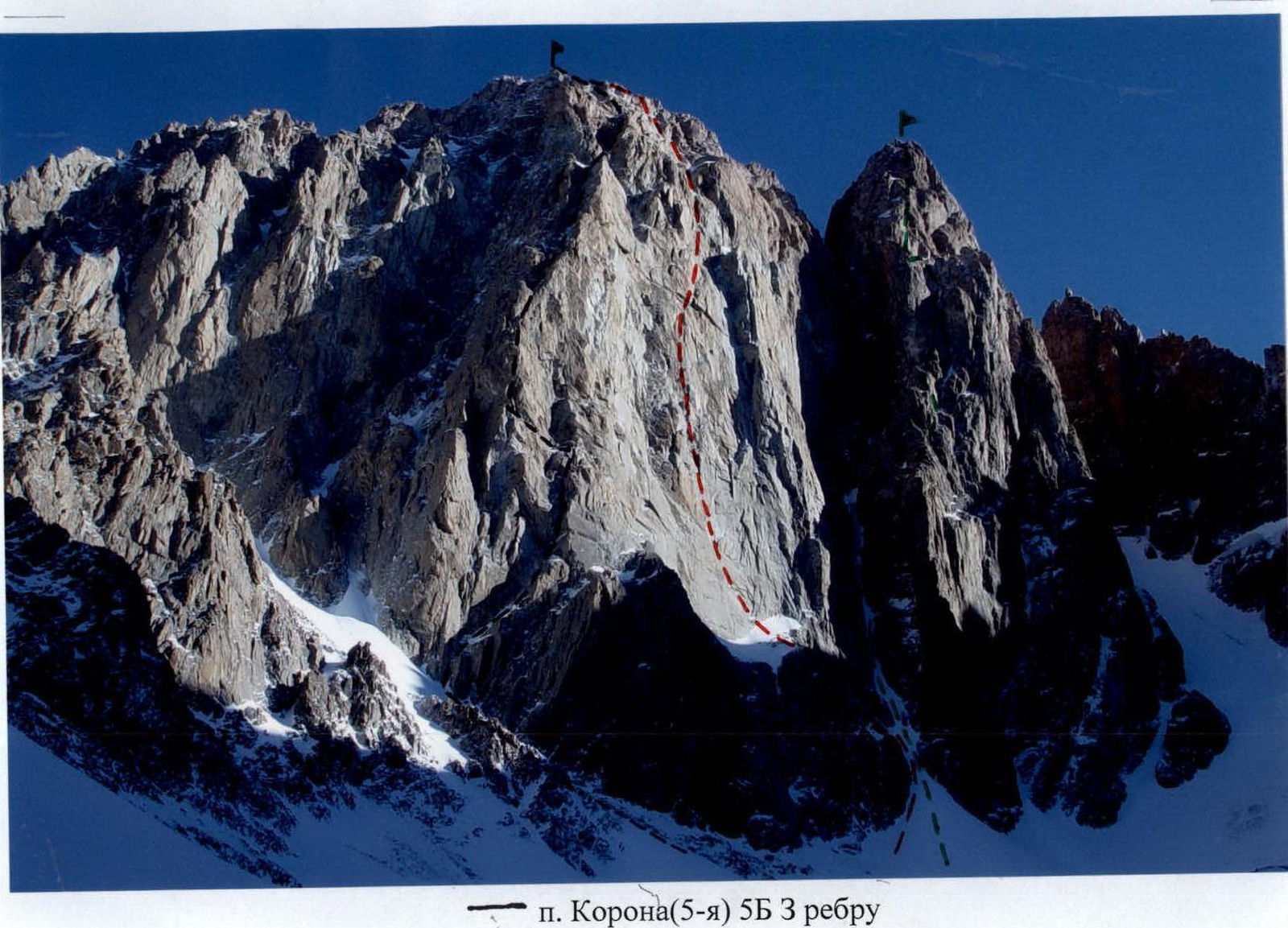
- p. Korona (5th) 5B via 3rd ridge
- p. Korona (5th) 6A via center of SW wall
- p. Korona (6th) 5B via 3rd wall
Route Profile
p. Korona 5th, 4860 m
Tactical Actions of the Team
The ascent was made from Koronskaya Hut. In our opinion, this is the optimal location, as the approach from the hut to the route takes about an hour, and descending from the summit via Korona Glacier, we returned back to our campsite. Having planned one night bivouac on the mountain, we took a light bivouac gear: three foam pads, two sleeping bags, a tent fly, a small gas canister, a burner, a pot (for tea), and food that didn't require cooking (sausages, cheese, crackers, cookies, etc.). Although the route is primarily rock, it begins with a large, two-hundred-meter snow-ice couloir, and the descent also goes via the glacier. Therefore, we took ice equipment: crampons and ice axes for each participant, and six ice screws. On the route, the group worked as follows. The first participant, with a lightened backpack, climbed with lower belay on a dynamic rope and pulled a static rope for setting up the rappel. All other participants moved along the rappel with upper belay. We took four ropes (one dynamic and three static) on the route. This allowed us to organize the group's movement so that the speed of the first participant depended only on the speed of the second participant, and also allowed us to provide upper belay for the rest of the group. The team departed from the bivouac at 3:00 AM on August 14, 2006, and started working on the route at 4:00 AM. The lower half of the route, R0–R10, was first worked by Remenyuk A.V., then he was replaced by Evstifeev V.V., who worked as the first participant until the end of the route. At the intermediate control point (R13), a note was not found. The group reached the pre-summit ridge already in the dark; there was no suitable place for a bivouac, so it was decided to continue moving along the ridge towards the summit. At 10:00 PM on August 14, 2006, they reached the summit, continued moving along the ridge towards the fourth tower. About 100 meters after the fifth tower, they stopped for a bivouac on the ridge. The next day, August 15, 2006, at 5:00 AM, the group continued their descent. The descent from the summit was not very simple: traversing the fourth and third towers and Korona Glacier. After 4 hours, at 9:00 AM, they descended to Koronskaya Hut. Throughout the ascent, radio communication was maintained with a group of observers at Koronskie bivouacs.
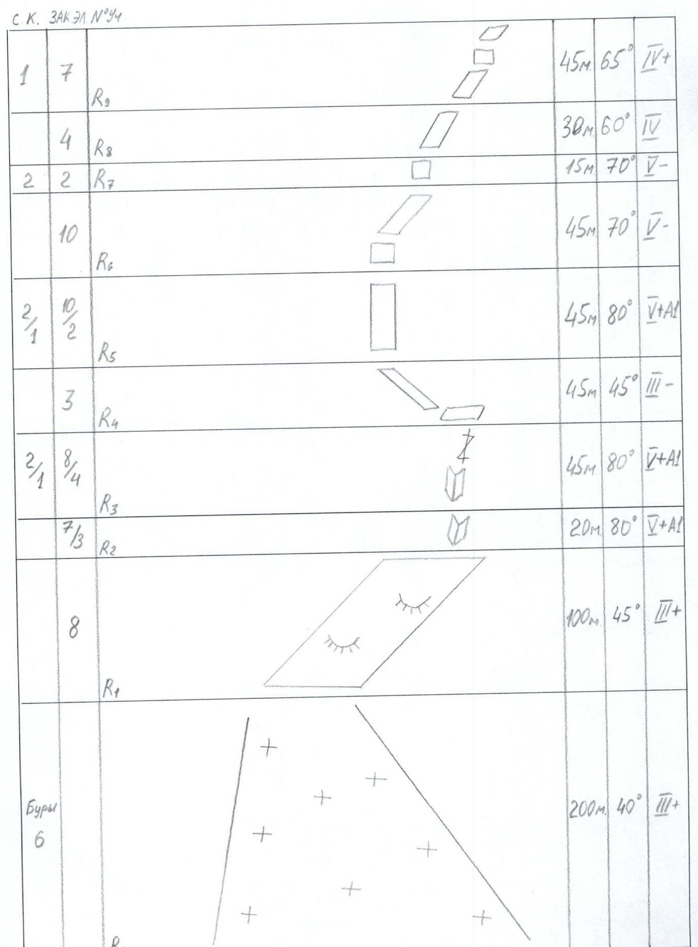
Route Diagram in UIAA Symbols M 1:2000 (Part 1)
Route Diagram in UIAA Symbols M 1:2000 (Part 2)
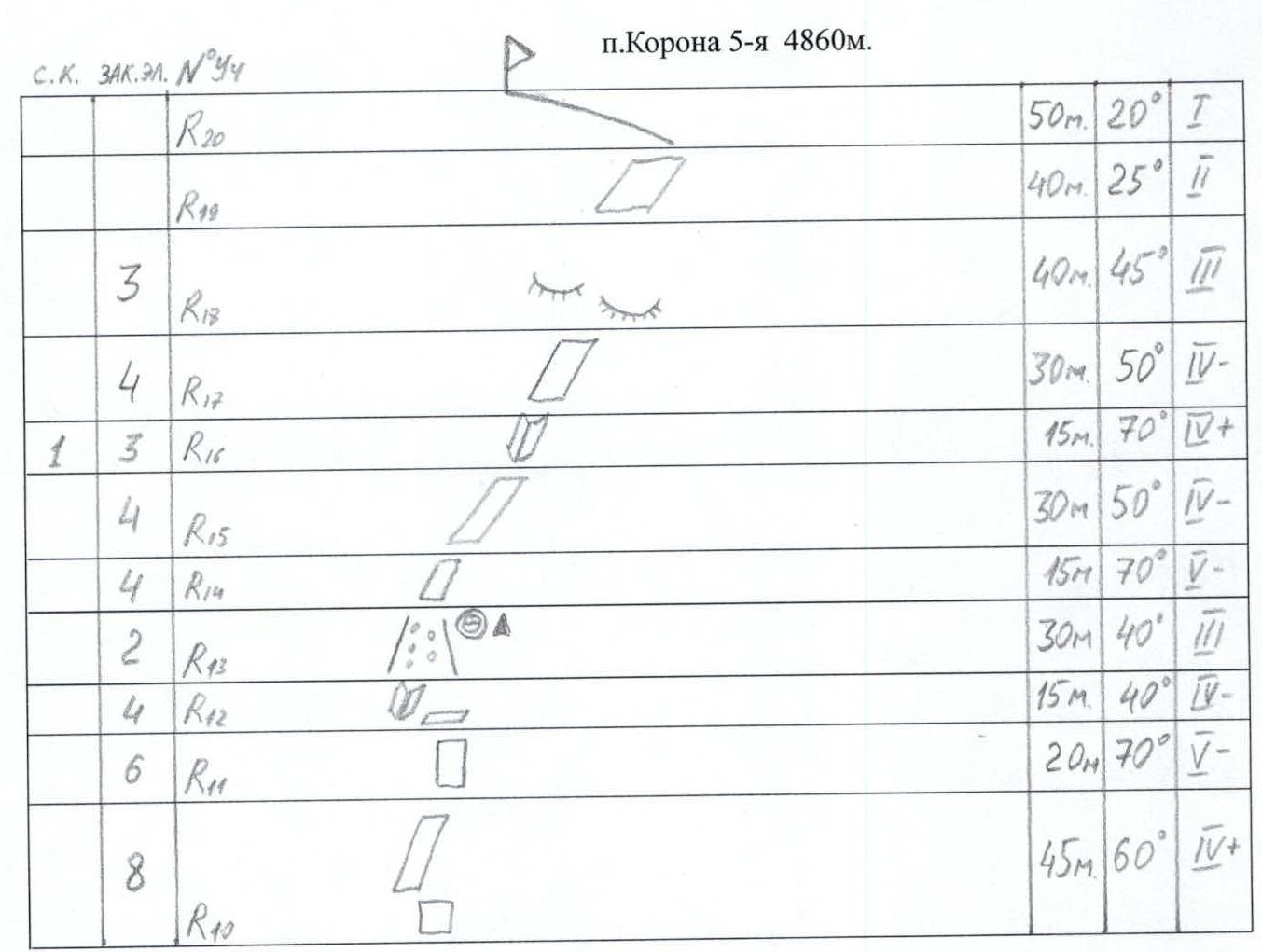
Route Description by Sections
R0–R1 From Ak-Sai Glacier, to the left of the fifth tower, ascend a snow-ice couloir to the base of the western ridge. R1–R2 From the base of the western ridge, move right along a huge diagonal ledge. R2–R4 The huge diagonal ledge leads to a series of steep internal corners that lead to a ledge. R4–R5 Then, move left along a simple inclined ledge to exit onto the western ridge. R5–R8 Then, ascend the right side of the ridge, via steep walls. R8–R12 Transition from the right side of the ridge to the left, the steepness of the rock decreases significantly, then ascend the walls, to the left of the ridge, to a narrow horizontal ledge. R12–R14 From the narrow horizontal ledge, move left into a scree-filled couloir, approaching the base of a steep rock tower — there are bivouac sites and a control point. From this section, the route becomes prone to rockfall, the rock is loose, with much scree on the ledges and loose rocks. The roof of the fifth tower of p. Korona begins. R14–R17 Bypass the rock tower on the right, enter a giant bowl-eroded area, ascend via an internal corner on the right side of the bowl to relatively easy, loose rock. R17–R20 Ascend relatively easy, loose rock to reach the ridge. R20–(summit) Ascend the ridge to the summit.
The route is very logical; after exiting onto the huge diagonal ledge at the base of the western ridge, there is no opportunity to deviate from the route, and the movement continues along the simplest path; there is no desire to deviate from the route to the right or left. The upper part of the route is prone to rockfall.
Descent from the summit: from the fifth tower, traverse to the fourth, then to the third, and from it, make two rappels to Korona Glacier and descend to Koronskie bivouacs.
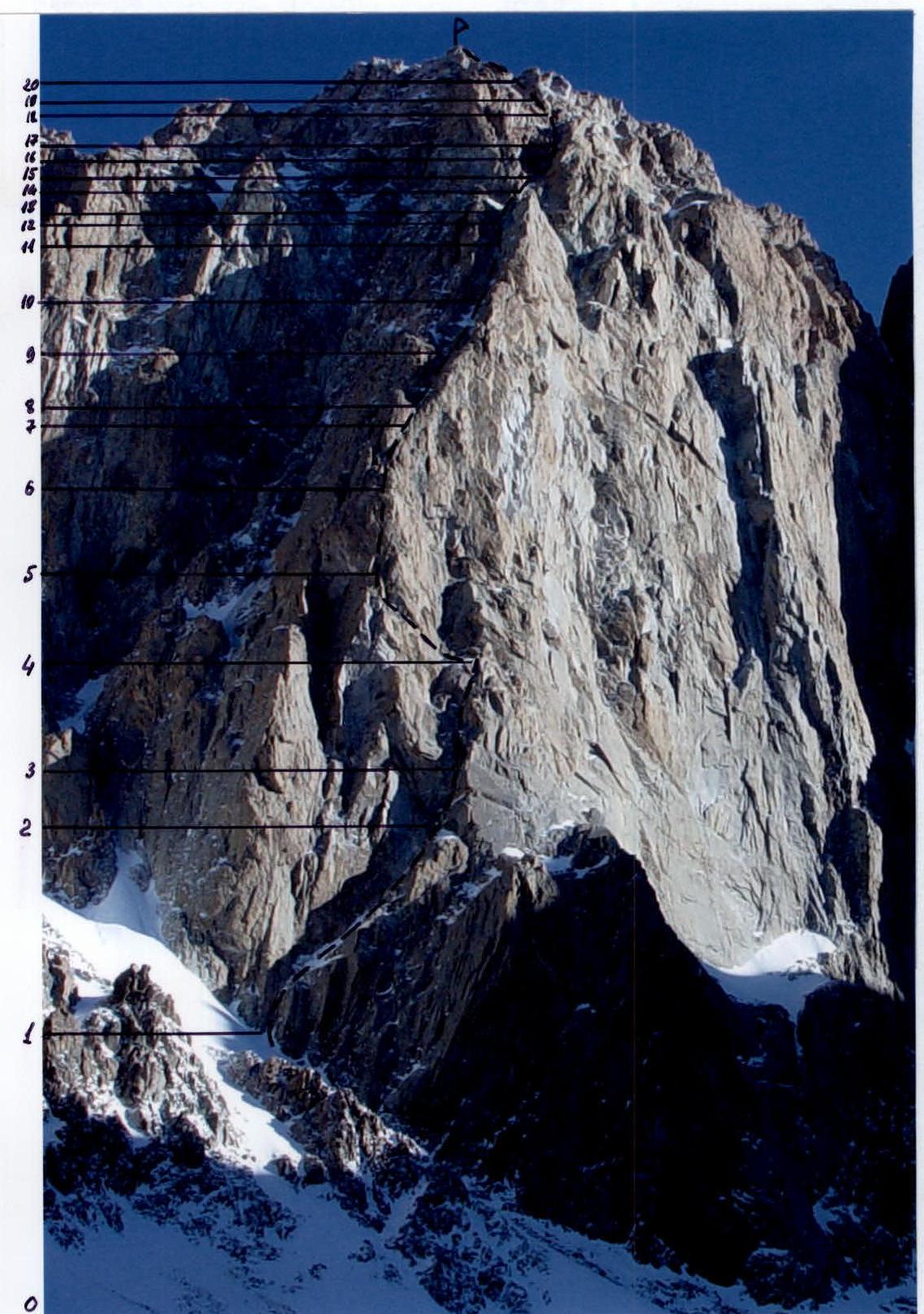
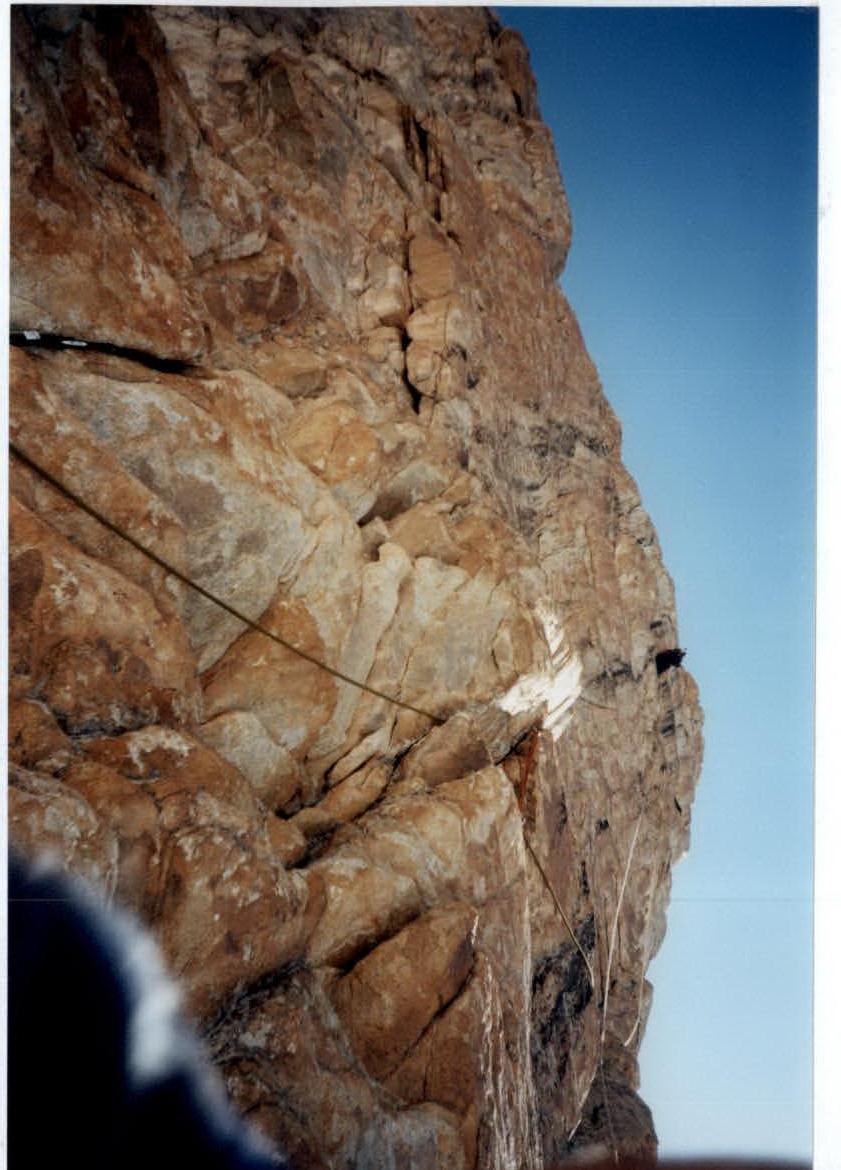
Photo #2. First participant working on the upper part of section R5–R6
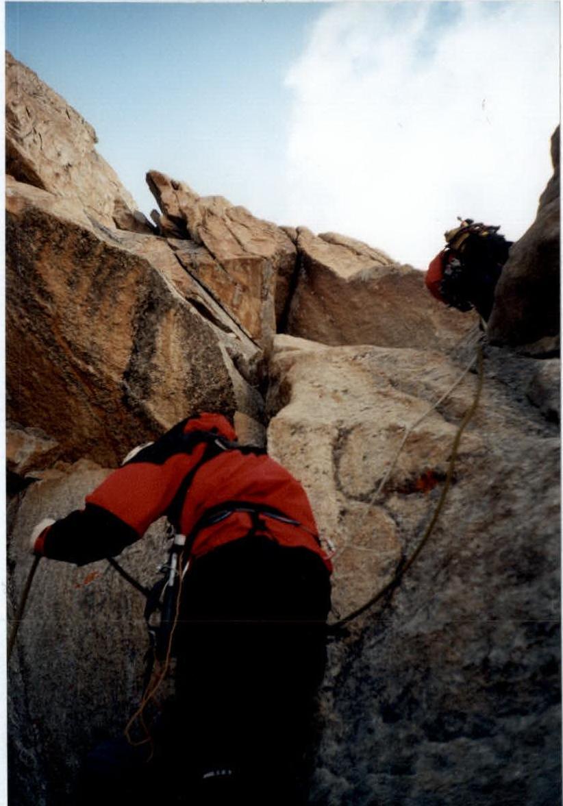
Photo #1. Working on the station at point R5 and the first participant's exit onto section R5–R6
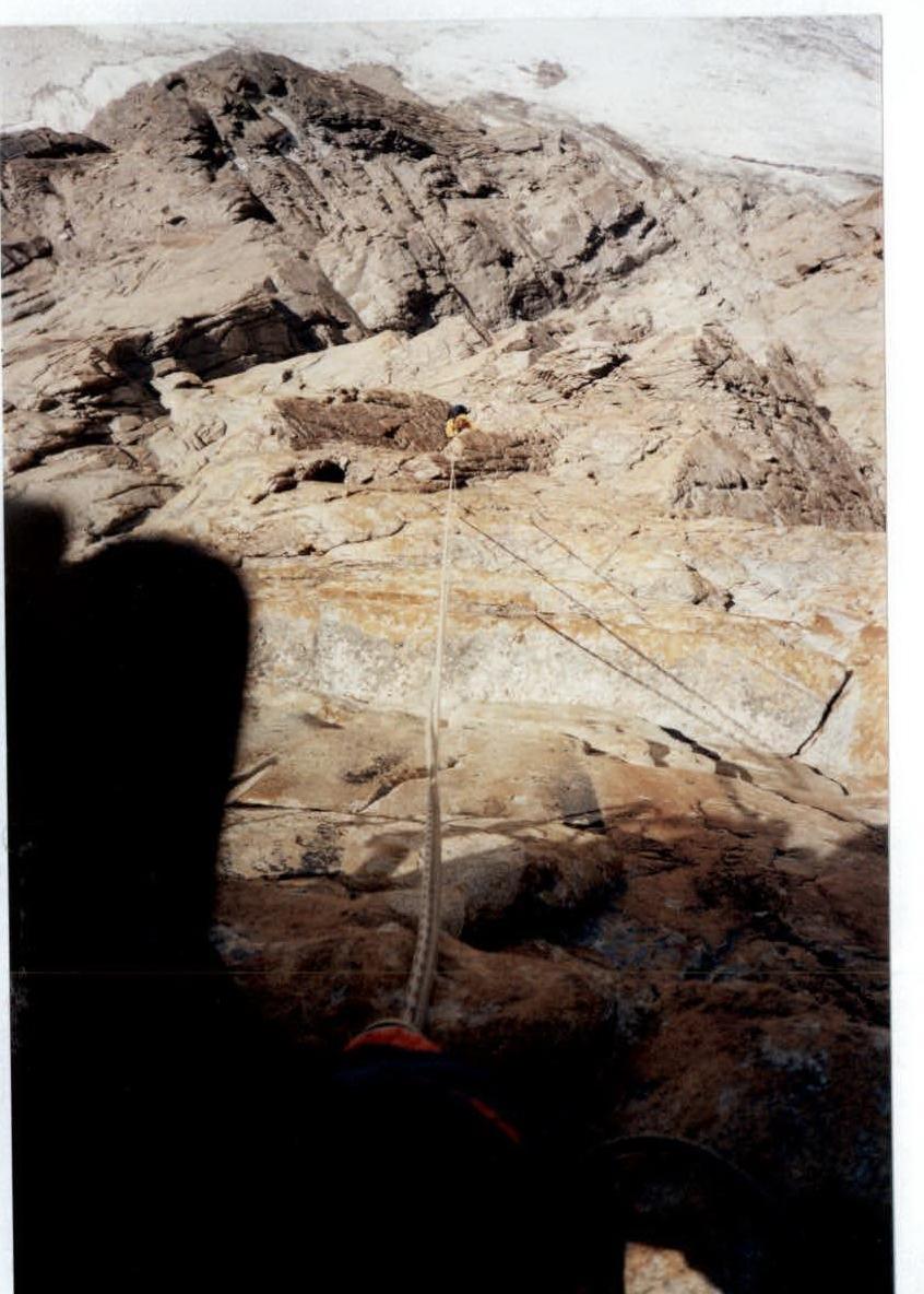
Photo #4. Last participant moving along the rappel on section R5–R6
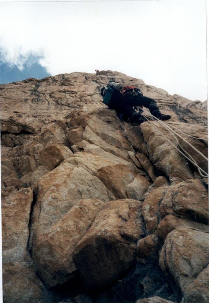
Photo #3. Second participant moving along the rappel on section R5–R6