V. Korona (4th)
4820 m
Report
of the Tomsk Region team (TFA) on the ascent to v. Korona (4th) via the western wall and ice gully “5A”, (c)
Ascent Passport:
-
TIAN-SHAN, Kyrgyz Ala-Too, Ala-Archa gorge, 7
-
Pik Korona (4th), via the western wall and ice gully.
-
First ascent, proposed 5A category of difficulty.
-
Nature of the route: combined.
-
Height difference of the route — 610 m. Start of movement at an altitude of 4210 m. Start of climbing at an altitude of 4350 m. Height difference of the main part of the route — 470 m. Total route length — 875 m. Length of sections:
- III category of difficulty — 275 m.
- IV category of difficulty — 260 m.
- V category of difficulty — 140 m.
- VI category of difficulty — 60 m. Average steepness:
- main part of the route — 65°
-
Number of pitons used on the route:
- ice screws — 32 pcs., incl. ITO — 0 pcs.
- anchor pitons — 17 pcs., incl. ITO — 0 pcs.
- protection elements — 18 pcs., incl. ITO — 0 pcs.
-
Team's travel time: 9 h, 1 day.
-
Leader: Ivan Mikhaylovich Temerev — MS Participant: Alexander Valeryevich Novoseltsev — CMS
-
Coach: Sapunova Yu. V.
-
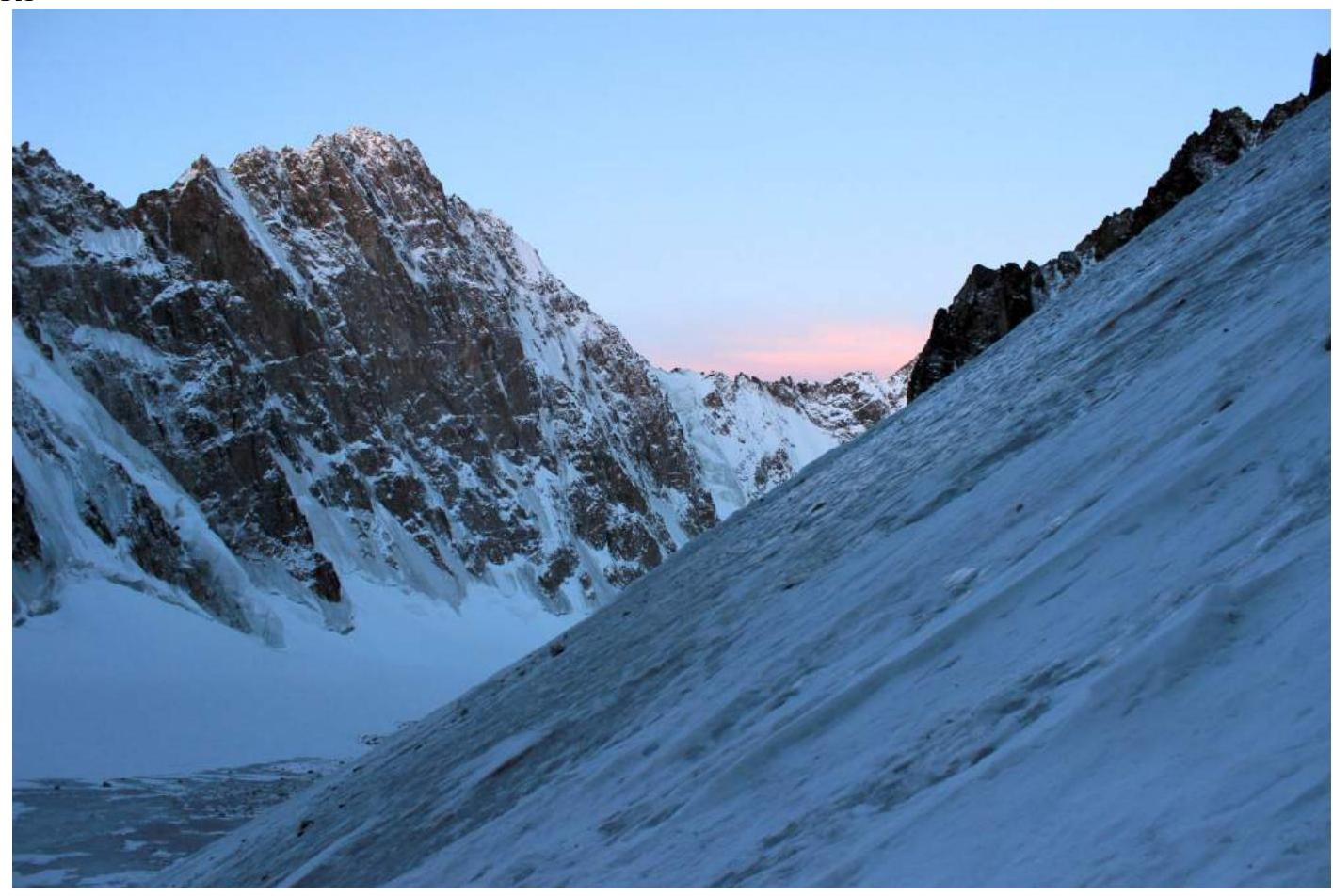
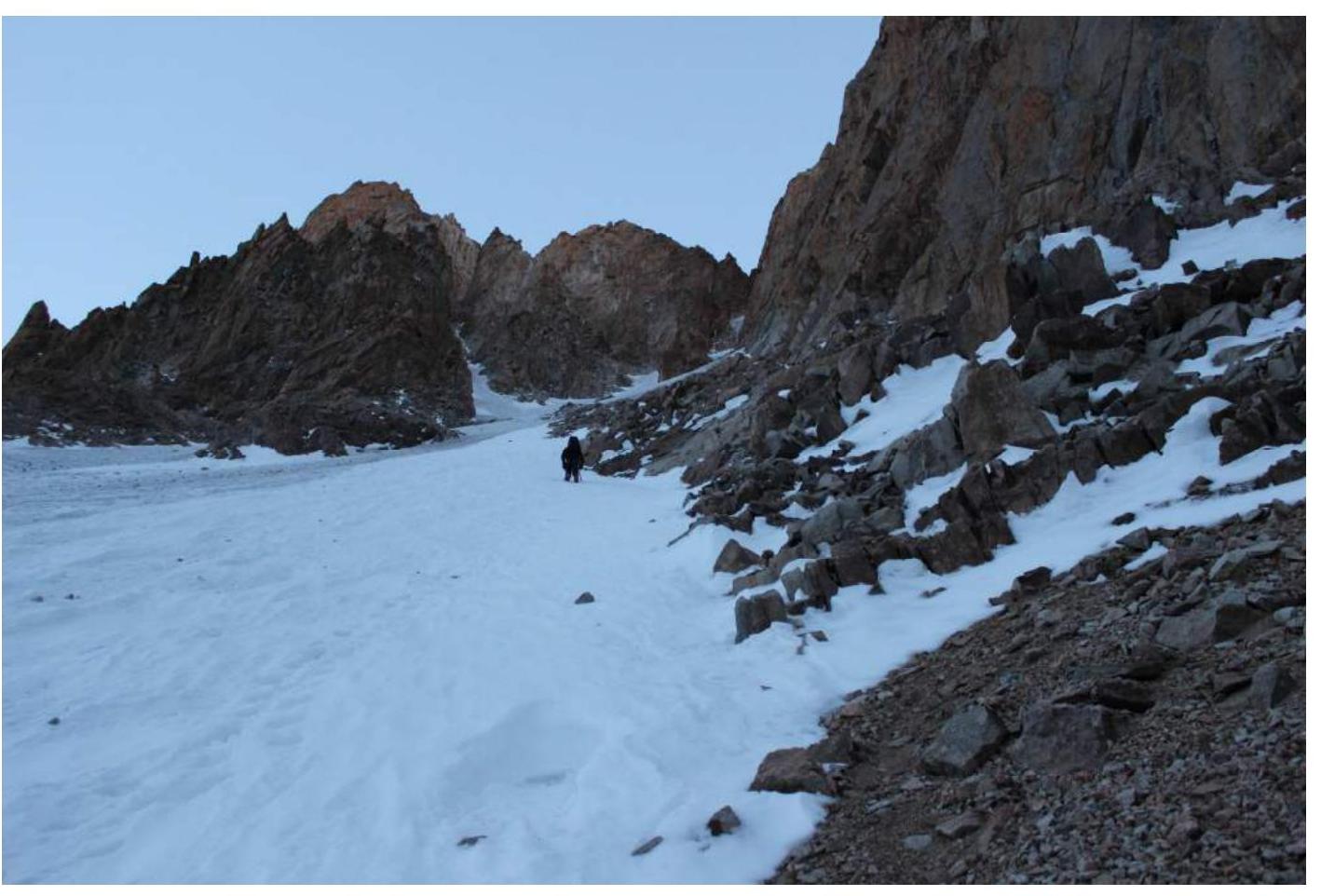
Departure from Koronskie overnight camp: 6:00, March 13, 2014. Start of work on the route: 8:00, March 13, 2014. Reaching the summit: 17:00, March 13, 2014. Return to overnight camp: 22:00, March 13, 2014.
-
Organization: MROO “Tomsk Alpine Federation”.
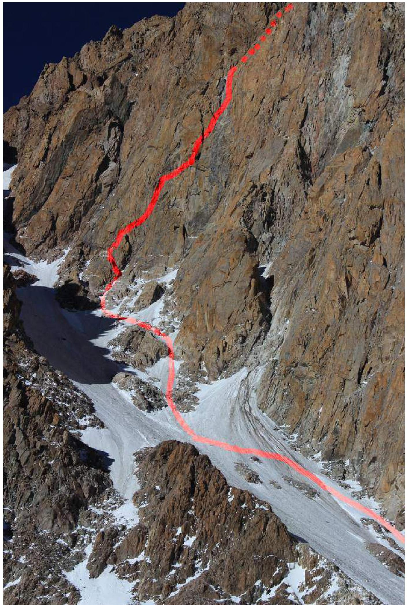
Photo of the general view of the summit
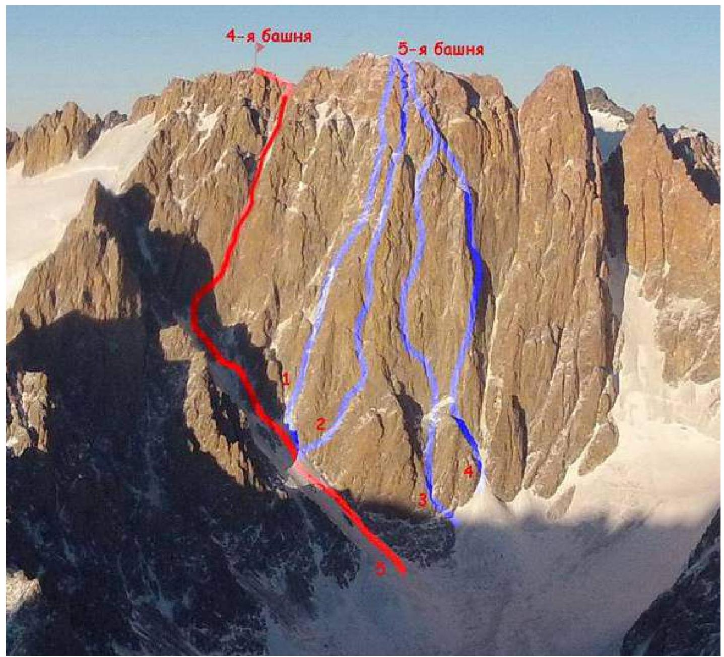
- 5A Egorov's route
- 5B Sadovsky's route 1968
- 6A Balezin's route 1994
- 5B Ruzhevsky's route 1976
- 5A Temerev's route 2014.
Photo of the route profile.
Panorama of the area.
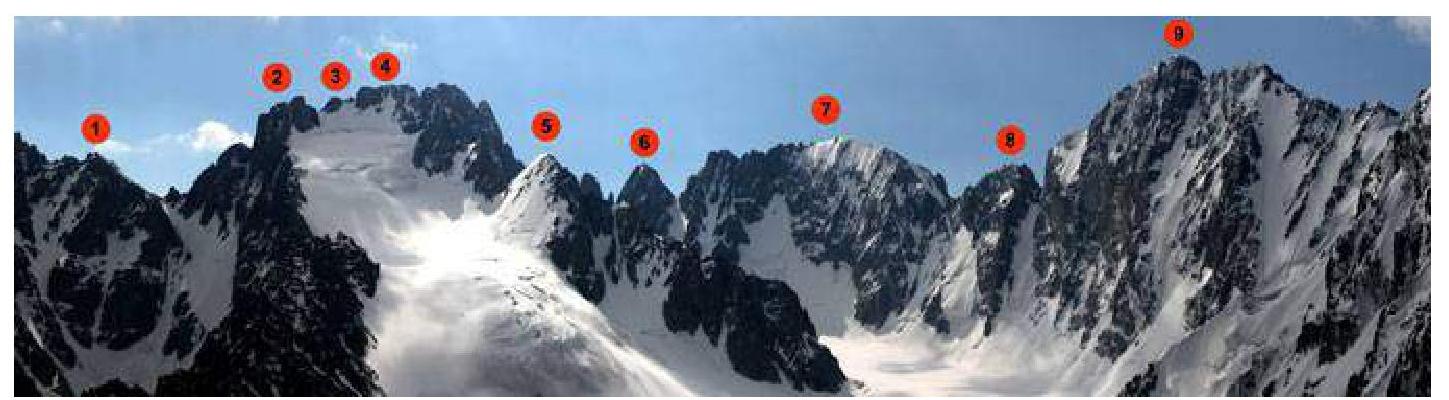
1 — Pik Semenova-Tyan-Shanskogo 4875 m, 2, 3, 4 — Korona — massif with peaks from 4750 to 4860 m, marked with numbers: 1st, 2nd and 3rd towers, to the left are visible 4th, 5th and 6th towers. 5 — Pik Izyiskatel 4400 m. 6 — Pik Kosmonavtov 4200 m. 7 — Pik Baylyan-Bashi 4700 m. 8 — Pik Simagina 4400 m. 9 — Pik Svobodnaya Korea 4740 m.
Diagram of the ascent route in UIAA symbols
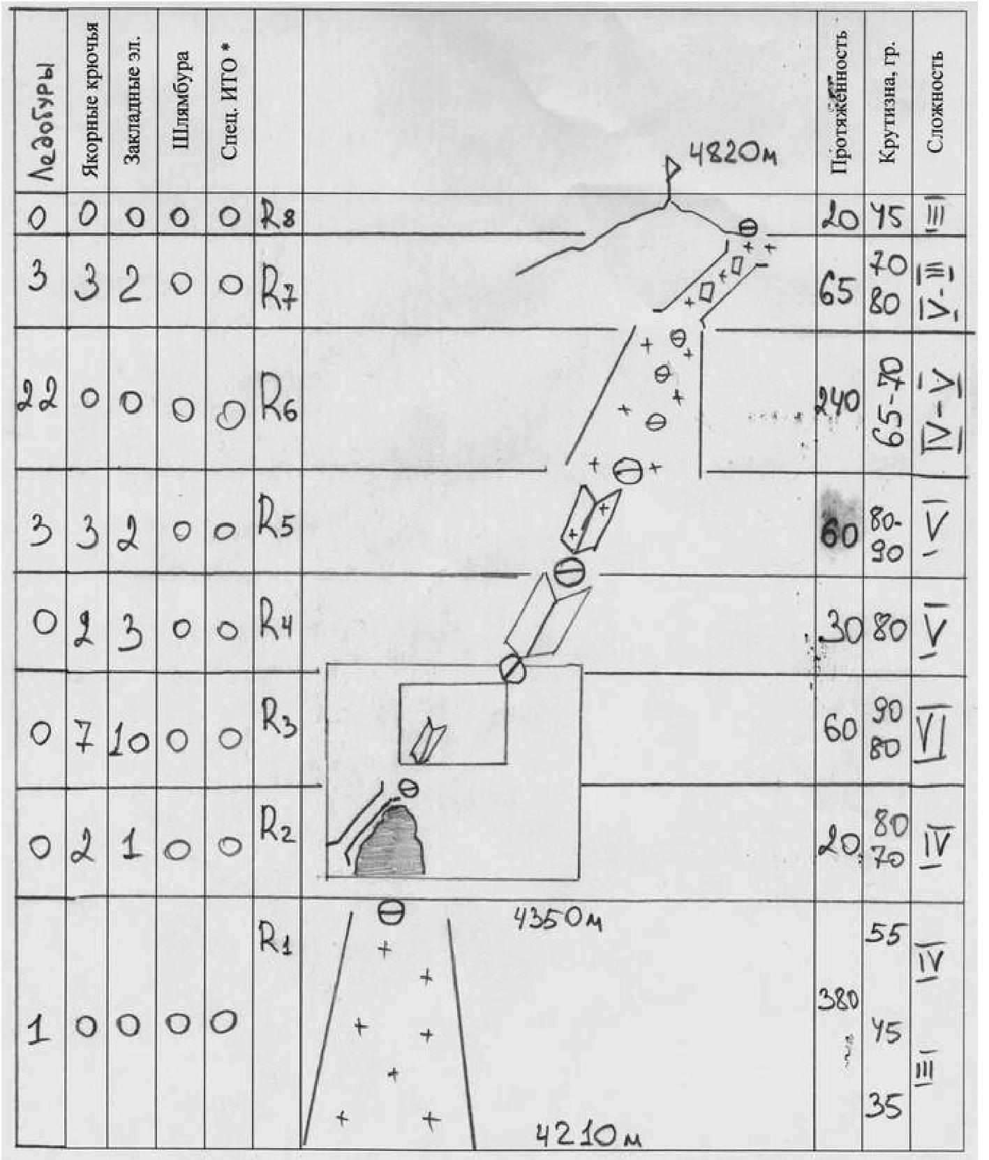
Description of the route by sections
From the Koronskie overnight camp, move along the glacier under the SW wall of Pik Korona, 5th tower. Further movement is along the ice gully towards the start of Sadovsky's 5B route.
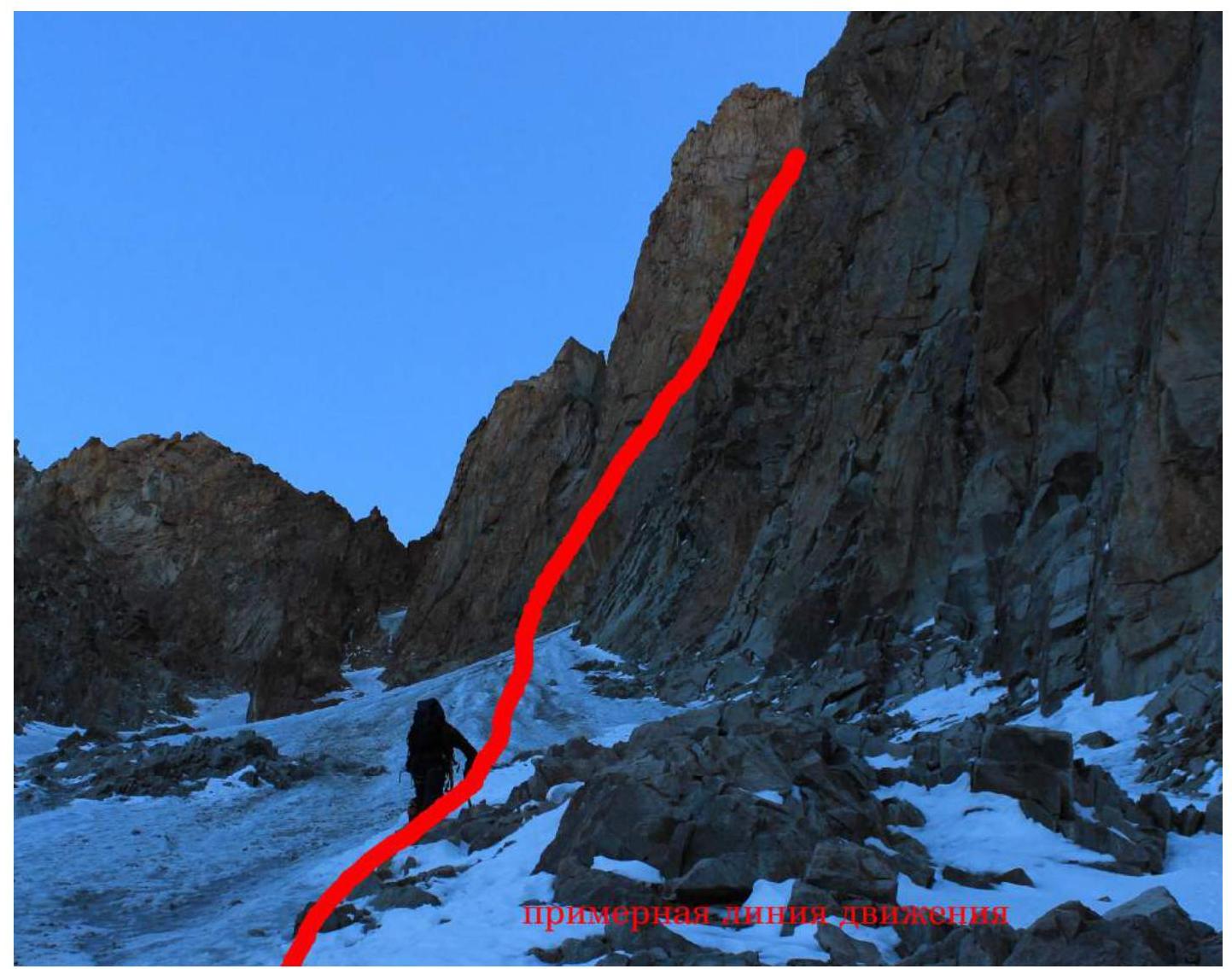
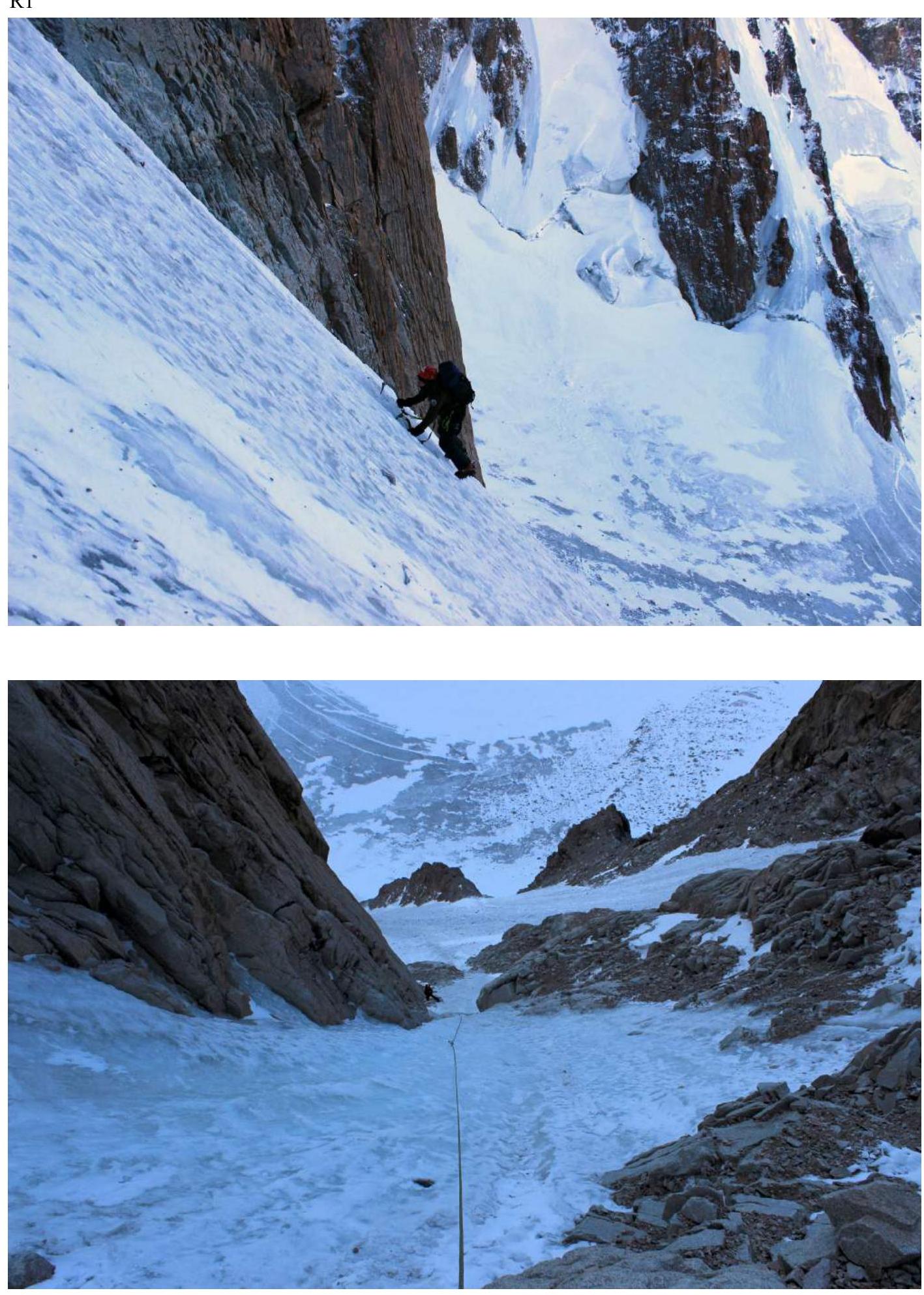
- R1: 380 m, III–IV, 35–45–55°. Move simultaneously (in steep places alternately) up the ice gully, closer to the southwest wall of Pik Korona.
- R2: 20 m, IV, 70–80°. Under the rock wall that blocks the ice gully leading to the 4th tower of Korona, take a left turn (in the direction of travel). The start of the rock climb is on the left side of a vaguely defined “rock lap — a pad” in a rock chimney. At the top of the “lap” is a base.
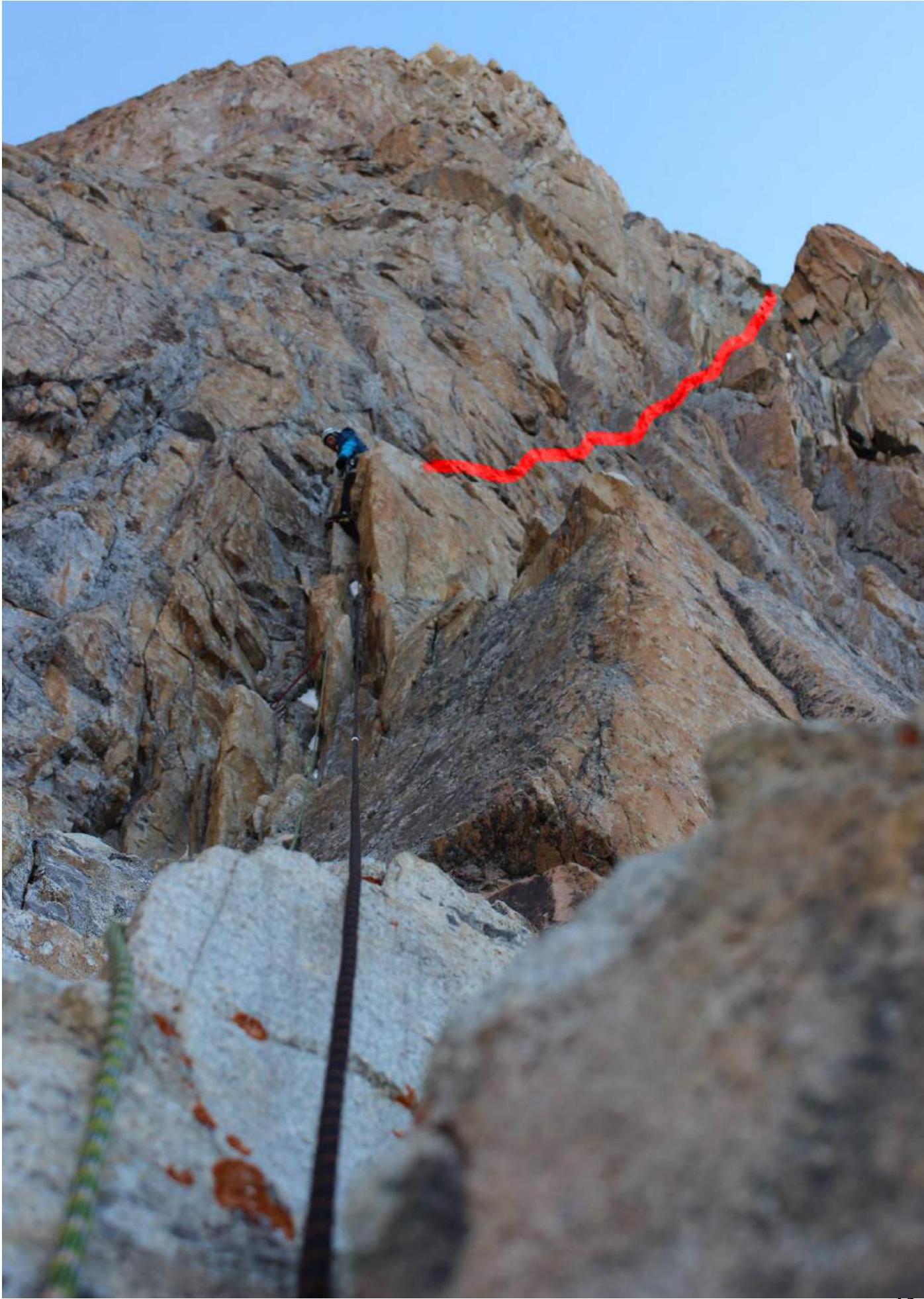
- R3: 60 m, VI, 80–90°. Up a small inner corner and to the right onto the rock wall. Constantly shifting to the right.
- R4: 30 m, V, 80°. Up a dissected corner. Exit to the rocks — via ice. In case of snowfall, this place is very dangerous — it is a natural collection point for everything that falls from above.
- R5: 60 m, V, 80–90°. Inner corner and rocks in ice. Mixed climbing 25–30 m. Exit onto thin ice. Insurance is problematic. Drilled ice screws only at the station at the end of the section.
- R6: 240 m, IV–V, 65–70°. Up the ice gully. Stations were made under the cover of rocks to protect against falling stones from above (the side walls of the gully are heavily destroyed).
- R7: 65 m, V–III, 80°. The ice gully abuts the summit rock bastion of the 4th tower. A small ice stream goes to the right in the direction of travel. Gradually, the climbing becomes mixed, and then simplifies to III.
- R8: 20 m, III, 45°. Exit to the summit tower.
Thread of movement
Thread of movement
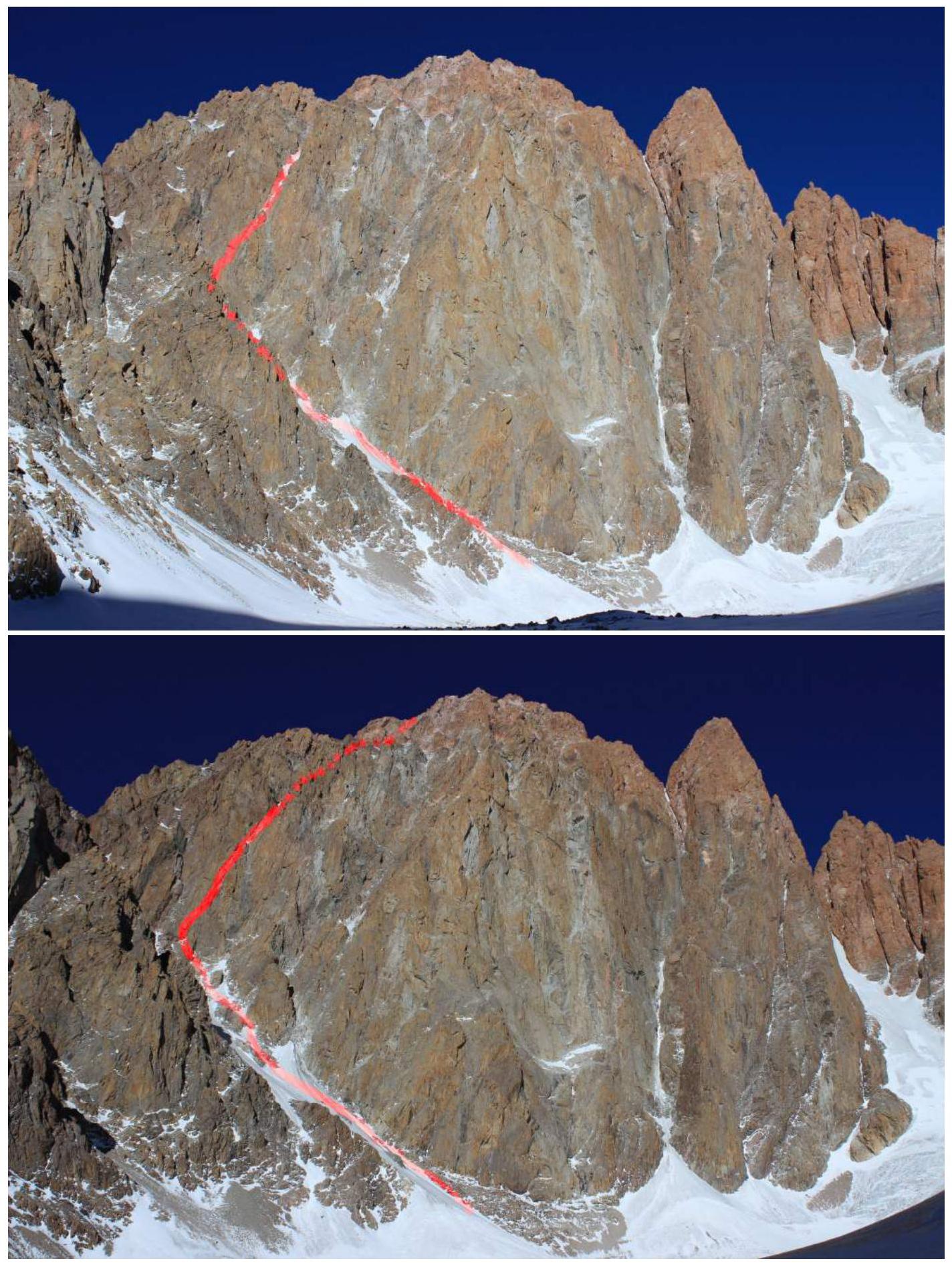
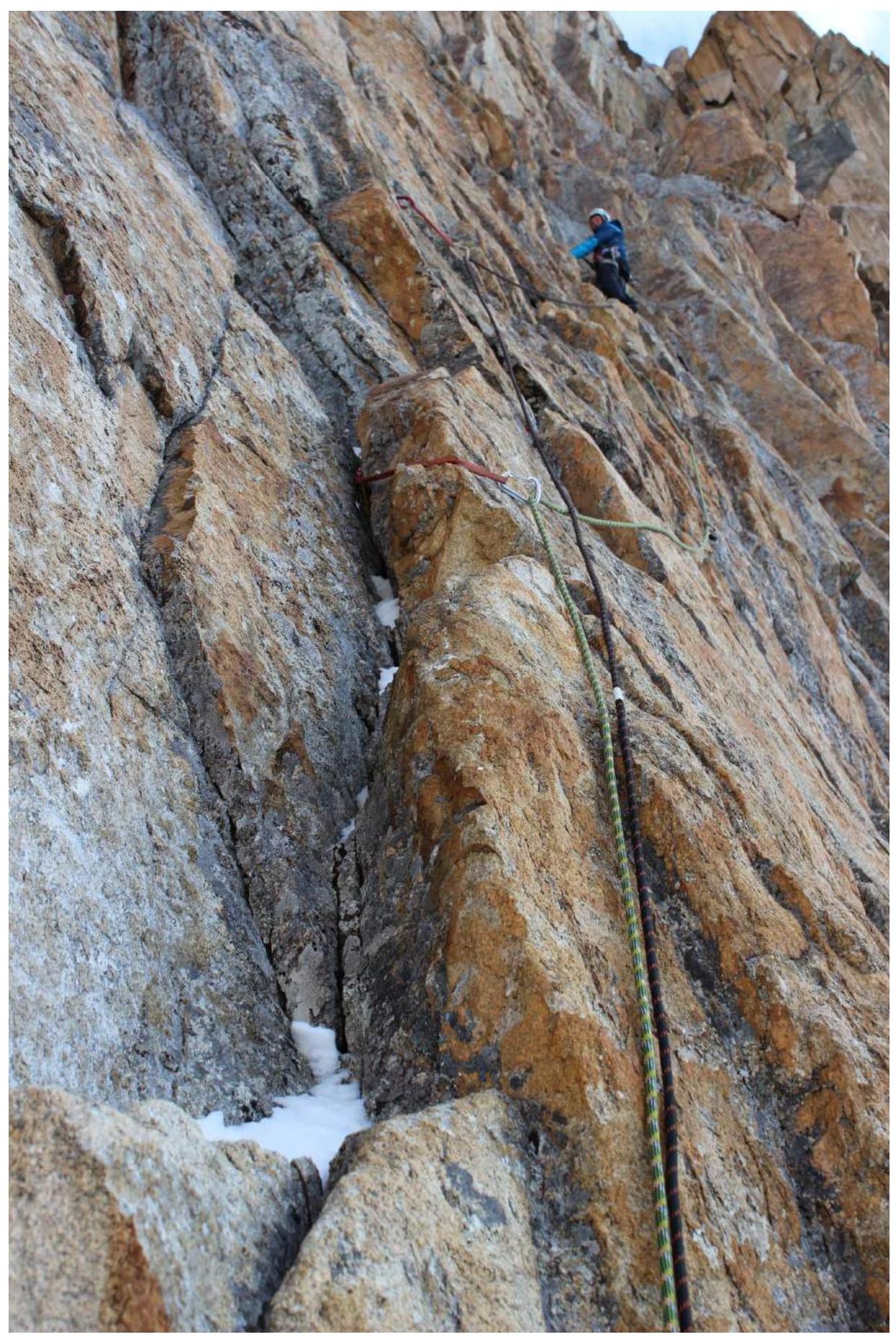
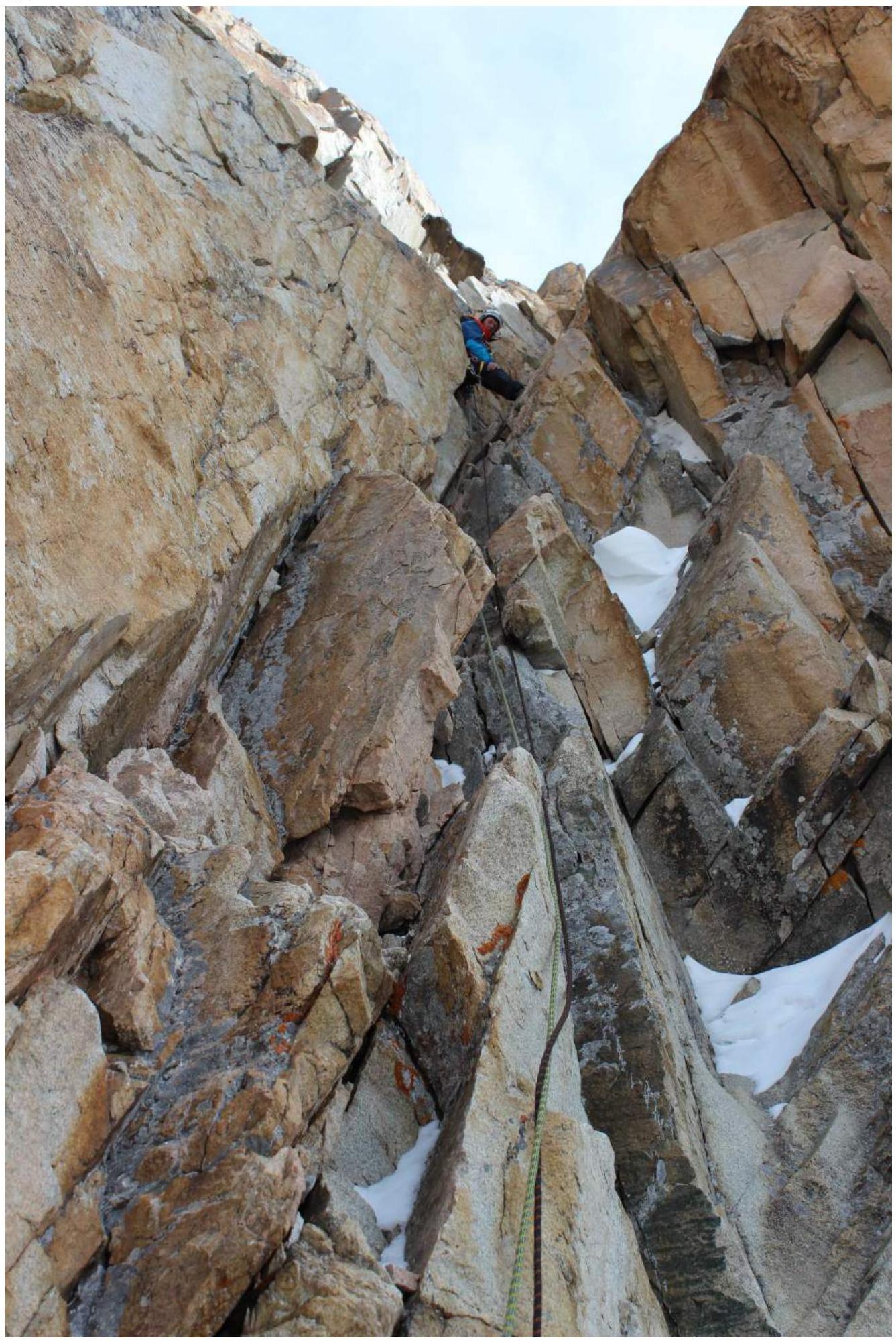
Photos of route sections.
R1
R1
 R2–R3
R2–R3
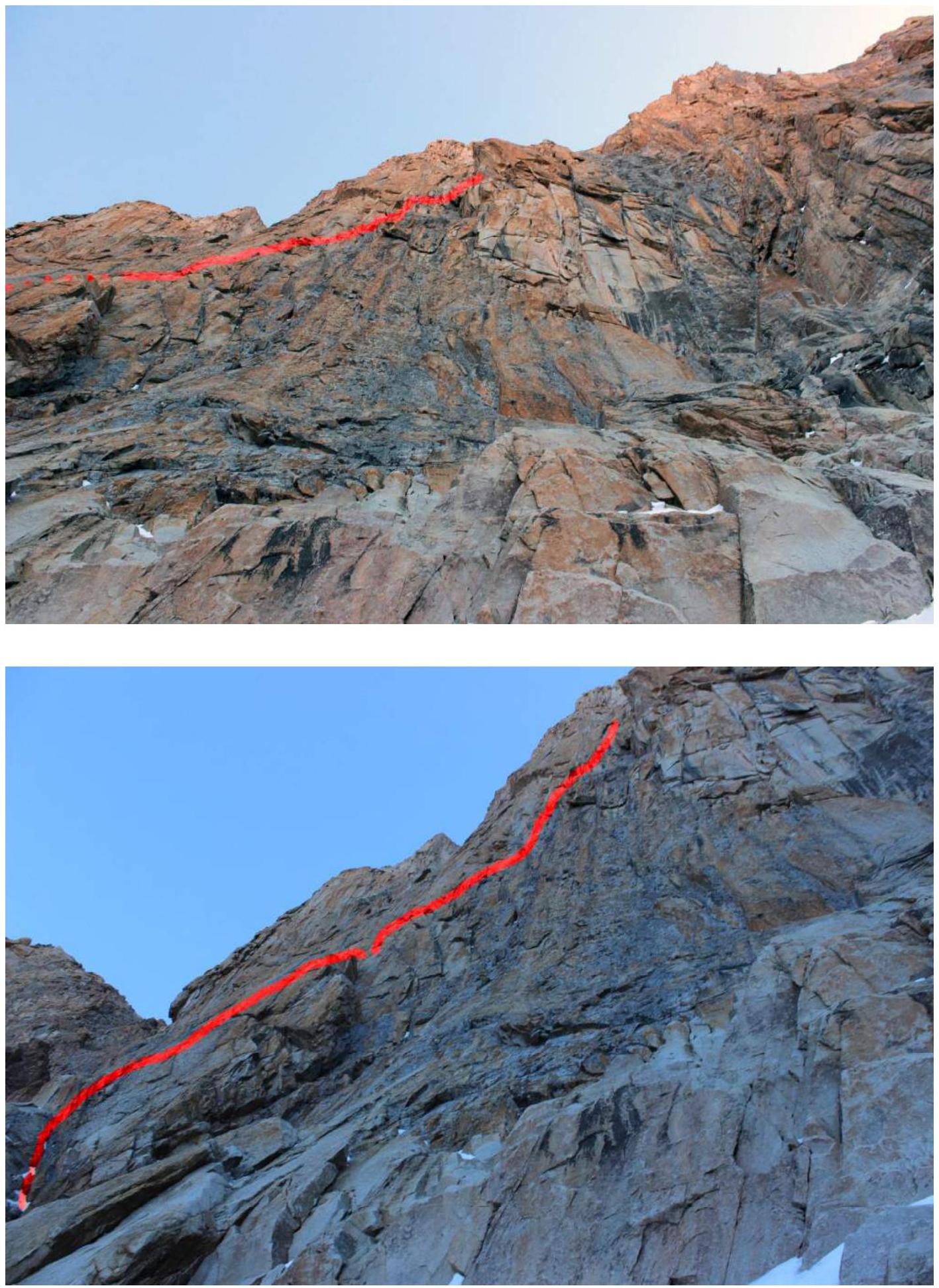
R2
R4
 View from R5 down to R4.
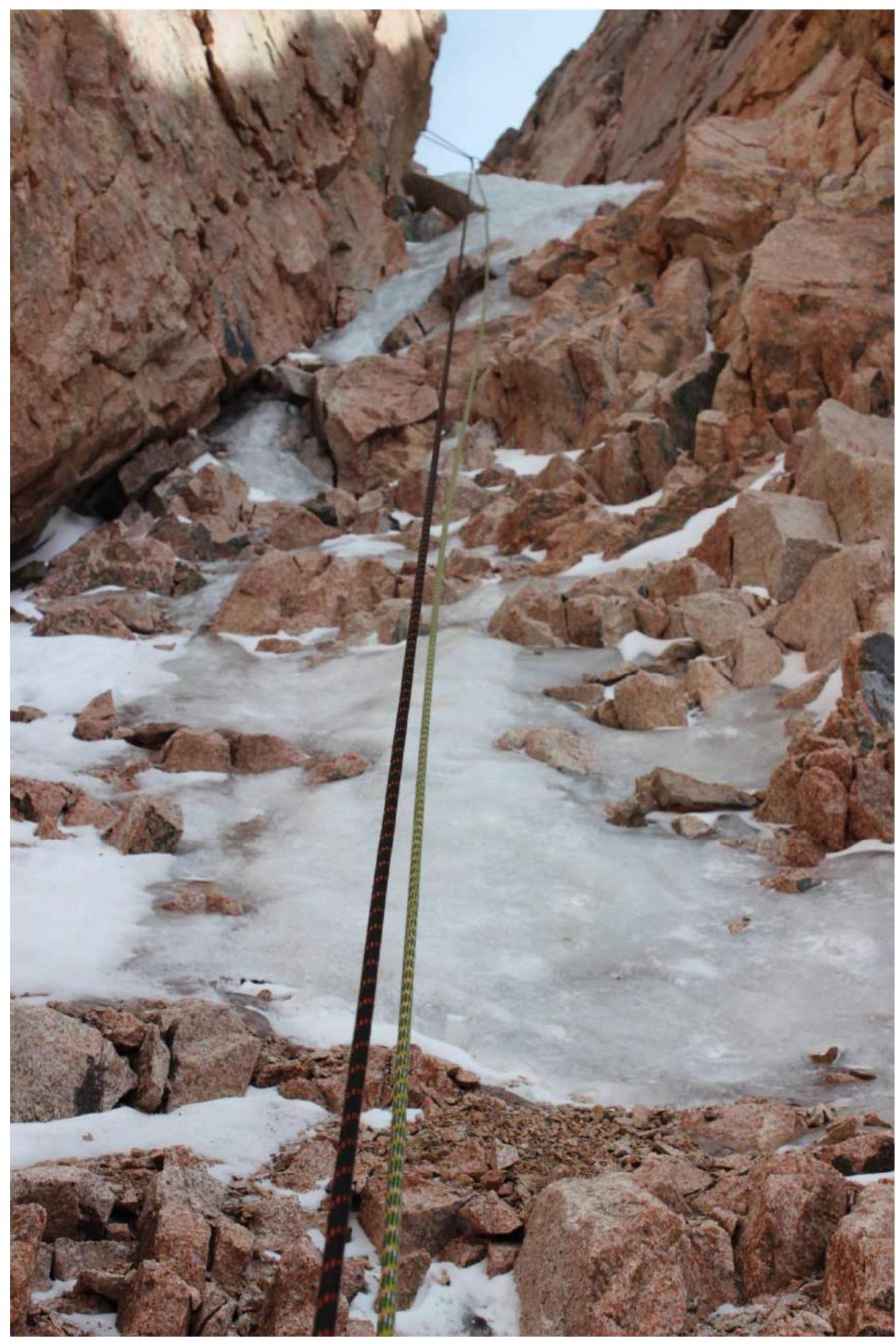
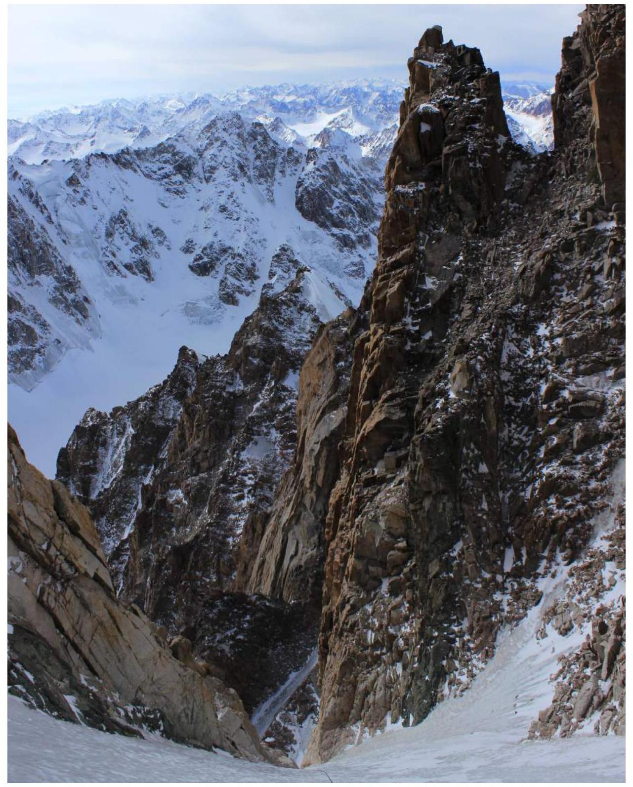
 View from the start of R6 to the end of R5 and the entrance to the ice gully.
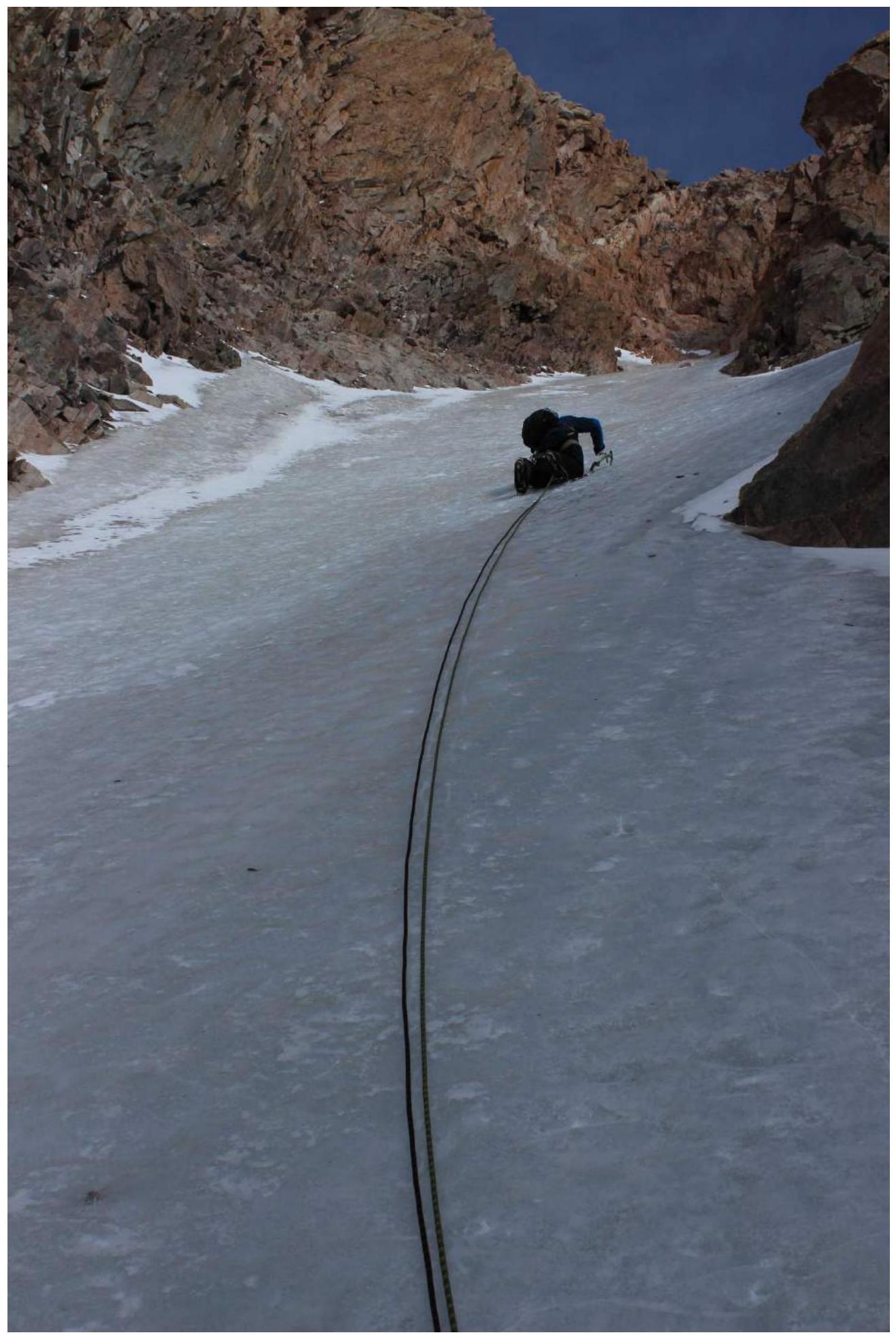
R6
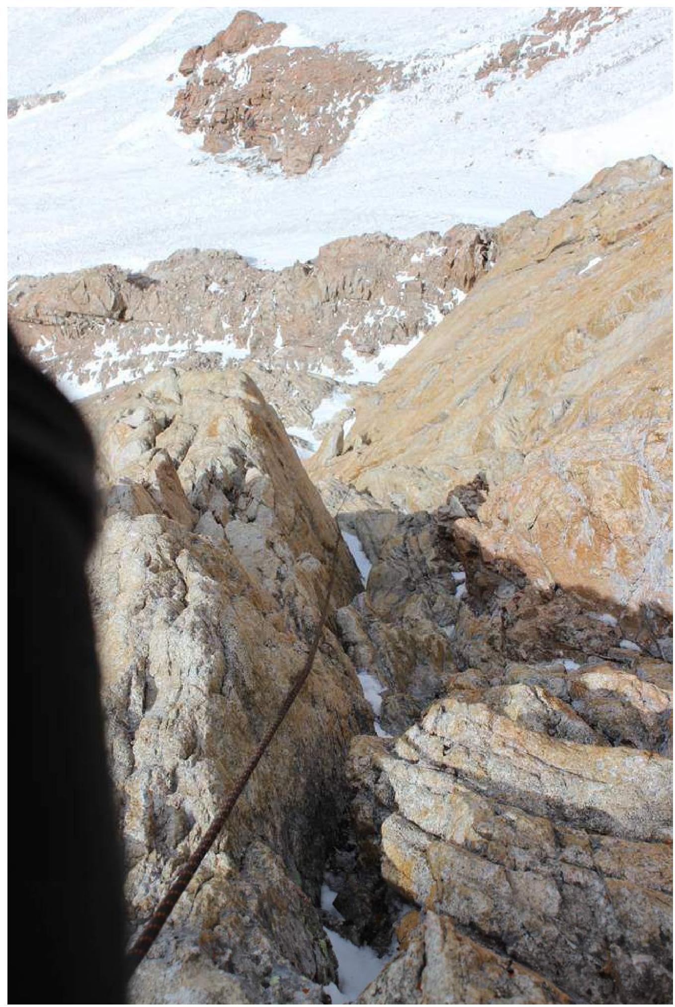
 End of R7. The bridge on the ridge to the 5th tower of Korona is visible.
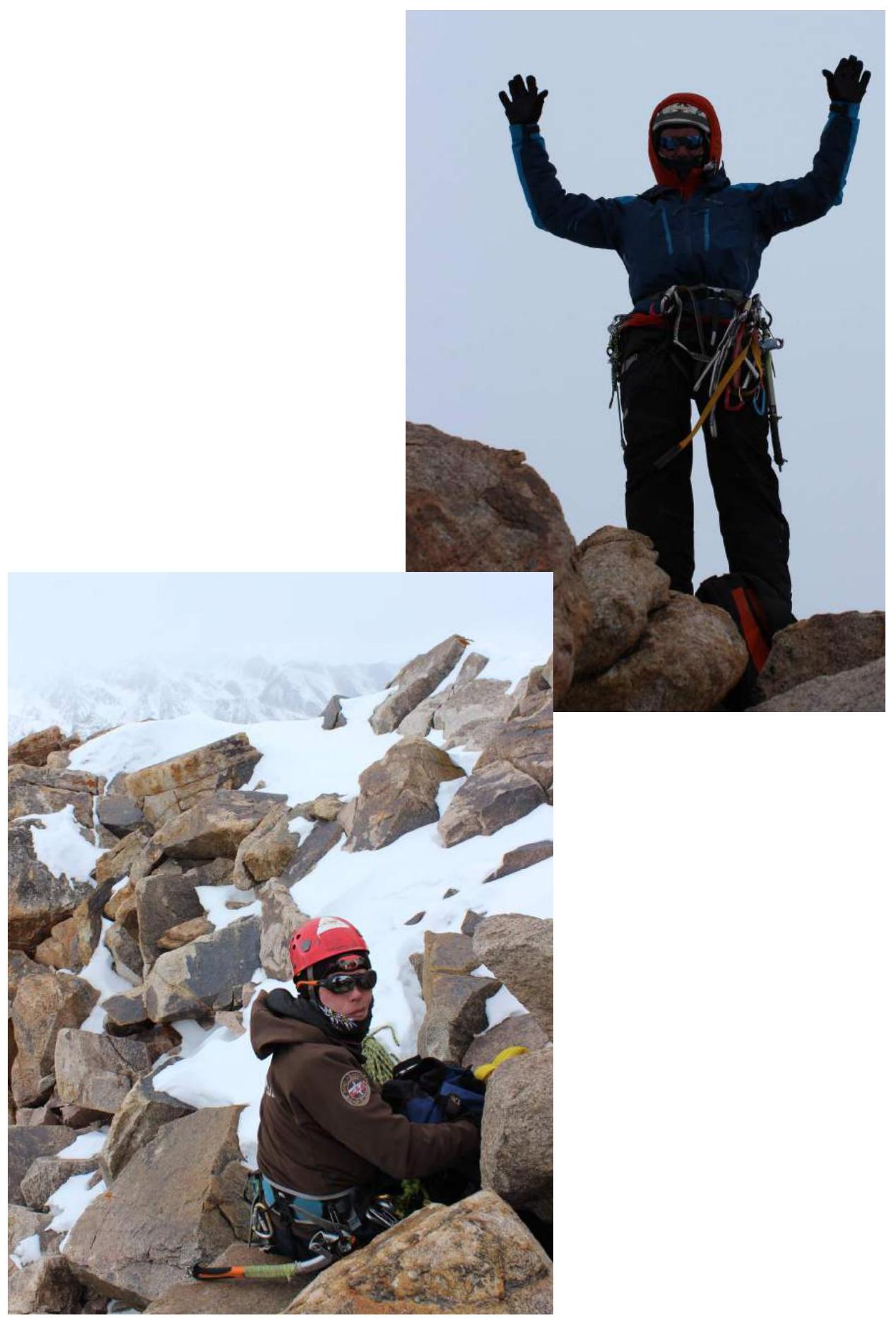
At the summit