Report
On the ascent of Pik Vladimira Putina (4446 m)
via a route of category 2B difficulty (presumably), Bishkek, 2012
Ascent Passport
- Region: Tian-Shan, Kyrgyz Ala-Too Range, Zhartash gorge
- Peak name: Pik Vladimira Putina, 4446.2 m Route name: via the northern ridge
- Assumed: 2B category difficulty, first ascent.
- Route type: combined.
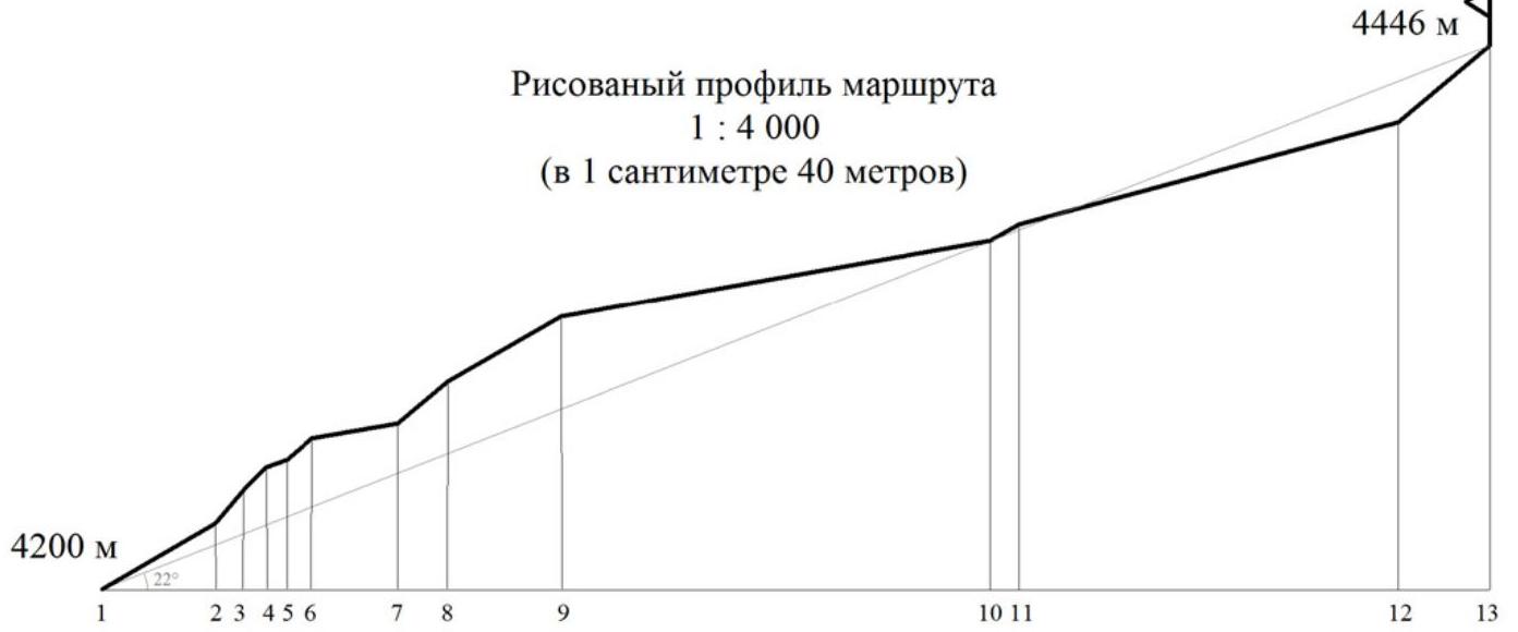
- Elevation gain: 1700 m Route length: 4700 m Length of sections with 2nd and 3rd category difficulty: 700 m. Average slope: 20°.
- Pitons used (on ascent):
| Rock | Bolt | Nuts | Ice screws | Loops |
|---|---|---|---|---|
| 0 | 0 | 23 | 0 | 4 |
| left on site: 0 | 0 | 0 | 0 | 0 |
- Team's travel time: 11 hours
- Leader: GUTNIK Nikolay, Master of Sports Team members: RYBYAKOV Viktor, 2nd sports category; MURATOV Nail, 2nd sports category
- Start of the route: "7:00", August 19, 2012 Summit reached: "15:00", August 19, 2012 Return to Base Camp: "18:00", August 19, 2012
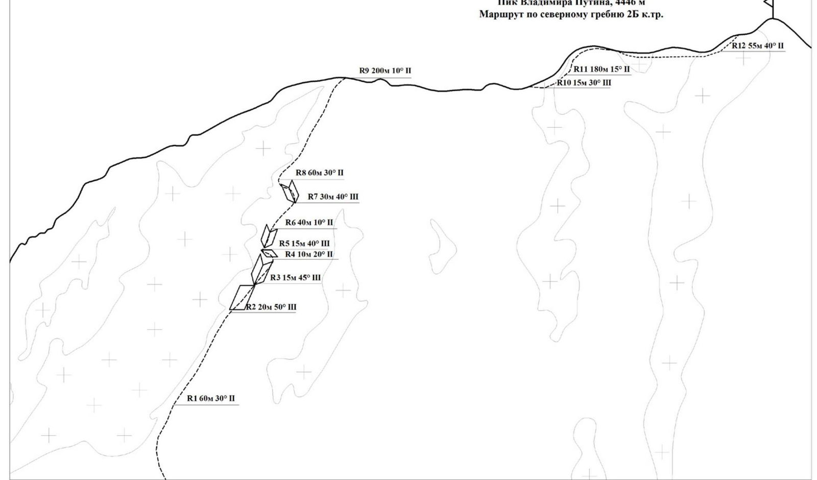
| Section # | Length, m | Slope, ° | Difficulty category | Belay | Remarks |
|---|---|---|---|---|---|
| R0–R1 | 4000 | 20 | 1 | No belay | Elevation gain 1500 m |
| R1–R2 | 60 | 30 | 2 | Through outcrops, loops | Heavily destroyed rocks |
| R2–R3 | 20 | 50 | 3 | Nuts | Good cracks |
| R3–R4 | 15 | 45 | 3 | Nuts | Loose rocks on ledges |
| R4–R5 | 10 | 20 | 2 | Through outcrops, loops | |
| R5–R6 | 15 | 40 | 3 | Nuts | Icy rocks |
| R6–R7 | 40 | 10 | 2 | Through outcrops, loops | |
| R7–R8 | 30 | 40 | 3 | Belay problematic | Icy rocks, loose rocks |
| R8–R9 | 60 | 30 | 2 | Through outcrops, loops | Simultaneous movement |
| R9–R10 | 200 | 10 | 2 | Through outcrops | Simultaneous movement |
| R10–R11 | 15 | 30 | 3 | Loops | Icy couloir |
| R11–R12 | 180 | 15 | 2 | Through outcrops | Simultaneous movement |
| R12–R13 | 55 | 40 | 2 | Through outcrops, loops | Summit ridge |
General Description
Pik Vladimira Putina is located in the Zhartash gorge, a right tributary of the Ak-Suu gorge. The base camp is at the end of a dirt road, near forester's trailers above a mineral water spring. The approach from the base camp to the route follows the gorge for about 2.5 km, with an elevation gain of 250 m (from 2500 to 2750 m).
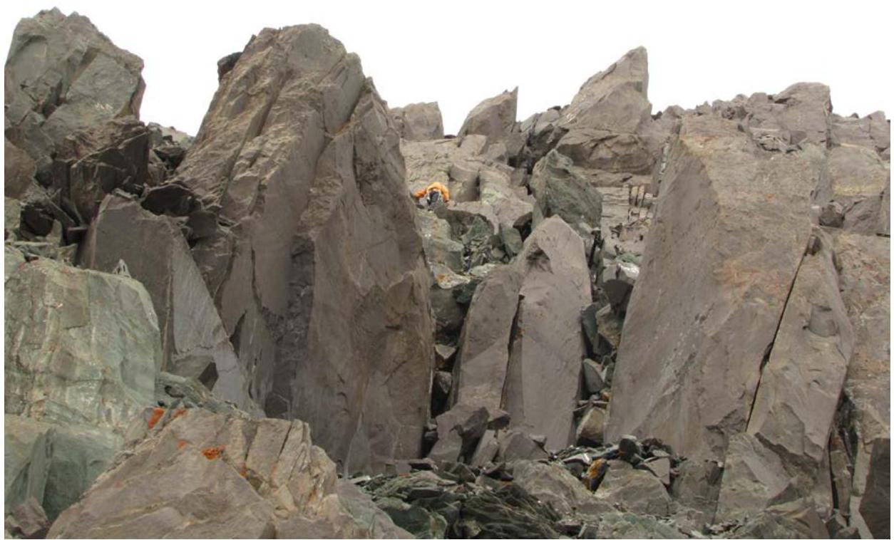
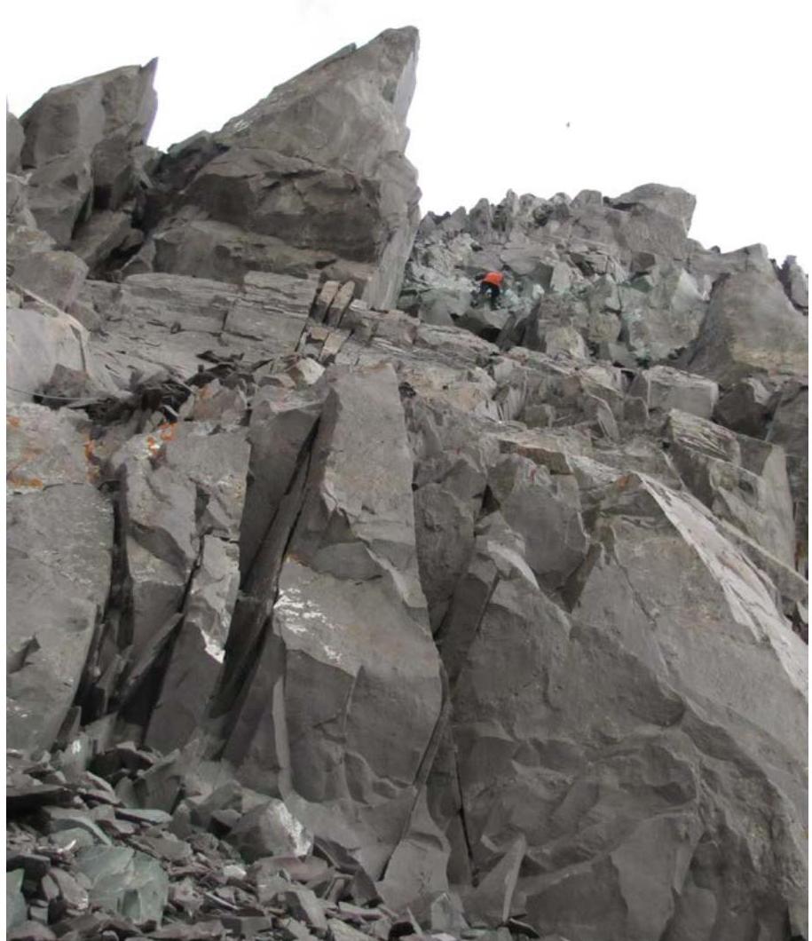
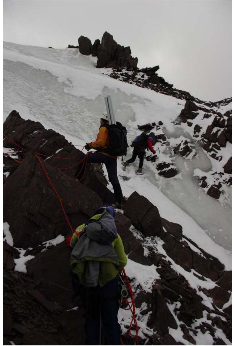
The technical part of the route is a rocky ridge starting at an elevation of 4200 m. The rocks are heavily destroyed, requiring caution during movement and attention to belay organization. In some places, the rocks are iced over, necessitating the use of crampons.
The majority of the time is spent on the first section — the ascent to the ridge via a cirque, with an elevation gain of almost 1500 m, taking 4–6 hours.
Brief Description of the Route by Sections
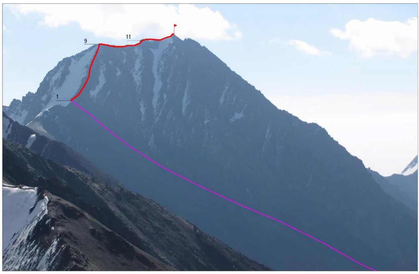
Section R0–R1. Ascent via the cirque to the ridge. Fine scree. Simultaneous movement without belay. Various ascent options are available: via the central part of the cirque, as well as its left and right sides. 4000 m, 20°, 1.
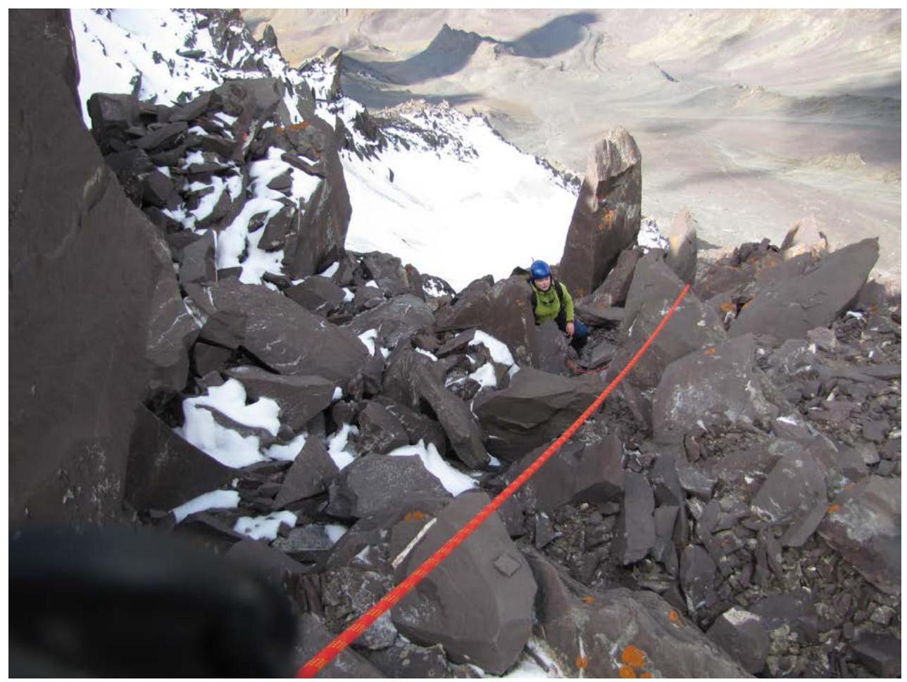
Section R1–R2. Ridge. Heavily destroyed rocks. Simultaneous movement, belay through outcrops and loops. 60 m, 30°, 2.
Section R2–R3. Bypass of a bastion on the right via a rocky slab. Good cracks for belay using nuts. Alternate belay. 20 m, 50°, 3.
Section R3–R4. Inner corner — continuation of the bastion bypass. Good cracks for belay using nuts. Loose rocks on ledges. 15 m, 45°, 3.
Section R4–R5. Inclined ledge with large scree. Exit to the ridge. 10 m, 20°, 2.
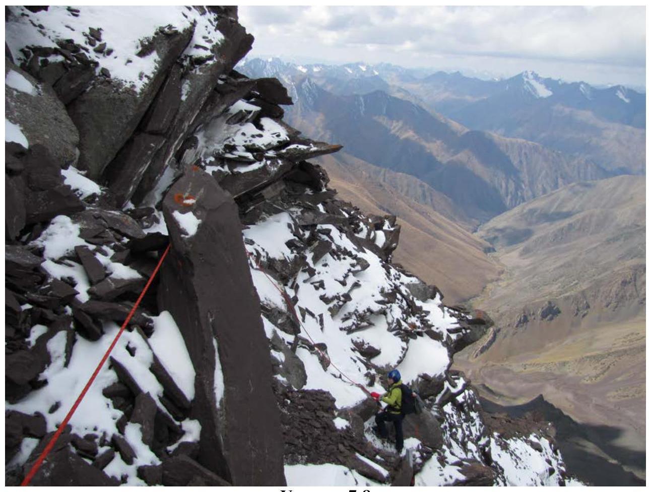
Section R5–R6. Inner corner, iced over. Cracks suitable for camming devices available. 15 m, 40°, 3.
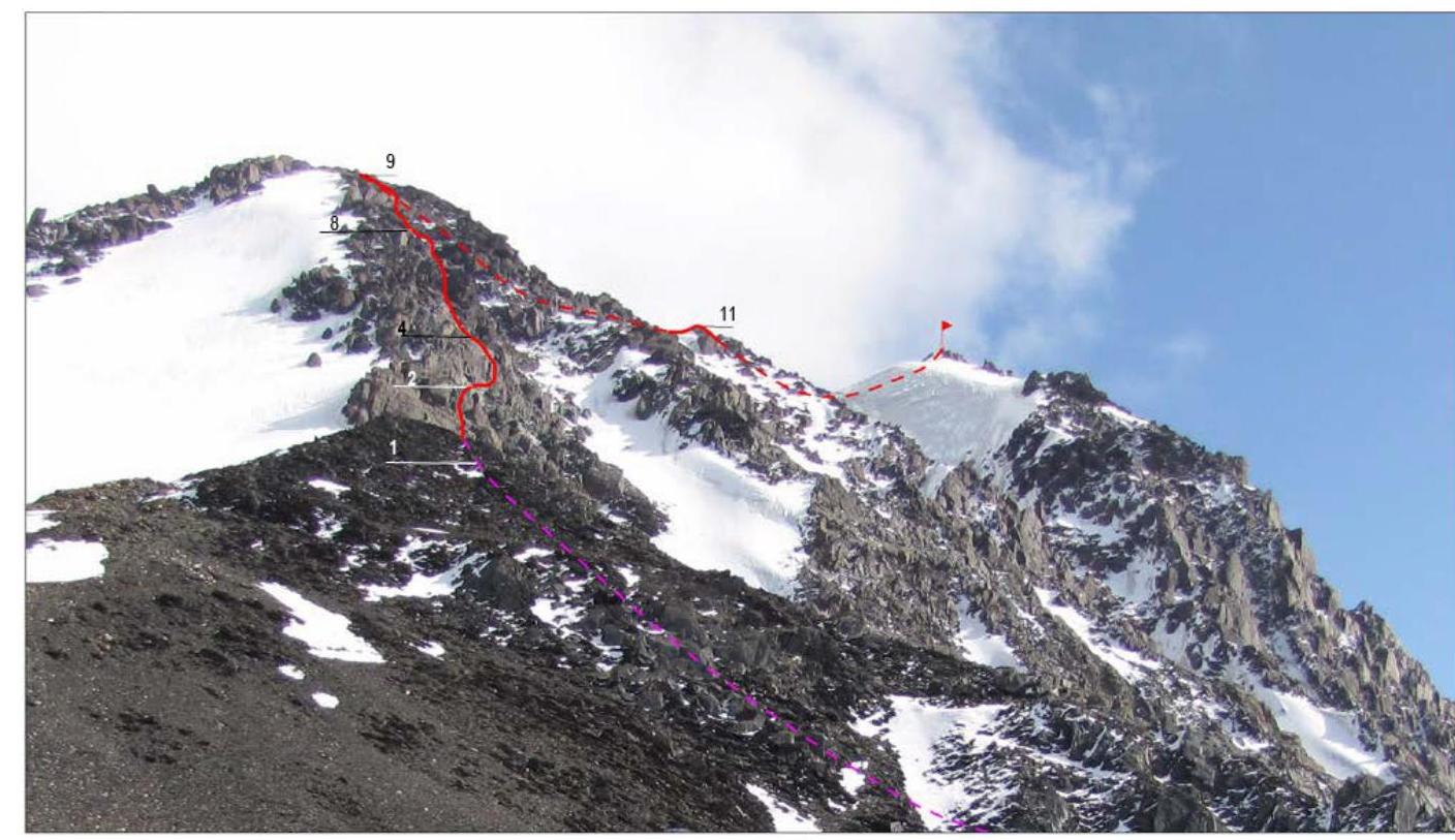
Section R6–R7. Ledge with loose rocks bypasses the main ridge on the right. Belay through outcrops and loops. 40 m, 10°, 2.
Section R7–R8. Inner corner with snow and iced rocks leads to the ridge. Limited number of reliable cracks for belay. 30 m, 40°, 3.
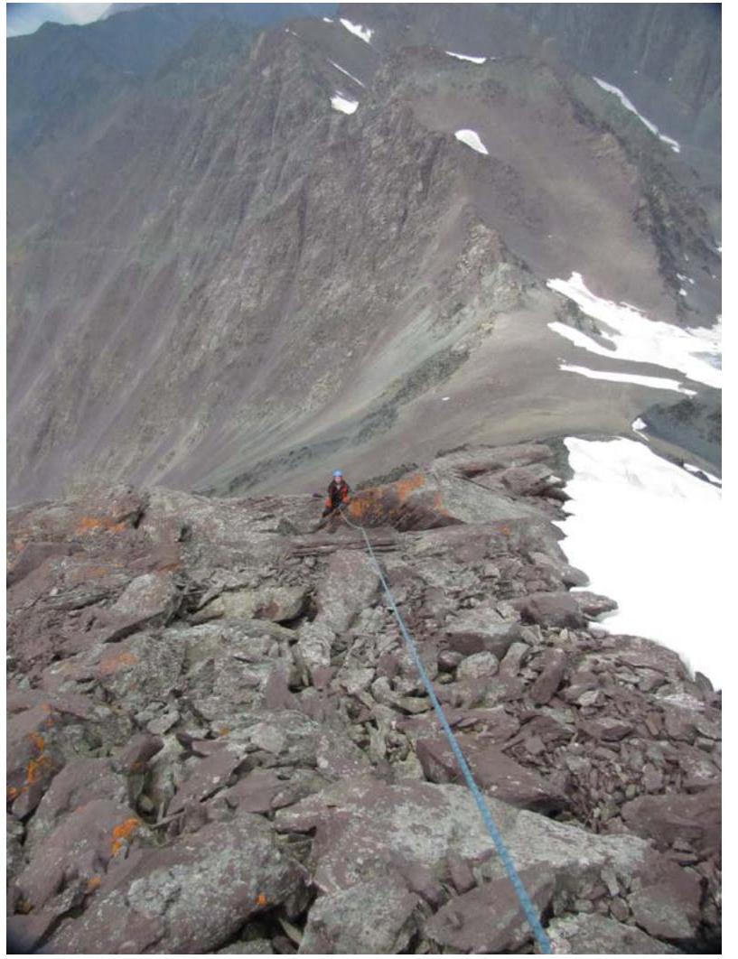
Section R8–R9. Wide slope transitions into a narrow, almost horizontal ridge. Simultaneous belay through outcrops. 60 m, 30°, 2.
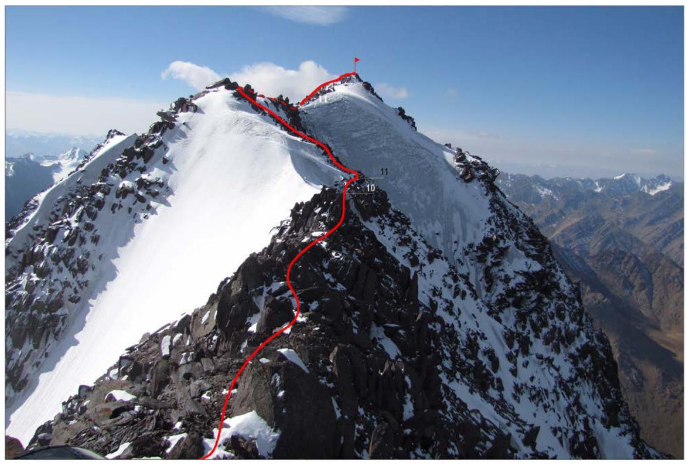
Section R9–R10. Narrow rocky ridge. Simultaneous belay through outcrops. 200 m, 10°, 2.
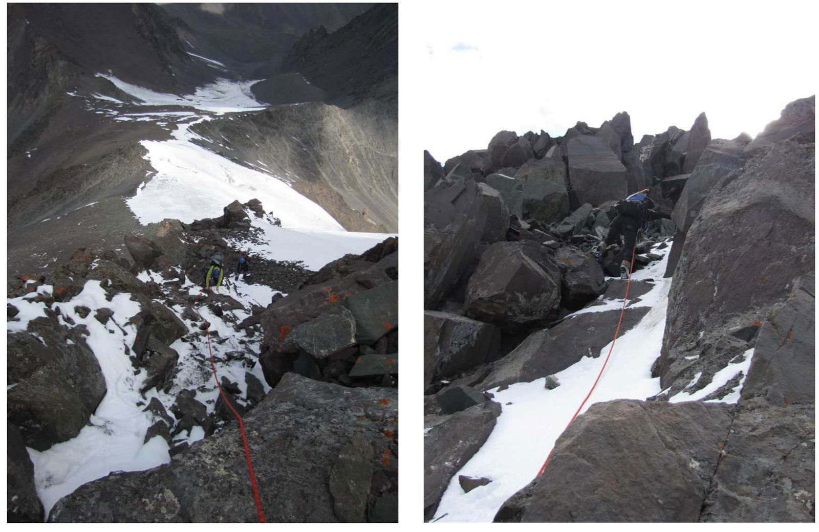
Section R10–R11. Crossing an icy couloir. Belay through outcrops. 15 m, 30°, 3.
Section R11–R12. Rocky ridge. Simultaneous belay through outcrops. 180 m, 15°, 2.
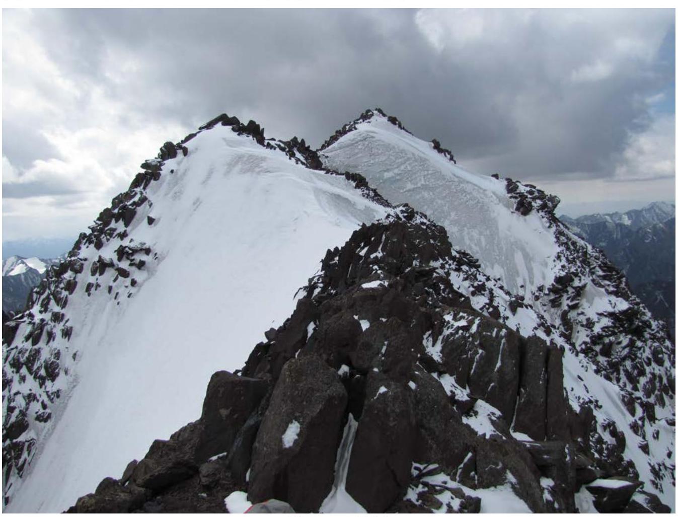
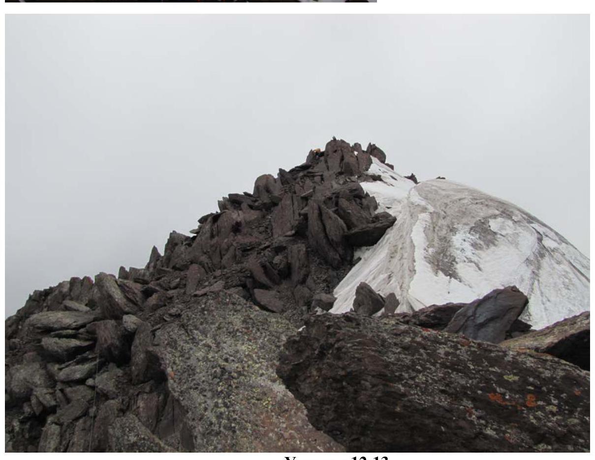
Section R12–R13. Summit ridge. Simultaneous belay through outcrops. 55 m, 40°, 2.
Descent follows the ascent route. Pik Vladimira Putina, 4446 m. Route via the northern ridge, category 2B difficulty.
1995–2005
Hand-drawn route profile, scale 1:4000 (1 cm = 40 m)

Section R0–R1
Section R1–R2
Sections R2–R4
Section R5–R6
Section R6–R7
Section R7–R8
Section R8–R9
Section R9–R10
Section R10–R11
Section R12–R13
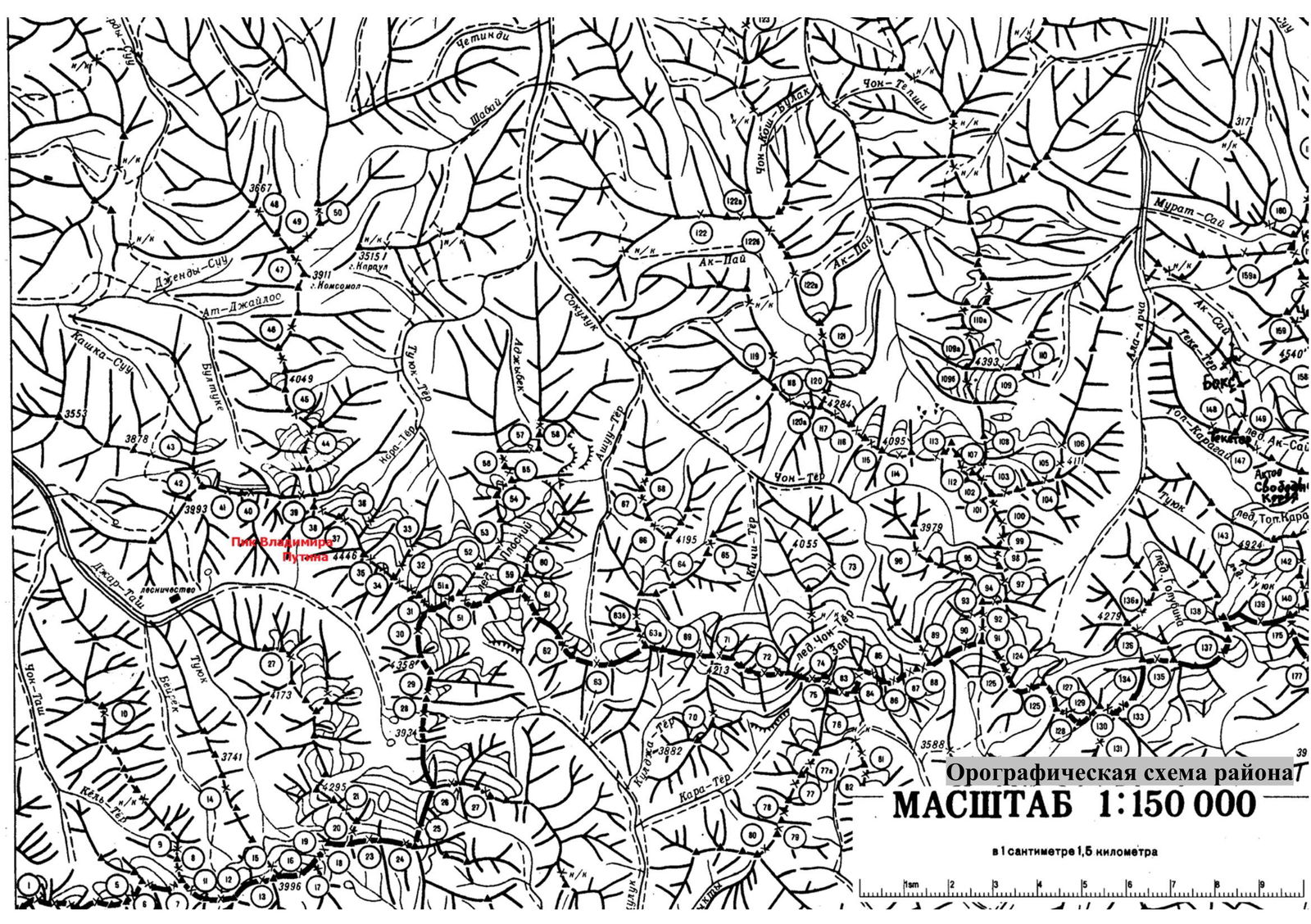
Orographic scheme of the region. Scale 1:150 000 (1 cm = 1.5 km)