Ascent Log
| Ascent Category | — rock climbing |
|---|---|
| Ascent Area | — Trans-Ili Alatau |
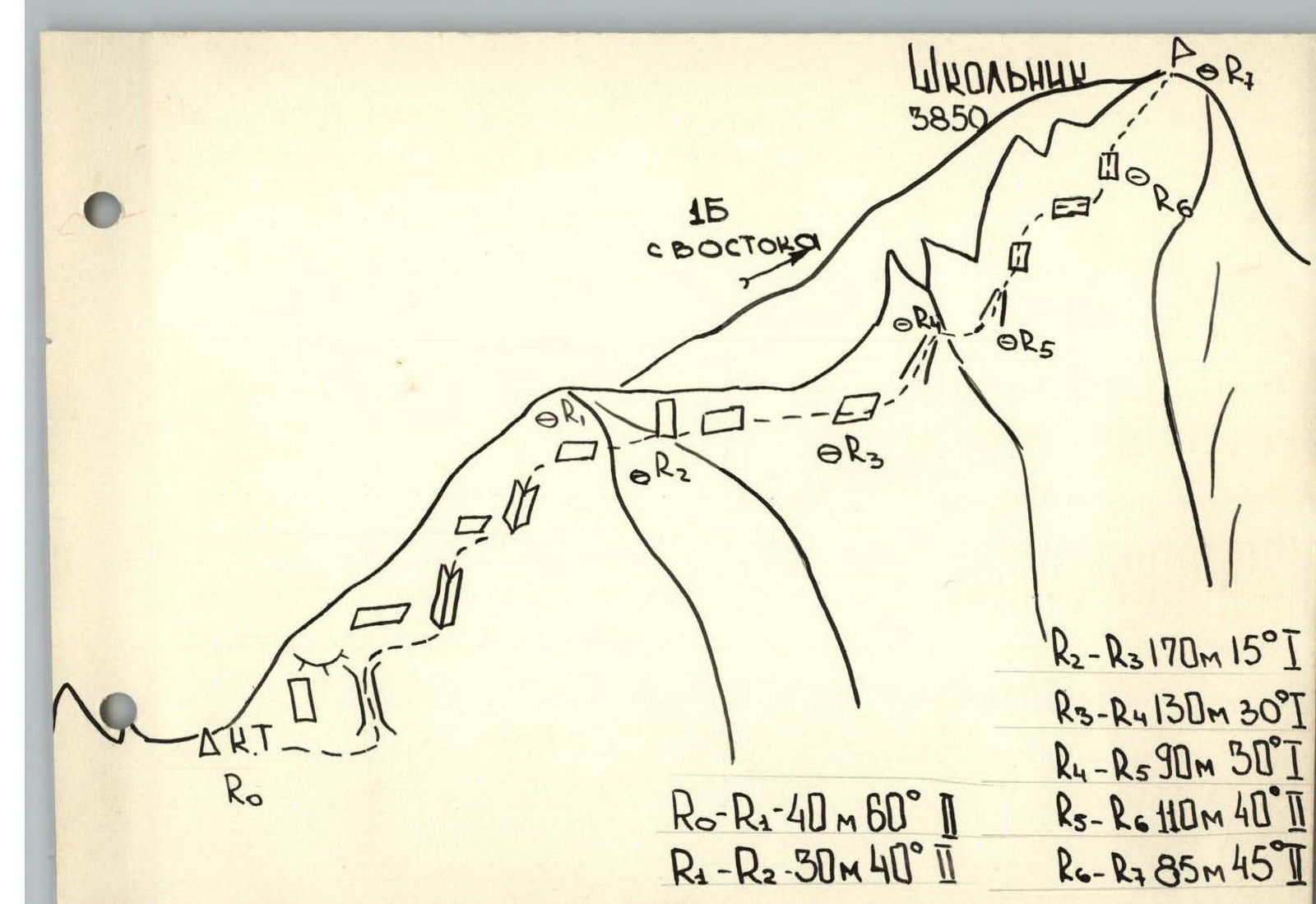
| Peak | — Shkolnik, 3850 m North-West ridge, 2A category of difficulty (preliminary) |
| Route characteristics: elevation gain average steepness | — 350 m — 40°–45° |
| Pitons hammered in | — two — two chocks |
| Number of travel hours Number of overnight stays | — eight — none |
| Full name of the leader | — Pitersov V.V. — 1st sports category; Fedorov V.L. — 1st sports category |
| Team coach | — Public Rescue Team under KSP |
| Date of departure on the route | — October 21, 1989 Route is one-day |
| Organization | — KSP of Trans-Ili district |
Brief description of the approach to the route
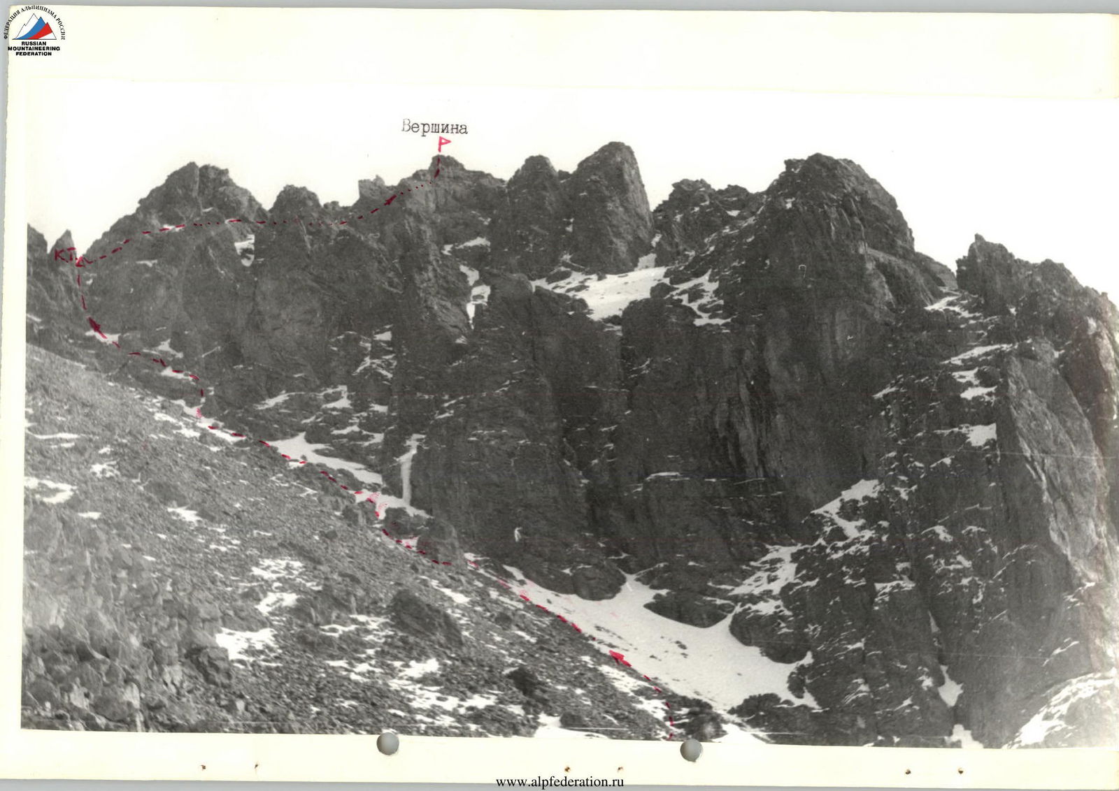
The Shkolnik peak with a height of 3850 m is located in a lateral spur of the main ridge
of Trans-Ili Alatau. From the Tuyuk-Su alpine camp, past the mudflow protection houses, ascend a steep trail
to the top of the old moraine overgrown with spruce trees. Then follow the trail along the stream
flowing from under the moraine to the second ridge. The third moraine ridge can be
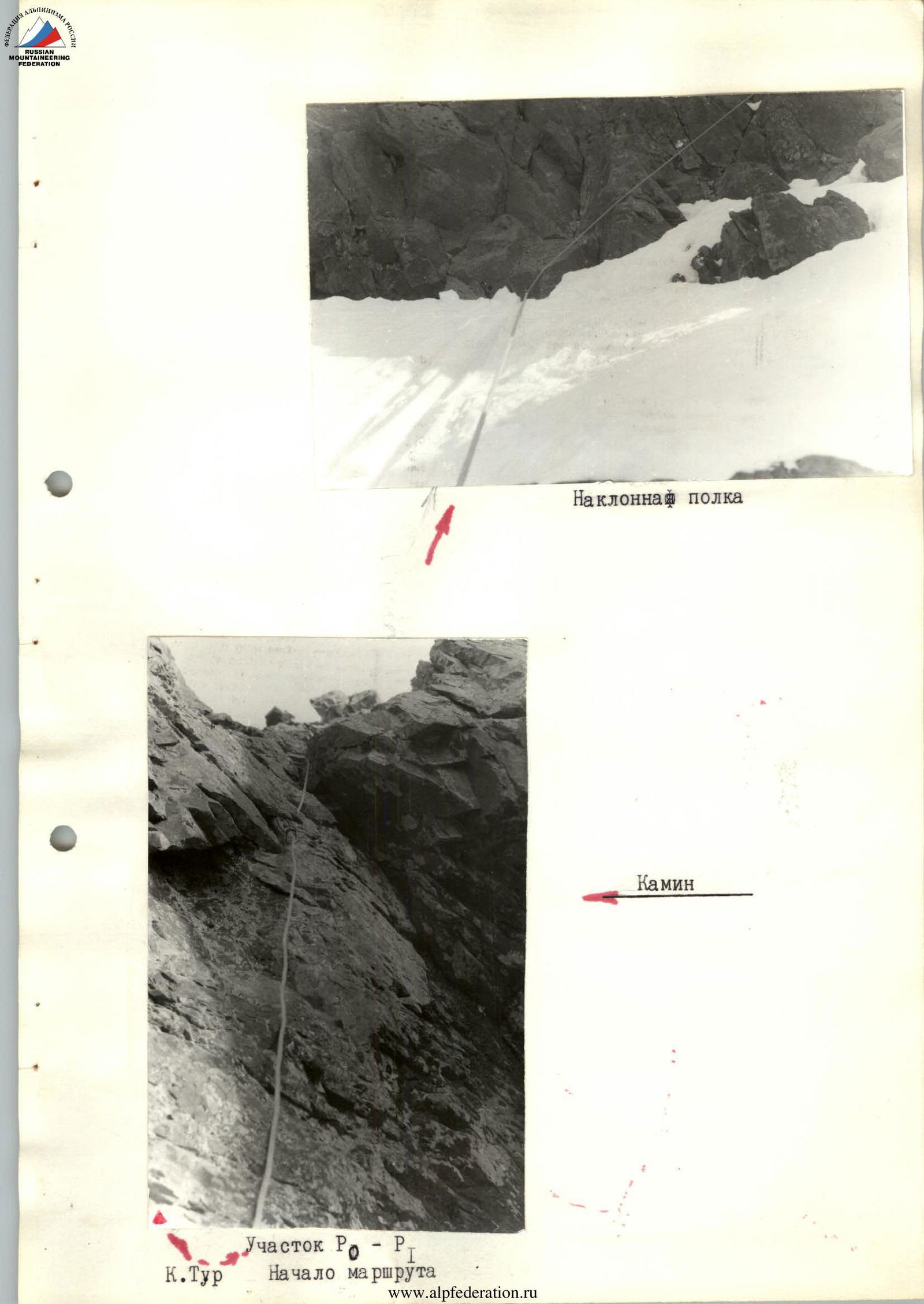
ascended by two paths, bypassing it on the left or right. Having ascended to the moraine, the western wall of the Shkolnik peak will appear before you. Ascend a wide couloir
leading to the northern ridge to a saddle. Here is a control cairn. This is the start of the route.