Northern Tien Shan, Trans-Ili Alatau
Peak Pioneer
via the right edge of the South Face
Category 4A difficulty
Ascent Passport
- Region, valley, section number according to the classification table of 20__ year — Northern Tien Shan, Trans-Ili Alatau, Maloe Almatinskoe valley.
- Name of the peak, its height, name of the route: Peak Pioneer 4031 m, via the right edge of the South Face
- Proposed: Category 4A difficulty
- Character of the route: rock
- Height difference of the route: 360 m
Route length: 550 m. Length of sections: Category V difficulty — 5 m. Average steepness: main part of the route — 70°; entire route — 50°
- Pitons left on the route:
total 5; including bolted — 0
- Team's travel hours: 6 hours
- Leader: Kirill Belotserkovsky, 1st sports category
Participants: Dmitry Degtyarev, 2nd sports category
- Coach: E.T. Ilyinsky, Honored Coach of the Republic
- Exit to the route from Base Camp: hour, day, month, year
Route started: September 14, 2009, 9:00 AM. Reached the summit: September 14, 2009, 3:00 PM. Returned to Base Camp: September 14, 2009, 5:00 PM. Descent from the summit: via route Category 1B difficulty to Pioneer Pass;
-
Organization: CSKA MO RK
-
Responsible for the report: K. Belotserkovsky
Email and phone: k.belotserkovskiy@gmail.com, +7 701 736 18 87 General photo
of the wall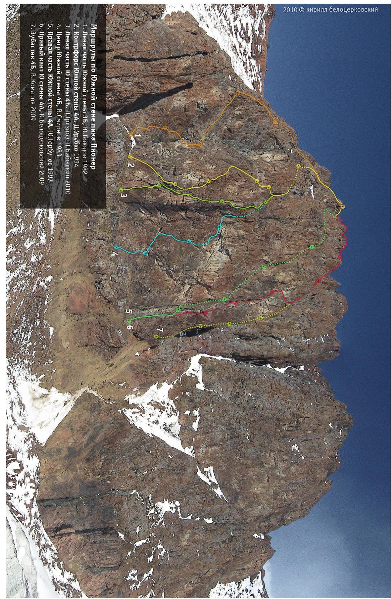
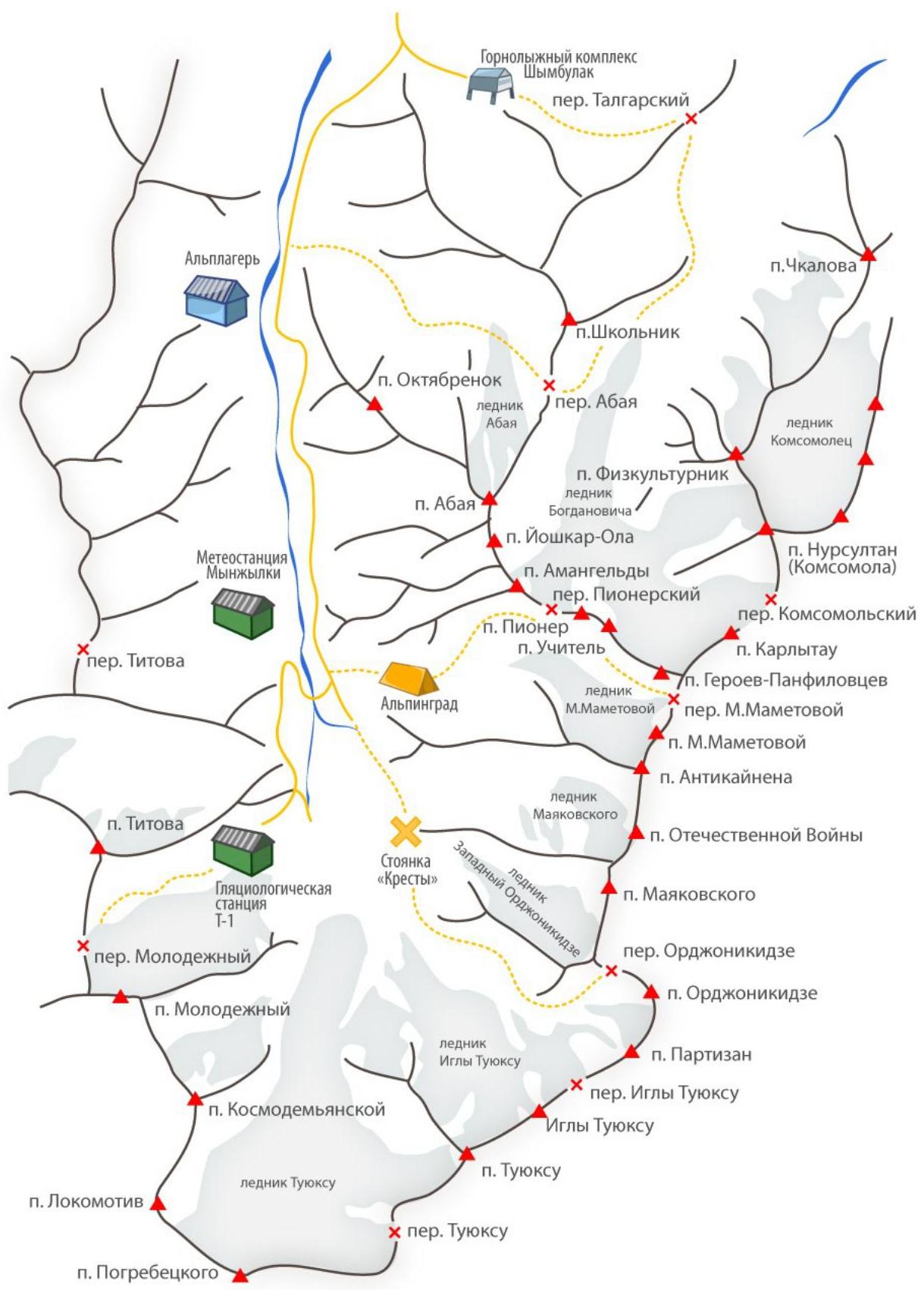
Map of the area
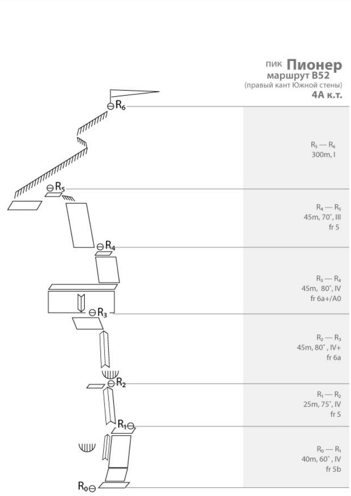
Route diagram
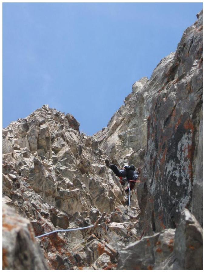
Kirill Belotserkovsky on the section
R2–R3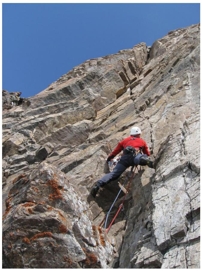
Kirill Belotserkovsky on the section R3–R4
Description.
R0–R1
Start from the ledge with a cross. Ascend upwards along a gentle wall. The wall then becomes one of the walls of an inner corner, which leads to a small ledge. Station.
R1–R2
Ascend upwards along a steep inner corner. Station under a cornice after 25–30 m.
R2–R3
From the station, ascend upwards along a steep corner. Crux rope. Section length is 45 m. Climbing is uniformly difficult. Station is set up on a large ledge.
R3–R4
From the ledge, climb vertically upwards to a narrow ledge. Move right along the ledge to reach the edge of the wall.
R4–R5
Ascend upwards along a moderately difficult wall.
R5–R6
Ascend upwards along the wall and ridge to reach a large scree ledge. The route then coincides with the routes of Urubko, Smirnov, and Gorbunov.
On the upper part of the ledge:
- enter a steep rocky couloir and ascend upwards to the ridge;
- then follow the ridge to the start of Category 1B route.
A prepared team takes around 25–30 minutes. The ridge leads to a large scree couloir, which needs to be ascended to reach the start of Category 1B route, which then leads to the summit.
Descent is via Category 1B route and then to Pioneer Pass.